#AZFire

2025-04-28

#AZwx #CochiseCounty #Firewx

From Arizona Department of Forestry and Fire Management on FB:

***Update - #StrongholdFire

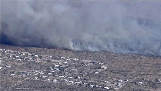
The fire is being reported at 283 acres, moving to the northeast, and remains very active. Additional resources have been ordered including two Large Air Tankers, two Single Engine Air Tankers, four engines, the Globe Hotshots, and overhead.

Currently four Arizona Forestry crews remain assigned along with state, federal, and local engines.

Per at Cochise County Sheriff's Office - Mark J. Dannels Sheriff: GO for homes west of Cochise Stronghold and south of Ironwood Roads in Sunsites. If residents need assistance with evacuating large animals, they can call SEACOM and CCSO Ranch Patrol will assist.

All evacuation information will come from the Cochise County Sheriff's Office.

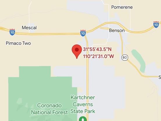
The fire is located approximately 16 miles south of Cochise.
#AZFire #AZForestry

NWS Phoenixnwsphx_repost
2025-03-26

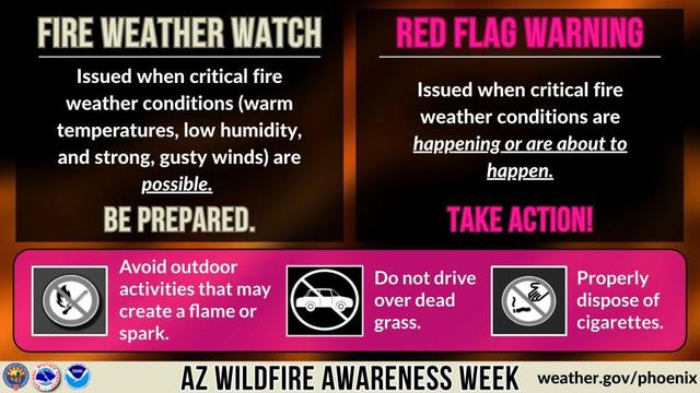
A Fire Weather Watch means critical fire weather conditions are possible and a Red Flag Warning means they are happening or are imminent. When these products are in effect please avoid any activities that may create a flame or spark. t.co/RSDPcXFy1V

Mar 26, 09:00am -0700

2024-06-28

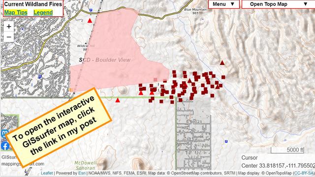
#BoulderViewFire is on the north side of the greater Phoenix area.

If you are seeing one of my fire maps for the first time, there are two links in the upper left corner to help you get the most benefit from the map.
#AZfire #AZwx #Wildfire

Open GISsurfer map:
mappingsupport.com/p2/gissurfe

2024-05-24

Via Dave In Prescott: Per Pinal Sheriff, a fire has sparked in the desert area near SR79 and E. Paisano Dr. south of Florence and is moving north. Homes in the area have been placed in "SET-Be Alert" status. Click the link below to follow:

share.watchduty.org/i/19972

#azfire #azwx

2024-05-19

#WildcatFire NE of Phoenix metro area continues to expand.

The text pic is from the “NOAA fire weather forecast”.

The map has lots of GIS overlays you can turn on/off/restack. For help please read the “Map tips” link in upper left corner.

#AZfire #AZwx

Open GISsurfer map:
mappingsupport.com/p2/gissurfe

2024-05-18

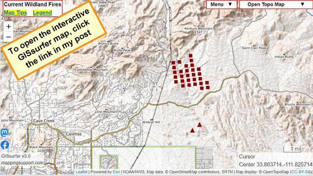
#WildcatFire just NE of Phoenix metro area. Map shows satellite heat detections. The uniform pattern of the data suggests that some data might be ‘false positive’. To learn more, open the map and click “Map tips” in upper left corner.

Do not rely on any map to ignore an order to evacuate.
#AZfire #AZwx

Open GISsurfer map:
mappingsupport.com/p2/gissurfe

TomKrajci 🇺🇦 🏳️‍🌈 🏳️‍⚧️KrajciTom@universeodon.com
2024-04-12

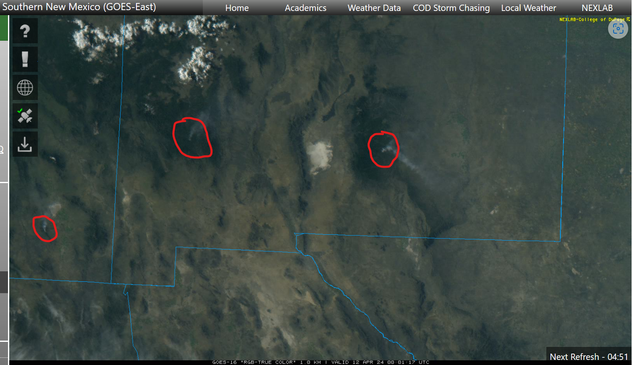
Visible weather satellite image of southern New Mexico and southeast Arizona.

When the sun gets low in the west, smoke plumes are easily seen.

I have circled three of them.

I don't know if these are prescribed burns or not...but the wind kicks up Friday and stays that way for several days.

#NMwx #AZwx #NMfire #AZfire

2023-07-27

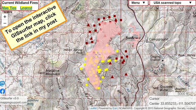
July 26 afternoon. Interactive #GIS map for #DiamondFire near Sunflower Arizona.

Dark red symbols are *heat* detection by MODIS and VIIRS satellites. This data is not real time, locations are only approximate and sometimes ‘false positive’.

To get the most benefit from the map see 2 links upper left corner.

Never rely on any map to ignore an order to evacuate.
#AZwx #AZfire #AZwildfire #Geospatial #Maps #Mapping #Leaflet #ArcGIS #WebMap

Open #GISsurfer map:
mappingsupport.com/p2/gissurfe

🇺🇸 Bewickwren 🇵🇹Bewickwren@toot.community
2023-07-05

Initial Attack: 26 new fires (Heavy) reported for yesterday (July 04) for 213.87 acres.

(AZ: 18 fires/207.76 acres;
NM: 8 fires/6.11 acres.)
2 Fire(s) >10 acres: Stockton Hill (AZA5S) 192 ac.; Avenue 3 (AZA4S) 10 ac.

gacc.nifc.gov/swcc/predictive/

#NMFire
#AZFire
🔥🔥🔥

2023-06-29

Arizona: Evacuation notices went out yesterday out near #Scottsdale for the #Diamond Fire.

Scottsdale Police have evacuated the areas west of 136th Street, south of Quail Track, and east of 144th Street.
#azfire #azwx #wildfire
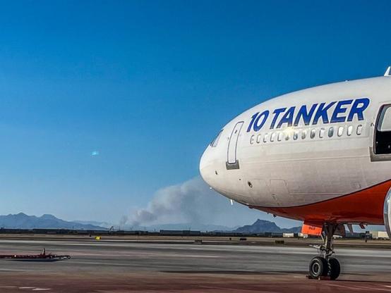
10Tanker VLAT914 is also doing back to back missions on the #DiamondFire near #Phoenix. Aircraft Assisting.
1 AA, Lead Bravo 59.
Air Tankers 16, 164, 167, 914.
1 copter.

2023-06-22

Via AZ State Forestry: CLOSURE

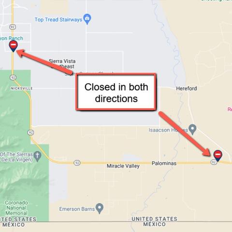
SR 92 is CLOSED in both directions south of Sierra Vista due to the #WildhorseFire.
The closure is between mileposts 327-343.
Expect delays and seek an alternate route. #Arizonawildfire #Arizona
And another one - #PostFire, approx 7 miles SW Benson. Air Attack reporting fire at 10 acres with structures threatened. We have requested heavy air tankers, but high winds causing issues with air support currently.
#AZFire #AZForestry

2023-04-01

Drought can be dangerous. Improve your odds and prepare your home now to survive a wildfire
before one begins. Learn more at ein.az.gov/ready-set-go. #AZFire #ReadySetGoAZ
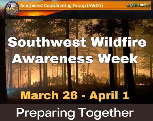
#SouthwestWildfireAwarenessWeek

2023-03-31

Is your community prepared for a wildfire? Proactive communities play a key role in minimizing the
impact of wildfires. Become fire-adapted by taking steps now to prepare. Learn more at
piped.video/gDbwKUQ-Y80, azfac.org/ #AZFire #AZwx #SouthwestWildfireAwarenessWeek

2023-03-30

Begin now to organize an event or plan to participate in your community’s Wildfire Preparedness
Day, May 6, 2023! Learn more at nfpa.org/-/media/Files/Publi… | NFPA and azfac.org. #AZFire
#WildfireSafety #SouthwestWildfireAwarenessWeek

2023-03-29

Make it your goal to extinguish hot coals. If your campfire is to hot to touch, it's too hot to leave!
Drown, stir and repeat until cold! WildlandFire.AZ.gov smokeybear.com.

#PreventWildfires #AZFire #SouthwestWildfireAwarenessWeek #SmokeyBear

2023-03-27

Don’t start the spark that destroys your home & community! Always check the weather & local
restrictions before burning waste & debris. Be prepared with water & a shovel nearby. Learn more at
azdeq.gov/OpenBurn #PreventWildfires #AZFire #SouthwestWildfireAwarenessWeek

Deborah Lee Solteszdsoltesz@az.social
2023-03-11

..."county forest restoration director Jay Smith estimated that the economic impact of a large fire on the Peaks would top a billion dollars.'Probably over $2 billion,' Smith said."

#Flagstaff #Arizona #wildfire #azfire #SanFranciscoPeaks

azdailysun.com/news/local/anot

Deborah Lee Solteszdsoltesz@mastodon.online
2022-12-11
2022-12-06

FROM AZ STATE FORESTRY - #AZForestry starting ignitions on 3-day, 1,800-acre #FlyingMRanchRXBurn. Project loc. E. Mormon Lake, approx. 30 mi. SE Flag @CoconinoCounty. Minimal smoke impact. Goals: wildfire risk reduction by reducing hazardous fuels around infrastructure & nearby private property. #AZFire

2020-06-17

RT @journtoolbox: Dozens of resources for covering the #BushFire in Arizona and other #wildfires: t.co/Blo5913E5p

#AZFire #BushFireAZ #BushFireTontoNF #AZWX t.co/AY2rTqSMkf —@spj_tweets@twitter.com twitter.com/spj_tweets/status/

Client Info

Server: https://mastodon.social
Version: 2025.04
Repository: https://github.com/cyevgeniy/lmst