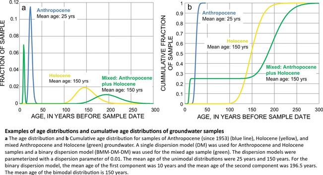
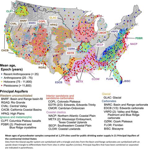
Over A Third Of Groundwater In USA Public-Supply Aquifers Is Anthropocene[sic]-Age And Susceptible To Surface Contamination
--
https://doi.org/10.1038/s43247-022-00473-y <-- shared paper
--
#GIS #spatial #mapping #surface #contamination #USA #waterquality #waterresources #groundwater #publicsupply #Anthropocene #potable #waterwell #municipal #watersupply #residential #age #aquifers #regional #landsurface #contamination #spatialanalysis #spatiotemporal #holocene #publicsafety #pumping #sustainability
#LandSurface
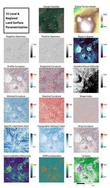
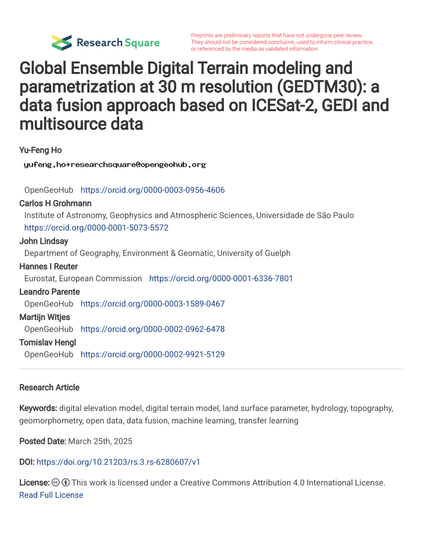
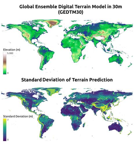
GEDTM30 – A Global 1-Arc-Second (~30m) Digital Terrain Model (DTM)
--
https://github.com/openlandmap/GEDTM30 <-- shared GitHub repository
--
#GIS #spatial #mapping #opendata #global #DTM #GEDTM30 #GitHub #30m #landsurface #parameters #documentation #hydrology #remotesensing #earthobservation #slope #geomorphons #hillshade #geomorphometry #geomorphology #topography #Equi7 #terrainheight #DigitalTerrainModel #landform
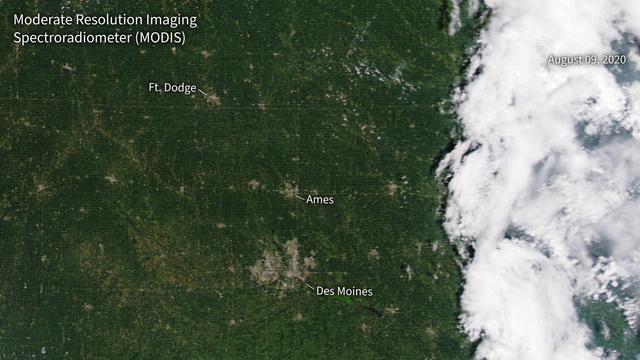
IMAP Testing and Integration at NASA's Marshall Space Flight Center
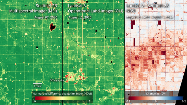
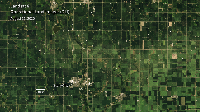
#Agriculture #Crop/PlantYields #Heliosphere #Imap #Iowa #LandSurface/agricultureIndicators #NDVI #PlantCharacteristics
⏩ 1 new picture and 2 new videos from NASA (SVS) https://commons.wikimedia.org/wiki/Special:ListFiles?limit=13&user=OptimusPrimeBot&ilshowall=1&offset=20250412125831
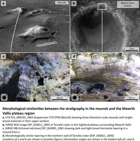
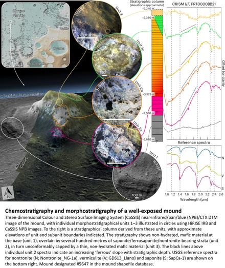
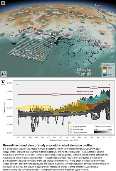
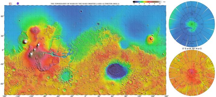
Edge Of Mars’ Great Dichotomy Eroded Back By Hundreds Of Kilometres
--
https://arstechnica.com/science/2025/01/field-of-mounds-on-mars-may-be-sign-of-erosion-at-the-edge-of-an-ocean/ <-- shared technical article
--
http://dx.doi.org/10.1038/s41561-024-01634-8 <-- shared paper
--
#GIS #spatial #mapping #planet #Mars #remotesensing #imagery #landsurface #geology #topography #astrogeology #elevation #morphology #martian #geography #marsdichotomy #plateau #lowlands #model #3dmodel #basin #highlands #shoreline #ocean #crust #structuralgeology #chemostratigraphy #morphostratigraphy #geomorphometry #geomorphology #water #hydrology #CaSSIS #HiRISE #stratigraphy #strata #MOLA #laser #LiDAR #MawrthVallis #crater #mound #profile #crosssection #geochemistry #mineralogy #CRISM #CTX #HRSC #DTM #erosion #weathering #spatialanalysis #spatiotemporal
Old Forests Are Irreplaceably Cool
--
https://pubs.aip.org/physicstoday/online/43370 <-- shared technical article
--
https://doi.org/10.1038/s41561-024-01423-3 <-- shared paper
--
“Satellite measurements confirm that the sudden disappearance of mature tropical forests has a more drastic effect on local land temperature than does the gradual growth of young forests…”
#GIS #spatial #mapping #remotesensing #tropics #tropical #earthobservation #vegetation #forest #forests #loss #gain #differences #landsurface #local #temperatures #heat #coolingeffect #energybudget #biophysical #climatechange #spatialanalysis #spatiotemporal #leafareaindex #aldebo #canopy #structure #geomorphometry #NDVI #model #modeling #ecology #NASA #Aqua #Terra #satellite #atmosphere #circulation
The Case For Remote Sensing Of Individual Plants
--
https://doi.org/10.1002/ajb2.1347 <-- shared short article
--
#GIS #spatial #mapping #UAV #drone #drones #LiDAR #photosynthesis #imagingspectroscopy #trees #plants #vegetation #forest #monitoring #identification #satellite #cubesat #landsurface #landcover #spatialanalysis # interpretation #biology #scale #sensor #technology #fieldwork #fieldplatforms #spatiotemporal #resources #naturalresources #phenology #photogrammetry #plantbiology #model #modeling #inference #remotesensing
Europe’s Sizzling Summer - A Heatwave Like Never Before
--
https://scitechdaily.com/europes-sizzling-summer-a-heatwave-like-never-before/ <-- shared technical article
--
#GIS #spatial #mapping #remotesensing #copernicus #satellite #sentinel #sentinel3 #Europe #heatwave #heat #temperature #extremeweather #Cerberus #deaths #publichealth #publicsafety #Sicily #Sardinia #mountetna #etna #anticyclone #Italy #storms #floods #animation #landsurface #temperature
@ESA
Geomorphometry - A Brief Guide
--
https://doi.org/10.1016/S0166-2481(08)00001-9 <-- shared paper
--
https://geomorphometry.org/ <-- International Society for Geomorphometry home page
--
#GIS #spatial #mapping #elevation #remotesensing #data #digital #civilengineering #science #visualization #geometry #military #algorithms #society #visualisation #model #modeling #geomorphology #landcover #geomorphometry #quantitative #landsurface #analysis #spatialanalysis #spatiotemporal #terrainanalysis #physicalgeography #geography #geology #topography #landforms #watersheds #surfacemodel #algorithms #interpretation #gischat #tutorial #guide #overview #learning
TopoPyScale - A Python Package for Hillslope Climate Downscaling
--
https://doi.org/10.21105/joss.05059 <-- shared paper
--
#GIS #spatial #mapping #python #climatechange #development #energy #complexity #spatialanalysis #spatiotemporal #remotesensing #pythonfordatascience #model #modeling #global #reanalyses #resampling #topography #TopoPyScale #mountain #water #hydrology #hillslope #geomorphology #cryosphere #glacier #glacial #atmosphere #datadensity #landsurface #opensource
So, I guess one needs to add an #introduction. I work on #remotesensing of the #landsurface, and I am particularly interested in #disturbances, #wildfires #agriculture #dataassimilation and #carboncycle
Based in London
