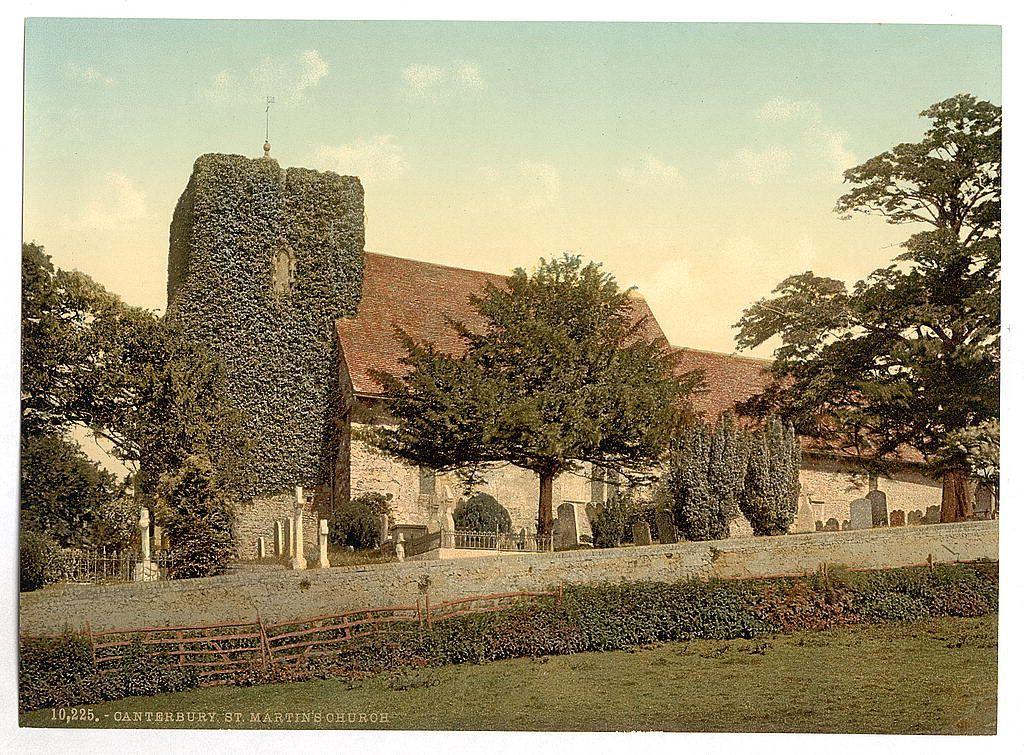
St. Martin's Church, Canterbury, England between ca. 1890 and ca. 1900. Views of the British Isles England Cambridge
#StMartinsChurch #Canterbury #England #Cambridge #photography #historicalPhotos #photochrom
St. Martin's Church, Canterbury, England between ca. 1890 and ca. 1900. Views of the British Isles England Cambridge
#StMartinsChurch #Canterbury #England #Cambridge #photography #historicalPhotos #photochrom
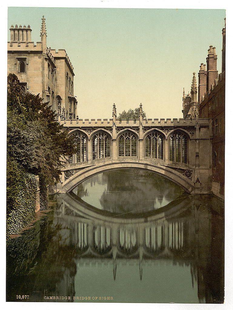
Bridge of Sighs, Cambridge, England between ca. 1890 and ca. 1900. Views of the British Isles England Cambridge
#Cambridge #England #European #photography #historicalPhotos #photochrom
Settle, from west, Yorkshire, England between ca. 1890 and ca. 1900. Views of the British Isles
Image shows the market town of Settle, located in the Craven district, North Yorkshire, England. (Source: Flickr Commons project, 2015)
England Settle
The British Isles are an archipelago in the North Atlantic Ocean off the north-western coast of continental Europe, consisting of the islands of Great Britain, Ireland, the Isle of Man, the Inner and Outer Hebrides, the Northern Isles, and over six thousand smaller islands. They have a total area of 315,159 km2 (121,684 sq mi) and a combined population of almost 75 million, and include two sovereign states, the Republic of Ireland and the United Kingdom of Great Britain and Northern Ireland. The Channel Islands, off the north coast of France, are normally taken to be part of the British Isles, even though geographically they do not form part of the archipelago. Under the UK Interpretation Act 1978, the Channel Islands are clarified as forming part of the British Islands, not to be confused with the British Isles.
England is a country that is part of the United Kingdom. It is located on the island of Great Britain, of which it covers about 62%, and more than 100 smaller adjacent islands. England shares a land border with Scotland to the north and another land border with Wales to the west, and is otherwise surrounded by the North Sea to the east, the English Channel to the south, the Celtic Sea to the south-west, and the Irish Sea to the west. Continental Europe lies to the south-east, and Ireland to the west. At the 2021 census, the population was 56,490,048. London is both the largest city and the capital.
North Yorkshire is a ceremonial county in Northern England. It is bordered by County Durham to the north, the North Sea to the east, the East Riding of Yorkshire to the south-east, South Yorkshire to the south, West Yorkshire to the south-west, and Cumbria and Lancashire to the west.
Yorkshire is an area of Northern England which was historically a county. Despite no longer being used for administration, Yorkshire retains a strong regional identity. The county was named after the city of York.
#Settle #Yorkshire #England #RailwayViaduct #HistoricalCharm #Railway #Architecture #historicalPhotos #photochrom #photography #BritishIsles #Cravendistrict #NorthYorkshire
https://www.loc.gov/pictures/item/2002708328/

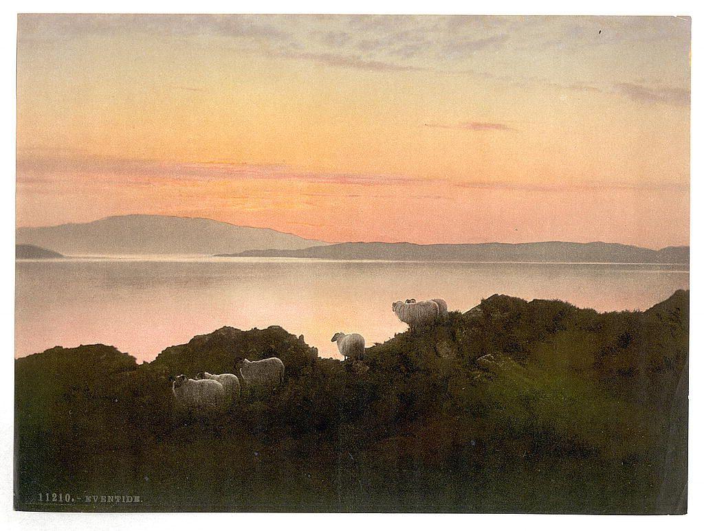
Eventide, England between ca. 1890 and ca. 1900. Views of the British Isles
Sunrises & sunsets,Sheep,England
The British Isles are an archipelago in the North Atlantic Ocean off the north-western coast of continental Europe, consisting of the islands of Great Britain, Ireland, the Isle of Man, the Inner and Outer Hebrides, the Northern Isles, and over six thousand smaller islands. They have a total area of 315,159 km2 (121,684 sq mi) and a combined population of almost 75 million, and include two sovereign states, the Republic of Ireland and the United Kingdom of Great Britain and Northern Ireland. The Channel Islands, off the north coast of France, are normally taken to be part of the British Isles, even though geographically they do not form part of the archipelago. Under the UK Interpretation Act 1978, the Channel Islands are clarified as forming part of the British Islands, not to be confused with the British Isles.
England is a country that is part of the United Kingdom. It is located on the island of Great Britain, of which it covers about 62%, and more than 100 smaller adjacent islands. England shares a land border with Scotland to the north and another land border with Wales to the west, and is otherwise surrounded by the North Sea to the east, the English Channel to the south, the Celtic Sea to the south-west, and the Irish Sea to the west. Continental Europe lies to the south-east, and Ireland to the west. At the 2021 census, the population was 56,490,048. London is both the largest city and the capital.
#England #Sunrise #Sheep #Landscape #Nature #Sunset #historicalPhotos #photochrom #photography #BritishIsles #Eventide,England
https://www.loc.gov/pictures/item/2002708361/
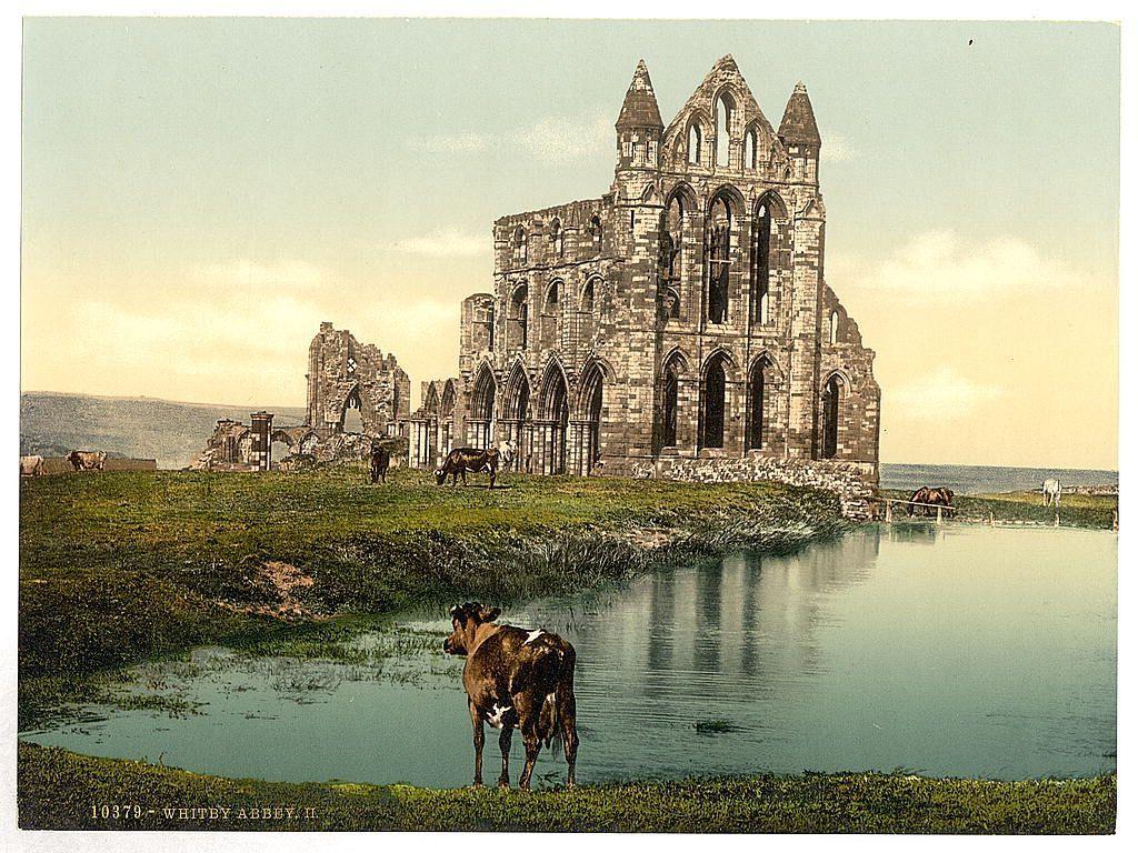
Whitby, the abbey, II., Yorkshire, England between ca. 1890 and ca. 1900. Views of the British Isles
Image shows the ruins of Whitby Abbey which are located above Whitby, North Yorkshire, England. (Source: Flickr Commons project, 2015)
England Whitby
The British Isles are an archipelago in the North Atlantic Ocean off the north-western coast of continental Europe, consisting of the islands of Great Britain, Ireland, the Isle of Man, the Inner and Outer Hebrides, the Northern Isles, and over six thousand smaller islands. They have a total area of 315,159 km2 (121,684 sq mi) and a combined population of almost 75 million, and include two sovereign states, the Republic of Ireland and the United Kingdom of Great Britain and Northern Ireland. The Channel Islands, off the north coast of France, are normally taken to be part of the British Isles, even though geographically they do not form part of the archipelago. Under the UK Interpretation Act 1978, the Channel Islands are clarified as forming part of the British Islands, not to be confused with the British Isles.
England is a country that is part of the United Kingdom. It is located on the island of Great Britain, of which it covers about 62%, and more than 100 smaller adjacent islands. England shares a land border with Scotland to the north and another land border with Wales to the west, and is otherwise surrounded by the North Sea to the east, the English Channel to the south, the Celtic Sea to the south-west, and the Irish Sea to the west. Continental Europe lies to the south-east, and Ireland to the west. At the 2021 census, the population was 56,490,048. London is both the largest city and the capital.
North Yorkshire is a ceremonial county in Northern England. It is bordered by County Durham to the north, the North Sea to the east, the East Riding of Yorkshire to the south-east, South Yorkshire to the south, West Yorkshire to the south-west, and Cumbria and Lancashire to the west.
Whitby is a seaside town, port and civil parish in North Yorkshire, England. It is located at the mouth of the River Esk, where the North York Moors meet the Yorkshire Coast, and has a maritime, mineral and tourist economy. It is 47 miles (76 km) from York and 22 miles (35 km) from Middlesbrough.
Yorkshire is an area of Northern England which was historically a county. Despite no longer being used for administration, Yorkshire retains a strong regional identity. The county was named after the city of York.
#WhitbyAbbey #England #GothicArchitecture #PastoralScene #HistoricalLandmark #Ruins #Cow #Gothic #Whitby #Abbey #Yorkshire #historicalPhotos #photochrom #photography #BritishIsles #NorthYorkshire
https://www.loc.gov/pictures/item/2002708340/
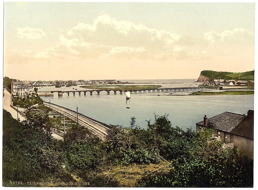
Shaldon Bridge, Teignmouth, England between ca. 1890 and ca. 1900. Views of the British Isles
#ShaldonBridge #Teignmouth #England #theBritishIsles #Britain #Devon #photography #historicalPhotos #photochrom
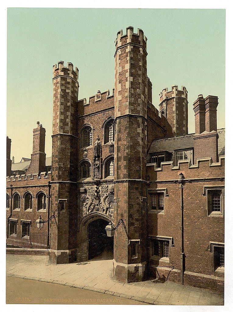
St. John's Gateway, Cambridge, England between ca. 1890 and ca. 1900. Views of the British Isles England Cambridge
#StJohnsGateway #Cambridge #England #English #photography #historicalPhotos #photochrom
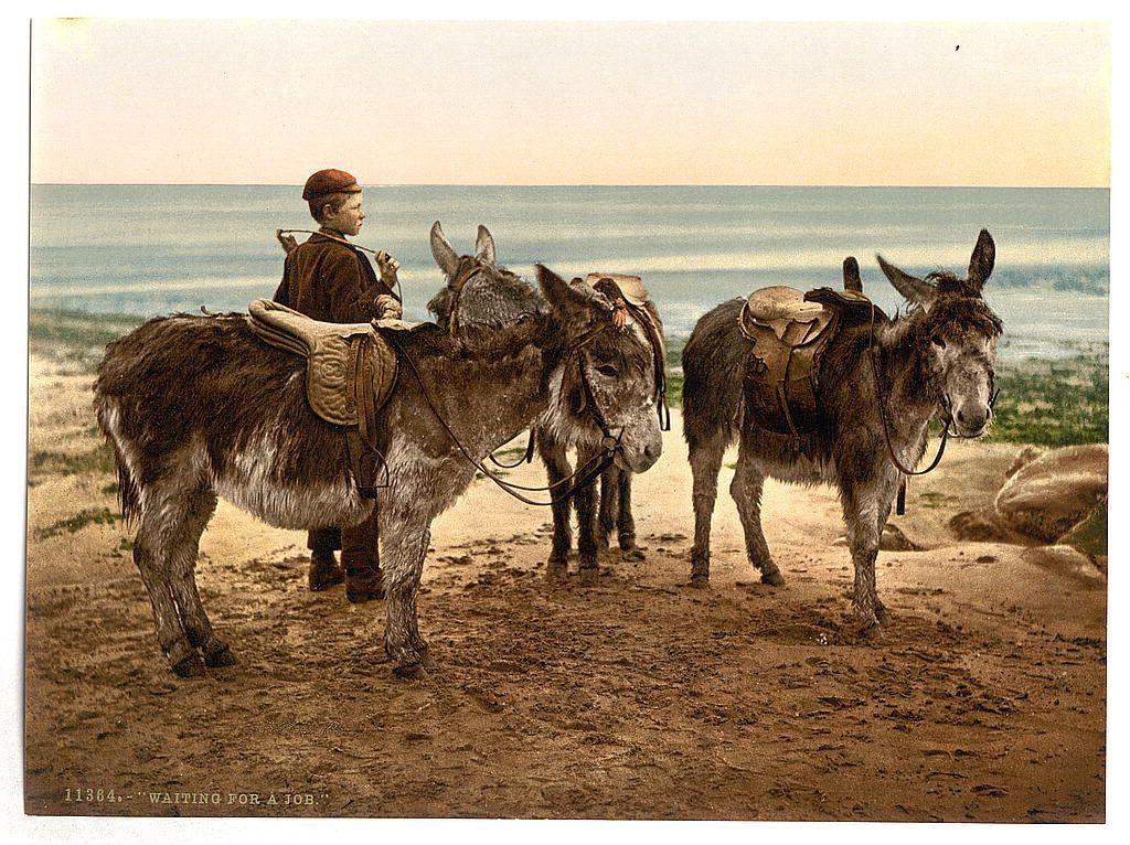
Waiting for a job (donkeys), England between ca. 1890 and ca. 1900. Views of the British Isles England
Milking time, England between ca. 1890 and ca. 1900. Views of the British Isles Cows,England
#England #theBritishIslesCows #photography #historicalPhotos #photochrom

Eventide, England between ca. 1890 and ca. 1900. Views of the British Isles Sunrises & sunsets,Sheep,England
#England #Sheep,EnglandThe #Sunrises&sunsets #Britain #Photochroms #photography #historicalPhotos #photochrom

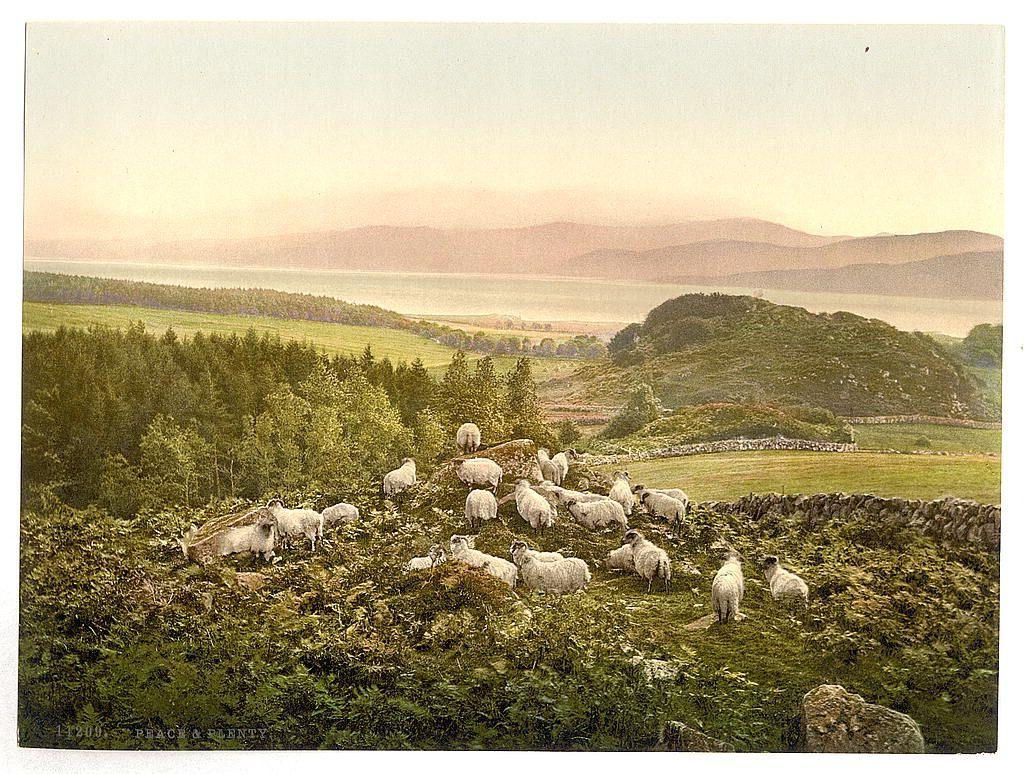
Peace and plenty, England between ca. 1890 and ca. 1900. Views of the British Isles Sheep,England
#England #English #Edwardian #photography #historicalPhotos #photochrom
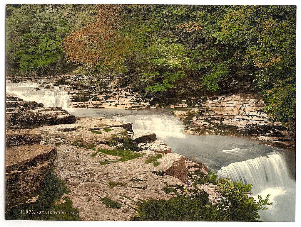
Stainforth Falls, Yorkshire, England between ca. 1890 and ca. 1900. Views of the British Isles
England Yorkshire
England is a country that is part of the United Kingdom. It is located on the island of Great Britain, of which it covers about 62%, and more than 100 smaller adjacent islands. England shares a land border with Scotland to the north and another land border with Wales to the west, and is otherwise surrounded by the North Sea to the east, the English Channel to the south, the Celtic Sea to the south-west, and the Irish Sea to the west. Continental Europe lies to the south-east, and Ireland to the west. At the 2021 census, the population was 56,490,048. London is both the largest city and the capital.
Yorkshire is an area of Northern England which was historically a county. Despite no longer being used for administration, Yorkshire retains a strong regional identity. The county was named after the city of York.
#Waterfall #England #Yorkshire #Bridge #River #StainforthFalls #historicalPhotos #photochrom #photography
//www.loc.gov/pictures/item/2002708332/
Whitby, Staithes, Yorkshire, England between ca. 1890 and ca. 1900. Views of the British Isles
Image shows an aerial view of Staithes, a coastal fishing village in North Yorkshire, England. (Source: Flickr Commons project, 2015)
England Whitby
North Yorkshire is a ceremonial county in Northern England. It is bordered by County Durham to the north, the North Sea to the east, the East Riding of Yorkshire to the south-east, South Yorkshire to the south, West Yorkshire to the south-west, and Cumbria and Lancashire to the west.
Staithes is a village in North Yorkshire, England, situated by the border between the unitary authorities of North Yorkshire and Redcar and Cleveland. The area located on the Redcar and Cleveland side is known as Cowbar. Formerly a hub for fishing and mining, Staithes is now a tourist destination in the North York Moors National Park.
Whitby is a seaside town, port and civil parish in North Yorkshire, England. It is located at the mouth of the River Esk, where the North York Moors meet the Yorkshire Coast, and has a maritime, mineral and tourist economy. It is 47 miles (76 km) from York and 22 miles (35 km) from Middlesbrough.
Yorkshire is an area of Northern England which was historically a county. Despite no longer being used for administration, Yorkshire retains a strong regional identity. The county was named after the city of York.
#Whitby #Staithes #Yorkshire #England #Coastal #CoastalTown #Fishingvillage #historicalPhotos #photochrom #photography #NorthYorkshire
//www.loc.gov/pictures/item/2002708349/

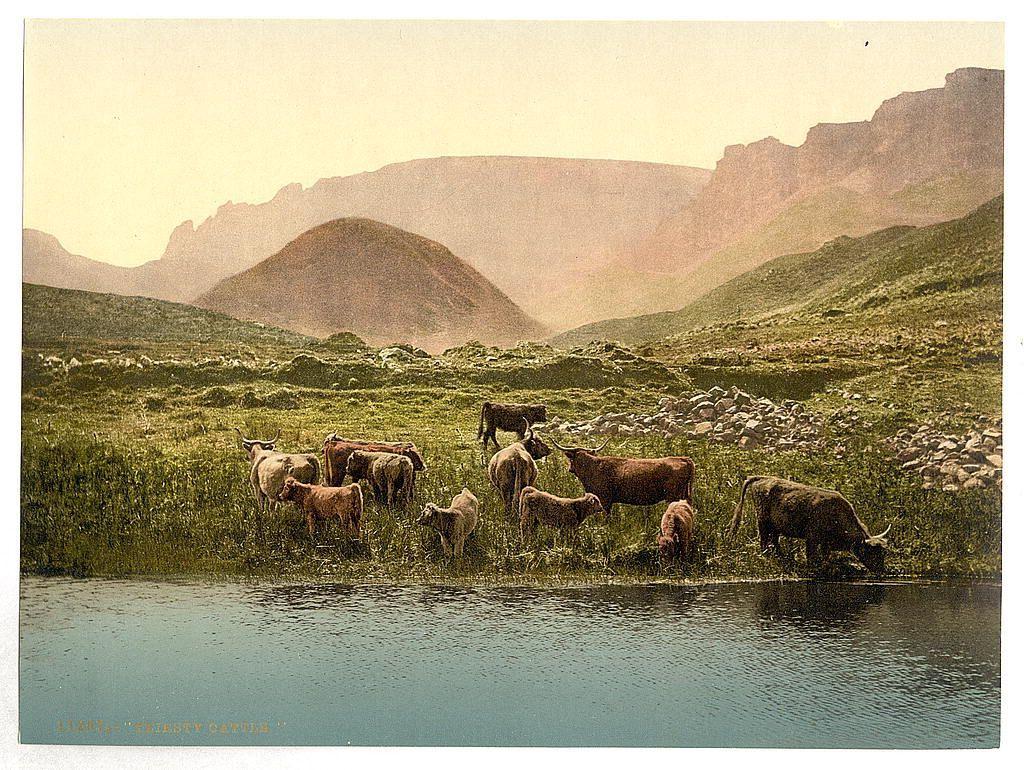
Thirsty cattle, England between ca. 1890 and ca. 1900. Views of the British Isles Cattle,England

Thirsty cattle, England between ca. 1890 and ca. 1900. Views of the British Isles
Cattle,England
British Isles: The British Isles are an archipelago in the North Atlantic Ocean off the north-western coast of continental Europe, consisting of the islands of Great Britain, Ireland, the Isle of Man, the Inner and Outer Hebrides, the Northern Isles, and over six thousand smaller islands. They have a total area of 315,159 km2 (121,684 sq mi) and a combined population of almost 75 million, and include two sovereign states, the Republic of Ireland and the United Kingdom of Great Britain and Northern Ireland. The Channel Islands, off the north coast of France, are normally taken to be part of the British Isles, even though geographically they do not form part of the archipelago. Under the UK Interpretation Act 1978, the Channel Islands are clarified as forming part of the British Islands, not to be confused with the British Isles.
England: England is a country that is part of the United Kingdom. It is located on the island of Great Britain, of which it covers about 62%, and more than 100 smaller adjacent islands. England shares a land border with Scotland to the north and another land border with Wales to the west, and is otherwise surrounded by the North Sea to the east, the English Channel to the south, the Celtic Sea to the south-west, and the Irish Sea to the west. Continental Europe lies to the south-east, and Ireland to the west. At the 2021 census, the population was 56,490,048. London is both the largest city and the capital.
#Pastoralscene #Oilpainting #cattle #England #pastoralscene #mountains #oilpainting #painting #pastoral #historicalPhotos #photochrom #photography #BritishIsles
//www.loc.gov/pictures/item/2002708359/
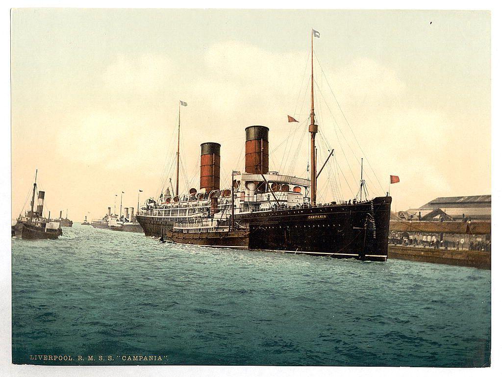
R. M. S. "Campania" in the Mersey between ca. 1890 and ca. 1900 Views of the British Isles Image shows the R.M.S. Campania, a British ocean liner of the Cunard Steamship Line, on the River Mersey. (Source: Flickr Commons project, 2015) Ocean liners,England Mersey River
#RMS"Campania #Mersey #British #theRiverMersey #EnglandMerseyRiver #Campania #Liverpool #Britain #photography #historicalPhotos #photochrom
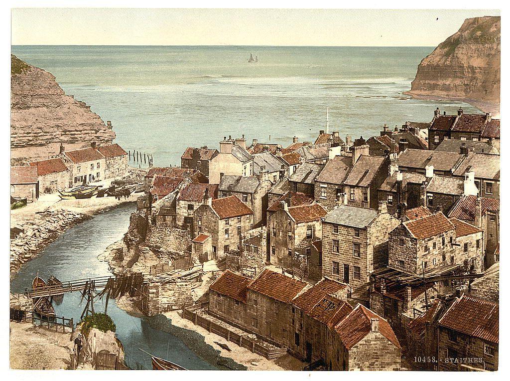
Whitby, Staithes, Yorkshire, England between ca. 1890 and ca. 1900. Views of the British Isles Image shows an aerial view of Staithes, a coastal fishing village in North Yorkshire, England. (Source: Flickr Commons project, 2015) England Whitby
#Whitby #Staithes #Yorkshire #England #NorthYorkshire #EnglandWhitby #photography #historicalPhotos #photochrom
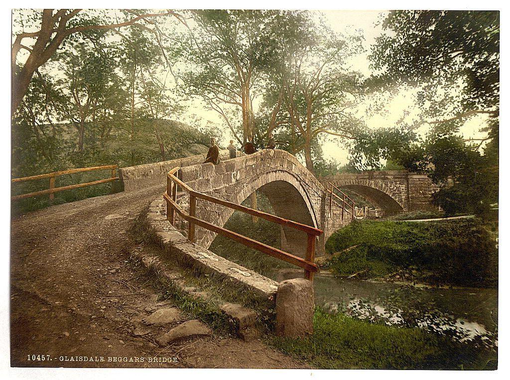
Whitby, Glaisdale, Beggars' Bridge, Yorkshire, England between ca. 1890 and ca. 1900. Views of the British Isles Image shows bridge over the River Esk, built in 1619 by Thomas Ferris of Hull. (Source: Flickr Commons project, 2015) England Whitby
#Whitby #Yorkshire #England #theRiverEsk #ThomasFerris #EnglandWhitby #photography #historicalPhotos #photochrom
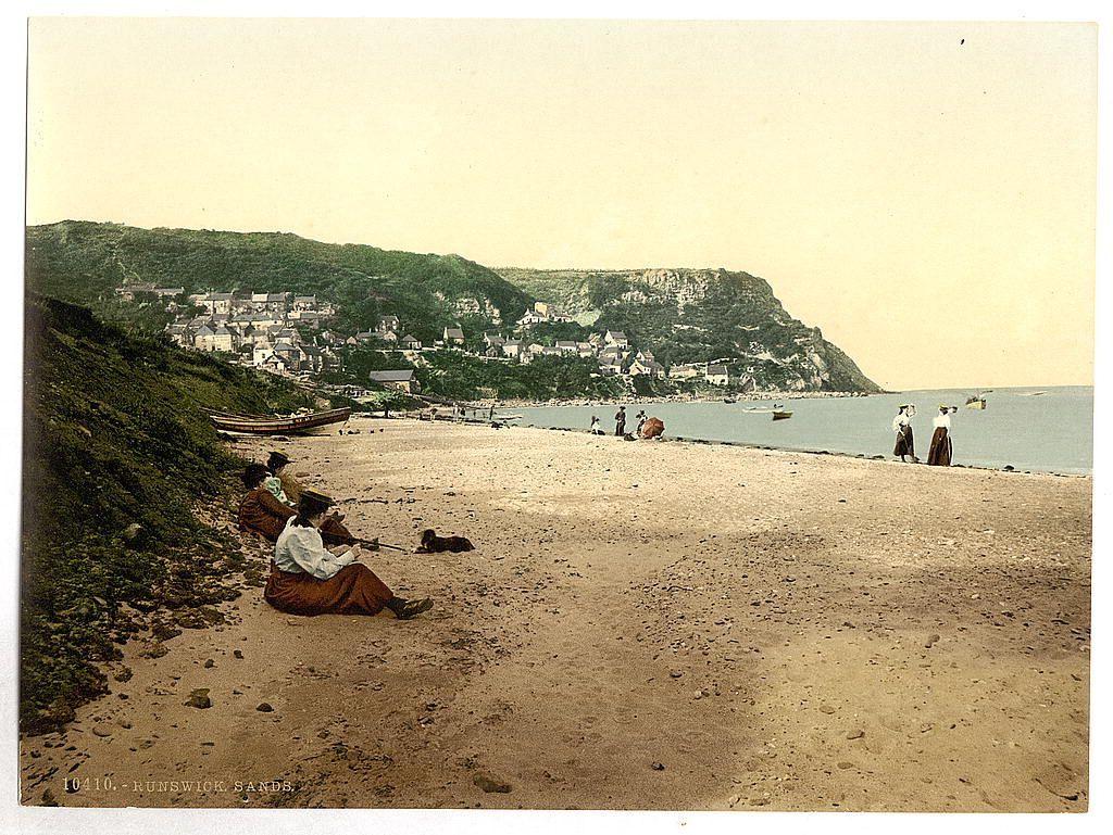
Whitby, Runswick sands, Yorkshire, England between ca. 1890 and ca. 1900. Views of the British Isles England Whitby
#Whitby #Runswick #Yorkshire #England #RunswickSands #Britain #photography #historicalPhotos #photochrom
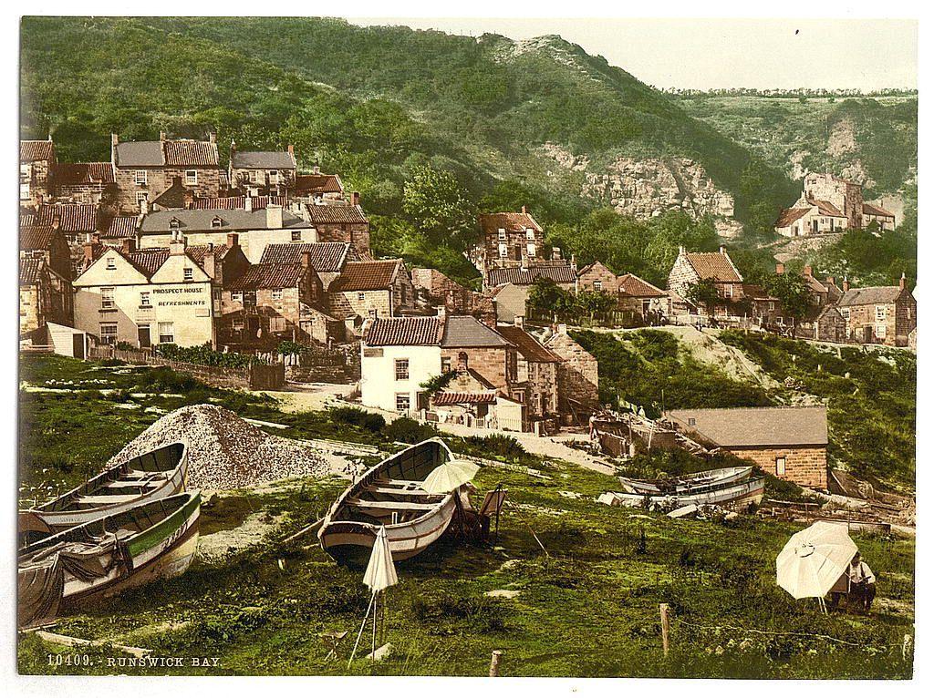
Whitby, Runswick Bay, Yorkshire, England between ca. 1890 and ca. 1900. Views of the British Isles England Whitby
#Whitby #RunswickBay #Yorkshire #England #British #photography #historicalPhotos #photochrom