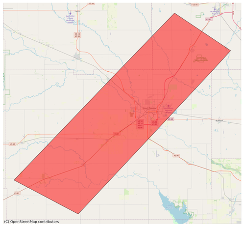
#EAS #WEA for McPherson, #KS; #Reno, #KS; #Rice, #KS: National Weather Service: A FLASH #FLOOD WARNING is in effect for this area until 2:45 AM CDT. This is a dangerous and life-threatening situation. Do not attempt to travel unless you are fleeing an area subject to flooding or under an evacuation order. Source: NWS Wichita KS ** DO NOT RELY ON THIS FEED FOR LIFE SAFETY, SEEK OUT OFFICIAL SOURCES ***
#Reno
Manchild - Half An Album EP
Back from a visit to family and greeted by this gem #punk #oldSkoolPunk #HardCore #Reno #bandcamp @vinylrecords #vinyl #NowPlaying
🔔#Earthquake (#sismo) M2.1 strikes 15 mi NW of #Reno (#Nevada) 2 min ago. More info: https://m.emsc.eu/?id=1823220
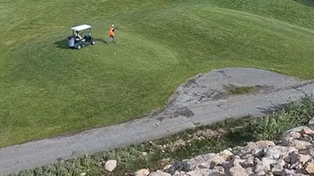
https://www.fogolf.com/989696/residents-alarmed-by-marmot-control-methods-at-popular-reno-golf-course/ Residents alarmed by marmot control methods at popular Reno golf course #AlternativeMethods #FirearmsDischarge #GolfCourse #GolfCourses #LocalResidents #MarmotControl #PestControl #Reno #SafetyConcerns
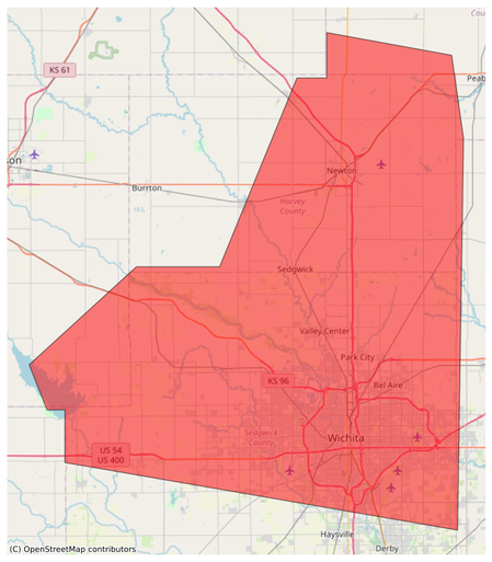
#EAS #WEA for Harvey, #KS; #Marion, #KS; #Reno, #KS; #Sedgwick, #KS: National Weather Service: SEVERE THUNDERSTORM WARNING in effect for this area until 4:45 AM CDT for DESTRUCTIVE 90 mph winds. Take shelter in a sturdy building, away from windows. Flying debris may be deadly to those caught without shelter. Source: NWS Wichita KS ** DO NOT RELY ON THIS FEED FOR LIFE SAFETY, SEEK OUT OFFICIAL SOURCES ***
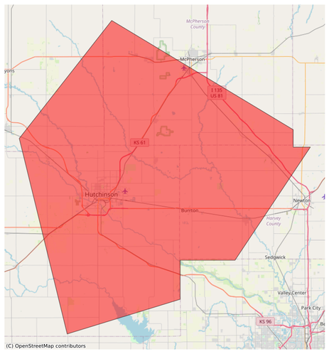
#EAS #WEA for Harvey, #KS; #McPherson, #KS; #Reno, #KS; #Rice, #KS: National Weather Service: SEVERE THUNDERSTORM WARNING in effect for this area until 4:00 AM CDT for DESTRUCTIVE 80 mph winds. Take shelter in a sturdy building, away from windows. Flying debris may be deadly to those caught without shelter. Source: NWS Wichita KS ** DO NOT RELY ON THIS FEED FOR LIFE SAFETY, SEEK OUT OFFICIAL SOURCES ***
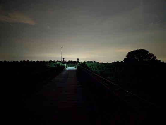
#Baricella #Bologna #PassoSegni #BassaBolognese #Bailey #BaileyBridge #notte #night #ponte #bridge #Reno
How many runways do you see for Reno Tahoe International airport (USA) ? : The answer is on https://www.bigorre.org/aero/meteo/krno/en #reno #usa #renotahoeinternationalairport #krno #rno #airport #aviation #avgeek vl
#TheMetalDogArticleList
#Blabbermouth
YES Announces 'The Fragile Tour 2025, The Album Series'
https://blabbermouth.net/news/yes-announces-the-fragile-tour-2025-the-album-series
#YES #TheFragileTour2025 #SteveHowe #GeoffDownes #JonDavison #BillySherwood #JaySchellen #Wallingford #Connecticut #Reno
Ten+ planning lessons from “The Biggest Little City in the World” – Reno
Source: travelnevada.comProvided below are a list of ten planning lessons from Reno, Nevada. There are NOT presented in order of importance. Peace!
——-
- Preserving and incorporating mountainous open space and parklands such as Rattlesnake Mountain and Huffaker Hills close within the city limits allows all its citizens regardless of socioeconomic status to enjoy the great outdoors.
- Reno was smart to concentrate the majority of its casinos in the downtown area. This builds vitality and foot traffic in its core. Unfortunately, some recent resorts have been built away from the city center. Hopefully, this is a short-term trend that will be soon corrected.
- Surrounded by mountains and adorned with beautiful streams like the Truckee River and nearby lakes such as Tahoe, Reno is an outdoor enthusiast’s paradise.
- The developing Reno Experience District (RED) may get more recent press, but it’s Midtown Reno that instantly captured this retired visiting planner’s attention with its charming blend of old, new, cute, quaint, and weird. Did I mention there was great food too!
- Reno’s proximity to Northern California population centers has always been one of its attributes. Today, it has a strong identity and draw of its own beyond just gambling.
- Compared to its larger competitor to the south (Vegas), Reno feels much more like a traditional city that grew organically and which has a richly diverse economy.
- Enormous white rooftops abound in office, technology, and industrial parks. While these may keep the buildings cooler, they would be more efficient and effective as rooftop solar farms.
- “The Biggest Little City in the World” has grown up to be an impressive and vibrant community with its impressive downtown districts including the Arch District, the Riverwalk District, the Brewery District, the Neon Line District, the Freight House District, as well as the University of Nevada in the heart of the city.
- Linking Reno with nearby Lake Tahoe is an excellent marketing and branding idea that best reflects the regional nature of the city and its role as a gateway to the vast abundance of staggering scenic beauty surrounding it.
- Reno is one of those rare places where your approach to it from any direction is filled with incredible beauty and jaw-dropping vistas. As the area continues to grow, protecting these visual and geographical attributes is paramount.
- While some of the extraordinary art created for Burning Man is displayed in Reno, the connections between permanent Reno an temporary Black Rock City should be enhanced exponentially so they build upon one another as a continuously positive example of artful coexistence, inclusion, environmental stewardship, civic responsibility, people-focused urban design, volunteerism, and the other principles of both Burning Man and Urban Planning.
#biking #BlackRockCity #BurningMan #cities #coexistence #environment #gambling #geography #history #LakeTahoe #landUse #MidtownReno #Nevada #planning #RED #Reno #solar #transportation #travel #TruckeeRiver #walkability
How many runways do you see for Reno Tahoe International airport (USA) ? : The answer is on https://www.bigorre.org/aero/meteo/krno/en #reno #usa #renotahoeinternationalairport #krno #rno #airport #aviation #avgeek vl
Hiking eye-to-eye with the passenger jets
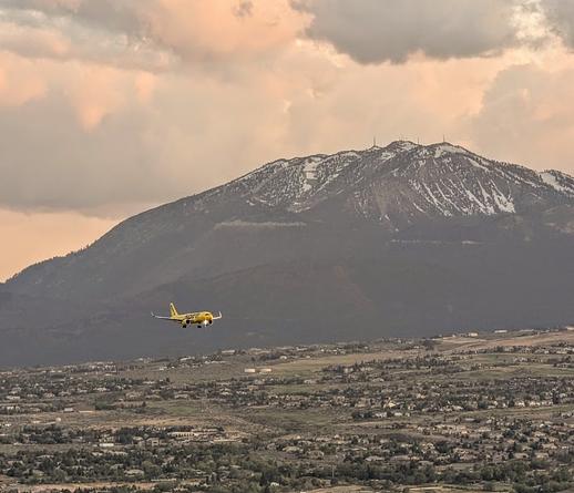
Spirit Airlines jet approaching Reno from Rattlesnake Mountain with the snowy Sierras in the background.It’s not often you have a chance from ground level to get eye-to-eye with a passenger jet let alone be above it while it’s still airborne. Well, if you are in the Reno area, be sure to hike 5,014 foot Rattlesnake Mountain, as you will get a close-up view of them as they are descending to land at Reno/Tahoe International Airport. FYI – This does depend on the wind direction.
With the Sierras as a backdrop, it’s 360 degrees of amazing views from Rattlesnake Mountain. Out and back, the trail is approximately 1.7 miles in length and you gain approximately 415 feet in elevation.
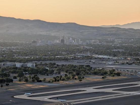
Jets preparing for takeoff with downtown Reno in the background. View from Rattlesnake Mountain.There are several approaches to the summit of Rattlesnake Mountain to choose from with varying degrees of steepness. Once near the summit, you are afforded splendid views of greater Reno, including a full-on vista of the airport, as well as a great view of downtown.
Rattlesnake Mountain and the adjacent hills in the Huffaker Hills Open Space form the east side of a narrow air corridor, along with the Sierras on the west side, that aircraft fly through on approach to Reno/Tahoe International Airport from the south.
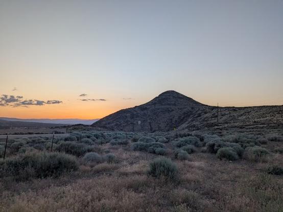
Rattlesnake Mountain at dusk from the Huffaker Hills Open Space Trailhead.So, if you love plane watching and cityscapes, Rattlesnake Mountain in Reno, Nevada is the place for you. After sunset, the lights of the city and airport must be even more amazing!
Peace!
Source: wikipedia.org#airTravel #airports #cities #fun #geography #hiking #history #landUse #Nevada #RattlesnakeMountain #Reno #Sierras #sightseeing #tourism #transportation #travel
After a couple of trips, word spread of an ex-bounty hunter bringing gold from the desert territory east of California.
#writersofmastodon #jswelch #shortstory #storycycle #flashfiction #theprospectorsdreams #thelegendofthebountyhunter #gold #outlaw #mountains #reno
That day, Frank gave up being a bounty hunter and followed a different kind of bounty.
He kept the discovery of the bodies and the gold a secret. He began traveling back and forth between the oasis and Lake’s Crossing (later known as Reno) with his gold, selling it for more money than he had ever imagined owning.
#writersofmastodon #jswelch #shortstory #storycycle #flashfiction #theprospectorsdreams #thelegendofthebountyhunter #gold #outlaw #mountains #reno
Postcard from the National Reno Gay Rodeo, 1981
.
#Reno #Postcard #Travel #NationalgayRodeo #Ephemera #LGBTQ #pridemonth
How many runways do you see for Reno Tahoe International airport (USA) ? : The answer is on https://www.bigorre.org/aero/meteo/krno/en #reno #usa #renotahoeinternationalairport #krno #rno #airport #aviation #avgeek vl
1941 Reno Nevada Palace Club Casino Center Street Night View Postcard
.
#Reno #Nevada #Postcard #Travel #Oldpostcard #Ephemera #Retro #Vintage #neonlights
