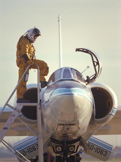
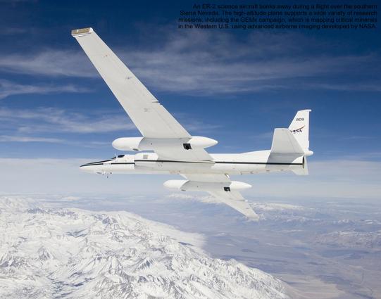
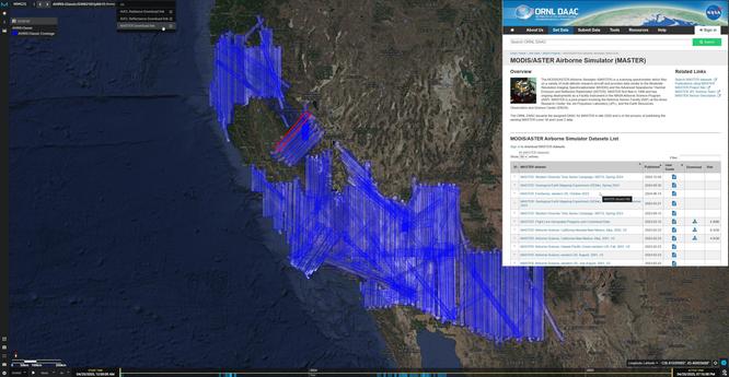
NASA Flights Map Critical Minerals From Skies Above Western US - Technology Used To Chart Other Worlds Is Revealing Minerals In The American West That Are Critical To The Country’s Renewable Energy Future.
--
https://science.nasa.gov/earth/nasa-flights-map-critical-minerals-from-skies-above-western-us/ <-- shared technical article
--
https://popo.jpl.nasa.gov/mmgis-aviris/?mission=GEMx <-- shared GEMx data collection portal
--
#GIS #spatial #mapping #remotesensing #earthobservation #mineral #mineralogy #mining #criticalminerals #USWest #renewableenergy #lithium #GEMx #fedscience #cost #economics #USGS #NASA #GeologicalEarthMappingExperiment #lithium #aluminum #rareearthelements #neodymium #cerium #nationalsecurity #cleanenergy #batteries #smartphones #cellphones #naturalresources #steel #steelmill #dependency #localsources #importing #survey #geology #geologicmapping #exploration #spectrometers #hyperspectral #EMIT #mine #extraction #EarthMRI #opendata
@USGS @nasa
#USWest
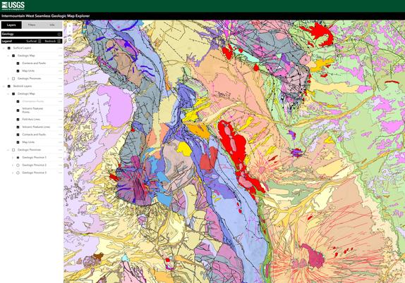
Intermountain West Seamless Geologic Map Explorer - National Cooperative Geologic Mapping Program
--
https://apps.usgs.gov/intermountain_west_seamless_geologic_map_explorer/index.html <-- shared web map / app
--
https://www.sciencebase.gov/catalog/item/65cea1c8d34ec3e1801bf74f <-- shared USGS SB details
--
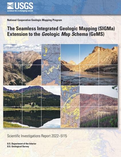
https://doi.org/10.3133/sir20225115 <-- shared SIGMa-GeMS
--
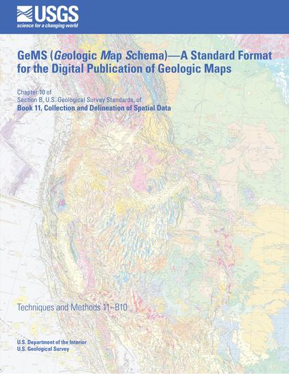
https://doi.org/10.3133/tm11B10 <-- shared GeMS
--
#GIS #spatial #mapping #geology #geologicmapping #USA #USWest #fedscience #usecase #GeMS #SIGMa #opendata #seamless #IntermountainWest #MapExplorer bedrock #surficial #data #NationalCooperativeGeologicMappingProgram #NCGMP #framework #resources #exploration #Strategic #Planning #ProjectDevelopment #ScientificCollaboration #Colorado #NewMexico #interactive #downloadable
@USGS
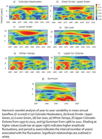
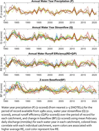
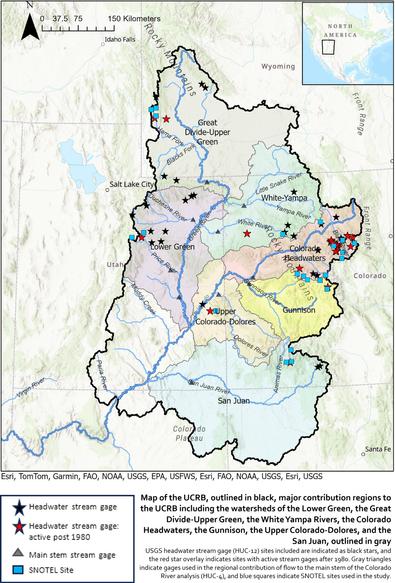
Periodic Variability in Baseflow in Headwater Streams of the Upper Colorado River - Implications for Runoff Efficiency
--
https://doi.org/10.1111/1752-1688.70017 <-- shared paper
--
#GIS #spatial #mapping #water #hydrology #waterresources #USWest #USA #Colorado #ColoradoRiver #ColoradoR #snowmelt #headwater #catchments #flow #baseflow #model #modeling #spatialanalysis #spatiotemporal #geostatistics #planning #groundwater #storage #USGS #periodicity #climatechange #climateforcing #statistics #runoff #rainfall #precipitation #snow
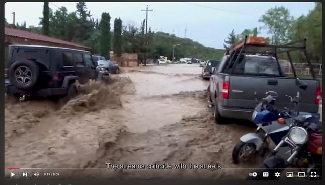
Can These Rocks Reduce Flooding? [USGS video]
--
https://youtu.be/RWoSGOfxOQA?si=bsOLDozyY0CFxhmF <-- shared video
--
“Creating a binational sponge city in the desert: Flooding in the binational cities at Ambos Nogales on the Arizona-Sonora portion of the US-Mexico border has caused damage, ruined livelihoods and taken lives for hundreds of years. New research suggests that flooding can be detained using low-tech, nature-based solutions, like natural infrastructure in dryland streams (NIDS), rock detention structures and green infrastructure.…”
#GIS #spatial #mapping #geology #risk #hazard #water #hydrology #flood #flooding #mitigation #engineering #control #engineeringgeology #planning #management #rock #AmbosNogales #Arizona #USA #USWest #Sonora #Mexico #drylandstreams #natural #floodrisk #stormwater #runoff #economics #cost #floodplains #publicsafety #community #communities #spatialanalysis #spatiotemporal #model #modeling #watershed #pollution #greenspace
@USGS
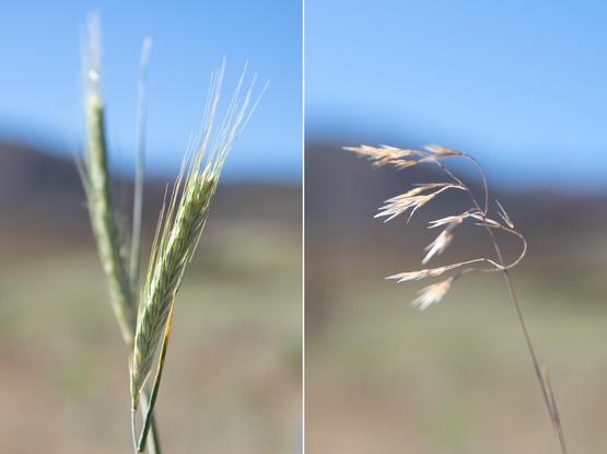
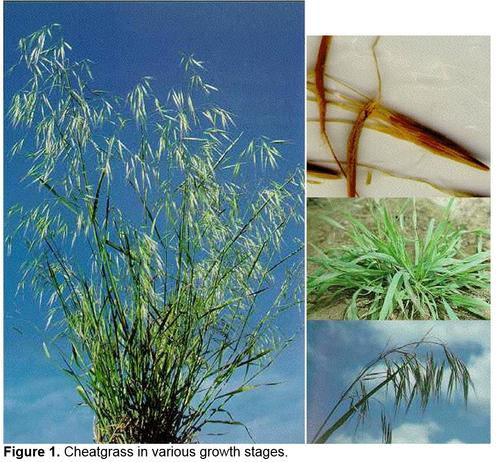
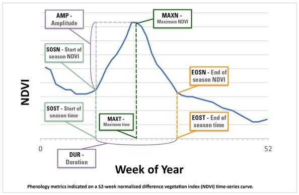
Differentiating Cheatgrass And Medusahead Phenological Characteristics In Western United States Rangelands [remote sensing]
--
https://doi.org/10.3390/rs16224258 <-- shared paper
--
#GIS #spatial #mapping #vegetation #grassland #cheatgrass #medusahead #BRTE #TACA8 #phenology #growingseason #rangeland #EAG #invasivespecies #management #landmanagers #habitat #cost #loss #economicimpact #ecosystem #deterioration #impacts #USWest #spatialanalysis #spatiotemporal #model #modeling #treemodel #landsat #sentinel #HLS #satellite #remotesensing #vegetationindex #NDVI #research #testcase #corrleation #metrics #controlmeasures #herbicide #cattle #grazing #mitigation #landcover #NLDI
Climate Futures For Lizards And Snakes [in the US West, spatial extent changes]
--
https://www.usgs.gov/news/featured-story/climate-futures-lizards-and-snakes <-- shared technical article
--
https://doi.org/10.1002/ece3.70379 <-- shared paper
--
#GIS #spatial #mapping #USWest #climatechange #spatialanalysis #spatiotemporal #US #USA #model #modeling #spatiotemporal #range #extent #ecosystems #reptile #lizard #snake #ectotherms #coldblooded #temperature #water #hydrology #waterresources #species #climateniches #planning #management
@USGS @USFS
OpenET Project – Estimating The Volume Of Evapotranspiration From Remote Sensing Weather & Other Data Sources
--
https://etdata.org/ <-- link to the project / data resources
--
[sharing of this post does not constitute an endorsement of this product or company]
#GIS #spatial #mapping #remotesensing #OpenET #evapotranspiration #weather #waterresources #watersecurity #watermanagement #water #hydrology #USWest #US #USA #webmaps #EarthEngine #spatialdata #API #ET #farming #agriculture #satellite #DataExplorer #sustainability #irrigation #landsat #waterbudgets #people #ecosystems #environment #groundwater #consumption #planning #budgeting #model #modeling
It’s Not Otherworldly, It’s Death Valley – Photo Gallery
Description: It bugs me how often people use the term 'otherworldly' to describe things here on Earth.
https://thecareyadventures.com/blog/its-not-otherworldly-its-death-valley-photo-gallery/
#California #NationalPark #NorthAmerica #OnTheRoad #PhotoOfTheDay #Photography #USA #California #crater #DeathValley #DeathValleyNationalPark #desert #mountains #NationalPark #NPS #PhotoOfTheDay #travel #UbehebeCrater #USWest #USA
Las Vegas Is Going All In On Its Water Conservation Plan
--
https://www.smithsonianmag.com/innovation/las-vegas-going-all-in-water-conservation-plan-180983974/ <-- shared technical article
--
[Las Vegas was never a smart place for a city, a happenstance of cultural, commercial and other social factors, including the legalization of gambling in 1931 with the associated organised crime and now commercial money-making interests driving large growth; climate change and dwindling water resources have only exacerbated that poor location’s various issues – but it is refreshing to see that the city and state officials realise that they were on the proverbial ‘borrowed time’, or in this case: water]
#water #hydrology #waterresources #watersecurity #climatechange #drought #LasVegas #ColoradoRiver #growth #urban #urbandevelopment #sutainability #zeroscaping #waterconservation #Nevada #sustainability #greywater #blackwater #watersaving #urbanplanning #townplanning #regulations #fines #enforcement #legislation #USWest
Albuquerque Made Itself Drought-Proof; Then Its [1930’s Era El Vado] Dam Started Leaking
--
https://grist.org/drought/albuquerque-water-el-vado-dam/ <-- shared media article
--
https://www.inkstain.net/2024/04/the-loss-of-el-vado-dam/ <-- April 2024 article on the loss of the El Vado Dam, reporting on the BuRec’s decision and possible ongoing consequences
--
#water #hydrology #waterresources #watersecurity #NewMexico #irrigation #farming #engineering #engineeringgeology #ElVado #dam #infrastructure #construction #engineering #architecture #civilengineering #reservoir #climatechange #infrastructureworks #sustainability #failing #failinginfrastructure #drought #monsoon #precipitation #surfacewater #aginginfrastructure #household #urban #damfailure #watersupply #groundwater #mining #ecosystems #habitats #sustainable #USWest #USA
Jeffersonian "liberty": the opportunity for white male landowners to establish coexistence amongst themselves by dominating and exploiting everyone else.
How the United States Laid Claim to the Mississippi River, One Mile at a Time | Smithsonian
#USHistory #USExpansion #Mississippi #ThomasJefferson #AndrewJackson #USWest #BoyceUpholt #TheGreatRiver #NativeAmericanHistory
Colorado River Basin - Coordinated Reservoir Operations (CROS) Again In 2024
--
https://coloradoriverrecovery.org/blog/cros-again-in-2024/ <-- shared technical post
--
http://www.cbrfc.noaa.gov/ <-- Colorado Basin River Forecast Center, More detailed information about forecasted streamflows in the Colorado River basin
--
#GIS #spatial #mapping #ColoradoRiver #ColoradoR #ColoradoRiverBasin #spatiotemporal #reservoir #reservoirs #releases #mountain #snowpack #headwaters #storage #waterresources #watersecurity #USA #USWest #CROS #planning #management #water #hydrology #surfacewater #habitat #fish #ecosystems #endangered #climatechange #pikeminnow #humpbackchub #razorbacksucker #bonytailchub #streamflow #riverconditions #riverflow #surplus #wateruse #coordination #model #modeling
[State Of] Colorado To Shield Thousands Of Acres Of Wetlands, Miles Of Streams [After Federal Supreme Court Sackett Decision]
--
https://coloradosun.com/2024/05/09/colorado-law-protecting-wetlands-supreme-court/ <-- shared media article
--
#water #hydrology #waterquality #waterresources #watersecurity #Colorado #USWest #staterights #supremecourt #Sackett #protection #CleanWaterAct #EPA #permits #permitting #construction #development #roads #impacts #statewaters #wetlands #streams #seasonal #ephemeral #legislation #statehouse #WesternUSA #rain #snowmelt #precipitation #climatechange #oversight #subsurface #groundwater #legal #regulations #waterways #dredge #fill #farming #agriculture #irrigation #wastewater #treatment #pollution #treatment #mitigation
Precipitation May Brighten Colorado River’s Future
--
https://cires.colorado.edu/news/precipitation-may-brighten-colorado-rivers-future <-- shared technical article
--
https://doi.org/10.1175/JCLI-D-23-0617.1 <-- shared paper
--
#GIS #spatial #mapping #modeling #model #water #hydrology #waterresources #prediction #climatechange #Colorado #ColoradoR #ColoradoRiver #drought #watersecurity #planning #management #temperature #precipitation #rainfall #snow #snowpack #headwaters #watersheds #USWest #watermanagers #IPCC #LeeFerry #ColoradoRiverCompact #climatemodel #basin #geography #spatialanalysis #vulnerability
@CIRES
Improved AI Process Could Better Predict Water Supplies
--
https://www.sciencedaily.com/releases/2024/05/240501091622.htm <-- shared technical article
--
https://doi.org/10.1609/aaai.v38i21.30337 <-- shared paper
--
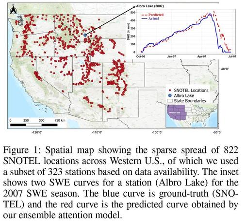
“A new computer model uses a better artificial intelligence process to measure snow and water availability more accurately across vast distances in the West, information that could someday be used to better predict water availability for farmers and others. The researchers [link above] predict water availability from areas in the West where snow amounts aren't being physically measured…”
#GIS #spatial #mapping #water #hydrology #waterresources #spatialanalysis #spatiotemporal #model #modeling #numericalmodeling #computermodel #AI #snowpack #WesternUSA #USWest #watersecurity #prediction #SnowWaterEquivalent #SWE #irrigation #floodcontrol #powergeneration #drought #management #decisions #SnowTelemetry #SNOTEL #machinelearning #attentionmechanisms #correlations #snowpack
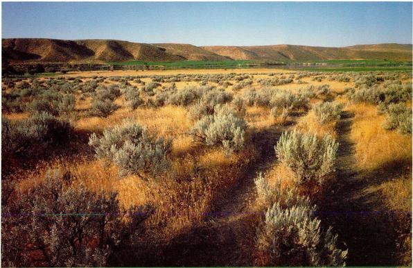
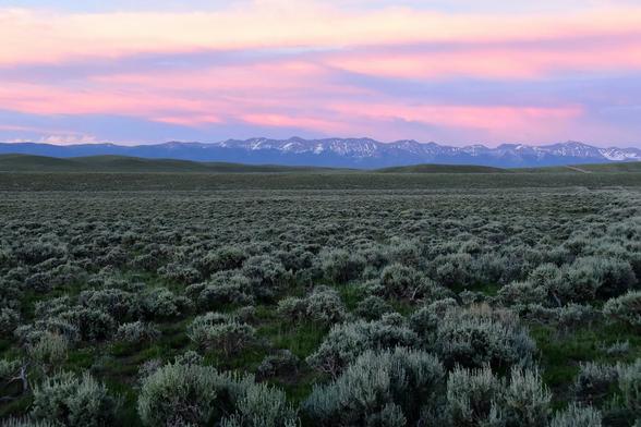
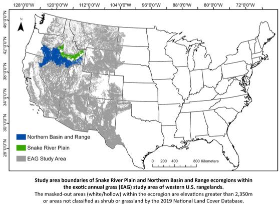
Early Estimates Of Exotic Annual Grass (EAG) In The Sagebrush Biome, USA, 2024 (ver. 1.0, April 2024)
--
https://doi.org/10.5066/P9351ZTZ <-- link to @USGS open data resource
--
#RemoteSensing #GIS #spatial #mapping #MachineLearning #Mapping #EnvironmentalResearch #earthobservation #datadownload #digitaldata #opendata #EROS #invasivespecies #exotic #grass #vegetation #spatialanalysis #EAG #AIM #AI #machinelearning #NDVI #USWest #USA #satellite #sagebrush #biome #landmanagement #planning #range #landmanagers
@USGS
🐐 Researchers map 33 new big game migrations across American West
https://phys.org/news/2024-04-big-game-migrations-american-west.html
#nature #animals #conservation #usa #uswest #biggame #migration
Researchers Find The Link Between Human Activity And Shifting Weather Patterns In Western North America
--
https://phys.org/news/2024-04-link-human-shifting-weather-patterns.html <-- shared technical article
--
https://doi.org/10.1038/s41612-024-00608-2 <-- shared paper
--
#GIS #spatial #mapping #spatialanalysis #model #modeling #climatechange #climate #weather #extremeweather #humanactivity #humanimpact #weatherpatterns #NorthAmerica #USWest #USA #drought #flood #watersecurity #naturalhazards #disasters #global #weathersystems #remotesensing #earthobservation #teleconnection #CommunityEarthSystem #numericmodeling #spatiotemporal
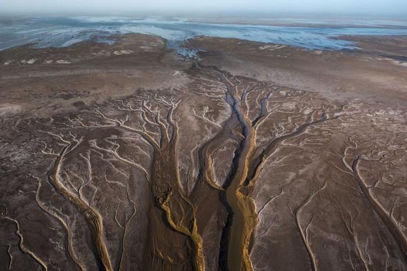
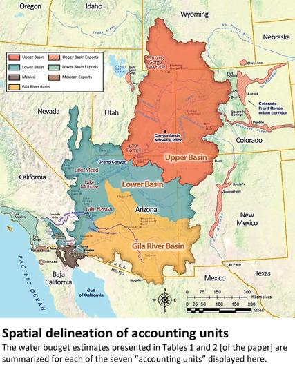
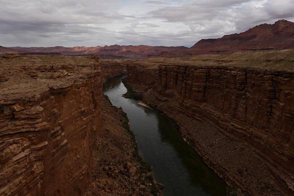
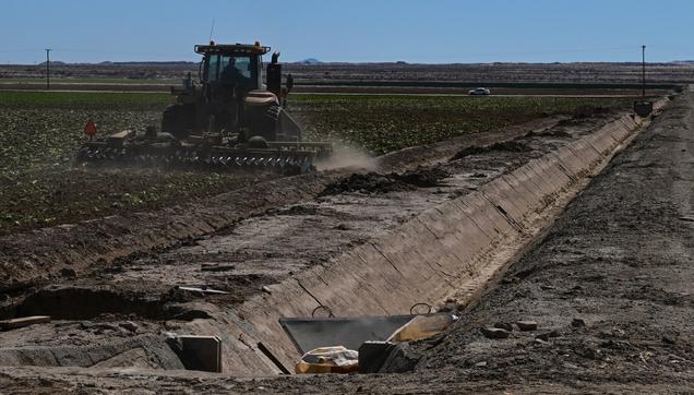
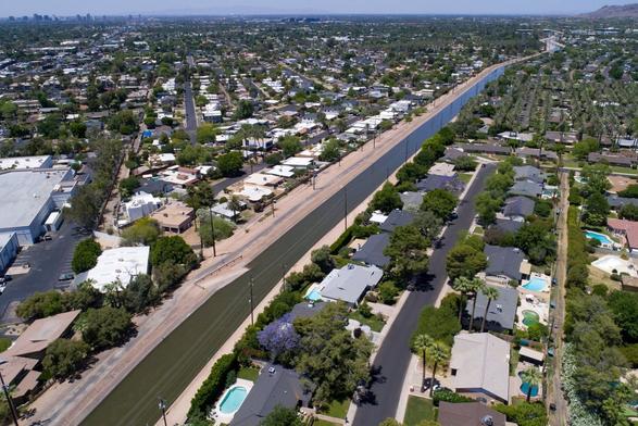
New Water Accounting Reveals Why The Colorado River No Longer Reaches The Sea
--
https://doi.org/10.1038/s43247-024-01291-0 <-- shared paper
--
#GIS #spatial #mapping #ColoradoRiver #ColoradoRiverBasin #CRB #USA #waterresources #USWest #irrigation #crops #feed #grass #hay #alfalfa #SaudiArabia #watersecurity #wateruse #water #hydrology #waterrights #overuse #magicwater #extraction #rationing #cropland #watercrisis #accounting #volumetric #model #river #watersupply #modeling #riparian #wetland #ET #evapotranspiration #waterbudget #regional #municipal #agriculture #commercial #industrial #cattle #cattlefeed #spatialanalysis #spatiotemporal
Talks To Save The Colorado River Just Hit A Logjam
--
https://www.washingtonpost.com/climate-environment/2024/03/06/colorado-river-water-conservation-state-plans/ <-- shared media article
--
#water #hydrology #USA #USWest #coloradoriver #waterresources #watersecurity #waterconservation #arizona #california #colorado #accord #planning #federal #state #recharge #snowpack #proposals #compact #coloradorivercompact #government #regulations #drought #overuse #irrigation #WesternStates #nevada #comprise #agreement #watermanagement #climatechange #demographics #growth #demands

![work flow graphic - Phenology method flowchart. This flowchart is the overview of capturing the phenology training data for cheatgrass (BRTE [44]) and medusahead (TACA8)
(a) The methods for extracting high probability BRTE and TACA8 pixels
(b) the decision tree analysis development using exotic annual grass (EAG) training data from Benedict et al.
(c) developing the training data
(d) developing the phenology model.](https://files.mastodon.social/cache/media_attachments/files/113/556/797/383/305/767/small/c01cdbcb19f2ea9a.jpg)
