#WyeValleyWalk

2023-05-19

Last #WyeValleyWalk for the week, and the penultimate section of the walk as a whole. From Llangurig to Pont Rhydgaled, the route heading westwards, the river at over 1000 ft OD. The valley here is broader than it has been for a while, the river shallower, running clear over stone. Finishing at the confluence with Afon Tarrenig, the first river to join Afon Gwy.

Looking forward to the walk up to the source on Pumlumon, whenever that might be.
#AfonGwy #FingerpostFriday #Wales #Cymru

Looking across and upstream a calm river from a low riverbank. The land on each side is green and fertile in early summer. Steeper hills rise beyond. The sky is blue with plentiful grey-white cloud, mirrored in the water.Looking down on a broad green valley, with a silver-blue river curving through it. Below to the right is a bridge carrying a single lane unmetalled track over the river. The track wends its way towards the centre of the image. Higher wooded and scrubby hills rise on the right, a mountain (Pumlumon) can be seen in shadow in the V of the valley, far left horizon.The meeting of two rivers. Afon Tarrenig flows underneath the viewer into the blue waters of Afon Gwy. Trees partially overhang on the right, steep hills rise on the left beyond. The blue sky is mirrored in the waters at the confluence.Portrait of a woodenfingerpost. Arrows point left and right. The left arm says "Maes Parcio Hafren 
Hafren Car Park 5 3/4 m" 

The right arm says "Llangurig 6 1/2 m" 

Both arms carry the circular leaping salmon logo of the Wye Valley Walk. The post itself has "Wye Valley Walk" carved into it vertically. The post is next to a tarmac'd main road.
2023-05-16

Another marvellous section of #WyeValleyWalk today, between Rhayader and Llangurig.

Some big climbs, the total ascent over the 12 miles was over 600 metres. Beautiful plunging valleys, a late medieval farmhouse turned visitor centre at Gilfach, bluebell woods, a terrific Bronze Age kerbed cairn in a wonderful location, and views of Pumlumon and the source of the Gwy.

#AfonGwy #BronzeAge #Rhayader #Llangurig #RadnorshireWildlifeTrust

The Byre at Gilfach, part of a late medieval longhouse, now run as a visitor centre by Radnorshire Wildlife Trust. A slate built building with three doors and a window above.A Bronze Age kerbed cairn, with a kerb of upright stones leaning outwards, set on a little knoll above a valley. A steep hillside in shadow across the valley forms the backdrop.A wooded hillside, blue with bluebells, leads steeply down to the river below.A blue river curves gently away from the viewer up a lush valley. A grey slate church with a tower topped with a short spire is on the right hand side. A blue sky with fluffy white clouds overhead.
2023-05-15

A fine day on the #WyeValleyWalk today, walking the section between Newbridge and Rhayader.

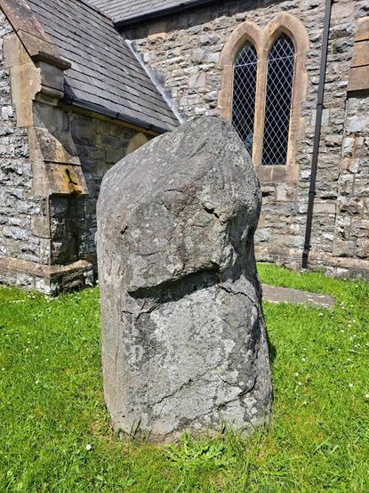
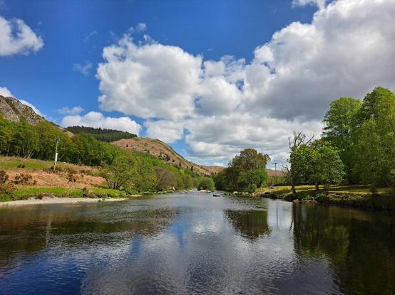
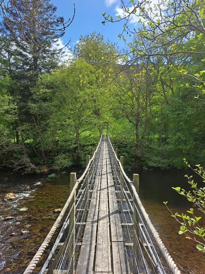
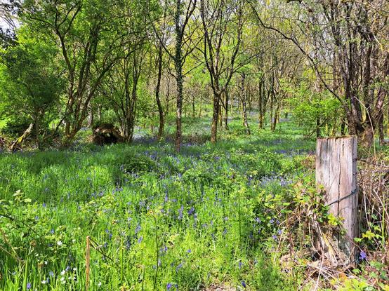
Not so close to the river as last time, but some beautiful spring woods full of bluebells, some striking upland landscapes, a likely Bronze Age standing stone on the later site of a churchyard, and an exciting bouncy suspension bridge to cross the Afon Elan at its confluence with Afon Gwy in the style of Indiana Jones. Less than 30 miles to the source now.

#AfonGwy #Rhayader #BronzeAge

A spring wood redolent with bluebells. Mixed deciduous trees in late spring canopy, with thick vegetation below. An old wooden gatepost slowly returning to nature in the right foreground. Sunny and warm.Portrait. A grey stone of close-grained stone standing in a churchyard near the church porch. The stone is a bit less than 6 feet tall, and very broad and chunky. From this angle the top third appears wider than the bottom, coming to a tapered point. The effect is rather phallic.Steep hills drop down to a blue-green river. The water is calm and mirrors the hills and the cloud-strewn blue sky above.Portrait. Looking along a narrow wood and rope suspension bridge from one end. The footway is formed of planks laid in three parallel rows. Ropes form a handrail on either side. Lush green trees and grass form the backdrop across the river. The bridge is swaying slightly in the breeze, and walking across it makes it bounce.
2023-05-01

A wonderful section of #WyeValleyWalk from Builth Wells to Newbridge on Wye today, using the #TrawsCymru T4.

Cold to start, but the sun soon came out and the riverbank and Beltane woods were viscerally, achingly beautiful.

A day to make the heart sing, with some lovely human interaction (for someone who likes solitude); kindness from a bus driver, a beekeeper and campervan driver.

Lovely Bronze Age standing stone too.

#AfonGwy #CalenHaf #Beltane #FingerpostFriday #StandingStoneSunday

A stone bridge with rounded arches spans a wide river. The sky is partly cloudy, but blue sky peaks through.A wooden fingerpost with arrows pointing left and right. Both sides are marked with yellow arrowheads, a walking figure and a circular badge showing a leaping salmon (the Wye Valley Walk symbol). The wood is worn and sports some crusty lichen.A wide river flowing over small rapids, white water streaking the blue. The river bank is lush with green grass and spring flowers, trees overhang. The sky is blue and the scene is lit with sunshine.A squat standing stone in a field. The stone is leaning heavily to the left. It's a block of sandstone, gnarled and weathered. Blue skies above.
2023-04-08

Back on the #WyeValleyWalk for Easter Saturday. An incredibly beautiful walk between Boughrood and Builth Wells/Llanfair-ym-Muallt.

Barely saw anyone in 6 hours. Managed to fit in some prehistoric detours en-route: a fine standing stone, two Bronze Age round barrows, a Bronze Age cairn, two hilllforts and a joy of a very obscure stone circle with magic views of the Black Mountains and Brecon Beacons.

#BronzeAge #StandingStoneSunday #HillfortsWednesday #Wales

The Afon Gwy at Boughrood, from the river bank. The river is blue and calm, across the other side are grass fields and trees. The sky is blue, with some high altitude cloud.A large standing stone, with a very pronounced lean, in a field. The earth around the base of the stone is pitted from animals rubbing. Under a very blue sky.Very low stones of a small stone circle (Banc y Celyn) protruding from tussocky grass. The backdrop is a panorama of the Black Mountains escarpment.A view over lush green fields with a river running through, form a very steep hill above. Beyind the valley, hills rise steeply either side. The centre skyline is dominated by a rounded mountain plateau (The Radnor Forest).
2023-03-25

Last summer I started on a long held ambition to walk the River Wye/Afon Gwy from Severn to source. After doing 70 miles of the #WyeValleyWalk a combination of train difficulties, worsening weather and finally Covid stopped my progress at Hay on Wye.

Delighted to be back on it today, a short 8 mile section of changeable spring weather and stunningly beautiful scenery between Hay and Boughrood, the Black Mountains an ever present companion.

#BlackMountains #SouthWales #RiverWye #SouthWales

Morris-men performing in the sunshine outside Hay Castle.Panoramic view of the Black Mountains across the Wye Valley near Llowes. Fluffy clouds paint shadows on the slopes of the mountains, the valley below is green and lush.A large upright slab of stone with an intricate Celtic cross incised on its wide face, erected inside a church. Moll Walbec's stone, apparently thrown by a giantess and then later Christianised.The swollen Gwy in spate at Glasbury Bridge. Looking downstream, the river is blue-brown and broken with swift currents. The sky is blue with white fluffy clouds.

Client Info

Server: https://mastodon.social
Version: 2025.07
Repository: https://github.com/cyevgeniy/lmst