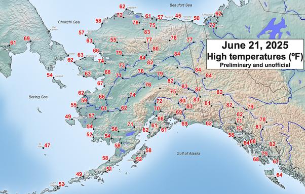
High temperatures (ºF) in and around Alaska on Saturday. Warmest day of the year so far in parts of Southeast Alaska, southern Yukon Territory and NW British Columbia. Also warm North Slope and Bering Strait. Wildfire smoke took the edge of high temperatures in parts of the Interior. #akwx #weather
#akwx
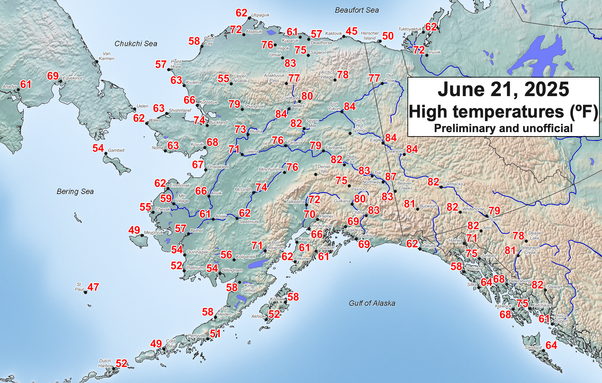
High temperatures (ºF) in and around Alaska on Saturday. Warmest day of the year so far in parts of Southeast Alaska, southern Yukon Territory and NW British Columbia. Also warm on the North Slope and in the Bering Strait. Wildfire smoke took the edge of high temperatures in parts of the Interior. #akwx #weather
Fire Status Updates for June 22 2025 for fires followed by BakersRelay. NOTE: Fire info could be several hours old.
ALASKA
#HimalayaRoadFire ACRES: 1,600 Contain: unknown
#BonanzaCreekFire ACRES: 540 Contain: unknown
#NinetyeightFire ACRES: 800 Contain: unknown
#WolverineComplex ACRES: 1,000 Contain: unknown
#KechumstukCreekFire ACRES: 4,201 Contain: unknown
#MarshallMountainFire: ACRES: 300 Contain: unknown
#BearCreekFire: ACRES: unknown Contain: Unk
#SaintGeorgeCreekFire ACRES 285 Contain: Unk
#TwelveMileLakeFire ACRES 2,000 Contain: Unk
#AggieCreekFire ACRES 400 Contain: Unknown
#GilmoreTrailFire ACRES 15.5 Contain: Unknown
#GoldstreamCreekFire ACRES 80s Cont. Unknown
Fire info from: https://akfireinfo.com/2025/06/21/roundup-of-interior-fires-and-evacuations/
Typically updated at 6:00 pm EDT daily
CALIFORNIA
#RockFire ACRES 7
OREGON
#PinnacleFire ACRES 15 CONTAINMENT Unknown
#UpperApplegateFire ACRES 468 CONTAIN. 55%
NEVADA
#ConnerFire ACRES 17,352.7 CONTAIN. O%
UTAH
#ForsythFire ACRES 1,639.6 CONTAINMENT 0%
#FranceCanyonFire ACRES 15,755.9 CONT. 10%
#BridgeCreekFire ACRES 2,218.6 CONTAIN. Unk
WASHINGTON
#PomasFire ACRES 1,059.5 CONTAINMENT 0%
#TrailCreekFire ACRES 50.6 CONTAINMENT Unk
Fires No Longer Followed:
#ChariotFire Forward Progress stopped
#ElizabethFire Forward Progress stopped
#RushFire ACRES 33 CONTAINMENT 60%
#GreenFire ACRES 75 CONTAINMENT Unknown
#NIFC #wildfires #firewx
NIFC New Or Updated Wildfire Perimeter
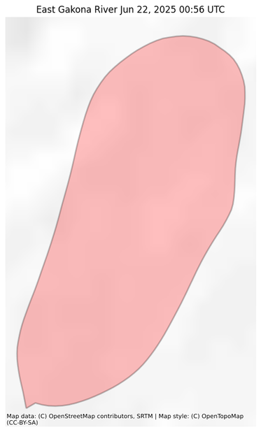
Incident Name: East Gakona River
Acres: 405.1 acres
Updated: Jun 22, 2025 00:56 UTC
Source: IRWIN
#EastGakonaRiverFire #AKwx
#NIFC #wildfires #firewx
NIFC New Or Updated Wildfire Perimeter
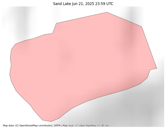
Incident Name: Sand Lake
Acres: 303.7 acres
Updated: Jun 21, 2025 23:59 UTC
Source: IRWIN
#SandLakeFire #AKwx
#NIFC #wildfires #firewx
NIFC New Or Updated Wildfire Perimeter
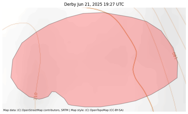
Incident Name: Derby
Acres: 34.6 acres
Updated: Jun 21, 2025 19:27 UTC
Source: IRWIN
#DerbyFire #AKwx
#NIFC #wildfires #firewx
NIFC New Or Updated Wildfire Perimeter
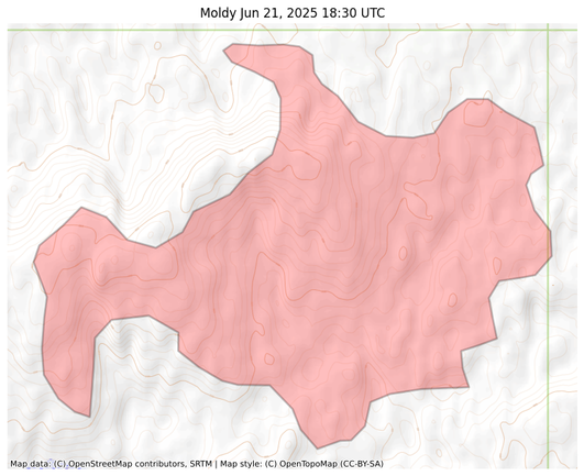
Incident Name: Moldy
Acres: 3407.3 acres
Updated: Jun 21, 2025 18:30 UTC
Source: IRWIN
#MoldyFire #AKwx
#NIFC #wildfires #firewx
NIFC New Or Updated Wildfire Perimeter
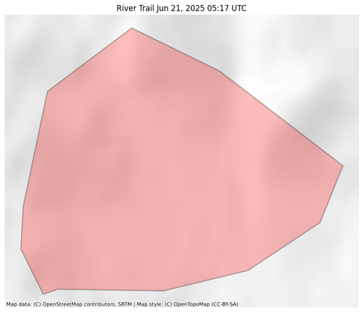
Incident Name: River Trail
Acres: 861.5 acres
Updated: Jun 21, 2025 05:17 UTC
Source: IRWIN
#RiverTrailFire #AKwx
#NIFC #wildfires #firewx
NIFC New Or Updated Wildfire Perimeter
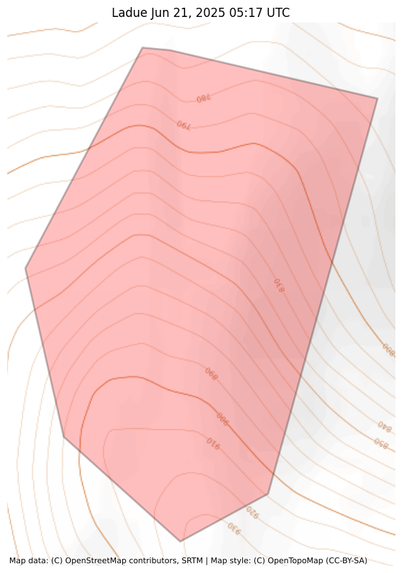
Incident Name: Ladue
Acres: 105.1 acres
Updated: Jun 21, 2025 05:17 UTC
Source: IRWIN
#LadueFire #AKwx
#NIFC #wildfires #firewx
NIFC New Or Updated Wildfire Perimeter
Incident Name: McArthur Creek
Acres: 1093.7 acres
Updated: Jun 22, 2025 05:10 UTC
Source: IRWIN
#McArthurCreekFire #AKwx
#NIFC #wildfires #firewx
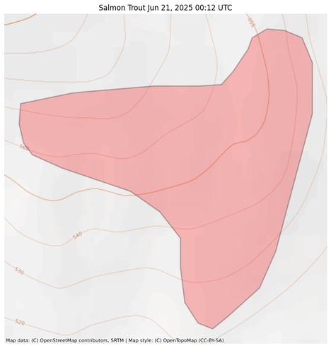
NIFC New Or Updated Wildfire Perimeter
Incident Name: Salmon Trout
Acres: 70.0 acres
Updated: Jun 21, 2025 00:12 UTC
Source: IRWIN
#SalmonTroutFire #AKwx
#NIFC #wildfires #firewx
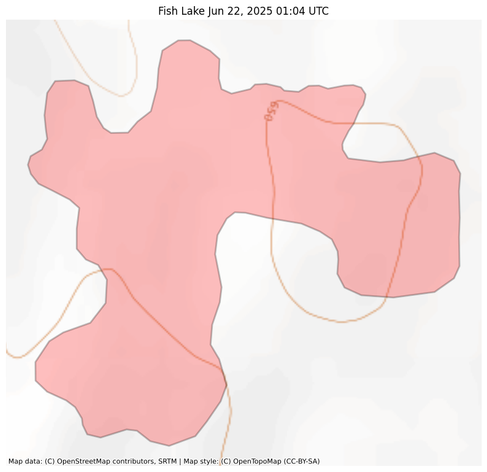
NIFC New Or Updated Wildfire Perimeter
Incident Name: Fish Lake
Acres: 40.7 acres
Updated: Jun 22, 2025 01:04 UTC
Source: IRWIN
#FishLakeFire #AKwx
#NIFC #wildfires #firewx
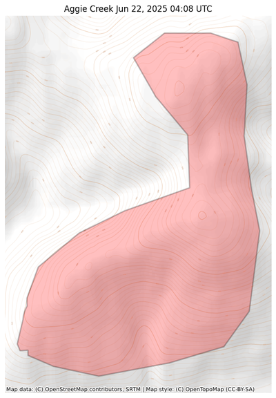
NIFC New Or Updated Wildfire Perimeter
Incident Name: Aggie Creek
Acres: 933.6 acres
Updated: Jun 22, 2025 04:08 UTC
Source: IRWIN
#AggieCreekFire #AKwx
#NIFC #wildfires #firewx
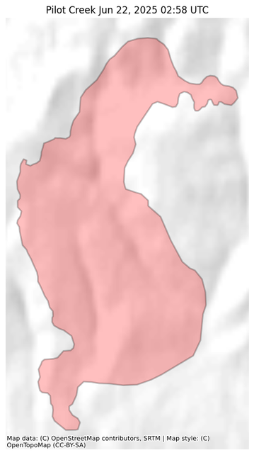
NIFC New Or Updated Wildfire Perimeter
Incident Name: Pilot Creek
Acres: 3301.1 acres
Updated: Jun 22, 2025 02:58 UTC
Source: IRWIN
#PilotCreekFire #AKwx
#NIFC #wildfires #firewx
NIFC New Or Updated Wildfire Perimeter
Incident Name: Buckley Bar
Acres: 3.9 acres
Updated: Jun 21, 2025 18:31 UTC
Source: IRWIN
#BuckleyBarFire #AKwx
#NIFC #wildfires #firewx
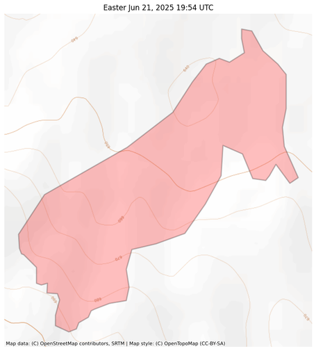
NIFC New Or Updated Wildfire Perimeter
Incident Name: Easter
Acres: 86.2 acres
Updated: Jun 21, 2025 19:54 UTC
Source: IRWIN
#EasterFire #AKwx
#NIFC #wildfires #firewx
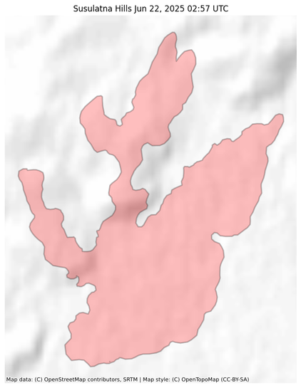
NIFC New Or Updated Wildfire Perimeter
Incident Name: Susulatna Hills
Acres: 2784.3 acres
Updated: Jun 22, 2025 02:57 UTC
Source: IRWIN
#SusulatnaHillsFire #AKwx
#NIFC #wildfires #firewx
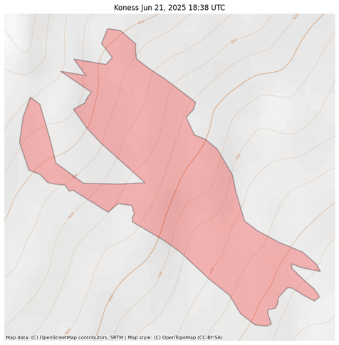
NIFC New Or Updated Wildfire Perimeter
Incident Name: Koness
Acres: 92.7 acres
Updated: Jun 21, 2025 18:38 UTC
Source: IRWIN
#KonessFire #AKwx
#NIFC #wildfires #firewx
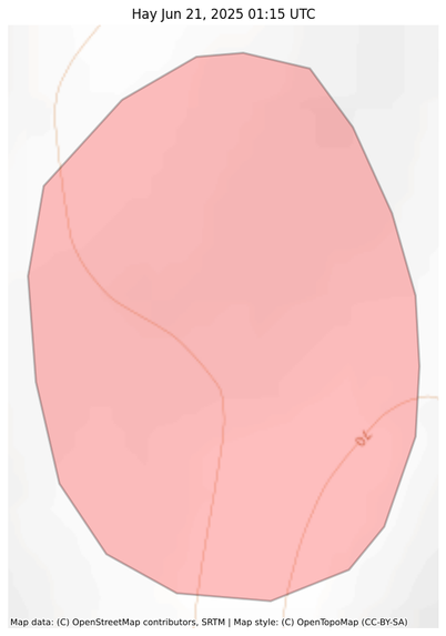
NIFC New Or Updated Wildfire Perimeter
Incident Name: Hay
Acres: 44.5 acres
Updated: Jun 21, 2025 01:15 UTC
Source: IRWIN
#HayFire #AKwx
#NIFC #wildfires #firewx
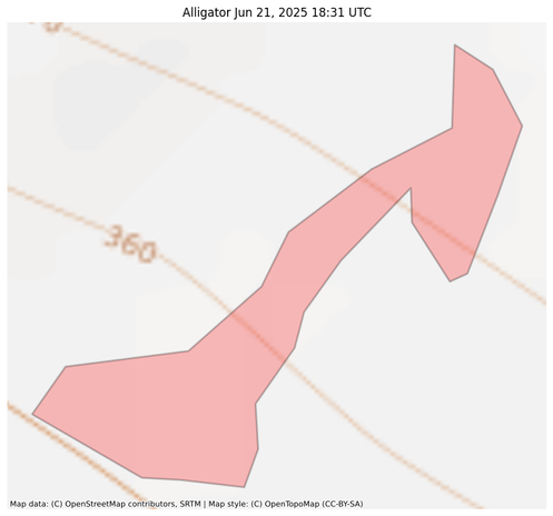
NIFC New Or Updated Wildfire Perimeter
Incident Name: Alligator
Acres: 2.9 acres
Updated: Jun 21, 2025 18:31 UTC
Source: IRWIN
#AlligatorFire #AKwx
