The Feasibility Of Using LiDAR-Derived Digital Elevation Models [DEMs] For Gravity Data Reduction
--
https://www.usgs.gov/3d-elevation-program/news/feasibility-using-lidar-derived-digital-elevation-models-gravity-data <-- shared article
--
https://pubs.usgs.gov/publication/ofr20251019 <-- shared report
--
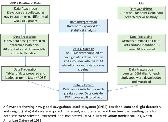
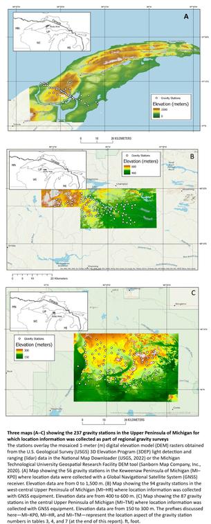
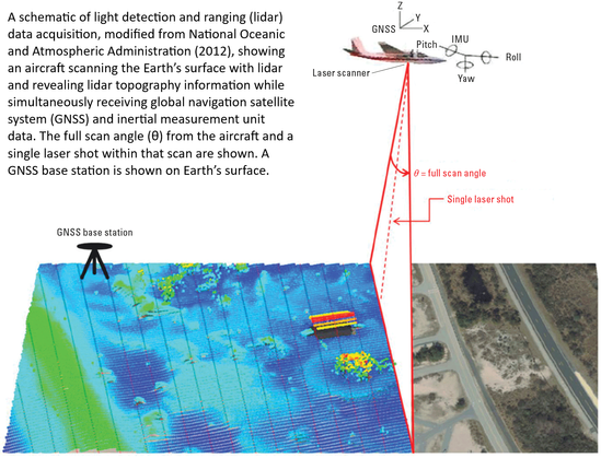
“A nice report from our colleagues in the USGS Mineral Resources Program on the feasibility of lidar-derived DEMs, including 3DEP data, for gravity data reduction…”
#GIS #spatial #mapping #3dep #elevation #fedscience #remotesensing #earthobservation #gravity #submetre #accuracy #precision #dGNSS #GNSS #global #navigation #satellite #GPS #LiDAR #DEMs #gravimetrics #milligals #Bouguer #anomaly #monitoring #corrleation #refinement #datareduction #appliedscience #usecases
@USGS
#dGNSS
Embrace another transformation powered by #technology!
This article delves into using affordable #geolocation equipment to capture precise locations of each find during an archaeological survey. It shares our experience using #dGNSS equipment, revealing how it enhances #data recording and representation. Read: https://doi.org/10.1017/aap.2019.21
Join us on this journey if you're also interested in utilizing technology in archaeology!
Client Info
Server: https://mastodon.social
Version: 2025.04
Repository: https://github.com/cyevgeniy/lmst


