#geohash

Lam 'al AdieLamal@ruhr.social
2025-06-06

Heute ist ein Tag zum Davonlaufen…
Beim #mdrza überholt mich ein Auto in einer Baustelle über den Linksabbieger des Gegenverkehrs.
Beim #mdrnh will ich gleich noch den #Geohash des Tages in #Bochum einsammeln. Der ist heute nur mit der Bahn erreichbar. Also ausschließlich, er liegt auf dem Gleis von GE bzw RE nach BO.

Screenshot der App GeohashDroid. Auf dem Luftbild ist der Zielpunkt des Tages mit einerschwarz-weiß-karierten Flagge gekennzeichnet. die Flagge markiert einen Punkt mitten im Gleiskörper einer Bahnstrecke
Anatoly Tsyplenkovatsyplenkov@fosstodon.org
2025-04-15

Just learnt about the #quadbin spatial indexing. There is not much information about it compared to #geohash, #h3 or #s2. Has anyone worked with it before? Are there any pitfalls that I am missing, because it sounds freakin cool.

2025-03-12

Any deno kv experts out here?
For FLOSS ActivityPub Clients:
I am looking for best practices for a key which has a geohash as secondary index and might be searchable by Date as well, like an as `Event` with a `location`
:)

#deno #kv #keyvalue #denokv #geohash #database #activitypub

2024-10-21

I am looking for a small libarary for #Kotlin on #Android to calculate a #geohash from Location. I am considering this:

github.com/AANikolaev/android-

Do you know any other small footprint alternatives?

What is going on with #geohash this weekend? Why are the points since thursday in pairs, a few hundred meters from each other?

Screenshot of geohashdroid showing the geohash in my graticule for 11 of august, somewhere between Muret and St GaudensScreenshot of geohashdroid showing the point for the 8th of august, prtty much in the same place as the 11th of august oneThe point for the 9th of August is on the other side of the graticule, slightly north of the city of RevelAnd finally the point for 10th of august, a little east of Revel
Lam 'al AdieLamal@ruhr.social
2024-08-08

@orrbot
Ich bin so neidisch auf Euch, #Wuppertal !

Heute (08.08.2024) war der beste Tag, einen grandiosen #Geohash einzusammeln:
geo:51.24806,7.12260
Erreichbar sowohl per Schiff (auf der Wupper) als auch mit dem coolsten öffentlichen Nahverkehrsmittel der Welt.

Und ich hatte keine Zeit…
#geohashing #Schwebebahn #NRW

Lam 'al AdieLamal@ruhr.social
2024-07-14

Hurra, der Geohash des Tages ist nur knapp 2km (Luftlinie, real 3,5km) vom heutigen Camping entfernt.
Ich musste zum Sportplatz-Eintritt die Zaunkarte nehmen.
#Görlitz #geohash 51N14E 14.07.2024
Es ist erstaunlich, wie viele Höhenmeter sich bei Görlitz auf so kurzer Strecke sammeln lassen.

Lam 'al AdieLamal@ruhr.social
2024-07-14

Tag 2: heute geht es nach Görlitz. Eine ganz besonders schöne Überraschung gibt es direkt am Zielort: der #Geohash des Tages ist in #Görlitz, der wird dann auch eingesammelt😃
Unterwegs schauen wir einen Bagger an, viel Gegend, alte Gemäuer… ich freue mich schon.
#TandeMartha #oderneisseradweg #zittau #mdrddg #mdRidU

#todaysbikeride and #geohash expedition was supposed to be a simple and quickly done thing. The target point is just 5km from home.

That was counting without the strong headwind and one of my tires experiencing a Rapid Unscheduled Decompression event, about 1km before reaching the target, so I had to walk the remaining distance and then all the way back home, while carrying the bike (I didn't take my bike lock with me, so I couldn't leave it at the accident place and recover it on the way back)

Screenshot of geohashdroid showing that I reached the target point ("as close as gps precision allows")A pile of hayballs at the edge of the fieldThe target point. There isnothing there, it's in the middle of a grass field (well, not really in the middle, I shot the picture pointing in the most empty directihn for dramatic effece, there is in #act a house/farm just behind me)

#TodaysBikeRide and #Geohash expedition. It's been a while since I went out! Well I guess the 3 day weekend helps with recovering from a week of work, doing chores,and then having abit of time and energy left. I should do that more often.

Anyways, thegeohash point today was in someone's garden, and unfortunately they are not playing geohash. So I could not get closer than16m in the backalley.

Geohashdroid screenshot showing my gps position some 16 meters away from the targetAn interesting foldabe barrier. The control panel has four keyholes and there is some code/pattern to close it, but the key is a regular triangle socket wrench thingThe geohash point is in someones garden, behind this fence. It's a not very biodiverse garden, looks like a golf green. There is a tree on the right of the picture and a garage wall on the leftA view of the unpaved back alley near the geohash point. Lots of trees around, and there is a house entrance at the far end
P3KO | Petrified activist 🐧P3KO@mstdn.social
2024-02-16

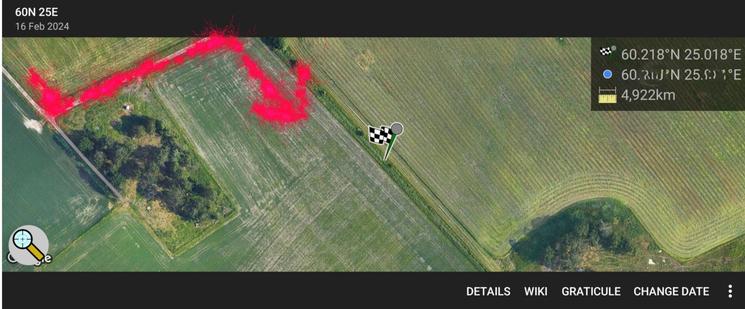
Päivän #N60E25 #geohash olis niin lähellä,

mutta ojassa Viikin pelloilla,
sataa tuulen kanssa vettä vaakasuoraan
ja lämpötila on nollan pinnassa

Niin kiimassa en ole, että lähtisin #Viikki 'in laduille polkeen ...

#pyöräily

#TodaysBikeRide is a #GeoHash expedition alongsioe the Garonne's Lateral Canal to Eurocentre, a logistics platform north of Toulouse with lots of warehouse, a mail sorting center and the like. Nothing new for me: I used to work there a few years ago,when the owner of a company I worked (as a software engineer) for decided he didn't want to waste time in traffic jams entering the city, and moved us outside the city. Leading to several of us finding other jobs nearer to home.

Screenshot of Geohashdroid congratulating me for getting as close to the point as GPS can measureView from the target point: alarge warehouse with truck loading docks numbered up to 70View of the CanalView of some overflow path besides the canal

#TodaysBikeRide and #GeoHash expedition brings us to the village of St Sernin, once again in the middle of a field, but I got quite close this time

Screenshot showing I got within 18 meters of the targetView from the village. You probably can't see it on the picture, but in real life you can barely see the TV tower in the distance, which is not far my starting pointThe target point is in the middle of a field fieldThe village church, with typical red brick steeple wall

#TodaysBikeRide and #GeoHash expedition. Once again the target point was in the middle of a field, but I got "close enough". It was very slightly raining during 2 hours while I was out. The sun came out just as I came back home.

Screenshot of geohashdroid showing my position about 270m from the target point, with no roads allowing to get any closerThe target point is somewhere in this field. poppies are in bloom, and so is a hedge of privet (I guess? I'm not good at plants) on the left. The sky is gray and cloudy and the field is green (unidentified plants)The local church, typical of the area, is built from red bricks and has bells in arcades in a steeple-wall, instead of the bell tower you'd find elsewhere. It also has a relatively large forecourt with trees on either side

#TodaysBikeRide and #GeoHash expedition. The target point was not quite reachable (would have to go down a few meters, seemed somewhat dangerous, and no road on the downhill side to get back). And then it started raining, so I didn't stay there very long.
Fun thing found nearby: some person owning a closed restaurant which has a Google Maps pin saying "PLEASE DELETE THIS"

Geohashdroid screenshot showing I was about 50 meters from the target pointThe target point, it's in the middle of a grass (I suppose?) field and not quite reachable
sporksmith :unicycle: :rust:sporksmith@hachyderm.io
2023-03-19

Made a video of my pseudorandom #geohash #unicycle adventure from yesterday: youtube.com/watch?v=nrlpUz9nL_

Also wrote it up on the geohash wiki: geohashing.site/geohashing/202

Sadly I was only able to get within 5m of the hash point, so had to settle for the "No Trespassing" consolation prize achievement.

2023-03-03

Looks like there's a decent Saturday #Geohash tomorrow near Inverurie! I'm going for it.

Satellite view of community woodland, showing a marker for a geohash point near one of the paths.

#TodaysBikeRide and #geohash expedition. I couldn't reach the exact geohash point as I didn't want to step or ride into a freshly planted field. Well, I got close enough, and the fun part is the journey to get there anyways.

Screenshot of OpenStreetMap, showing my position close to the target point, but not exactly over itPicture of a field, slightly cloudy blue skyOther side of the field, freshly planted
@fediverse@mro.namemro@pleroma.tilde.zone
2022-10-07

Client Info

Server: https://mastodon.social
Version: 2025.04
Repository: https://github.com/cyevgeniy/lmst