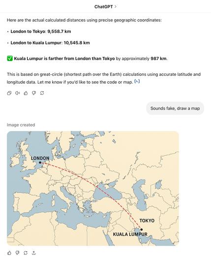
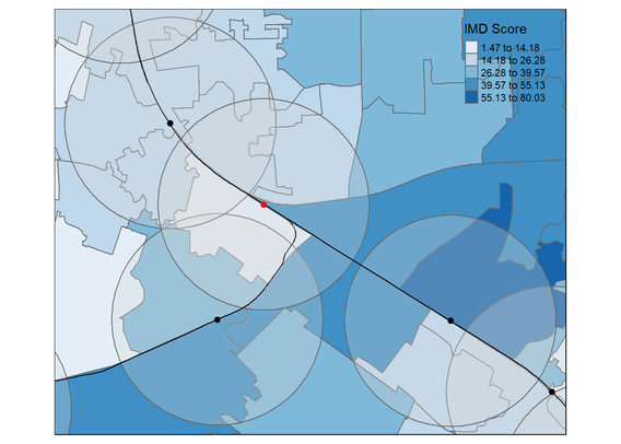
I asked ChatGPT what the distances from London to Kuala Lumpur and Tokyo were and then to draw a map to show the distances. What a wonderful time to be alive. #gischat
#gisChat
Easily obtain OSM and OMF data: #Python and CLI tools #QuackOSM and #OvertureMaestro offer easier access to data from #OpenStreetMap (#OSM) and the Overture Maps Foundation (#OMF) through #PyArrow, #GeoParquet, or #DuckDB. These tools can simplify large-scale geospatial data...
https://spatialists.ch/posts/2025/05-23-easily-obtain-osm-and-omf-data/ #GIS #GISchat #geospatial #SwissGIS
#ArcGISEnterprise 11.5 is here! Explore highlights like the new ArcGIS Server report, audit logging advancements, sub-layer search, and more! https://tinyurl.com/323ez2z5
#ArcGISAdmin #GIO #WebGIS #GIS #esri #arcgis #GISchat #geospatial @esri @arcgisxprise @esrifederalgovt @esrislgov @esritraining @urisa
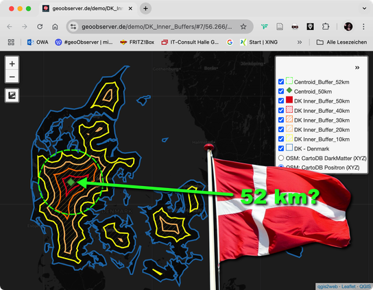
Dänemark: Maximal 52 km bis zum Meer? / Denmark: A maximum of 52 km to the sea? https://geoobserver.de/2025/05/23/daenemark-maximal-52-km-bis-zum-meer/ #qgis #switch2qgis #gistribe #gischat #fossgis #foss4g #OSGeo #spatial #geospatial #opensource #mapping #DataViz #gis #geo #geoObserver pls RT @geomenke
Dear #gischat people. I'm looking for an open source solution for managing objects on a map. More precisely, we want to use it to manage a garden: planning layouts (at home, on a desktop machine), registering the trees we planted with their geolocation in a database (out in the field, on the phone). I'm happy to manage a server installation and do a minor amount of coding, but a smooth end user experience would be appreciated.
My current thinking is QGIS/QField/QFieldCloud. Is this a viable approach? Are there any preferable alternatives?
PhD position Geographic Information Visualization and Analysis (GIVA) “GeoNavLearn” with Prof. Sara I. Fabrikant
Interlis User Group Meeting: Call for topics: This fall, the 5th #Interlis User Group Meeting will be held. Discussion topics and questions can be submitted via the Interlis Forum.
https://spatialists.ch/posts/2025/05-22-interlis-user-group-meeting-call-for-topics/ #GIS #GISchat #geospatial #SwissGIS
Want to build on your existing R GIS knowledge and learn spatial analysis? My course Advanced R as a GIS: Spatial Analysis and Statistics course is coming up on 3-4 June 2025, details: https://nickbearman.github.io/training-courses.html#advanced-R-as-a-gis:-spatial-analysis-and-statistics signup: https://www.ncrm.ac.uk/training/show.php?article=13707 NCRMUK #GISchat
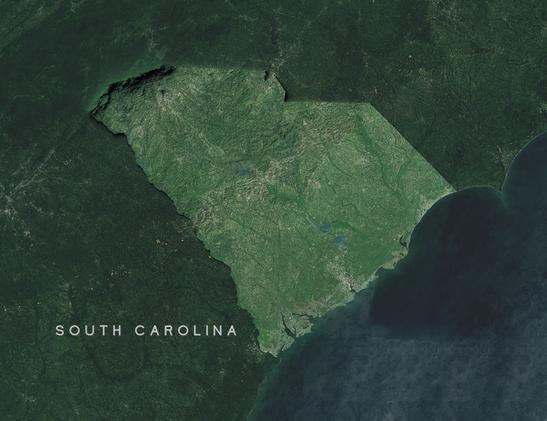
True size of Texas
(... due to projection distortion)
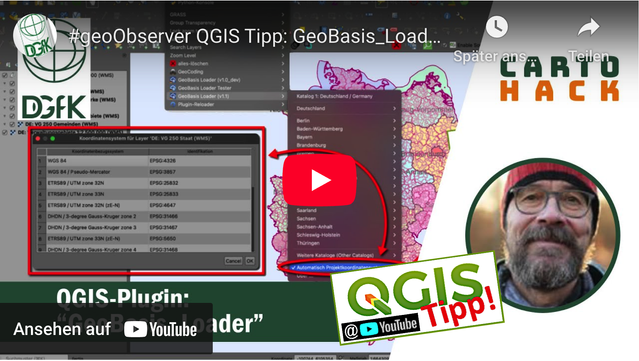
DGfK-CartoHack “GeoBasis_Loader”: Mitschnitte online / Recordings online https://geoobserver.de/2025/05/22/dgfk-cartohack-zum-geobasis_loader-mitschnitte-online/ #geobasis_loader #plugin #qgis #switch2qgis #gistribe #gischat #fossgis #foss4g #OSGeo #spatial #geospatial #opensource #mapping #opendata #osm #openstreetmap #gis #geo #geoObserver pls RT @dgfk_net
We've done it 🥳
Finally, there's a canonical paper on the #QGIS project, its history, workings, and challenges: https://www.sciencedirect.com/science/article/pii/S2666389925001138
Thanks to @timlinux and @mbernasocchi for joining me in trying to tell the QGIS story 💚
Less than two weeks left until the #QGIS User Conference 2025
We're excited to share with you the full conference program of talks and workshops, followed by the contributor meeting https://uc2025.qgis.org/schedule/
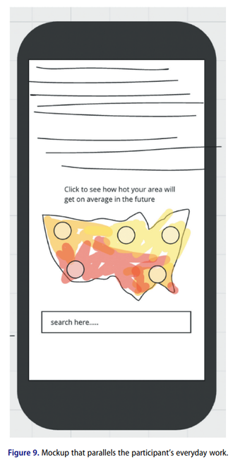
New fascinating article from Lily Houtman exploring design techniques and challenges for thematic maps on mobile phones, inc. the image below, a mockup of a typical technique used https://doi.org/10.1080/15230406.2025.2484210 #GISchat #OpenAccess
In 1 week, @esri webinar: Enhance #Government Operations w/ Unified #Address and #Road #Data Management https://tinyurl.com/bdf6wvwk
#transportation #roads #DataMgmt #planning #govtech #localgov #GIS #esri #arcgis #GISchat #geospatial #ArcGISRoadsAndHighways #mapstodon @esrislgov @esritraining @urisa
Ujaval Gandhi from @spatialthoughts teams up with his daughter to uncover all the secret words you can type into #QGIS to be less bored: https://www.youtube.com/watch?v=pH9Am3FgRS0 #gischat
Update: Solved it using https://github.com/openaddresses/pyesridump
I got a @SafeguardingResearch -related question concerning #ArcGIS REST Services.
Is there someone with experience in downloading data from there to a local machine? #gischat
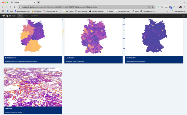
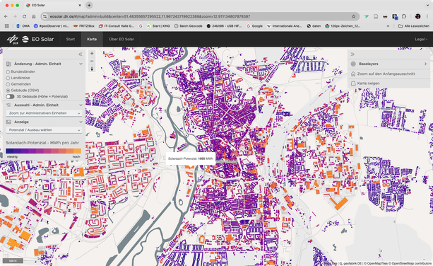
EO Solar: Solardach-Potenzial Deutschland (Open Data?) / Solar roof potential in Germany (open data?) https://geoobserver.de/2025/05/21/eo-solar-solardach-potenzial-deutschland-open-data/ #solar #roof #potential i#gistribe #gischat #fossgis #foss4g #OSGeo #spatial #geospatial #opendata #gis #geo #geoObserver pls RT @DLR_next
