#gr%C3%B6nabandet
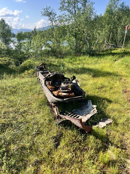
We camped at an abandoned sameviste just before Klimpfjäll because we had to wait until the supermarket would open. A nice spot by the river, where we took a quick bird bath before the rain would set in. Next morning we learned, that the supermarket now is open around the clock, like most others in this region it has a self-service checkout counter now.
Just when we leave the little store, we notice two more hikers, who - except for their comically large gloves - look like actual thruhikers. Turns out, they are on Gröna Bandet too, a couple from Australia, the first to do GB from their country, and have both hiked the PCT. They’d stick around until almost the end of my hike and we’d tag along on and off from then on.
#lapplandsleden #grönaBandet #fjällvandring #thruhike #longDistanceHiking
Goals I’ve set for myself on my recent long-distance hike of Gröna Bandet:
- lose weight ✅
- talk Swedish throughout to all who understand ✅
- don’t drink any alcohol ✅
Despite being sore all over I haven’t felt so good in a very long time.
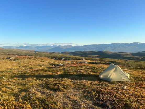
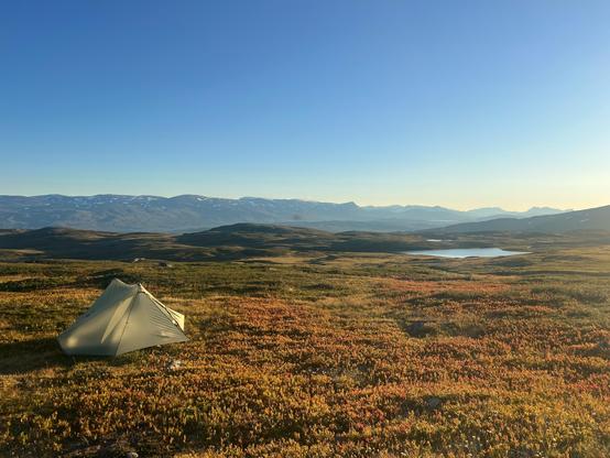
The nerd that I am, I can’t stop thinking about what would have been the perfect tent for my Gröna Band thruhike, if it wasn’t the Tarptent Stratospire, that I was carrying.
#ultralight #ultralightBackpacking #ultralightTrekking #ultralightHiking #hiking #scandinavia #fjällvandring #grönaBandet
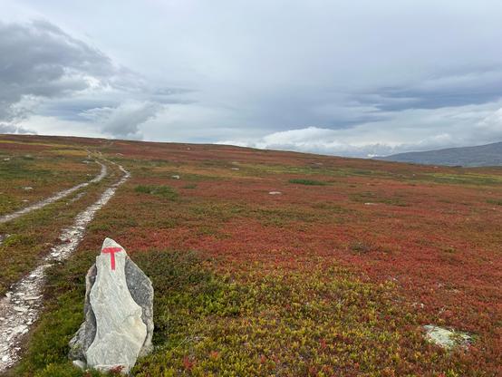
Autumn colors everywhere now. I was hoping for that. It’s so beautiful!
#autumn #fall #autumnColors #lapland #lappland #sapmi #grönaBandet #fjällvandring #nordkalottleden
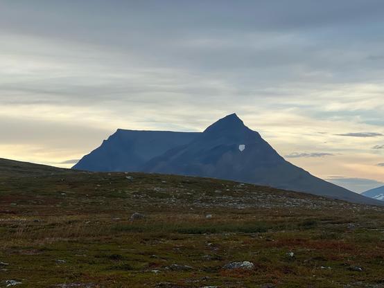
Pältsan in the evening sun.
#sapmi #lapland #mountains #grönaBandet #fjällvandring #nordkalottleden
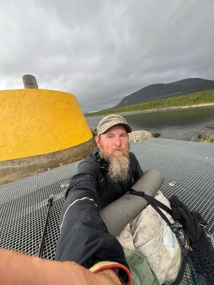
Made it!
God kväll!
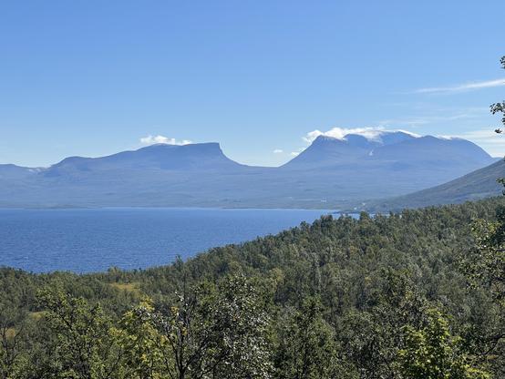
Famous Lapporten
#abisko #mountains #fjällvandring #grönaBandet #lapporten #sapmi
Updated sleeping pad from StS. R value up from 3.2 to 4.1. A dream come true? It’s the most comfortable pad I’ve ever had.
That said, it broke after just three weeks. Micro holes everywhere. Unfixable.
Compare this to the TaR Neoair Xtherm, that lasted me almost five weeks this time. 🤬💩
https://seatosummit.com/products/ether-light-xr-insulated-air-sleeping-pad?variant=44032184975533
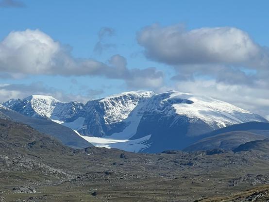
View of the Kebnekaise massif as seen from the trail between Sitasjaure and Hukejaure near Kaisejaure. You can see both peaks, sydtoppen as well as norrtoppen and Rabots glacier.
#mountains #glaciers #hiking #lapland #hikingSweden #kungsleden #nordkalottleden #grönaBandet #sapmi #kebnekaise
The best thing about Gäddede is that the ICA sells peanut doodles. Something that’s rather hard to find in Sweden otherwise.
After resupply in Storlien I headed out to make my way towards and over middagsfjället (the dinner mountain?). The trail would soon fade away and while there were still markers here and there, I was soon on my own. Eventually you make it to a somewhat eerie place where there is a gigantic, pink colored hunting lodge in the middle of nowhere, Rensjösätern, and just a few kilometers later, when I pitched my tent for the first night, thunders started to roll in. This went on for hours and left me feeling a bit uneasy, exposed and unprotected as I was.
Past Medstugan you can follow an old forest road for a while until bogs and marshlands become your companion again for many many kilometers to come. Found a picture prefect tent site just before dropping down to Storrensjön that overlooked the beautiful lake and the whole area.
The next day looked like a lot of bogs again but was not as bad after all. Pretty, pretty old, natural forests along lake sides, a somewhat adventures climb along a gorge and finally the swamp of hell that made me decide to go all the way to Anjans fjäll station and ask for a bed to sleep there. And a shower. But most of all, luckily they had some köttbullar for me. Yumm!
Met some US hiker there and he convinced me to not take a rest day but instead have a slow one and so I set out to Skäckerfjällen and camped just before the second steep pass on this route. It was amazing. Took a swim and enjoyed the sun. Unfortunately and unexpectedly some other hike came along while I was still running around there naked as I was and I hope they will forgive me.
The next valley was just stunning. It reminded me a lot of the Sierra meadows Southern California is famous for. I just sat there in awe and was waiting for some bears to start dancing between the trees on the other side. But to no avail. What followed was a rather unpretentious episode of bush whacking and route finding through bogs and what not until I reached the small Sami village by Burvattnet. I decided to follow the ATV track from there but caught me swearing when sweating my way up the steep climb. Made it all the way to Gaunan where I found the best camp spot ever, just after that locked cabin there. Protected from the sun by beautiful trees, miraculously there were almost no bugs. There’s a swimming hole I took advantage of, washed my clothes and hung them up to dry.
Crossing the river was a no brainer since it hadn’t rained in weeks. Making it up the mountain in that heat on the other hand took its toll. I almost fainted. The stretch over to Hösjöbäcken was like torture. Finding the ATV track to Edevik was sheer luck. I was challenging myself that day by not using my phone and relying on map and compass only. And instead of camping down by Holden I decided to continue and make my way up into Sösjöfjällen. I felt awful. Exhausted. And my stomach started to rumble. Had the worst night thanks to mosquitoes buzzing around under my fly.
The next day was just survival mode. Doing kilometers as good as it gets. One is better than none. Made it through the fjäll and made it to Tjovre. Camped near Fisklösån (the fish less river, probably a ploy to confuse strangers) amongst beautiful old trees. Next day I felt better, stronger. The climb up into Offerdalsfjällen felt easy, I even picked a harder but shorter route than planned and eventually camped just before Gubbdalen.
This was just as wet as I expected. But the idea of getting a burger in Rörvattnet kept me going. Except the restaurant there was closed. So I pushed on to Rötviken where I was lucky enough to learn that supermarket can just be opened using your phone and so I ended up with a fabulous dinner. And a rest day to top it off. Met Matthias and we talked all day.
From there I took the straight route along the Norwegian border, past Penningkaise and Murfjället. Rather uneventful, pretty. Had a lot of rain but that’s what it is sometimes.
Now enjoying another day of rest in Gäddede.
#grönaBandet #jämtland #hikingSweden #fjällvandring #mountains
So there were these two German ultra runners who made a lot of fuzz about how they will set a new record on Gröna Bandet this year. They even had hired a coach who has been to Scandinavia before! (Hear, hear). Of course they have a long list of sponsors and last but not least a podcast (it’s two white guys, it’s inevitable). After three days one is stuck at Abisko, the other one at Kiruna airport. That’s two more days than I’d given them.
Got lost in the swamps yesterday afternoon when rain had set in and I couldn’t use my phone anymore and thus had no more GPS. Eventually I’d dig out my map and compass and with a lot of luck I was able to find the right trail again. The map I have of this region is 1:100.000 and basically almost useless for hiking.
Thought I’d make it to Gäddede by yesterday evening. But then I just had enough and when the rain stopped I pitched my tent at a pretty spot.
Day 45, Alep Njallajávrre-Guoledisjávrre rest stop, 8 km hiking + 2 km packrafting
Short day planned to meet up with my wife and have a cabin night in Vuoggatjålme and resupply.
Hiked down to the lake and paddled over it, made the bad decision to push on into a bay to cut 50m off my lift to the next lake. Got stuck half-way in the shallow rocks and had to get out and drag the boat. Slipped on the slipperies and cut my foot. Taped it up and hiked out to the road in pain.
Day 44, Gujjávrre-Alep Njallajávrre, 17 km hiking + 8 km packrafting
Incredible views from the boat, waterfalls running down on one side and bare cliffs on the other.
The rest of the hike also had stunning surroundings, but was a trail of contrasts. Some parts were very easy flat heath, and then rocky ridges overgrown with dense birch or osier that you had to force your way through.
Started to look for a tent spot a couple of km before I found one, but flat+water took a while.
Day 43, Laisälven-Gujjávrre, 21 km hiking + 7 km packrafting.
Started the day with an easy wade of the river and a longish ascent to the marked path. The path was not all that well-travelled, but I could mostly follow it to where I diverted to put in my packraft after the rapids in Smuolejåhkå. A fun ride and then a fair bit of paddling after the stream lost all speed and turned into a very shallow lake.
Slogged the winter trail for 5 km to Gujjávrre where I tented on the beach.
Day 42, Randalen-Laisälven, 19 km hiking , 2 km packtafting
Getting cool and more reasonable weather! Hiked up to Tsaggiekjávrieh, paddled a while, then up pretty much straight north over the ridge towards Laisälven.
Up was okay, using some snow fields etc. My north-west down diagonally along the slope was more challenging with lots of rock fields and sudden sheer drops leading to some zig-zag and backtracking.
Made it eventually to a nice tent spot along the river.
Person on Gröna Bandet support group asks where to get a Covid test, since they fell sick. Swedish people reply “what’s Covid?”, “what would you need a test for?” (while that person explained why in their post) and more such crap. Sweden is a a fuckup society built on ableism and eugenics as its fundamental principles. 🤮🤮🤮
#CovidIsNotOver #covid #covidSverige #sverige #sweden #grönaBandet
Rained on me for hours yesterday. Now all my clothes are wet. If I want to continue hiking today, I have to put on cold, wet clothes. 🥶💦
At least, it’s just a few kilometers today, mostly road and then a rest day tomorrow. Really need to wash my clothes. Been sleeping in the same for three weeks now. 😷💩

