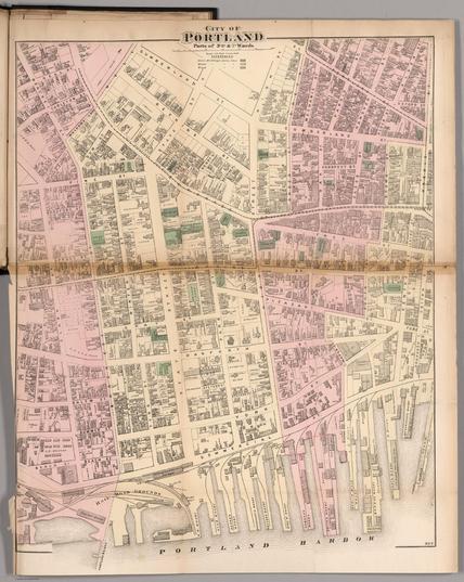
City of Portland, Parts of 5th, 6th, & 7th Wards. https://www.davidrumsey.com/luna/servlet/detail/RUMSEY~8~1~227156~5507124
#historicalmaps
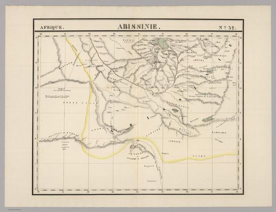
Abissinie. Afrique no. 32. (Dresse par Ph. Vandermaelen, lithographie par H. Ode. Troisieme partie. - Afrique. Bruxelles. 1827) https://www.davidrumsey.com/luna/servlet/detail/RUMSEY~8~1~25212~5500073
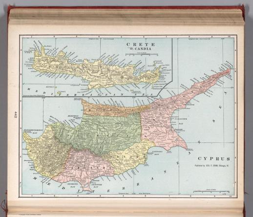
Cyprus. Published by George F. Cram, Chicago, Ill. (to accompany) Cram's atlas of the world, ancient and modern : new census edition -- indexed. (inset) Crete and Candia. https://www.davidrumsey.com/luna/servlet/detail/RUMSEY~8~1~273858~90047301
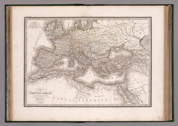
Carte de l'Empire Romain. Dressee par M. Lapie, Colonel et M. Lapie fils, Chef d'Escon au meme Corps. Paris,1851. Chez P. C. Lehuby. Grave par Pierre Tardieu. (to accompany) Atlas Universel de Geographie ancienne et moderne ...1851. https://www.davidrumsey.com/luna/servlet/detail/RUMSEY~8~1~318062~90086942
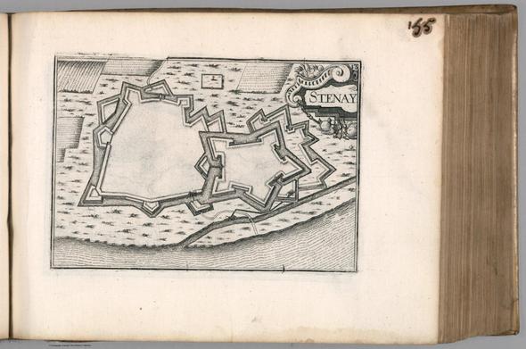
Stenay. (to accompany) Les plans et profils de tovtes les principales villes et lievx considerables de France ... Par le Sieur Tassin. A Paris, M. DC. XXXVI (1636). https://www.davidrumsey.com/luna/servlet/detail/RUMSEY~8~1~318592~90087568
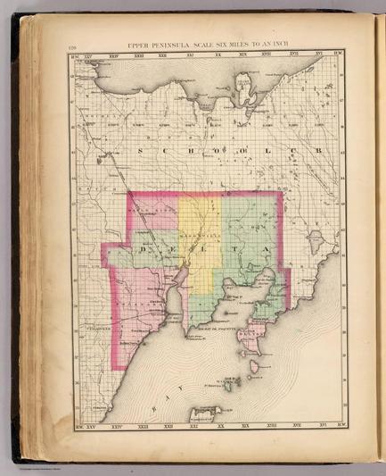
Upper Peninsula, scale six miles to an inch (Delta County. Drawn, compiled, and edited by H.F. Walling, C.E. ... Published by R.M. & S.T. Tackabury, Detroit, Mich. Entered ... 1873, by H.F. Walling ... Washington. The Claremont Manufacturing Company, Claremont, N.H., Book Manufacturers) https://www.davidrumsey.com/luna/servlet/detail/RUMSEY~8~1~22417~740029
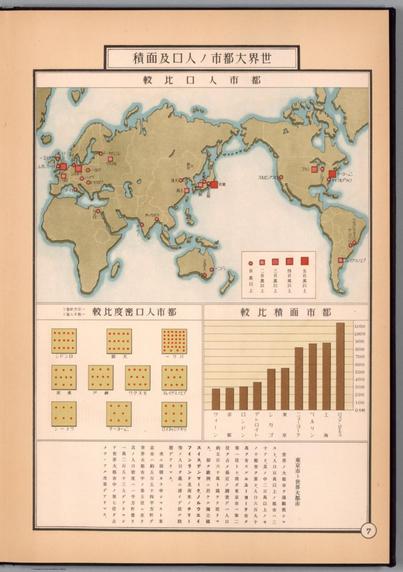
(World map). (to accompany) 東京市勢圖表 = Tōkyo Shisei Zuhyo = Graphic Illustration of Tokyo City. 東京市, Tokyo shi, Showa 10 (1935). https://www.davidrumsey.com/luna/servlet/detail/RUMSEY~8~1~332339~90100808
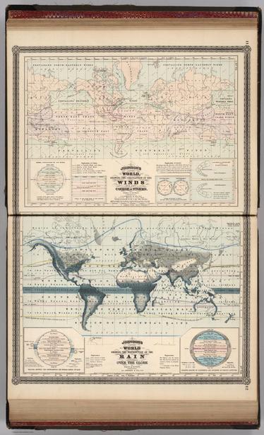
Johnson's World, Showing the Circulation of the Winds and the Course of Storms. By Prof. A. Guyot. Published by A. J. Johnson, New York. Johnson's World, Showing the Distribution of the Rain over the Globe By Prof. A. Guyot. Published by A. J. Johnson, New York. 11. 12. Entered according to the Act of Congress, in the year 1870, by A.J. Johnson in the Clerk's Office of the District Court of the United States for the Southern District of New York. https://www.davidrumsey.com/luna/servlet/detail/RUMSEY~8~1~345121~3003123
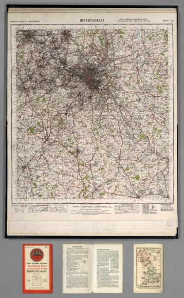
Sheet 131. Birmingham. https://www.davidrumsey.com/luna/servlet/detail/RUMSEY~8~1~245478~5514668
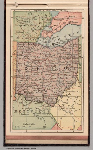
Ohio. (to accompany) Bradstreet's Pocket Atlas Of The United States. Published Exclusively for Macullar, Parker & Company, Boston, Massachusetts ... New York: The Bradstreet Company, 1885. (on verso) Entered ... 1879, by The Bradstreet Company ... Washington. https://www.davidrumsey.com/luna/servlet/detail/RUMSEY~8~1~244994~5514140
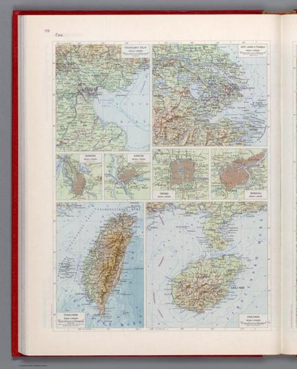
Čína. Československý vojenský atlas̊. https://www.davidrumsey.com/luna/servlet/detail/RUMSEY~8~1~345460~90112917
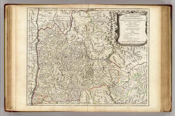
Tabula Delphinatus et vicinarum regionum distributa in principatus comitatus baronias &c. Cum usdem nominibus quae in antiquis Chartis sub Principibus Delphinis expressa reperiuntur. Auctore Guillelmo de l'Isle e Regia Scientarum Academia, 1710. Parisiis, apud Auctorem in Ripa vulgo dicta le Quai de l'Horloge cum Privilegio 1o. Jan. 1711. Berey sculpsit. https://www.davidrumsey.com/luna/servlet/detail/RUMSEY~8~1~2864~290051
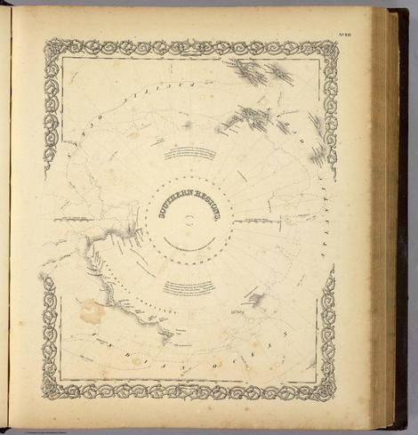
Southern Regions. Published by J.H. Colton And Co. 172 William St. New York. Entered ... 1855 by J.H. Colton & Co. ... New York. No. XIII. https://www.davidrumsey.com/luna/servlet/detail/RUMSEY~8~1~1653~130012
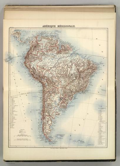
Amerique Meridionale. Atlas St. Cyr. Furne, Jouvet et Cie. Editeurs. Imp. Lemercier et Cie. Paris. (1882) https://www.davidrumsey.com/luna/servlet/detail/RUMSEY~8~1~38222~1211239
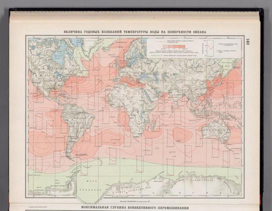
Velichina godovykh kolebaniy temperatury vody na poverkhnosti okeana. (to accompany) Atlas okeanov : Atlanticheskiy i Indiyskiy Okeany 1977. https://www.davidrumsey.com/luna/servlet/detail/RUMSEY~8~1~354843~90121805
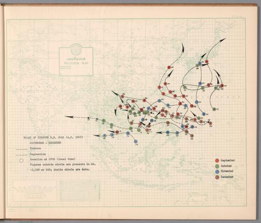
Track of typhoon B. E. 2491 (A. D. 1948) : [September, October, November, December]. https://www.davidrumsey.com/luna/servlet/detail/RUMSEY~8~1~343117~90111280
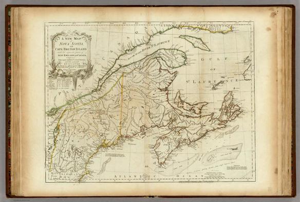
A New Map of Nova Scotia, and Cape Breton Island with the adjacent parts of New England and Canada, Composed from a great number of actual Surveys; and other materials Regulated by many new Astronomical Observations of the Longitude as well as Latitude; by Thomas Jefferys, Geographer to the King. London. Printed & Sold by R. Sayer & J. Bennett ... 15 June 1775. https://www.davidrumsey.com/luna/servlet/detail/RUMSEY~8~1~1909~120016
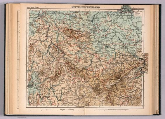
Mitteldeutschland. Gotha : Justus Perthes. Sydow-Wagners method. Schul-Atlas. XXIII. https://www.davidrumsey.com/luna/servlet/detail/RUMSEY~8~1~354311~90121358
