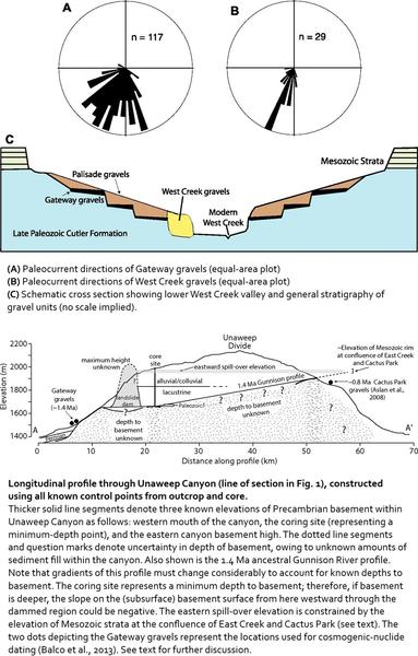
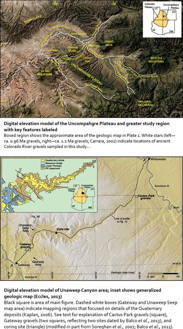
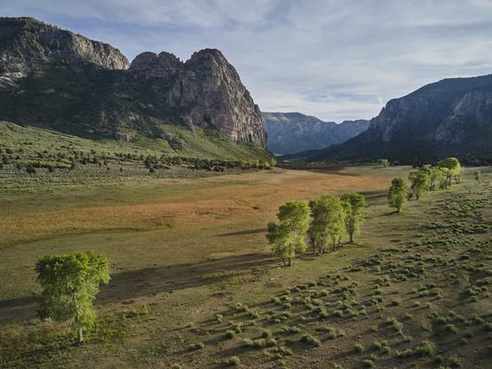
Unaweep Canyon - Two Creeks Flow Out Of Either End Of This [Colorado] Canyon In Opposite Directions
--
https://www.atlasobscura.com/places/unaweep-canyon <-- shared technical article
--
https://doi.org/10.1130/GES01112.1 <-- shared paper
--
[seems like a motorcycle road trip is in order - and happy to visit this beautiful part of the world again]
#geology #colorado #paleovalley #UnaweepCanyon #unaweep #precambrian #unique #divide #water #hydrology #underfit #drainage #EastCreek #WestCreek #Dolores #Uncompahgre #UncompahgrePlateau #erosion #Gunninson #canyon #Tabeguache #mapping #geologicmapping #fieldwork #Cenozoic #gravel #sediment #rockcore #coring #lacustrine #geomorphology #geomorphometry #dating #landform #volcanics #tectonics
#lacustrine
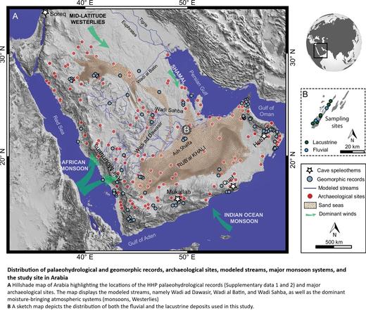
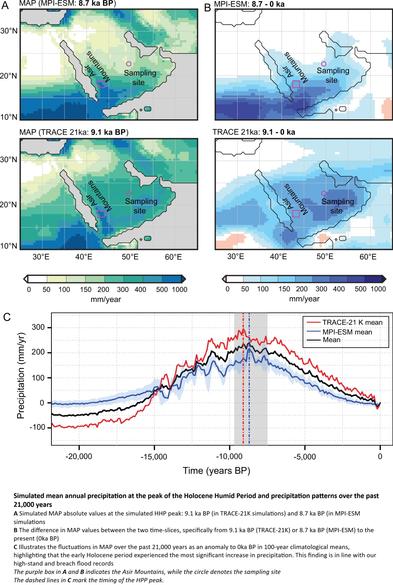
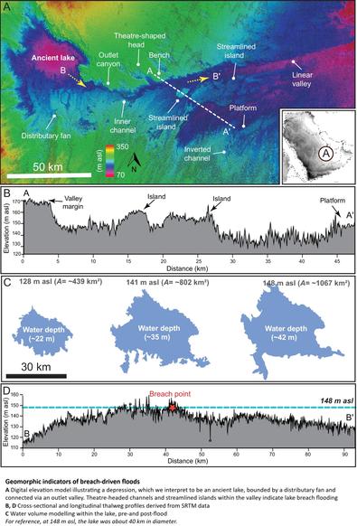
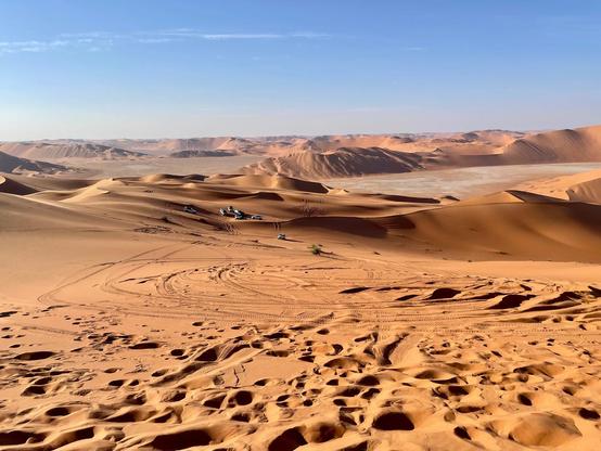
Ancient Lakes And Rivers Unearthed In Arabia's Vast Desert
--
https://phys.org/news/2025-04-ancient-lakes-rivers-unearthed-arabia.html <-- shared technical article
--
https://doi.org/10.1038/s43247-025-02224-1 <-- shared paper
--
#GIS #spatial #mapping #water #hydrology #quaternary #desert #geomorphology #landforms #geomorphometry #Arabia #climatechange #RubalKhali #SaudiArabia #holocene #model #modeling #spatialanalysis #spatiotemporal #earthsystemmodel #geology #lacustrine #fluvial #sediments #sedimentary #flood #flooding #lakes #AfricanMonsoon #rivers #paleohydrology #stratigraphy #remotesensing #landsat #earthobservation #dating #delta #cliff #terrace #rainfall #precipitation
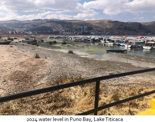
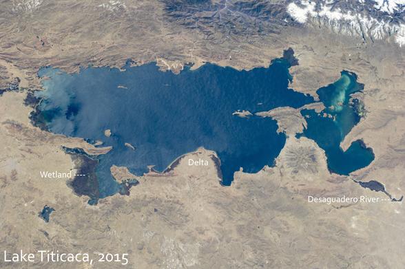
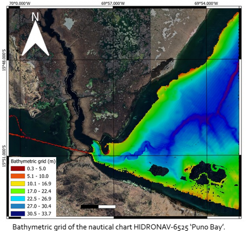
Surveying Lake Titicaca [2024]
--
https://www.hydro-international.com/content/article/surveying-lake-titicaca <-- shared technical article
--
[A very comprehensive hydrographic and shallow geophysical study and mapping effort of Lake Titicaca…]
“In October 2024, officers from the Category “A” Specialization Programme in Hydrography for Naval Officers of the Peruvian Navy conducted their complex multidisciplinary field project at Lake Titicaca at Puno in Peru, which is the highest navigable lake in the world (3,800 metres above sea level). The purpose of this survey was to address issues in the lacustrine environment due to hydrological processes that have occurred in recent years in this water body.…”
#GIS #spatial #mapping #hydrospatial #hydrology #hydrography #LakeTiticaca #Bolvia #Puno #Peru #PeruvianNavy #lake #remotesensing #survey #lacustrine #vertical #multibeam #echsounder #sonar #geomatics #cartography #QGIS
.
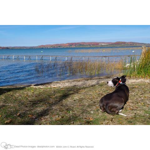
🌐44°56'28.1436" N 85°12'34.1388" W
.
◉ HD PENTAX-FA 31mm F1.8 Limited
📷 Ricoh Pentax K-3 Mark III
🎞️ISO 200
⏱️¹⁄₈₀₀ sec at ƒ / 7.1 (𝑓=31 mm)
.
.
#Lacustrine #Wilderness #animal #autumn #beach #collar #companion #dock #dog #grass #horizon #lake #landscape #leaf #leaves #nature #pentax_fa31limited #pentaxk3mkiii #plant #reeds #sand, #sky #tail #tree #water ##borderpittie #pittie #dogs #dogsofinstagram
.
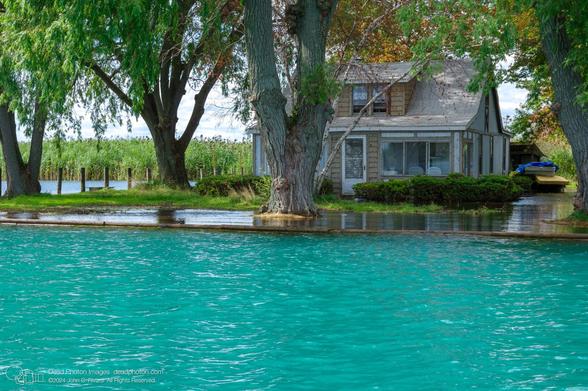
🌐42°36'12.498" N 82°41'54.168" W
.
◉ smc PENTAX-DA 18-135mm F3.5-5.6 ED AL [IF] DC WR
📷 Ricoh Pentax K-3
🎞️Fuji Color 200 at ISO 200
⏱️¹⁄₂₅₀ sec at ƒ / 9.5 (𝑓=40 mm)
.
.
#Bayou #Canal #Channel #Coast #Cottage #Inlet #Lacustrine #Leisure #Property #Town #Watercourse #climatechange #flood #flooding #lake #landscape #nature #newtopographics #pentax_da18135 #pentaxk3 #plant #tree #water #willow #nowherediary #subjectivelyobjective #thisisnthappiness #banalmag
.
.
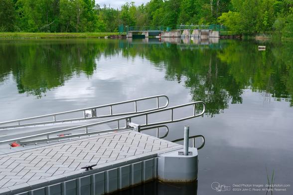
PENTAX K-3 Mark III Ver. 2.13 📷HD PENTAX-FA 31mm F1.8 Limited ISO 160 ¹⁄₂₀₀ sec at ƒ / 7.1 𝑓=31 mm
.
.
#Bank #Channel #Dock #Lacustrine #Lake #Landscape #Leisure #Reservoir #Sky #Tree #Water #Watercourse #dam #dock #fluvial #infrastructure #landscape #newtopographics #pentax_fa31limited #pentaxk3mkiii #river #sluice #water #nowherediary #subjectivelyobjective #thisisnthappiness #banalmag
Long-Lived Lakes Reveal A History Of Water On Mars
--
https://phys.org/news/2022-12-long-lived-lakes-reveal-history-mars.html <-- article
--
https://doi.org/10.1029/2021JE007152 <-- shared paper
--
"... KEY POINTS
• A detailed local study of a system of seven previously unknown palaeolakes near the dichotomy in western Arabia Terra, Mars
• High resolution topographic data aids in identification and characterization of palaeolakes and regional hydrological history
• Evidence for a prolonged history of fluvial and lacustrine processes, with palaeolakes fed by groundwater and surface accumulation... "
#GIS #spatial #mapping #Mars #remotesensing #hydrology #paleolakes #lakes #lacustrine #imagery #elevation #DEM #height #basins #solarsystem #topography #geomorphology #spatialanalysis #groundwater #surfacewater #erosion #network #waterflow #flow #fluvial #lacustrine #delta #surfacefeatures #water #HiRISE #MOLAR #LiDAR
