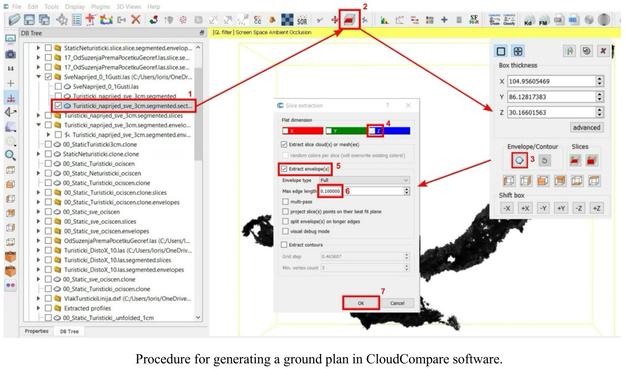
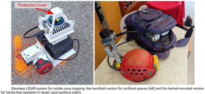
The Affordable DIY Mandeye Lidar System For Surveying Caves, And How To Convert 3D Clouds Into Traditional Cave Ground Plans And Extended Profiles
--
https://doi.org/10.5038/1827-806X.53.3.2535 <-- shared paper
--
#GIS #spatial #mapping #LiDAR #cave #cavediving #cavemapping #speleology #workflow #survey #remotesensing #pointcloud #mobilemapping #3Dmapping #profile #model #modeling #3dmodel #opensource #openhardware #reproducible #affordable #DIY #Mandeye
#mobilemapping
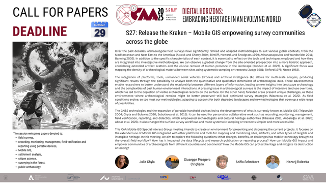
If you're attending the #CAA2025 conference and conducting field surveys, we have a great session for you:
🌀S27: Release the Kraken – Mobile GIS empowering survey communities across the globe
🚀📍 #GIS #MobileMapping #CommunityPower #TechForGood #GeoInnovation #Survey
Terrestrial Laser Scanner Quality with SLAM Flexibility! The Z+F FlexScan 22 delivers many modes including static and mobile scanning!
This makes the Z+F FlexScan 22 with the Z+F IMAGER 5016 powered by Z+F LaserControl Office one of the most versatile Reality Capture systems on the market today!
@geoinstinct is the Exclusive Distributor for Zoller + Fröhlich in #Vietnam.
www.geoinstinct.com
sales@geoinstinct.com
+84 (0) 28 710 99 369
Securing and verifying GNSS base files for post-processing is a crucial step for many drone, mobile mapping, asset and GIS mapping, and surveying static campaigns. This should be done early in the workflow.
https://gogeomatics.ca/gnss-base-data/
#gps #gnss #postprocessing #surveying #geomatics #gis #assetmapping #mobilemapping
When Your [Apple] Maps Is Down (Black Mirror Spoof) [Friday Afternoon GIS / Spatial Data / Mapping Fun]
--
https://youtu.be/kBGo942Xyrg <-- link to video
--
#GIS #spatial #mapping #fridayvibes #fridayfunday #fridayfunny #mappymeme #applemaps #mapping #routing #fridaymotivation #fridayfeels #spoof #BlackMirror #mobilemapping #gischat
Soeben bin ich auf #EveryDoor gestossen und konnte die App antesten. Mittlerweile habe ich einige #MobileMapping Lösungen genutzt und denke das ist eine weitere Ergänzung um schnell mal ein paar Objekte hinzuzufügen.
#Vespucci ist grossartig um mobil beliebige Objekte und Strukturen zu erfassen, aber langsam.
#StreetComplete wiederum perfekt um bestehendes zu ergänzen (vor allem das woran man gerade nicht denkt).
Der Ansatz von #OSMTracker war in ungemaptem Gelände ok.
Winner and Finalists in the Surveying and Monitoring category of the Year-in-Infrastructure Awards: https://gogeomatics.ca/yii-infrastructure-awards-surveying/
#infrastructure #surveying #geomatics #damsafety #mobilemapping #aerialmapping
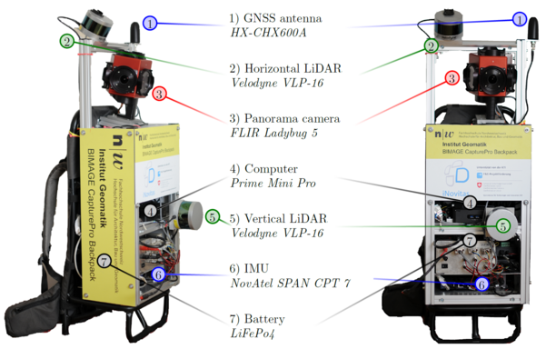
Congrats to Dr. Stefan Blaser @Stibe88 for the succesful completion of his joint PhD project between @KITKarlsruhe and @igeoFHNW / @FHNW.
His dissertation on new #georeferencing methods for #portable #mobilemapping is now online under: https://doi.org/10.5445/IR/1000151555
