図書館情報アップデート
今日は数え間違えていなければ10市町の21館をアップデートしました
朝霞市,鴻巣市,川口市,羽生市,春日部市,草加市
吉見町,鳩山町,小川町,ときがわ町
#OpenStreetMap
#openStreetMap
Primera estación de reparación de bicicletas añadida al mapa de Málaga en #OpenStreetMap: https://commons.wikimedia.org/wiki/File:Bicycle_Repair_Station_at_University_of_M%C3%A1laga.jpg. Se encuentra en la zona de estacionamiento de bicicletas de la Escuela de Ingenierías Industriales de la Universidad de Málaga. https://osm.org/go/b7ClvXFB5?m=
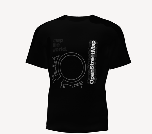
OK SO I was designing T-Shirts for us folks at OSM India to wear in the upcoming IndiaFOSS (which has become a yearly tradition of a sort), and it made me wonder if folks of #OpenStreetMap elsewhere approves of this design.
Matter of fact, would y'all love to wear and see more of these? 🤔
Le saviez-vous ?
Avec le site web https://cartes.app, vous pouvez vous connecter avec votre compte #OpenStreetMap puis modifier des commerces, restaurants... notamment le nom, la description et les horaires d'ouverture.
Tout ceci au travers d'une interface léchée et simplifiée, suffit de cliquer sur "Modifier ce lieu" ⤵️
Really love the idea of “Coffee in the Sun”! I always hunt around my hood to find a spot to drink my coffee in the sun. And this app makes it super easy. ☕️😎
What a great use of #OpenStreetMap data. Also no ads or IAP, just a simple one time purchase. Love it!
https://apps.apple.com/de/app/kaffee-in-der-sonne/id6746173958
Three common mistakes I’ve seen #FOSS people and other #introverted geeks make in #PublicSpeaking…well, as an introverted #FreeSoftware geek myself, these also things I have to keep in mind when I speak.
Slow…down. Speak at a consistent, slow speed. This ensures people don’t miss things, you get time to think, and people get time to absorb the information.
Speak loudly. There’s a limit to how much the microphone will do for you. Sometimes you won’t even have a microphone (e.g. when hosting outdoor #OpenStreetMap mapping parties) - learn to make yourself heard without one.
Don’t trail off. End your sentences with a consistent volume and pitch.
So how slow, and how loud? In a lot of cases I’d say WAY slower than what you call slow, and WAY louder than what you call loud 😅
There’s more, but this is the foundation of any talk. The best content in the world means nothing if it doesn’t actually reach your audience.
A lot of this is useful in everyday life too. Start practicing! 🙂
cartographie des lieux de santé sexuelle sur #openstreetmap , venez participer!
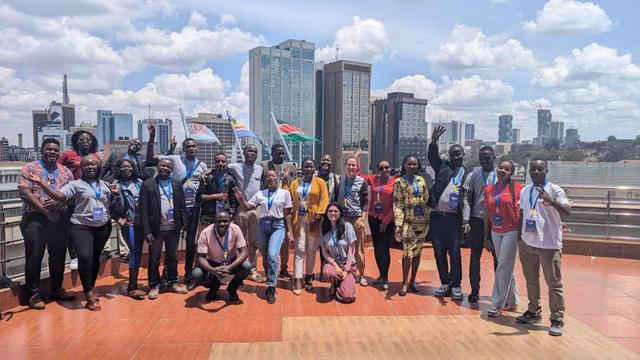
Un contributeur #OpenStreetMap :osm: a écrit en Français 💬 : "Engagement et rencontres : un retour sur SotM Global 2024 au Kenya."
🎋 Lisez leur journal @osm dans 👉🏼 https://www.openstreetmap.org/user/Abibis/diary/407030.
Ich komme übrigens von google Maps nicht los. 😭
Die Kombination mit Weblinks und Routenplaner, und das alles in einer Smartphone App, ist einfach zu bequem.
Hat die #OSM Tipps, wie man so etwas mit #OpenStreetMap erreichen kann?
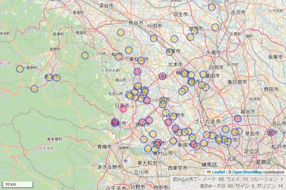
ここ2週間ほどで図書館POIをアップデートしまくった結果、埼玉県で住所と識別子が分かる図書館がここまで増えました! #OpenStreetMap
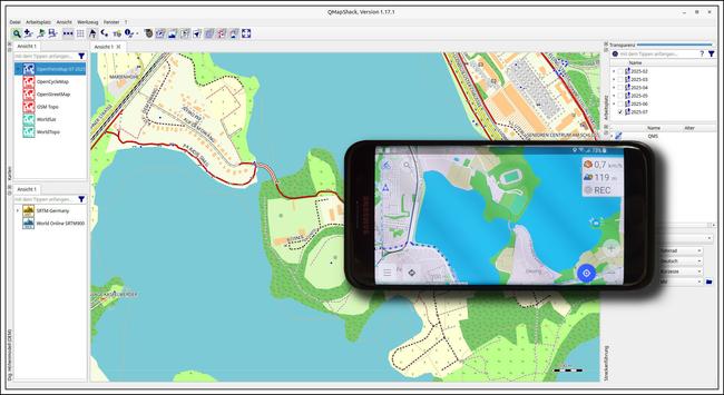
Ich habe soeben die aktuelle Version der OFM (OpenFietsMap) vom 05. Juli, in QMapShack installiert 🗺️ 🚲 😀
Auf meinem “Navi-Handy” ist die OpenStreetMap dank OsmAnd ja ohnehin immer aktuell.
Nicht, dass ich die neueste Version unbedingt brauchen würde, aber man weiß ja nie, wohin mich mein Fahrrad führt 😉
🔗 https://www.openfietsmap.nl/downloads/germany
#Rad #Fahrrad #Bike #Radtour #Navigation #Navi #QMapShack #OpenStreetMap #OsmAnd #OFM #OpenFietsMap
図書館情報アップデート、朝霞の2館,鴻巣の3館,川口の6館で実施
吹上町とか鳩ヶ谷市とか合併してなくなりましたね、しみじみ #OpenStreetMap
41 people made 8720 changes yesterday to #OpenStreetMap using https://mapcomplete.org
@User:Robot8A@wiki.openstreetmap.org, jetterrr, Diego de la Hera and NaanAvanIllai contributed with thematic map etymology
jozin-belgium added 6352 points and moved 1015 points with the thematic map grb
MarionRAP added 138 points, answered 171 questions and moved 2 points with the thematic map advertising
Seriously, #OpenStreetMap #Portland, get your shit together, because what you have now is wildly inaccurate.
Just downloaded #CoMaps as an experiment - haven't tried it in the car with #AndroidAuto yet, but also found there seems to be a some delay between the app making use of an #OpenStreetMap dataset (in this case the map is 2025-06-25 ).
This is understandable as it must take a fair bit of time to get all the data across and maybe it has to be validated (otherwise trolls/vandals could end up causing all sorts of chaos) - found in the FAQ that CoMaps apparently updates 1-4 times each month (which if true seems fairly good and better than some commercial apps!)
#OpenStreetMap: osm: 기고자가 한국어로 썼습니다 💬: "First Steps in Mapping: My Experience with Transmission Projects and OSM."
👉🏼 https://www.openstreetmap.org/user/%EA%B2%BD%EC%82%AC%EB%9E%91/diary/407027 에서 @osm 🎋 일기를 읽어보세요.
Ein :osm: #OpenStreetMap mitwirkender schrieb auf Deutsch 💬: "highway=bus_stop."
🎋 Lesen sie das @osm tagebuch 👉🏼 https://www.openstreetmap.org/user/bernward1/diary/407028.
I just came across @SmallTownUSA it is a fun little bot for small towns in the USA that need some mapping updates on #OpenStreetMap
How can we get one of these for #Canada? I would love to help out with improving #OSM for #Canadian towns when I see a random prompt.
Image by: Angoca, Creative Commons Attribution-Share Alike 4.0 International license
Anyone here know what arrangement the #MagicEarth devs have with #OpenStreetMap ? Been using app for a while and downloaded latest UK #map updates, but in spite of statements its an OSM basemap they do not reflect latest OSM for my area (an entire new housing estate is missing on MagicEarth but present on OSM).
Is there some kind of validation that occurs before the OSM maps appear? There is 0 info about how this process works on MagicEarths website, and as its closed source there is no public GitHub repo or issue tracker #navi #GIS
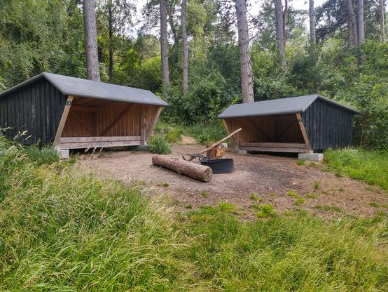
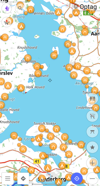
Did you know? #Denmark has over 3,700 shelters (shelter_type=lean_to) mapped in #OpenStreetMap!
Many of these are found in peaceful, scenic spots. Together with numerous primitive campsites, they make up for the fact that we don’t have the same Allemandsret (Freedom to roam) as our Nordic neighbors.
Want to find them while out and about? Apps like #OsmAnd (using OpenStreetMap-data) make it super easy to explore and navigate to these (usually free) shelters and tent spots.

