#riverbasin

alxd ✏️ solarpunk promptsalxd@writing.exchange
2025-05-20

#Solarpunk #writing and #art idea:

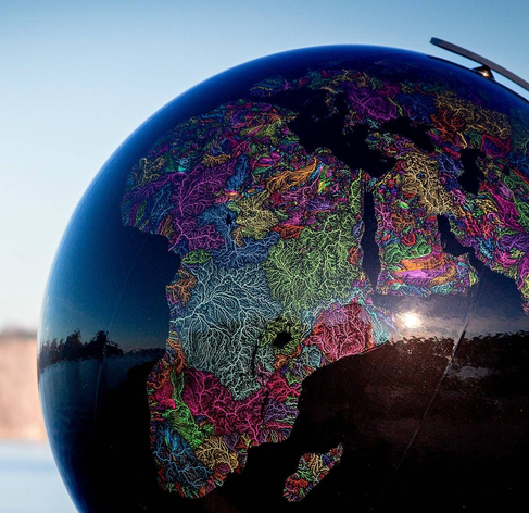
A #watershed #map instead of a political or elevation one.

Imagining a world divided into bio-regions not by some arbitrary political body, but by the rivers and water circulation.

We could make it into a beautiful symbol of a sustainable future.

More about it - en.wikipedia.org/wiki/Drainage

The one below is a work of grasshoppergeography.com/

"A Half Built Garden" book by Ruthanna Emrys implements such a vision!
#geography #drainageBasin #riverBasin

A globe of the Earth, but instead of a political or altitude map it's a colored map of watersheds with brightly-colored rivers making for the natural regions of the planet
2024-11-13

New publication: Governance Conditions for a Successful Restoration of Riverine Ecosystems, Lessons from the #Rhine River Basin. #biodiversity #ecosystemrestoration #governance #riverbasin
doi.org/10.3390/w16202983

2024-10-12

#HighlyCited Paper of #Water
Water and Health Nexus—Land Use Dynamics, Flooding, and #WaterBorneDiseases in the Odaw #RiverBasin, Ghana
by Joshua Ntajal, Britta Höllermann, et al.
Read and Download for free at: brnw.ch/21wNH2Z Water MDPI @Water_MDPI

2024-08-21

#FeaturePaper of #Water
A Review of Current Capabilities and Science Gaps in #WaterSupply Data, Modeling, and Trends for Water Availability Assessments in the Upper Colorado #RiverBasin by Fred D Tillman, et al. Read and Download for free at: brnw.ch/21wLXM1
Water MDPI @Water_MDPI

2024-03-22

New NIOO publication: Towards Design Principles for Good Multi-Level #Drought Risk #Governance: Some Lessons from the #Rhine Basin. #waterscarcity #climatechange #droughtrisk #riverbasin
doi.org/10.3390/w16060879

💧🌏 Greg CocksGregCocks@techhub.social
2023-11-10

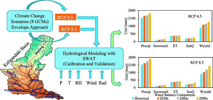
Climate Change Impact Assessment On The Hydrological Regime Of The Kaligandaki Basin, Nepal
--
doi.org/10.1016/j.scitotenv.20 <-- shared paper
--
“HIGHLIGHTS
• The rise in temperature and increase in precipitation is projected in future in Kaligandaki River basin.
• The water availability in the basin is not likely to decrease during this century.
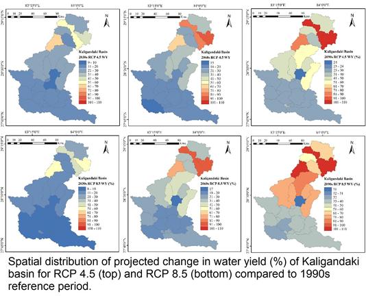
• The change in water balance in the upper sub-basins of Kaligandaki River is higher.
• The output from this research could be beneficial for water resources management..."
#GIS #spatial #mapping #Nepal #Kaligandaki #riverbasin #basin #river #hydrology #model #modeling #numericmodeling #climatechange #temperature #precipitation #ET ##waterresources #water #watersecurity #waterbalance #impactassessment #humanimpacts #freshwater #HinduKush #himalayas #SWAT #prediction #projection #cimip5 #gcm #waterbalance #snowmelt #evapotranspiration #spatialanalysis #spatiotemporal

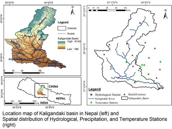
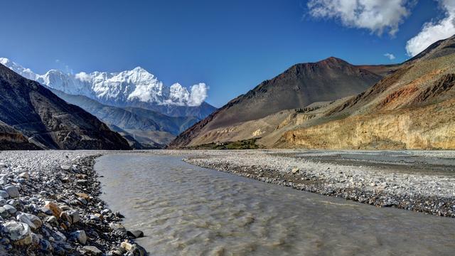
image - study Graphical abstractmaps - model results - Spatial distribution of projected change in water yield (%) of Kaligandaki basin for RCP 4.5 (top) and RCP 8.5 (bottom) compared to 1990s reference period.graphic - Location map of Kaligandaki basin in Nepal (left) and Spatial distribution of Hydrological, Precipitation, and Temperature Stations (right).photo - Gandaki River, Nepal

Client Info

Server: https://mastodon.social
Version: 2025.04
Repository: https://github.com/cyevgeniy/lmst