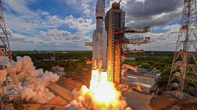
ISRO will launch Chandrayaan-4 in 2028, aiming for a historic lunar sample return. The mission plans to collect and bring Moon soil to India, putting ISRO among elite agencies. https://english.mathrubhumi.com/technology/science/chandrayaan-4-lunar-sample-return-2028-jc2cxrpv?utm_source=dlvr.it&utm_medium=mastodon #ISRO #chandrayaan4 #spacestation #LunarMissions
#spacestation
The International Space Station is passing overhead Ouseburn at:
18:00 hrs 16 Nov, from SSW to SSE for 2min 38s and max elevation 20°
ESA's Sophie Adenot to test new European spacesuit on ISS in 2026
- By Andrew Parsonson
https://europeanspaceflight.com/european-spacesuit-to-be-tested-aboard-iss-in-2026/
More: https://hype.aero/coverage/human-spaceflight-space-stations/?story=7d19927c-0388-4666-9a31-717d324eac67
#iss #spacestation #space
The International Space Station is passing overhead Ouseburn at:
18:48 hrs 15 Nov, from SW to SSW for 1min 4s and max elevation 17°
Three #chinese #astronauts come home, three stay behind on the #tiangong #spacestation with a cracked window on their #shenzou lifeboat. #Space is hard!
The International Space Station is passing overhead Ouseburn at:
18:02 hrs 14 Nov, from SSE to SSE for 0min 32s and max elevation 11°
The #ISS gets a lot of news in the west, but not so much about the #Chinese #spacestation
SpaceShipTember 2025 - Day 27 - Station
A station in the style of Kalpana One, at 1-6th my normal scale
#lego #space #spacecraft #spaceship #spacestation #kalpanaone
🇨🇳 #Shenzhou20, the vessel that was meant to bring the crew home, is now likely to return to Earth without the three #astronauts https://www.scmp.com/news/china/science/article/3332295/china-preparing-bring-home-astronauts-stranded-tiangong-space-station
Station in the Pochven Sunlight
#EVEOnline #Planet #SpaceStation #Triglavian
https://evepics.wordpress.com/2025/11/10/station-in-the-pochven-sunlight/
WHERE IS MAJOR TOM?
46/2025
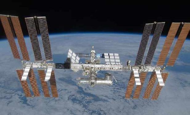
INTERNATIONAL SPACE STATION
Crew: 7
Docked vehicles:
- Cargo Dragon C211
- Crew Dragon Endeavour
- Cygnus CRS NG-23 (S.S. William “Willie” C. McCool)
- HTV-X1
- Progress MS-31
- Progress MS-32
- Soyuz MS-27
TIANGONG SPACE STATION
Crew: 3
Docked vehicles:
- Shenzhou 20
- Shenzhou 21
- Tianzhou-9
If you were born after Nov. 2, 2000, there has never been a time in your life when every living human being was on Earth at the same time. That date marked the beginning of 25 years of constant occupancy on the International Space Station, meaning some humans have always been in space since then.
-The Planetary Society
#Jamicon #Spacestation, a stylish first-generation all-in-one 486slc computer. It has a floppy drive and a hard drive, from which it also boots. Only the BIOS battery needs to be replaced.
#RetroComputing #ComputerMuseum
NASA To Discontinue ISS With Fiery Plunge In Point Nemo? Know Its Mission Amid 3I/ATLAS Chaos
• #Vast plans to send the 45 m3 #Haven1 to orbit in 📆 2026, the 55 m3 #Haven2 in 📆 2028
• #AxiomSpace plans to launch its first module to the #ISS in 📆 2027, later joined by two 11 x 4.2 meter (145 m3) habitable modules
• #Airbus and #VoyagerSpace plan to launch the 450 m3 #Starlab 📆 2028
• #SierraSpace and #BlueOrigin start operating the 830 m3 #OrbitalReef by the end of the decade
China delays Shenzhou-20 crew return after suspected orbital debris strike on Tiangong
- By SCMP Reporter
https://www.scmp.com/news/china/science/article/3331561/china-postpones-astronauts-return-after-suspected-debris-strikes-space-station
More: https://hype.aero/coverage/space-debris-traffic-management/?story=80f1f6a3-2c3e-457d-9e56-a46d970e2155
#spacestation #space
Chinese astronauts enjoy '1st ever space BBQ' from Tiangong's brand-new oven (video)
https://cdn.jwplayer.com/previews/4kdgUHaS
src: https://www.space.com/space-exploration/human-spaceflight/watch-chinese-astronauts-enjoy-1st-ever-space-bbq-from-tiangongs-brand-new-oven-video
Trên Trạm vũ trụ Trung Quốc, lò nướng khí nóng từ tàu Thần Châu-21 đã hoạt động, cho phép phi hành gia nướng cánh gà và bít tết ngay ngoài không gian—trải nghiệm ẩm thực mới lạ trong quỹ đạo. #SpaceStation #Astronaut #SpaceFood #HotAirOven #TrạmVũTrụ #PhiHànhGia #ẨmThựcKhôngGian #LòNướngKhíNóng
https://vtcnews.vn/phi-hanh-gia-nuong-canh-ga-va-bit-tet-ngay-tren-tram-vu-tru-ar985163.html
SpaceX launches private space station pathfinder 'Haven Demo,' 17 other satellites to orbit
SpaceX launches private space station pathfinder 'Haven Demo,' 17 other satellites to orbit (video)
https://cdn.jwplayer.com/previews/HrqqY5yk
https://www.space.com/space-exploration/launches-spacecraft/spacex-launches-private-space-station-pathfinder-haven-demo-17-other-satellites-to-orbit
* Haven-1 is a planned space station in low Earth orbit that is currently in development by American aerospace company Vast.
https://en.wikipedia.org/wiki/Haven-1
A commercial space station startup now has a foothold in space https://arstechni.ca/YS9E #Commercialspace #lowearthorbit #spacestation #bandwagon #haven-1 #spacex #Space #vast
