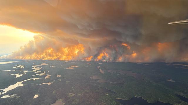
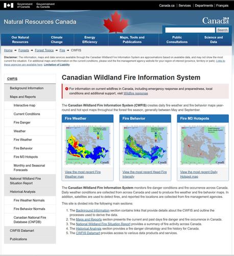
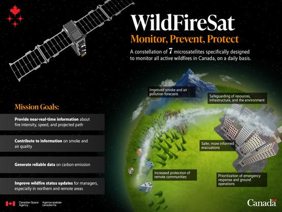
Canada Is On Fire - Maps, Satellite Data, Smoke Forecasts Powering Emergency Response [spatial resources]
--
https://gogeomatics.ca/wildfire-maps-satellite-data-smoke-forecasts-powering-emergency-response/ <-- shared technical article / resource
--
https://cwfis.cfs.nrcan.gc.ca/home <-- shared Canadian Wildland Fire Information System (CWFIS) page
--
#GIS #spatial #mapping #resources #Canada #provinces #remotesensing #fire #wildfire #monitoring #response #hazardresponse #riskassessment #risk #hazard #loss #cost #infrastructure #extremeweather #climatechange #hot #dry #fireseason #stateofemergency #humanimpacts #publichealth #smoke #publicsafety #community #urban #opendata #spatialanalysis #spatiotemporal
#spatiotemporal
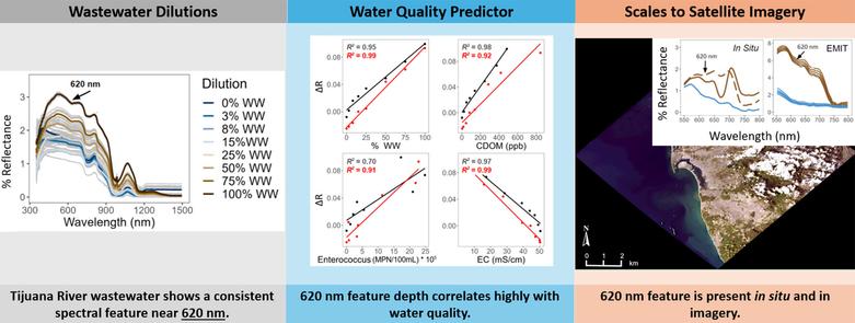
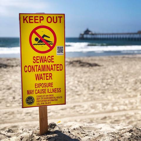
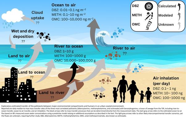
Sewage Crisis At California Coastline Can Be Seen From Space [remote sensing]
--
https://www.sfgate.com/bayarea/article/sewage-crisis-california-coastline-visible-space-20384048.php <-- shared media article
--
https://doi.org/10.1016/j.scitotenv.2025.179598 <-- shared paper
--
https://doi.org/10.1126/sciadv.ads9476 <-- shared paper
--
https://earth.jpl.nasa.gov/emit/ <-- shared NASA EMIT home page
--
#GIS #spatial #mapping #remotesensing #earthobservation #sewage #sewerage #California #coast #coastline #pollution #monitoring #spatialanalysis #spatiotemporal #Tijuana #SanDiego #USA #Mexico #NASA #publichealth #publicsafety #waterquality #airquality #marine #ocean #industrialwaster #stormwater #urban #runoff #estuary #beach #closure #contamination #contaminants #ctinoxate #methamphetamine #reflectance #wastewater #EMIT
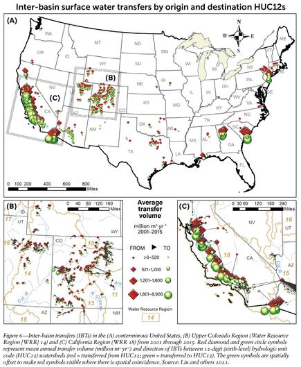
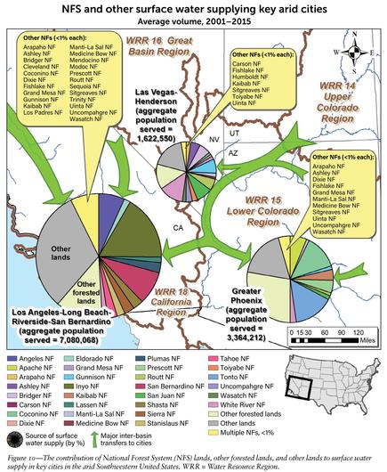
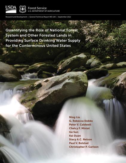
[Public Lands] National Forests Deliver Almost Half Of The West's Drinking Water Supply, [USFS] Report Shows
--
https://www.kunm.org/news/2022-10-07/national-forests-deliver-almost-half-of-the-wests-drinking-water-supply-report-shows <-- shared media article
--
https://www.fs.usda.gov/sites/default/files/fs_media/fs_document/GTR-WO-100.pdf <-- shared USFS publication
--
#water #watersupply #hydrology #publicwatersupply #PWS #USWest #publiclands #waterresources #forests #grasslands #nationalforests #nationalgrasslands #MountainWest #surfacewater #waterquality #community #watersecurity #urban #industrial #residential #drinkingwater #planning #management #watershed #GIS #spatial #mapping #spatialanalysis #spatiotemporal #model #modeling #interbasintransfers #NationalForestSystem #WaSSI #population #USA #US #publiclands
@USFS
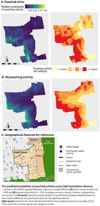
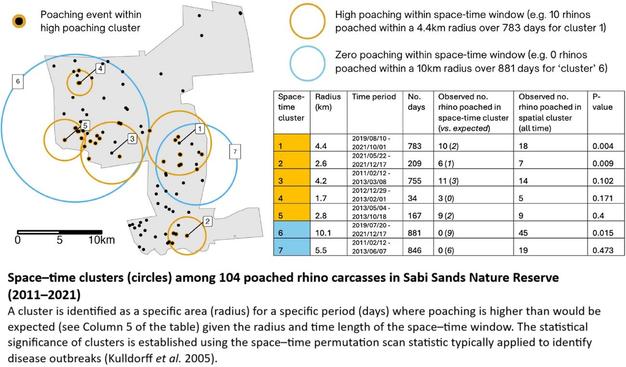
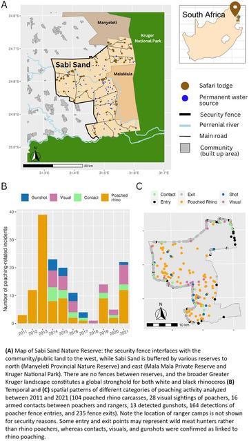
Colluding Rhino Poachers Exploit Space–Time Variation In Opportunity And Risk
--
https://doi.org/10.1111/conl.13106 <-- shared paper
--
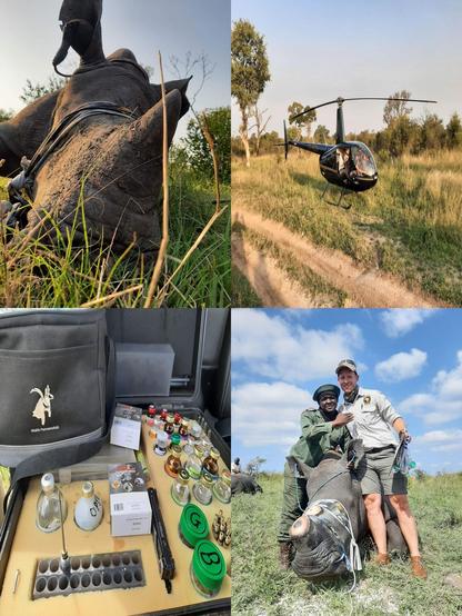
“[R]esearch analysing over 500 rhino poaching incidents and exploring what these patterns reveal about the behaviours of poachers, rangers, and rhinos. [Their] study highlights concerning evidence of criminal syndicate infiltration, space–time targeting by poachers, and how behavioural insights can inform effective responses—from targeted dehorning to bolstering ranger resilience…”
#GIS #spatial #mapping #spatialanalysis #wildlifeconservation #wildlife #conservation #statistics #geostatistics #rhino #rhinohorn #rhinoceros #poaching #rangers #criminal #syndicate #mafia #criminalsyndicate #activity #crime #illegal #behaviour #dehorning #rangerstation #protection #humanimpacts #ecosystem #habitat #deterrencetheory #deterrence #methodology #tourist #tourism #reserve #spatiotemporal #opportunity #risk #hazard #riskassessment #Africa #SouthAfrica #alldataisspatial
@Sabi Sand Nature Reserve
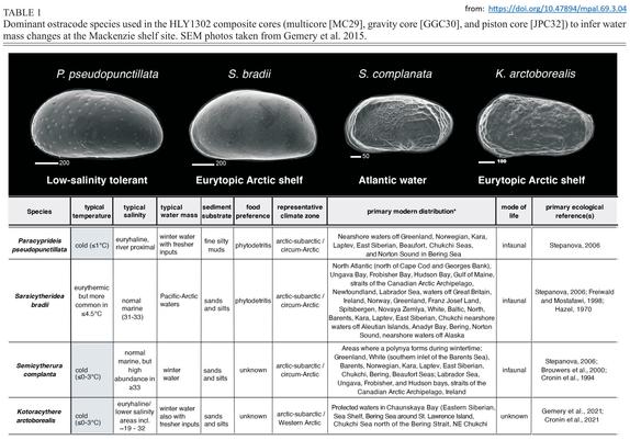
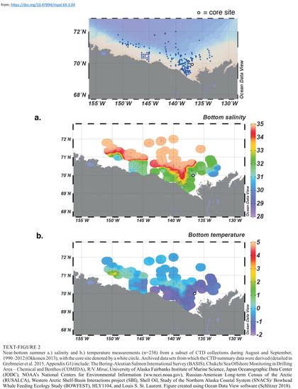
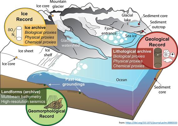
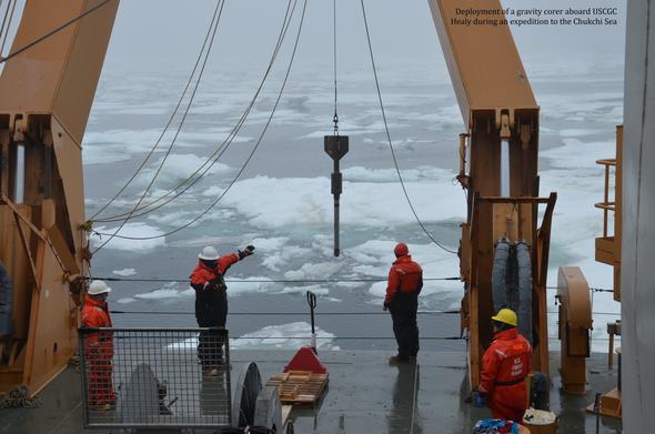
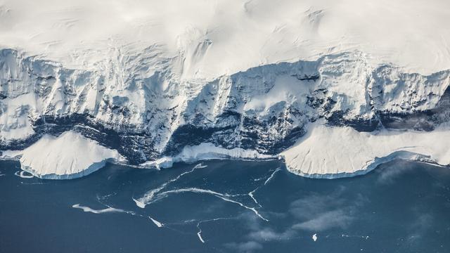
Land-Sea Linkages In The Arctic – What Is Paleoclimatology?
--
https://www.usgs.gov/programs/ecosystems-land-change-science-program/science/land-sea-linkages-arctic <-- shared technical article
--
https://doi.org/10.1371/journal.pclm.0000333 <-- shared example of paper
--
https://doi.org/10.47894/mpal.69.3.04 <-- shared example of paper
--
[who doesn’t like a good foraminifera! (memories of staring down a microscope for hours at grad school) 😊 ]
#fedscience #Paleoclimatology #Paleoecology #Paleooceanography #Icesheet #climatechange #Paleoanthropology #Seaice #Marineecosystems #GIS #spatial #mapping #spatialanalysis #model #modeling #spatiotemporal #foraminifera #arctic #change #cryosphere #ArcticOcean #glacial #interglacial #Holocene #future
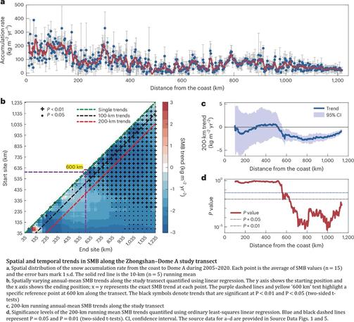
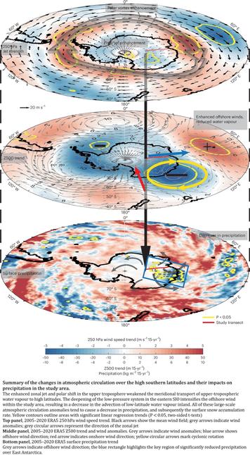
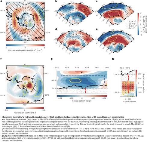
Sustained Decrease In Inland East Antarctic Surface Mass Balance Between 2005 And 2020
--
https://doi.org/10.1038/s41561-025-01699-z <-- shared paper
--
#GIS #spatial #mapping #Antarctic #EastAntarctic #icesheet #massbalance #spatialanalysis #model #modeling #spatiotemporal #water #climate #climatedynamics #monitoring #remotesensing #earthobservation #icecore #snowpit #wind #melting #water #ice #science #cryology #snow #weather #watervapour #climatemodel
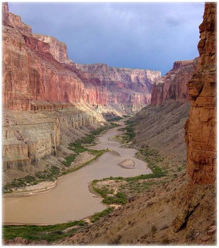
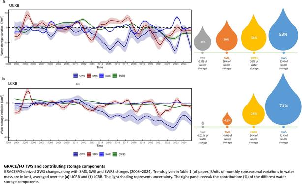
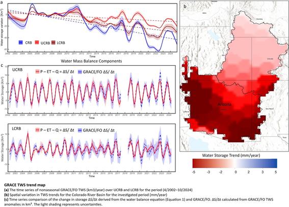
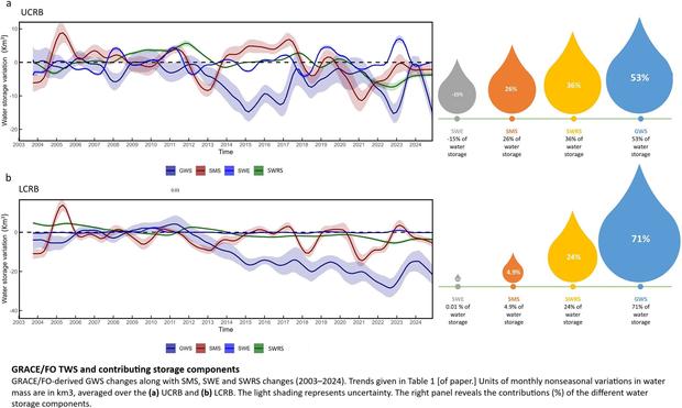
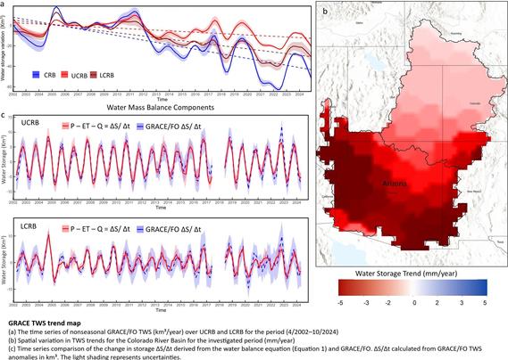
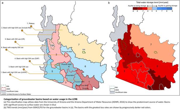
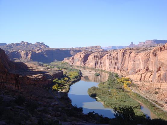
Declining Freshwater Availability in the Colorado River Basin Threatens Sustainability of Its Critical Groundwater Supplies
--
https://doi.org/10.1029/2025GL115593 <-- shared paper
--
https://www.livescience.com/planet-earth/rivers-oceans/groundwater-in-the-colorado-river-basin-wont-run-out-but-eventually-we-wont-be-able-to-get-at-it-scientists-warn <-- shared technical overview article
--
#GIS #spatial #mapping #water #hydrology #groundwater #waterresources #management #planning #ColoradoRiver #ColoradoRiverBasin #depletion #pumping #overpumping #climatechange #extremeweather #droughts #watershortage #waterstorage #remotesensing #spatialanalysis #earthobservation #satellite #spatiotemporal #GRACE #GRACEFO #model #modeling #sustainable #extraction #research
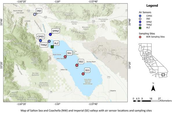
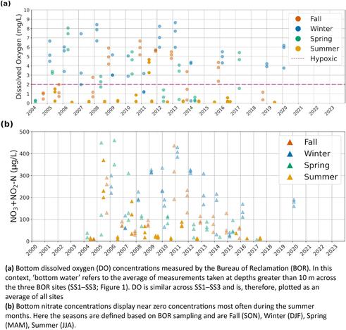
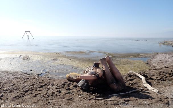
Hypereutrophication, Hydrogen Sulfide, And Environmental Injustices - Mechanisms And Knowledge Gaps At The Salton Sea
-
https://doi.org/10.1029/2024GH001327
-
[I have long been fascinated by this ‘accidental waterbody’, from its creation all the way through the extreme pollution issues as it evaporates – and the lithium under it – a heck of a history, culturally, demographically, hydrologically, contaminants, public health, agriculturally and so much more…]
#GIS #spatial #mapping #Hypereutrophication #HydrogenSulfide, #EnvironmentalInjustice #SaltonSea #California #publichealth #water #hydrology #sea #waterbody #accident #fertiliser #fertilizer #dust #dustborne #lake #degradation #health #community #rural #Latinx #Hispanic #farmworkers #children #TorresMartinezDesert #Cahuilla #Indian #FirstNation #evaporation #H2S #research #waterquality #waterresources #agriculture #environment #airquality #wind #airborne #spatialanalysis #monitoring #spatiotemporal #sensor #emissions #nutrients #Coachella #ImperialValley #sediment
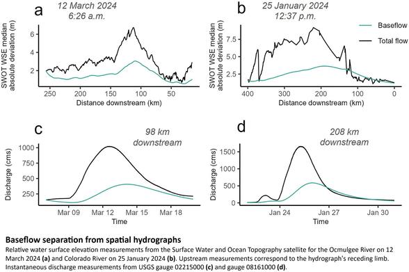
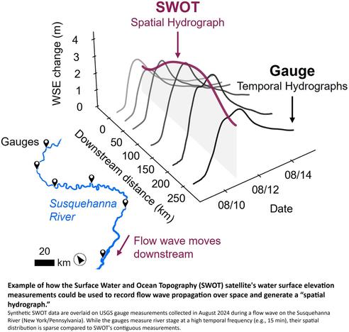
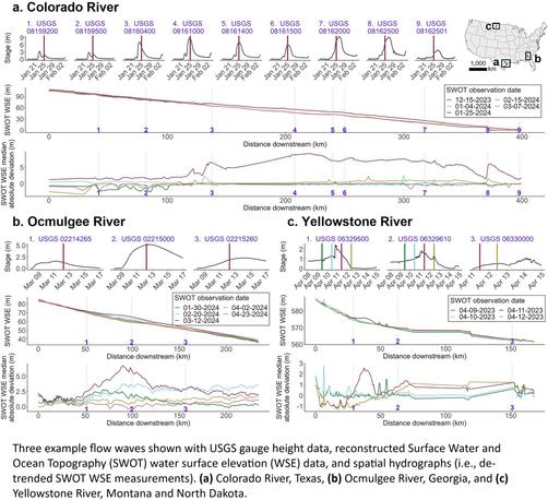
SWOT Captures Hydrologic Waves Traveling Down Rivers
--
https://doi.org/10.1029/2024GL113875 <-- shared paper
--
#GIS #spatial #mapping #model #SWOT #water #hydrology #hydrography #discharge #flowwaves #stream #river #gage #gauge #hydrograph #spatialanalysis #spatiotemporal #baseflow #extremeweather #highflow #remotesensing #earthobservation #satellite
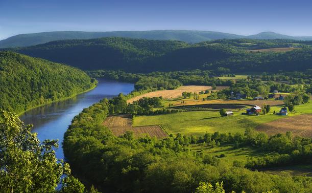
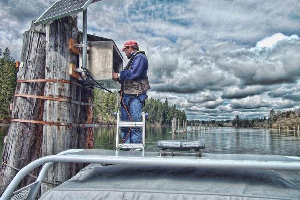
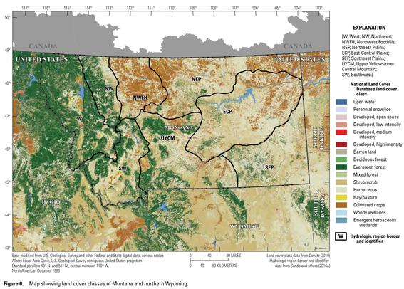
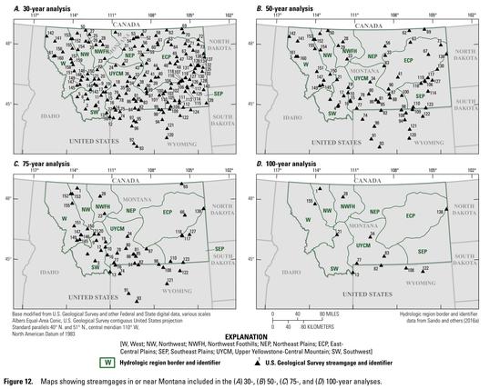
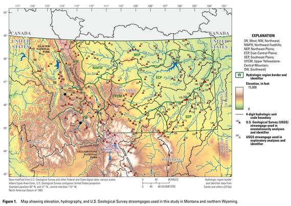
Peak Streamflow Trends In Montana And Northern Wyoming And Their Relation To Changes In Climate, Water Years 1921–2020
--
https://pubs.usgs.gov/publication/sir20235064G <-- shared USGS publication
--
#water #hydrology #fedscience #climatechange #mapping #GIS #spatial #spatialanalysis #Montana #Wyoming #gage #streamgage #model #modeling #stream #river #watershed #streamflow #waterresources #management #planning #forecasting #statistics #geostatistics #flood #flooding #extremeweather #rainfall #precipitation #spatiotemporal #climate #climatechange #hydroclimate
@USGS
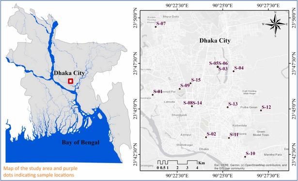
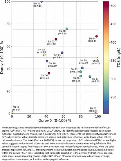
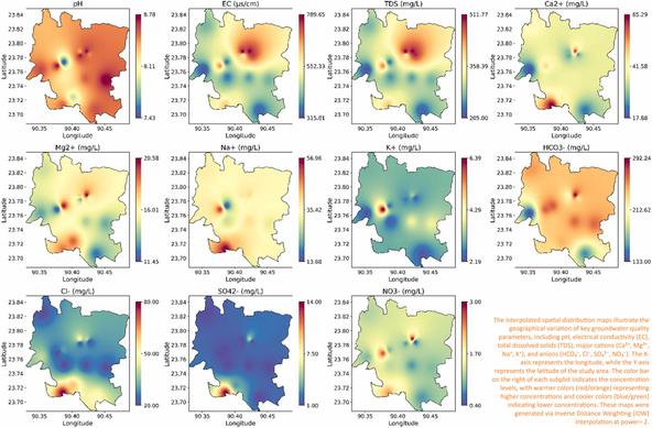
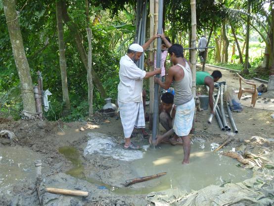
Interpreting Hydrogeochemical Interactions And Controlling Processes In Groundwater Using Advanced Statistical Techniques In The Southeast Asian Megacity - Dhaka, Bangladesh
--
https://doi.org/10.1016/j.clwat.2025.100084 <-- shared paper
--
#GIS #spatial #mapping #spatialanalysis #spatiotemporal #Hydrogeochemistry #Groundwater #Quality #Statistics #geostatistics #Analysis #Irrigation #suitability #water #hydrology #waterresources #statistics geostatistics #waterquality #model #modeling #potable #drinkingwater #urbanisation #city #growth #population #stress #planning #management #industrial #residential #geochemical #testing # Dhaka #Bangladesh #pumping #overpumping #drinking #irrigation #regional #WQI #multivariate #monitoring #contamination #pollution #assessment #watersecurity
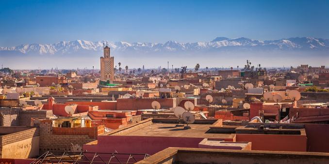
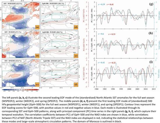
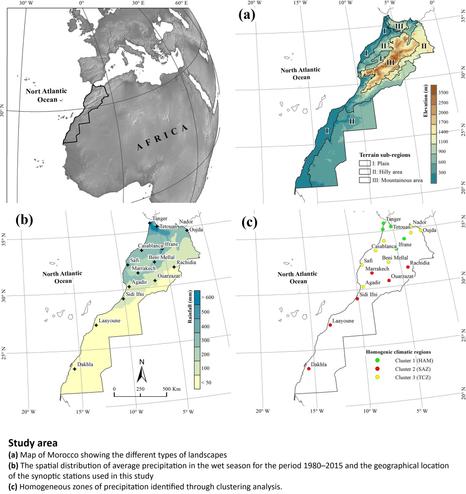
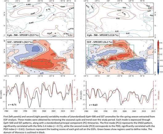
Influence Of Atmospheric And Oceanic Circulation Patterns On Precipitation Variability In North Africa With A Focus On Morocco
--
https://doi.org/10.1038/s41598-025-02718-0 <-- shared paper
--
[metrology, including regional, is not a subject I know a lot about, but this was an excellent paper to read]
#GIS #spatial #mapping #Morocco #NorthAfrica #meteorology #regional #model #modeling #weather #rainfall #precipitation #temperature #spatialanalysis #spatiotemporal #wetseason #patterns #statistics #geostatistics #climate #climatechange #indicators #teleconnections #seasonal #regression #wavelet #seasurfacetemperature #MediterraneanOscillation #NorthAtlanticOscillation #forecasting #atmosphere #ocean #marine #circulation
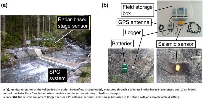
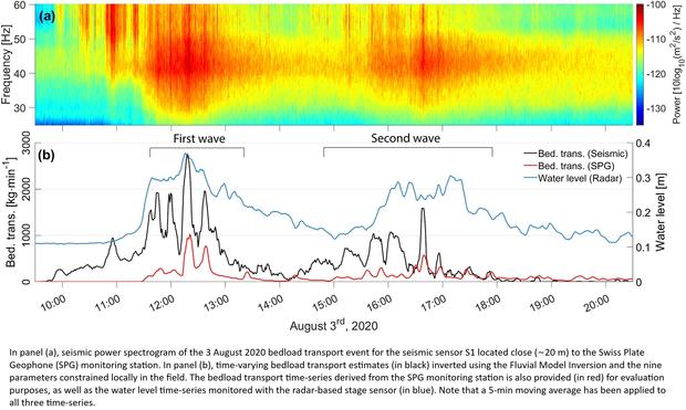
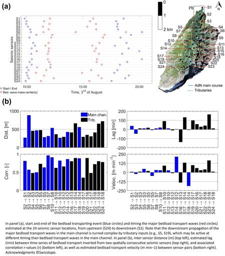
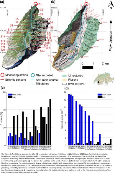
Seismometers Listening At Rivers To Measure Sediment Transport
--
https://eos.org/editor-highlights/seismometers-listening-at-rivers-to-measure-sediment-transport <-- shared technical article
--
https://doi.org/10.1029/2022JF007000 <-- shared paper
--
“Bedload sediment, transported throughout an alpine catchment by a flood, was remotely tracked in detail by analyzing the ground vibrations recorded by a network of 24 seismic sensors….
--
#GIS #spatial #mapping #water #sediment #remotesensing #bedload #alpine #catchment #flood #seismic #seismology #river #mountianous #watershed #sensor #model #modeling #sedimentology #spatialanalysis #spatiotemporal #erosion #deposition
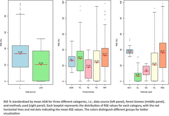
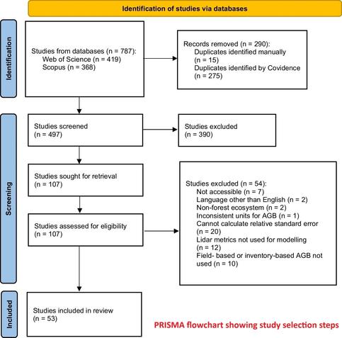
Forest Aboveground Biomass Estimation Using Airborne LiDAR - A Systematic Review And Meta-Analysis
--
https://doi.org/10.1007/s44392-025-00029-w <-- shared paper
--
#GIS #spatial #mapping #remotesensing #earthobservation #LiDAR #forest #vegetation #degradation #biomass #spatialanalysis #spatiotemporal #REDD #research #review #metaanalysis #opendata #AGB #model #modeling #papers #journal #PRISMA #statistics #geostatistics
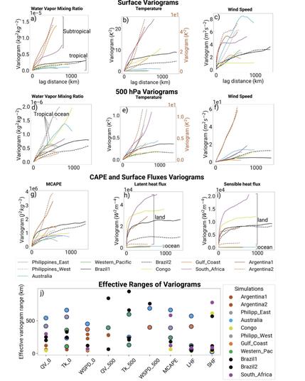
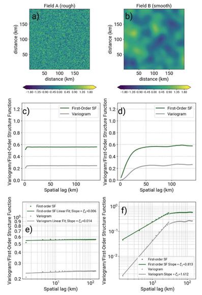
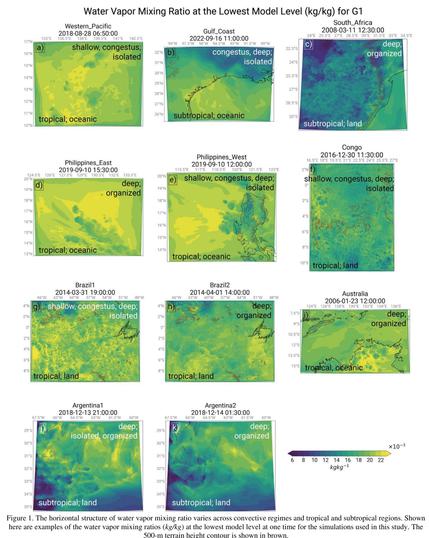
How Spatially Variable Are Tropical And Subtropical Convective Environments?
--
https://doi.org/10.22541/essoar.174559275.55062333/v1 <-- shared paper
--
#GIS #spatial #mapping #water #humidity #weather #evaporation #vapor #vapour #model #modeling #convective #environment #tropical #subtropical #climate #weather #meteorology #observation #spatialanalysis #spatiotemporal #structurefunctions #variograms #water #wind #moisture #temperature #atmosphere #air #ocean #oceanic #marine #surface ##
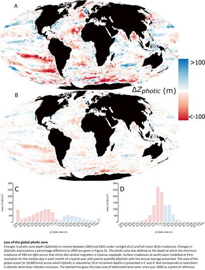
Darkening Of The Global Ocean
--
https://doi.org/10.1111/gcb.70227 <-- shared paper
--
[a little outside of ‘my usual’, but fascinating (and alarming, frankly…)]
#GIS #spatial #mapping #marine #ocean #photic #photiczone #ecology #change #sunlight #moonlight #spatialanalysis #spatiotemporal #darkening #habitat #biogeochemical #penetration #MODIS #remotesensing #earthobservation #satellite #light #coast #deepsea #openocean #nutrient #sediment #currents #circulation #productivity #fisheries #surface #ecology #ecosystems #impacts #humanimpacts
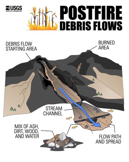
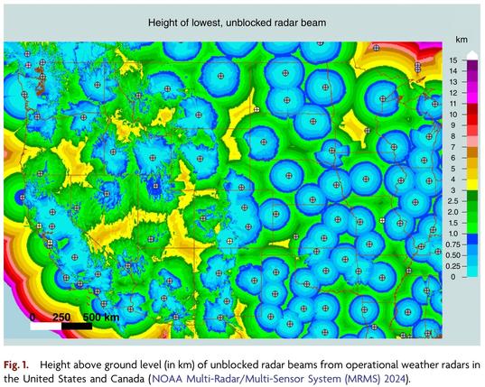
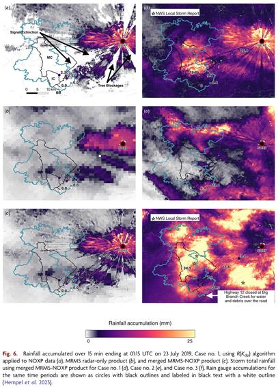
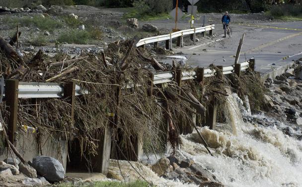
Mobile Radar Provides Insights Into Hydrologic Responses In Burn Areas
--
https://doi.org/10.1071/WF24163 <-- shared paper
--
#GIS #spatial #mapping #remotesensing #radar #water #hydrology #engineeringgeology #risk #hazard #massmovement #landslide #debrisflow #mobileobservatory #postfire #rainfall #precipitation #estimation #RockyMountains #streamradar #weatherradar #extremeweather # metrology #wildfire #fire #impacts #monitoring #hydrometeorological #instrumentation #burnarea #burnt #soil #basin #runoff #spatialanalysis #spatiotemporal #remoteareas #planning #management #mitigation
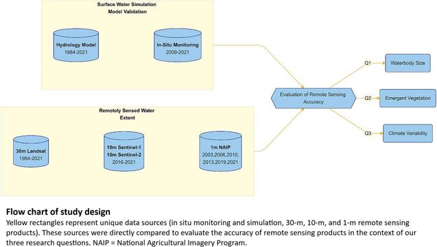
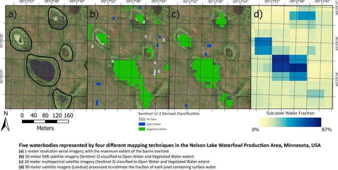
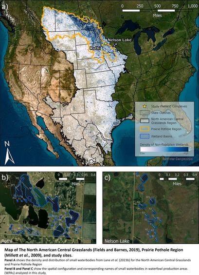
Small Waterbodies Of Large Conservation Concern - Towards An Integrated Approach To More Accurately Measuring Surface Water Dynamics
--
https://doi.org/10.1016/j.ecolind.2025.113525 <-- shared paper
--
“HIGHLIGHTS
• Hydrologic models were used to assess remotely sensed surface water estimates.
• The accuracy of satellite surface water estimates diminished for waterbodies < 2 ha.
• Vegetation reduces accuracy of surface water detection, especially during wet years..."
#GIS #spatial #mapping #waterbodies #Conservation #planning #surfacewater #Hydrologicmodeling #remotesensing #earthobservation #water #hydrology #hydrographic #model #modeling #spatialanalysis #spatiotemporal #waterbody #small #conservation #inventory #monitoring #accuracy #aquatic #vegetation #climate #NorthAmerica #kettle #landforms #landcover #glaciation #prairie #pothole
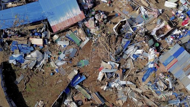
Saving Lives, One Pixel at a Time - End Users Share Their Stories
--
https://disasterscharter.org/news/saving-lives-one-pixel-at-a-time-end-users-share-their-stories <-- shared technical article
--
“For 25 years the International Charter has organized the distribution and use of satellite and remotely sensed data for response to natural disasters across the globe, informing countless applications where timely acquisition of remote sensing data literally...saves lives…”
--
#GIS #spatial #mapping #webmapping #remotesensing #earthobservation #satellite #imagery #risk #hazard #global #emergencymanagement #naturaldisaster #monitoring #response #planning #management #landsat #hurricane #cyclone #climatechange #extremeweather #flood #flooding #city #urban #crops #agriculture #foodsecurity #infrastructure #emergencyresponse #spatialanalysis #spatiotemporal
@InternationalCharterSpaceAndMajorDisasters | U.S. Geological Survey (USGS) | @earth Resources Observation And Science #EROS
Declining Freshwater Availability in the Colorado River Basin Threatens Sustainability of Its Critical Groundwater Supplies
--
https://doi.org/10.1029/2025GL115593 <-- shared paper
--
https://thehill.com/policy/equilibrium-sustainability/5320154-colorado-river-basin-study-groundwater-crisis/ <-- shared media article
--
#GIS #spatial #mapping #ColoradoRiverBasin #water #hydrology #waterresources #aridification #anthropogenic #climatechange #humanimpacts #groundwater #depletion #pumping #wateruse #agriculture #irrigation #management #planning #monitoring #remotesensing #earthonservation #satellite #NASA #GRACE #GRACEFO #landsurface #model #modeling #sustainability #surfacewater #waterrights #droughts #USA #Mexico #watershortages #waterstorage #spatialanalysis #spatiotemporal #strategy
