Zwischen dem #Zensus 2011 und 2022 ist die #Bevölkerung im #MitteldeutschenRevier um 1,6 % gestiegen.
Die #Storymap zeigt die Veränderungen zwischen den Zensusstichtagen unter anderem zu den Themen #Erwerbstätigkeit, #Wohnen:
➡️https://lsaurl.de/StorymapMitteldeutschesRevier
📰https://lsaurl.de/dO4oJc
#storymap
🗺️ Les outils #MaCarte d'@ignfrance pour la création de cartes et #storymap en ligne proposent maintenant de travailler en équipe et permettent de mettre en place une véritable chaine d'édition et de publication de #cartes en ligne. 💡
Je vous explique ⬇️
https://www.linkedin.com/pulse/travailler-en-%C3%A9quipe-avec-ma-carte-jean-marc-viglino-ah8he/
#LeJardinDesDélices est aussi l'un des exemples d'utilisation de #StoryMap JS (https://storymap.knightlab.com), outil gratuit avec code ouvert pour #médiationumérique #dataviz #outilspedagogiques #GLAM #mednum
RT @MadameMollette - Si vous avez aimé la carte interactive de #Cassini, je me permets de remettre le lien vers le plus beau site interactif que j'ai jamais vu, "Jheronimus #Bosch, the Garden of Earthly Delights", pour voyager cette fois dans le Jardin des Délices.
https://archief.ntr.nl/tuinderlusten/en.html
#30DayMapChallenge day 21: conflict ⚔️
🏔️ Mont Blanc ou Monte Blanco ✂️ conflit à la frontière ❗️
🗺️ Une #storymap #Macarte avec des #cartes de @ignfrance #IGM @swisstopo & @gallicabnf
poc @Laurentgontier
@julesgrandin @oliviermarchon
🗺️ online #map: https://macarte.ign.fr/carte/mctfGY/Mont-Blanc-ou-Monte-Blanco
🌍 Celebrating #GISDay2024!
GIS helps tackle critical challenges by turning data into actionable insights. Explore an interactive #StoryMap that illustrates 50 years of water quality trends in the #SourisRiver basin, showcasing how geospatial tools inform decision-making:
🔗 https://ijc.org/en/souris-river-water-quality-trends-examined-report-and-storymap
#30DayMapChallenge Day 13: New tool
⏹️ Testing new tool: #StoryMap 🏆 #QuizGeo
☑️ Test d'une nouvelle fonctionnalité #Macarte : le #QCM
🗺️ Quiz #carto 🏅 JO-1924➡️https://macarte.ign.fr/carte/lF9pjX/Quiz-JO-1924
✅Vous en pensez quoi ❓ #TeamHG #Edugeo
#30DayMapChallenge day 10: Pen & paper
🎨Brush & canvas
Carte de France de la peinture #paysage au XIXe s. 🖼️#impressionnisme🌄#fauvisme🌃#naturalisme🧑🎨#Barbizon🖌️ #Macarte 🗺️#mapping
🎨 19th century landscape #painting in France 🇫🇷
🗺️ online #storymap ➡️ https://macarte.ign.fr/carte/137w0v/Le-paysage-au-XIXe-siecle
I saw this example of a storymap:
https://storymaps.arcgis.com/briefings/b3375648976a4c349e64899f39a0684f
Does someone has any idea where to find a tutorial or learning path to make something similar? @esri
#esri #storymap
Malte en ordre de marche. Les #AD31 vous font revivre la visite d'une commanderie en 1637.
https://archives.haute-garonne.fr/web/malte/visites/index.html
#archivistodon #storymap #podcast
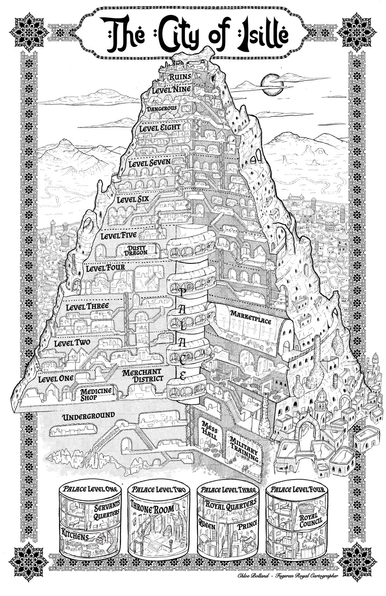
It’s not always easy to showcase black and white line art online, it looks stunning in print, but sometimes fails to compete with everything online. So I’ve tried adding a little colour, just for my portfolio and socials. The colour tries to balance an aged paper feel with artificial addition of glowing luminosity to make the central tower city pop. I’m pleased with it. Map is for Darci Cole‘s book Clever. #storymap #novelmap #novelmaps #cartography
I had fabulous fun drawing the map for Darci Cole‘s https://www.darcicole.com/ fantasy romance novel. The city is carved inside a small mountain, and has a Middle Eastern vibe, which I hinted at with the font, title and border decoration. The main challenge was detailing the inside layout where different levels are distinct but connecting and a central spiral road winds around a cylinder shaped palace. #storymap #gamemap #mapmakers #rpgart #novelmaps #dndart #citymap #oldmap #ink #lineart
Discover the St. Croix basin through a new GeoNarrative #StoryMap, a collaboration between the USGS New England Water Science Center, New Brunswick and IJC. Explore the complex water management strategies safeguarding this diverse binational basin:
https://storymaps.arcgis.com/stories/577ff8ff2029428f8b7716ae666c3261
#WaterManagement #BiNationalBasin
Explore the Souris River basin with a new GeoNarrative #StoryMap, developed by USGS and IJC. Based on a USGS Scientific Investigations Report, this tool aids in assessing water-quality changes over time. Mobile-friendly — give it a try 🗺️
https://storymaps.arcgis.com/stories/81db8f2e71c94436ab6d129f8b376fb3
#SourisRiver #WaterQuality
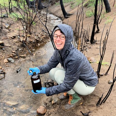
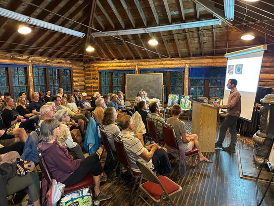
LAUREN MAGLIOZZI (INSTAAR & CEAE)
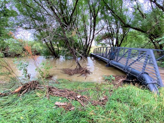
🔥🌊🌱 Fire, water, & the urban wild: Impacts of the Marshall Fire on Coal Creek in Boulder County, CO
Join us for her summer evening talk at the CU Boulder+INSTAAR Mountain Research Station
🗓 Wed July 10
🕖 7 pm
🔗 https://calendar.colorado.edu/event/lauren-magliozzi-mrs-seminar-fire-water-and-the-urban-wild-impacts-of-the-marshall-fire-on-coal-creek-in-boulder-county-colorado
Additionally, see a well-illustrated #storymap by Magliozzi et al. that assesses water quality & ecosystem impacts of the #MarshallFire at the Wildland-Urban Interface #WUI https://storymaps.arcgis.com/stories/5f19b8becef94ba3a537612b0332d99d
Taken the day off tomorrow.
It’s the anniversary of my wife’s mum’s death.
Going to be a tough day for her. I want to be there.
We’re going to do a road trip with her dad to all the places she lived in. Take photos and create a #storyMap for her grandkids.
She would have liked, though barely understood, that.
Haha, rad! A woman in Guyana used @terraso's story maps feature to document a motorcycle trip across the landscape.
I love this. Often in the nonprofit sector we (I) get really clinical describing my community's environment. Telling an actual narrative (road trip!) is a great way to communicate the wonderful things about a place and its people.
https://app.terraso.org/tools/story-maps/703ea3e0/safari-trip
Interested in learning more about MapSwipe's history and its contributions to the #geospatial data space? 🔍 Check out our #StoryMap here!
https://storymaps.arcgis.com/stories/4ed670067e9647b5b2f23d107b6d36ea
#mapswipe #mapping #humanitarian #HumanitarianData #gis #osm #data #missingmaps
Sharing from the Ontario Breeding Bird Atlas:
As we're gearing up for YEAR 3 of the Atlas, we have created an immersive way to explore the purpose of the Atlas, with interactive maps, data summaries, and more... a #storymap! Remind yourself why your contributions are so important to #birdconservation across the province, by viewing the StoryMap. Share with your #birder friends who can still contribute to the #onbirdatlas3 by visiting the link in our bio ("StoryMap").
🌍 From the case of Belgium's #3M factory and the discovery of extensive #PFAS pollution, to hotspots across Europe, delve into the intricate web of #ForeverChemicals with our comprehensive #Storymap. #ZeroPollution
#GRIDArendal
#SOSZEROPOL
#EU
RT jmviglino@twitter.com
#30DayMapChallenge day 25: Antarctica
#Map of the penguins 🐧 #SurfUp Where can you find penguins? #Macarte 🧊 #Edugeo #wildlife
❄️ #StoryMap 🔊 with @xenocanto #sound
🗺️ Online map ➡️ https://macarte.ign.fr/carte/COg3MM/Antarctica
🐦📎: https://twitter.com/jmviglino/status/1728463896481087659


