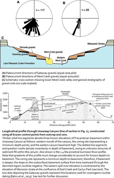
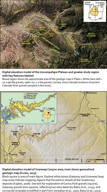
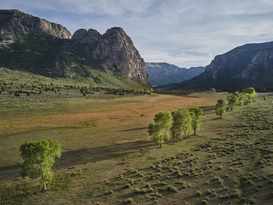
Unaweep Canyon - Two Creeks Flow Out Of Either End Of This [Colorado] Canyon In Opposite Directions
--
https://www.atlasobscura.com/places/unaweep-canyon <-- shared technical article
--
https://doi.org/10.1130/GES01112.1 <-- shared paper
--
[seems like a motorcycle road trip is in order - and happy to visit this beautiful part of the world again]
#geology #colorado #paleovalley #UnaweepCanyon #unaweep #precambrian #unique #divide #water #hydrology #underfit #drainage #EastCreek #WestCreek #Dolores #Uncompahgre #UncompahgrePlateau #erosion #Gunninson #canyon #Tabeguache #mapping #geologicmapping #fieldwork #Cenozoic #gravel #sediment #rockcore #coring #lacustrine #geomorphology #geomorphometry #dating #landform #volcanics #tectonics
#volcanics
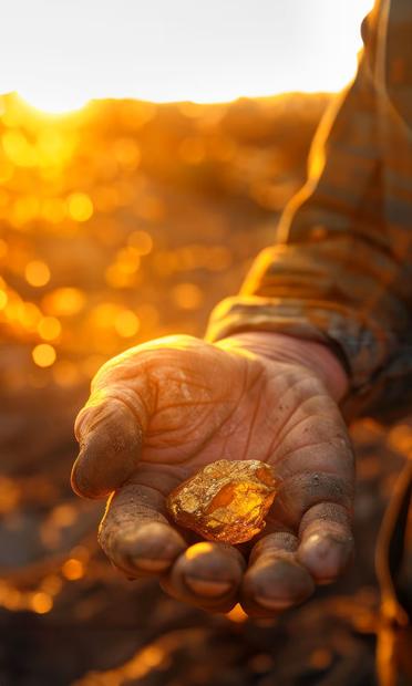
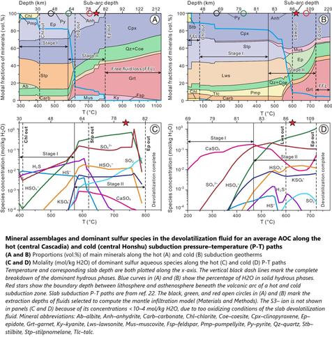
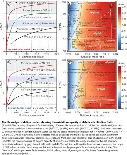
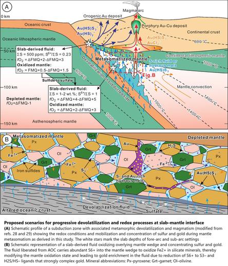
Thermodynamic Model Identifies How Gold Reaches Earth's Surface
--
https://phys.org/news/2024-12-thermodynamic-gold-earth-surface.html <-- shared technical article
--
https://doi.org/10.1073/pnas.2404731121 <-- shared paper
--
#geology #structuralgeology #mantle #crust #tectonics #platetectonics #gold #preciousmetals #subduction #mantle #crust #sulfur #RingOfFire #volcano #volcanics #magma #model #modeling #trisulfur #pressure #temperature #geochemistry #subductionzone #thermodynamics
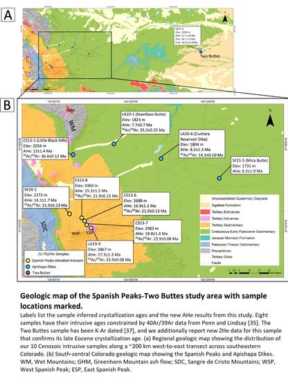
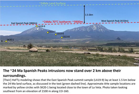
Cenozoic Exhumation Across The High Plains Of Southeastern Colorado From (U-Th)/He Thermochronology
--
https://doi.org/10.2113/2023/lithosphere_2023_310 <-- shared paper
--
[as a geologist and an adventure rider – and a Colorado resident that loves history - I have travelled all over this area; first photo is mine, my motorcycle under the Apishapa Arch in Aguilar, Colorado, a 1930s Civilian Conservation Corps project through a volcanic dyke, ‘coincidentally’ providing better access to land that a senator had purchased up around Cuchara and Cordova Passes]
#GIS #spatial #mapping #geology #Colorado #structuralgeology #Cenozoic #Thermochronology #model #modeling #3dmodeling #HighPlains #RockyMountains #Tertiary #intrusives #volcanics #vulcanism #SpanishPeaks #ApishapaArch #dates #dating #erosions #peneplanation #dikes #dykes
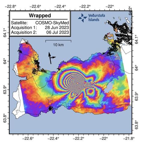
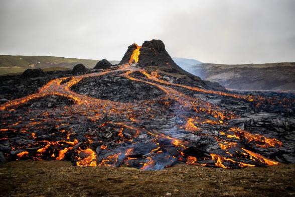
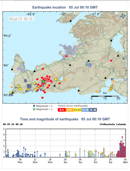
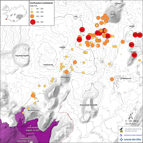
Earthquake Activity In Fagradalsfjall [Volcanic] Area [Iceland]
--
https://en.vedur.is/about-imo/news/earthquake-activity-in-fagradalsfjall-area <-- monitoring records
--
#GIS #spatial #mapping #Keilir #Fagradalsfjall #LitliHrútur #Reykjanes #iceland #volcano #volcanics #vulcanism #magma #earthquakes #eruption #earthquake #epicenter #remotesensing #satellite #cosmo #skymed #monitoring #seismic #seismology #deformation #normalisation #spatialanalysis #spatiotemporal #dike #dyke #intrusion #ground #elevation #fault #movement #gischat
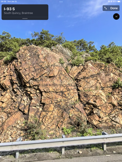
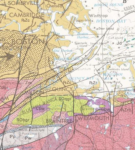
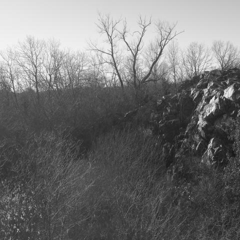
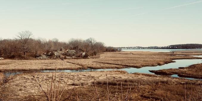
Proterozoic Mattapan Volcanics (Zm)
These felsic rocks are exposed on the south of the Boston Basin, and lay between the Dedham Granite and the Roxbury Conglomerate. They correlate to the Lynn Volcanics in Middlesex Fells and elsewhere north of Boston. The Roxbury (PzZr) mapped on Hough’s Neck (east of “Quincy”, map) is at least partly Mattapan, as seen at Rock Island (lower photos), which was quarried for “trap rock” ~ 1910. See captions for more.
#volcanics #igneous #geology #Boston #Quincy

![Schematic [geologic] cross-section of Cenozoic exhumation in the High Plains from the Spanish Peaks (A - west) to Two Buttes (A’ - east).](https://files.mastodon.social/cache/media_attachments/files/112/287/764/207/513/294/small/99621962cf9ba718.jpeg)
![[as a geologist and an adventure rider – and a Colorado resident that loves history - I have travelled all over this area; this photo is mine, my motorcycle under the Apishapa Arch in Aguilar, Colorado, a 1930s Civilian Conservation Corps project through a volcanic dyke, ‘coincidentally’ providing better access to land that a senator had purchased up around Cuchara and Cordova Passes]](https://files.mastodon.social/cache/media_attachments/files/112/287/764/428/090/023/small/ef4b2554c3fdb0cc.jpg)
