#wafire

2025-11-25

The Community Wildfire Protection Plan for King County WA has been approved by the state and a PDF is now available on the county website at:
cdn.kingcounty.gov/-/media/kin

I searched for info about evacuation and found this passage on p21-22.

“An east wind event that coincides with a wildfire could push embers directly into the urban areas of King County, a situation which would be dangerous and even life-threatening. This could cause unprecedented destruction to our communities, though such a fire in and of itself is not unprecedented – it is a known feature of our local fire regime. Rapid evacuation is likely the only option for immediately protecting communities in a high-severity, east wind driven fire. 12. Because major high-severity fires occur infrequently, people in higher-risk areas may not realize just how vulnerable they would be to a destructive, wind-driven wildfire. Lack of awareness can lead to lack of preparedness, low interest in mitigation, and taking inadequate precaution with potential ignition sources – the opposite of actions that are needed to become a fire-adapted community.”

Footnote 12:
“Cascadia Burning: the historic, but not historically unprecedented, 2020 wildfires in the Pacific Northwest, USA,” PDF is online at:
esajournals.onlinelibrary.wile
#PNW #WAfire #Wildfire #Seattle

2025-11-17

@ai6yr I want one too! We live in the wildland urban interface (WUI) in King County which adjoins the south side of Snohomish County.

Just did a quick search and wound up chatting with a state staffer. Surprise!!! Turns out the King County Wildfire Protection Plan was approved earlier today.

Might take a day or more but when I get a link I will certainly share it.
#wildfires #WAfire #Seattle #EmergencyManagement

2025-09-22

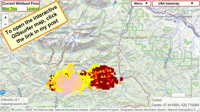
#LaborMountainFire SW of Cashmere WA. This is on the east slopes of the Cascade Mountains. US highway 97 is closed.

Dark red symbols are heat detections by satellite within prior 6 hours.

The winds from the weekend have died down so hopefully the fire spread will slow down. At the time of my post the most recent perimeter data is several days old.
#WAfire #WAwx #Wildfire

Open GISsurfer map:
mappingsupport.com/p2/gissurfe

Astro Hawk (Ian Kluft) ✅🚀🛰️AstroHawk@spacey.space
2025-09-16

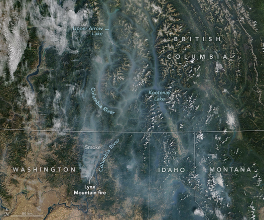
"Smoky Skies in the Pacific Northwest" by #NASA Earth Observatory - Sept 13 satellite imagery shows fires and smoke across Washington, Idaho, Montana and British Columbia. Besides unhealthy particulates in smoky air, study has shown effects of fires include effects on water quality and less-restrained runoff in burned areas. earthobservatory.nasa.gov/imag #WAfire #WAwx #IDfire #IDwx #MTfire #MTwx #BCfire #BCwx #weather #PNW

NASA/NOAA satellite imagery https://earthobservatory.nasa.gov/images/154797/smoky-skies-in-the-pacific-northwest

first paragraph of the article serves as an image caption:

Throughout the summer, satellites have tracked smoke in Washington state as hot weather, bouts of strong wind, and a prolonged drought have fueled several outbreaks of wildland fires. On September 13, 2025, the MODIS (Moderate Resolution Imaging Spectroradiometer) on NASA’s Terra satellite captured this view of smoke spreading from the Lynx Mountain fire across the northeastern part of the state and into British Columbia.
2025-08-28

(Continued) “The Border Patrol operation is not interfering with firefighting activity and Bear Gulch firefighters continue to make progress on the fire.” #BearGulchFire #wawx #wafire

2025-08-28

I have sent an email to the incident command team (CA IIMT 7) on the Bear Gulch Fire asking about the arrests of firefighters by Border Patrol, their status, and guidance re possible future USBP action. I’ll share any updates I get. #BearGulchFire #wawx #wafire

2025-08-28

The Border Patrol is now arresting firefighters on the line on the #BearGulchFire in Western Washington state. #wawx #wafire www.seattletimes.com/seattle-news...

Federal agents arrest firefigh...

New article: High fire danger for Eastern Washington and Eastern Oregon Wednesday ingallswx.com/2025/08/13/h... #WAwx #WAfire #ORwx #ORfire

High fire danger for Eastern W...

Mark Ingallsingalls@mstdn.ca
2025-08-13

New article: High fire danger for Eastern Washington and Eastern Oregon Wednesday

ingallswx.com/2025/08/13/high-

#WAwx #WAfire #ORwx #ORfire

2025-07-09

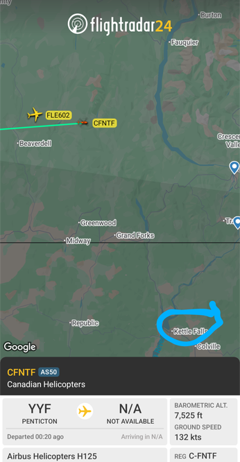
#bcws #bcfire night operations helicopter up from #penticton doing fire watch .I wonder if he has a view of the #wafire by #KettleFalls

2025-07-09

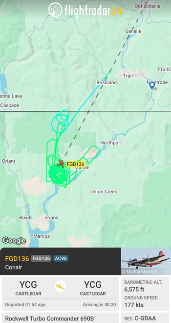
Looks like #bcws airtankers is assisting #WAFire north of #KettleFall Washington State

New article: High fire danger for Lower Columbia Basin and Yakima Valley on Tuesday ingallswx.com/2025/06/10/h... #WAwx #WAfire #TriCities #weather

High fire danger for Lower Col...

Mark Ingallsingalls@mstdn.ca
2025-06-10
2025-06-09

#RedFlagWarning

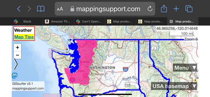
For details from NOAA - including timing - open the map, click colored area, follow the link. Since the spot you clicked might have more than one type of watch/warning, scroll down in the popup since each type of watch or warning has its own link for the details.
#WAwx #WAfire #Wildfire

Open GISsurfer map:
mappingsupport.com/p2/gissurfe

2025-05-08

Interesting #bcws air tankers have crossed the US / can border #wafire ?

2025-02-08

You only get to pick one.

Option A. Hire wildland firefighters to help prevent people's homes from burning.
Option B. Give zillionaires a tax cut.

Sadly, the story has a paywall.
#Wildfire #WAfire #Seattle #PNW
seattletimes.com/seattle-news/

2025-01-10

Got stupid?

Map shows part of #KingCounty WA. To the right of the Redmond Watershed Preserve is the dense Trilogy development.

Assume there is a #Wildfire and the whole area has to evacuate to the west. There are very few bridges across major creeks. The east-west road just on the north side of the Preserve will be jammed with traffic.

Good news. The 2 markers west of the Preserve mark a county-owned north-south gravel ‘fire road’ which could divert some traffic to a different bridge over Bear Creek.

Bad news: The county refuses to do any work to cut back trees/brush so the fire road is easily passable. #PNW #WAfire #Wildfire

Open GISsurfer map:
mappingsupport.com/p2/gissurfe

Client Info

Server: https://mastodon.social
Version: 2025.07
Repository: https://github.com/cyevgeniy/lmst