@kristinHenry Thank you!
Robert Simmon
Visualization, cartography, Earth from Space. Planet, ex NASA Earth Observatory.
I finally got around to publishing a portfolio! https://robertsimmon.com
Please check it out!
@Darrell_Carvalho I don’t recall if I’ve gotten back to you elsewhere, but it should be accessible: https://drive.google.com/file/d/0B-vzf2mGcaRzQlJ3cE9BSE1LNTQ/view?usp=share_link&resourcekey=0-mMkhkaaQthf44jD8ovgK7Q
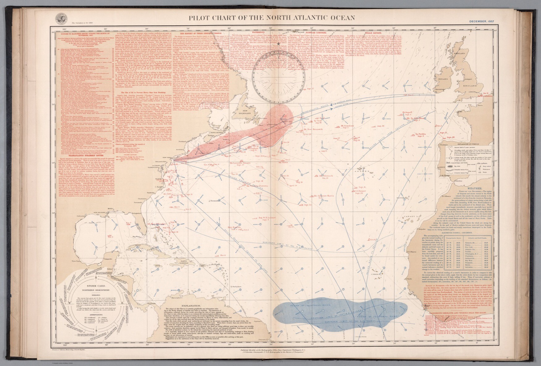
A virtual visit the the Ramsey Map Library rarely goes unrewarded — look at the detail and layers of information in this map of the North Atlantic. "Pilot chart of the North Atlantic Ocean : December, 1887"
I had a question sparked by the excellent presentations by Ken Fields, Paul Kahn, & Jessica Martin at the Rumsey Map Center last night — where are all the great 20th Century epidemic maps?
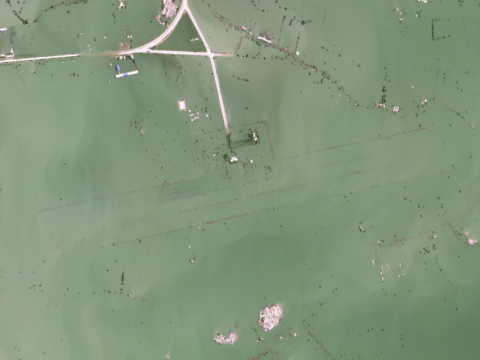
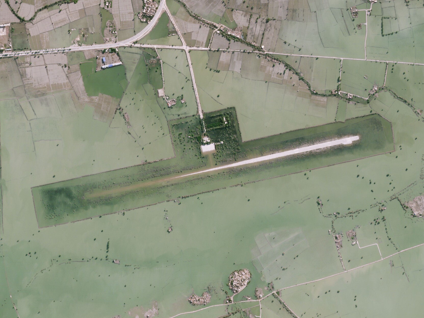
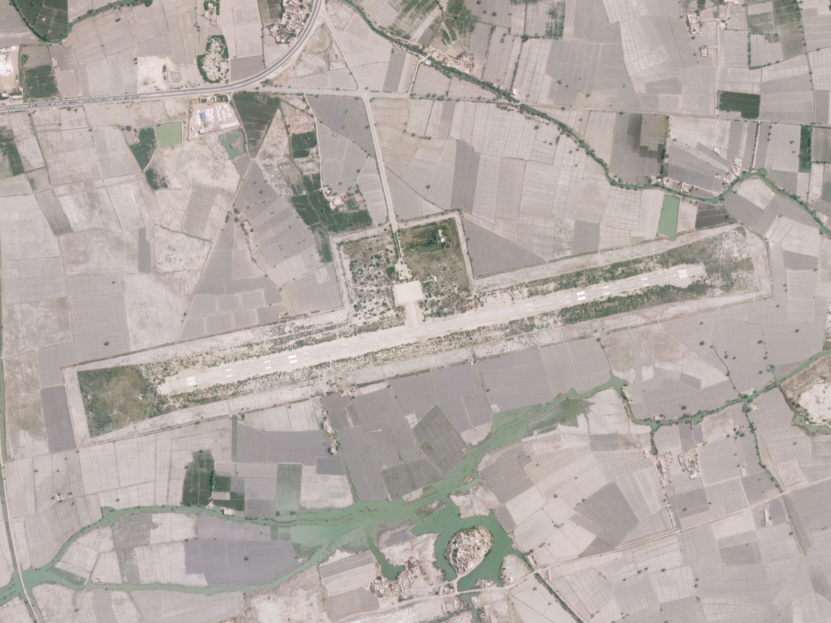
Flood waters linger in Pakistan long after the media’s attention has moved elsewhere — these high-res satellite images from Planet show Sehwan Sharif Airport, still partially submerged more than two months after the flooding peaked.
Robert Simmon boosted:
Maybe you haven't heard of Shiveluch on the Kamchatka Peninsula in Far Eastern Russia, but it is one of the most explosive and active volcanoes on the planet. In today's post you can check out some excellent satellite images by Planet that show the results of some recent dome collapses and explosions from this Russian volcano.
https://www.discovermagazine.com/planet-earth/the-most-active-volcano-youve-likely-dont-know
@ewklemetti I do not have any good advice, but I am now having flashbacks to the summer I spent polishing & prepping Aluminum Oxide samples for a Transmission Electron Microscope.
Illegal logging of old-growth forests in Australia, documented by Planet satellite imagery & illustrated with an exceptional (if depressing) set of small multiples by ABC Australia https://www.abc.net.au/news/2022-11-13/our-vanishing-old-growth-forests/101641964
(Satellite pics by my new & amazing colleague Julian Peschel.)
@FragariaChemist If you’re looking for inspiration I’d start with "Info We Trust" by, erm, @infowetrust
Do you have a specific dataset you’re interested in exploring or communicating? Or a more general interest in best practices?
Since the topic of "how do you scale colors on a map?" came up at work recently, here’s two invaluable resources:
"How to choose an interpolation for your color scale" by @lisacrost https://blog.datawrapper.de/interpolation-for-color-scales-and-maps/
& "Truthful Mapping" by John Nelson https://www.linkedin.com/pulse/truthful-mapping-john-nelson/
Robert Simmon boosted:
Morning folks, time for my first Mastodon thread (!)
Ahead of the #midterms tomorrow, I want to talk about the tragic politicisation of science in the US.
It’s hard to pinpoint exactly when the Republicans became the anti-science party, but the process probably began in the 1980s, when the Christian right first emerged as a major force in conservative American politics.
Since then, the journey has been smooth and swift, and there is now a stunning partisan divide on confidence in science 😥
Hi! Time to fire this thing back up.
Here’s the world’s largest solar-powered art project. Or maybe it’s an art-powered solar project?
https://www.planet.com/gallery/#!/post/junma-solar-power-station
I released a new post for Planet—side views of the most vertical places on Earth, via satellite. It was incredibly rewarding putting these together after scoping them out in Google Earth and imagining how they’d look. In my opinion the angle makes them look more real than most pics from space. https://medium.com/planet-stories/earths-wonders-like-you-ve-never-seen-them-before-ac9e2f39aa56
Sneak preview of my latest #thumbsupviz post, on the beauty and utility of hand-crafted data visualization: https://medium.com/@robsimmon/thumbs-up-viz-handcrafted-b1da422192de https://vis.social/media/mCv70LjvU6sxv23GJ6o
@francis Thought? Yes. Written? Nope. It’s…complicated. The idea is that providing non-exclusive access to medium and high-res data will democratize access, so it’s not just used by large & wealthy organizations. For example, the Center for Nonproliferation Studies uses our data to track missile development in North Korea, Egypt, Russia, etc. Plus some obvious applications for environmental research.
@scott Heya!
There’s a new issue of National Geographic out today, with a day in the life of the planet, from Planet (the company I work for) https://www.nationalgeographic.com/magazine/2018/02/surveillance-watching-you/ In addition to the satellite pics there’s additional visualizations of CCTV networks in London & satellites currently in orbit. https://vis.social/media/cSEfGCvMco3sz5ggGJY
Client Info
Server: https://mastodon.social
Version: 2025.04
Repository: https://github.com/cyevgeniy/lmst