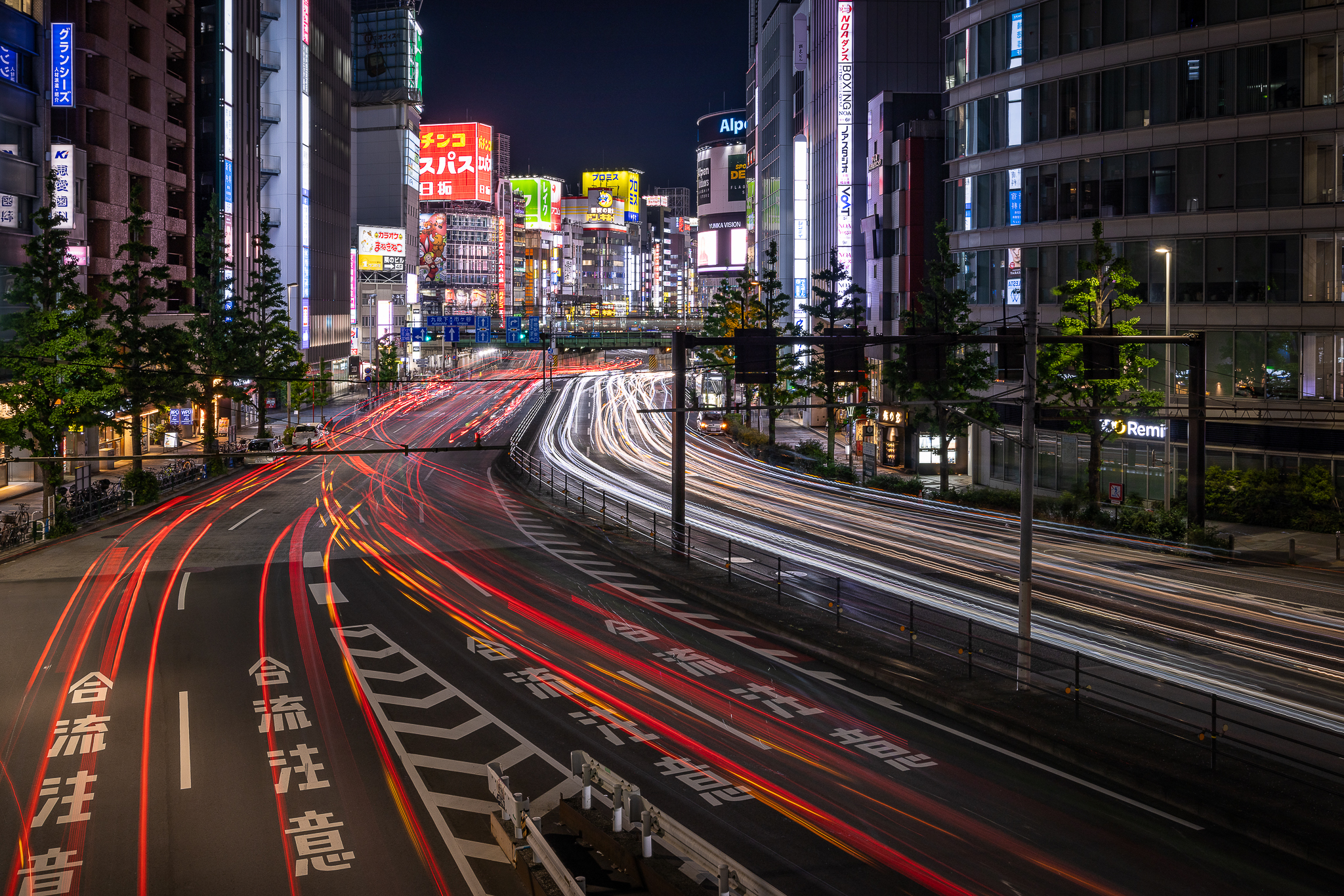
'Tokyo nights', Shinjuku, Tokyo
📸© helene-cook.eu
#art #photography #urbanphotography #cityscape #urbanlandscape #streetphotography #womeninstreet #streetscenes #photoderue #nightphotography #nightlife #tokyo #shinjuku #japan
virtualmarc
This account is primary for photos,
Main Account https://edgie.me/@virtualmarc
Introduction: https://edgie.me/@virtualmarc/statuses/01JGH6618REE3VHXBYKBEPNY47
Lead Software Developer,
Hobby Videographer since 2006
Videos: https://www.youtube.com/@MaVoFilms
PostCrossing: https://www.postcrossing.com/user/virtualmarc
Avatar thanks to https://mastodon.world/@loadingartist
Matrix on Request (Just ask me and I might add you)
#fedi22 #photography #nature #industry #landscape #NaturePhotography #videography #RuhrArea #Germany #Essen #PostCrossing
virtualmarc boosted:
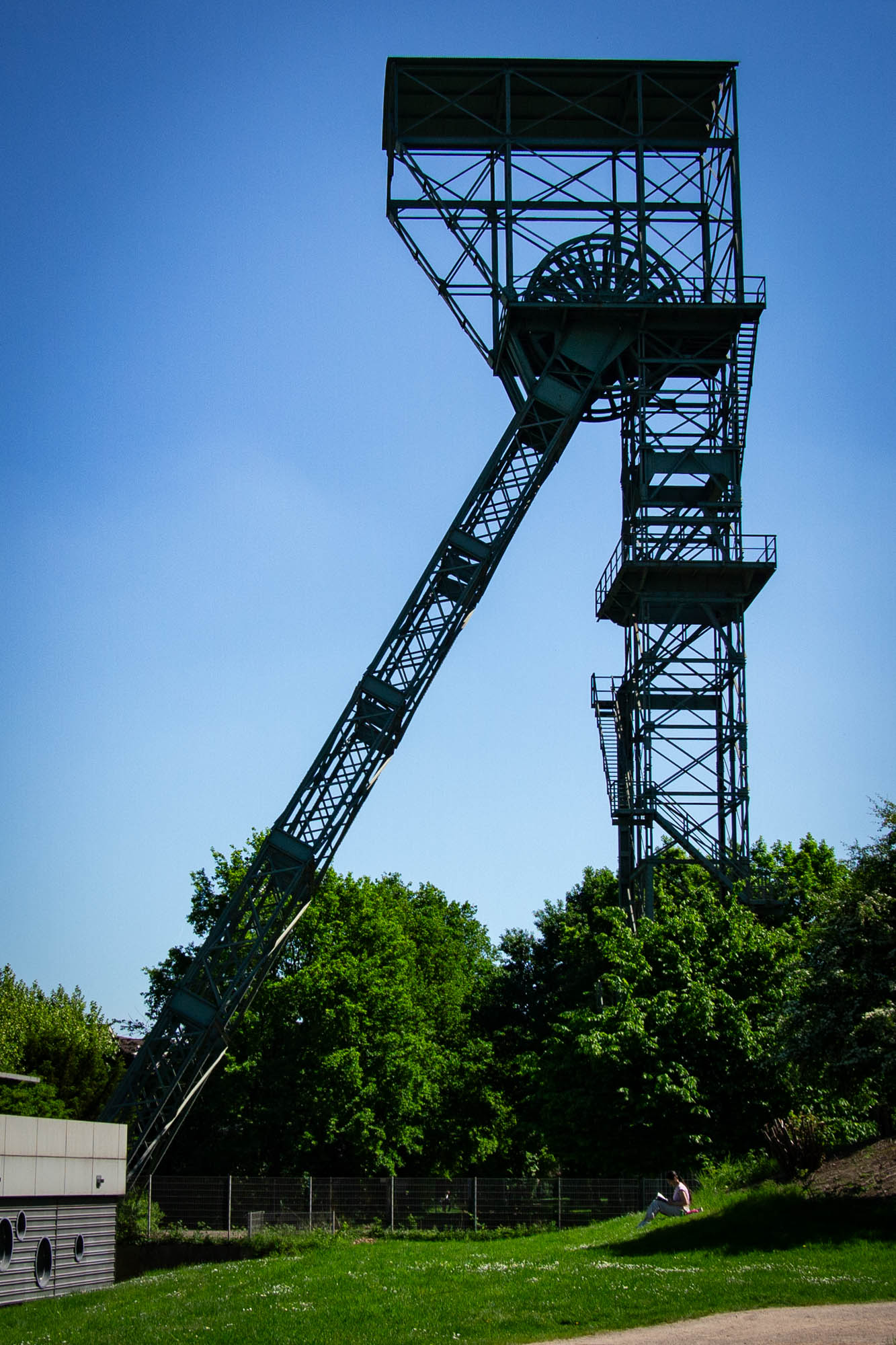
Week 18 of the #WeeklyPic project.
Schacht 6
https://www.weeklypic.de/bilder-der-woche-18-2025/
#Ruhrpott #Duisburg #Mining
Schacht 6
https://www.weeklypic.de/bilder-der-woche-18-2025/
#Ruhrpott #Duisburg #Mining
virtualmarc boosted:
virtualmarc boosted:
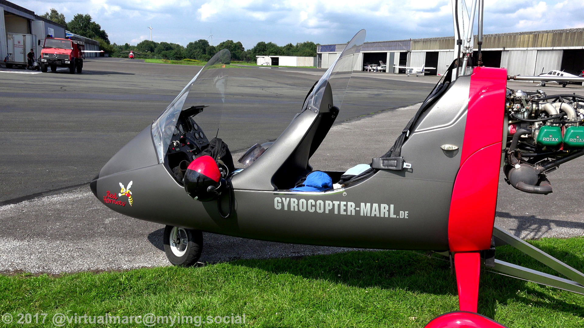
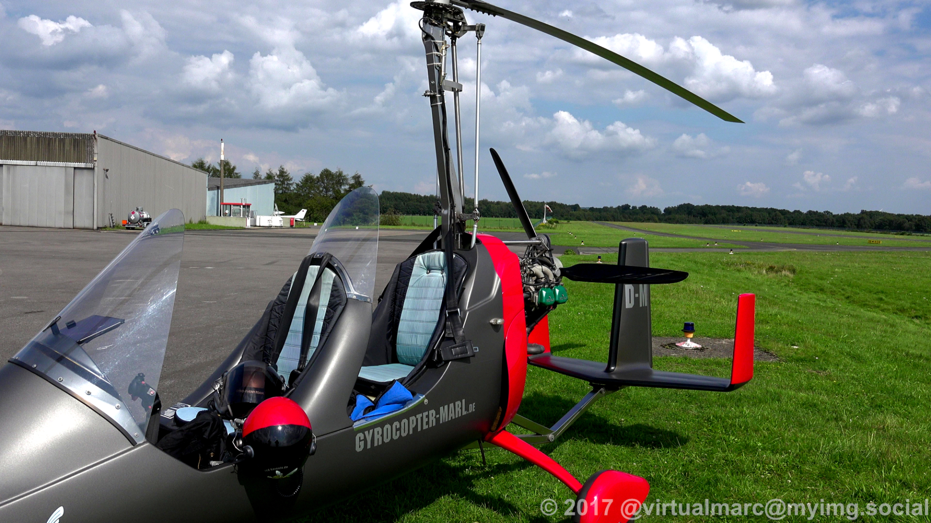
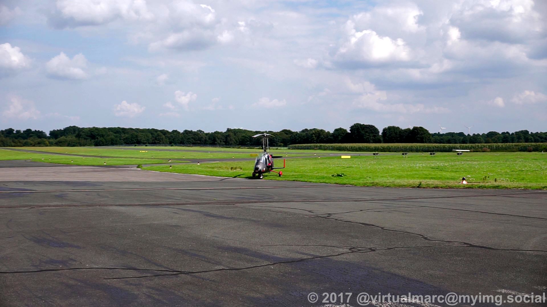
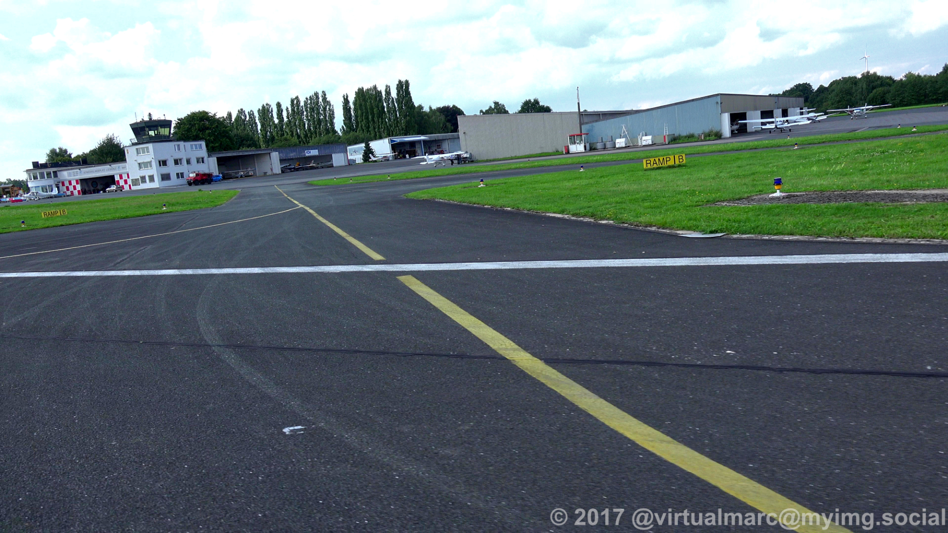
Thats it, we landed at the #Marl Lohemühle airport (EDLM) where we started earlier,
This also ends our Gyrocopter flight over part of the ruhr area.
#photography #nature #naturephotography #aerialphotography #aerialview #aerial #ruhrgebiet #ruhrpott #ruhr #ruhrarea #essen #gyrocopter #flying #edlm
This also ends our Gyrocopter flight over part of the ruhr area.
#photography #nature #naturephotography #aerialphotography #aerialview #aerial #ruhrgebiet #ruhrpott #ruhr #ruhrarea #essen #gyrocopter #flying #edlm
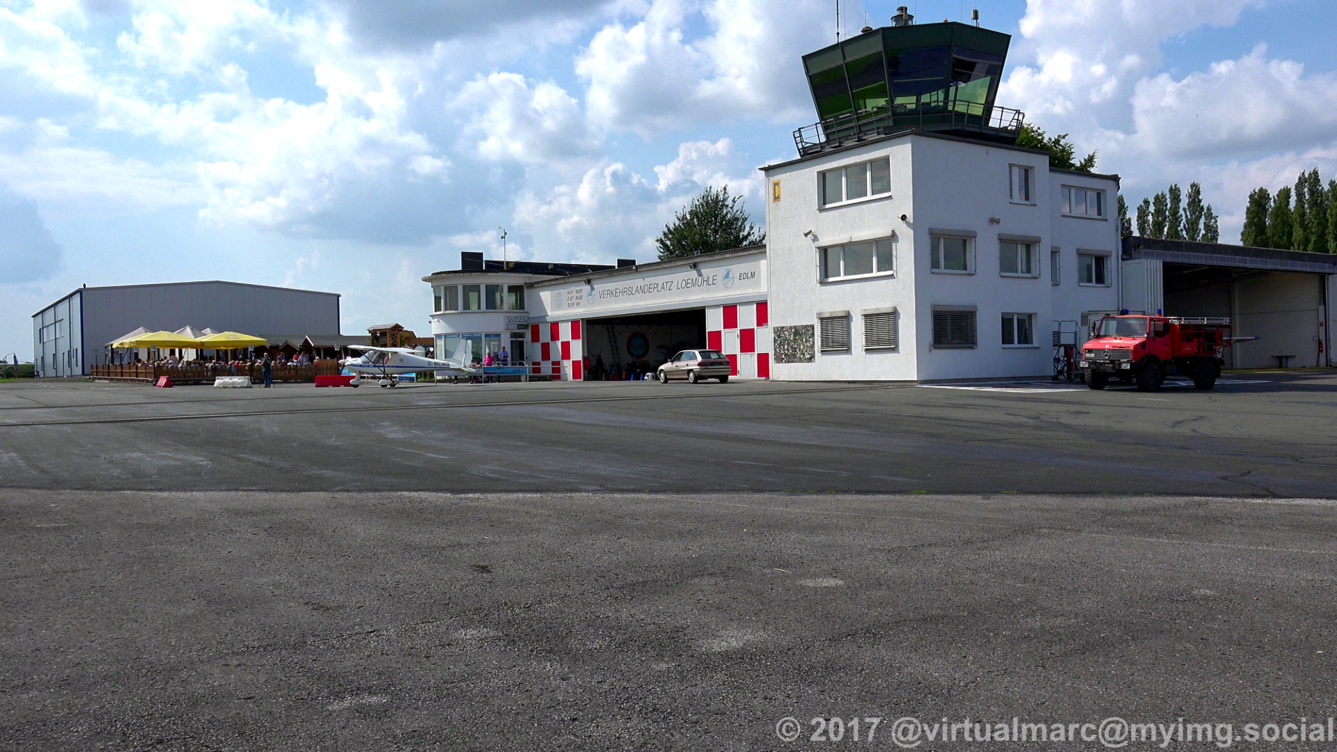
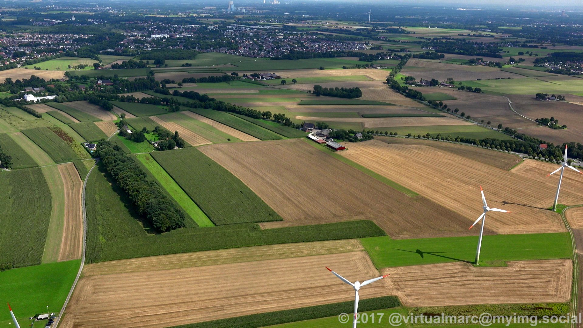
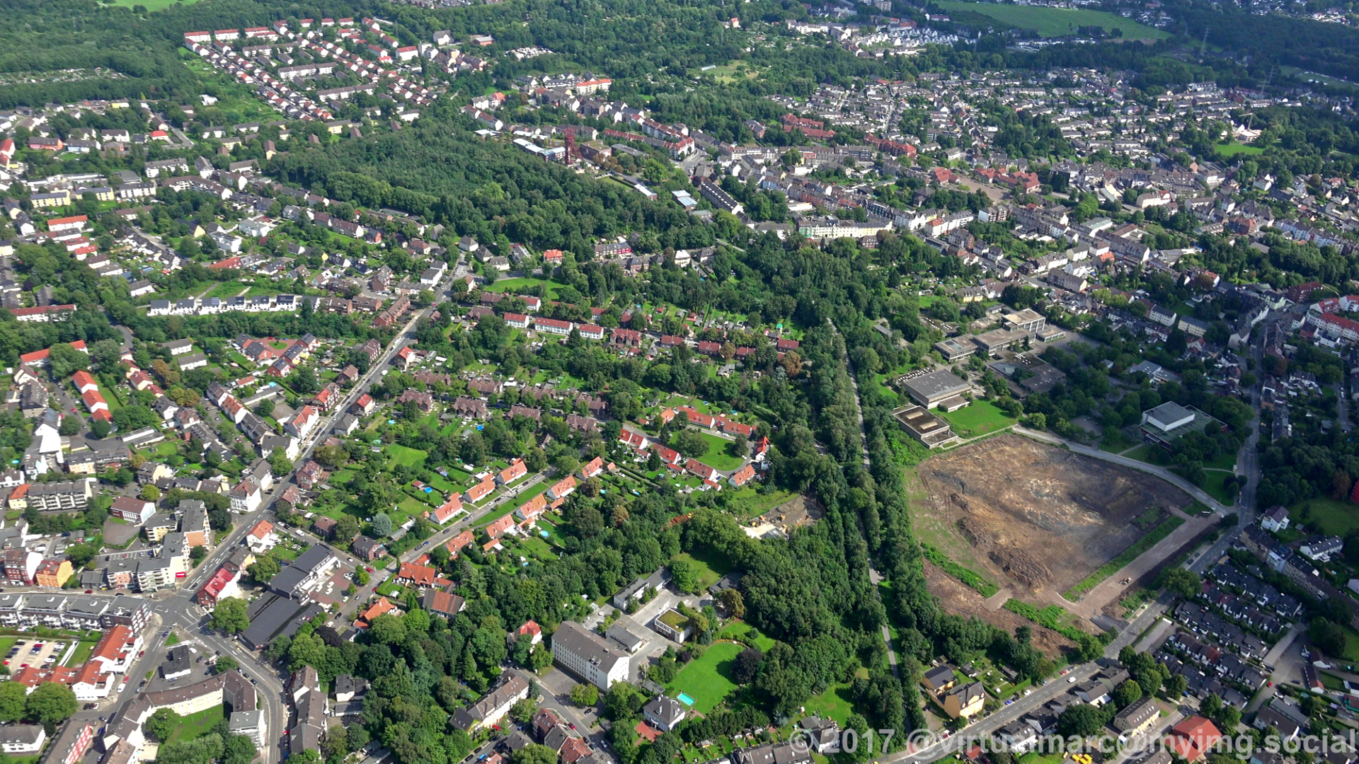
We are back in #Marl and ready to land at the Marl Loemühle Airport (EDLM).
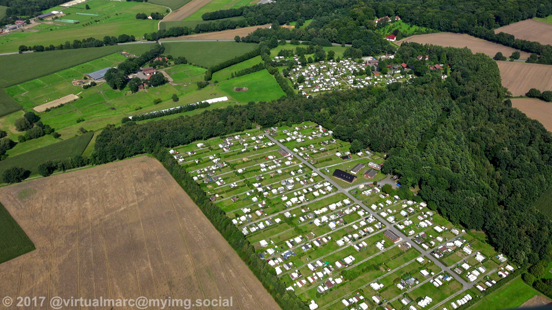
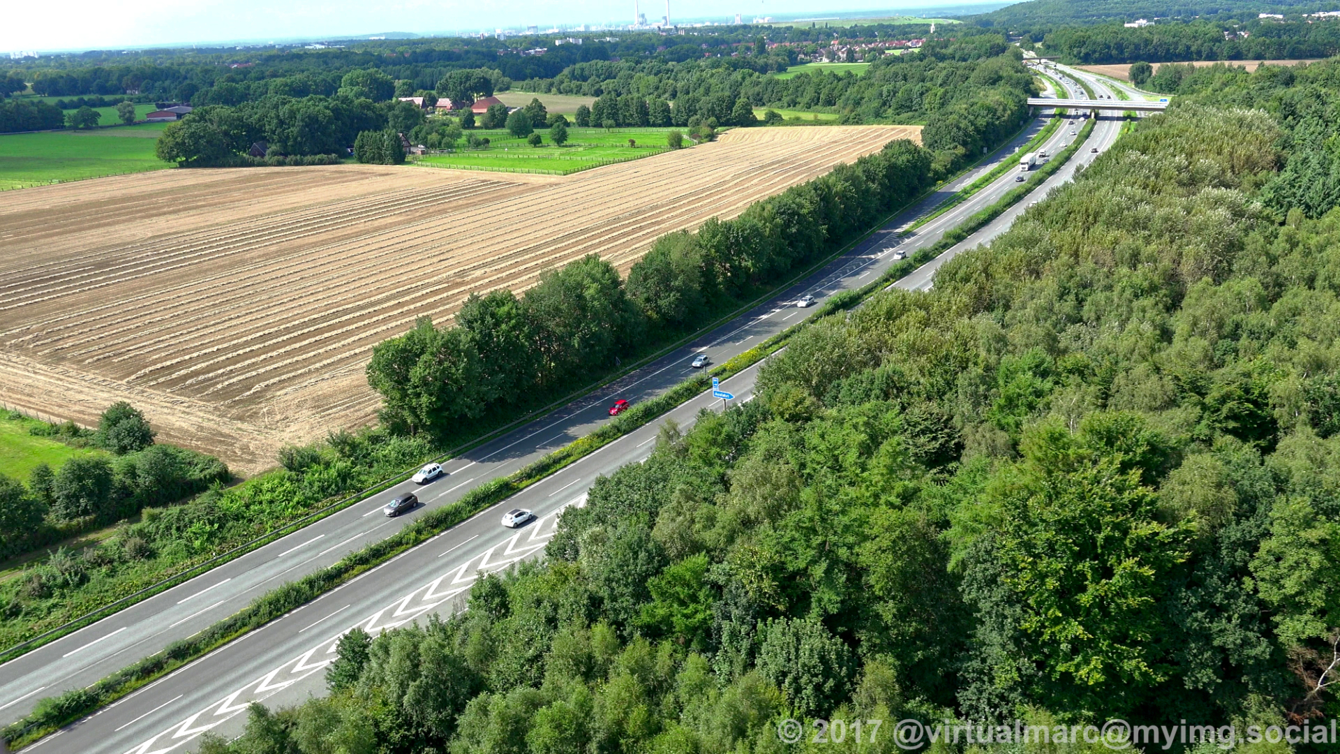
The first two images are not yet in Marl.
The first image shows the spoil heap near the Honermann settlement at the former General Blumenthal 8 mine in Oer-Erkenschwick.
The second image shows a campsite in Oer-Erkenschwick.
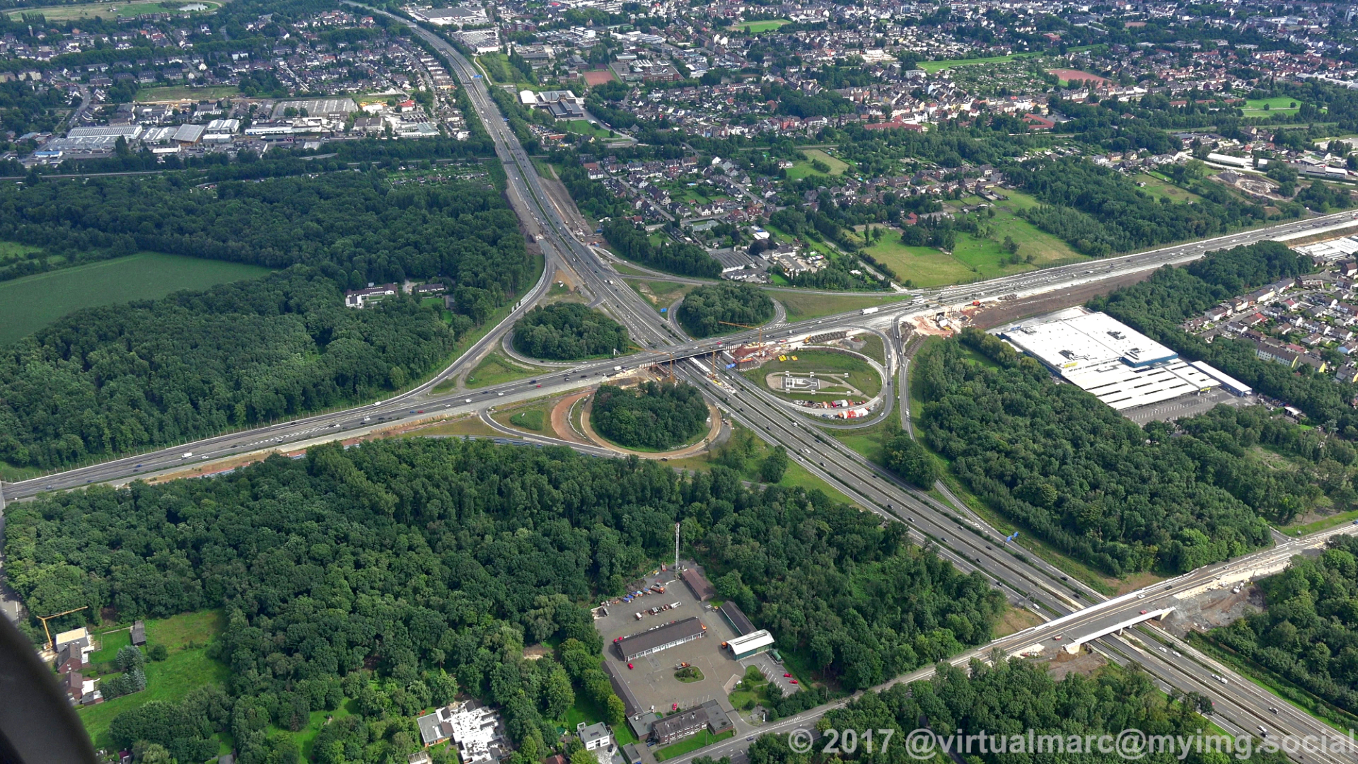
In the third image we started landing over the freeway A43.
#photography #nature #naturephotography #aerialphotography #aerialview #aerial #ruhrgebiet #ruhrpott #ruhr #ruhrarea #essen #gyrocopter #flying #edlm
The first two images are not yet in Marl.
The first image shows the spoil heap near the Honermann settlement at the former General Blumenthal 8 mine in Oer-Erkenschwick.
The second image shows a campsite in Oer-Erkenschwick.
In the third image we started landing over the freeway A43.
#photography #nature #naturephotography #aerialphotography #aerialview #aerial #ruhrgebiet #ruhrpott #ruhr #ruhrarea #essen #gyrocopter #flying #edlm
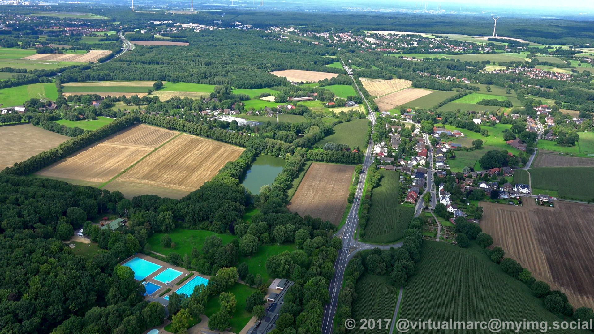
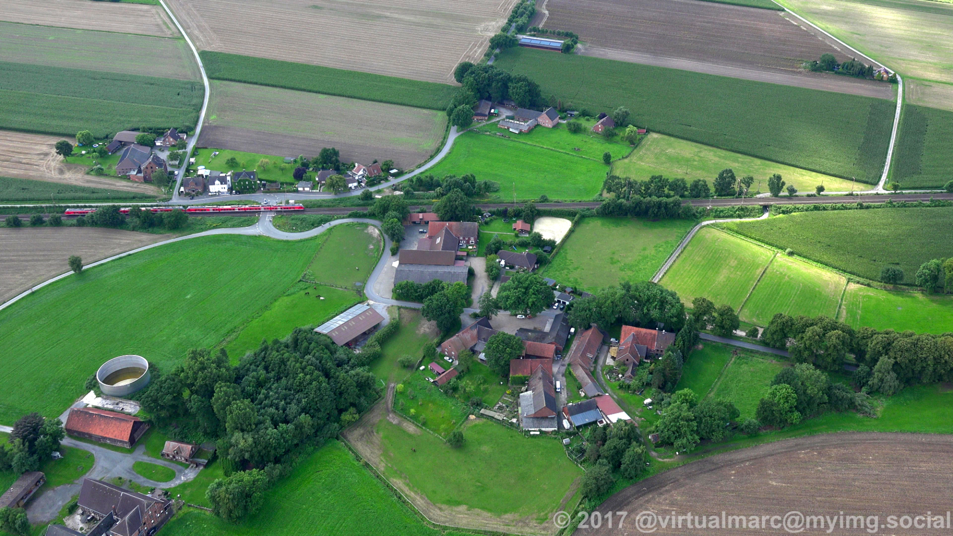
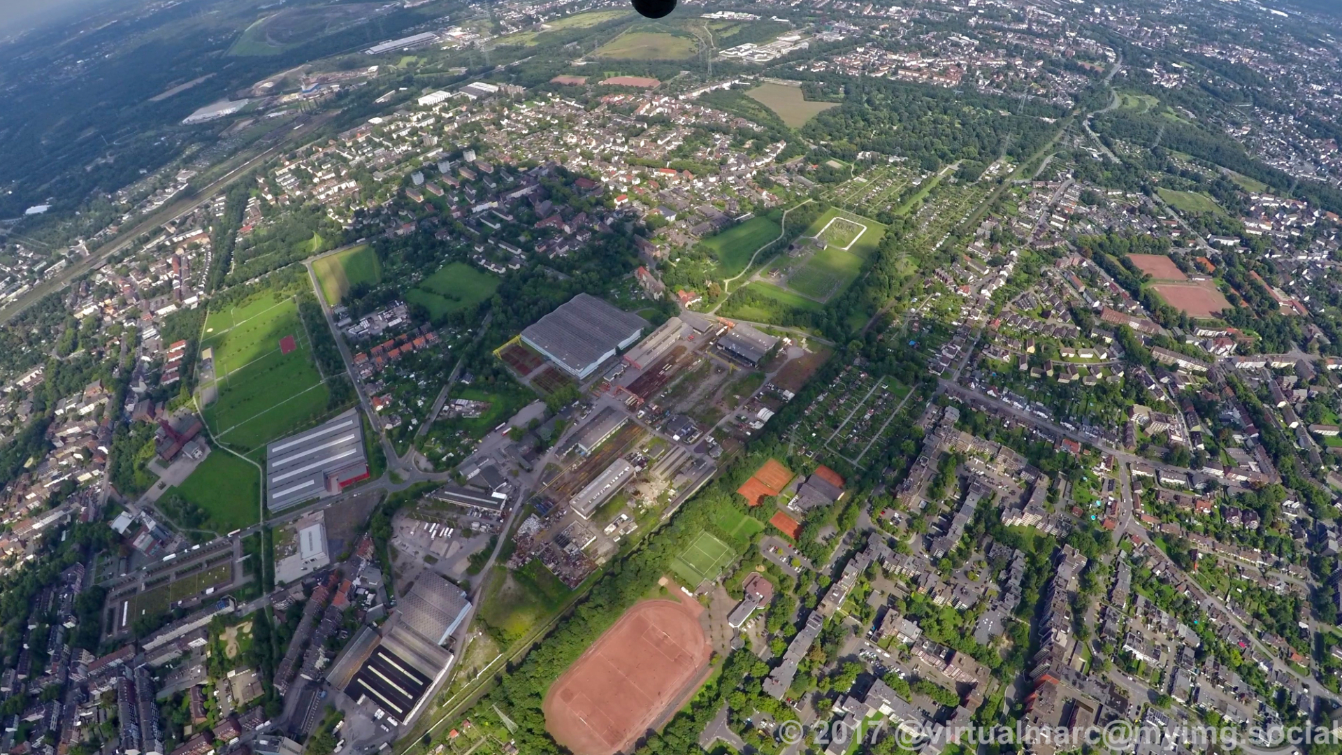
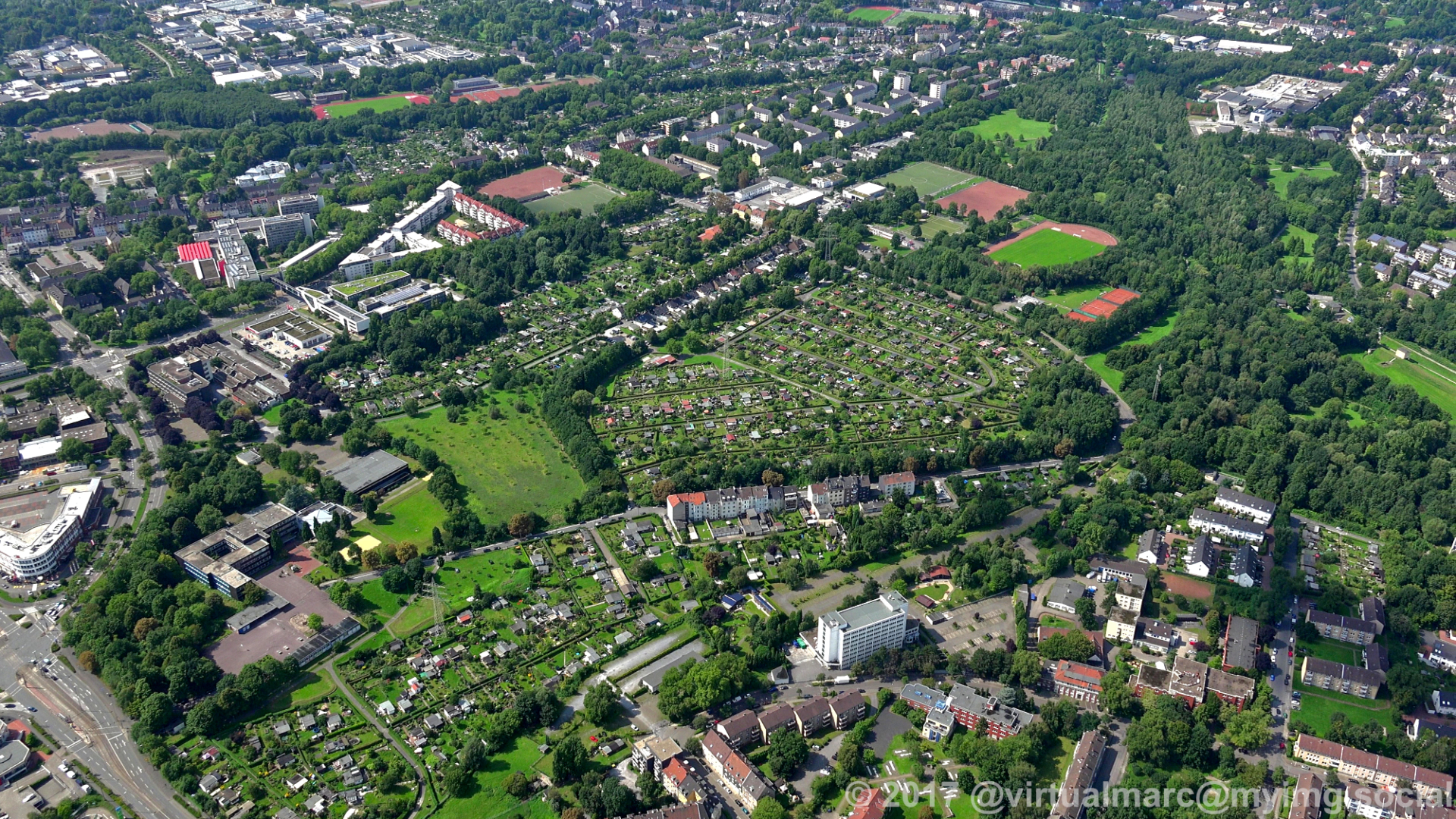
Behind the center of #Recklinghausen are some farm yards on the way back to the #Marl Loemühle Airport (EDLM).
#photography #nature #naturephotography #aerialphotography #aerialview #aerial #ruhrgebiet #ruhrpott #ruhr #ruhrarea #essen #gyrocopter #flying #edlm
#photography #nature #naturephotography #aerialphotography #aerialview #aerial #ruhrgebiet #ruhrpott #ruhr #ruhrarea #essen #gyrocopter #flying #edlm

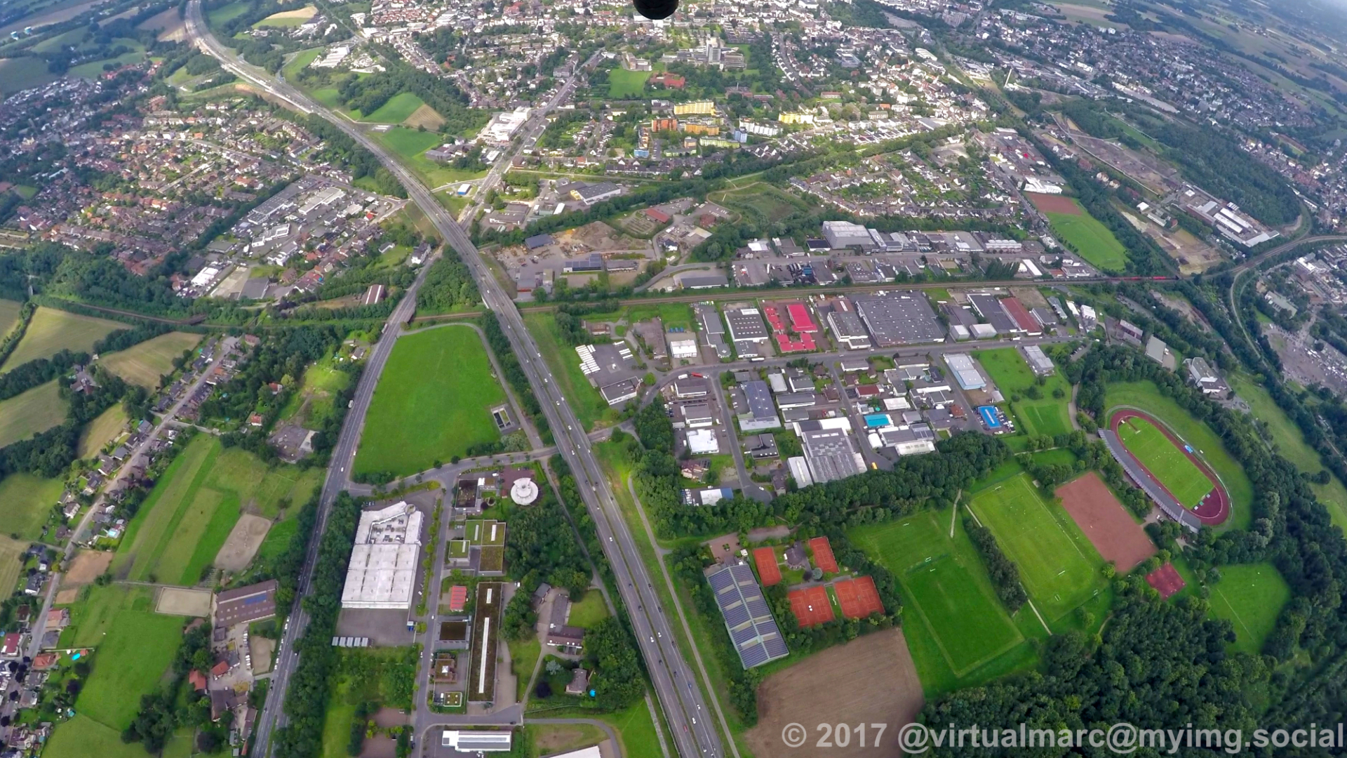
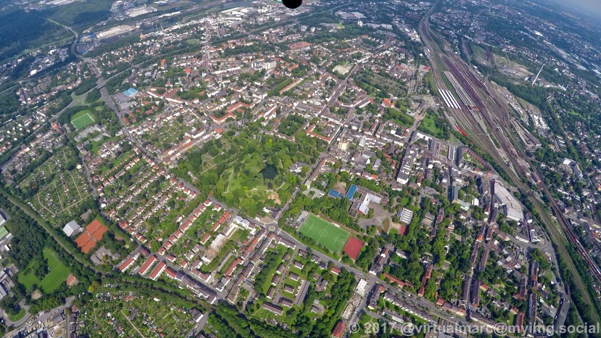
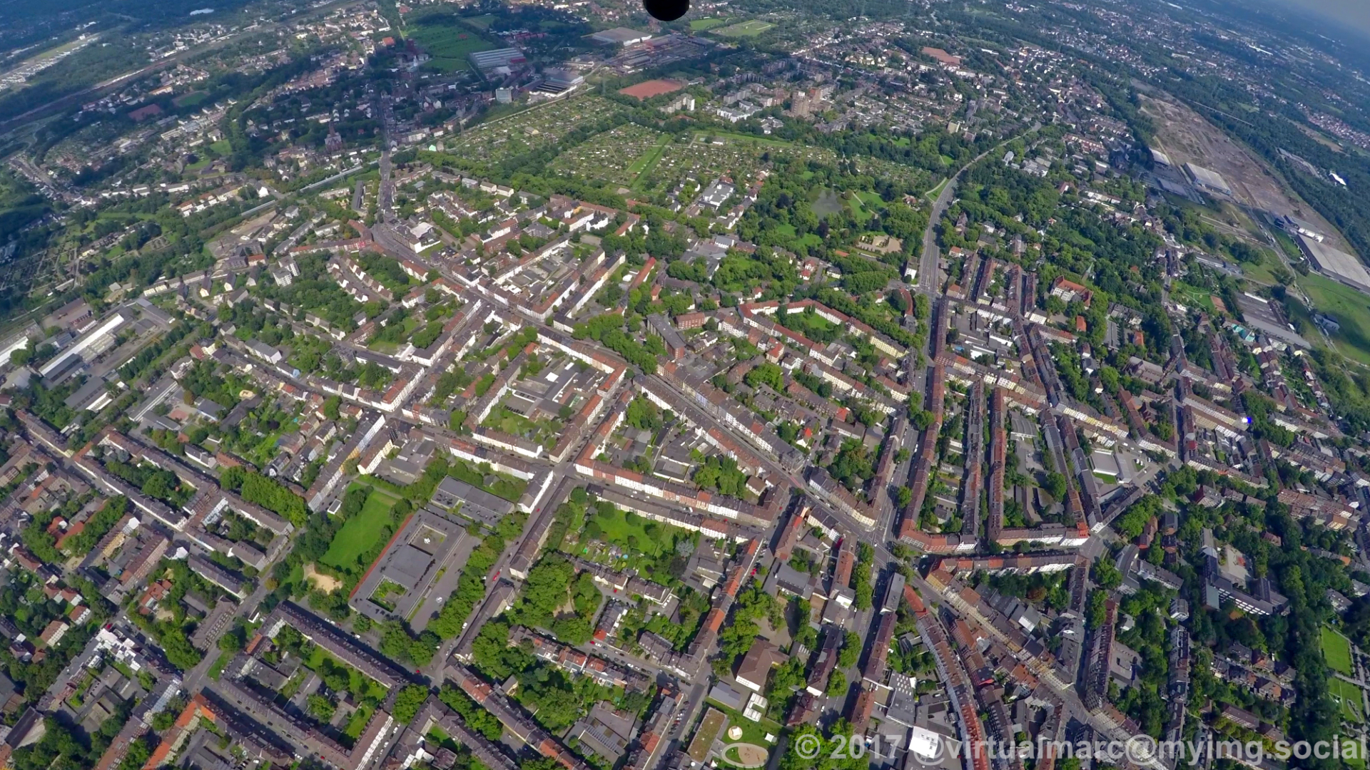
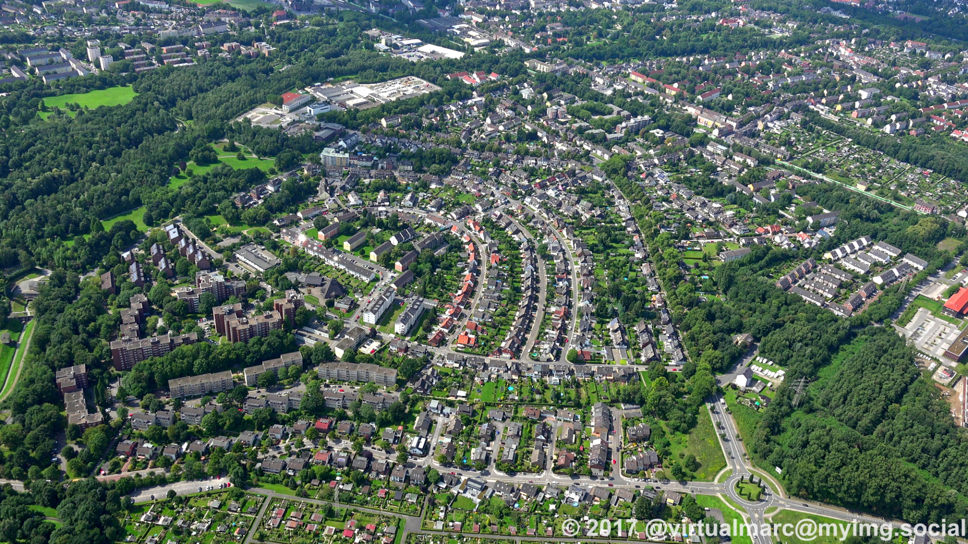
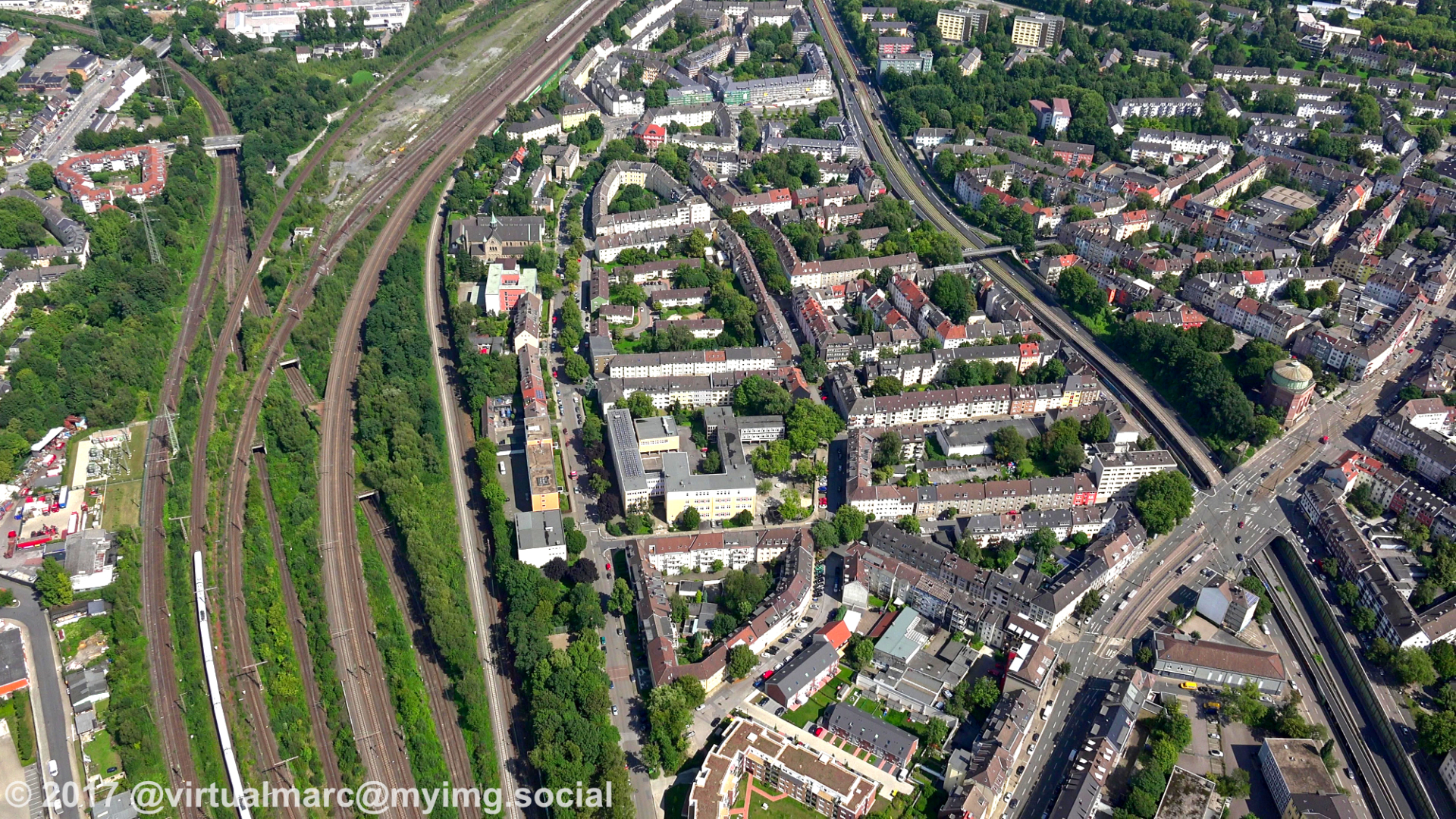
On the way back to the airport we are now over #Recklinghausen.
This is Recklinghausen centrum.
#photography #nature #naturephotography #aerialphotography #aerialview #aerial #ruhrgebiet #ruhrpott #ruhr #ruhrarea #essen #gyrocopter #flying #edlm
This is Recklinghausen centrum.
#photography #nature #naturephotography #aerialphotography #aerialview #aerial #ruhrgebiet #ruhrpott #ruhr #ruhrarea #essen #gyrocopter #flying #edlm
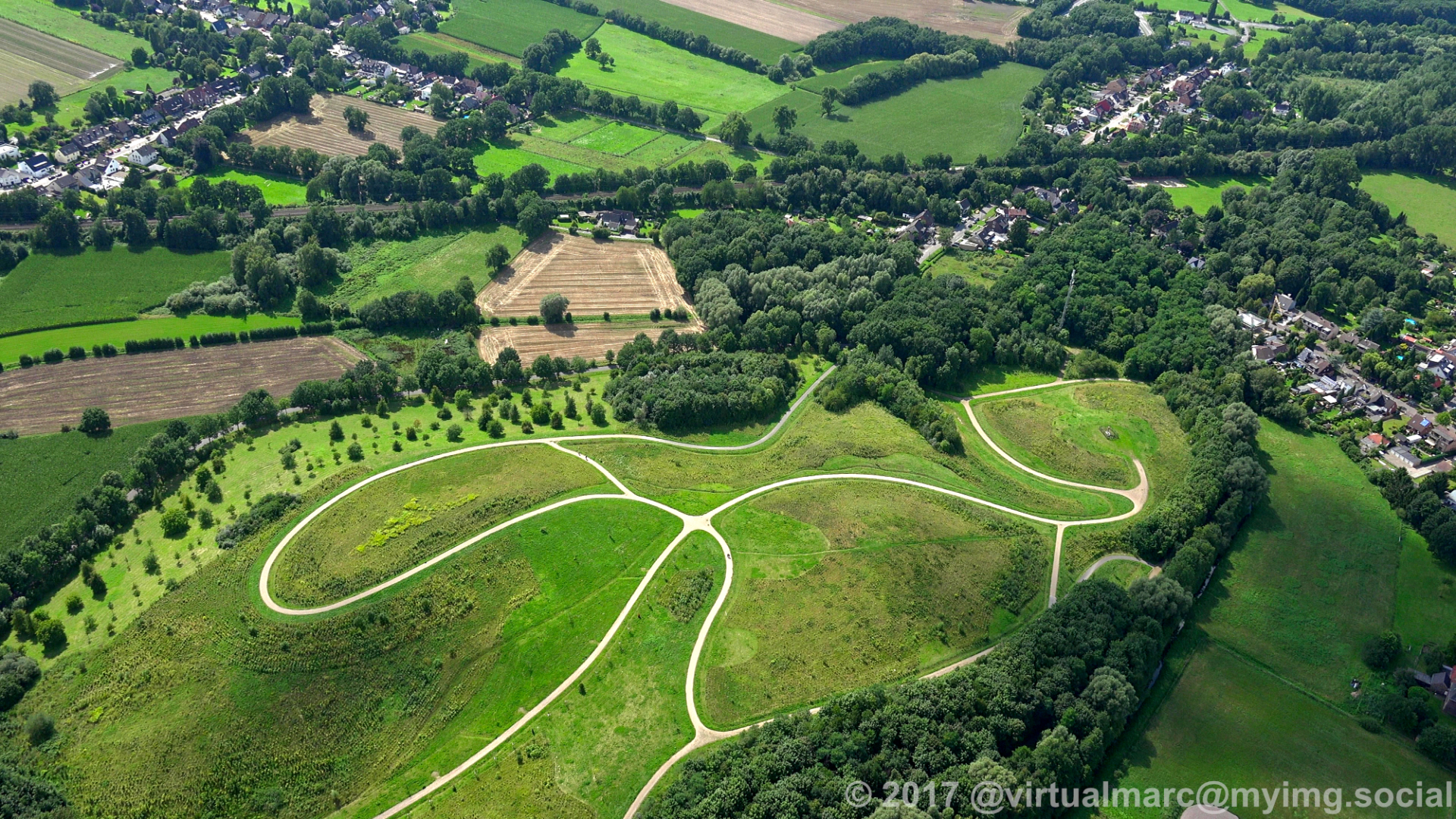
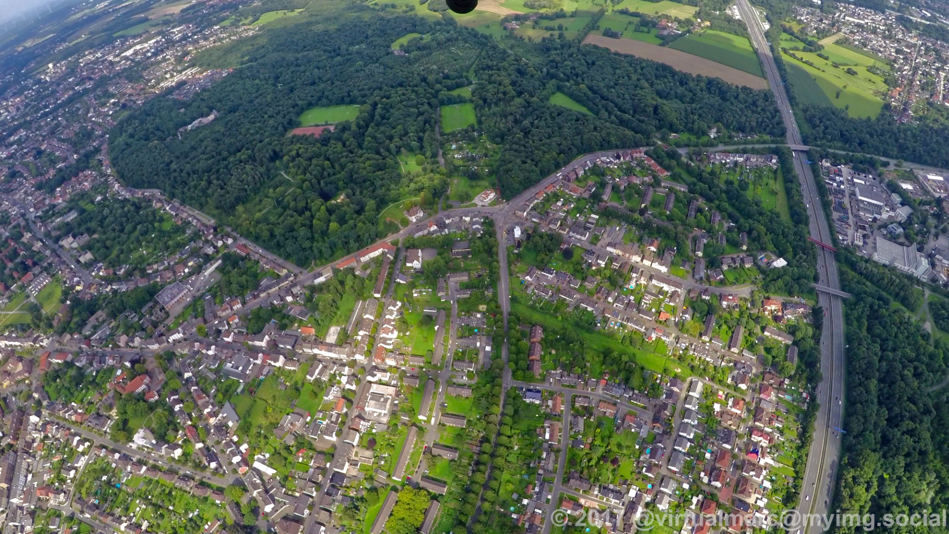
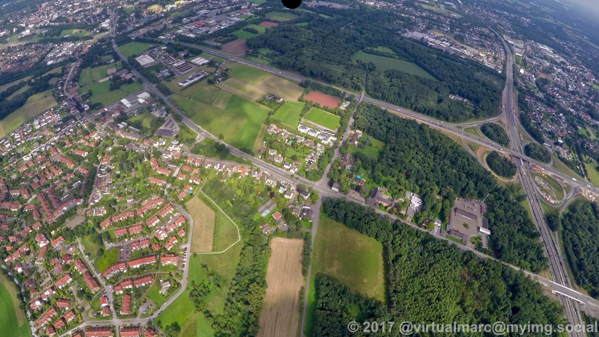
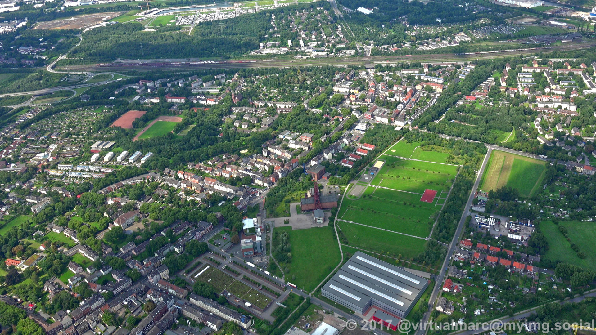
We are now at the border between #Herten and #Recklinghausen.
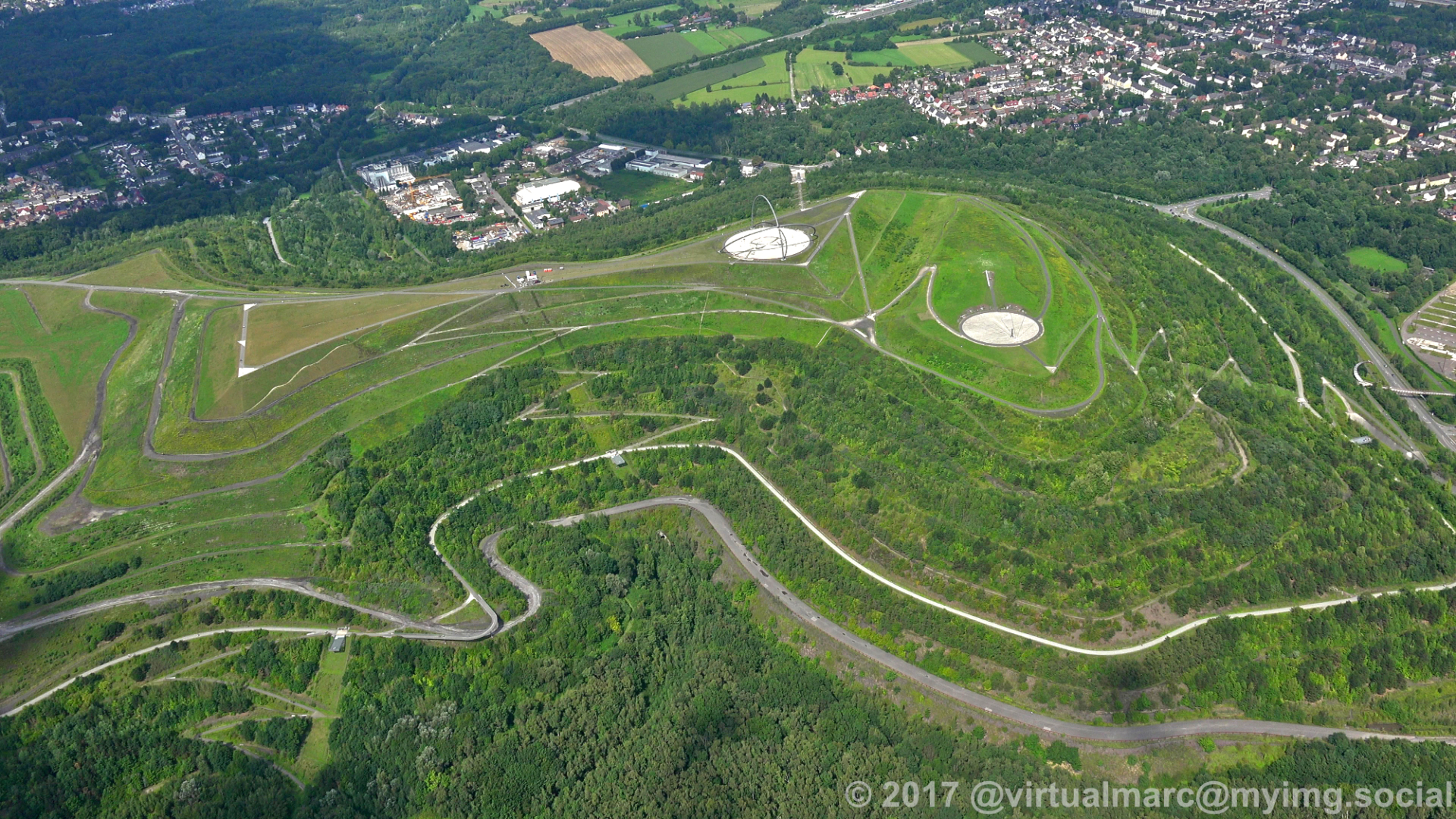
The first image, still in Herten, shows the spoil heal Hoheward with the Horizon Observatory.
The second image shows the border of Herten, Recklinghausen is ahead of it. Next to it is the freeway A2.
Starting with the third image we are now in Recklinghausen with the freeway crossing between the A2 and the A43.
#photography #nature #naturephotography #aerialphotography #aerialview #aerial #ruhrgebiet #ruhrpott #ruhr #ruhrarea #essen #gyrocopter #flying #edlm
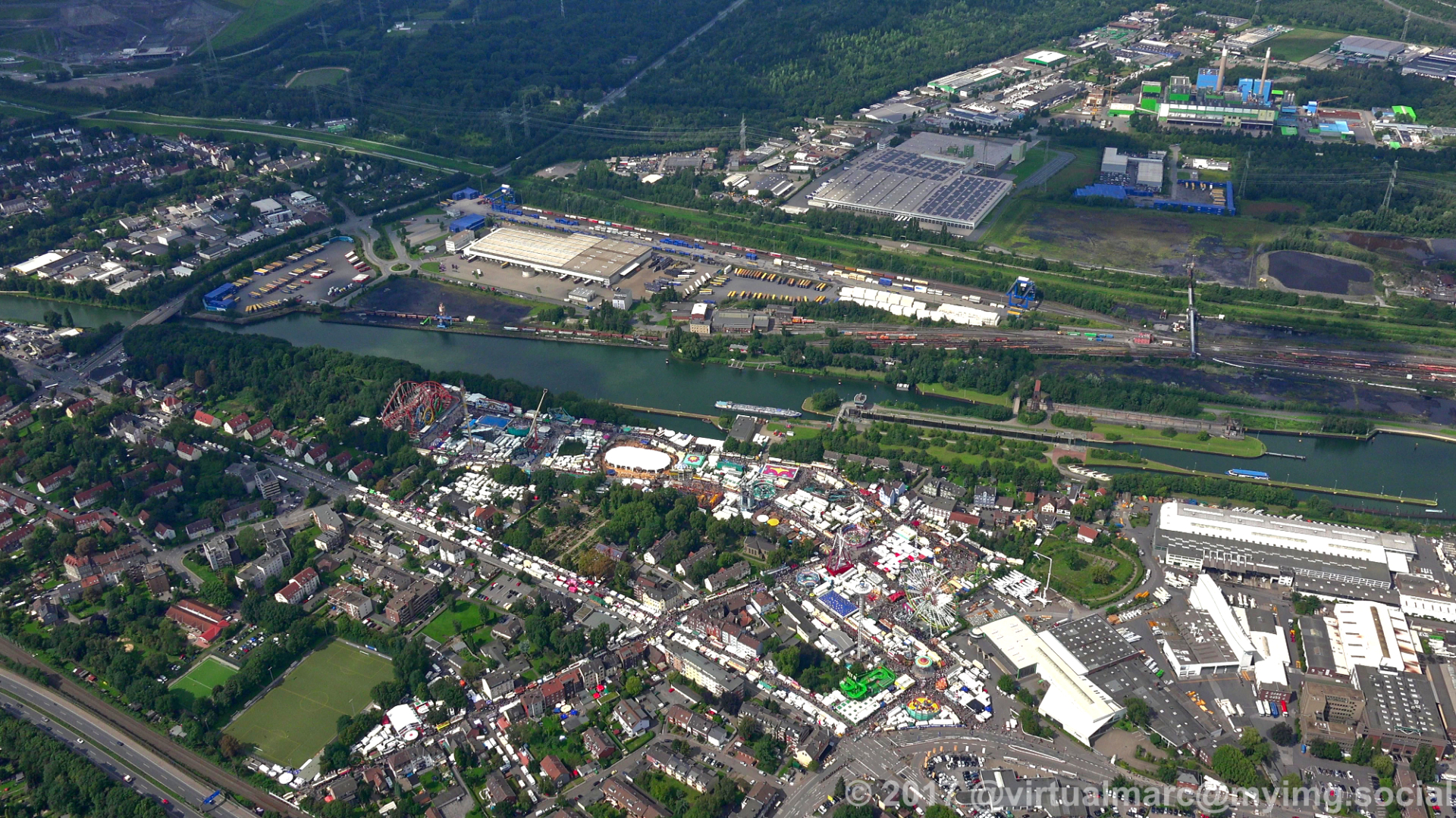
From #Herne near the #CrangerKirmes we now move north over #Herten.
You can see the Cranger Kirmes in the first image.
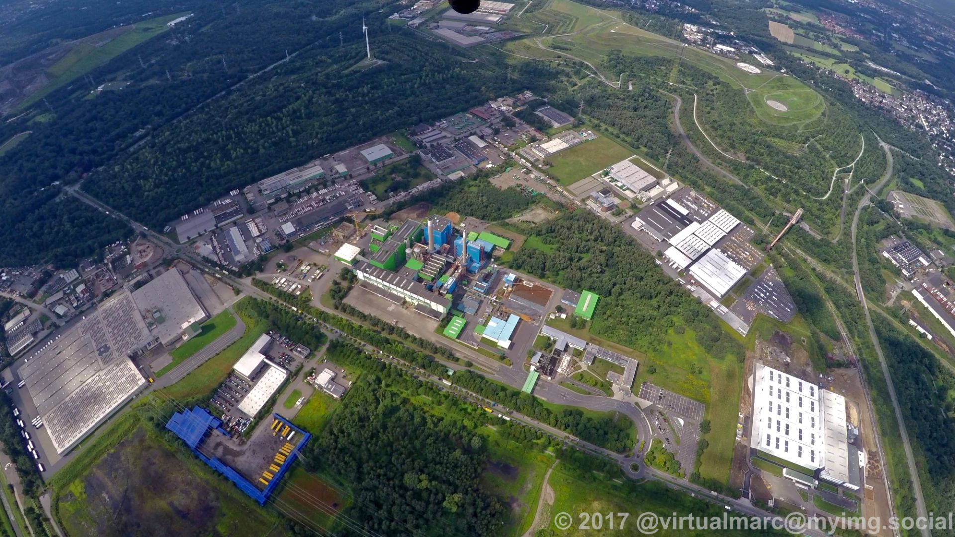
The second image shows the Waste-fired power plant in Herten. With the #Hoppenbruch spoil heap in the top left and the #Hoheward spoil heap in the top right.
The third image shows the spoil heal Hoheward with the Horizon Observatory.
The last image shows the coal mine #Ewald.
#photography #nature #naturephotography #aerialphotography #aerialview #aerial #ruhrgebiet #ruhrpott #ruhr #ruhrarea #essen #gyrocopter #flying #edlm
You can see the Cranger Kirmes in the first image.
The second image shows the Waste-fired power plant in Herten. With the #Hoppenbruch spoil heap in the top left and the #Hoheward spoil heap in the top right.
The third image shows the spoil heal Hoheward with the Horizon Observatory.
The last image shows the coal mine #Ewald.
#photography #nature #naturephotography #aerialphotography #aerialview #aerial #ruhrgebiet #ruhrpott #ruhr #ruhrarea #essen #gyrocopter #flying #edlm
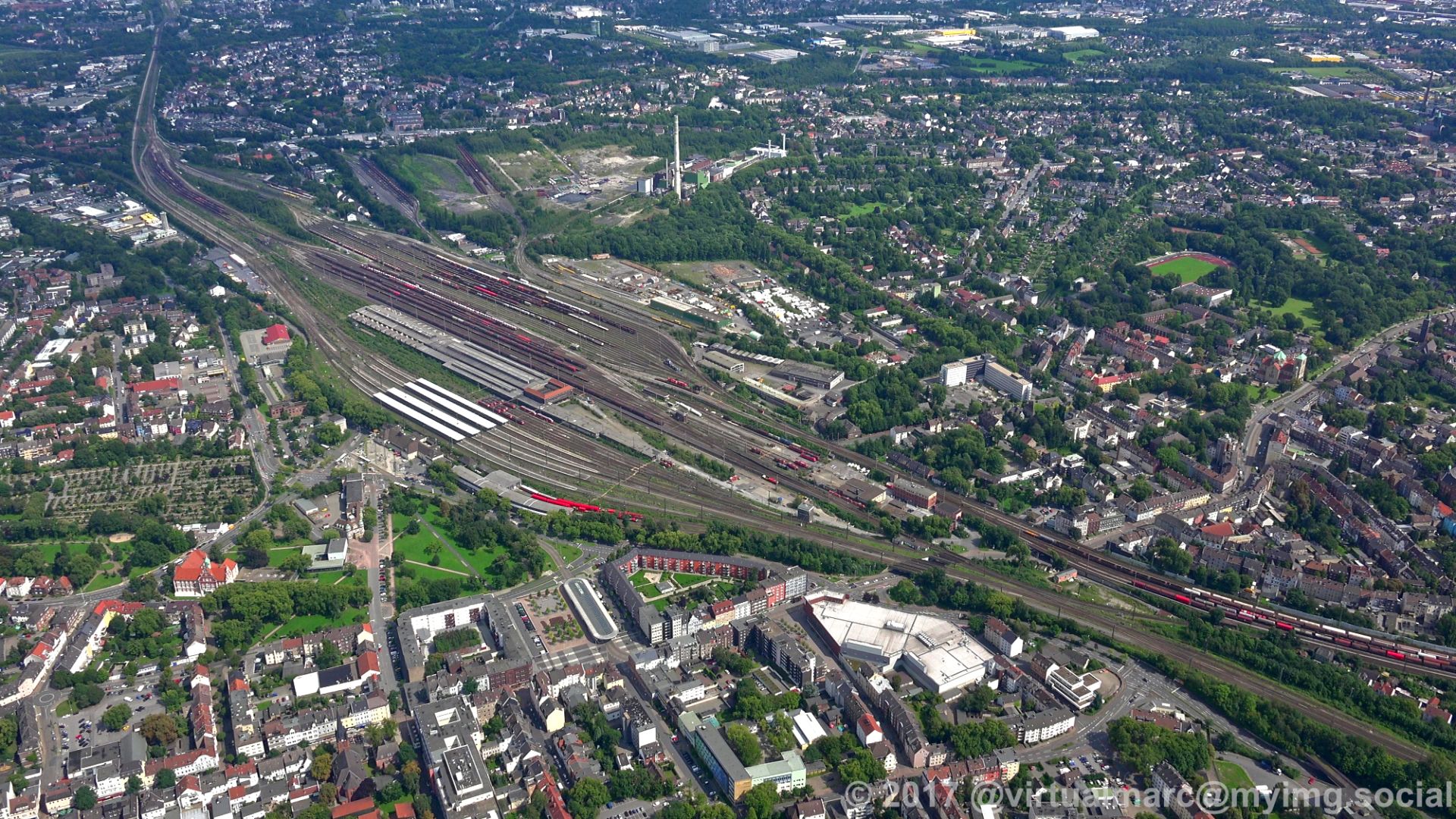
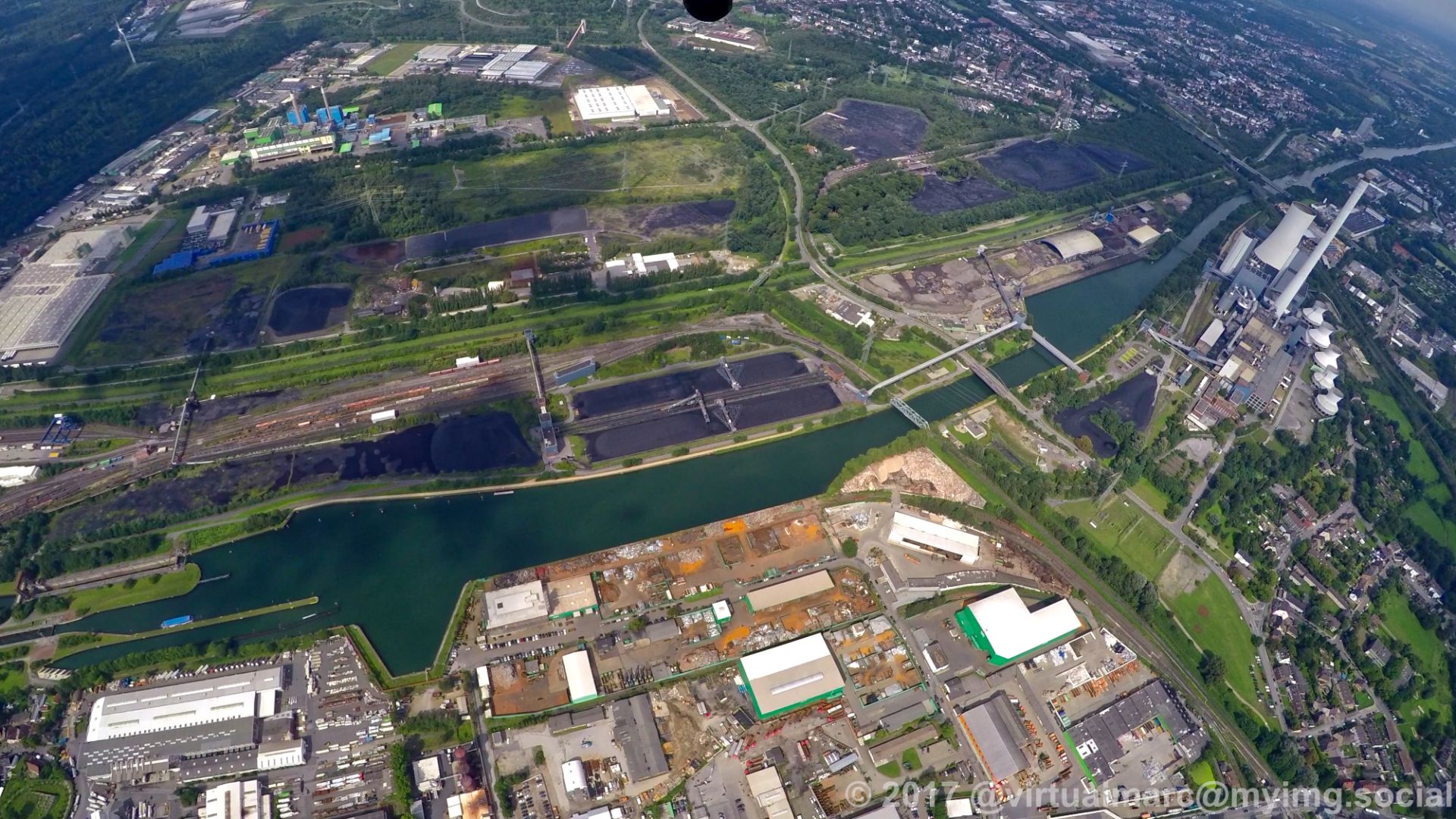
We are now over #Herne with views to Wanne-Eickel.
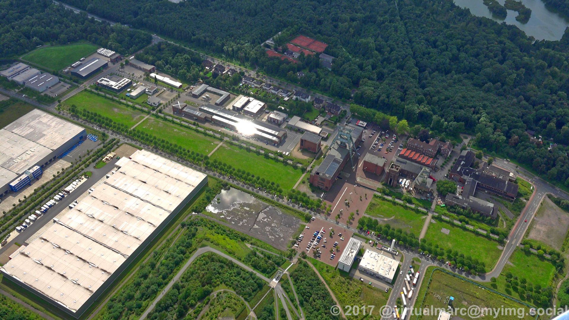
The firstimage shows the Pluto mine in Herne with the Pluto-Wilhelm spoil heap.
In the second and third image you can see the Wanne-Eickel main station.
The last image shows the Rhine-Herne Canal and the Emscher in front of the Waste-fired power plant in #Herten.
#photography #nature #naturephotography #aerialphotography #aerialview #aerial #ruhrgebiet #ruhrpott #ruhr #ruhrarea #essen #gyrocopter #flying #edlm #WanneEickel
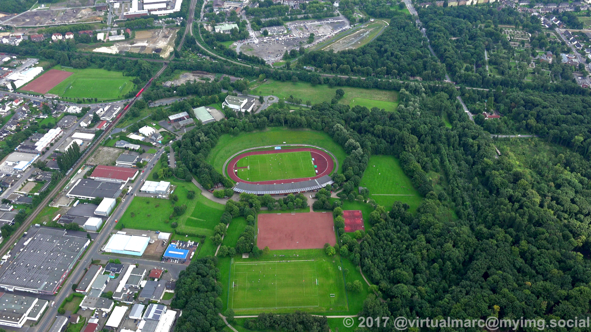
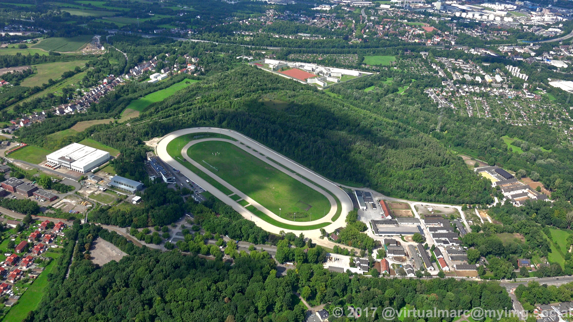
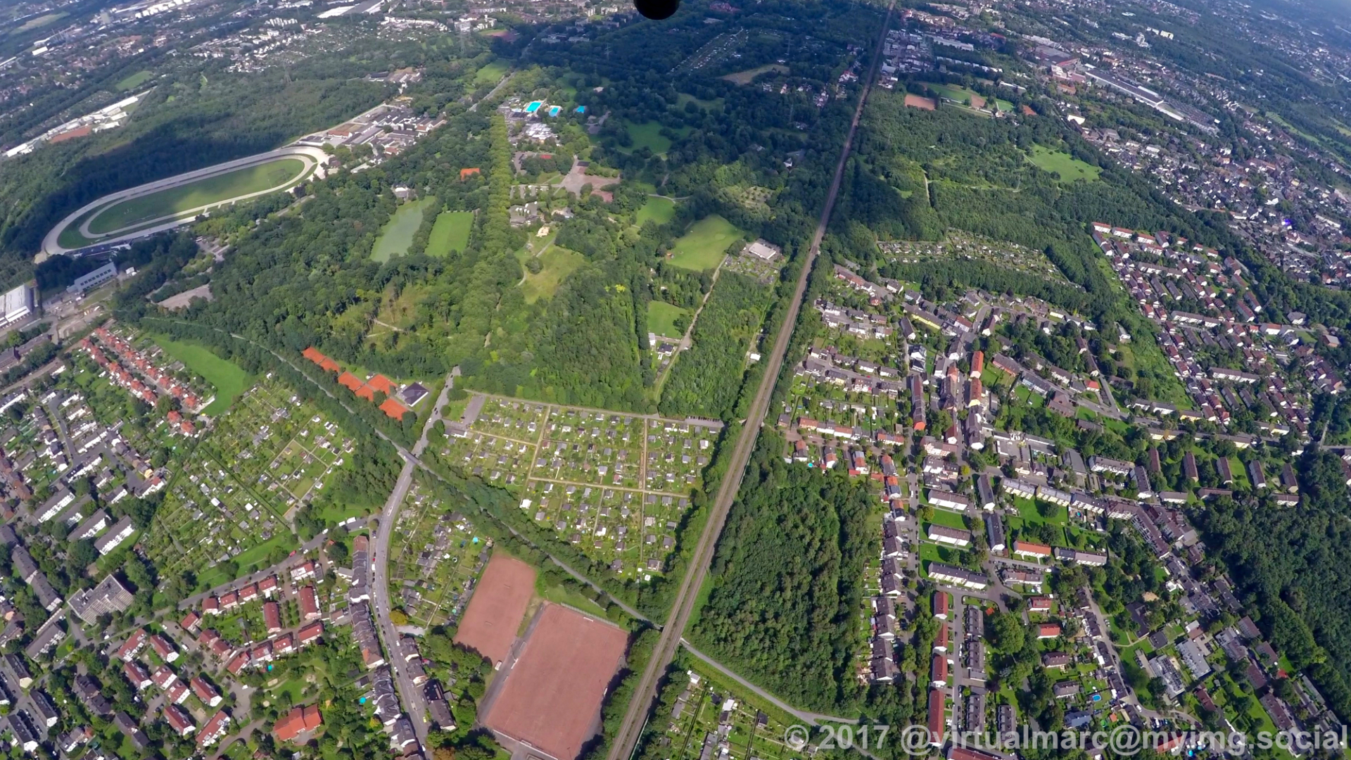
Back in #Gelsekirchen, you can see the harness racing track in the first image.
In the last image you can see the consol mine with the consol park.
#photography #nature #naturephotography #aerialphotography #aerialview #aerial #ruhrgebiet #ruhrpott #ruhr #ruhrarea #essen #gyrocopter #flying #edlm
In the last image you can see the consol mine with the consol park.
#photography #nature #naturephotography #aerialphotography #aerialview #aerial #ruhrgebiet #ruhrpott #ruhr #ruhrarea #essen #gyrocopter #flying #edlm
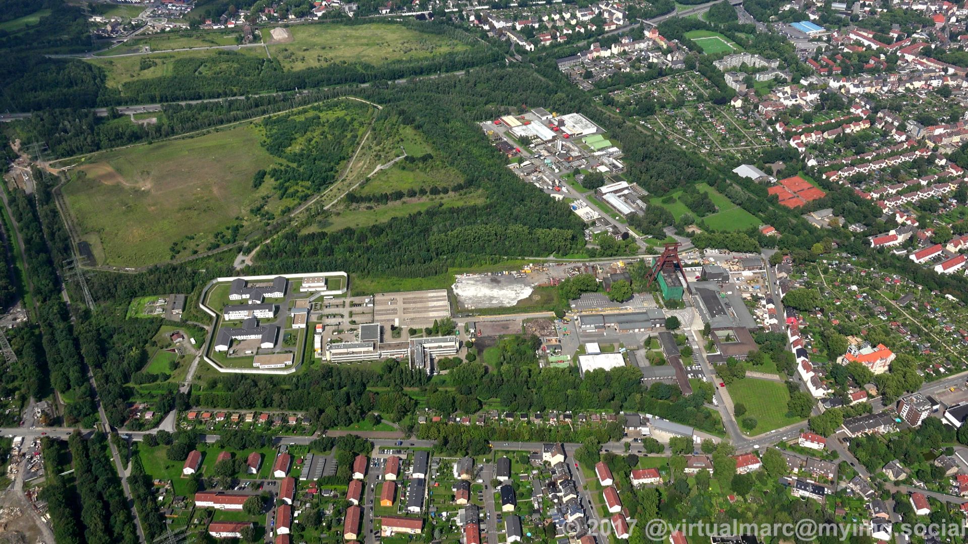
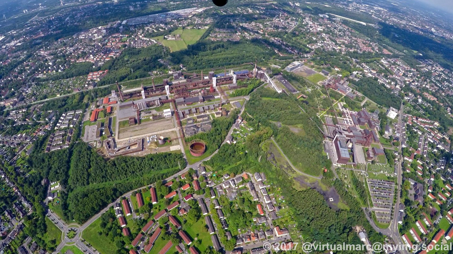
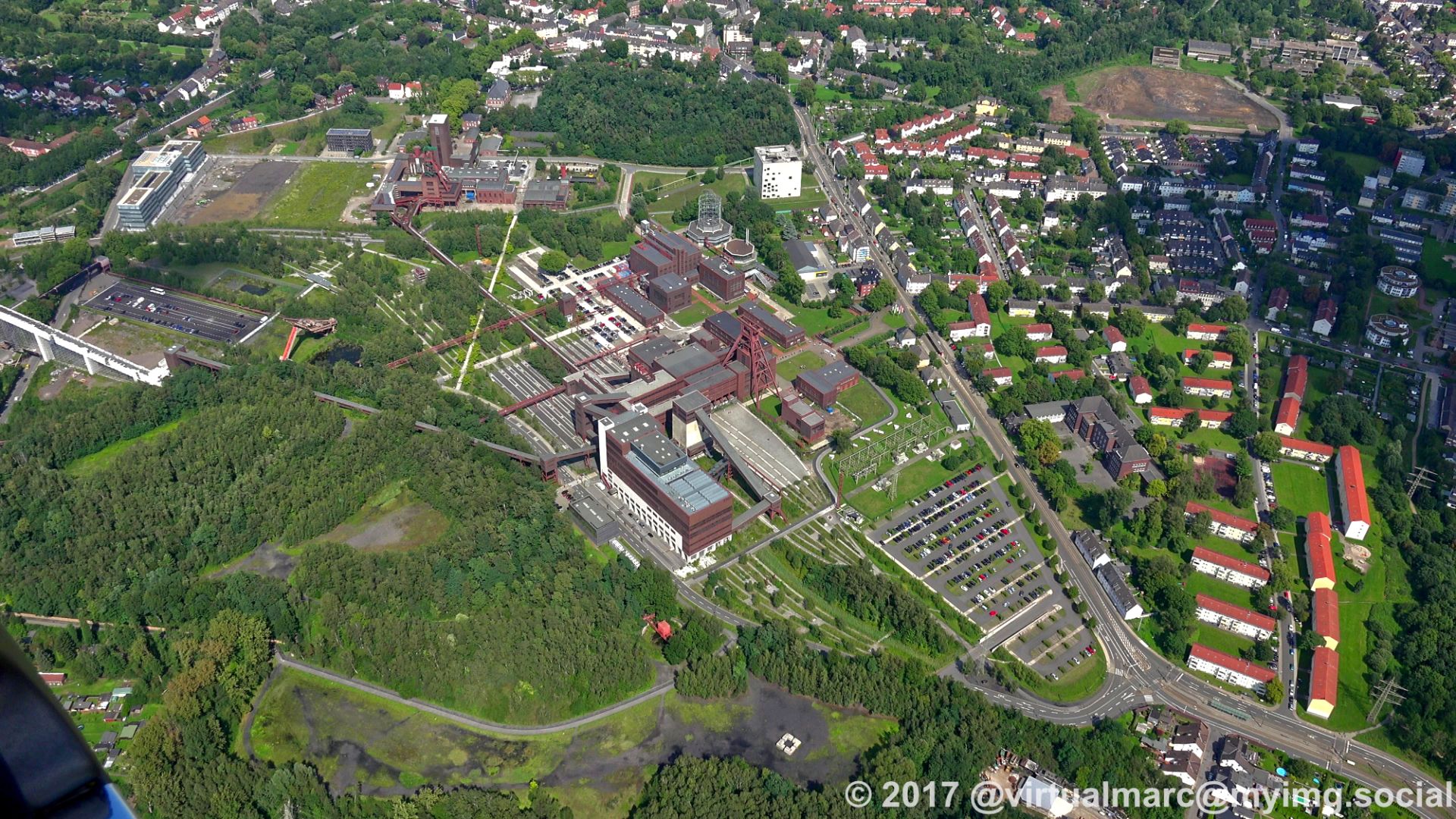
After flying over #Zollverein (the coking plant can be seen in the first image) we are now leaving the airspace of #Essen and enter the airspace of #Gelsenkirchen again.
#photography #nature #naturephotography #aerialphotography #aerialview #aerial #ruhrgebiet #ruhrpott #ruhr #ruhrarea #essen #gyrocopter #flying #edlm #unescoweltkulturerbe #unescoworldheritagesite #unescoworldheritage #UNESCO
#photography #nature #naturephotography #aerialphotography #aerialview #aerial #ruhrgebiet #ruhrpott #ruhr #ruhrarea #essen #gyrocopter #flying #edlm #unescoweltkulturerbe #unescoworldheritagesite #unescoworldheritage #UNESCO

Back in the north of #Essen near the #UNESCO world heritage site #Zollverein.
You can see the coal mine and coking plant here.
#photography #nature #naturephotography #aerialphotography #aerialview #aerial #ruhrgebiet #ruhrpott #ruhr #ruhrarea #essen #gyrocopter #flying #edlm #unescoweltkulturerbe #unescoworldheritagesite #unescoworldheritage
You can see the coal mine and coking plant here.
#photography #nature #naturephotography #aerialphotography #aerialview #aerial #ruhrgebiet #ruhrpott #ruhr #ruhrarea #essen #gyrocopter #flying #edlm #unescoweltkulturerbe #unescoworldheritagesite #unescoworldheritage
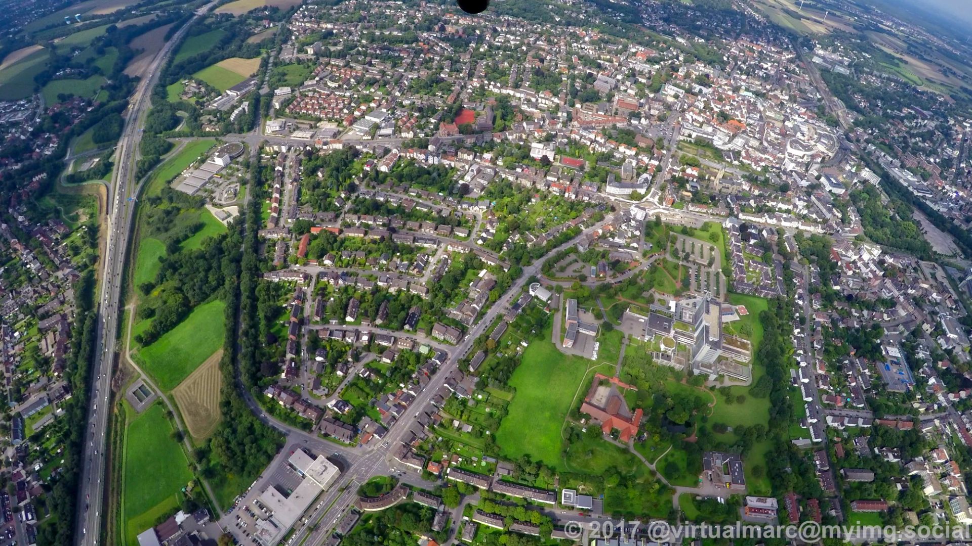
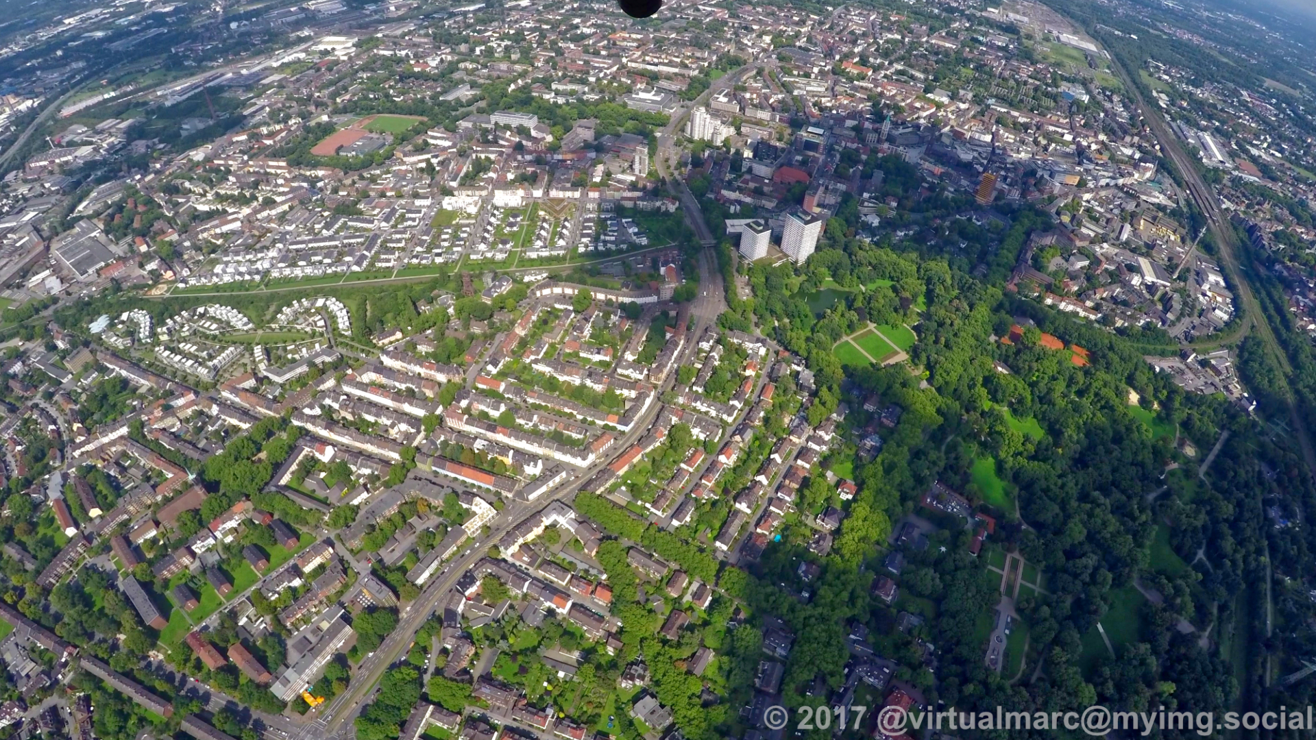
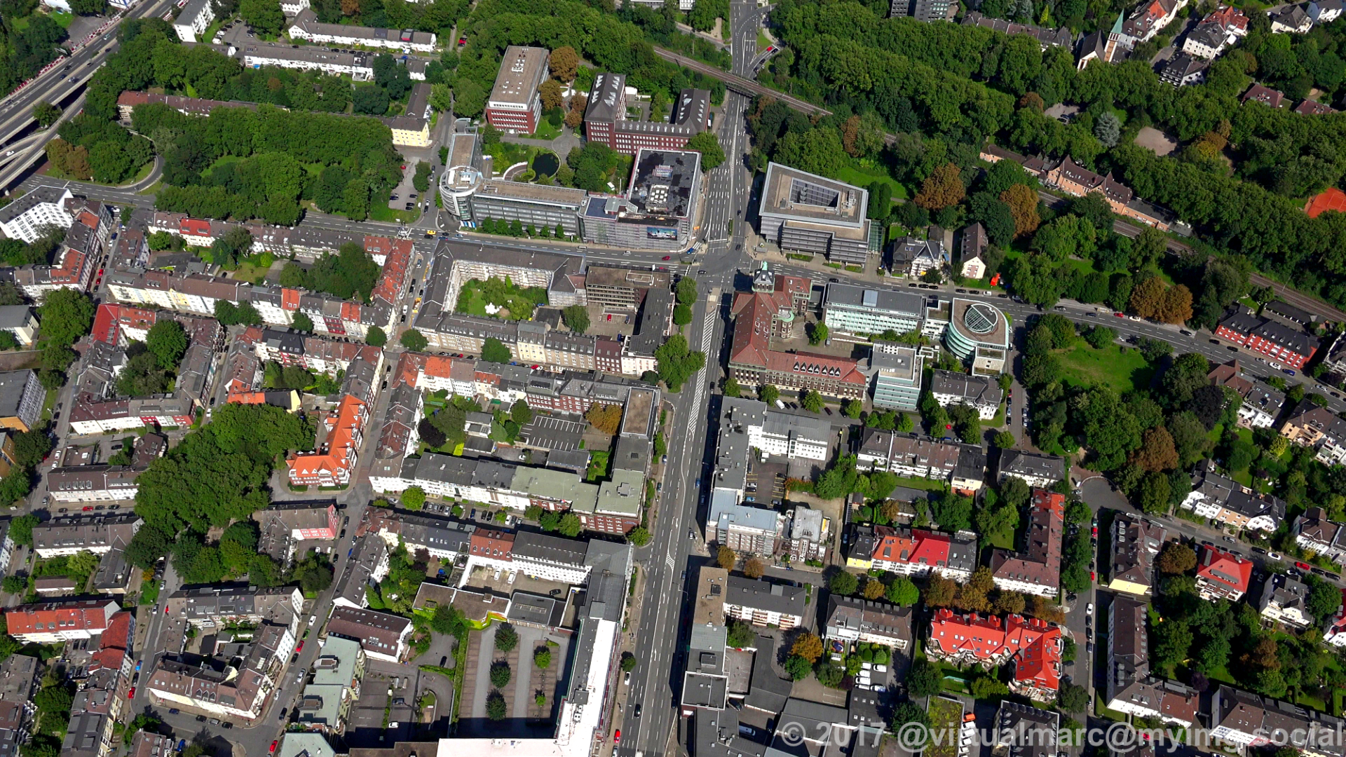
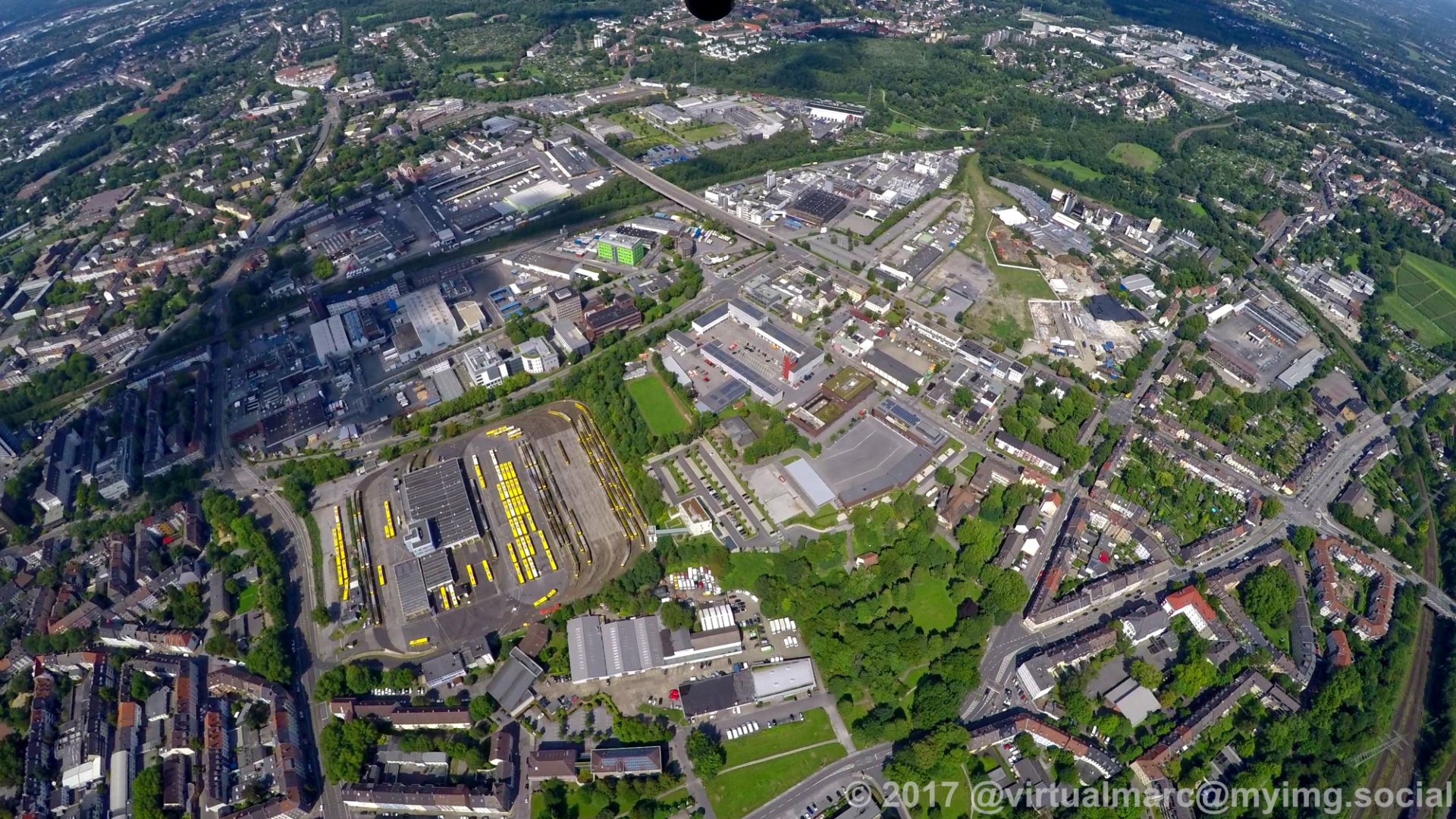
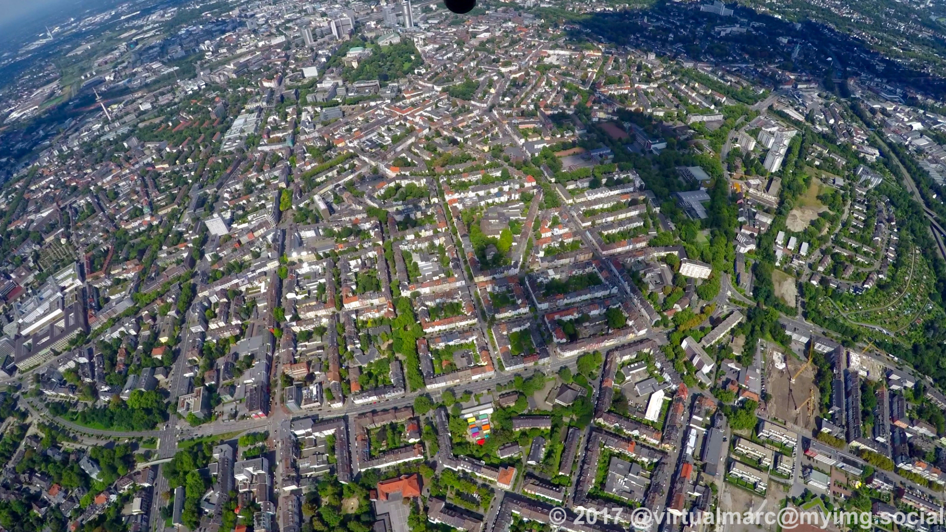
Moving back north from #Essen central.
The black Y-shaped building you see at the last image is the city hall of Essen.
#photography #nature #naturephotography #aerialphotography #aerialview #aerial #ruhrgebiet #ruhrpott #ruhr #ruhrarea #essen #gyrocopter #flying #edlm
The black Y-shaped building you see at the last image is the city hall of Essen.
#photography #nature #naturephotography #aerialphotography #aerialview #aerial #ruhrgebiet #ruhrpott #ruhr #ruhrarea #essen #gyrocopter #flying #edlm
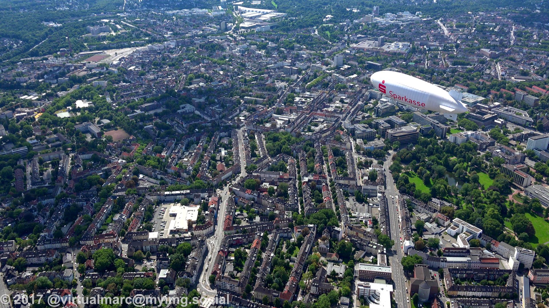
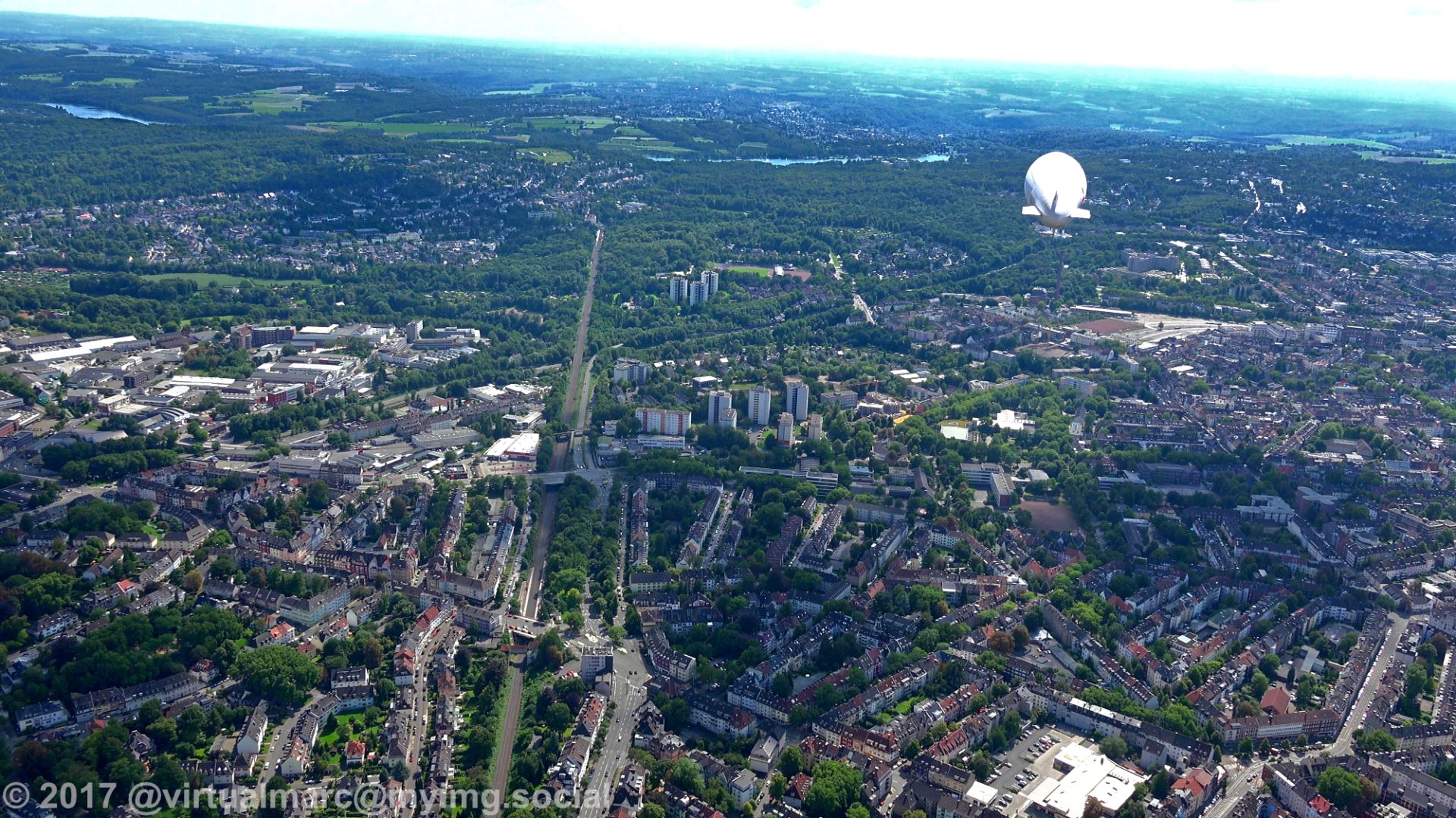
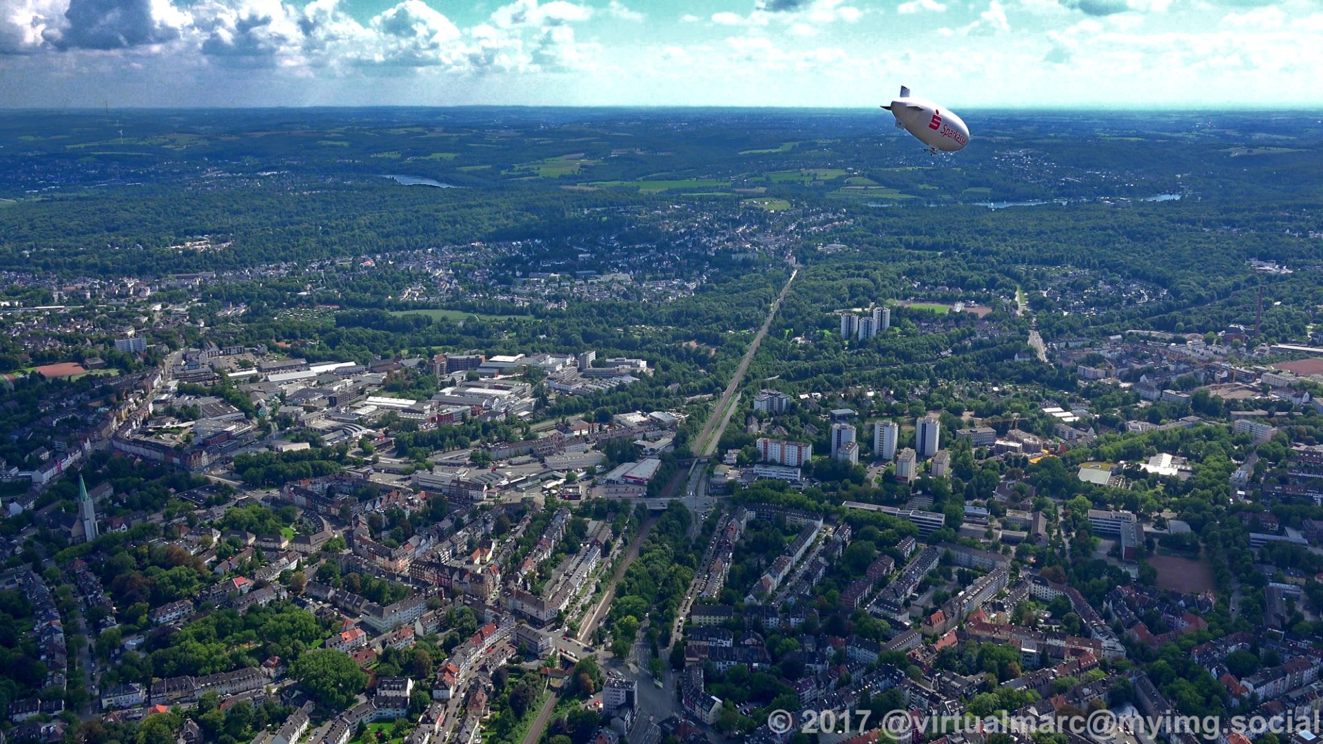
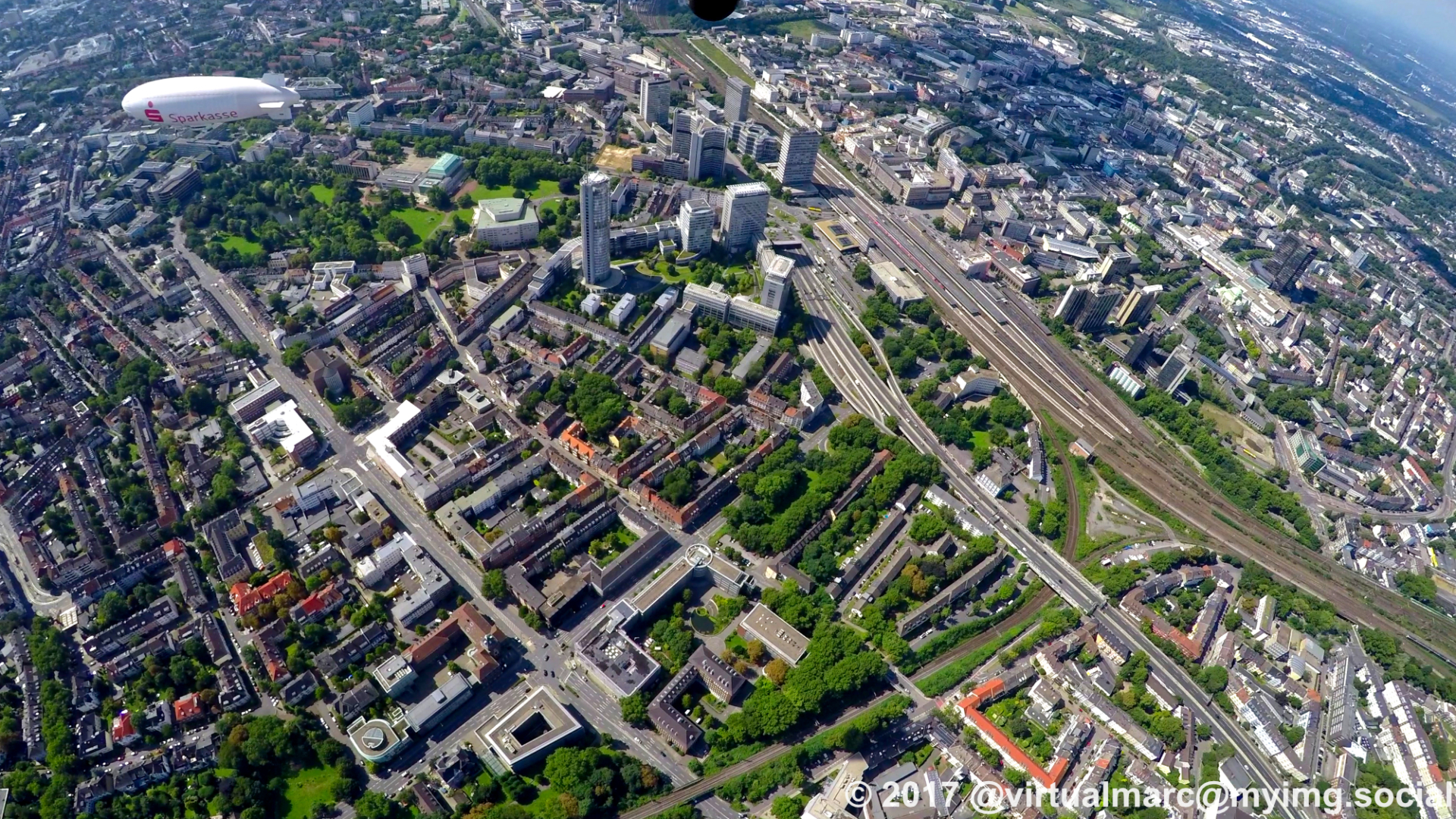
Above #Essen centrum we had a surprise meeting in the air with the airship of the WDL Luftschiffgesellschaft mbH.
We 👋, they 👋 and we both continued our journeys in the opposite direction!
#photography #nature #naturephotography #aerialphotography #aerialview #aerial #ruhrgebiet #ruhrpott #ruhr #ruhrarea #essen #gyrocopter #flying #edlm #airship
We 👋, they 👋 and we both continued our journeys in the opposite direction!
#photography #nature #naturephotography #aerialphotography #aerialview #aerial #ruhrgebiet #ruhrpott #ruhr #ruhrarea #essen #gyrocopter #flying #edlm #airship
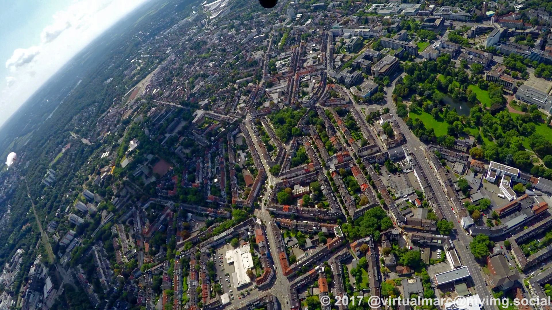
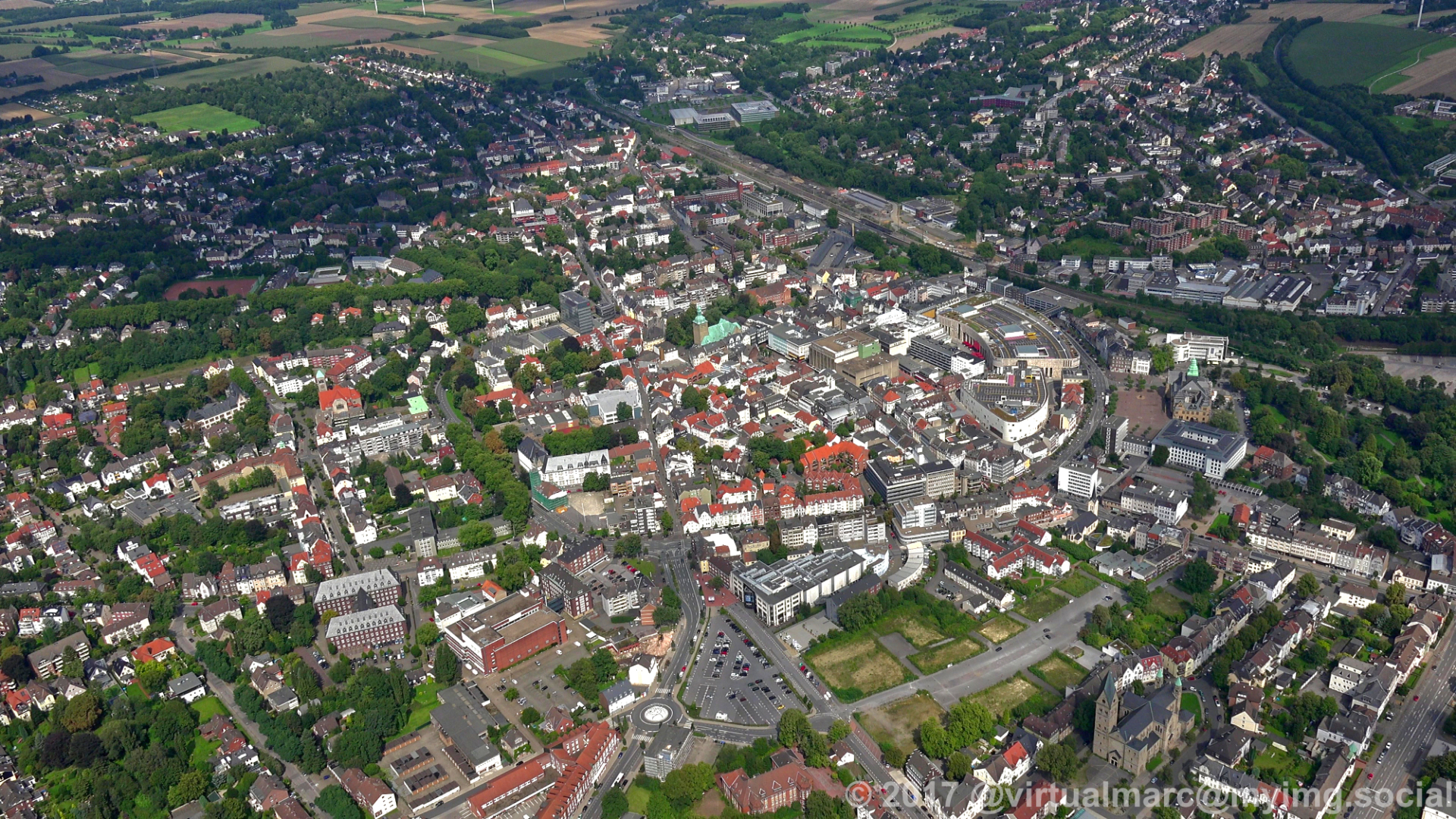
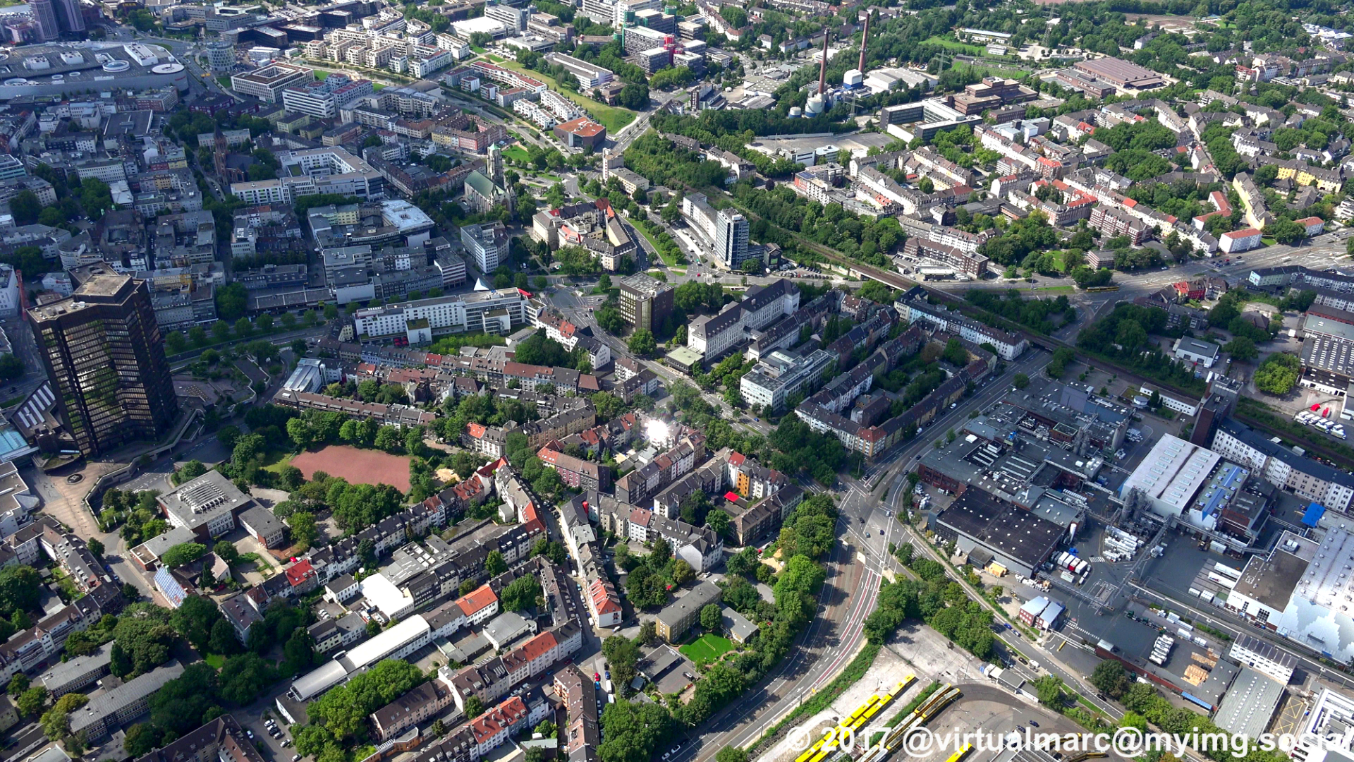
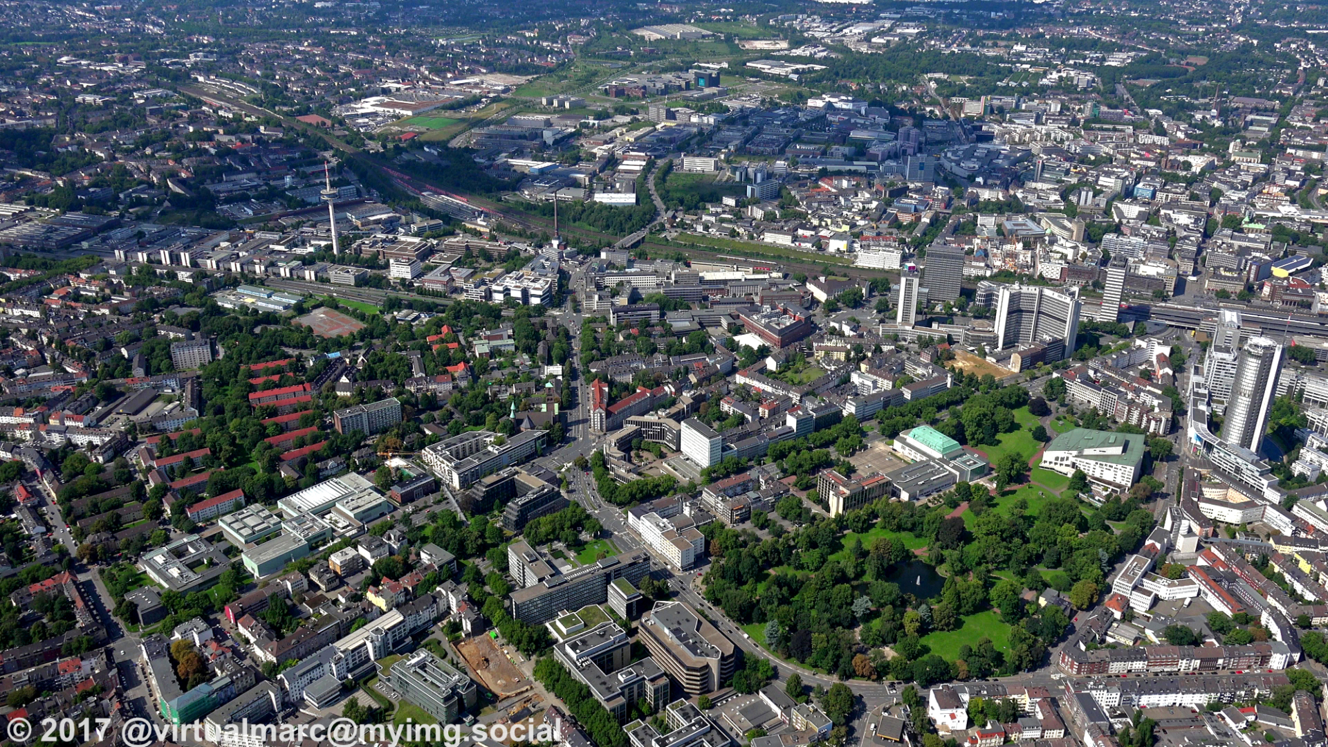
We are now flying back to #Essen centrum.
You can see the Aalto Theatre, the philharmonie, the innogy headquaters (former RWE Tower), Essen central station and the telecommunications tower.
And look who we met on the way!
#photography #nature #naturephotography #aerialphotography #aerialview #aerial #ruhrgebiet #ruhrpott #ruhr #ruhrarea #essen #gyrocopter #flying #edlm
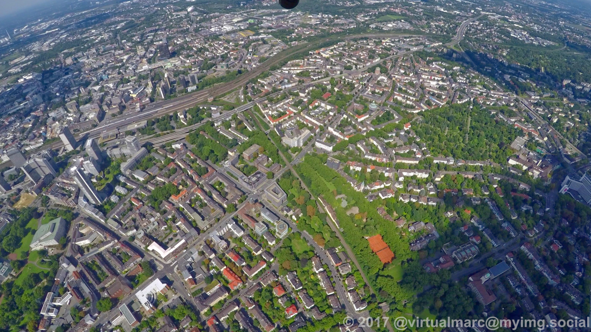
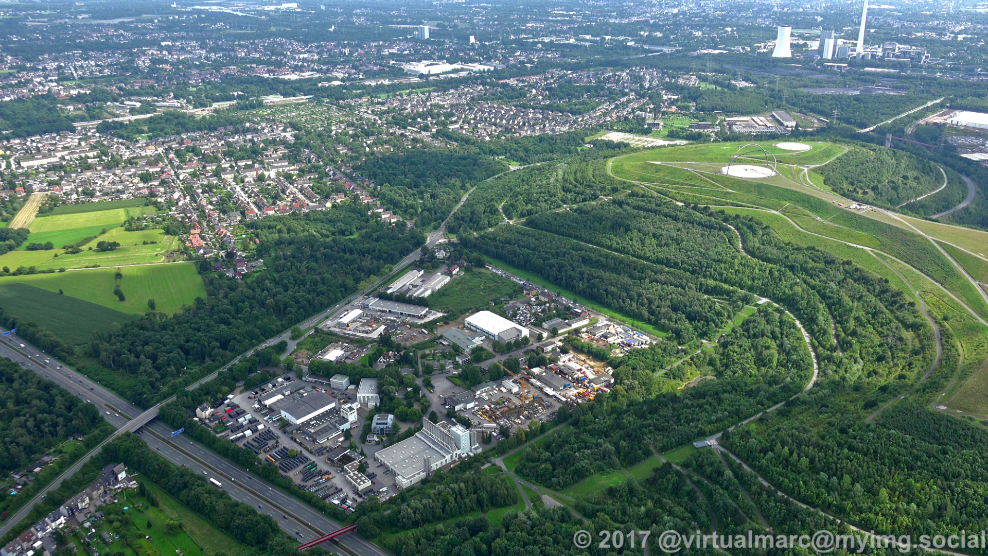
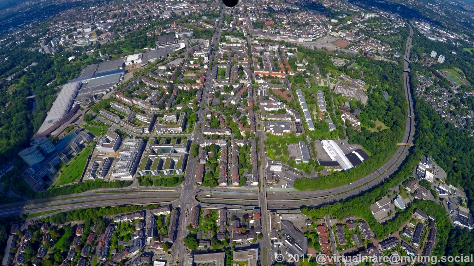
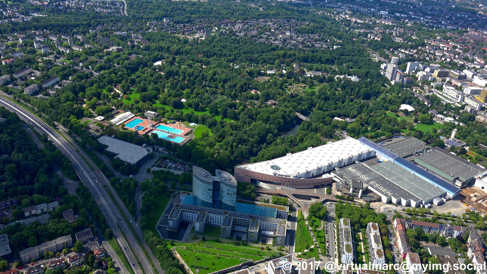
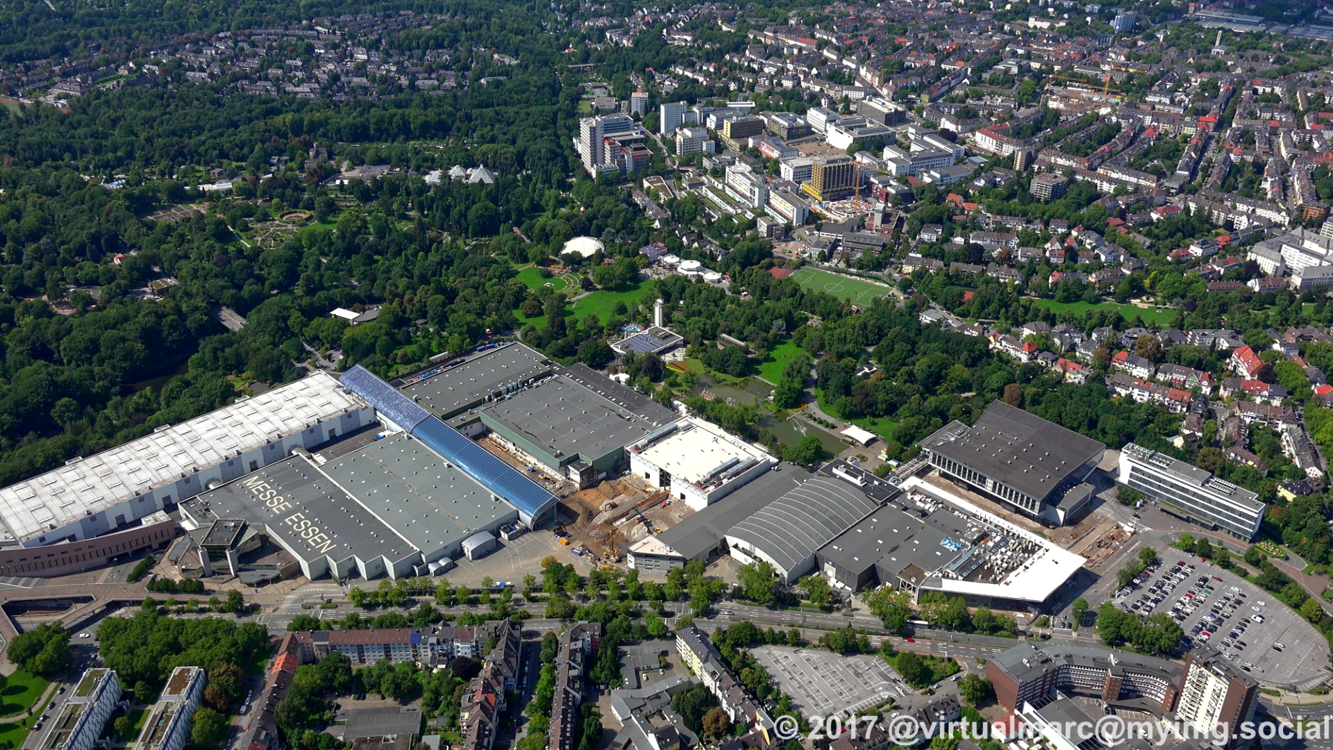
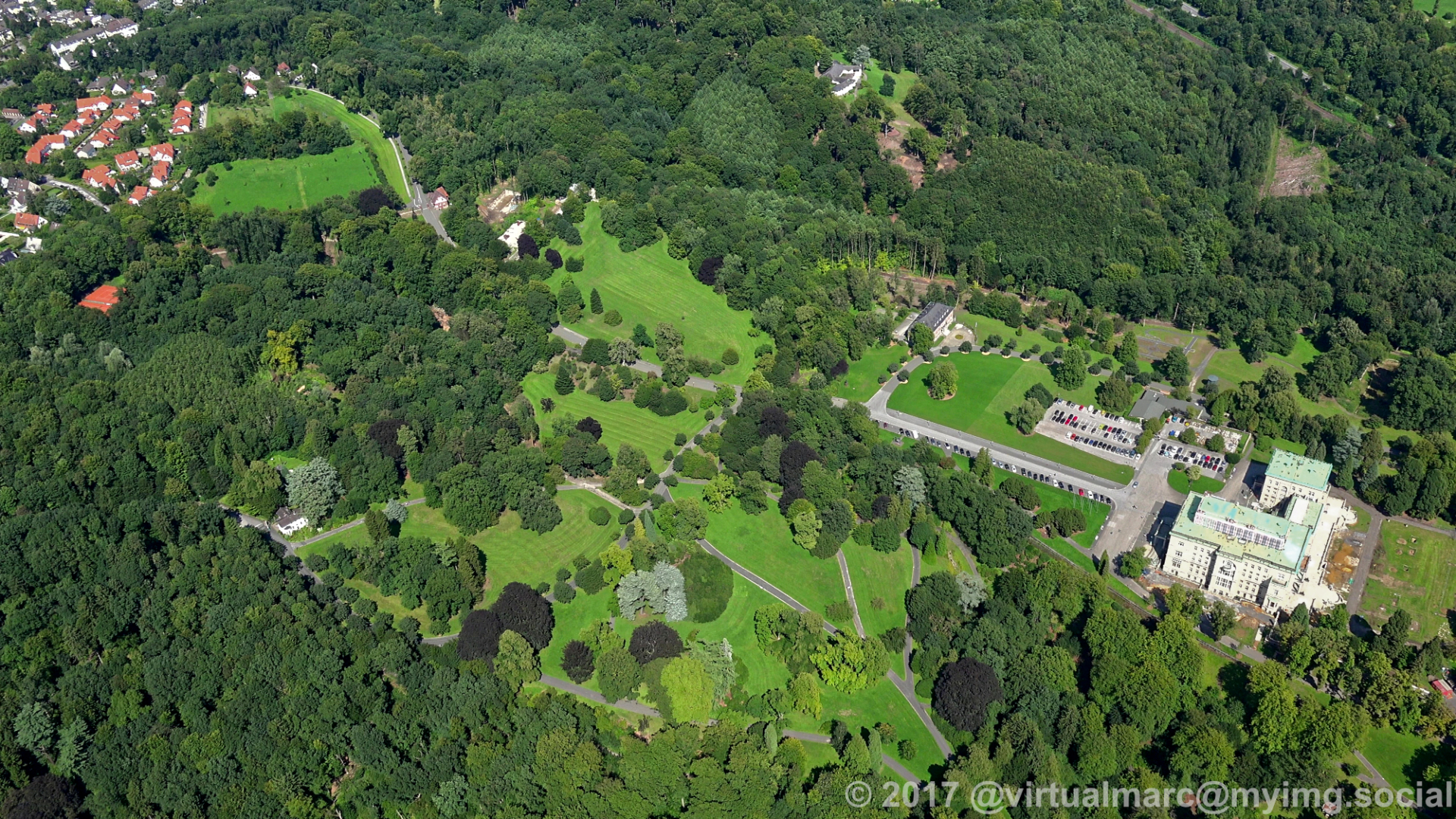
After leaving the Villa Hügel behind we are now passing the #Grugapark and the #Essen fair.
#photography #nature #naturephotography #aerialphotography #aerialview #aerial #ruhrgebiet #ruhrpott #ruhr #ruhrarea #essen #gyrocopter #flying #edlm #GrugaparkEssen #Grugabad #EssenFair #EssenTradeFair #MesseEssen
#photography #nature #naturephotography #aerialphotography #aerialview #aerial #ruhrgebiet #ruhrpott #ruhr #ruhrarea #essen #gyrocopter #flying #edlm #GrugaparkEssen #Grugabad #EssenFair #EssenTradeFair #MesseEssen
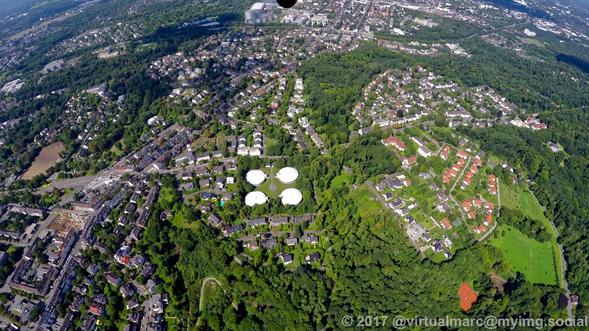
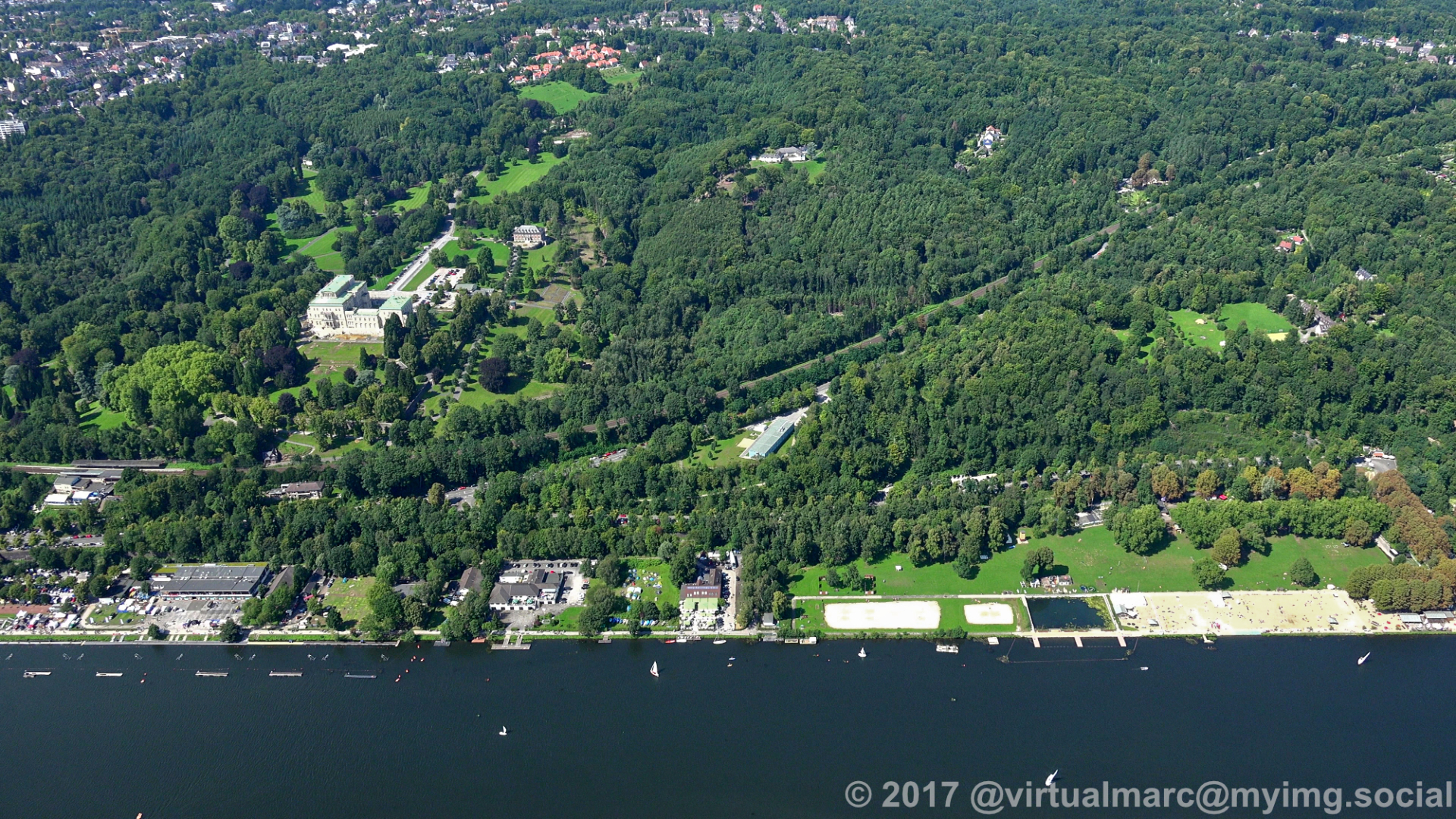
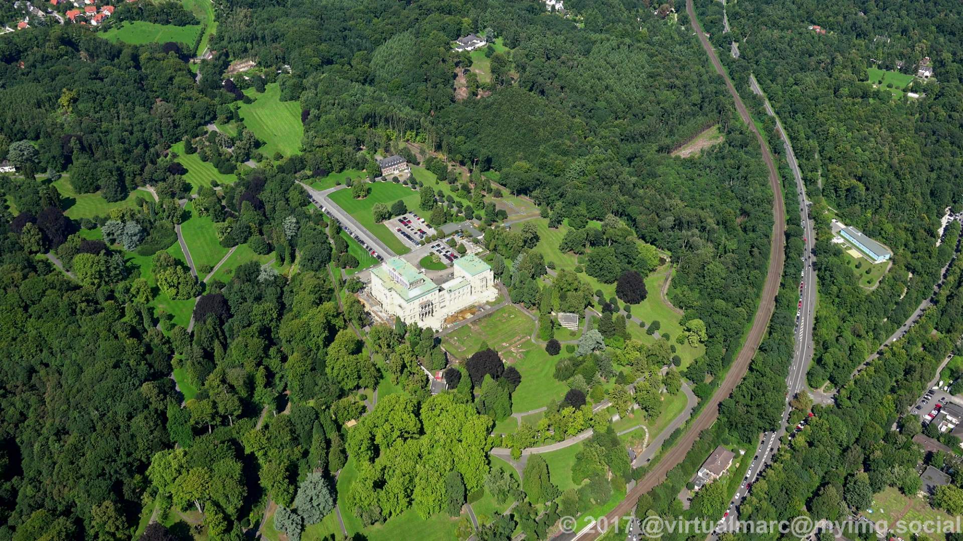
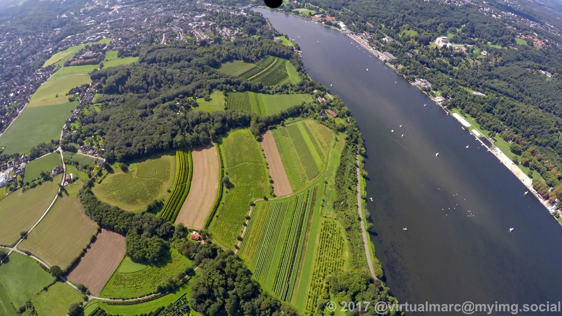
Flying over the #Baldeneysee in #Essen towards the Villa Hügel, the mansion of the Family #Krupp.
The area of the Villa Hügel was way bigger and it has an interesting Story.
Today it houses a permanent exhibition about Krupp and changing exhibitions inside the main building.
The park around can be explored.
#photography #nature #naturephotography #aerialphotography #aerialview #aerial #ruhrgebiet #ruhrpott #ruhr #ruhrarea #essen #gyrocopter #flying #edlm #thyssenkrupp #VillaHügel #VillaHuegel
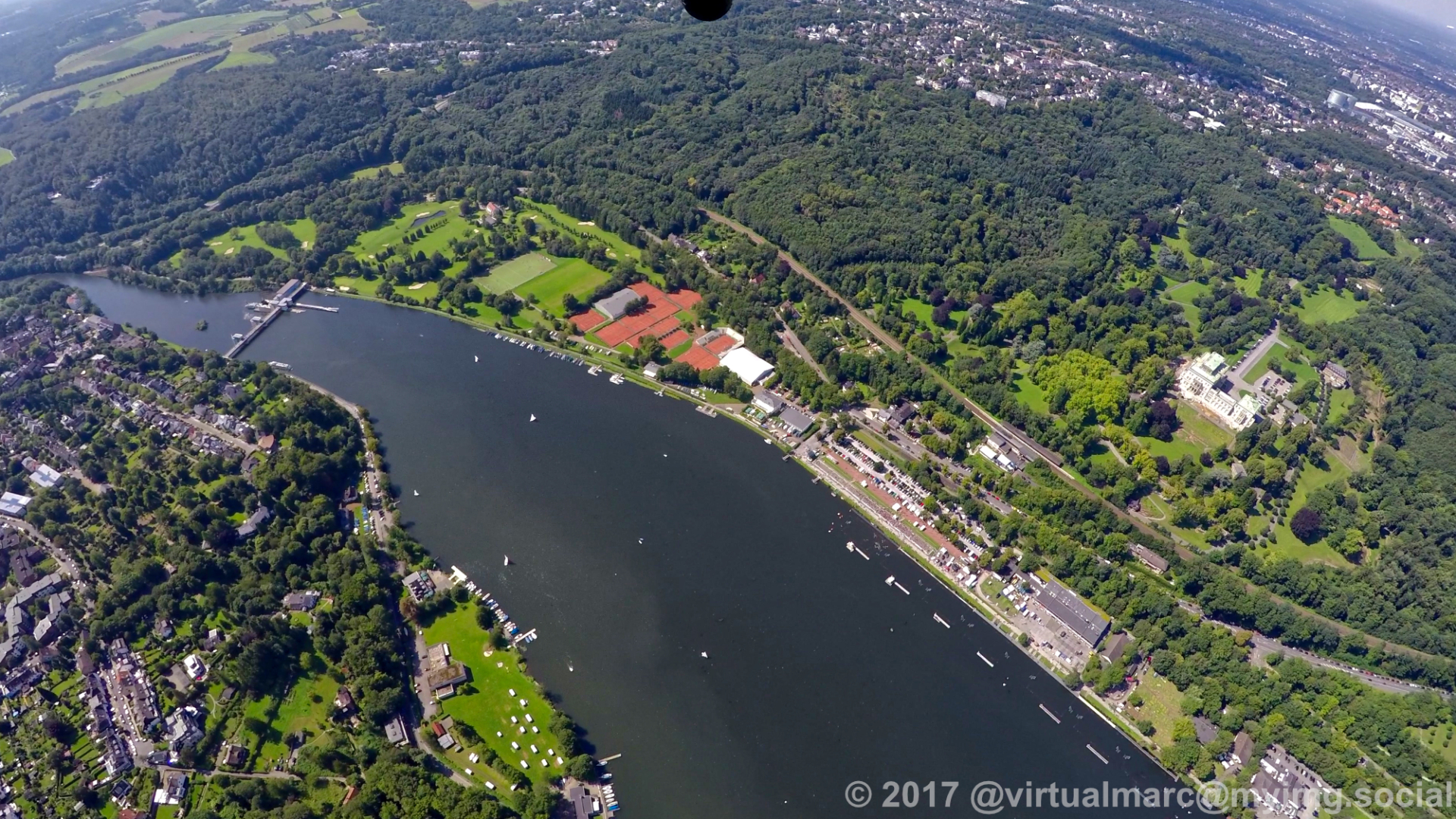
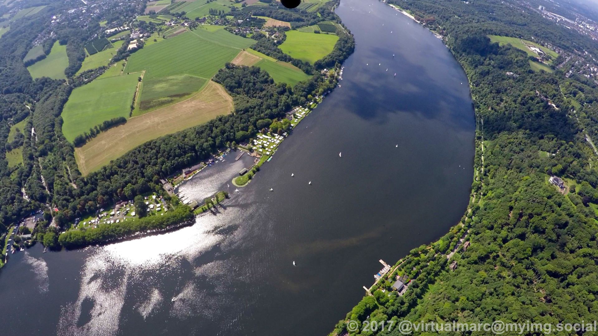
And here we continue our journey, from #Essen Heisingen now to the #Baldeneysee
#photography #nature #naturephotography #aerialphotography #aerialview #aerial #ruhrgebiet #ruhrpott #ruhr #ruhrarea #essen #gyrocopter #flying #edlm
#photography #nature #naturephotography #aerialphotography #aerialview #aerial #ruhrgebiet #ruhrpott #ruhr #ruhrarea #essen #gyrocopter #flying #edlm
Client Info
Server: https://mastodon.social
Version: 2025.04
Repository: https://github.com/cyevgeniy/lmst