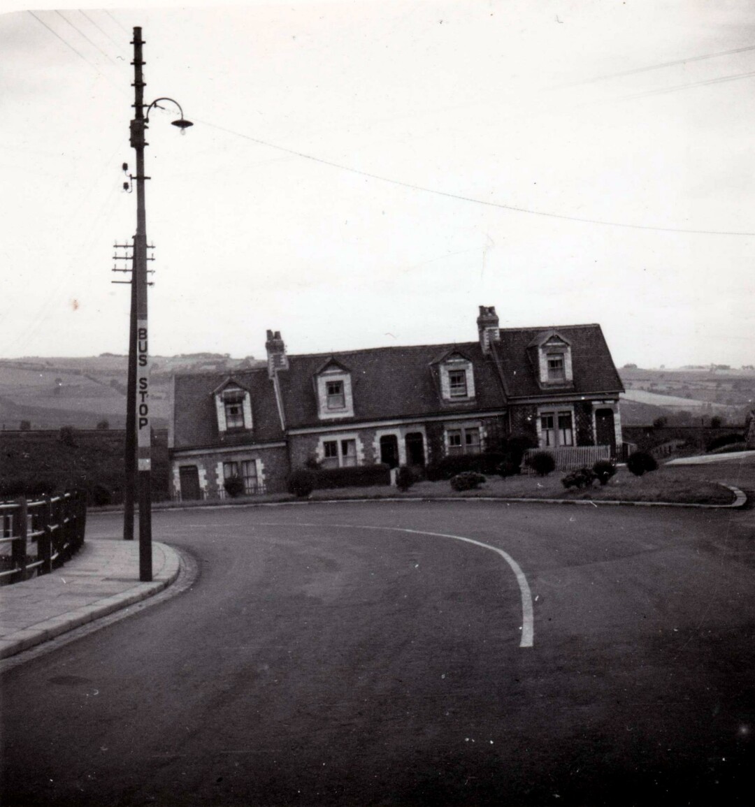
Continuing Jack & Mary's time in northern England, this week in 1950 they photographed these "sloping houses". The caption reads "21 August 1950. Sloping houses, Stanley, Co Durham" - thanks to which I've located where they were.
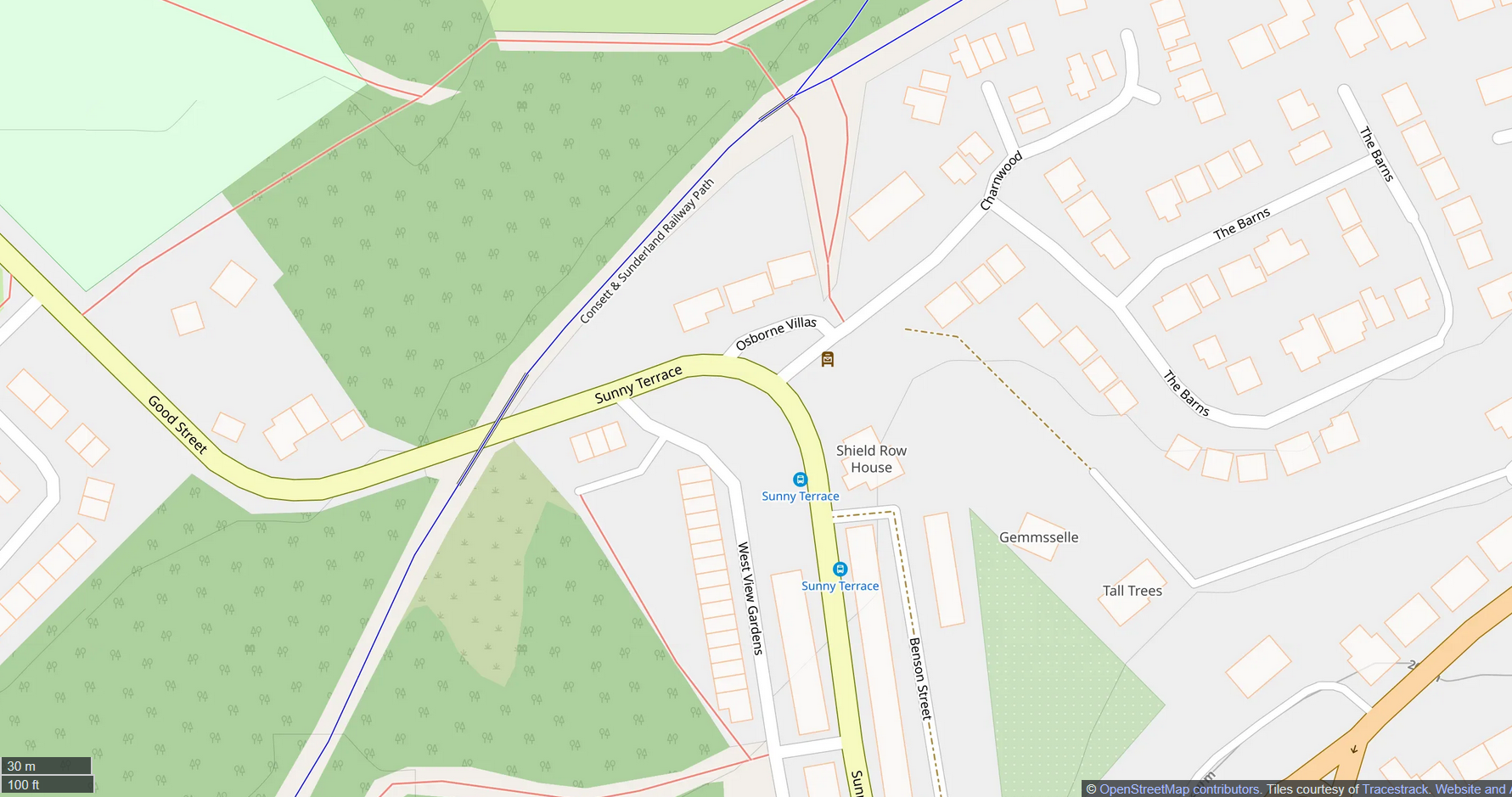
The photo shows houses on a sharp road bend, by a bus stop, on a hill, with railway behind and distant hills. Stanley sits near Newcastle and Sunderland with the Beamish Living Museum nearby. This was proper coal mining territory with collieries for miles. The area had many railway lines serving them, but only the former Annfield Plain branch of the North Eastern Railway, now a cycleway, is really noticeable on maps today.
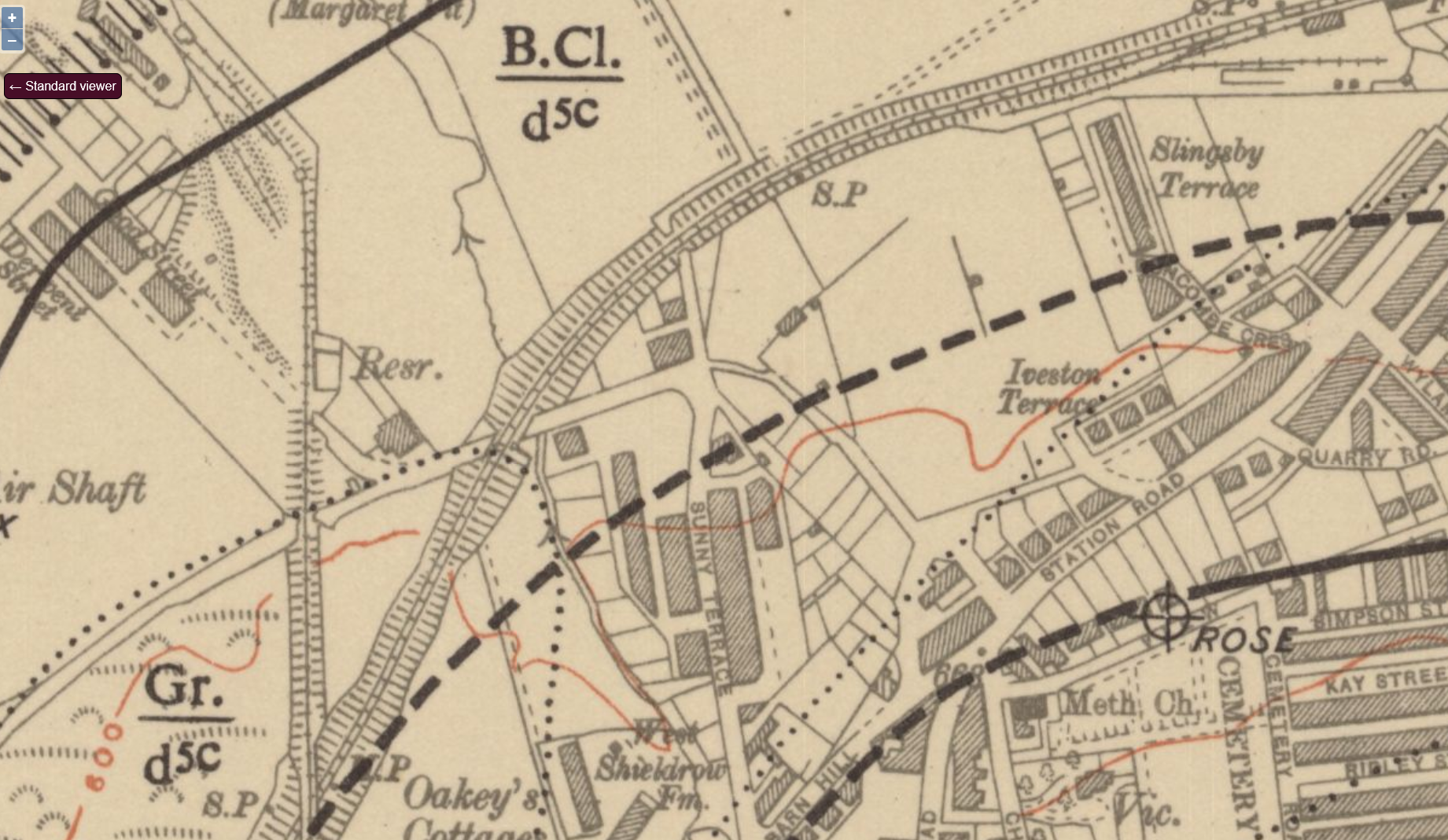
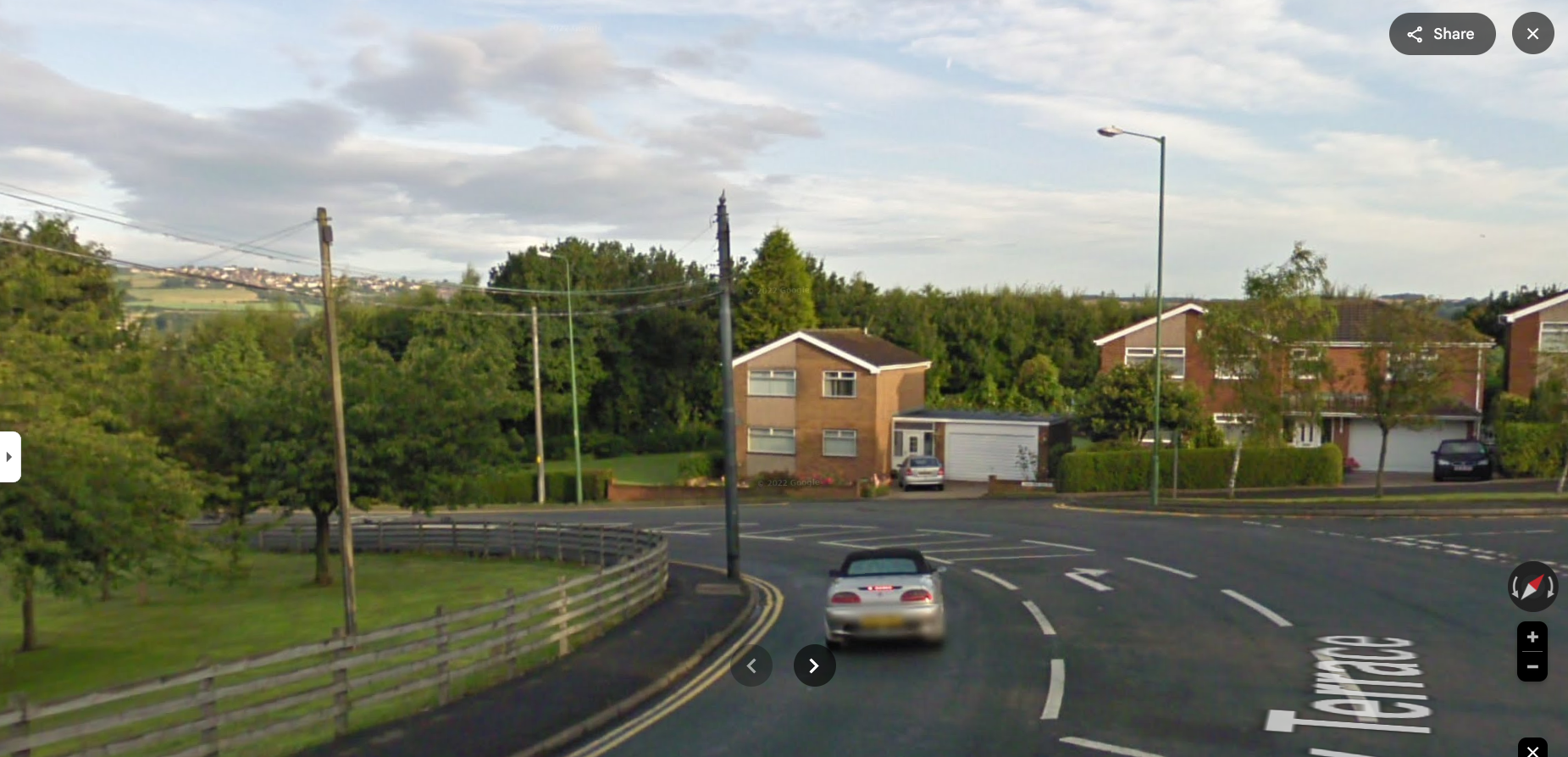
Tracing this line, I spotted a candidate location just northwest of Stanley - a very sharp left bend with the railway behind. Modern Street View shows a familiar scene, though these houses are gone and trees hide the railway. Moving down confirms it's on quite a hill, and a 2009 view shows the large hill in the background.
The National Library of Scotland's 1954 Ordnance Survey map shows this road existed then with a building at the bend. OpenStreetMap confirms there's a bus stop here. I'm 99.9% sure this is the right place.
I don't know why the houses were demolished - maybe they were sinking into coal mines below, maybe the uncomfortable angle, maybe just outdated - but I'm glad this photo preserved them.
#JackAndMaryArchive #Stanley #CountyDurham #Beamish #OrdnanceSurvey #maps
1954 map reproduced with the permission of the National Library of Scotland. 2009 image © Google. OSM image courtesy OpenStreetMap.