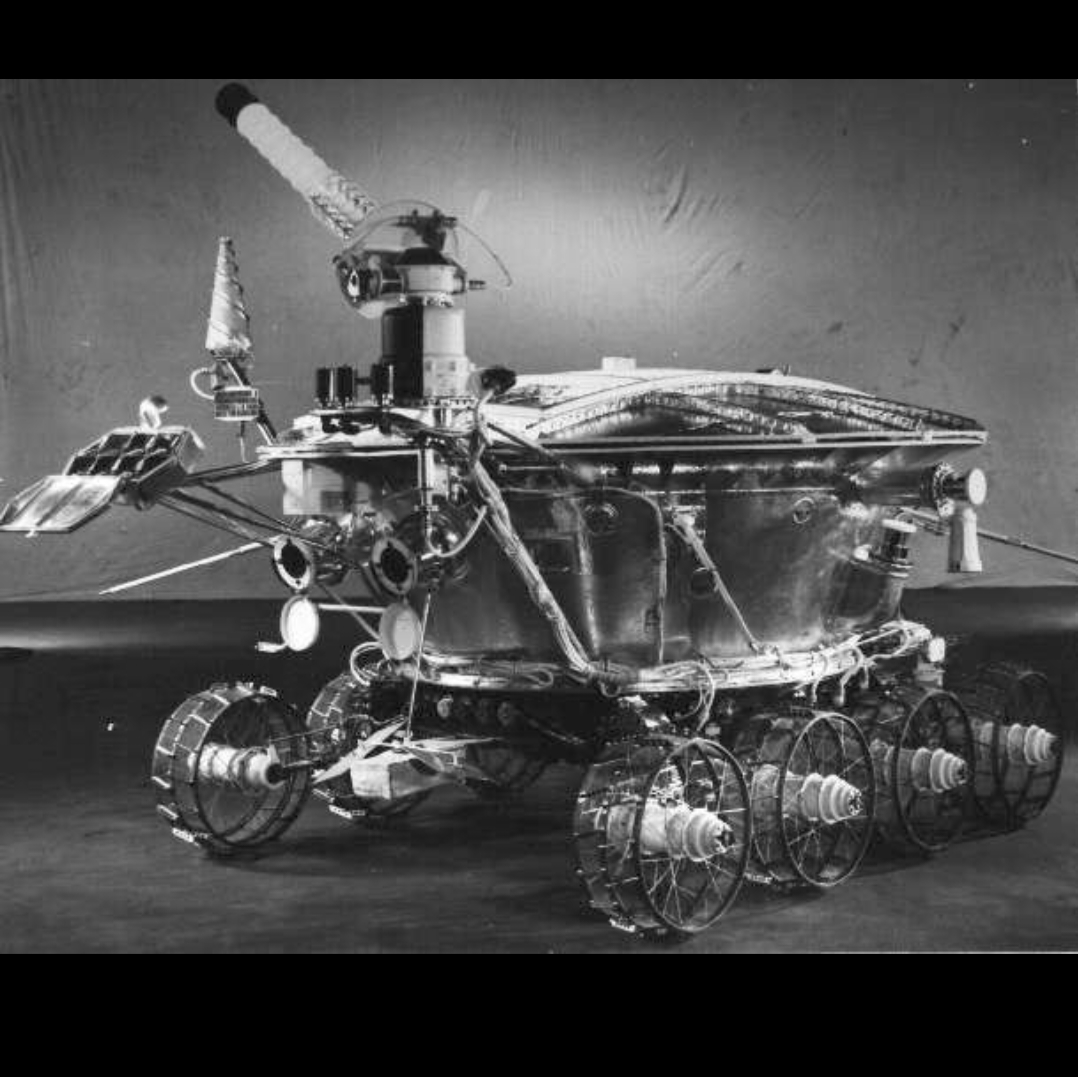
On #ThisDayInHistory in 1970, the #Soviet #Lunokhod1, the first robotic #rover on the lunar surface, landed at #MareImbrium. It was expected to operate for three months but functioned for almost 11 months. It used a solar array to get power during the day and polonium at night.
#Lunokhod1
My location for Luna 17 was too far west but was not ruled out by the laser data. Here is my LPSC abstract on it from 2005:
https://www.lpi.usra.edu/meetings/lpsc2005/pdf/1194.pdf
I was contacted by the team trying to get new detections from Lunokhod 1:
https://arxiv.org/pdf/1009.5720
With a small footprint and a very narrow range gate (see the second link) the uncertainty made the reflector very hard to detect, and my error wasted some of their time. Only when LRO found the rover did they succeed. #moon #luna17 #lunokhod1
To know where Lunokhod 1 was before LRO revealed it, the attempt at matching a map to images is one approach. But there was another - laser reflections. Lunokhod 1 carried a reflector supplied by France. The Vinogradov reference (Vol. 2) summarizes contemporary results, shown here. The ellipse is the spread-out footprint of a laser shot from Earth (footprints are much smaller now). laser shots centred at 1 and 2 gave reflections, but weakly at 3, not at 4. #maps #moon #luna17 #lunokhod1
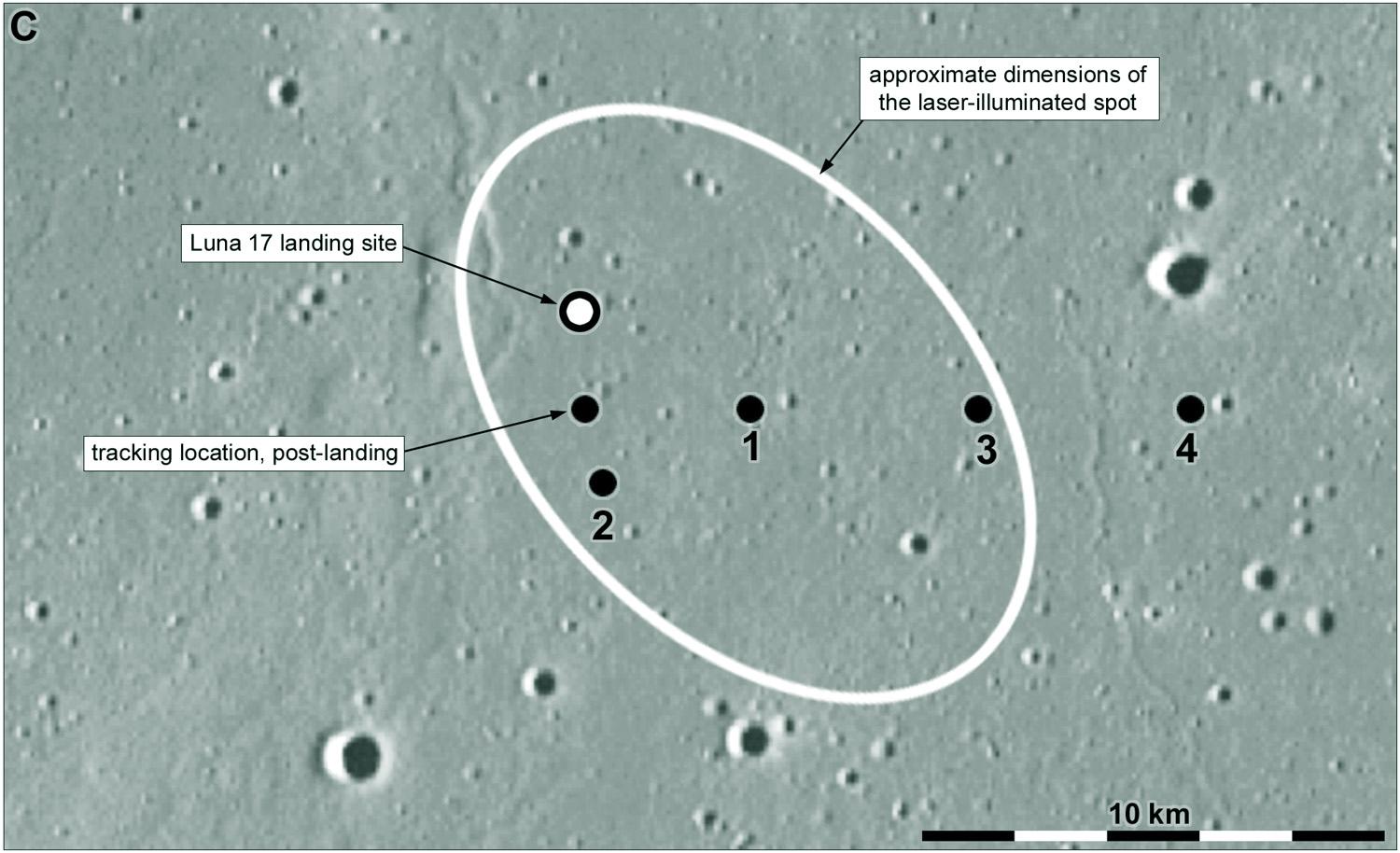
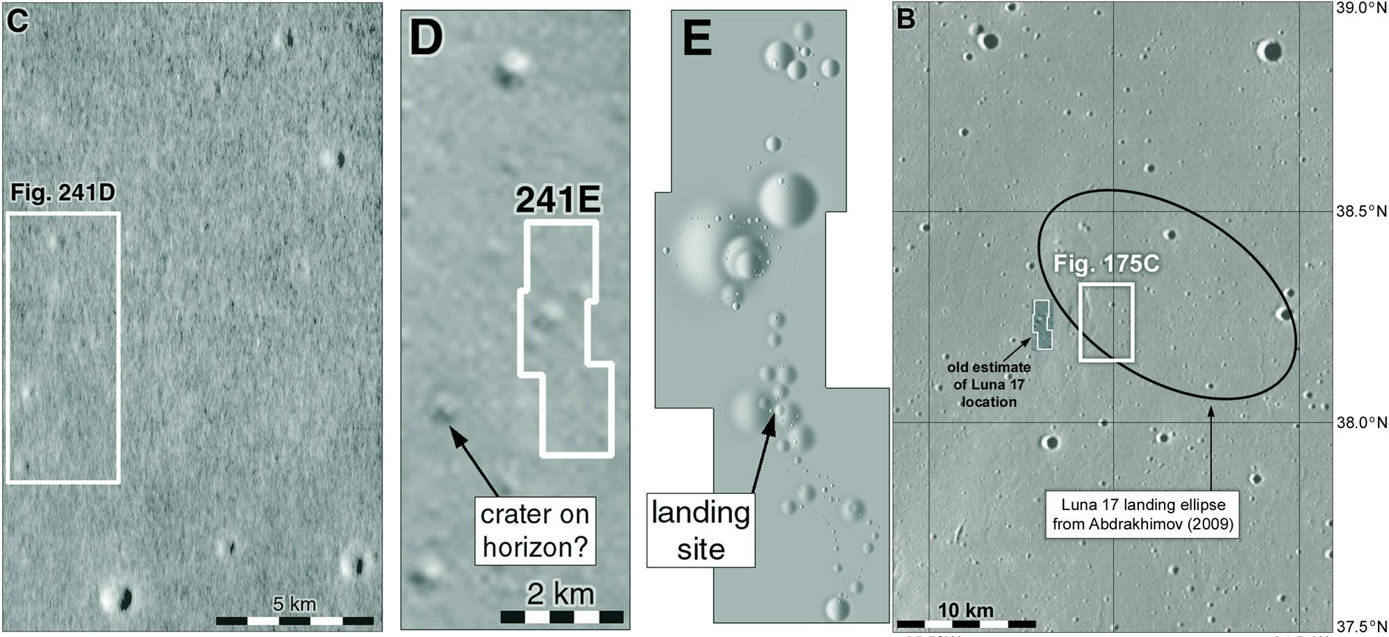
The significant thing to take from this is that I was about 6 km too far west. I chose that spot because it was the only place where there seemed to be a pair of craters matching the largest two in my relief map. As we have seen, the largest one doesn't really exist so I was never going to get it right. In fact, even the biggest crater (Borya) in the traverse area is almost invisible in the old image. This became a problem beyond just me being wrong... #moon #luna17 #lunokhod1
There is one other thing I want to say about Lunokhod 1. I will start by combining two posts from earlier in this sequence. This image shows 3 panels at left illustrating my old guess about where Luna 17 landed (best image at the time, from Apollo 15; a map of the traverse area showing craters on the old Soviet map, and between them, where I thought that map fitted on the image. At right is a context map for my later maps, with the old outline added.
#maps #moon #luna17 #lunokhod1
The Moon has been keeping me busy lately, but I'm back on the job. That view of the northern horizon showing distant hills can be replicated using synthetic panoramas made in Quickmap:
(https://quickmap.lroc.asu.edu).
Here is a panorama made at the Luna 17 location but at an elevation of several hundred meters, so it looks a bit further over the horizon. There are hills in other directions not seen by Lunokhod 1. #moon #luna17 #lunokhod1
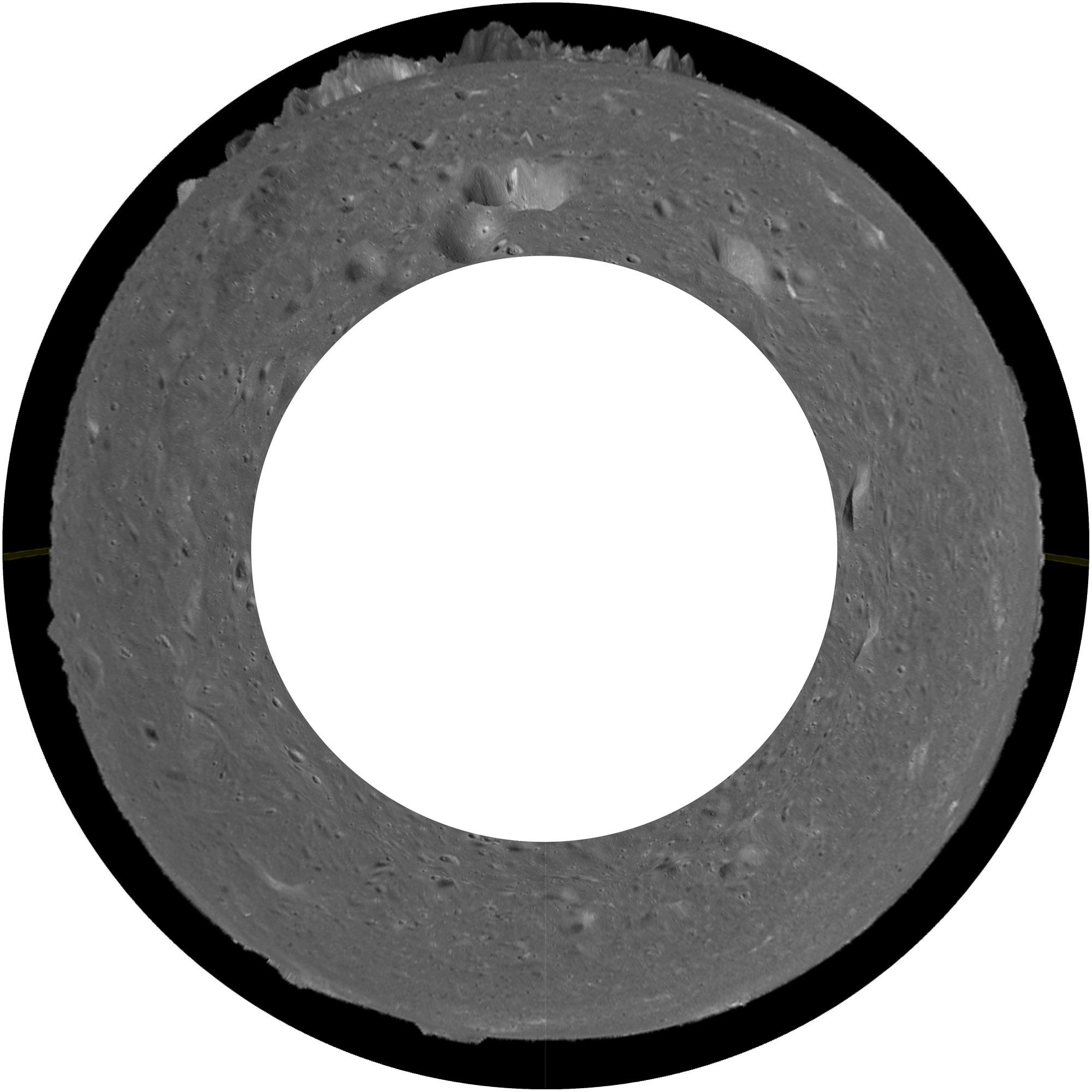
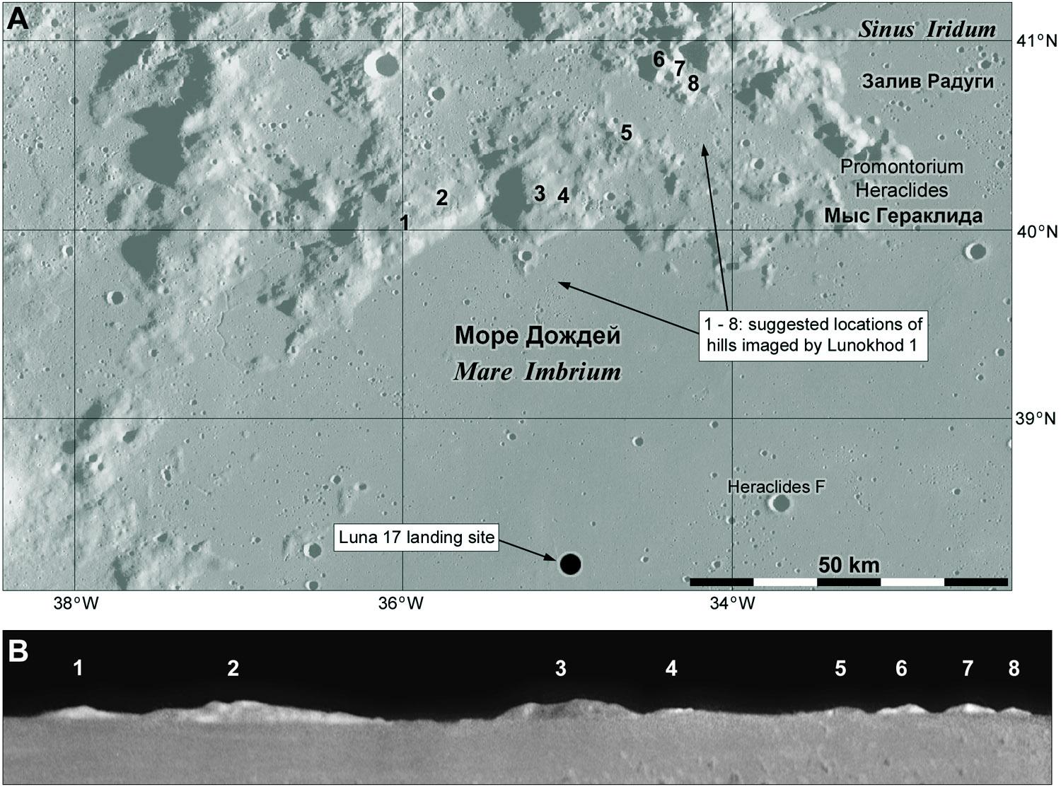
Here I show the hills at the bottom - a composite of all available images of the hills to ensure maximum coverage and improved signal to noise. The map above shows the locations of the various peaks - the small eastern ones are less certain than the larger ones.
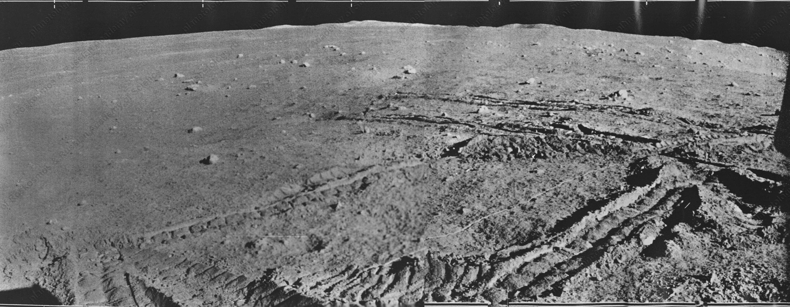
This link goes to a Lunokhod 1 panoramic image taken on lunar day 9:
https://www.planetology.ru/panoramas/images/big/lunokhod1_c/L1_D09_S02_P04m.jpg
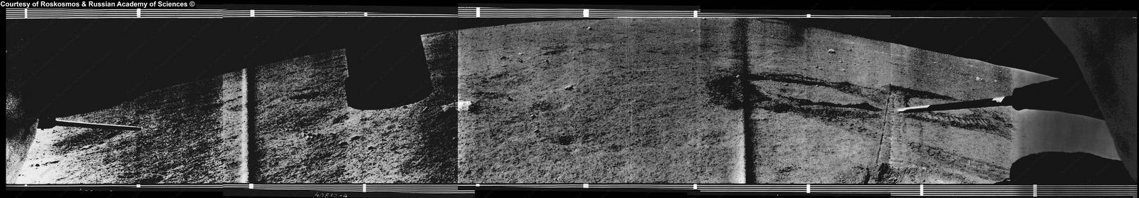
And here is part of it showing hills on the northern horizon (credit: Roscosmos and the Russian Academy of Sciences).
They are the only distant features visible at this site. Can we identify them? (Spoiler... yes!)
I should have mentioned that the Vinogradov reference comes in two volumes. There was no corresponding publication for Lunokhod 2, alas.
Here are the remaining plans from Lunokhod 1 images, and a final map of the end of the traverse derived from LRO images of tracks and the old Soviet map.
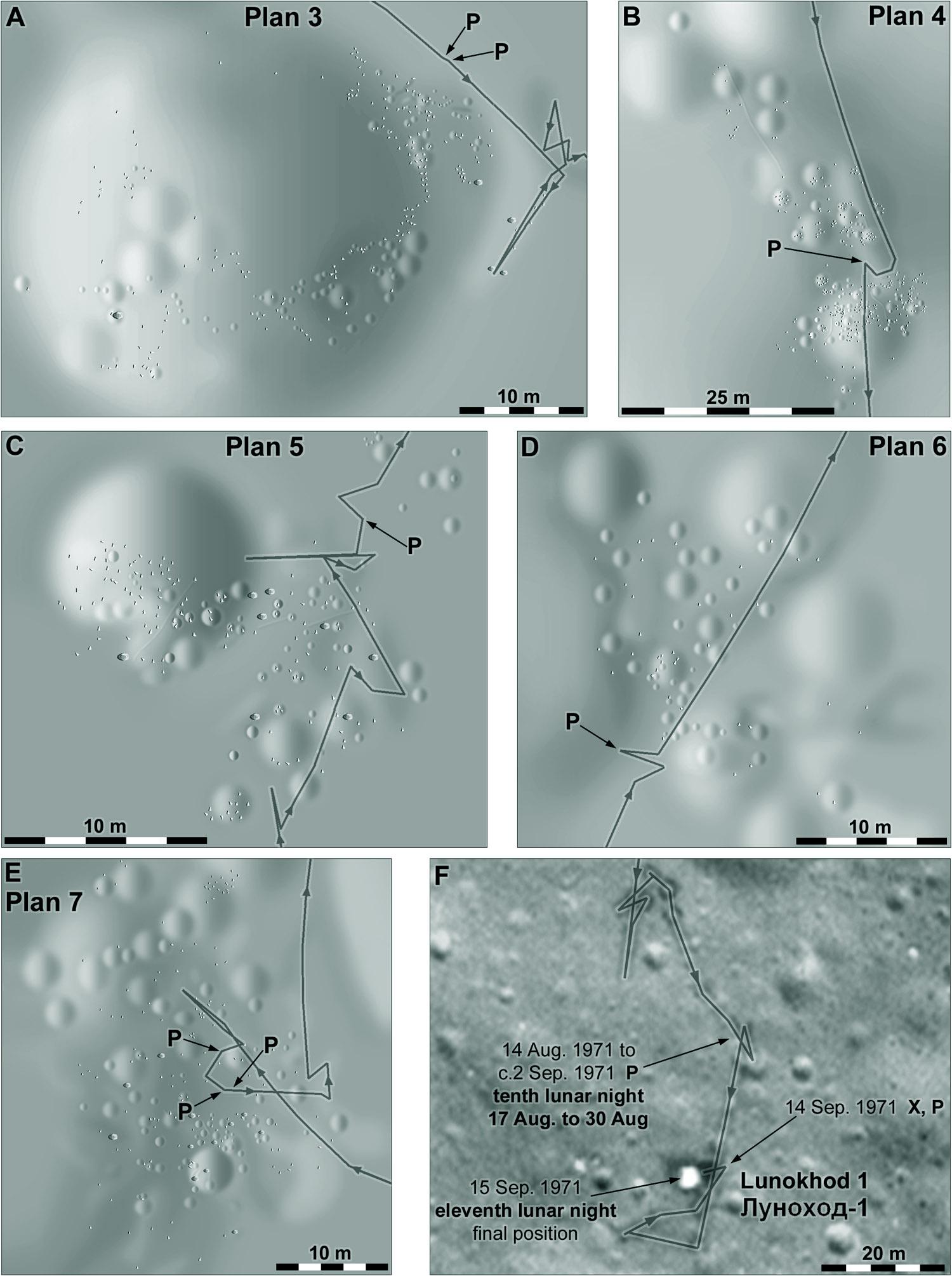
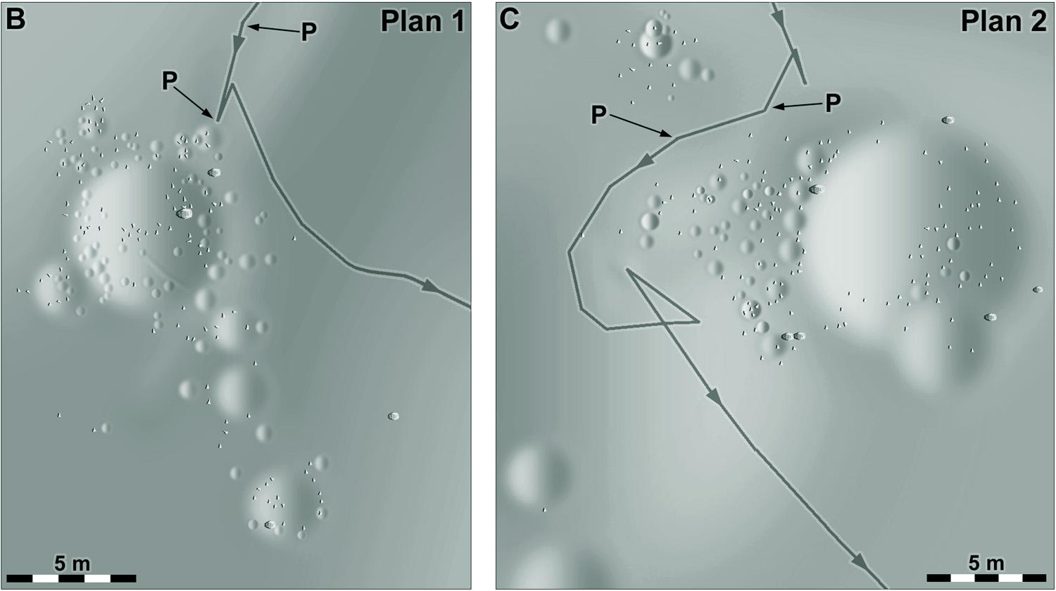
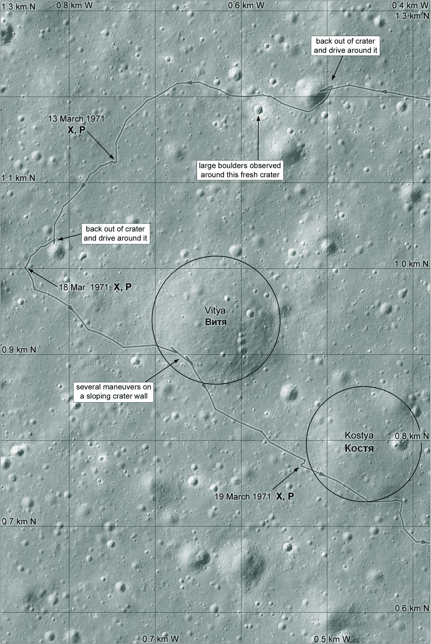
The first map of the Lunokhod 1 traverse included two areas marked Plan 1 and Plan 2. These are the plans - maps, in other words. They were made using several panorama images to form stereoscopic pairs and the originals included contour lines as well as small crater outlines and rocks. I made a shaded relief interpretation of each plan. The plans appeared in Vinogradov, A. P., 1971. Peredvizhnaya laboratoriya na lune Lunokhod-1. Moscow: Nauka. #maps #moon #luna17 #Lunokhod1
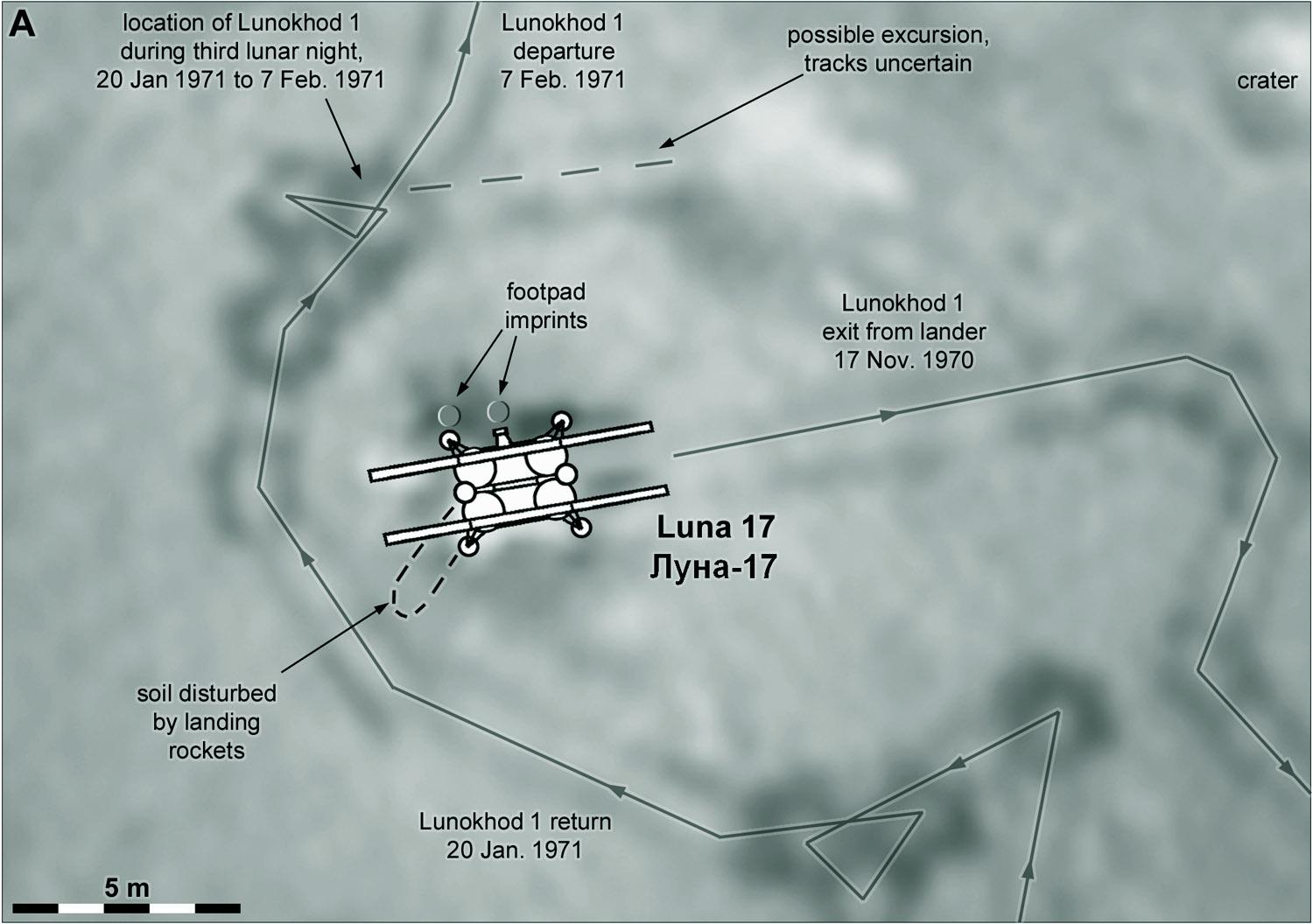
This is the immediate area of the Luna 17 landing site showing the paths of the rover around it. Lunokhod 1 departed on the east side, and after its excursion to the south it returned and drove around the lander, parking northwest of it. The dark rings are made by in-place turns, visible in LRO images. Some of the moves are to provide overlapping panoramas for stereo viewing. The footpad imprints and disturbed surface are visible in rover images. #maps #moon #Luna17 #lunokhod1
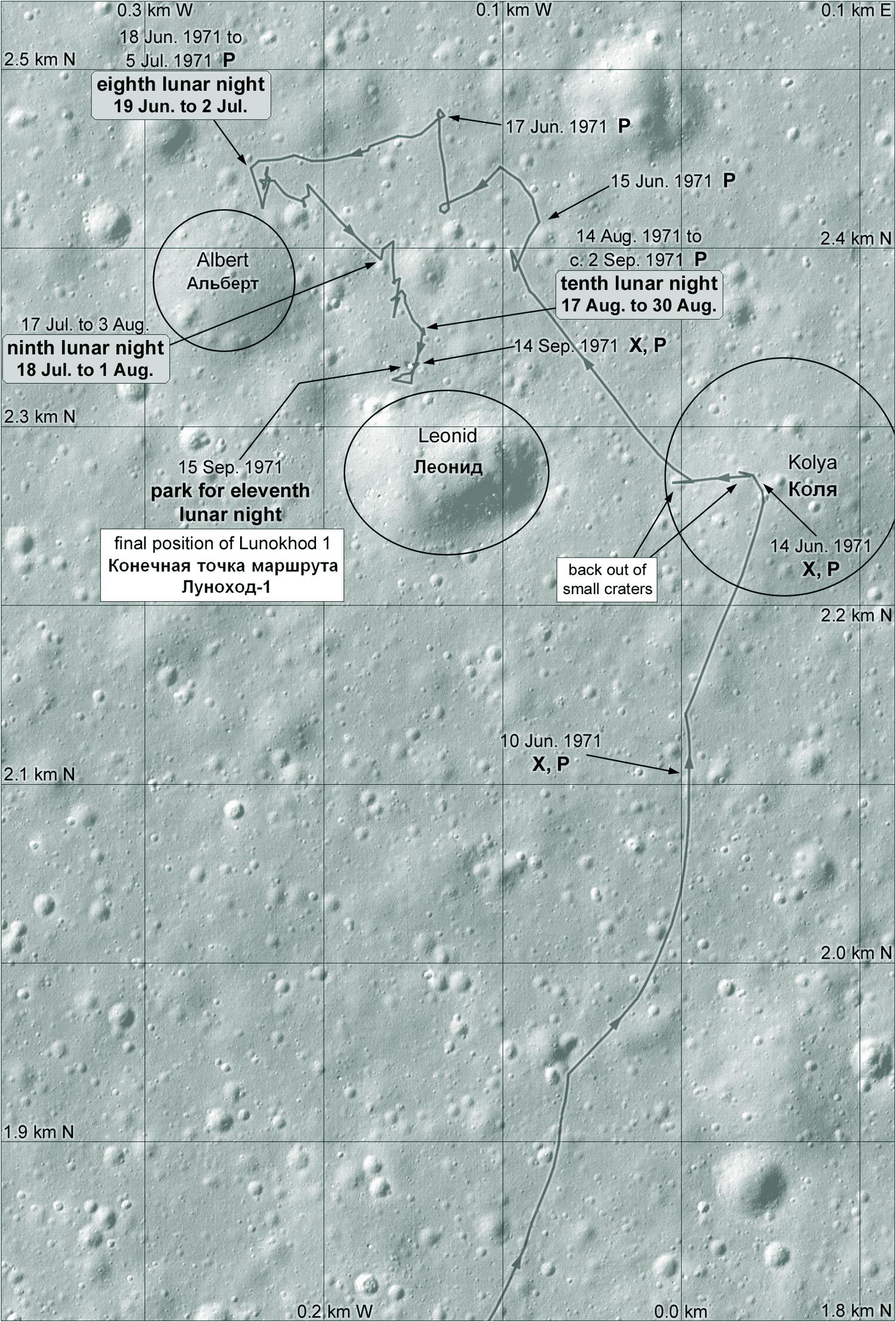
The last day, the 11th, saw the rover stop just north of a crater called Leonid. Next we will look at the 'plan' areas noted on the maps and the actual landing site.
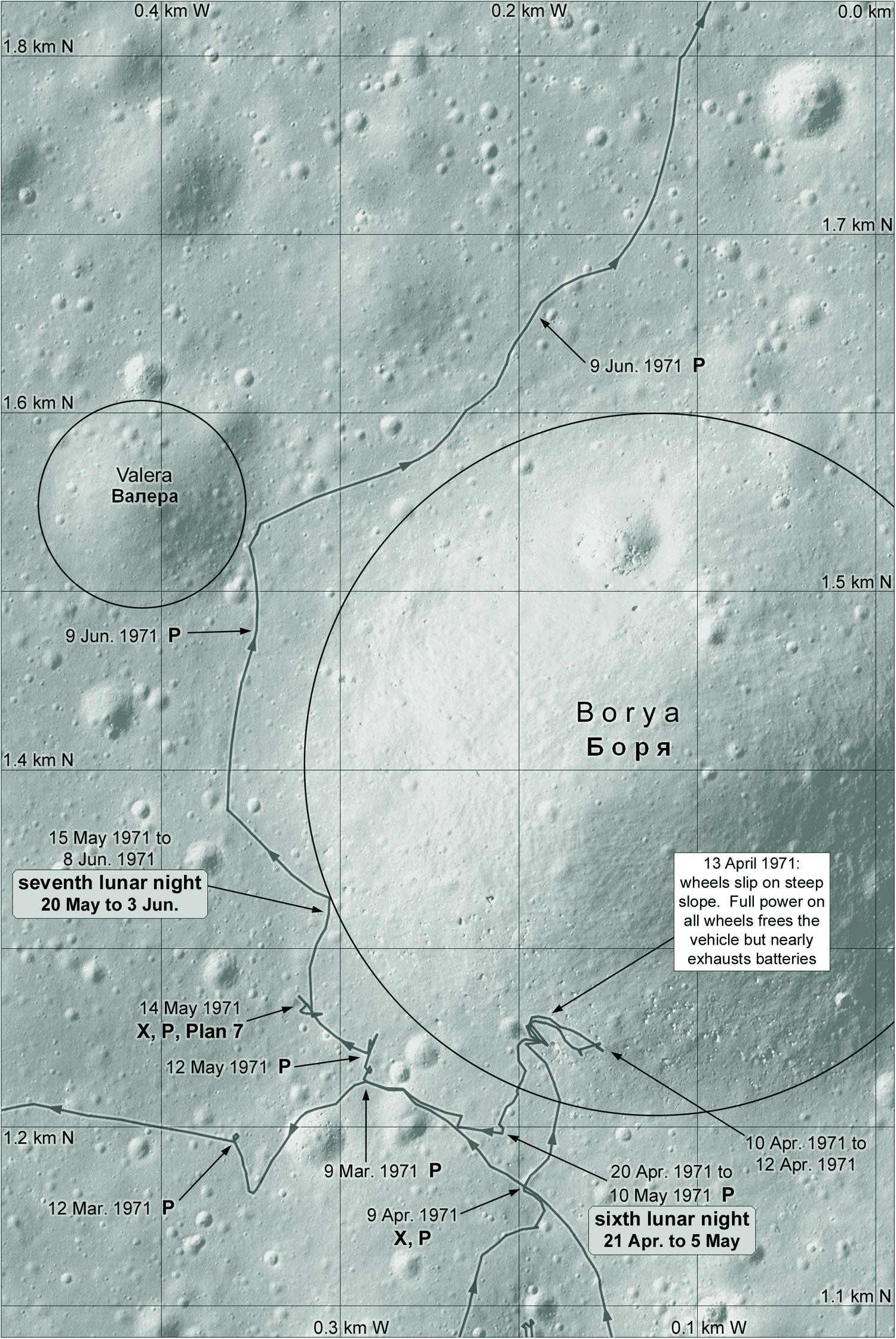
This is the 7th and final map of the Lunokhod 1 traverse. The rover was driven north from the previous map area and into a cluster of craters, some of which were given names. It reached its northernmost point on 17 June and parked for the 8th night nearby. Systems were apparently deteriorating and the next day saw only a short drive near Albert crater. The next lunar day, the 10th, was also marked by short drives and many twists and turns. #maps #moon #luna17 #lunokhod1
After that loop Lunokhod 1 returned to the vicinity of Borya crater, and it is now that it enters the crater. That may have been a mistake, and it was certainly hard to get out. The rover had to use full power to escape the steep slope, running down the battery. When it was back on level ground it rested to recharge and then went into its sixth night. It didn't go far in day 7 and spent the next night on the rim of Borya. #maps #moon #luna17 #lunokhod1
Today we see the fifth map of the Lunokhod 1 traverse. This is the big loop to the west of the previous map. It only took a few days. Compare this map with the Soviet traverse map I posted earlier. This loop was mapped as if it roughly followed the rim of a large subdued crater. Looking for that crater - which doesn't really exist - took up a lot of my time and gave me an incorrect location before LRO found the site. #maps #moon #luna17 #lunokhod1
... This story about Women's Day is also told about a marking made by Lunokhod 2, but the mark in question was made about 2 months before the day that year.
Where is this? As far as I can tell it's this marking. And I think it was made at that point I mentioned on 18 February. That was only an Earth day before the rover stopped for the night, easy to remember on the next morning. Enjoy the day this year with a special person (advice does not apply in the US).
We come to the 4th map of the Lunokhod 1 mission traverse, and there is quite a lot to say about it. The rover was driven north on the morning of lunar day 4 and paused for a few days around lunar noon in mid-February. Then it moved northwest to a spot on a crater rim on 18 February, turned back and stopped for the night on the 19th. On day 5 the rover drove a loop to the west, which runs into the next map, and back into this one.
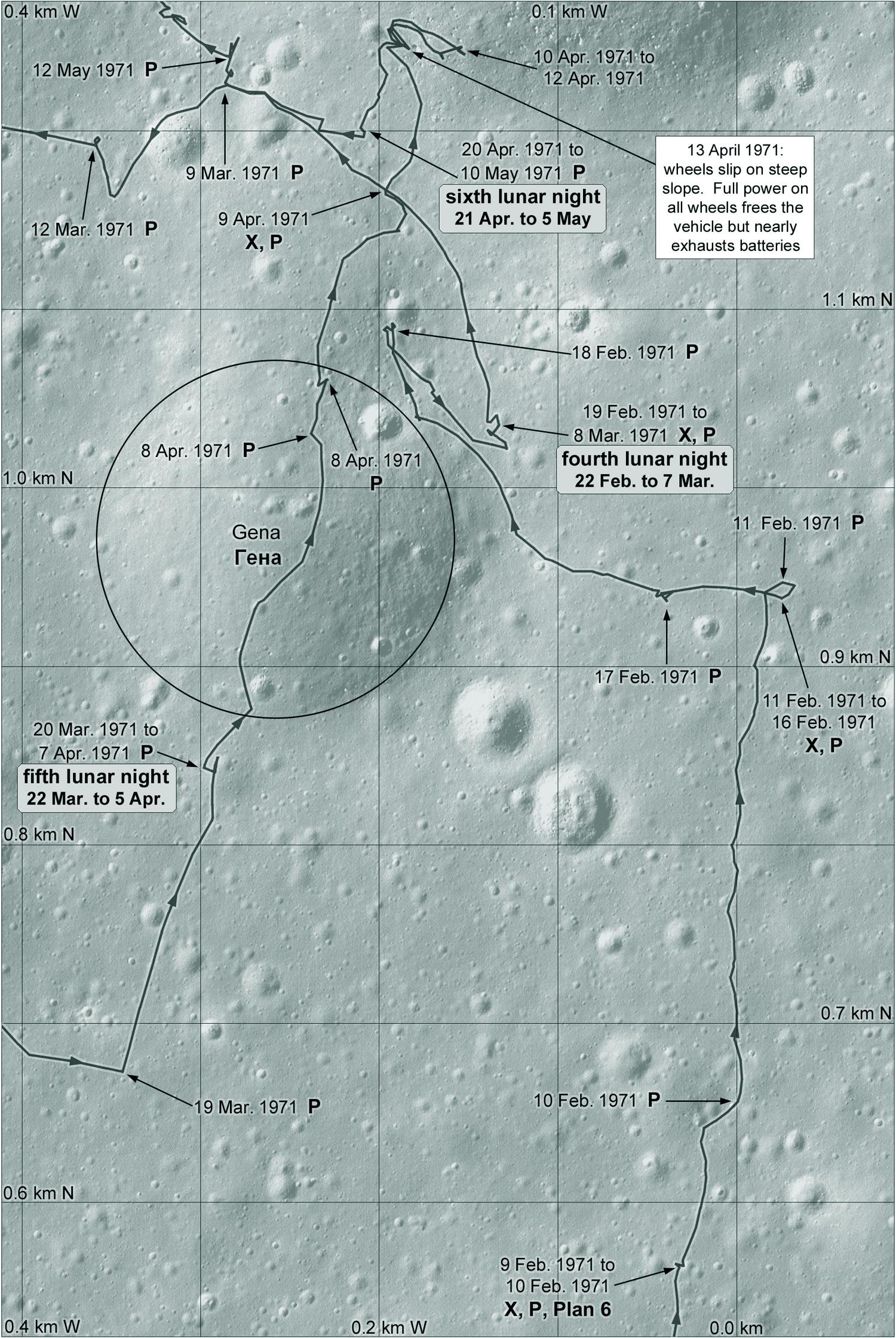
Lunokhod 1 spent its third night close to the lander - there wasn't room to label it on the first map but here it is made clear. The lander was imaged from several directions. Then the rover drove rapidly northwards. The mission team had spotted distant hills on the northern horizon and decided to head for them, not to reach them but at least to get a closer look. We'll get to that later. #maps #moon #luna17 #lunokhod1

This is the second Lunokhod 1 map, the southern end of the drive. The first lunar night was spent not far from the lander. The second was at the southern point here. On the third day the rover was driven quickly back to the lander, testing navigation. Remember they were driving effectively blind. There were no great images like these we have now. Just being able to get back to the lander quickly was an accomplishment. #maps #moon #luna17 #lunokhod1
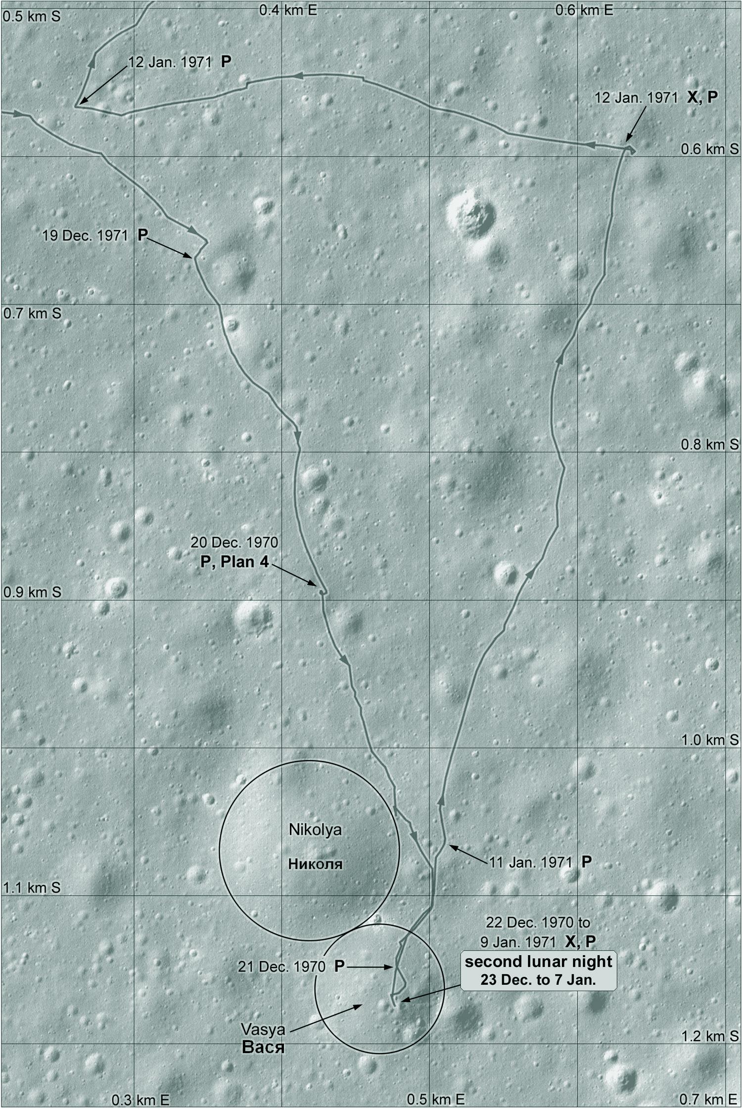
The letter P symbol on the Lunokhod 1 map shows where panoramic images were taken. The X symbol shows where the X-ray surface composition instrument was used. If you follow the dates carefully you will see that Lunokhod started work a day or two after sunrise, operated for just a few days, then took a nap over the middle of the lunar day (e.g 13-17 December), drove for a few days and shut down a day or 2 before sunset. China's Yutu rovers did the same.
#moon #luna17 #lunokhod1
Client Info
Server: https://mastodon.social
Version: 2025.07
Repository: https://github.com/cyevgeniy/lmst