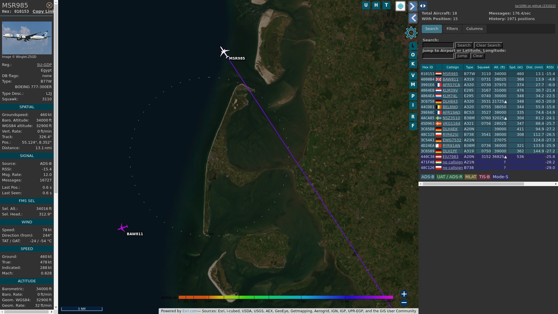
Flight: #MSR985
Registration: SU-GDM
ICAO code: #01012B
Callsign: #EGYPTAIR
Operator: Egypt Air
Type: BOEING 777-36N
Country: 🇪🇬
From: #CAI to #JFK
Speed: 790 kmh
Altitude: 9754 m
Distance: 1.9 km
Angle ∆: 78.8°
Direction ->: WNW
Track:
https://tinyurl.com/23npgguu
History:
https://www.radarbox.com/data/mode-s/01012B
https://www.flightradar24.com/data/aircraft/SU-GDM
Photos:
https://jetphotos.com/photo/keyword/SU-GDM
Seen: 16x
#MSR985
Flight: #MSR985
Registration: SU-GET
ICAO code: #0101DD
Callsign: #EGYPTAIR
Operator: Egypt Air
Type: BOEING 787-9
Country: 🇪🇬
From: #CAI to #JFK
Speed: 932 kmh
Altitude: 11575 m
Distance: 8.2 km
Angle ∆: 54.7°
Direction ->: WNW
Track:
https://tinyurl.com/27a5pytz
History:
https://www.radarbox.com/data/mode-s/0101DD
https://www.flightradar24.com/data/aircraft/SU-GET
Photos:
https://jetphotos.com/photo/keyword/SU-GET
Seen: 6x
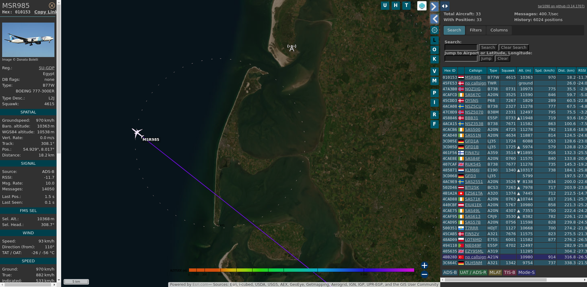
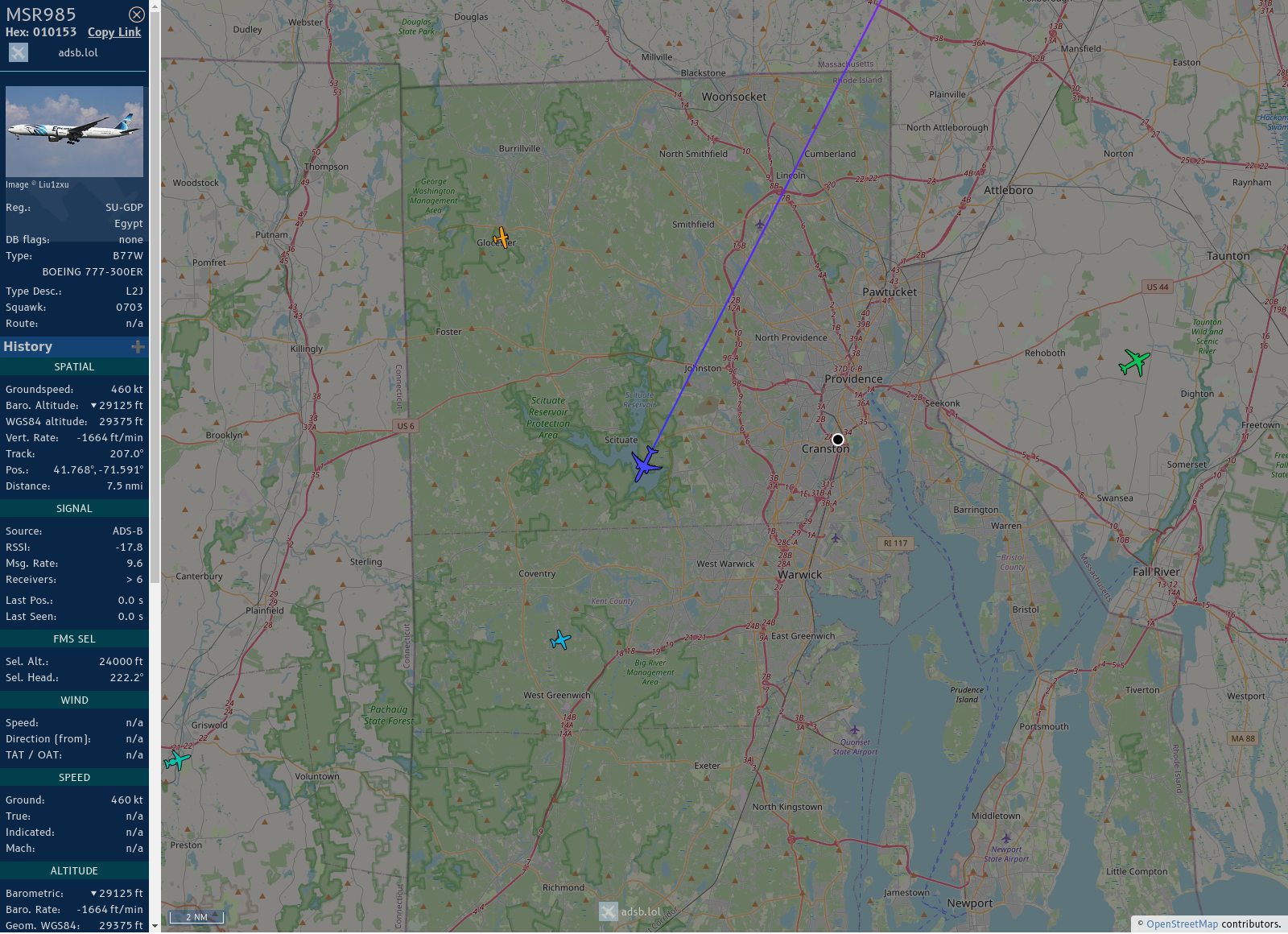
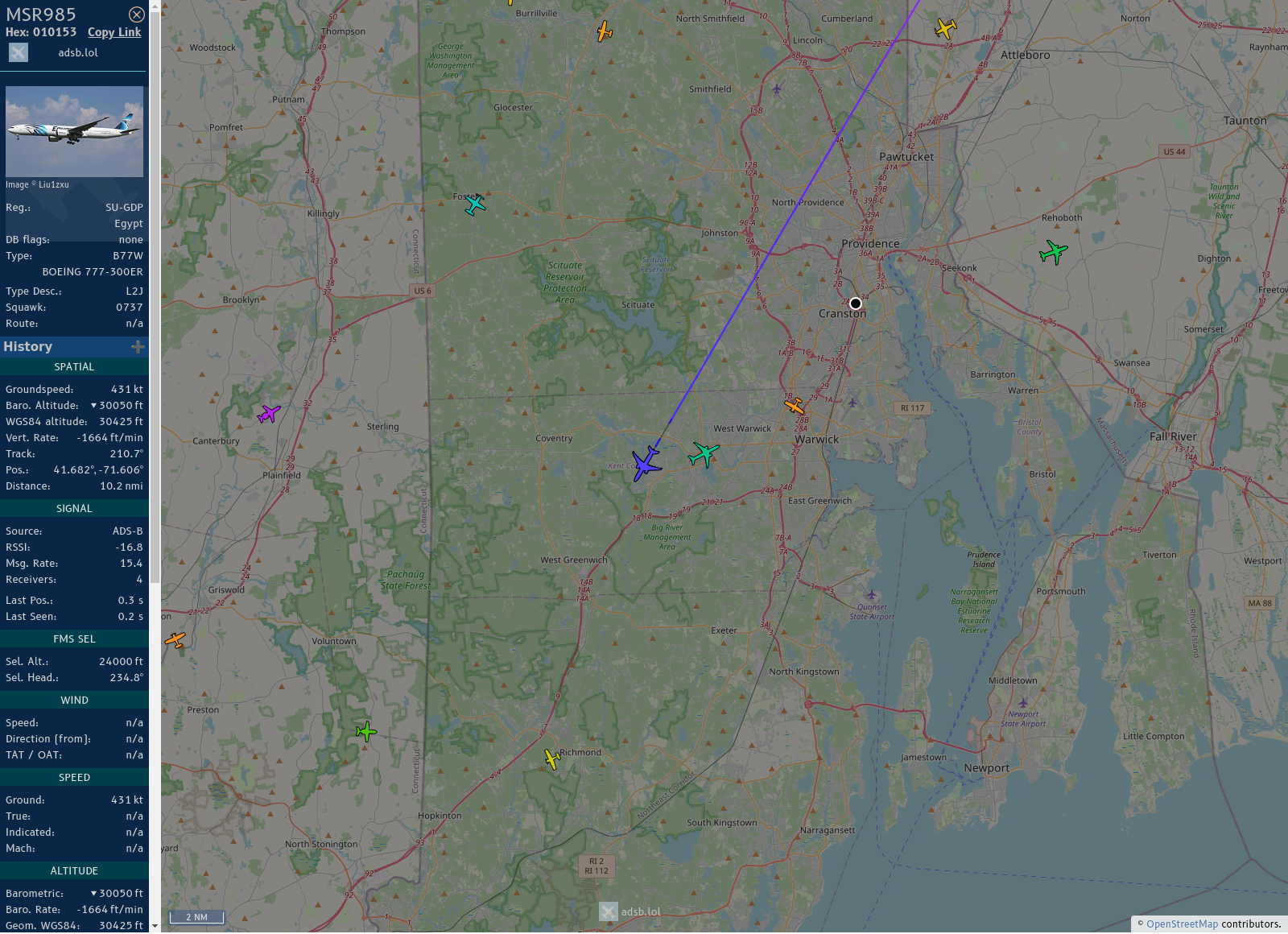
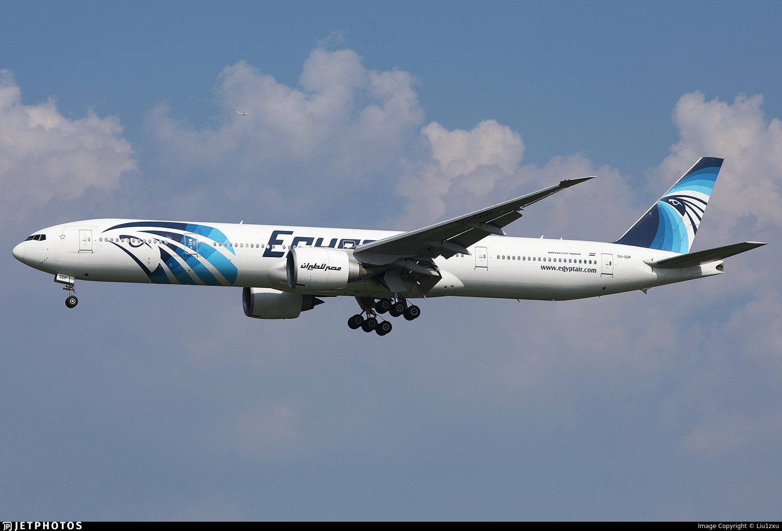
#MSR985: Egypt Air (#Boeing 777 36NER • SU-GDP)
9.6 km out at 34000 ft - heading NW with 1022.4 km/h. CAI ➜ JFK
https://globe.adsbexchange.com/?icao=010153
https://www.jetphotos.com/photo/keyword/SU-GDP
4615 • 08:57:16
#GWT #EDXW #adsb
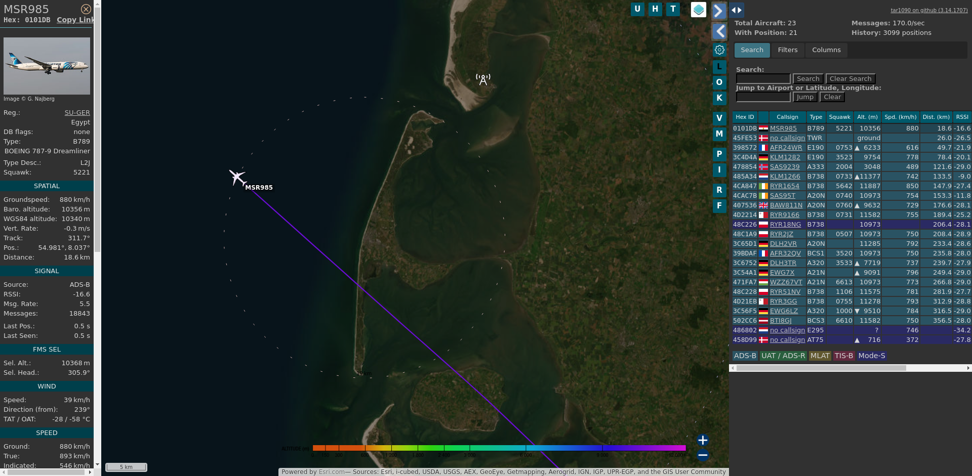
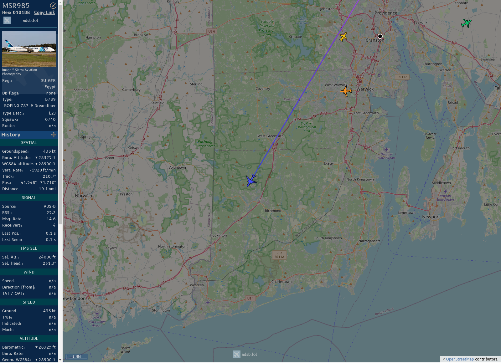
#MSR985: Egypt Air (#Boeing 787 9 • SU-GER)
5.5 km out at 34000 ft - heading NW with 1037.2 km/h. CAI ➜ JFK
https://globe.adsbexchange.com/?icao=0101DB
https://www.jetphotos.com/photo/keyword/SU-GER
5221 • 07:06:24
#GWT #EDXW #adsb
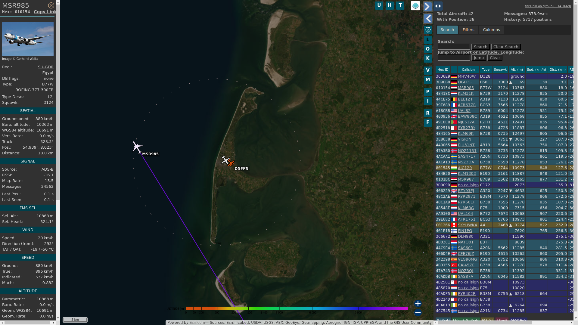
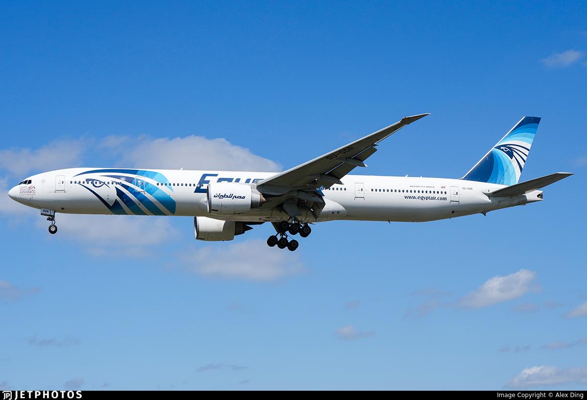
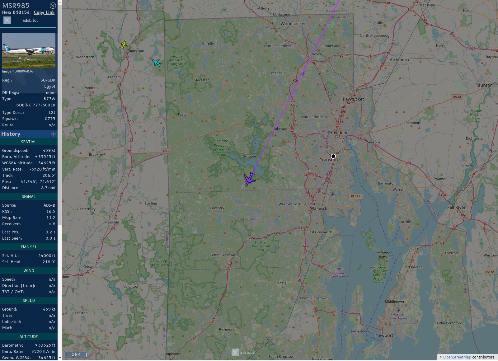
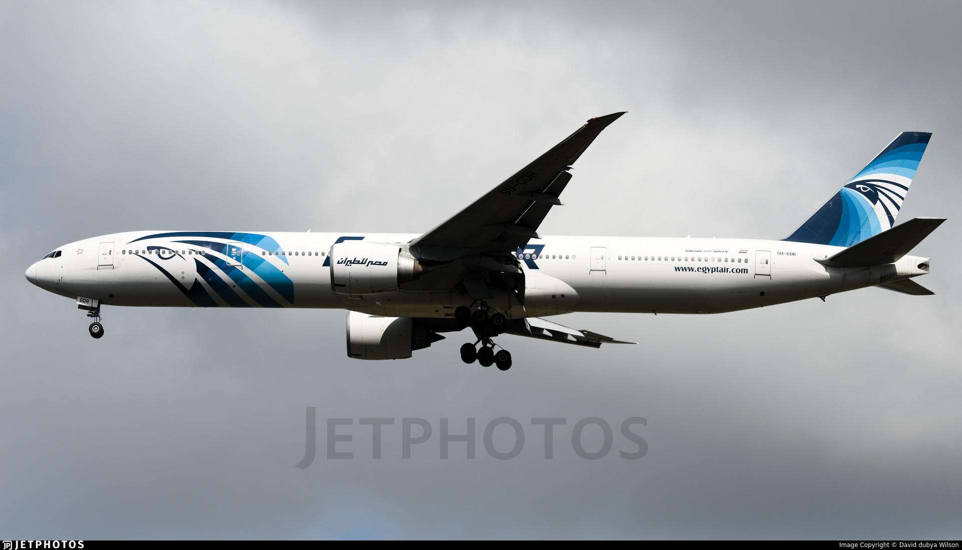
Flight: #MSR985
Registration: SU-GDR
ICAO code: #010154
Callsign: #EGYPTAIR
Operator: Egypt Air
Type: BOEING 777-36N
Country: 🇪🇬
From: #CAI to #JFK
Speed: 877 kmh
Altitude: 10363 m
Distance: 8.7 km
Angle ∆: 50.0°
Direction ->: WNW
Track:
https://tinyurl.com/2xsp8rdn
History:
https://www.radarbox.com/data/mode-s/010154
https://www.flightradar24.com/data/aircraft/SU-GDR
Photos:
https://jetphotos.com/photo/keyword/SU-GDR
Seen: 25x
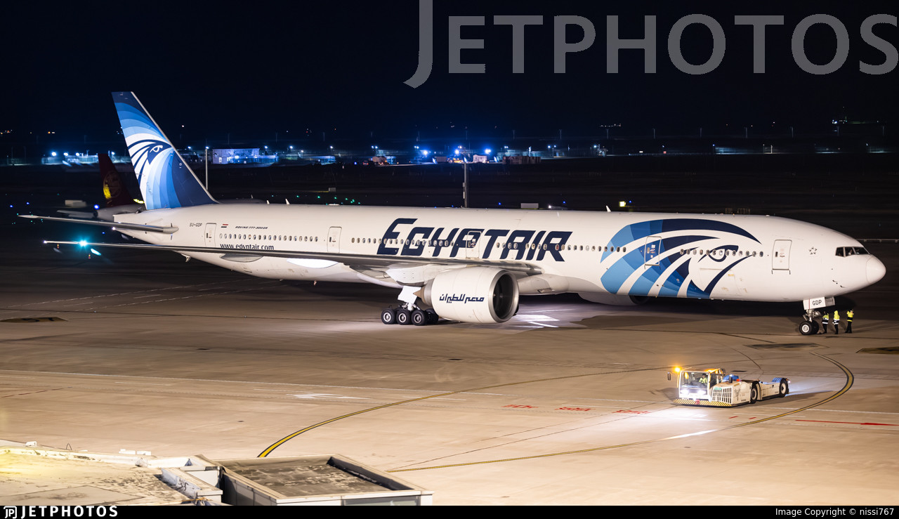
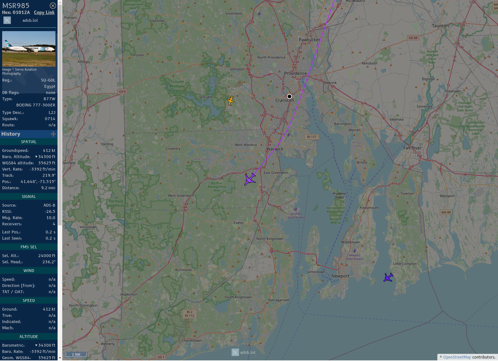
Flight: #MSR985
Registration: SU-GDO
ICAO code: #01013D
Callsign: #EGYPTAIR
Operator: Egypt Air
Type: BOEING 777-36N
Country: 🇪🇬
From: #CAI to #JFK
Speed: 681 kmh
Altitude: 9754 m
Distance: 2.4 km
Angle ∆: 76.1°
Direction ->: WNW
Track:
https://tinyurl.com/29xagewr
History:
https://www.radarbox.com/data/mode-s/01013D
https://www.flightradar24.com/data/aircraft/SU-GDO
Photos:
https://jetphotos.com/photo/keyword/SU-GDO
Seen: 16x
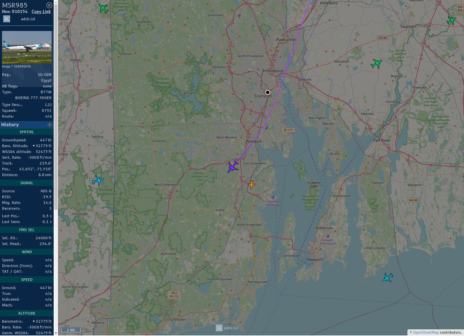
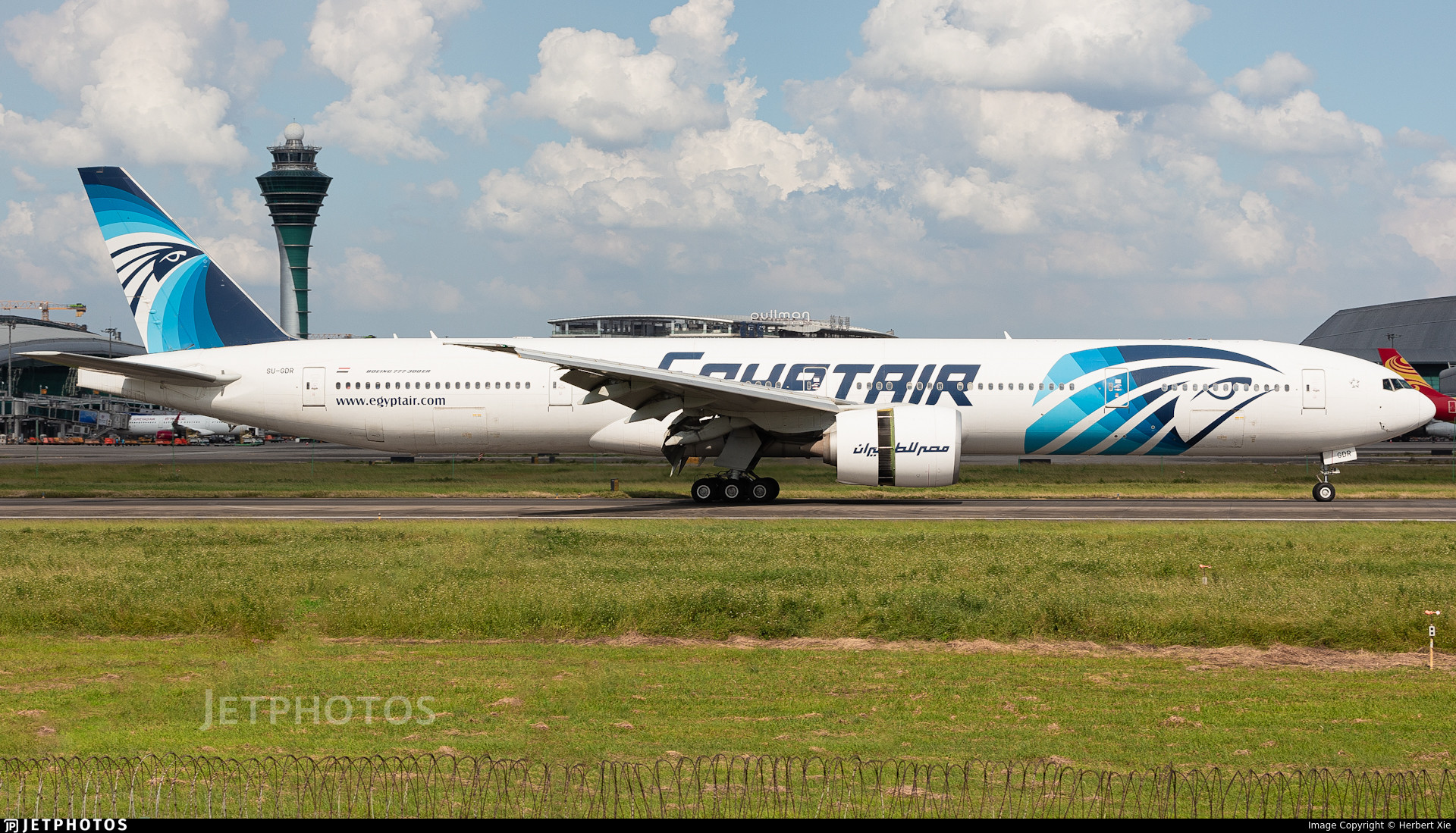
#MSR985: Egypt Air (#Boeing 777 36NER • SU-GDR)
13.7 km out at 34000 ft - heading NW with 1027.4 km/h. CAI ➜ JFK
https://globe.adsbexchange.com/?icao=010154
https://www.jetphotos.com/photo/keyword/SU-GDR
3124 • 10:26:10
#GWT #EDXW #adsb
Flight: #MSR985
Registration: SU-GDO
ICAO code: #01013D
Callsign: #EGYPTAIR
Operator: Egypt Air
Type: BOEING 777-36N
Country: 🇪🇬
From: #CAI to #JFK
Speed: 889 kmh
Altitude: 10363 m
Distance: 1.3 km
Angle ∆: 82.9°
Direction ->: WNW
Track:
http://globe.adsbexchange.com/?icao=01013D&lat=50.983&lon=4.447&zoom=10.5&showTrace=2024-09-21
http://globe.adsb.fi/?icao=01013D&lat=50.983&lon=4.447&zoom=10.5&showTrace=2024-09-21
History:
https://www.radarbox.com/data/mode-s/01013D
https://www.flightradar24.com/data/aircraft/SU-GDO
Photos:
https://jetphotos.com/photo/keyword/SU-GDO
Seen: 11x
#SF260 #Marchetti
https://bit.ly/3yX9TbL
Flight: #MSR985
Registration: SU-GDR
ICAO code: #010154
Callsign: #EGYPTAIR
Operator: Egypt Air
Type: BOEING 777-36N
Country: 🇪🇬
From: #CAI to #JFK
Speed: 941 kmh
Altitude: 10363 m
Distance: 0.8 km
Angle ∆: 85.6°
Direction ->: WNW
Track:
http://globe.adsbexchange.com/?icao=010154&lat=50.983&lon=4.447&zoom=10.5&showTrace=2024-09-17
http://globe.adsb.fi/?icao=010154&lat=50.983&lon=4.447&zoom=10.5&showTrace=2024-09-17
History:
https://www.radarbox.com/data/mode-s/010154
https://www.flightradar24.com/data/aircraft/SU-GDR
Photos:
https://jetphotos.com/photo/keyword/SU-GDR
Seen: 20x
#SF260 #Marchetti
https://bit.ly/3yX9TbL
#MSR985: Egypt Air (#Boeing 777 36NER • SU-GDP)
15.6 km out at 34000 ft - heading NW with 1002.7 km/h. CAI ➜ JFK
https://globe.adsbexchange.com/?icao=010153
https://www.jetphotos.com/photo/keyword/SU-GDP
3110 • 07:34:17
#GWT #EDXW #adsb
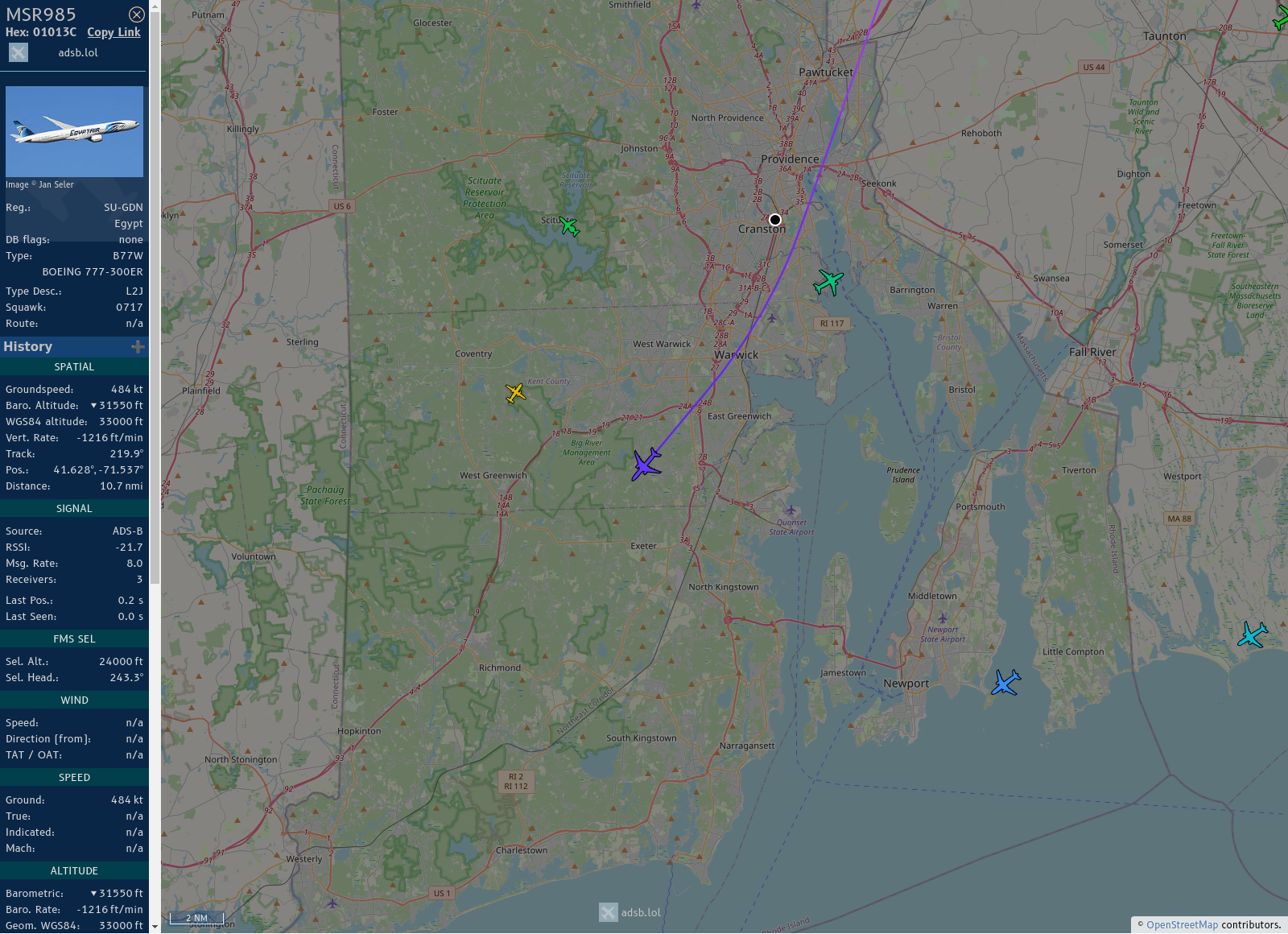
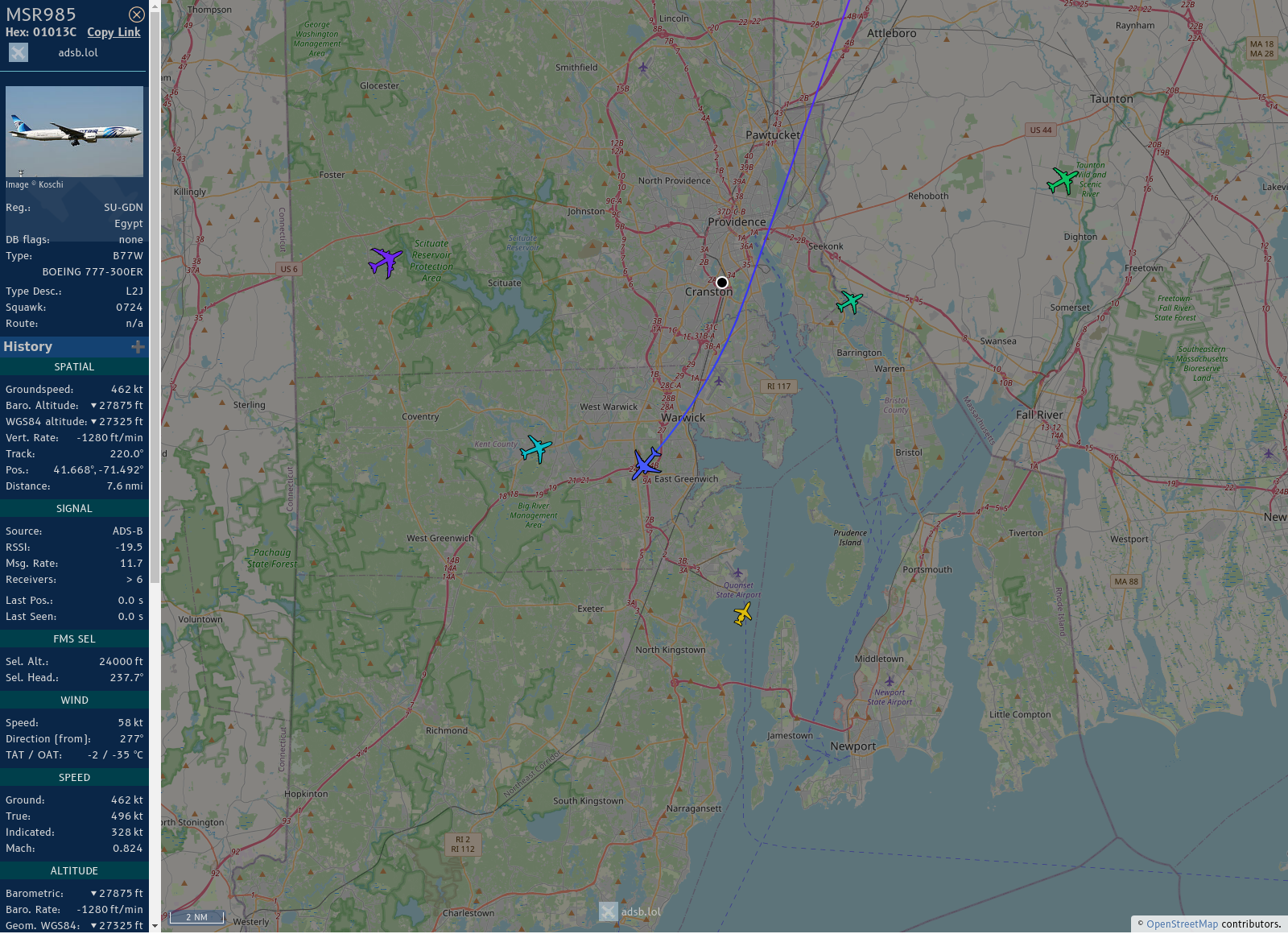
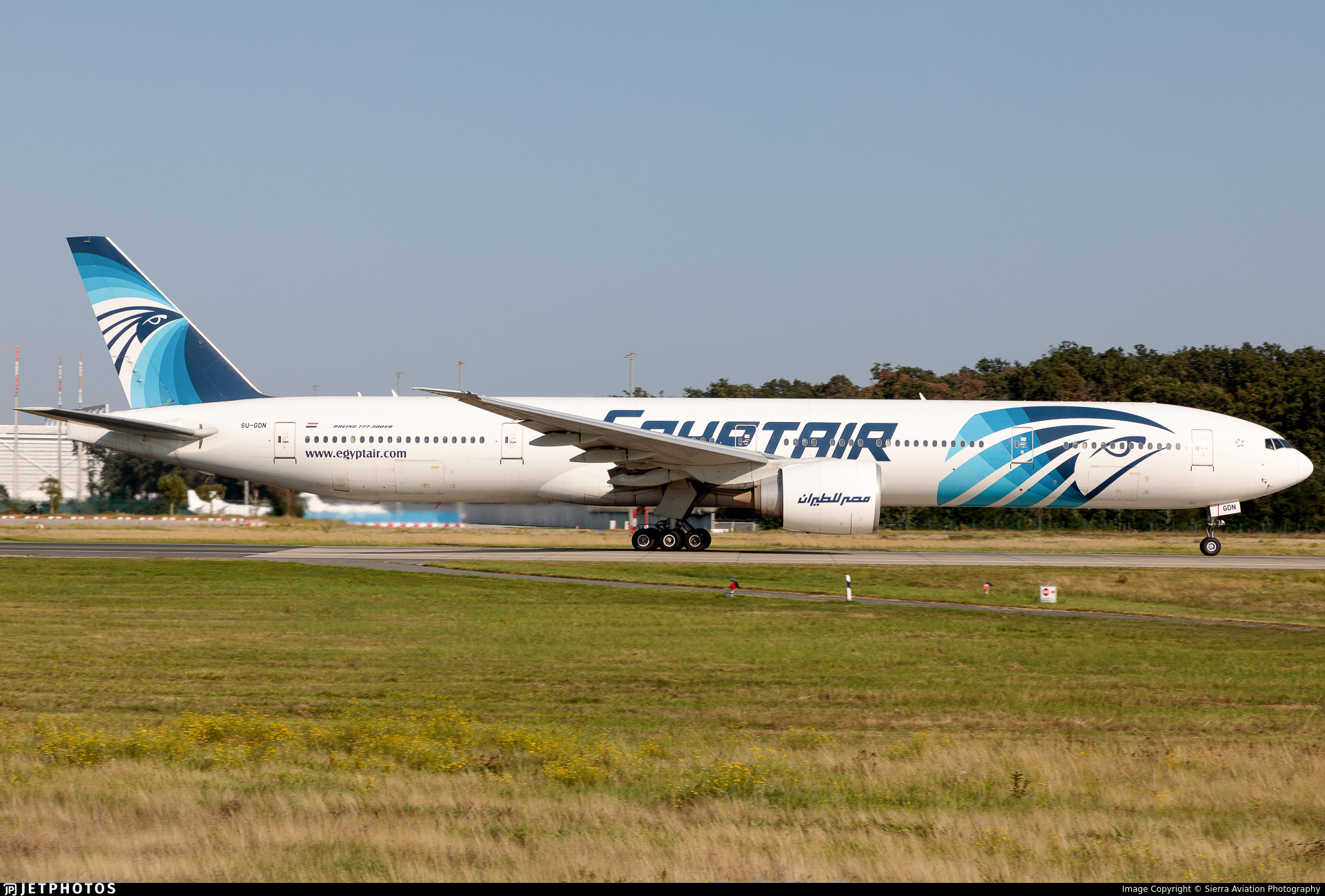
#KBOS / #KPVD - #MSR985 (Boeing 777-36N(ER) B77W) Egyptair @ 33500 ft and 79.4° frm hrzn, heading S @ 08:04:39 - https://globe.adsb.lol/?icao=01013C #UpInTheClouds #adsb #AnyFlightTracker #rtmladsb #Boston Photo by: https://www.planespotters.net/photo/1497641/su-gdn-egyptair-boeing-777-36ner?utm_source=api
#KBOS / #KPVD - #MSR985 (787-9 B789) Egyptair @ 36000 ft and 37.8° frm hrzn, heading SW @ 08:01:48 - https://globe.adsb.lol/?icao=0101DB #WayTheHeckUpThere #adsb #AnyFlightTracker #rtmladsb #Boston Photo by: https://www.planespotters.net/photo/1489219/su-ger-egyptair-boeing-787-9-dreamliner?utm_source=api
#KBOS / #KPVD - #MSR985 (Boeing 777-36N(ER) B77W) Egyptair @ 29950 ft and 38.6° frm hrzn, heading SW @ 07:54:27 - https://globe.adsb.lol/?icao=010153 #UpInTheClouds #adsb #AnyFlightTracker #rtmladsb #Boston Photo by: https://www.jetphotos.com/photo/keyword/SU-GDP

#KBOS / #KPVD - #MSR985 (Boeing 777-36N(ER) B77W) Egyptair @ 29125 ft and 77.9° frm hrzn, heading S @ 07:47:57 - https://globe.adsb.lol/?icao=01013C #UpInTheClouds #FlyingFast #adsb #AnyFlightTracker #rtmladsb #Boston Photo by: https://www.jetphotos.com/photo/keyword/SU-GDN

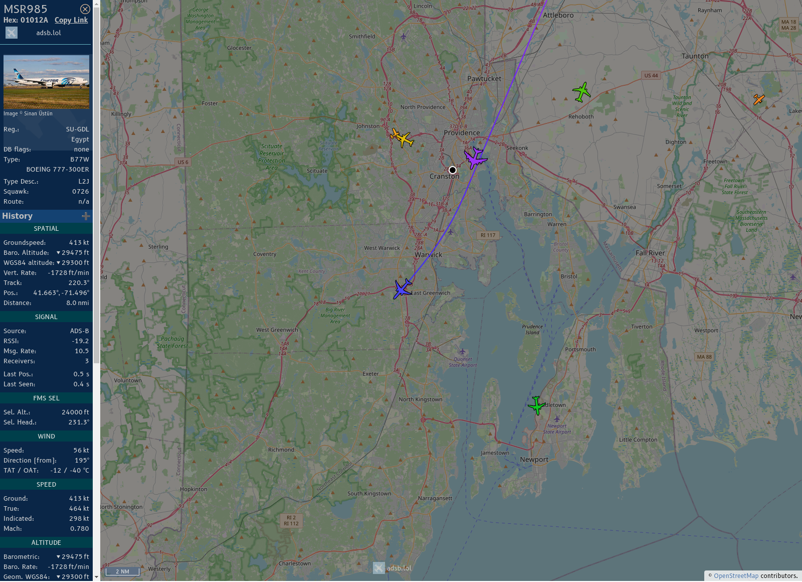
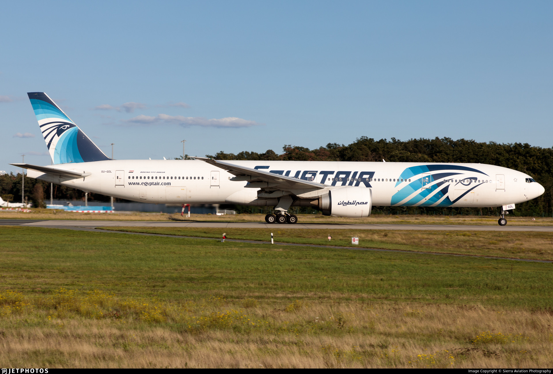
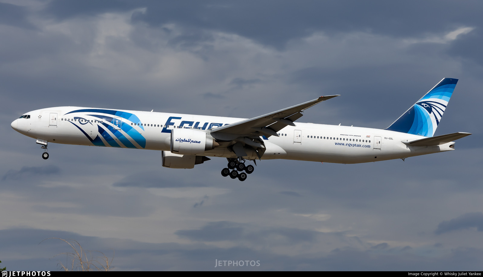
#KBOS / #KPVD - #MSR985 (777 36NER B77W) Egyptair @ 31300 ft and 68.0° frm hrzn, heading SW @ 08:10:54 - https://globe.adsb.lol/?icao=01012A #UpInTheClouds #FlyingFast #adsb #AnyFlightTracker #rtmladsb #Boston Photo by: https://www.jetphotos.com/photo/keyword/SU-GDL
#KBOS / #KPVD - #MSR985 (Boeing 777-36N(ER) B77W) Egyptair @ 31375 ft and 53.5° frm hrzn, heading SW @ 08:56:24 - https://globe.adsb.lol/?icao=010153 #UpInTheClouds #adsb #AnyFlightTracker #rtmladsb #Boston Photo by: https://www.jetphotos.com/photo/keyword/SU-GDP
#KBOS / #KPVD - #MSR985 (Boeing 777-36N(ER) B77W) Egyptair @ 35900 ft and 80.0° frm hrzn, heading S @ 07:39:23 - https://globe.adsb.lol/?icao=010154 #WayTheHeckUpThere #adsb #AnyFlightTracker #rtmladsb #Boston Photo by: https://www.jetphotos.com/photo/keyword/SU-GDR
#KBOS / #KPVD - #MSR985 (Boeing 777-36N(ER) B77W) Egyptair @ 33625 ft and 76.7° frm hrzn, heading SW @ 07:29:27 - https://globe.adsb.lol/?icao=01013C #UpInTheClouds #adsb #AnyFlightTracker #rtmladsb #Boston Photo by: https://www.jetphotos.com/photo/keyword/SU-GDN

#KBOS / #KPVD - #MSR985 (Boeing 777-36N(ER) B77W) Egyptair @ 35650 ft and 42.5° frm hrzn, heading SW @ 08:56:40 - https://globe.adsb.lol/?icao=010154 #WayTheHeckUpThere #adsb #AnyFlightTracker #rtmladsb #Boston Photo by: https://www.jetphotos.com/photo/keyword/SU-GDR
#KBOS / #KPVD - #MSR985 (777 36NER B77W) Egyptair @ 36000 ft and 80.1° frm hrzn, heading S @ 08:16:02 - https://globe.adsb.lol/?icao=01012A #WayTheHeckUpThere #adsb #AnyFlightTracker #rtmladsb #Boston Photo by: https://www.jetphotos.com/photo/keyword/SU-GDL
Client Info
Server: https://mastodon.social
Version: 2025.04
Repository: https://github.com/cyevgeniy/lmst