#QG54

UNOFFICIAL Queensland fire botqldfire@longlandclan.id.au
2025-10-11

#FireVegetation #NewMoontaQld #QG54 #QLDFire #BushfireWarning. See fire.qld.gov.au/Current-Incide for official warnings from the QFD. DO NOT RELY ON THIS SERVICE FOR TIMELY EMERGENCY WARNINGS.

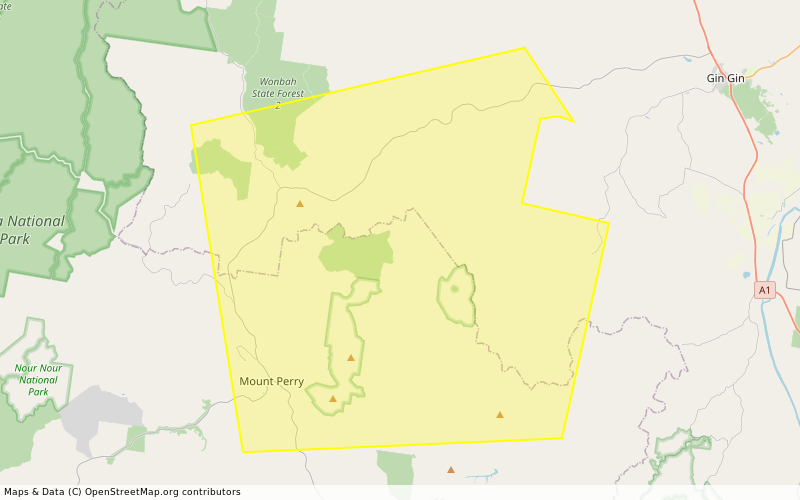
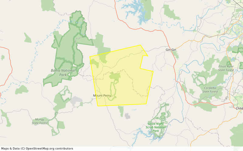
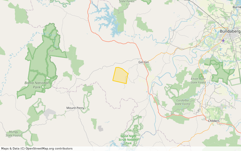
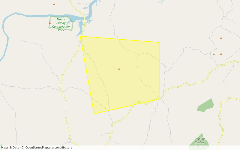
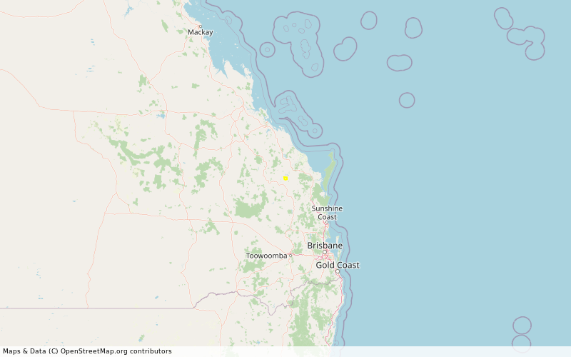
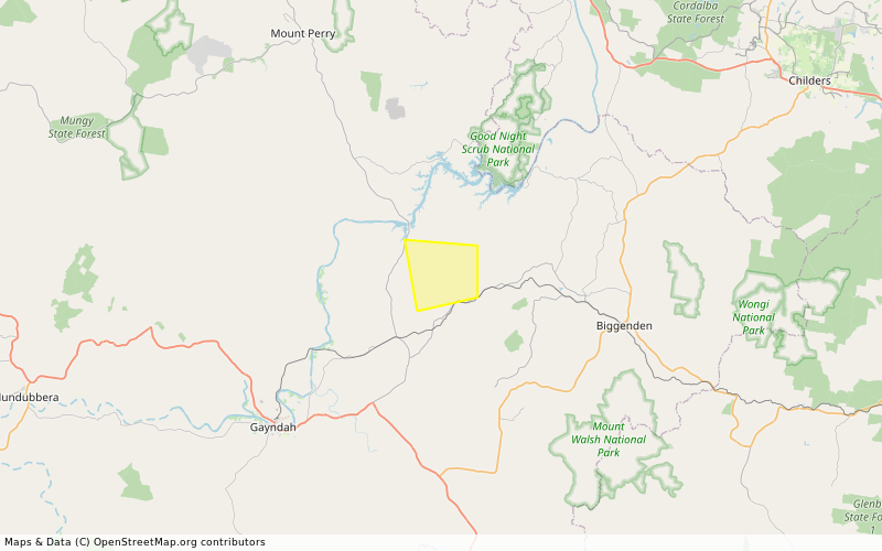
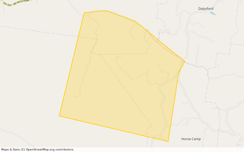
Information - NEW MOONTA (QF4-25-136876)

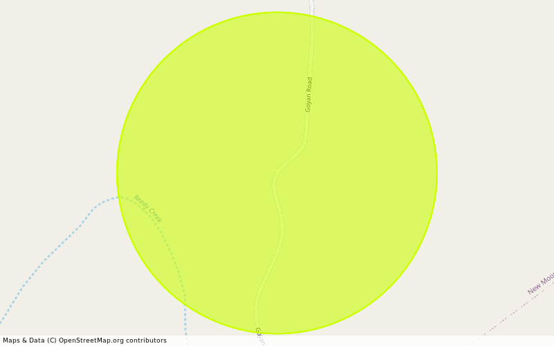
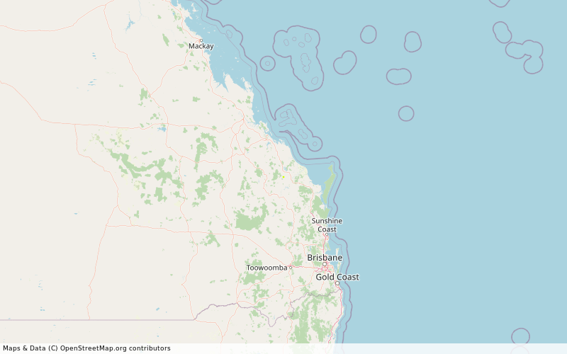
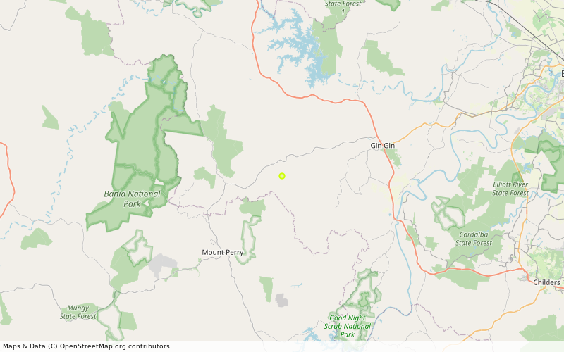
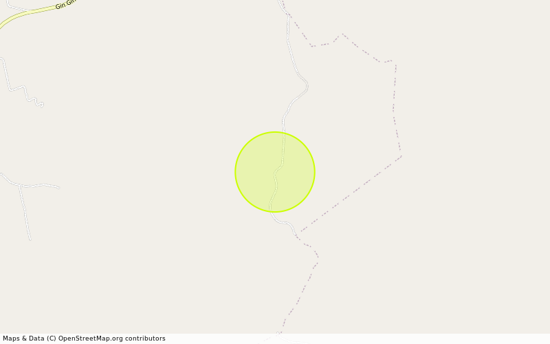
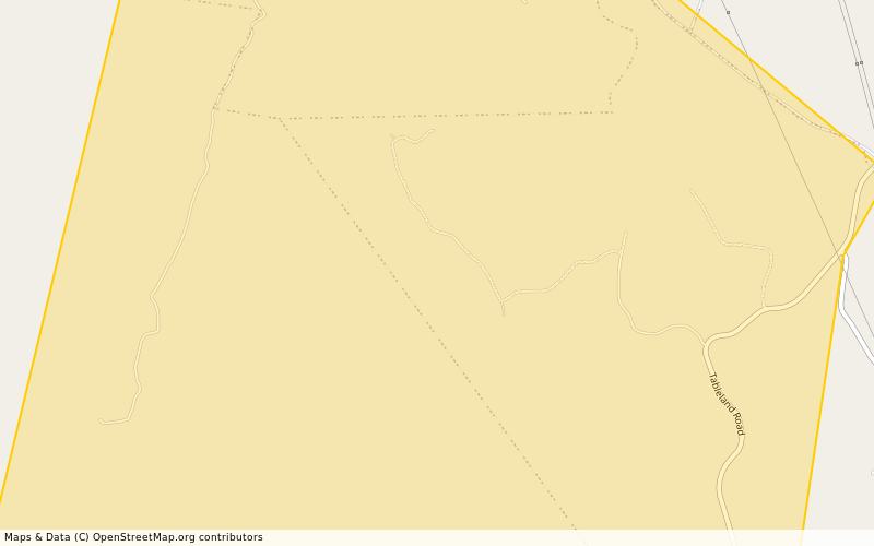
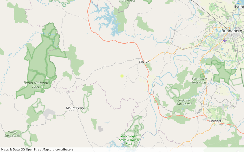
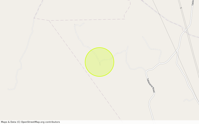
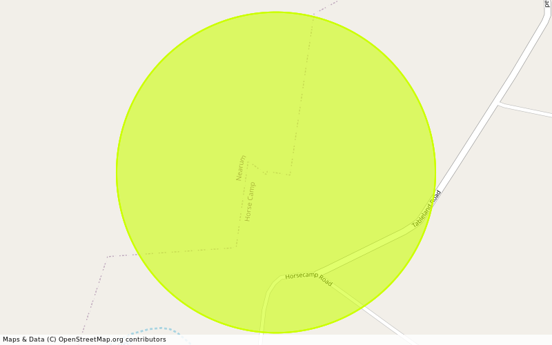
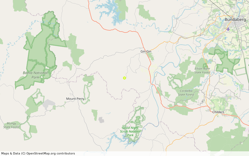
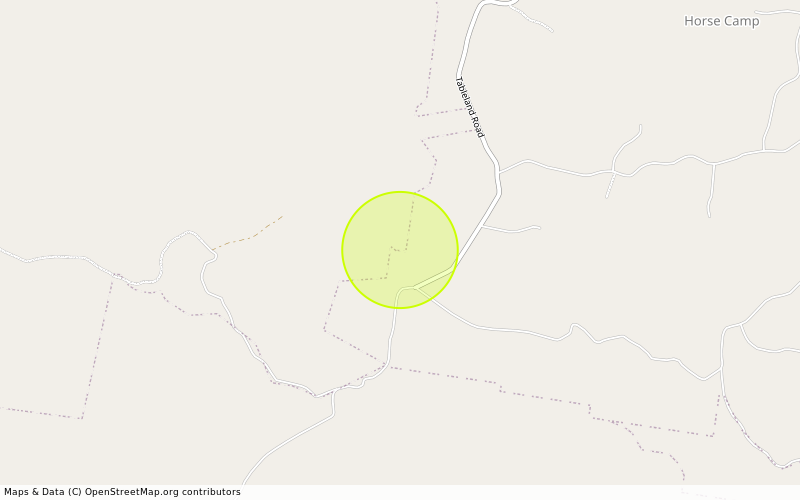
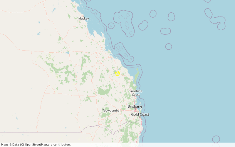
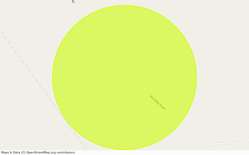
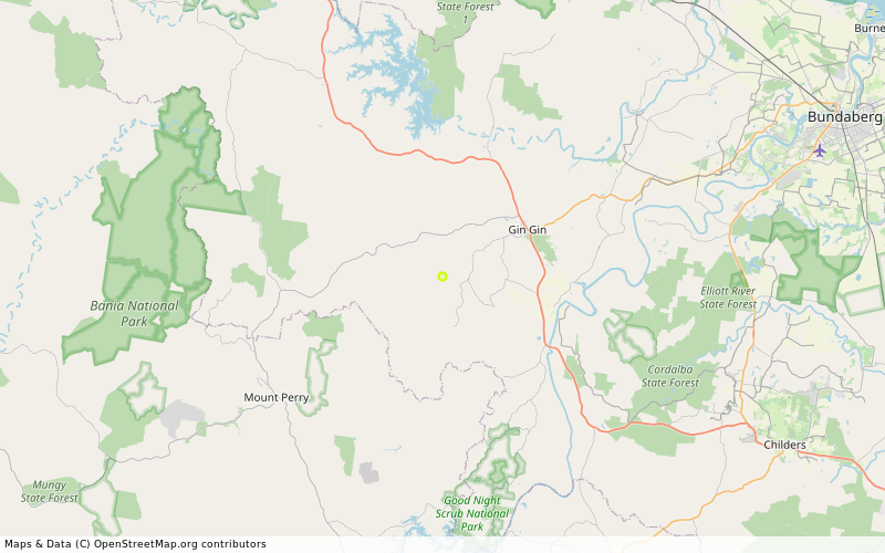
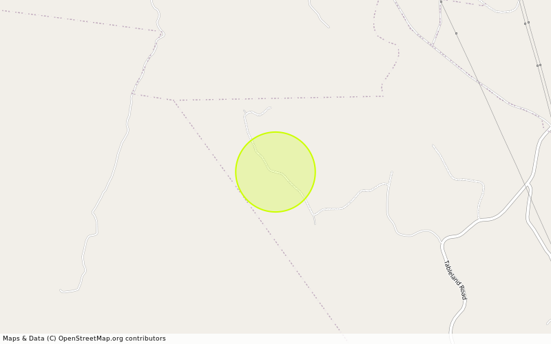
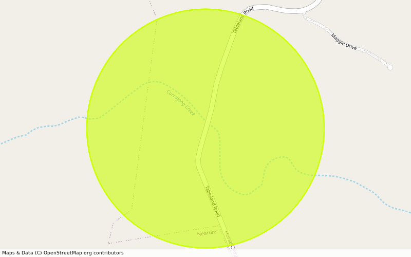
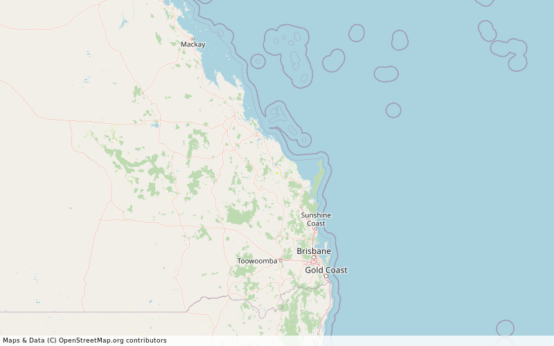
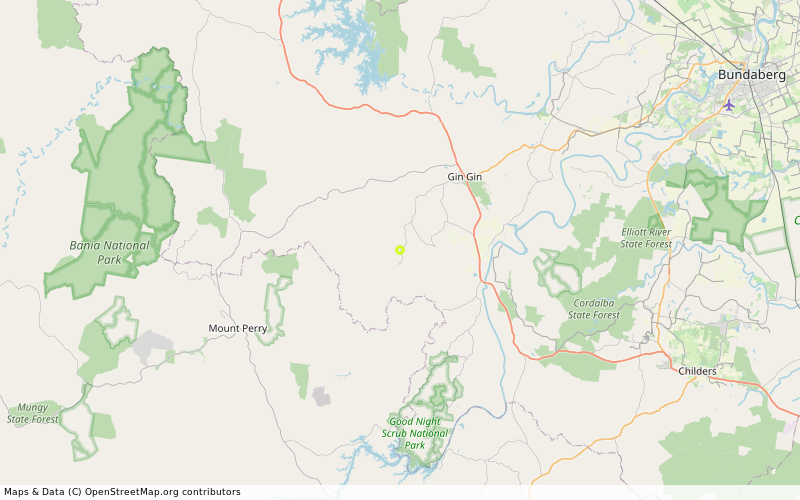
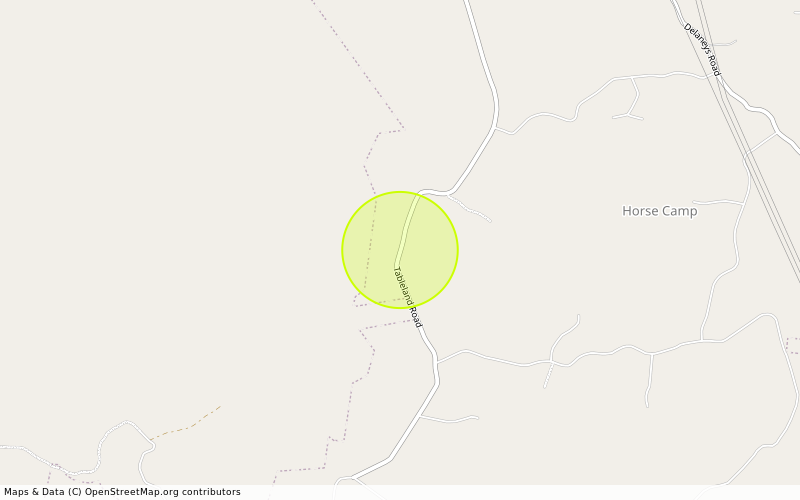
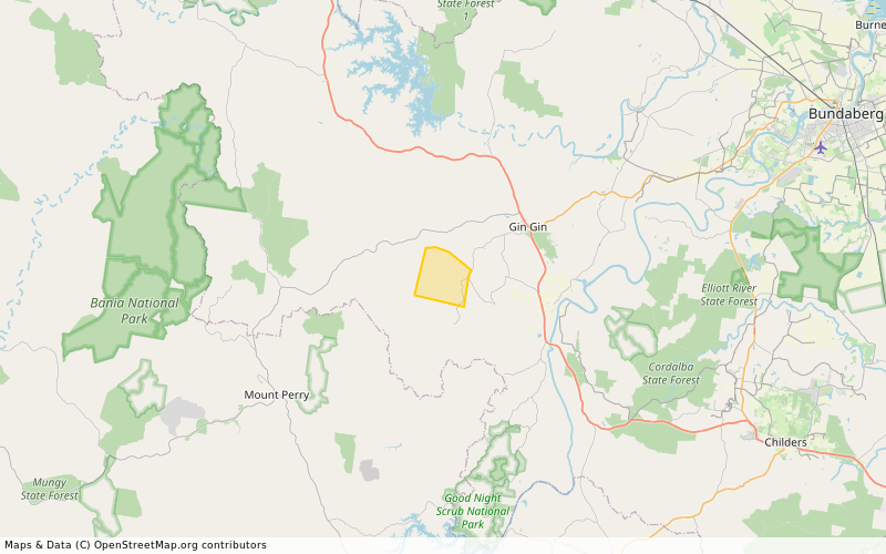
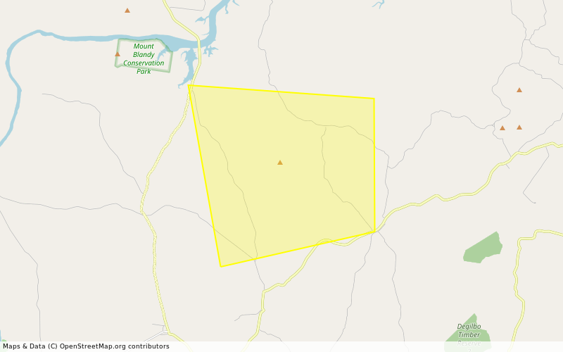
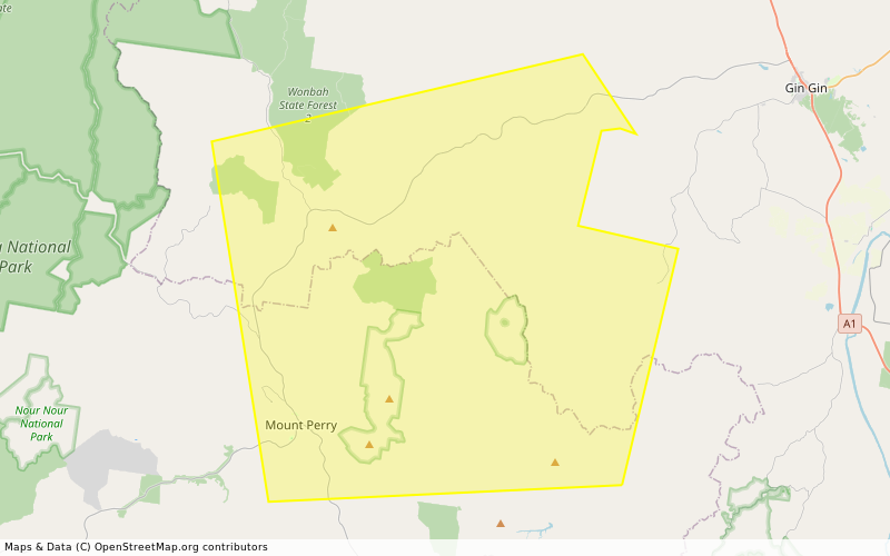
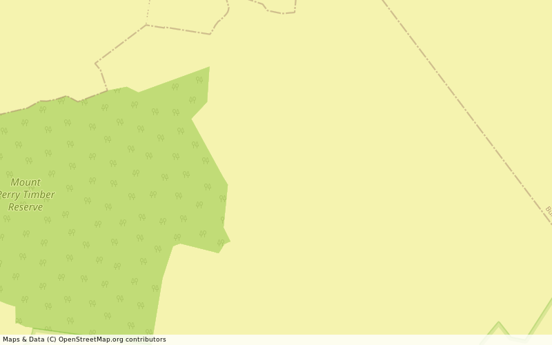
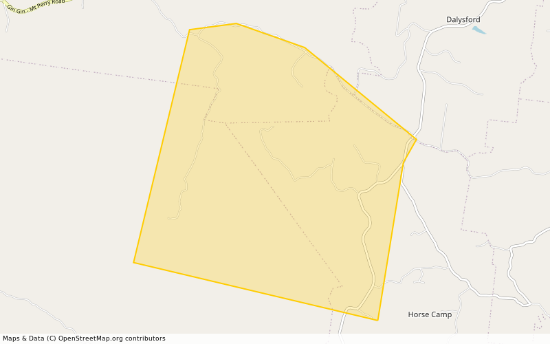
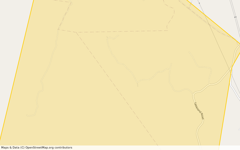
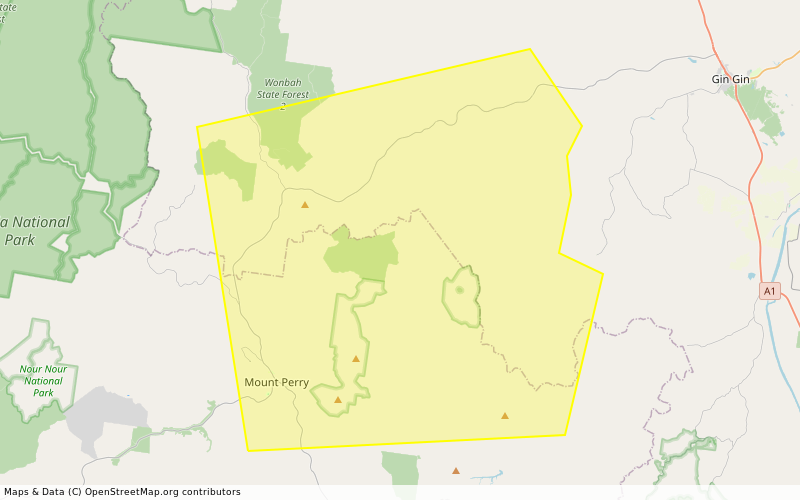
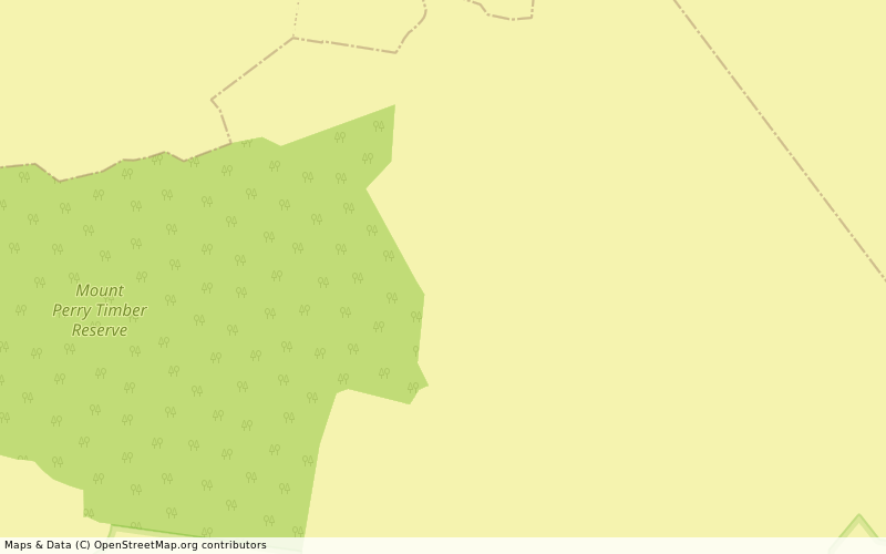
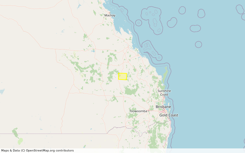
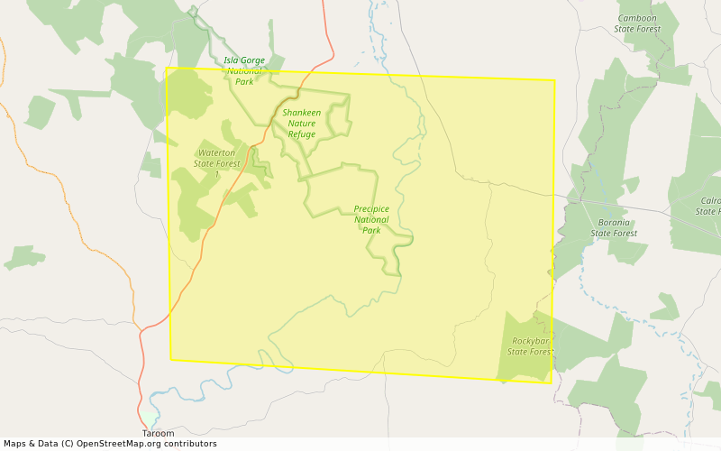
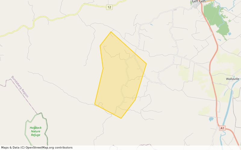
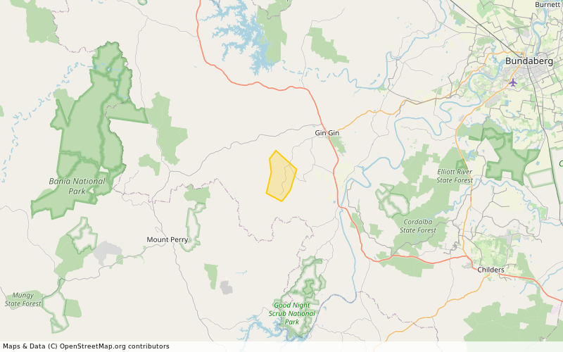
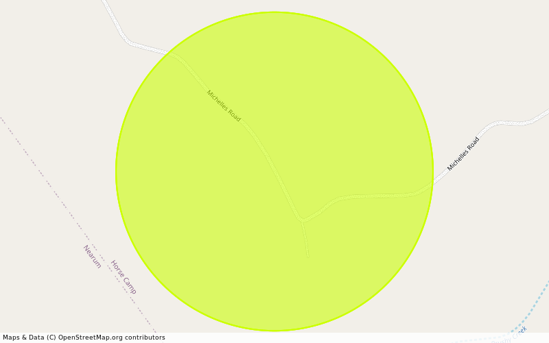
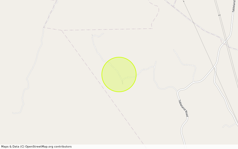
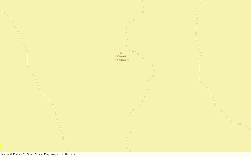
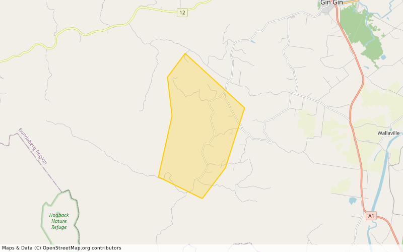
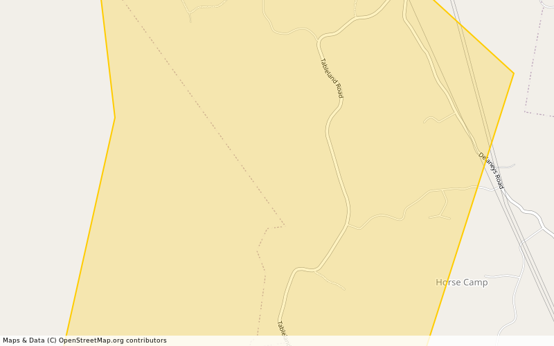
Location: NEW MOONTA -25.047584° latitude, 151.762355° longitude, grid square QG54VW18
Map: openstreetmap.org/#map=14/-25.
Incident Type: FIRE VEGETATION
Alert Level: Information
Severity: Minor
Action:
Expires: 2025-10-12T08:14:02+10:00

There is a vegetation fire at this location. Smoke may affect residents and motorists in the area. Residents should close their doors and windows and keep medication close by if suffering from a respiratory condition. Motorists should use caution and drive to conditions. If you believe your property is under threat, you should call Triple Zero (000) immediately.

- fire.qld.gov.au/Current-Incide ← Click here for current QFD incidents and warnings
- fire.qld.gov.au/prepare/bushfi ← Click here for bushfire preparation tips
- apps.des.qld.gov.au/air-qualit ← Click here for health advice and air quality information
- Follow QFD on facebook.com/qldfiredepartment ← Facebook and x.com/QldFireDept ← X.com
- qldtraffic.qld.gov.au ← Click here for road closure information or call 131940

- See help.abc.net.au/hc/en-us/artic for a listing of ABC Local Radio stations which may be broadcasting emergency information in your area. #NewMoontaQld #Information #FireVegetation #QG54

UNOFFICIAL Queensland fire botqldfire@longlandclan.id.au
2025-10-11

#StayInformed #FireVegetation #DoughboyQld #WonbahQld #QG54 #QLDFire #BushfireWarning. See fire.qld.gov.au/Current-Incide for official warnings from the QFD. DO NOT RELY ON THIS SERVICE FOR TIMELY EMERGENCY WARNINGS.

STAY INFORMED - Doughboy to Wonbah - Multiple Warnings - fire as at 6:07pm Saturday, 11 October 2025 (IF39-5042021)

Location: Doughboy, Wonbah, Mount Perry and surrounding areas. -25.125372338465° latitude, 151.73023942444° longitude, grid square QG54UU79
Map: openstreetmap.org/#map=14/-25.
Incident Type: FIRE VEGETATION
Alert Level: Advice
Severity: Moderate
Action:
Expires: 2025-10-12T18:00:00+10:00

*** There are multiple warnings for this area. To see all current warnings, visit the QFD Current Bushfires and Warnings website ***

A fire is burning at Doughboy and Nearum. ‎

- Stay informed because conditions could change:

- Check the QFD Current Bushfires and Warnings website regularly.

- Follow QFD on Facebook and X.com.

- Listen to your local radio station.

- Tell friends, family and neighbours in the area.

- Decide what you will do if the bushfire gets closer:

- Follow your bushfire survival plan now. If you do not have a bushfire survival plan, make one on the QFD website.

- Decide where you and the people you live with will go. This could be with family or a friend away from the fire.

- Keep medications close by.

- Avoid smoke - stay indoors, close windows and doors, and avoid driving through smoke.

- Watch out for firefighters working in the area.

- Do not fly drones around the fire. Drones affect air operations.

- If your life is in danger, call Triple Zero (000) immediately.
- fire.qld.gov.au/Current-Incide ← Click here for current QFD incidents and warnings
- fire.qld.gov.au/prepare/bushfi ← Click here for bushfire preparation tips
- apps.des.qld.gov.au/air-qualit ← Click here for health advice and air quality information
- Follow QFD on facebook.com/qldfiredepartment ← Facebook and x.com/QldFireDept ← X.com
- qldtraffic.qld.gov.au ← Click here for road closure information or call 131940

- See help.abc.net.au/hc/en-us/artic for a listing of ABC Local Radio stations which may be broadcasting emergency information in your area. #StayInformed #DoughboyQld #WonbahQld #Advice #FireVegetation #QG54

UNOFFICIAL Queensland fire botqldfire@longlandclan.id.au
2025-10-11

#PrepareToLeave #FireVegetation #HorsecampQld #NearumQld #QG54 #QLDFire #BushfireWarning. See fire.qld.gov.au/Current-Incide for official warnings from the QFD. DO NOT RELY ON THIS SERVICE FOR TIMELY EMERGENCY WARNINGS.

PREPARE TO LEAVE - Horsecamp and Nearum - Multiple Warnings - fire as at 6:07pm Saturday, 11 October 2025 (IF39-5041821)

Location: Between Moolboolman Road, Tableland Road and Grass Tree Road -25.052918826931° latitude, 151.85252105999° longitude, grid square QG54WW27
Map: openstreetmap.org/#map=14/-25.
Incident Type: FIRE VEGETATION
Alert Level: Watch and Act
Severity: Severe
Action:
Expires: 2025-10-12T18:00:00+10:00

*** There are multiple warnings for this area. To see all current warnings, visit the QFD Current Bushfires and Warnings website ***

A large, slow-moving fire is burning near Grass Tree Road, Michelles Road and Tableland Road. It is travelling towards Tableland Road, Grass Tree Road and Michelles Road.

Conditions could get worse quickly.

Firefighters are working to contain the fire. You should not expect a firefighter at your door.

If your life is in danger, call Triple Zero (000) immediately.

- If you have a bushfire survival plan, follow it now.

- Prepare now so you can leave quickly if the bushfire gets close:

- Decide where you and the people you live with will go. This could be with family or a friend away from the fire. Plan how you will get there. Tell others where you will go.

- Charge mobile phones and power banks.

- Be ready to take your pets, pet food, pet lead or crate/carrier.

- Pack a bag with a mobile phone charger, enough clothes for five days, important documents (like ID, insurance papers, passports and photos), medicine, cash and keys.

- If you do not drive, call your support service, a family member or a friend to organise transport if you need to leave or want to leave.

- If you find it hard to move quickly, leaving now is your safest option.

- Avoid driving on Nearum Road.

- Keep medications close by.

- Move flammable items away from your house if you can.

- Help others if it’s safe to do so.

- Watch out for firefighters working in the area.

- Do not fly drones around the fire. Drones affects air operations.

- Stay informed:

- Keep checking the QFD Current Bushfires and Warnings website.

- Follow QFD on Facebook and X.com.

- Listen to your local radio station.
- fire.qld.gov.au/Current-Incide ← Click here for current QFD incidents and warnings
- fire.qld.gov.au/prepare/bushfi ← Click here for bushfire preparation tips
- apps.des.qld.gov.au/air-qualit ← Click here for health advice and air quality information
- Follow QFD on facebook.com/qldfiredepartment ← Facebook and x.com/QldFireDept ← X.com
- qldtraffic.qld.gov.au ← Click here for road closure information or call 131940

- See help.abc.net.au/hc/en-us/artic for a listing of ABC Local Radio stations which may be broadcasting emergency information in your area. #PrepareToLeave #HorsecampQld #NearumQld #WatchAndAct #FireVegetation #QG54

UNOFFICIAL Queensland fire botqldfire@longlandclan.id.au
2025-10-11

#FireVegetation #HorseCampQld #QG54 #QLDFire #BushfireWarning. See fire.qld.gov.au/Current-Incide for official warnings from the QFD. DO NOT RELY ON THIS SERVICE FOR TIMELY EMERGENCY WARNINGS.

Information - HORSE CAMP (QF4-25-136603)

Location: HORSE CAMP -25.051479° latitude, 151.857628° longitude, grid square QG54WW27
Map: openstreetmap.org/#map=14/-25.
Incident Type: FIRE VEGETATION
Alert Level: Information
Severity: Minor
Action:
Expires: 2025-10-12T00:40:13+10:00

There is a vegetation fire at this location. Smoke may affect residents and motorists in the area. Residents should close their doors and windows and keep medication close by if suffering from a respiratory condition. Motorists should use caution and drive to conditions. If you believe your property is under threat, you should call Triple Zero (000) immediately.

- fire.qld.gov.au/Current-Incide ← Click here for current QFD incidents and warnings
- fire.qld.gov.au/prepare/bushfi ← Click here for bushfire preparation tips
- apps.des.qld.gov.au/air-qualit ← Click here for health advice and air quality information
- Follow QFD on facebook.com/qldfiredepartment ← Facebook and x.com/QldFireDept ← X.com
- qldtraffic.qld.gov.au ← Click here for road closure information or call 131940

- See help.abc.net.au/hc/en-us/artic for a listing of ABC Local Radio stations which may be broadcasting emergency information in your area. #HorseCampQld #Information #FireVegetation #QG54

UNOFFICIAL Queensland fire botqldfire@longlandclan.id.au
2025-10-11

#AvoidSmoke #FireVegetation #DidcotQld #BiggendenQld #QG54 #QLDFire #BushfireWarning. See fire.qld.gov.au/Current-Incide for official warnings from the QFD. DO NOT RELY ON THIS SERVICE FOR TIMELY EMERGENCY WARNINGS.

AVOID SMOKE - Didcot (near Biggenden) - fire as at 10:20am Saturday, 11 October 2025 (IF39-5024821)

Location: Between Mount Steadman Road, Gooroolba Biggenden Road and Wateranga Road -25.454043168485° latitude, 151.8220652535° longitude, grid square QG54VN81
Map: openstreetmap.org/#map=14/-25.
Incident Type: FIRE VEGETATION
Alert Level: Advice
Severity: Moderate
Action:
Expires: 2025-10-12T10:16:00+10:00

Smoke is currently affecting Between Mount Steadman Road, Gooroolba Biggenden Road and Wateranga Road. This is from a fire burning near Mount Steadman Road and Spring Creek Road.

- Stay inside and close windows and doors.

- Keep respiratory medication close by.

- Follow your bushfire survival plan now. If you do not have a bushfire survival plan, make one on the QFD website.

- Avoid driving through smoke if you can.

- Watch out for firefighters working in the area.

- Do not fly drones around the fire. Drones affect air operations.
- fire.qld.gov.au/Current-Incide ← Click here for current QFD incidents and warnings
- fire.qld.gov.au/prepare/bushfi ← Click here for bushfire preparation tips
- apps.des.qld.gov.au/air-qualit ← Click here for health advice and air quality information
- Follow QFD on facebook.com/qldfiredepartment ← Facebook and x.com/QldFireDept ← X.com
- qldtraffic.qld.gov.au ← Click here for road closure information or call 131940

- See help.abc.net.au/hc/en-us/artic for a listing of ABC Local Radio stations which may be broadcasting emergency information in your area. #AvoidSmoke #DidcotQld #BiggendenQld #Advice #FireVegetation #QG54

UNOFFICIAL Queensland fire botqldfire@longlandclan.id.au
2025-10-10

#FireVegetation #HorseCampQld #QG54 #QLDFire #BushfireWarning. See fire.qld.gov.au/Current-Incide for official warnings from the QFD. DO NOT RELY ON THIS SERVICE FOR TIMELY EMERGENCY WARNINGS.

Information - HORSE CAMP (QF4-25-136568)

Location: HORSE CAMP -25.09958° latitude, 151.863836° longitude, grid square QG54WV36
Map: openstreetmap.org/#map=14/-25.
Incident Type: FIRE VEGETATION
Alert Level: Information
Severity: Minor
Action:
Expires: 2025-10-11T23:27:31+10:00

There is a vegetation fire at this location. Smoke may affect residents and motorists in the area. Residents should close their doors and windows and keep medication close by if suffering from a respiratory condition. Motorists should use caution and drive to conditions. If you believe your property is under threat, you should call Triple Zero (000) immediately.

- fire.qld.gov.au/Current-Incide ← Click here for current QFD incidents and warnings
- fire.qld.gov.au/prepare/bushfi ← Click here for bushfire preparation tips
- apps.des.qld.gov.au/air-qualit ← Click here for health advice and air quality information
- Follow QFD on facebook.com/qldfiredepartment ← Facebook and x.com/QldFireDept ← X.com
- qldtraffic.qld.gov.au ← Click here for road closure information or call 131940

- See help.abc.net.au/hc/en-us/artic for a listing of ABC Local Radio stations which may be broadcasting emergency information in your area. #HorseCampQld #Information #FireVegetation #QG54

UNOFFICIAL Queensland fire botqldfire@longlandclan.id.au
2025-10-10

#StayInformed #FireVegetation #DoughboyQld #WonbahQld #QG54 #QLDFire #BushfireWarning. See fire.qld.gov.au/Current-Incide for official warnings from the QFD. DO NOT RELY ON THIS SERVICE FOR TIMELY EMERGENCY WARNINGS.

STAY INFORMED - Doughboy to Wonbah - Multiple Warnings - fire as at 9:20am Saturday, 11 October 2025 (IF39-5024221)

Location: Doughboy, Wonbah, Mount Perry and surrounding areas. -25.119777129041° latitude, 151.73301819298° longitude, grid square QG54UV71
Map: openstreetmap.org/#map=14/-25.
Incident Type: FIRE VEGETATION
Alert Level: Advice
Severity: Moderate
Action:
Expires: 2025-10-12T09:05:00+10:00

*** There are multiple warnings for this area. To see all current warnings, visit the QFD Current Bushfires and Warnings website ***

A fire is burning at Doughboy and Nearum. ‎

Firefighting aircraft are helping ground crews.

- Stay informed because conditions could change:

- Check the QFD Current Bushfires and Warnings website regularly.

- Follow QFD on Facebook and X.com.

- Listen to your local radio station.

- Tell friends, family and neighbours in the area.

- Decide what you will do if the bushfire gets closer:

- Follow your bushfire survival plan now. If you do not have a bushfire survival plan, make one on the QFD website.

- Decide where you and the people you live with will go. This could be with family or a friend away from the fire.

- Keep medications close by.

- Avoid smoke - stay indoors, close windows and doors, and avoid driving through smoke.

- Watch out for firefighters working in the area.

- Do not fly drones around the fire. Drones affect air operations.

- If your life is in danger, call Triple Zero (000) immediately.
- fire.qld.gov.au/Current-Incide ← Click here for current QFD incidents and warnings
- fire.qld.gov.au/prepare/bushfi ← Click here for bushfire preparation tips
- apps.des.qld.gov.au/air-qualit ← Click here for health advice and air quality information
- Follow QFD on facebook.com/qldfiredepartment ← Facebook and x.com/QldFireDept ← X.com
- qldtraffic.qld.gov.au ← Click here for road closure information or call 131940

- See help.abc.net.au/hc/en-us/artic for a listing of ABC Local Radio stations which may be broadcasting emergency information in your area. #StayInformed #DoughboyQld #WonbahQld #Advice #FireVegetation #QG54

UNOFFICIAL Queensland fire botqldfire@longlandclan.id.au
2025-10-10

#PrepareToLeave #FireVegetation #HorsecampQld #DoughboyQld #QG54 #QLDFire #BushfireWarning. See fire.qld.gov.au/Current-Incide for official warnings from the QFD. DO NOT RELY ON THIS SERVICE FOR TIMELY EMERGENCY WARNINGS.

PREPARE TO LEAVE - Horsecamp and Doughboy - Multiple Warnings - fire as at 9:20am Saturday, 11 October 2025 (IF39-5024021)

Location: Between Moolboolman Road, Tableland Road and Grass Tree Road -25.053540869238° latitude, 151.85523277331° longitude, grid square QG54WW27
Map: openstreetmap.org/#map=14/-25.
Incident Type: FIRE VEGETATION
Alert Level: Watch and Act
Severity: Severe
Action:
Expires: 2025-10-12T09:04:00+10:00

*** There are multiple warnings for this area. To see all current warnings, visit the QFD Current Bushfires and Warnings website ***

A large, slow-moving fire is burning near Grass Tree Road, Michelles Road and Tableland Road. It is travelling towards Tableland Road, Grass Tree Road and Michelles Road.

Conditions could get worse quickly.

Firefighters are working to contain the fire. You should not expect a firefighter at your door. Firefighting aircraft are helping ground crews.

If your life is in danger, call Triple Zero (000) immediately.

- If you have a bushfire survival plan, follow it now.

- Prepare now so you can leave quickly if the bushfire gets close:

- Decide where you and the people you live with will go. This could be with family or a friend away from the fire. Plan how you will get there. Tell others where you will go.

- Charge mobile phones and power banks.

- Be ready to take your pets, pet food, pet lead or crate/carrier.

- Pack a bag with a mobile phone charger, enough clothes for five days, important documents (like ID, insurance papers, passports and photos), medicine, cash and keys.

- If you do not drive, call your support service, a family member or a friend to organise transport if you need to leave or want to leave.

- If you find it hard to move quickly, leaving now is your safest option.

- Avoid driving on Nearum Road.

- Keep medications close by.

- Move flammable items away from your house if you can.

- Help others if it’s safe to do so.

- Watch out for firefighters working in the area.

- Do not fly drones around the fire. Drones affects air operations.

- Stay informed:

- Keep checking the QFD Current Bushfires and Warnings website.

- Follow QFD on Facebook and X.com.

- Listen to your local radio station.
- fire.qld.gov.au/Current-Incide ← Click here for current QFD incidents and warnings
- fire.qld.gov.au/prepare/bushfi ← Click here for bushfire preparation tips
- apps.des.qld.gov.au/air-qualit ← Click here for health advice and air quality information
- Follow QFD on facebook.com/qldfiredepartment ← Facebook and x.com/QldFireDept ← X.com
- qldtraffic.qld.gov.au ← Click here for road closure information or call 131940

- See help.abc.net.au/hc/en-us/artic for a listing of ABC Local Radio stations which may be broadcasting emergency information in your area. #PrepareToLeave #HorsecampQld #DoughboyQld #WatchAndAct #FireVegetation #QG54

UNOFFICIAL Queensland fire botqldfire@longlandclan.id.au
2025-10-10

#FireVegetation #HorseCampQld #QG54 #QLDFire #BushfireWarning. See fire.qld.gov.au/Current-Incide for official warnings from the QFD. DO NOT RELY ON THIS SERVICE FOR TIMELY EMERGENCY WARNINGS.

Information - HORSE CAMP (QF4-25-136555)

Location: HORSE CAMP -25.046647° latitude, 151.852895° longitude, grid square QG54WW28
Map: openstreetmap.org/#map=14/-25.
Incident Type: FIRE VEGETATION
Alert Level: Information
Severity: Minor
Action:
Expires: 2025-10-11T22:38:51+10:00

There is a vegetation fire at this location. Smoke may affect residents and motorists in the area. Residents should close their doors and windows and keep medication close by if suffering from a respiratory condition. Motorists should use caution and drive to conditions. If you believe your property is under threat, you should call Triple Zero (000) immediately.

- fire.qld.gov.au/Current-Incide ← Click here for current QFD incidents and warnings
- fire.qld.gov.au/prepare/bushfi ← Click here for bushfire preparation tips
- apps.des.qld.gov.au/air-qualit ← Click here for health advice and air quality information
- Follow QFD on facebook.com/qldfiredepartment ← Facebook and x.com/QldFireDept ← X.com
- qldtraffic.qld.gov.au ← Click here for road closure information or call 131940

- See help.abc.net.au/hc/en-us/artic for a listing of ABC Local Radio stations which may be broadcasting emergency information in your area. #HorseCampQld #Information #FireVegetation #QG54

UNOFFICIAL Queensland fire botqldfire@longlandclan.id.au
2025-10-10

#FireVegetation #HorseCampQld #QG54 #QLDFire #BushfireWarning. See fire.qld.gov.au/Current-Incide for official warnings from the QFD. DO NOT RELY ON THIS SERVICE FOR TIMELY EMERGENCY WARNINGS.

Information - HORSE CAMP (QF4-25-136287)

Location: HORSE CAMP -25.08482° latitude, 151.869112° longitude, grid square QG54WV49
Map: openstreetmap.org/#map=14/-25.
Incident Type: FIRE VEGETATION
Alert Level: Information
Severity: Minor
Action:
Expires: 2025-10-11T07:26:51+10:00

There is a vegetation fire at this location. Smoke may affect residents and motorists in the area. Residents should close their doors and windows and keep medication close by if suffering from a respiratory condition. Motorists should use caution and drive to conditions. If you believe your property is under threat, you should call Triple Zero (000) immediately.

- fire.qld.gov.au/Current-Incide ← Click here for current QFD incidents and warnings
- fire.qld.gov.au/prepare/bushfi ← Click here for bushfire preparation tips
- apps.des.qld.gov.au/air-qualit ← Click here for health advice and air quality information
- Follow QFD on facebook.com/qldfiredepartment ← Facebook and x.com/QldFireDept ← X.com
- qldtraffic.qld.gov.au ← Click here for road closure information or call 131940

- See help.abc.net.au/hc/en-us/artic for a listing of ABC Local Radio stations which may be broadcasting emergency information in your area. #HorseCampQld #Information #FireVegetation #QG54

UNOFFICIAL Queensland fire botqldfire@longlandclan.id.au
2025-10-10

#PrepareToLeave #FireVegetation #HorsecampQld #DoughboyQld #QG54 #QLDFire #BushfireWarning. See fire.qld.gov.au/Current-Incide for official warnings from the QFD. DO NOT RELY ON THIS SERVICE FOR TIMELY EMERGENCY WARNINGS.

PREPARE TO LEAVE - Horsecamp and Doughboy - Multiple Warnings - fire as at 5:17pm Friday, 10 October 2025 (IF39-5020721)

Location: Between Moolboolman Road, Tableland Road and Grass Tree Road -25.052607804595° latitude, 151.85391044427° longitude, grid square QG54WW27
Map: openstreetmap.org/#map=14/-25.
Incident Type: FIRE VEGETATION
Alert Level: Watch and Act
Severity: Severe
Action:
Expires: 2025-10-11T17:15:00+10:00

*** There are multiple warnings for this area. To see all current warnings, visit the QFD Current Bushfires and Warnings website ***

A large, slow-moving fire is burning near Michelles Road and Tableland Road. It is travelling towards Tableland Road, Grasstree Road and Michelles Road.

Conditions could get worse quickly.

Firefighters are working to contain the fire. You should not expect a firefighter at your door.

If your life is in danger, call Triple Zero (000) immediately.

- If you have a bushfire survival plan, follow it now.

- Prepare now so you can leave quickly if the bushfire gets close:

- Decide where you and the people you live with will go. This could be with family or a friend away from the fire. Plan how you will get there. Tell others where you will go.

- Charge mobile phones and power banks.

- Be ready to take your pets, pet food, pet lead or crate/carrier.

- Pack a bag with a mobile phone charger, enough clothes for five days, important documents (like ID, insurance papers, passports and photos), medicine, cash and keys.

- If you do not drive, call your support service, a family member or a friend to organise transport if you need to leave or want to leave.

- If you find it hard to move quickly, leaving now is your safest option.

- Avoid driving on Nearum Road.

- Keep medications close by.

- Move flammable items away from your house if you can.

- Help others if it’s safe to do so.

- Watch out for firefighters working in the area.

- Do not fly drones around the fire. Drones affects air operations.

- Stay informed:

- Keep checking the QFD Current Bushfires and Warnings website.

- Follow QFD on Facebook and X.com.

- Listen to your local radio station.
- fire.qld.gov.au/Current-Incide ← Click here for current QFD incidents and warnings
- fire.qld.gov.au/prepare/bushfi ← Click here for bushfire preparation tips
- apps.des.qld.gov.au/air-qualit ← Click here for health advice and air quality information
- Follow QFD on facebook.com/qldfiredepartment ← Facebook and x.com/QldFireDept ← X.com
- qldtraffic.qld.gov.au ← Click here for road closure information or call 131940

- See help.abc.net.au/hc/en-us/artic for a listing of ABC Local Radio stations which may be broadcasting emergency information in your area. #PrepareToLeave #HorsecampQld #DoughboyQld #WatchAndAct #FireVegetation #QG54

UNOFFICIAL Queensland fire botqldfire@longlandclan.id.au
2025-10-10

#AvoidSmoke #FireVegetation #DidcotQld #BiggendenQld #QG54 #QLDFire #BushfireWarning. See fire.qld.gov.au/Current-Incide for official warnings from the QFD. DO NOT RELY ON THIS SERVICE FOR TIMELY EMERGENCY WARNINGS.

AVOID SMOKE - Didcot (near Biggenden) - fire as at 4:45pm Friday, 10 October 2025 (IF39-5019021)

Location: Between Mount Steadman Road, Gooroolba Biggenden Road and Wateranga Road -25.454430663511° latitude, 151.82022794033° longitude, grid square QG54VN80
Map: openstreetmap.org/#map=14/-25.
Incident Type: FIRE VEGETATION
Alert Level: Advice
Severity: Moderate
Action:
Expires: 2025-10-11T16:45:00+10:00

Smoke is currently affecting Between Mount Steadman Road, Gooroolba Biggenden Road and Wateranga Road. This is from a fire burning near Mount Steadman Road and Spring Creek Road.

- Stay inside and close windows and doors.

- Keep respiratory medication close by.

- Follow your bushfire survival plan now. If you do not have a bushfire survival plan, make one on the QFD website.

- Avoid driving through smoke if you can.

- Watch out for firefighters working in the area.

- Do not fly drones around the fire. Drones affect air operations.
- fire.qld.gov.au/Current-Incide ← Click here for current QFD incidents and warnings
- fire.qld.gov.au/prepare/bushfi ← Click here for bushfire preparation tips
- apps.des.qld.gov.au/air-qualit ← Click here for health advice and air quality information
- Follow QFD on facebook.com/qldfiredepartment ← Facebook and x.com/QldFireDept ← X.com
- qldtraffic.qld.gov.au ← Click here for road closure information or call 131940

- See help.abc.net.au/hc/en-us/artic for a listing of ABC Local Radio stations which may be broadcasting emergency information in your area. #AvoidSmoke #DidcotQld #BiggendenQld #Advice #FireVegetation #QG54

UNOFFICIAL Queensland fire botqldfire@longlandclan.id.au
2025-10-10

#StayInformed #FireVegetation #DoughboyQld #WonbahQld #QG54 #QLDFire #BushfireWarning. See fire.qld.gov.au/Current-Incide for official warnings from the QFD. DO NOT RELY ON THIS SERVICE FOR TIMELY EMERGENCY WARNINGS.

STAY INFORMED - Doughboy to Wonbah - Multiple Warnings - fire as at 2:46pm Friday, 10 October 2025 (IF39-5015121)

Location: Doughboy, Wonbah, Mount Perry and surrounding areas. -25.093429575867° latitude, 151.7267359765° longitude, grid square QG54UV77
Map: openstreetmap.org/#map=14/-25.
Incident Type: FIRE VEGETATION
Alert Level: Advice
Severity: Moderate
Action:
Expires: 2025-10-11T14:43:00+10:00

*** There are multiple warnings for this area. To see all current warnings, visit the QFD Current Bushfires and Warnings website ***

A fire is burning at Doughboy and Nearum. ‎

Firefighting aircraft are helping ground crews.

- Stay informed because conditions could change:

- Check the QFD Current Bushfires and Warnings website regularly.

- Follow QFD on Facebook and X.com.

- Listen to your local radio station.

- Tell friends, family and neighbours in the area.

- Decide what you will do if the bushfire gets closer:

- Follow your bushfire survival plan now. If you do not have a bushfire survival plan, make one on the QFD website.

- Decide where you and the people you live with will go. This could be with family or a friend away from the fire.

- Keep medications close by.

- Avoid smoke - stay indoors, close windows and doors, and avoid driving through smoke.

- Watch out for firefighters working in the area.

- Do not fly drones around the fire. Drones affect air operations.

- If your life is in danger, call Triple Zero (000) immediately.
- fire.qld.gov.au/Current-Incide ← Click here for current QFD incidents and warnings
- fire.qld.gov.au/prepare/bushfi ← Click here for bushfire preparation tips
- apps.des.qld.gov.au/air-qualit ← Click here for health advice and air quality information
- Follow QFD on facebook.com/qldfiredepartment ← Facebook and x.com/QldFireDept ← X.com
- qldtraffic.qld.gov.au ← Click here for road closure information or call 131940

- See help.abc.net.au/hc/en-us/artic for a listing of ABC Local Radio stations which may be broadcasting emergency information in your area. #StayInformed #DoughboyQld #WonbahQld #Advice #FireVegetation #QG54

UNOFFICIAL Queensland fire botqldfire@longlandclan.id.au
2025-10-10

#PrepareToLeave #FireVegetation #HorsecampQld #DoughboyQld #QG54 #QLDFire #BushfireWarning. See fire.qld.gov.au/Current-Incide for official warnings from the QFD. DO NOT RELY ON THIS SERVICE FOR TIMELY EMERGENCY WARNINGS.

PREPARE TO LEAVE - Horsecamp and Doughboy - Multiple Warnings - fire as at 2:45pm Friday, 10 October 2025 (IF39-5014221)

Location: Between Moolboolman Road, Tableland Road and Grass Tree Road -25.051383146473° latitude, 151.85194438506° longitude, grid square QG54WW27
Map: openstreetmap.org/#map=14/-25.
Incident Type: FIRE VEGETATION
Alert Level: Watch and Act
Severity: Severe
Action:
Expires: 2025-10-11T14:42:00+10:00

*** There are multiple warnings for this area. To see all current warnings, visit the QFD Current Bushfires and Warnings website ***

A large, slow-moving fire is burning near Michelles Road and Tableland Road. It is travelling towards Tableland Road, Grass Tree Road and Michelles Road.

Conditions could get worse quickly.

Firefighters are working to contain the fire. You should not expect a firefighter at your door. Firefighting aircraft are helping ground crews.

If your life is in danger, call Triple Zero (000) immediately.

- If you have a bushfire survival plan, follow it now.

- Prepare now so you can leave quickly if the bushfire gets close:

- Decide where you and the people you live with will go. This could be with family or a friend away from the fire. Plan how you will get there. Tell others where you will go.

- Charge mobile phones and power banks.

- Be ready to take your pets, pet food, pet lead or crate/carrier.

- Pack a bag with a mobile phone charger, enough clothes for five days, important documents (like ID, insurance papers, passports and photos), medicine, cash and keys.

- If you do not drive, call your support service, a family member or a friend to organise transport if you need to leave or want to leave.

- If you find it hard to move quickly, leaving now is your safest option.

- Avoid driving on Nearum Road.

- Keep medications close by.

- Move flammable items away from your house if you can.

- Help others if it’s safe to do so.

- Watch out for firefighters working in the area.

- Do not fly drones around the fire. Drones affects air operations.

- Stay informed:

- Keep checking the QFD Current Bushfires and Warnings website.

- Follow QFD on Facebook and X.com.

- Listen to your local radio station.
- fire.qld.gov.au/Current-Incide ← Click here for current QFD incidents and warnings
- fire.qld.gov.au/prepare/bushfi ← Click here for bushfire preparation tips
- apps.des.qld.gov.au/air-qualit ← Click here for health advice and air quality information
- Follow QFD on facebook.com/qldfiredepartment ← Facebook and x.com/QldFireDept ← X.com
- qldtraffic.qld.gov.au ← Click here for road closure information or call 131940

- See help.abc.net.au/hc/en-us/artic for a listing of ABC Local Radio stations which may be broadcasting emergency information in your area. #PrepareToLeave #HorsecampQld #DoughboyQld #WatchAndAct #FireVegetation #QG54

UNOFFICIAL Queensland fire botqldfire@longlandclan.id.au
2025-10-10

#StayInformed #FireVegetation #DoughboyQld #WonbahQld #QG54 #QLDFire #BushfireWarning. See fire.qld.gov.au/Current-Incide for official warnings from the QFD. DO NOT RELY ON THIS SERVICE FOR TIMELY EMERGENCY WARNINGS.

STAY INFORMED - Doughboy to Wonbah - Multiple Warnings - fire as at 10:24am Friday, 10 October 2025 (IF39-5008921)

Location: Doughboy, Wonbah, Mount Perry and surrounding areas. -25.124595241368° latitude, 151.73311963396° longitude, grid square QG54UV70
Map: openstreetmap.org/#map=14/-25.
Incident Type: FIRE VEGETATION
Alert Level: Advice
Severity: Moderate
Action:
Expires: 2025-10-11T10:24:00+10:00

*** There are multiple warnings for this area. To see all current warnings, visit the QFD Current Bushfires and Warnings website ***

A fire is burning at Doughboy and Nearum. ‎

Firefighting aircraft are helping ground crews.

- Stay informed because conditions could change:

- Check the QFD Current Bushfires and Warnings website regularly.

- Follow QFD on Facebook and X.com.

- Listen to your local radio station.

- Tell friends, family and neighbours in the area.

- Decide what you will do if the bushfire gets closer:

- Follow your bushfire survival plan now. If you do not have a bushfire survival plan, make one on the QFD website.

- Decide where you and the people you live with will go. This could be with family or a friend away from the fire.

- Keep medications close by.

- Avoid smoke - stay indoors, close windows and doors, and avoid driving through smoke.

- Watch out for firefighters working in the area.

- Do not fly drones around the fire. Drones affect air operations.

- If your life is in danger, call Triple Zero (000) immediately.
- fire.qld.gov.au/Current-Incide ← Click here for current QFD incidents and warnings
- fire.qld.gov.au/prepare/bushfi ← Click here for bushfire preparation tips
- apps.des.qld.gov.au/air-qualit ← Click here for health advice and air quality information
- Follow QFD on facebook.com/qldfiredepartment ← Facebook and x.com/QldFireDept ← X.com
- qldtraffic.qld.gov.au ← Click here for road closure information or call 131940

- See help.abc.net.au/hc/en-us/artic for a listing of ABC Local Radio stations which may be broadcasting emergency information in your area. #StayInformed #DoughboyQld #WonbahQld #Advice #FireVegetation #QG54

UNOFFICIAL Queensland fire botqldfire@longlandclan.id.au
2025-10-10

#AvoidSmoke #FireVegetation #SpringCreekQld #TheodoreQld #QG54 #QLDFire #BushfireWarning. See fire.qld.gov.au/Current-Incide for official warnings from the QFD. DO NOT RELY ON THIS SERVICE FOR TIMELY EMERGENCY WARNINGS.

AVOID SMOKE - Spring Creek (near Theodore) - fire as at 10:19am Friday, 10 October 2025 (IF39-5010421)

Location: Spring Creek -25.371704948302° latitude, 150.10742698623° longitude, grid square QG54BP20
Map: openstreetmap.org/#map=14/-25.
Incident Type: FIRE VEGETATION
Alert Level: Advice
Severity: Moderate
Action:
Expires: 2025-10-11T10:13:00+10:00

Smoke is currently affecting Spring Creek. This is from a fire burning near Dawson River.

- Stay inside and close windows and doors.

- Keep respiratory medication close by.

- Follow your bushfire survival plan now. If you do not have a bushfire survival plan, make one on the QFD website.

- Avoid driving through smoke if you can.

- Watch out for firefighters working in the area.

- Do not fly drones around the fire. Drones affect air operations.
- fire.qld.gov.au/Current-Incide ← Click here for current QFD incidents and warnings
- fire.qld.gov.au/prepare/bushfi ← Click here for bushfire preparation tips
- apps.des.qld.gov.au/air-qualit ← Click here for health advice and air quality information
- Follow QFD on facebook.com/qldfiredepartment ← Facebook and x.com/QldFireDept ← X.com
- qldtraffic.qld.gov.au ← Click here for road closure information or call 131940

- See help.abc.net.au/hc/en-us/artic for a listing of ABC Local Radio stations which may be broadcasting emergency information in your area. #AvoidSmoke #SpringCreekQld #TheodoreQld #Advice #FireVegetation #QG54

UNOFFICIAL Queensland fire botqldfire@longlandclan.id.au
2025-10-09

#PrepareToLeave #FireVegetation #HorsecampQld #DoughboyQld #QG54 #QLDFire #BushfireWarning. See fire.qld.gov.au/Current-Incide for official warnings from the QFD. DO NOT RELY ON THIS SERVICE FOR TIMELY EMERGENCY WARNINGS.

PREPARE TO LEAVE - Horsecamp and Doughboy - Multiple Warnings - fire as at 9:37am Friday, 10 October 2025 (IF39-5008821)

Location: Between Tableland Road, Nearum Road, Grass Tree Road, Michelles Road and Doughboy Road -25.074366459685° latitude, 151.86967646886° longitude, grid square QG54WW42
Map: openstreetmap.org/#map=14/-25.
Incident Type: FIRE VEGETATION
Alert Level: Watch and Act
Severity: Severe
Action:
Expires: 2025-10-11T09:31:00+10:00

*** There are multiple warnings for this area. To see all current warnings, visit the QFD Current Bushfires and Warnings website ***

A large, slow-moving fire is burning near Michelles Road and Tableland Road. It is travelling towards Tableland Road, Grasstree Road, Michelles Road and Doughboy Road.

Conditions could get worse quickly.

Firefighters are working to contain the fire. You should not expect a firefighter at your door. Firefighting aircraft are helping ground crews.

If your life is in danger, call Triple Zero (000) immediately.

- If you have a bushfire survival plan, follow it now.

- Prepare now so you can leave quickly if the bushfire gets close:

- Decide where you and the people you live with will go. This could be with family or a friend away from the fire. Plan how you will get there. Tell others where you will go.

- Charge mobile phones and power banks.

- Be ready to take your pets, pet food, pet lead or crate/carrier.

- Pack a bag with a mobile phone charger, enough clothes for five days, important documents (like ID, insurance papers, passports and photos), medicine, cash and keys.

- If you do not drive, call your support service, a family member or a friend to organise transport if you need to leave or want to leave.

- If you find it hard to move quickly, leaving now is your safest option.

- Avoid driving on Nearum Road.

- Keep medications close by.

- Move flammable items away from your house if you can.

- Help others if it's safe to do so.

- Watch out for firefighters working in the area.

- Do not fly drones around the fire. Drones affect air operations.

- Stay informed:
- Keep checking the QFD Current Bushfires and Warnings website.
- Follow QFD on Facebook and X.com.
- Listen to your local radio station.
- fire.qld.gov.au/Current-Incide ← Click here for current QFD incidents and warnings
- fire.qld.gov.au/prepare/bushfi ← Click here for bushfire preparation tips
- apps.des.qld.gov.au/air-qualit ← Click here for health advice and air quality information
- Follow QFD on facebook.com/qldfiredepartment ← Facebook and x.com/QldFireDept ← X.com
- qldtraffic.qld.gov.au ← Click here for road closure information or call 131940

- See help.abc.net.au/hc/en-us/artic for a listing of ABC Local Radio stations which may be broadcasting emergency information in your area. #PrepareToLeave #HorsecampQld #DoughboyQld #WatchAndAct #FireVegetation #QG54

UNOFFICIAL Queensland fire botqldfire@longlandclan.id.au
2025-10-09

#FireVegetation #HorseCampQld #QG54 #QLDFire #BushfireWarning. See fire.qld.gov.au/Current-Incide for official warnings from the QFD. DO NOT RELY ON THIS SERVICE FOR TIMELY EMERGENCY WARNINGS.

Information - HORSE CAMP (QF4-25-135826)

Location: HORSE CAMP -25.050051° latitude, 151.856744° longitude, grid square QG54WW27
Map: openstreetmap.org/#map=14/-25.
Incident Type: FIRE VEGETATION
Alert Level: Information
Severity: Minor
Action:
Expires: 2025-10-10T08:35:27+10:00

There is a vegetation fire at this location. Smoke may affect residents and motorists in the area. Residents should close their doors and windows and keep medication close by if suffering from a respiratory condition. Motorists should use caution and drive to conditions. If you believe your property is under threat, you should call Triple Zero (000) immediately.

- fire.qld.gov.au/Current-Incide ← Click here for current QFD incidents and warnings
- fire.qld.gov.au/prepare/bushfi ← Click here for bushfire preparation tips
- apps.des.qld.gov.au/air-qualit ← Click here for health advice and air quality information
- Follow QFD on facebook.com/qldfiredepartment ← Facebook and x.com/QldFireDept ← X.com
- qldtraffic.qld.gov.au ← Click here for road closure information or call 131940

- See help.abc.net.au/hc/en-us/artic for a listing of ABC Local Radio stations which may be broadcasting emergency information in your area. #HorseCampQld #Information #FireVegetation #QG54

UNOFFICIAL Queensland fire botqldfire@longlandclan.id.au
2025-10-09

#StayInformed #FireVegetation #DidcotQld #BiggendenQld #QG54 #QLDFire #BushfireWarning. See fire.qld.gov.au/Current-Incide for official warnings from the QFD. DO NOT RELY ON THIS SERVICE FOR TIMELY EMERGENCY WARNINGS.

STAY INFORMED - Didcot (near Biggenden) - fire as at 5:35pm Thursday, 9 October 2025 (IF39-5006621)

Location: Between Mount Steadman Road, Gooroolba Biggenden Road and Wateranga Road -25.451784323043° latitude, 151.82182385469° longitude, grid square QG54VN81
Map: openstreetmap.org/#map=14/-25.
Incident Type: FIRE VEGETATION
Alert Level: Advice
Severity: Moderate
Action:
Expires: 2025-10-10T17:35:00+10:00

A fire is burning near Mount Steadman Road and Spring Creek Road. ‎

- Stay informed because conditions could change:

- Check the QFD Current Bushfires and Warnings website regularly.

- Follow QFD on Facebook and X.com.

- Listen to your local radio station.

- Tell friends, family and neighbours in the area.

- Decide what you will do if the bushfire gets closer:

- Follow your bushfire survival plan now. If you do not have a bushfire survival plan, make one on the QFD website.

- Decide where you and the people you live with will go. This could be with family or a friend away from the fire.

- Keep medications close by.

- Avoid smoke - stay indoors, close windows and doors, and avoid driving through smoke.

- Watch out for firefighters working in the area.

- Do not fly drones around the fire. Drones affect air operations.

- If your life is in danger, call Triple Zero (000) immediately.
- fire.qld.gov.au/Current-Incide ← Click here for current QFD incidents and warnings
- fire.qld.gov.au/prepare/bushfi ← Click here for bushfire preparation tips
- apps.des.qld.gov.au/air-qualit ← Click here for health advice and air quality information
- Follow QFD on facebook.com/qldfiredepartment ← Facebook and x.com/QldFireDept ← X.com
- qldtraffic.qld.gov.au ← Click here for road closure information or call 131940

- See help.abc.net.au/hc/en-us/artic for a listing of ABC Local Radio stations which may be broadcasting emergency information in your area. #StayInformed #DidcotQld #BiggendenQld #Advice #FireVegetation #QG54

UNOFFICIAL Queensland fire botqldfire@longlandclan.id.au
2025-10-09

#PrepareToLeave #FireVegetation #HorsecampQld #DoughboyQld #QG54 #QLDFire #BushfireWarning. See fire.qld.gov.au/Current-Incide for official warnings from the QFD. DO NOT RELY ON THIS SERVICE FOR TIMELY EMERGENCY WARNINGS.

PREPARE TO LEAVE - Horsecamp and Doughboy - Multiple Warnings - fire as at 4:43pm Thursday, 9 October 2025 (IF39-5005921)

Location: Between Tableland Road, Nearum Road, Grass Tree Road, Michelles Road and Doughboy Road -25.076620953302° latitude, 151.8662942033° longitude, grid square QG54WW31
Map: openstreetmap.org/#map=14/-25.
Incident Type: FIRE VEGETATION
Alert Level: Watch and Act
Severity: Severe
Action:
Expires: 2025-10-10T16:40:00+10:00

*** There are multiple warnings for this area. To see all current warnings, visit the QFD Current Bushfires and Warnings website ***

A large, slow-moving fire is burning near Nearum Road. It is travelling towards Tableland Road, Grass Tree Road, Michelles Road and Doughboy Road.

Conditions could get worse quickly.

Firefighters are working to contain the fire. You should not expect a firefighter at your door.

If your life is in danger, call Triple Zero (000) immediately.

- If you have a bushfire survival plan, follow it now.

- Prepare now so you can leave quickly if the bushfire gets close:

- Decide where you and the people you live with will go. This could be with family or a friend away from the fire. Plan how you will get there. Tell others where you will go.

- Charge mobile phones and power banks.

- Be ready to take your pets, pet food, pet lead or crate/carrier.

- Pack a bag with a mobile phone charger, enough clothes for five days, important documents (like ID, insurance papers, passports and photos), medicine, cash and keys.

- If you do not drive, call your support service, a family member or a friend to organise transport if you need to leave or want to leave.

- If you find it hard to move quickly, leaving now is your safest option.

- Avoid driving on Nearum Road.

- Keep medications close by.

- Move flammable items away from your house if you can.

- Help others if it’s safe to do so.

- Watch out for firefighters working in the area.

- Do not fly drones around the fire. Drones affects air operations.

- Stay informed:

- Keep checking the QFD Current Bushfires and Warnings website.

- Follow QFD on Facebook and X.com.

- Listen to your local radio station.
- fire.qld.gov.au/Current-Incide ← Click here for current QFD incidents and warnings
- fire.qld.gov.au/prepare/bushfi ← Click here for bushfire preparation tips
- apps.des.qld.gov.au/air-qualit ← Click here for health advice and air quality information
- Follow QFD on facebook.com/qldfiredepartment ← Facebook and x.com/QldFireDept ← X.com
- qldtraffic.qld.gov.au ← Click here for road closure information or call 131940

- See help.abc.net.au/hc/en-us/artic for a listing of ABC Local Radio stations which may be broadcasting emergency information in your area. #PrepareToLeave #HorsecampQld #DoughboyQld #WatchAndAct #FireVegetation #QG54

Client Info

Server: https://mastodon.social
Version: 2025.07
Repository: https://github.com/cyevgeniy/lmst