Widespread strong thunderstorm development is expected from parts of central and eastern Texas to the lower Mississippi and Tennessee Valleys, and into the Cumberland Plateau by evening. This includes potential for large hail and damaging wind gusts. #WeatherAwareDay #weather #wx #SPC #SevereWeather
Lisa Marie ☮️&💜
Little old lady who chases storms in her powered wheelchair equipped with roll cage, hail guard and a 400 big block. Kidding, it's a 351c.😎
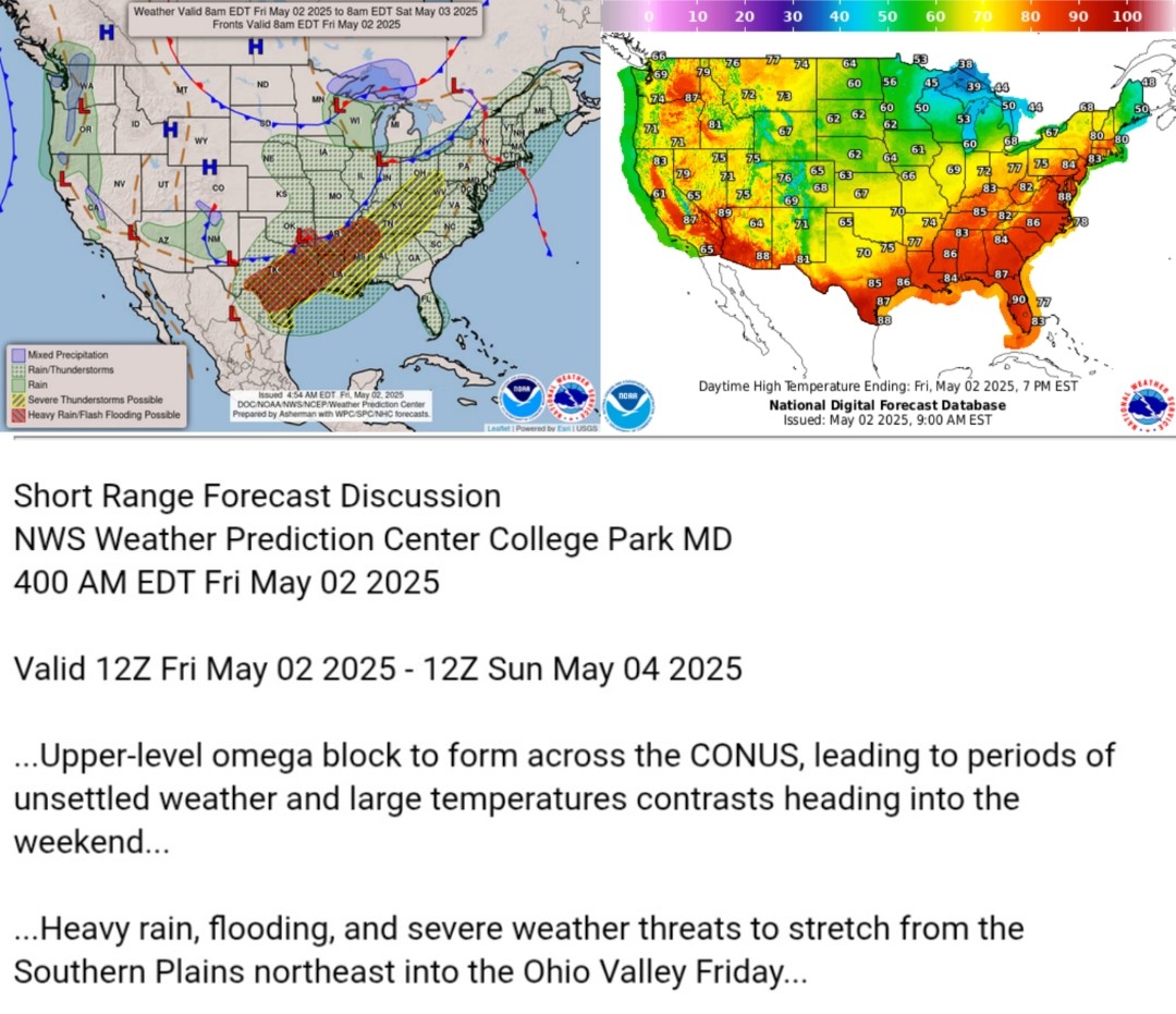
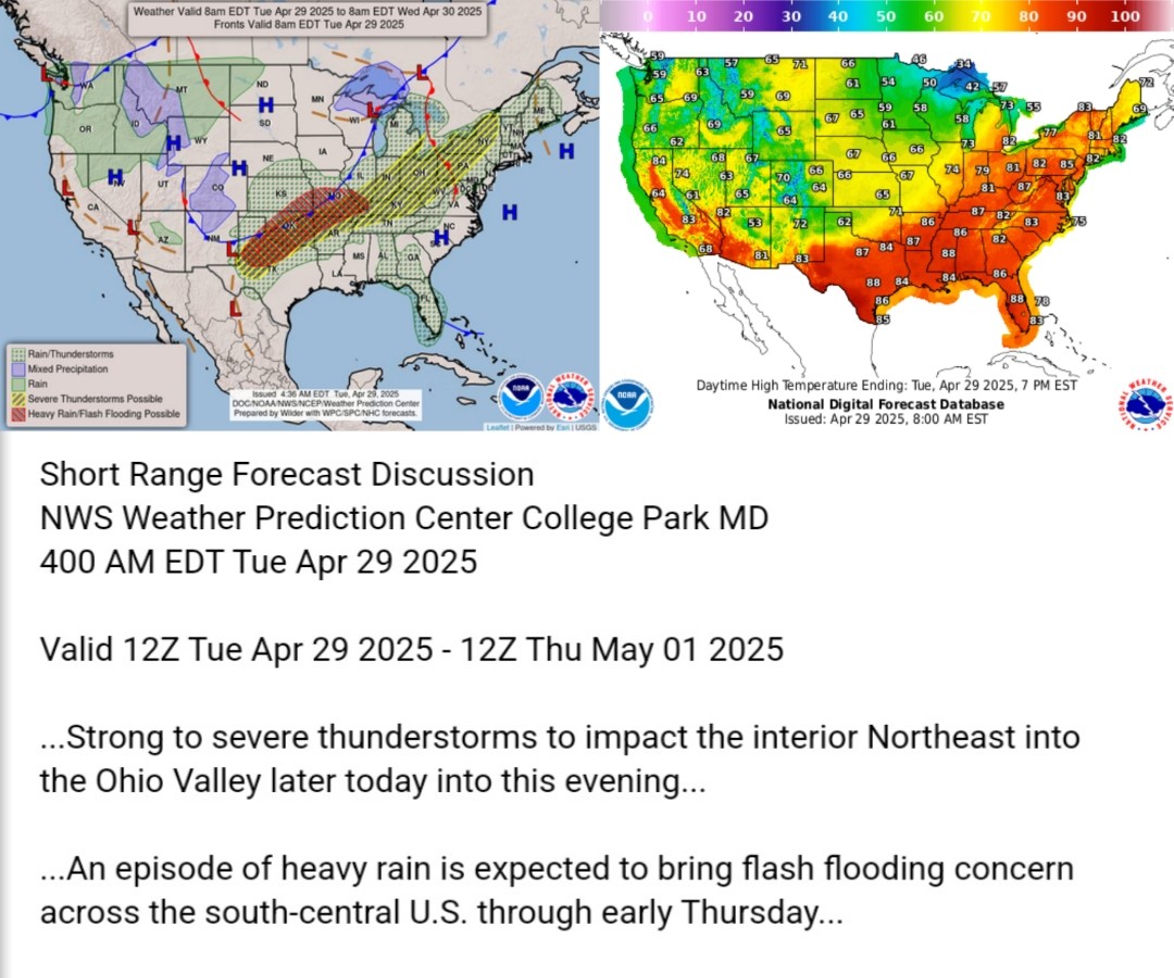
Here's today's forecast map and today's high temperature map. Check out the NWS site for more National Forecast Maps https://www.weather.gov/forecastmaps
#weather #wx #Forecast #precipitation #Temperature
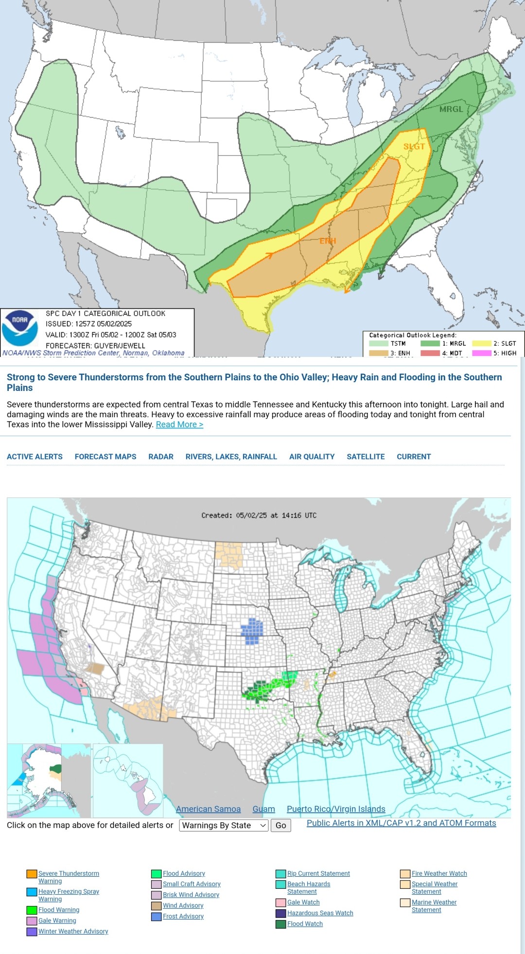
Lines and/or clusters of strong to severe thunderstorms are likely to impact parts of the Ohio Valley into lower Great Lakes, parts of the lower Mississippi Valley, and the southern Great Plains this afternoon through tonight. #WeatherAwareDay #weather #wx #SPC #SevereWeather
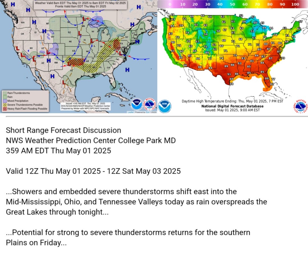
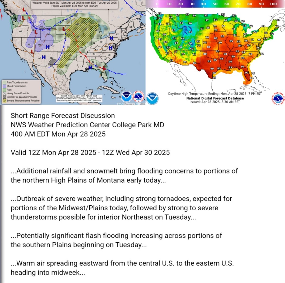
Here's today's forecast map and today's high temperature map. Check out the NWS site for more National Forecast Maps https://www.weather.gov/forecastmaps
#weather #wx #Forecast #precipitation #Temperature
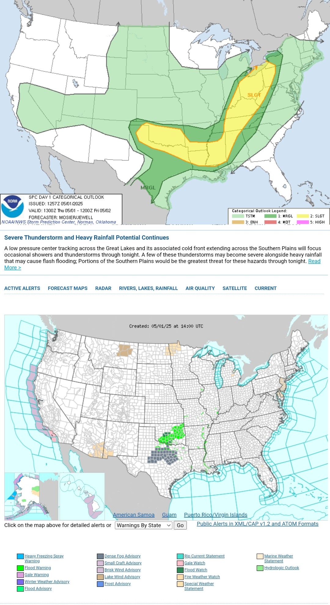
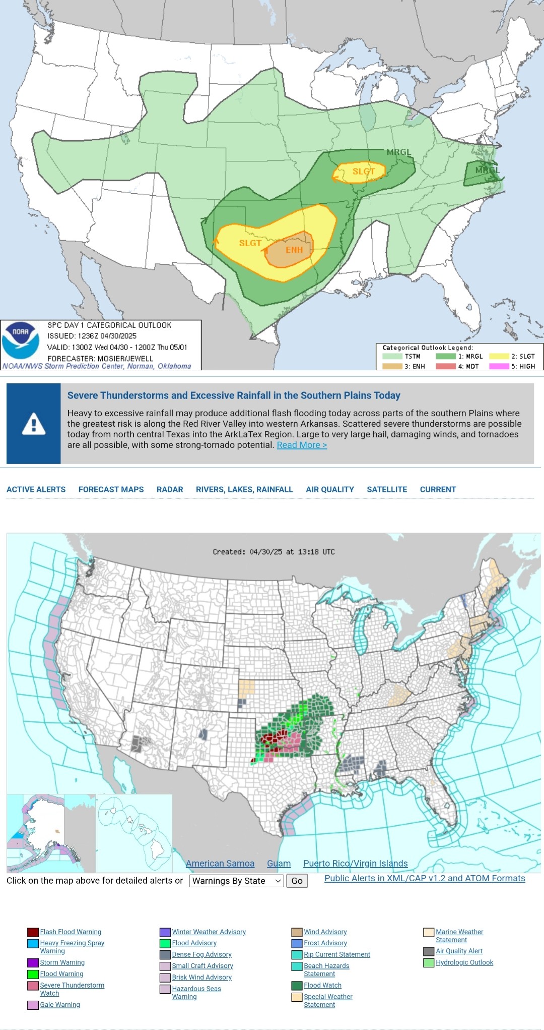
Scattered severe thunderstorms are possible on later today into this evening from the southern Plains into the Lower Ohio Valley, with the greatest risk expected across north-central Texas into the
ArkLaTex region. Large to very large hail, damaging winds, and tornadoes are all possible, with some strong-tornado potential. #WeatherAwareDay #weather #wx #SPC #SevereWeather
Here's today's forecast map and today's high temperature map. Check out the NWS site for more National Forecast Maps https://www.weather.gov/forecastmaps
#weather #wx #Forecast #precipitation #Temperature

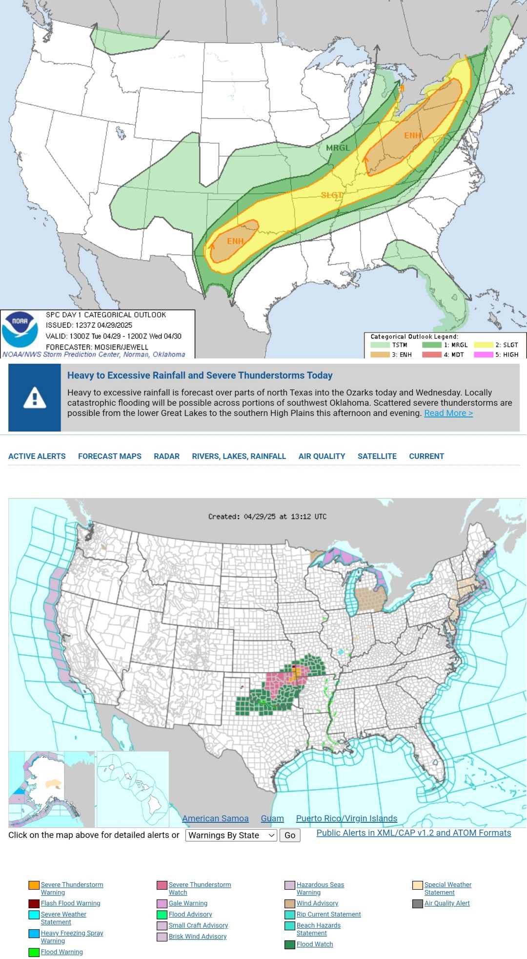
Scattered severe thunderstorms are possible within a broad swath from the Lower Great Lakes to the southern High Plains, mainly during this afternoon to evening. Corridors of greater threat are expected over the Upper Ohio Valley/Lower Great Lakes and in parts of west Texas into southwest Oklahoma. #WeatherAwareDay #weather #wx #SPC #SevereWeather
Here's today's forecast map and today's high temperature map. Check out the NWS site for more National Forecast Maps https://www.weather.gov/forecastmaps
#weather #wx #Forecast #precipitation #Temperature
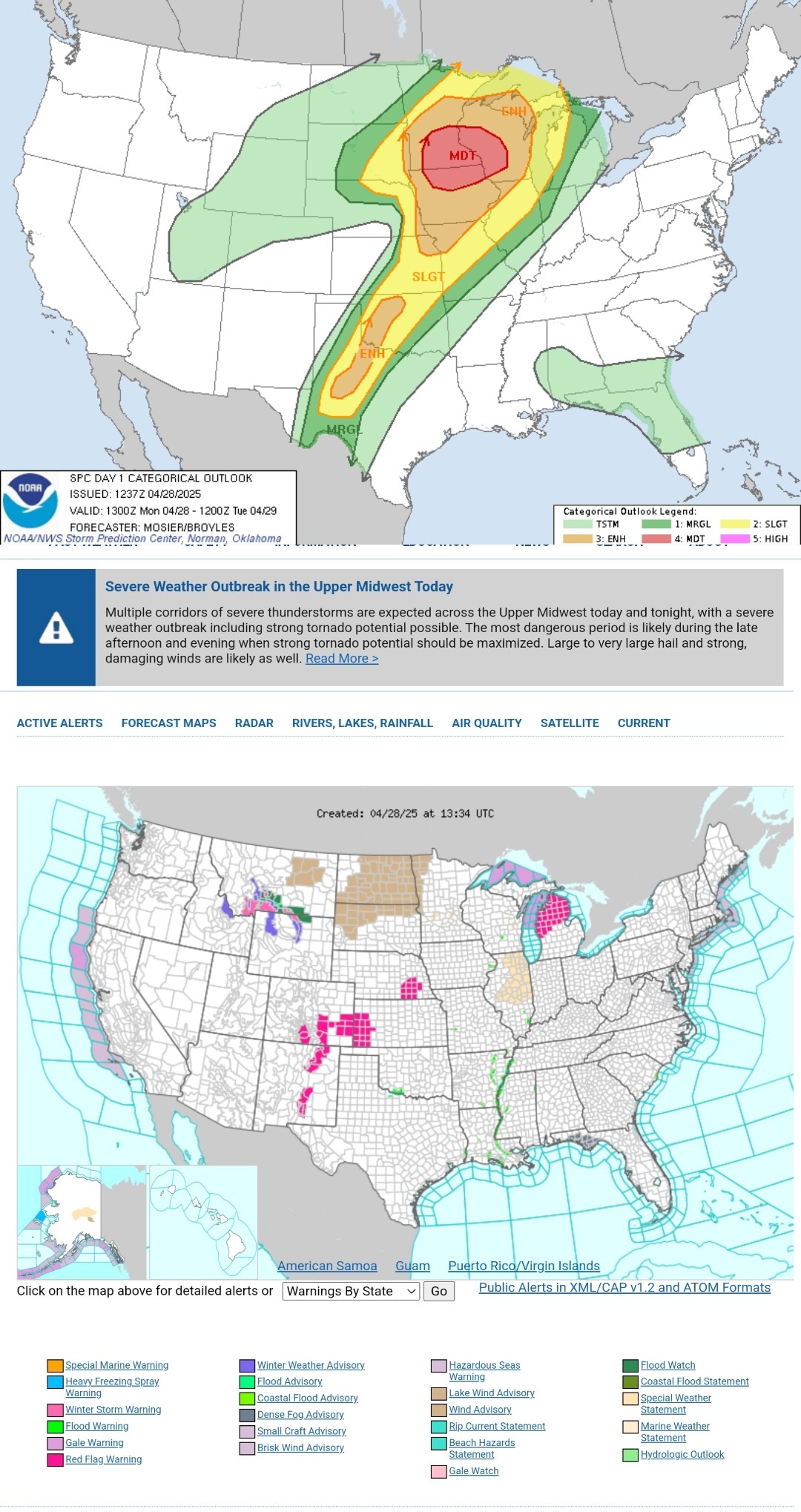
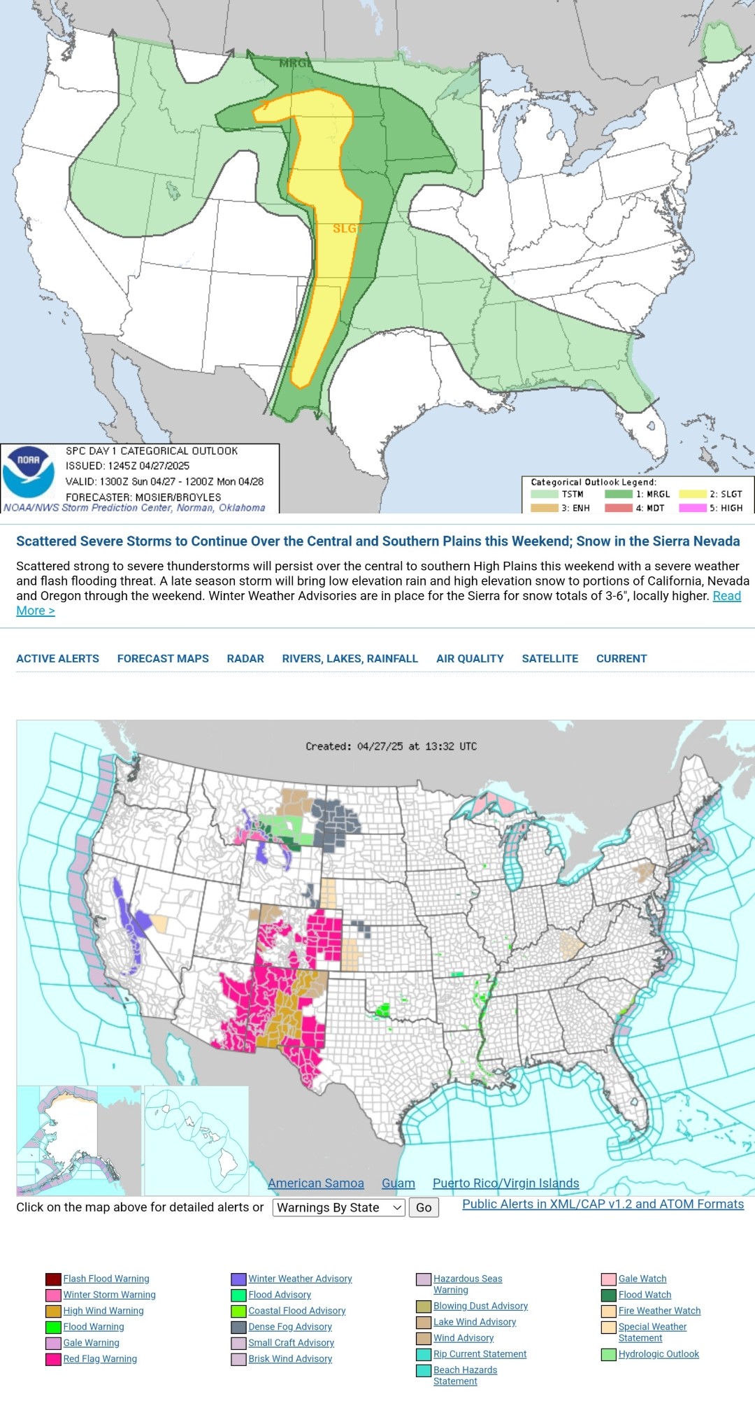
Multiple corridors of severe thunderstorms are expected across the Upper Midwest later today into tonight, with a regional severe weather outbreak possible. The most dangerous period is likely during the late afternoon and evening when strong tornado potential should be maximized. Scattered large to very large hail and damaging winds are likely as well. #WeatherAwareDay #weather #wx #SPC #SevereWeather
Here's today's forecast map and today's high temperature map. Check out the NWS site for more National Forecast Maps https://www.weather.gov/forecastmaps
#weather #wx #Forecast #precipitation #Temperature
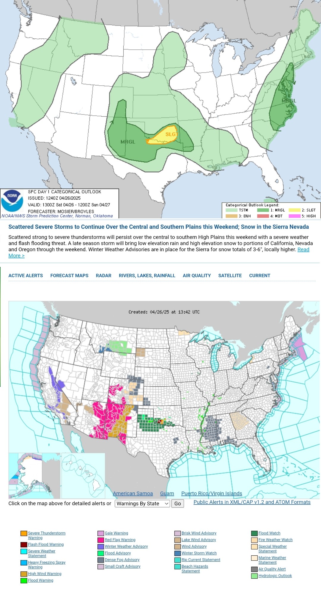
Isolated to scattered severe thunderstorms are possible on Sunday evening into early morning Monday across parts of the Great Plains. Large hail, severe gusts, and a few tornadoes are all possible. #WeatherAwareDay #weather #wx #SPC #SevereWeather
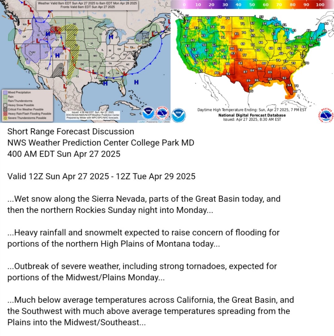
Here's today's forecast map and today's high temperature map. Check out the NWS site for more National Forecast Maps https://www.weather.gov/forecastmaps
#weather #wx #Forecast #precipitation #Temperature
Strong to potentially severe storms are possible later today across parts of the southern High Plains into the ArkLaTex region. Highest coverage is expected from south-central Oklahoma and far north-central Texas into eastern Oklahoma. Isolated severe storms are also across parts of the Mid Atlantic and Carolinas. #WeatherAwareDay #weather #wx #SPC #SevereWeather
Here's today's forecast map and today's high temperature map. Check out the NWS site for more National Forecast Maps https://www.weather.gov/forecastmaps
#weather #wx #Forecast #precipitation #Temperature
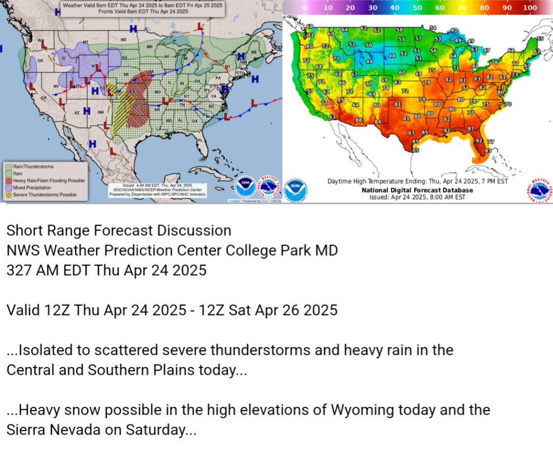
A concentrated area of severe thunderstorms is forecast over the Texas South Plains and vicinity during the late afternoon and evening. Large hail and localized wind damage appear likely.
#WeatherAwareDay #weather #wx #SPC #SevereWeather
Here's today's forecast map and today's high temperature map. Check out the NWS site for more National Forecast Maps https://www.weather.gov/forecastmaps
#weather #wx #Forecast #precipitation #Temperature

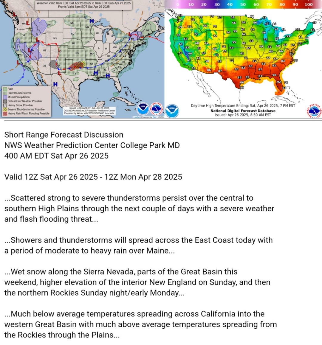
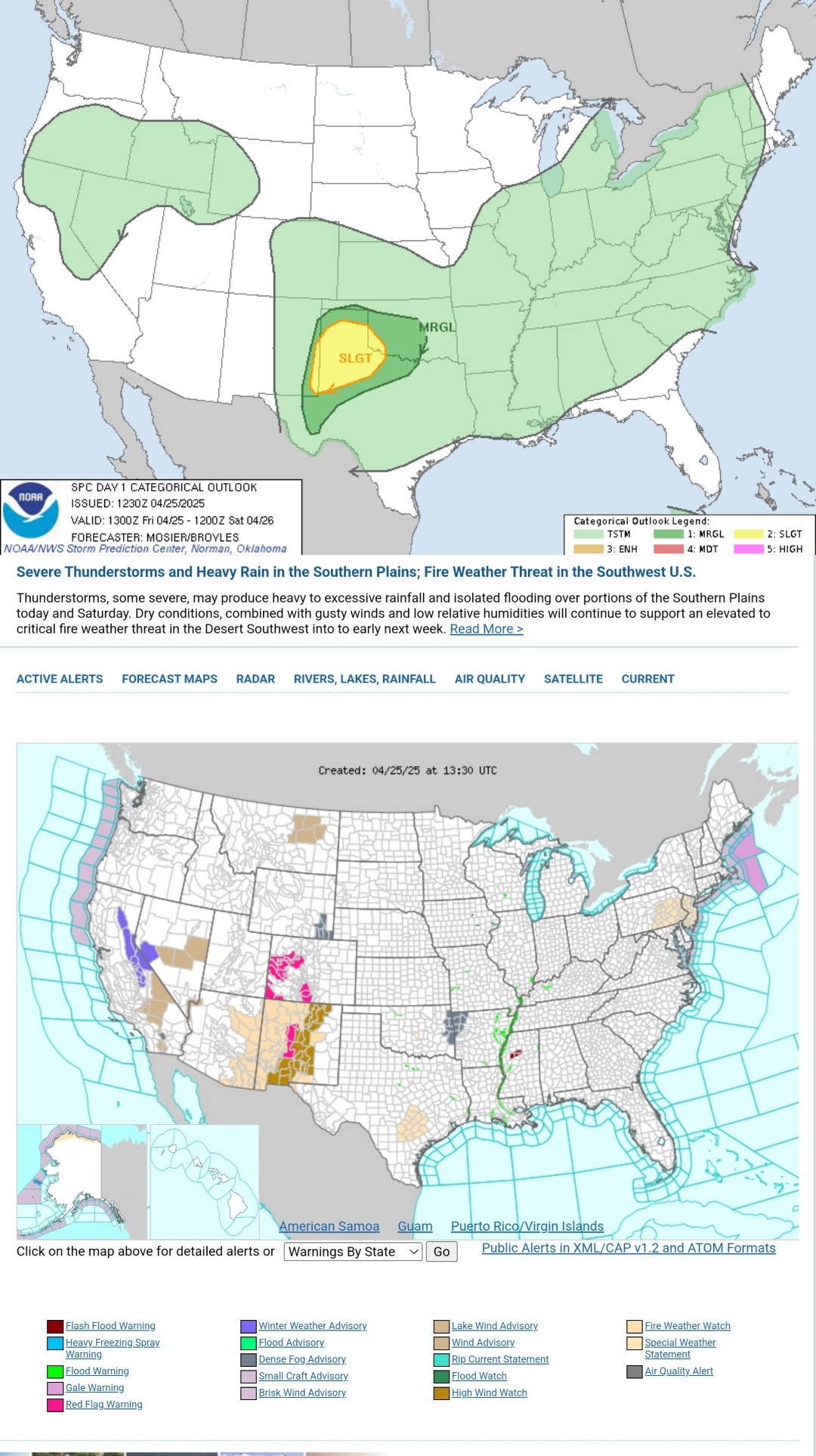
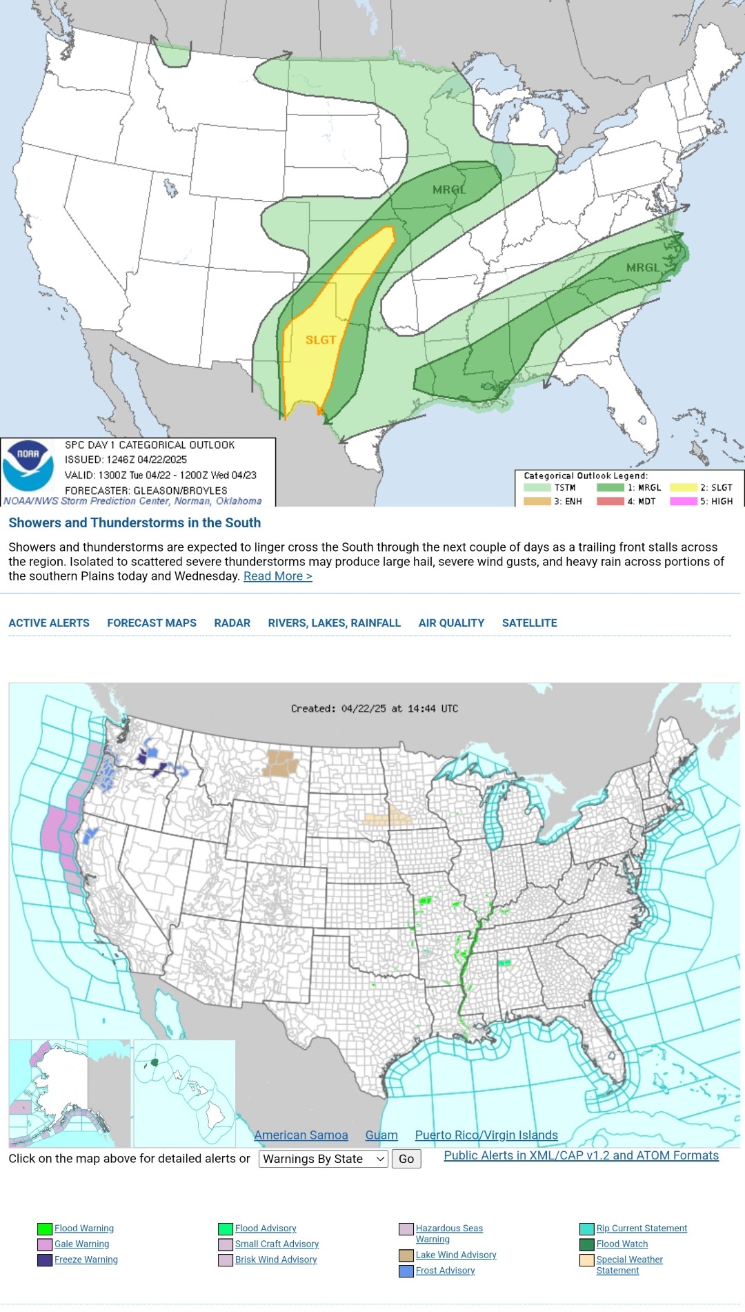
Isolated to scattered severe thunderstorms are possible today and tonight across parts of the southern/central Plains. Large to very large hail and severe wind gusts may occur with this activity. #WeatherAwareDay #weather #wx #SPC #TheOutPost #SevereWeather
Here's today's forecast map and today's high temperature map. Check out the NWS site for more National Forecast Maps https://www.weather.gov/forecastmaps #weather #wx #TheOutPost #Forecast #precipitation #Temperature
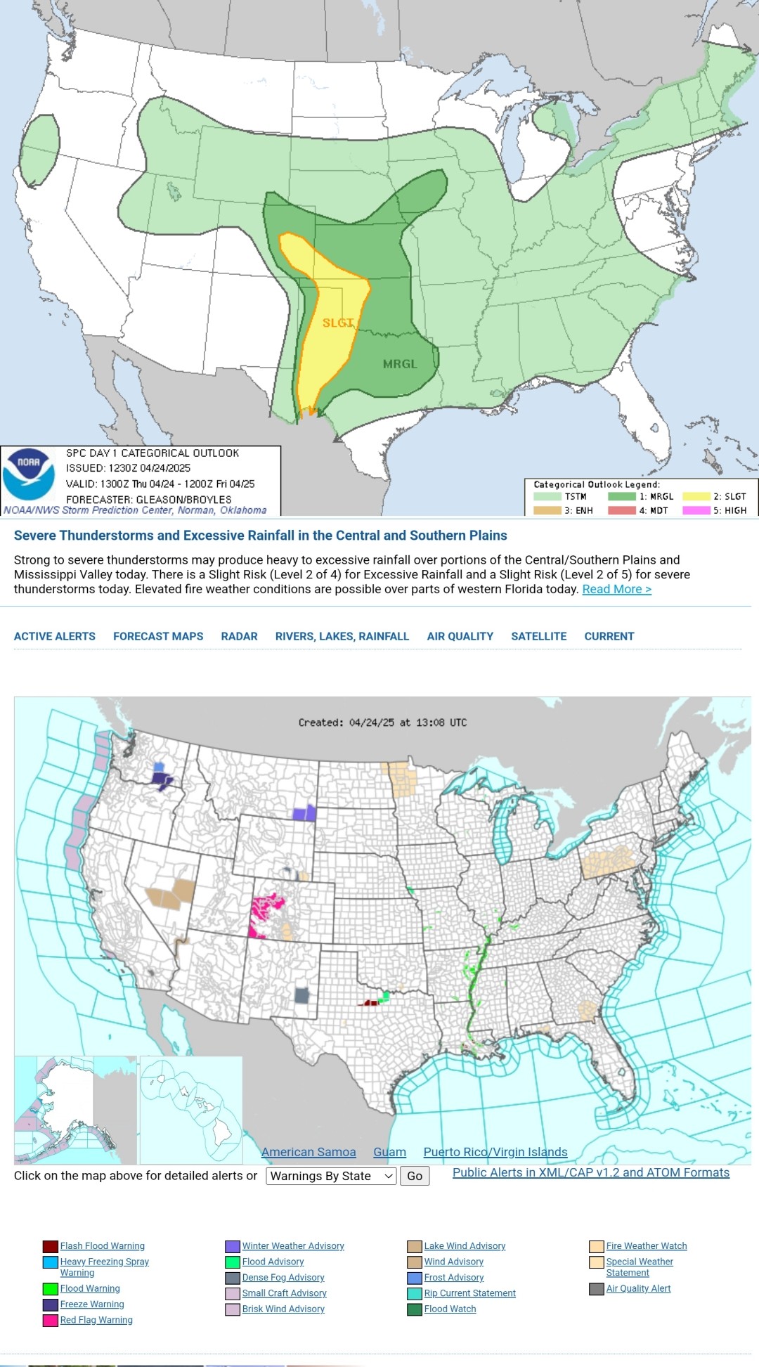
Isolated to scattered severe thunderstorms will be possible across parts of the southern/central Plains, mainly this afternoon and evening. Large hail and severe gusts should be the main threats. #WeatherAwareDay #weather #wx #SPC #TheOutPost #SevereWeather
Here's today's forecast map and today's high temperature map. Check out the NWS site for more National Forecast Maps https://www.weather.gov/forecastmaps #weather #wx #TheOutPost #Forecast #precipitation #Temperature

Client Info
Server: https://mastodon.social
Version: 2025.04
Repository: https://github.com/cyevgeniy/lmst