The view from space as Mount #Etna in Sicily, Italy erupts 🌋
Zoom Earth
Interactive weather map and hurricane tracker. Real-time satellite imagery, radar, and forecast maps. Get our app 👇
Zoom Earth boosted:
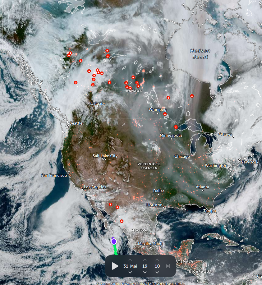
Smoky weather in North America
https://zoom.earth/maps/satellite/#view=44.1,-101.9,4z/overlays=heat,fires
The first tropical depression of 2025 has formed in the eastern Pacific: Tropical Depression One-E. It may become Tropical Storm Alvin soon, but is expected to weaken before approaching Mexico.
Latest satellite view and live tracker here: https://zoom.earth/storms/01e-2025/
@paul_ward_irl OK, "Britain and Ireland" if you prefer.
A rare view of clear skies over Britain and Ireland. Wildfire smoke can be seen in Northern Ireland, Wales, and southern Scotland, while Saharan dust drifts high over western Ireland.
Zoom Earth boosted:
Update April 5th:
We got everything we can.
The amount of help has been very awesome - we did good 💜
If you think you can help with more than a few TB and/or with additional contacts etc. pp.
Please write an email to contact@safeguar.de
We (@SafeguardingResearch) need urgent help with archiving websites & datasets from NOAA, specifically the stuff on Amazon Web Services (AWS):
https://forum.safeguar.de/t/noaa-all-services-urgent/569
If you can contribute, please consider doing so.
The moon’s shadow is moving across the North Atlantic during today’s partial solar eclipse 🌙
Zoom Earth boosted:
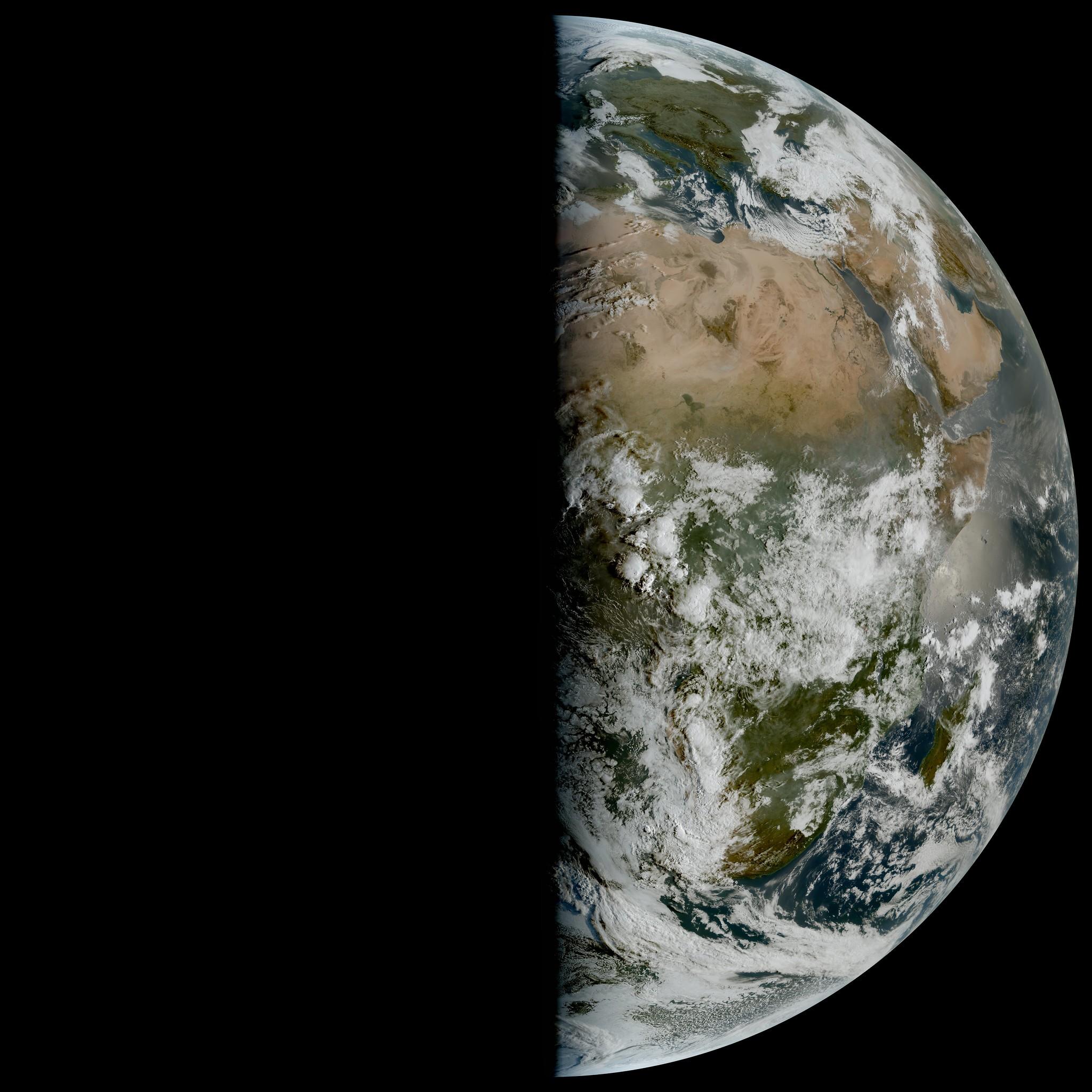
Here is a stunning image taken today by EUMETSAT's Meteosat-12 satellite. It shows the day-night boundary over West Africa running vertical from pole to pole, since it is Spring Equinox in the Northern Hemisphere today.
Meteosat-12 is located in geostationary orbit at longitude 0.3W.
A non-tropical low has been tagged by the NHC in the central Atlantic, but development is unlikely as it will move into an area of strong upper-level winds and dry air tonight into Tuesday.
A massive dust storm is currently sweeping across the southern Great Plains of the United States. Extreme winds are driving wildfires and setting the stage for a major tornado outbreak.
Latest satellite view:
Zoom Earth boosted:
Satellite imagery shows smoke rising above the clouds after an oil tanker collides with a cargo ship in the North Sea, off the coast of East Yorkshire in the United Kingdom.
Severe Tropical Storm #Jude has formed near Madagascar. Jude will likely continue to intensify before making landfall over #Mozambique near Nacala.
Live tracker here: https://zoom.earth/storms/jude-2025/
Zoom Earth boosted:
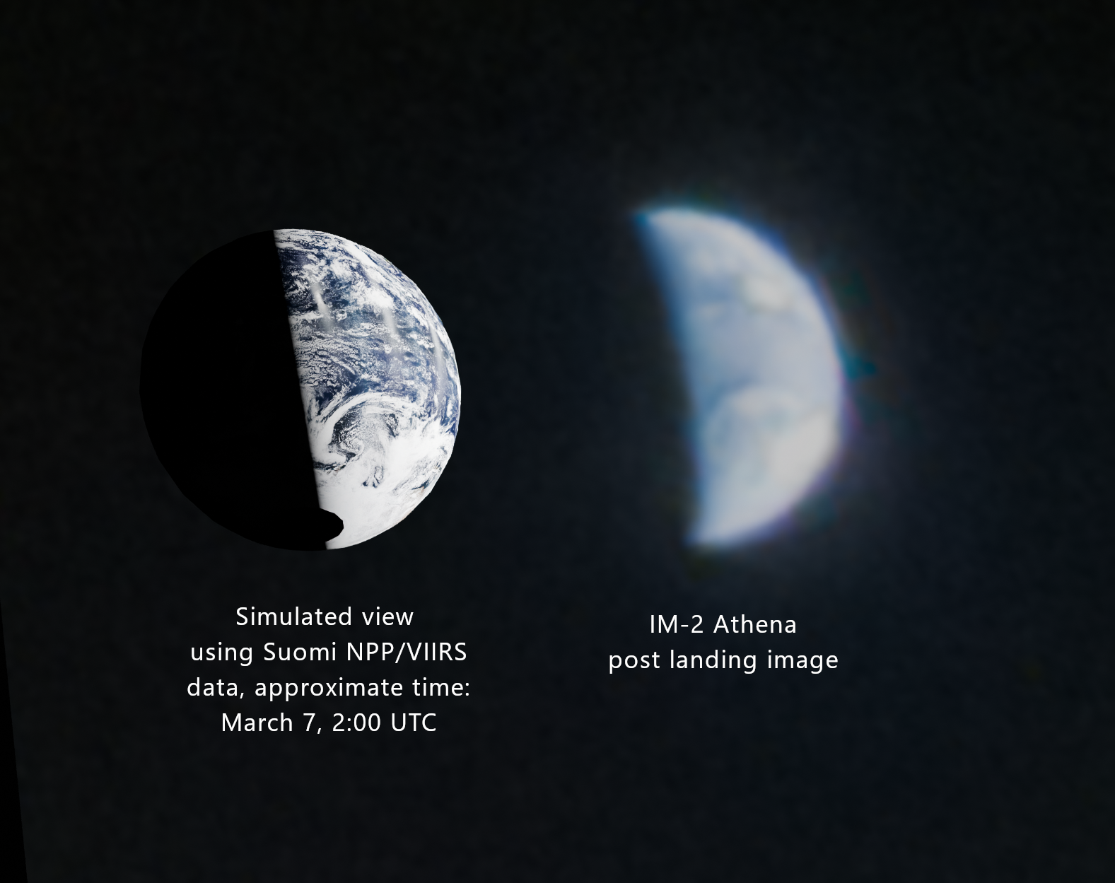
Since the capture time of the image wasn't published, I tried matching the Earth terminator and cloud patterns.
This area above the pacific ocean seems like a good match.
The approximate capture is Mar 7, 2:00 UTC. #IM2
Note that we are seeing the Earth "upside down" here and the North pole is slightly tilted towards us.
Alternative view via @zoom_earth: https://zoom.earth/maps/satellite/#view=23,-141.3,4z/date=2025-03-07,02:00/overlays=labels:off,lines:off
Zoom Earth boosted:
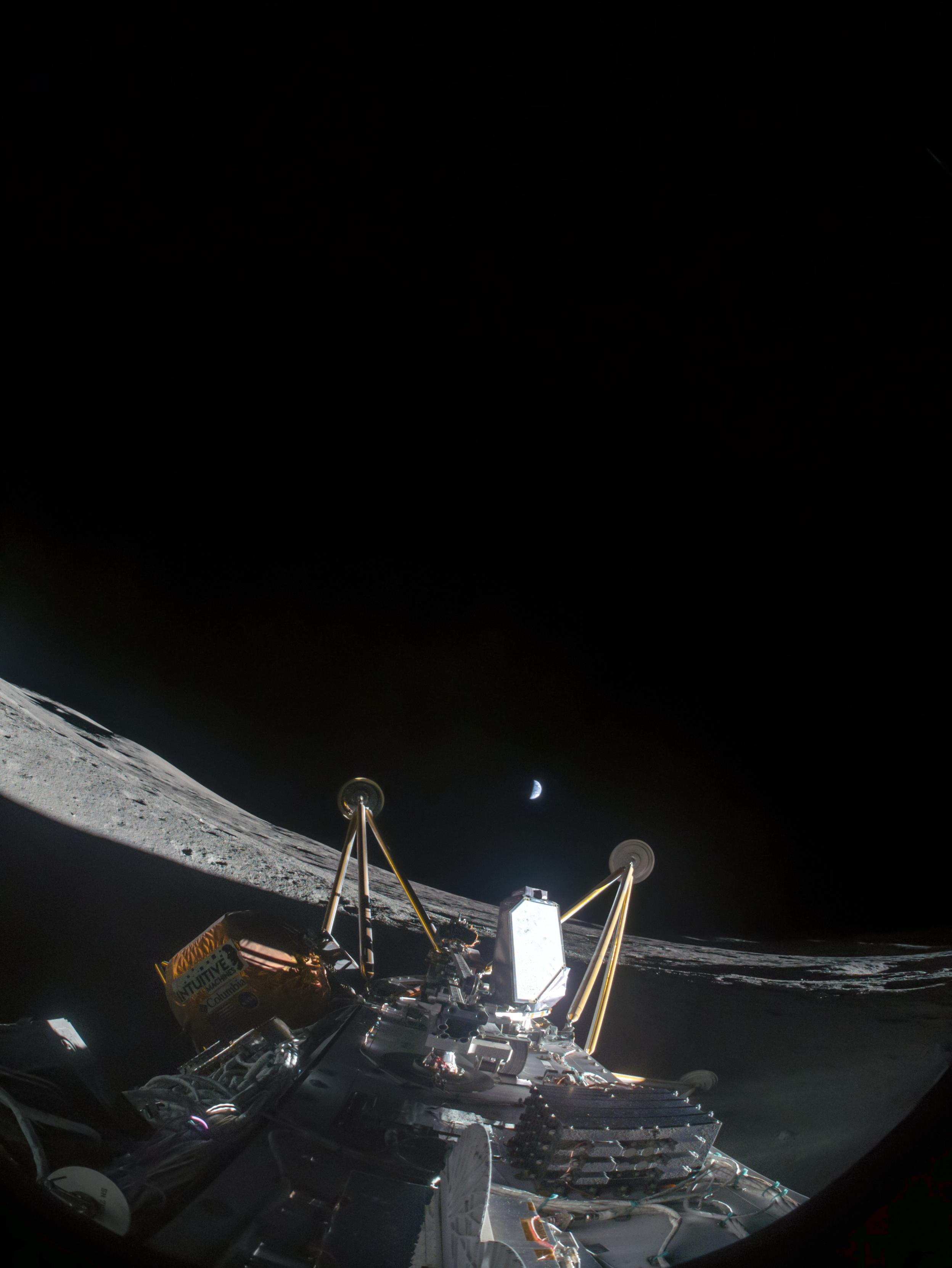
Another one bites the (Moon)dust!
This is Intuitive Machines' #IM2 lander that once again toppled over after trying to land on Mons Mouton near the lunar south pole.
The picture had lots of detail hidden in the shadows which I brought out in processing.
Rain detected by radar + latest wind model for Tropical Cyclone #Alfred:
Latest forecast track for Tropical Cyclone #Alfred can be seen here: https://zoom.earth/storms/alfred-2025/
Client Info
Server: https://mastodon.social
Version: 2025.04
Repository: https://github.com/cyevgeniy/lmst