big big big big book
#BikeMap
TIL that you can print the entire megamap at full size on one piece of paper for $9.70 at the UPS store in Kenmore.
#biking #BikeTooter #seattle #kenmore #northshore #BikeMap #GreaterNorthshore
RELEASE: Greater Northshore and MEGAMAP Bike Maps version 1.8 - 8 June 2025
Additions and changes this release:
* LOTS. Too many to list here. Mostly Seattle, but not only Seattle, as they've dropped the 2025-26 bike map, with which we have issues.
Check the blog post for changes and notes:
Maps download:
https://github.com/solarbirdy/NorthshoreBikeMap/
Previous permalinks continue to work.
If you like these maps, maybe hit my Patreon:
https://www.patreon.com/solarbird
Thanks!
#biking #BikeTooter #GreaterNorthshore #seattle #northshore #SnohomishCounty #Shoreline #Edmonds #MountlakeTerrace #LakeForestPark #Briar #Kenmore #Juanita #Kirkland #Bothell #Woodinville #Maltby #KingCounty #Redmond #BikeMap #maps #design

yep
quick release
maps 1.8
real release post later
https://github.com/solarbirdy/NorthshoreBikeMap/
g'night
#GreaterNorthshore #megamap #seattle #BikeMap #maps #BikeTooter
@mdione oh also
probably wait 'til Maps 1.8 drops for completeness
which will be soon, watch here (or just watch me whatever works):
https://github.com/solarbirdy/NorthshoreBikeMap/
1.7.x is ending up an incredibly short-lived map series tho' xD
This is what I did after work today.
well okay some yesterday also some today but all those REAL and NO and TBC and that CHANGE BACK are me out there on bike today validating - or often IN-validating - the Seattle 2025 bike map in person.
I got around today is what I’m saying.
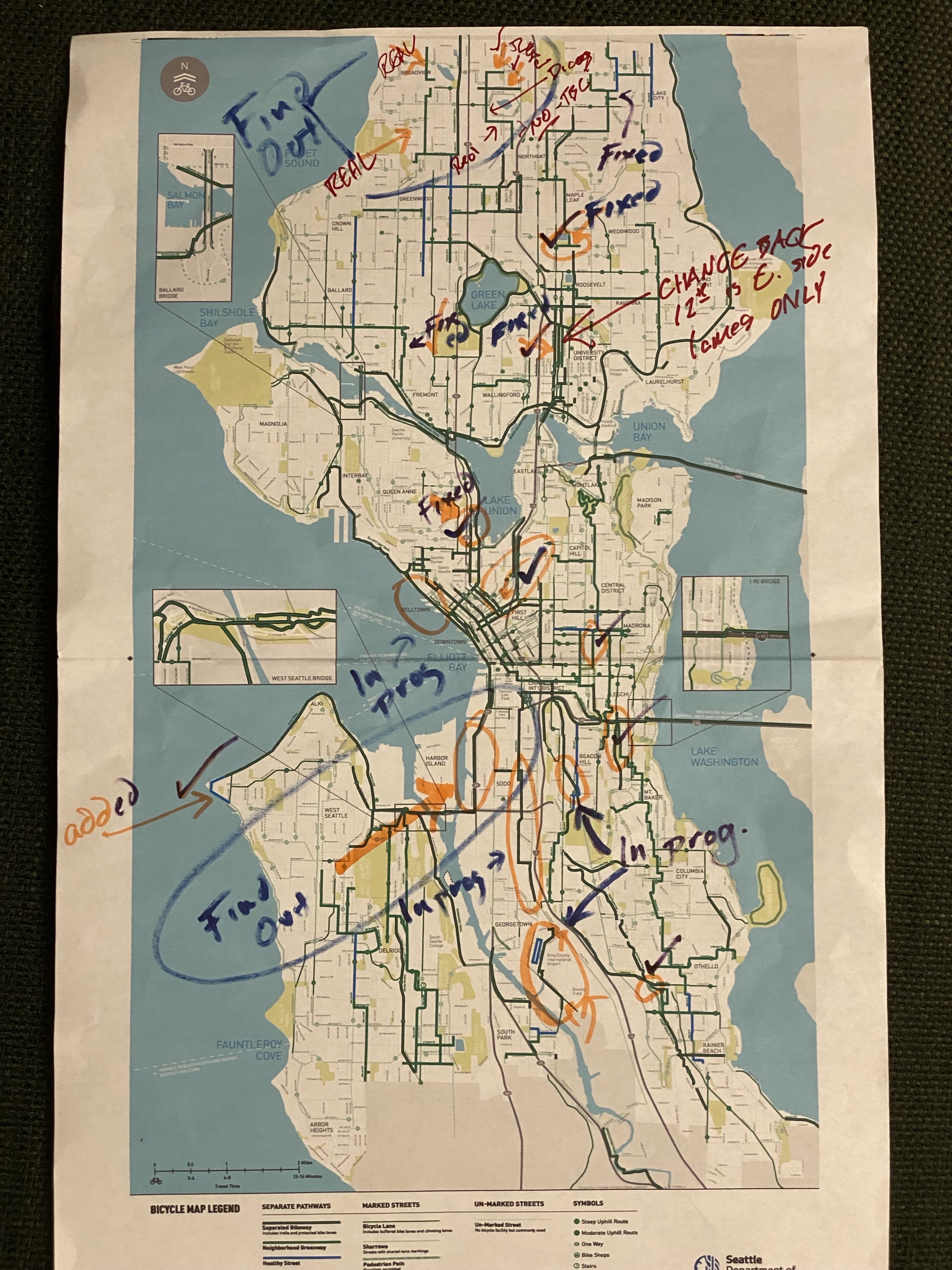
Okay, this is reasonably accurate and will hopefully prepare people better:

a preliminary report on northwest seattle in the seattle 2025 bike map release
now to integrate what actually exists and figure out how to mark what _kinda_ does
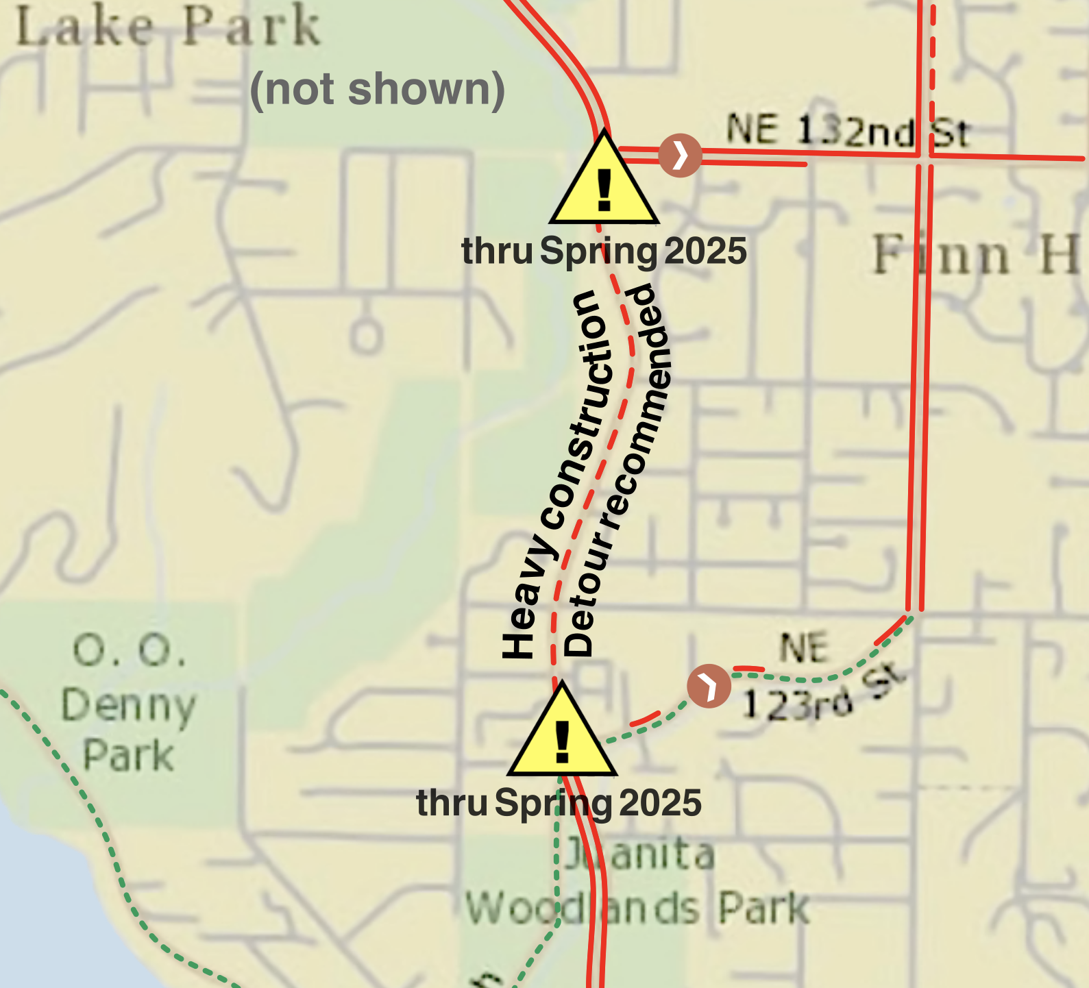
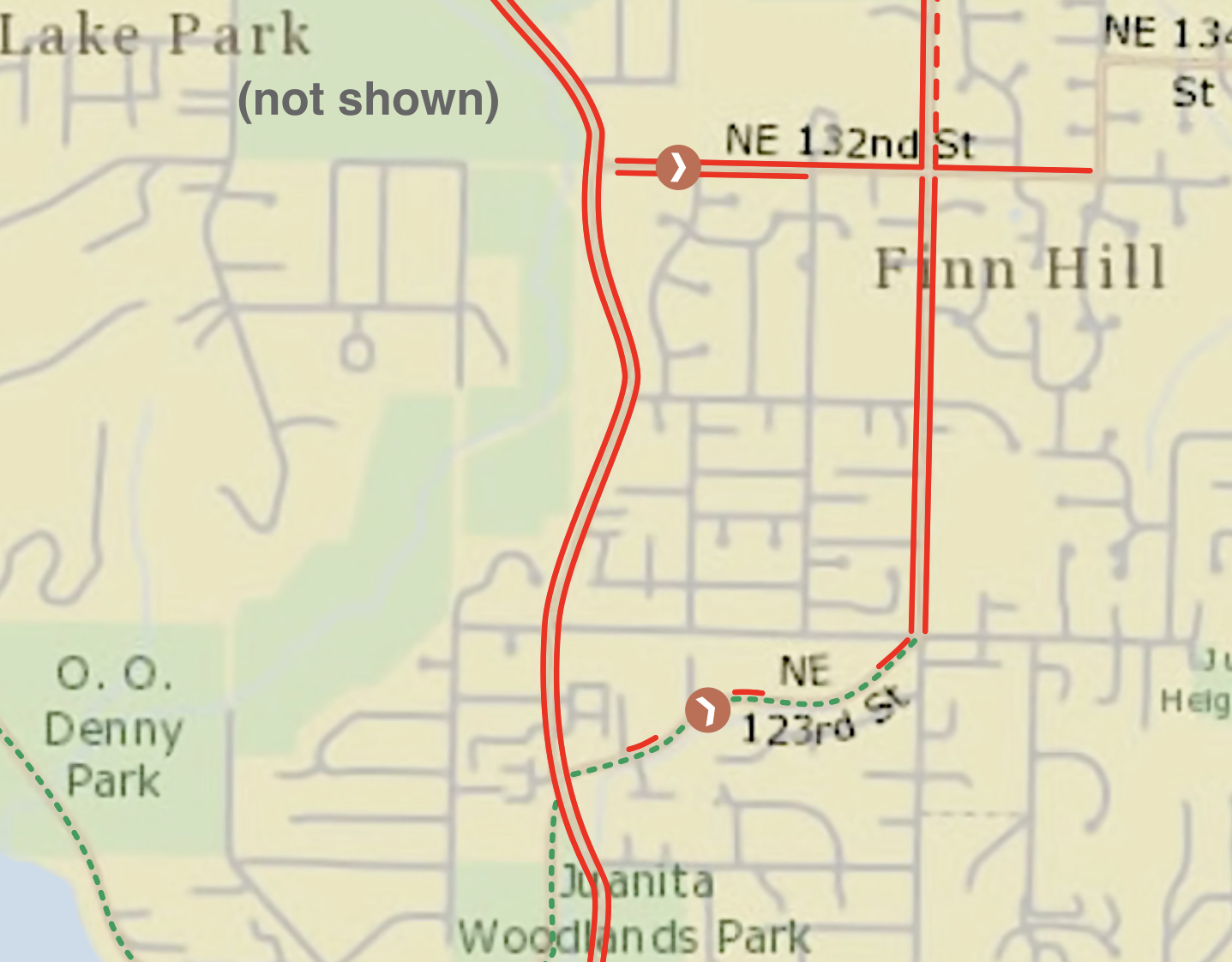
out we go, heavy construction detour recommended!
I did link to the Greater Northshore in a signature I typed up on the spot, though.
Maybe they'll give it a look.
There. Sent.
I was very polite. Professional.
I did mention that Bill Dawson is closed 'til 2030 and so probably shouldn't be shown as open and functional. I described it as a "suggestion," of course. Same with all of it.
I did not mention that I noticed they didn't bother updating the map inset onto the front of their own brochure, and that it's still showing the 2023 waterfront. That would be petty.
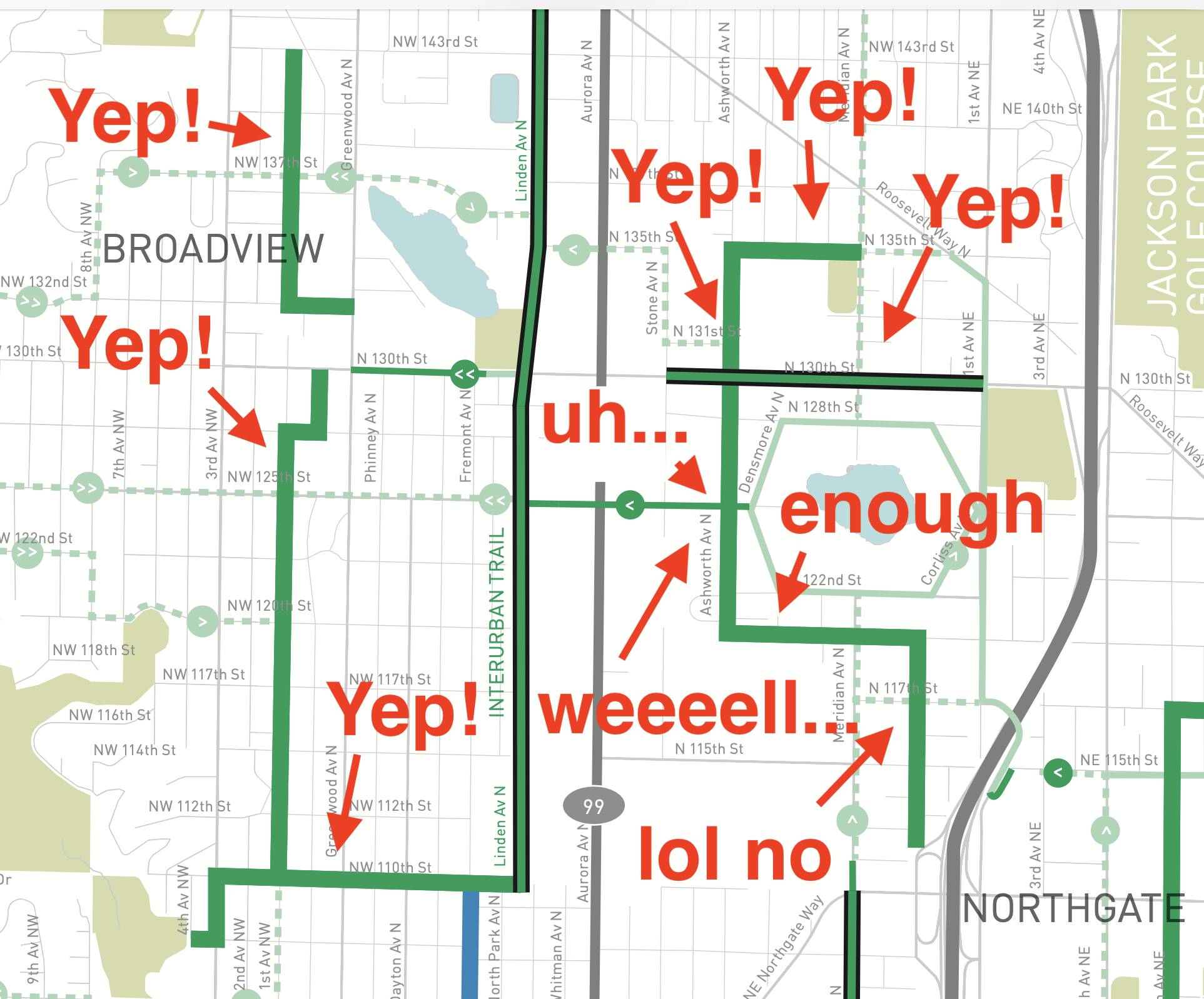
I also did not mention that they still have 125th between Aurora and Interurban marked incorrectly.
Maybe I should've mentioned that.
(Why yes, I did test my maps key in black-and-white before publishing, and yes, it still worked.)
(Am I writing them with suggestions at 12:30am? Yes. Yes, I am. Am I being a lot more polite about it? Yes, of course I am.)
They've also introduced a new colour (blue at the about the same intensity as the green) and a new term ("healthy streets") which they do not define. They seem to be peering them with neighbourhood greenways - and some of the "healthy streets" used to be tagged "neighbourhood greenways" - so I can assume they're similar enough not to care.
Which is I presume why they did blue and green at the same intensity since the most common forms of colour blindness will absolutely make them the same colour which would be quite bad if they actually meant different things.
apparently nobody thought of that. good job team.
(by which I mean for fuck’s sake, I’m a goddamn amateur volunteer and I’m doing better)
okay, seattle just dropped its 2025-2026 map. so now we know it's going to drop new maps about once every two years.
it has some infrastructure on it that's not finished yet, as in, infrastructure that doesn't actually exist. It also shows as open some infrastructure which exists but is currently closed and inaccessible - in one case I spotted immediately, until literally 2030.
i am... uncertain how to handle this. I _really_ do not like showing infrastructure that's not actually there as being there.
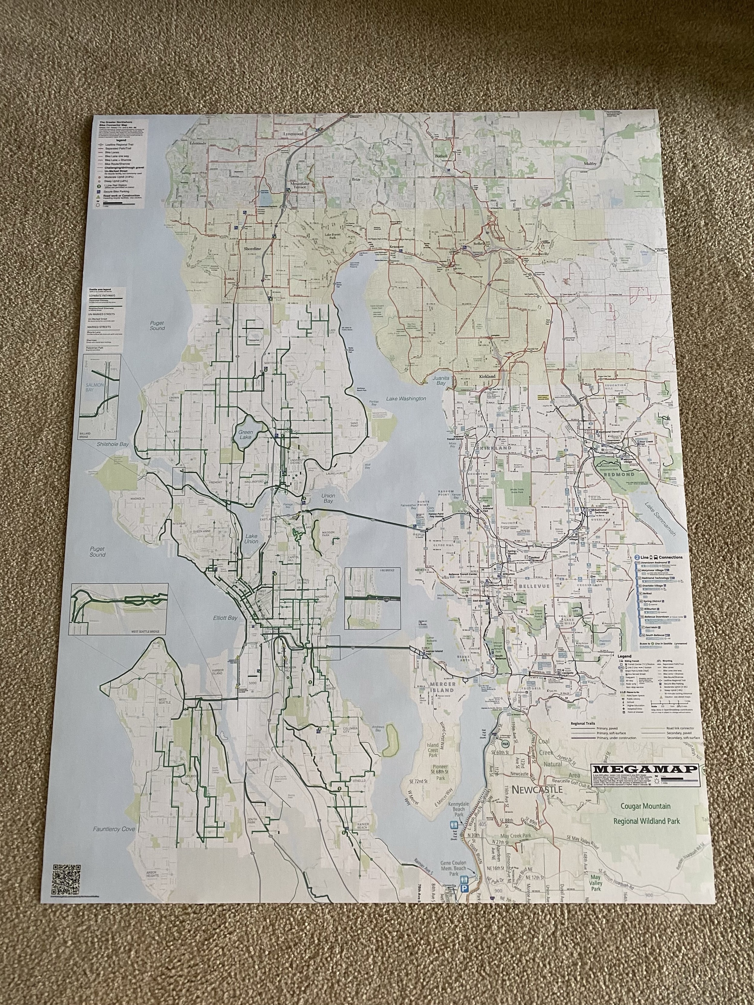
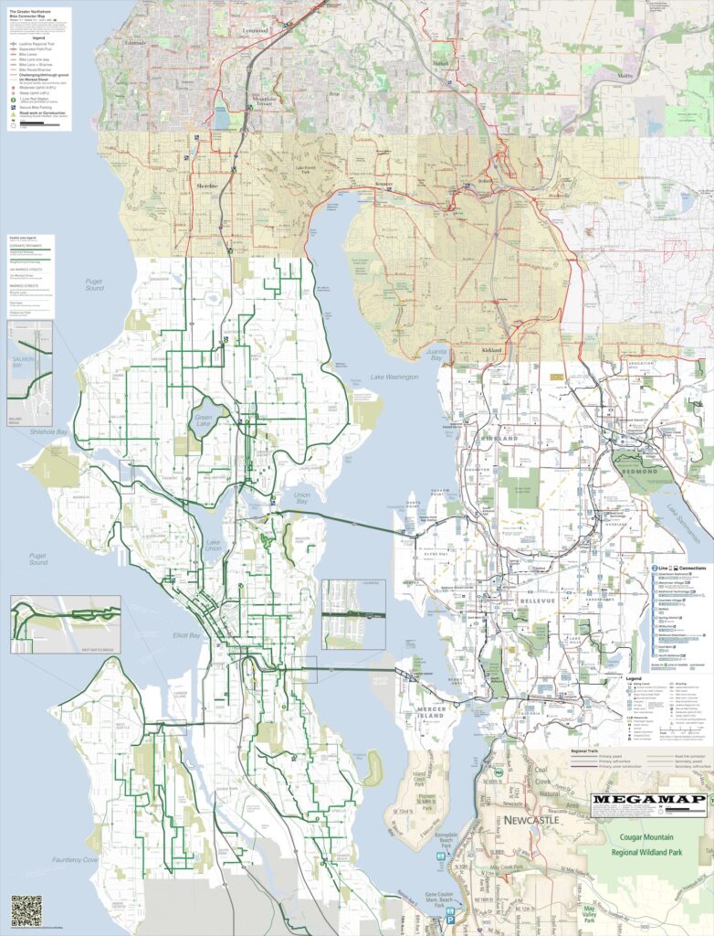
Maps Release: Greater Northshore Bike Connector, MEGAMAP 1.7.1
Greater Northshore Bike Connector Map 1.7.1 – 1 June 2025 – is now available on github, as is MEGAMAP 1.7.1.
Additions and changes since 1.7:
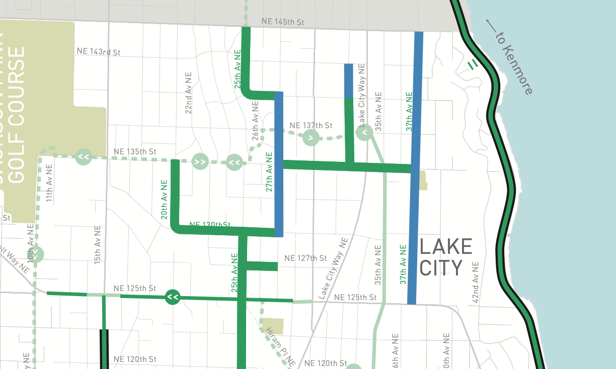
- Extension of bike lanes in Kenmore on 80th Ave NE up to NE 185th/186th street – this is new paint, done because they could; they also made their own city bike map;
- Refinement of intersections with streets on Interurban Trail North in Snohomish County;
- Small additions (short bike lane, shorter trails) around Totem Lake;
- Small addition (short mixed-use trail, pedestrian first but bikes permitted) in northern Woodinville at 130th/132nd;
- Addition of north bike exit from Shoreline North 1 Line station – possibly part of the Trail Under the Rail system? It’s not signed as such but it’s in the right place for it;
- Text cleanup in Redmond, replacing/moving certain street name text which gets cut off on the Greater Northshore map so that it is no longer cut off.
All permalinks continue to work.
If you enjoy these maps and feel like throwing some change at the tip jar, here’s my patreon. Patreon supports get things like pre-sliced printables of the Greater Northshore, and also the completely-uncompressed MEGAMAP, not that the .jpg has much compression in it because it doesn’t.
Thank you! ^_^
I've got errands to run but have a quick release notice anyway, I'll do a real one later:
BIKE MAPS 1.7.1 RELEASE
Greater Northshore
MEGAMAP
See the README for details.
https://github.com/solarbirdy/NorthshoreBikeMap
#BikeMap #art #seattle #northshore #GreaterNorthshore #MEGAMAP #BikeTooter #biking
Surprisingly, Kenmore have jumped on the bike-map-making bandwagon, with a City of Kenmore online interactive bike facilities map here:
cc: @seabikeblog
#kenmore #northshore #seattle #biking #BikeTooter #BikeMap #KingCounty
map map mappy map map
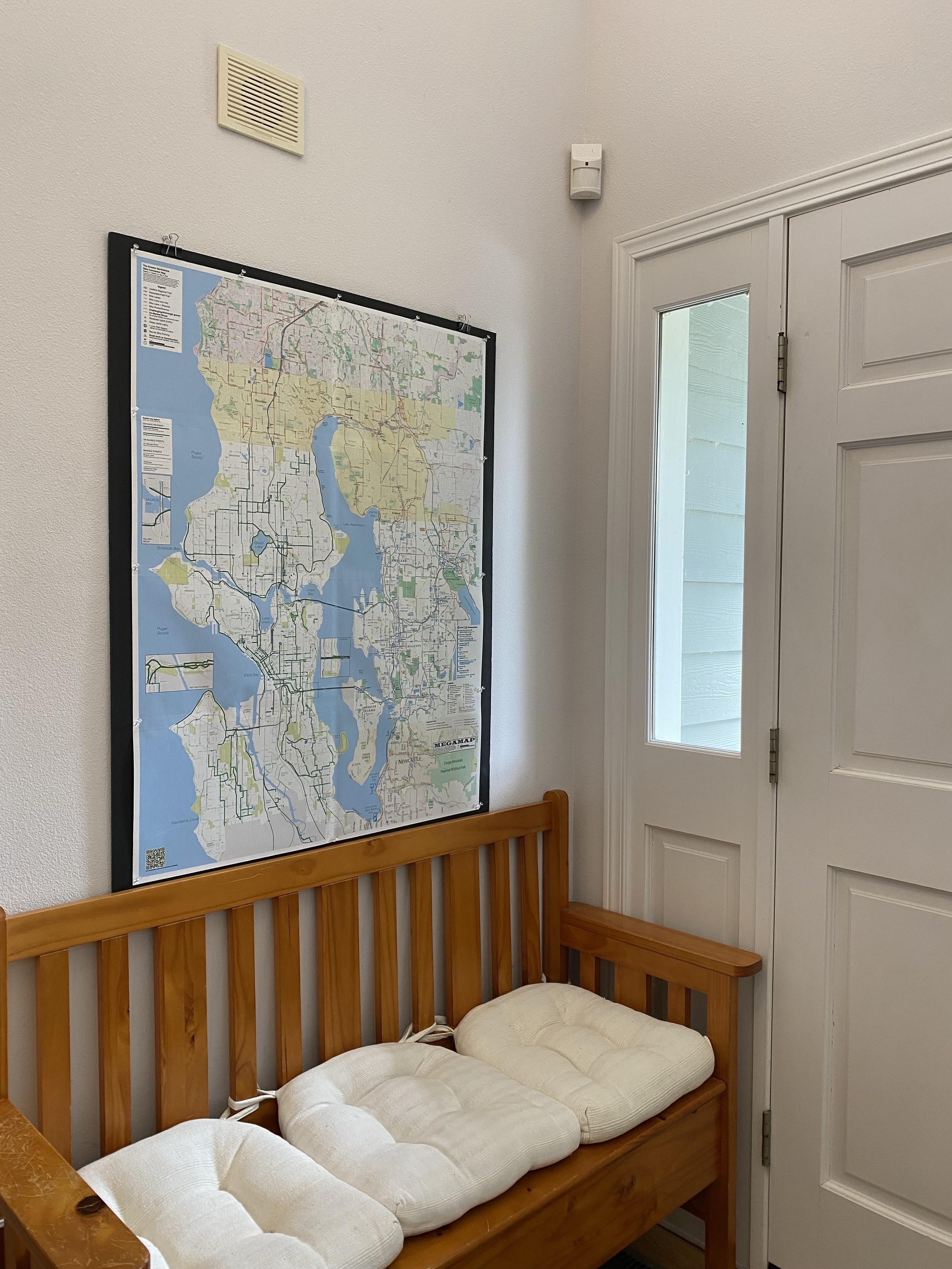
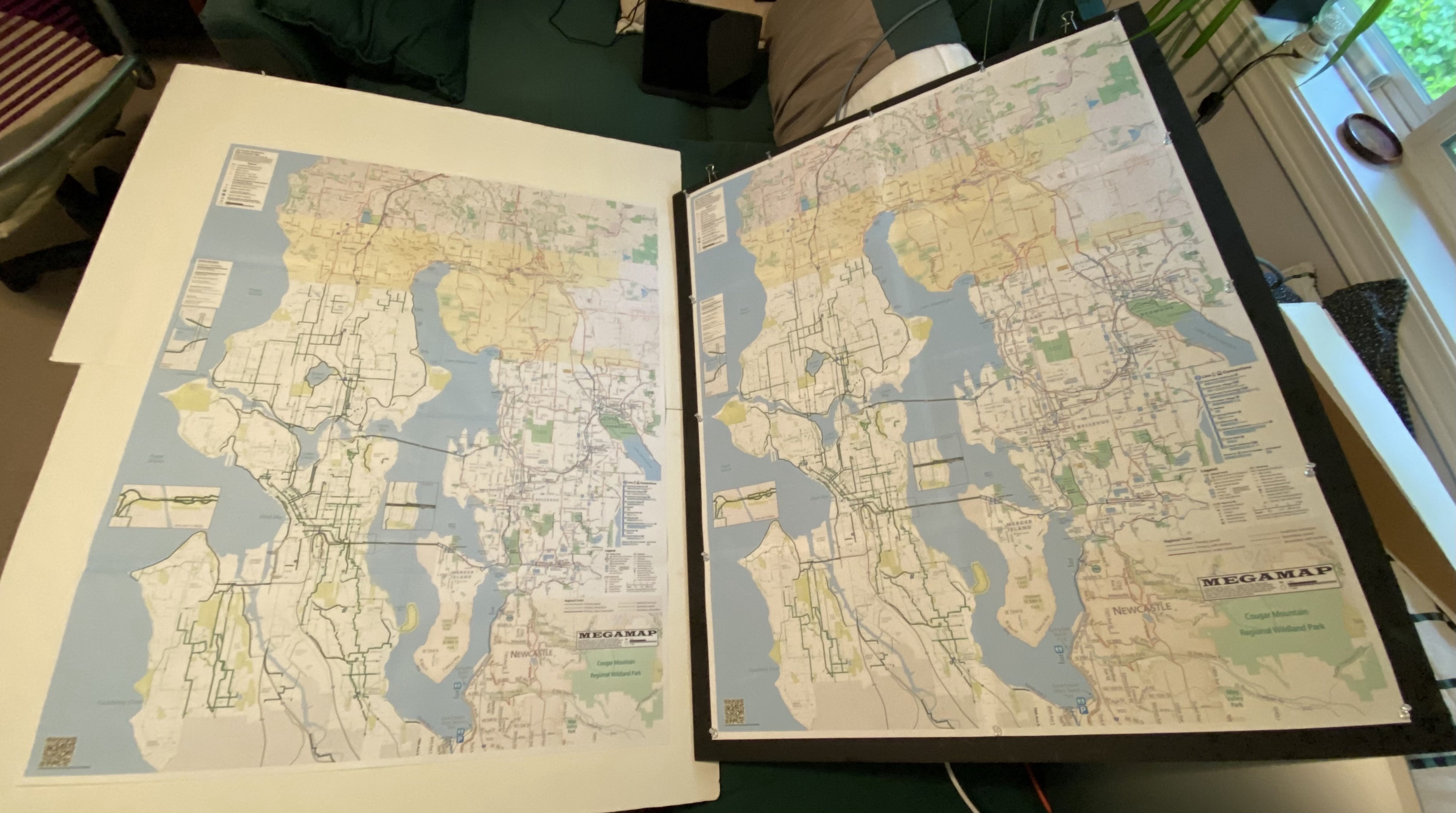
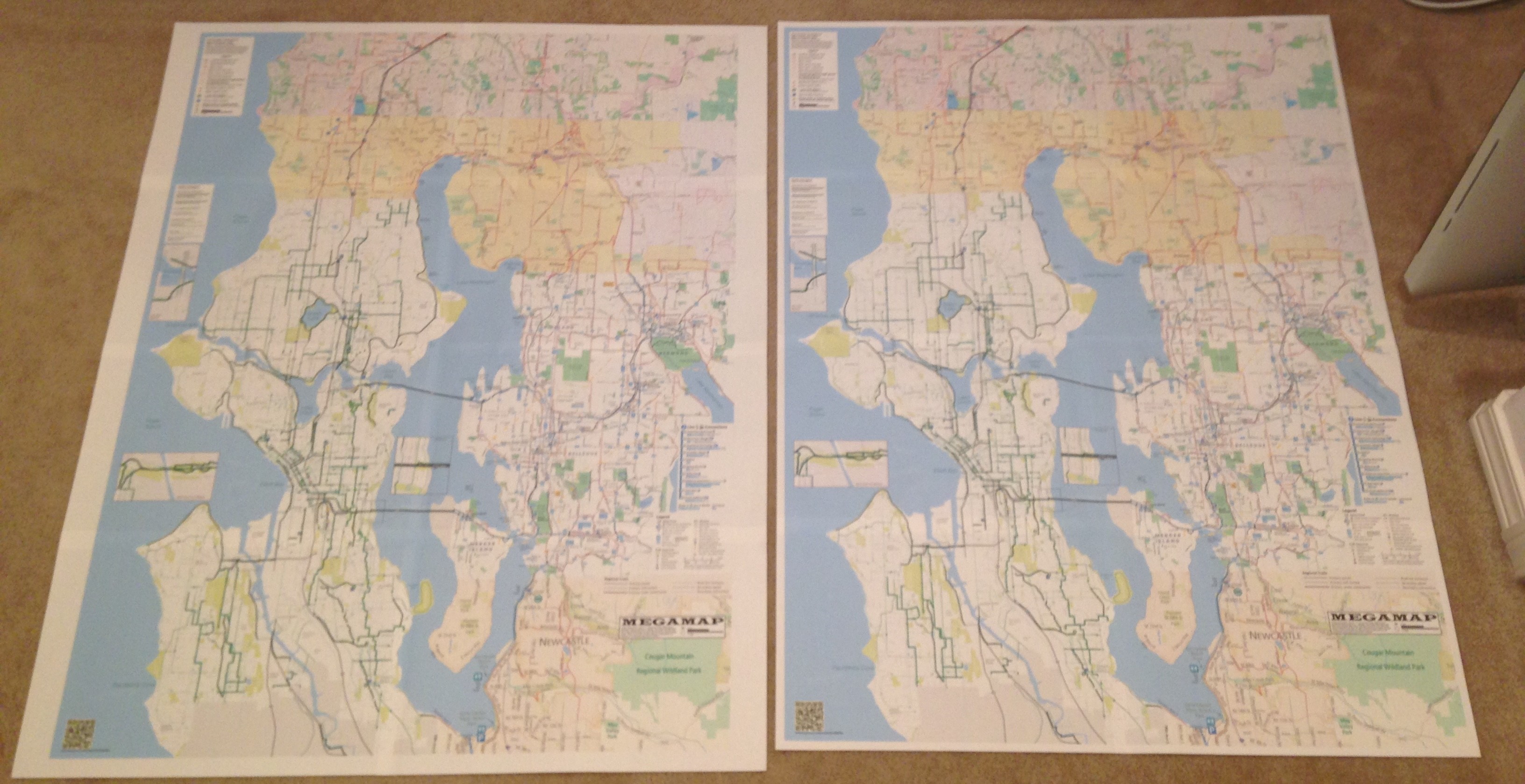
(this was me cutting a pair of new megamaps last night - one for the entryway, one for folding up and carrying around, which is honestly mostly for showing people it exists purposes. but I have used it to give people directions, too! so.)
if you make two megamaps at the same time, you can mix and match glued up quarter sections and get two maps of better quality than you should just making one, because you have more opportunities to test for counter-balancing errors.
Client Info
Server: https://mastodon.social
Version: 2025.04
Repository: https://github.com/cyevgeniy/lmst