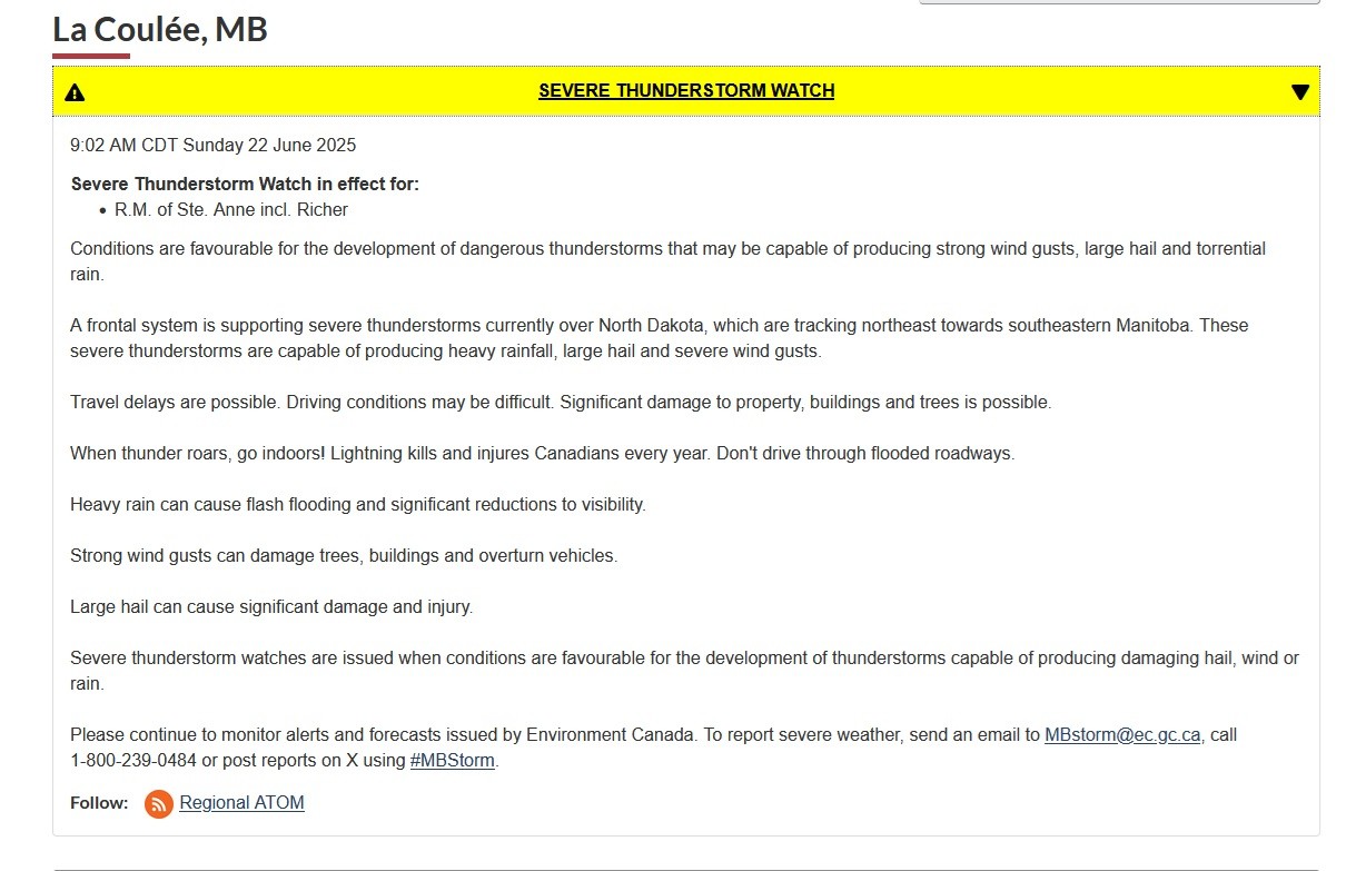
#MBStorm
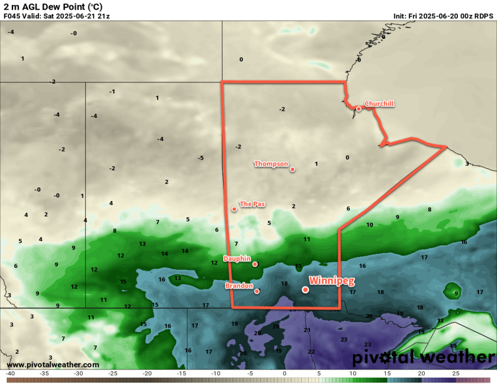
Warm and Unsettled Conditions for the Weekend
Warm and humid weather will bring a chance of showers or thunderstorms to the Winnipeg area this weekend.
Read the full forecast on our site: https://www.aweathermoment.com/2025/06/20/warm-and-unsettled-conditions-for-the-weekend/
Occasionally Unsettled, Smokey as Seasonal Temperatures Return
An upper low over the northern Prairies will bring relief from the heat along with unsettled conditions, but smoke will continue to be an issue.
Read the full forecast on our site: https://www.aweathermoment.com/2025/06/03/occasionally-unsettled-smokey-as-seasonal-temperatures-return/
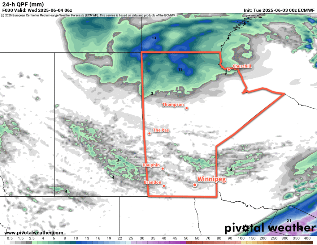
The clear skies and dry weather has helped the fire situation in Manitoba and Saskatchewan deteriorate today. You can see the fires really kicking up in the early afternoon hours.
A warm front is quickly pushing west towards Winnipeg and has temperatures quickly jumping from around 20 °C on the cold side to the upper 20s on the warm side. This will continue to push west through #Winnipeg this afternoon, bringing more thundershowers along with smoke from the #wildfires in SE #Manitoba. Smoke plumes may move in and out of the city through the evening, along with the risk for scattered showers and thunderstorms. #MBstorm
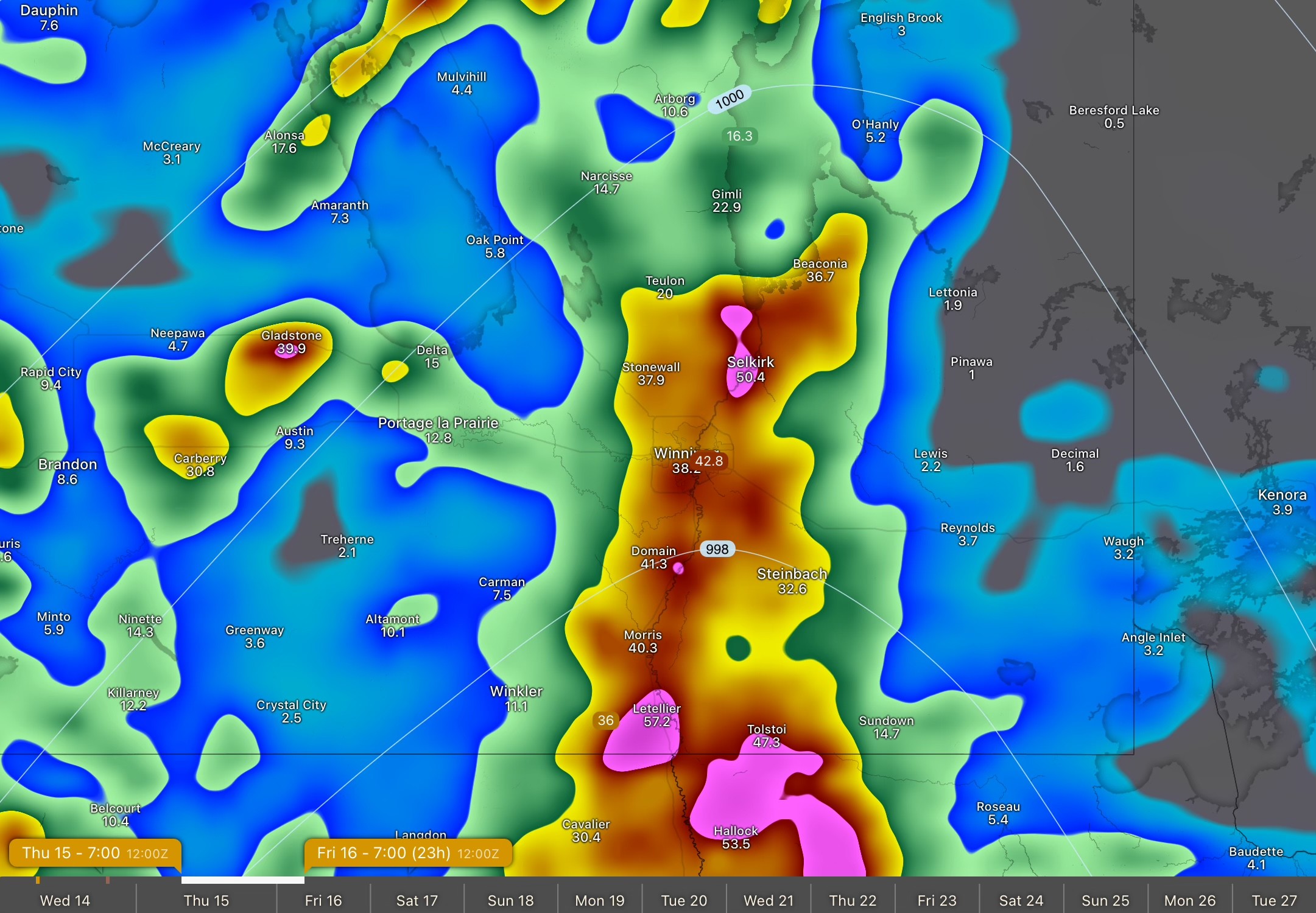
Some weather models starting to perk up with convection over the Red River Valley tomorrow associated with a stronger warm frontal push as the low develops in the Dakotas tomorrow. Potential showing up for a broad 25–50 mm of showery rain with localized higher amounts possible. Looks like the convection could fire up around lunch time or early afternoon. #Winnipeg #MBstorm
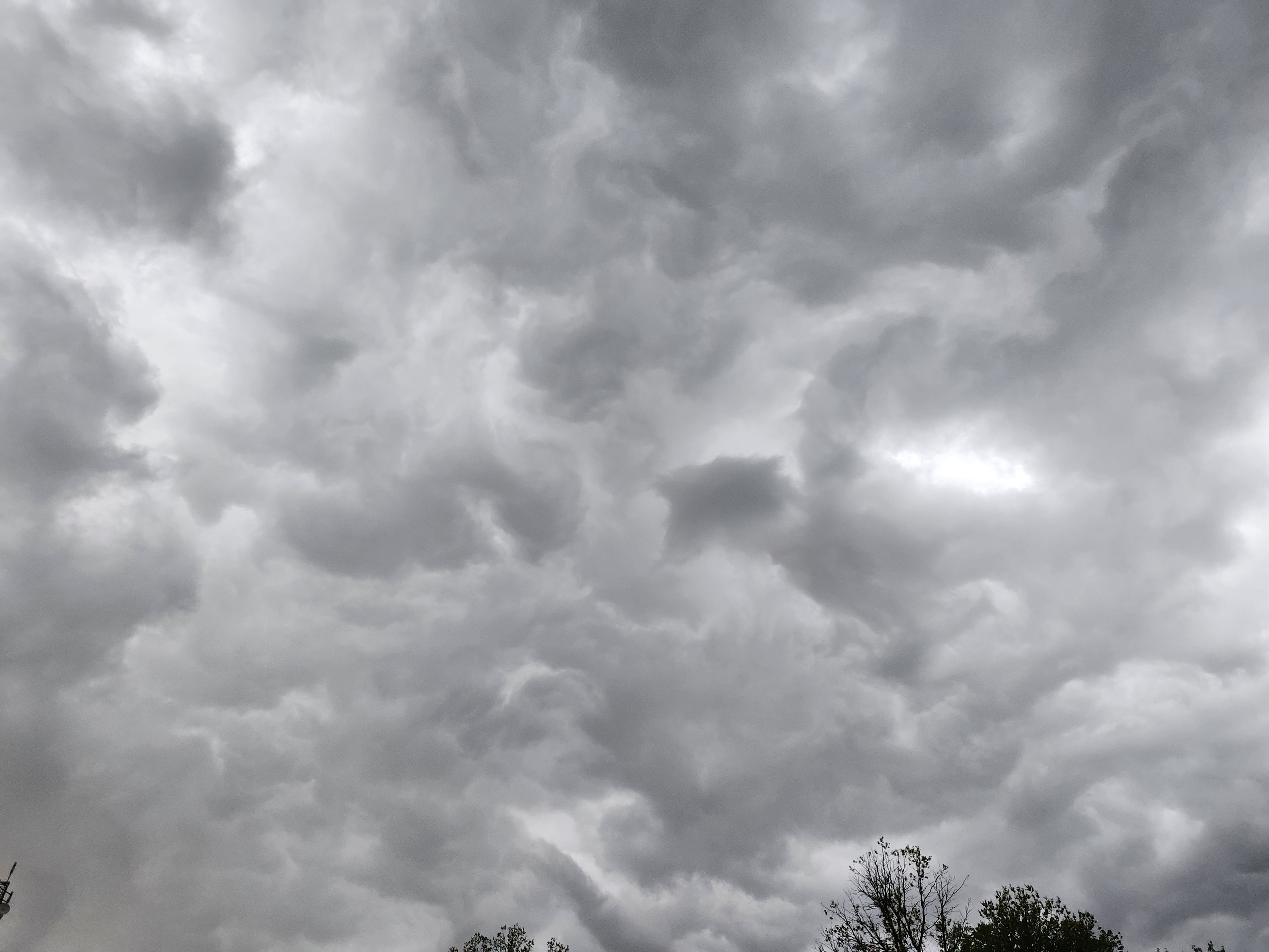
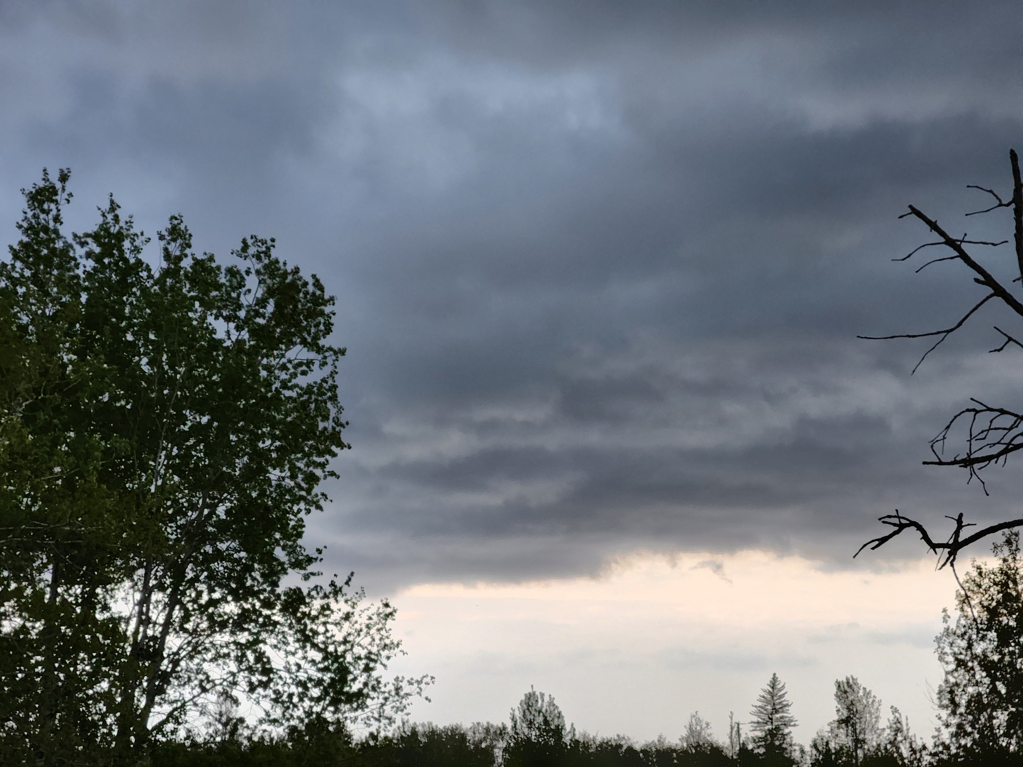
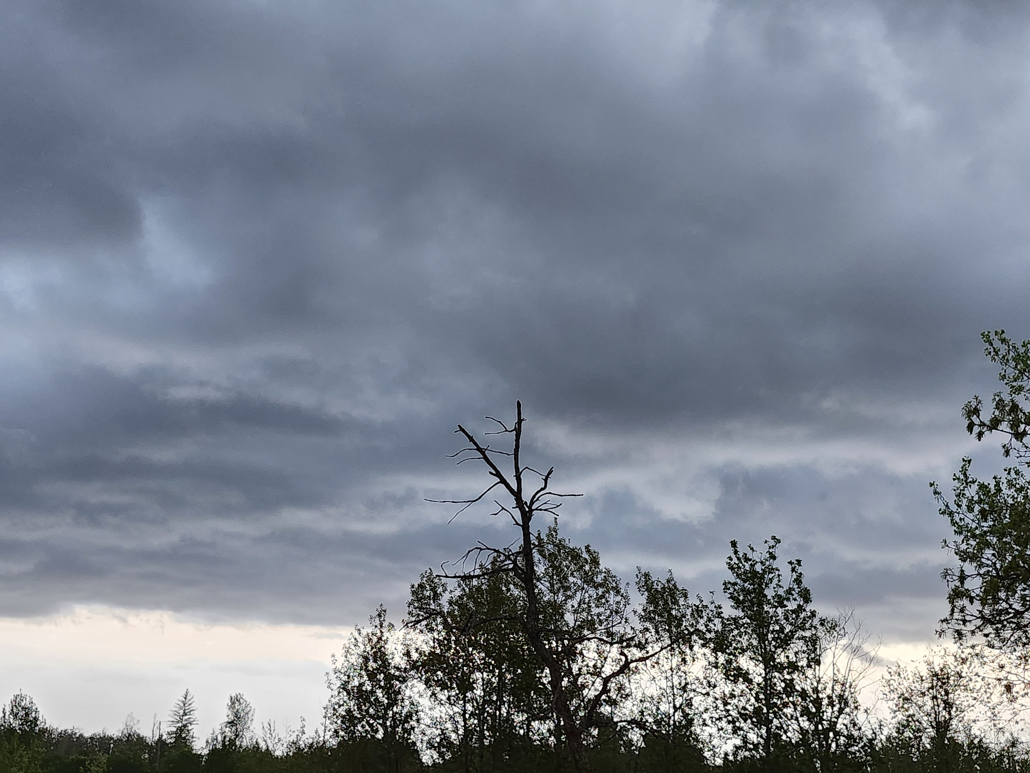
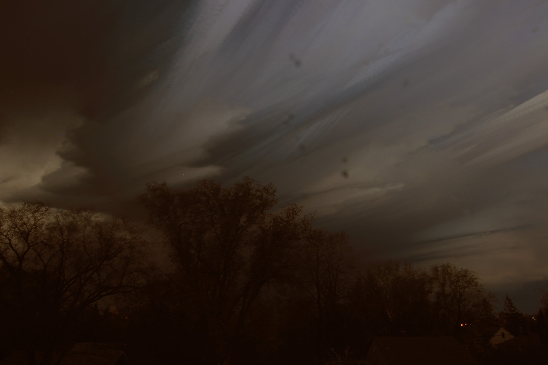
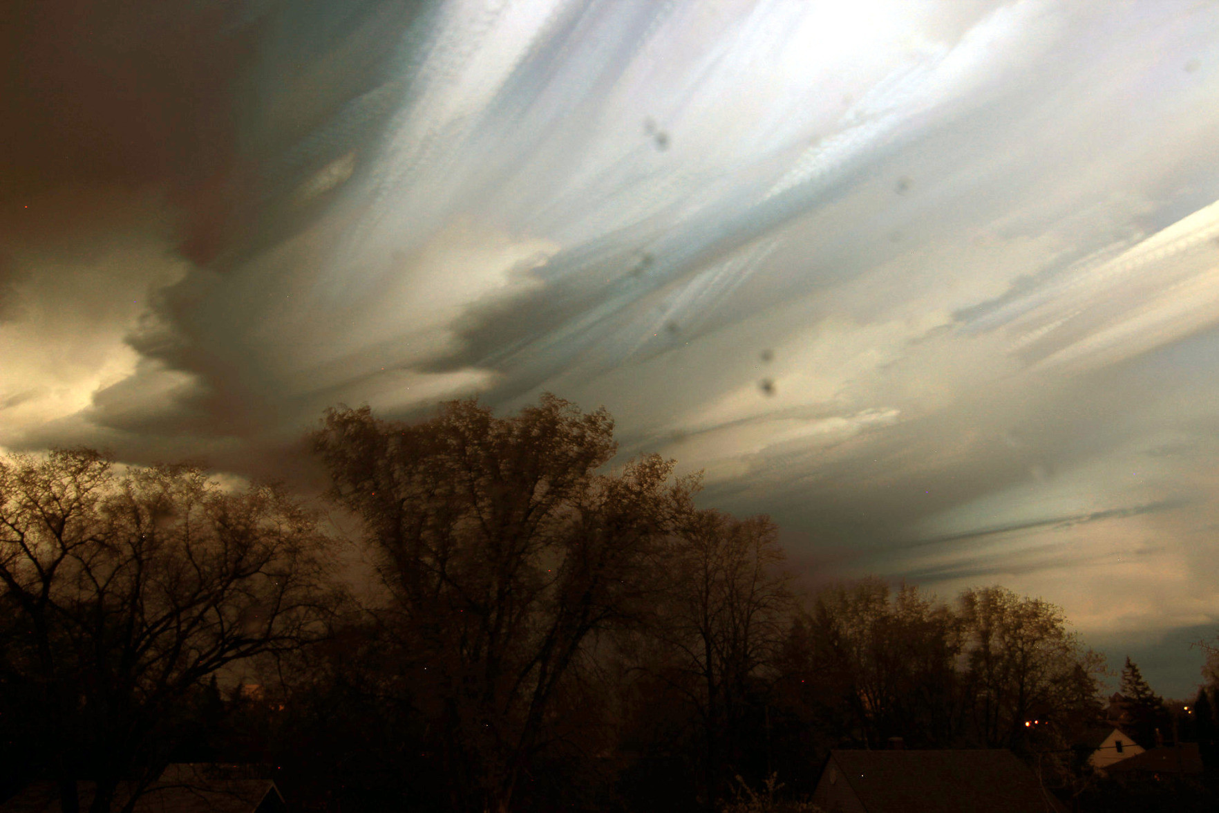
I was hoping to get some lightning on camera—which I don't think I did—but the neat striations resulting from stacking all the photos is a nice consolation prize.
[Edit] Added a brighter version of the photo.
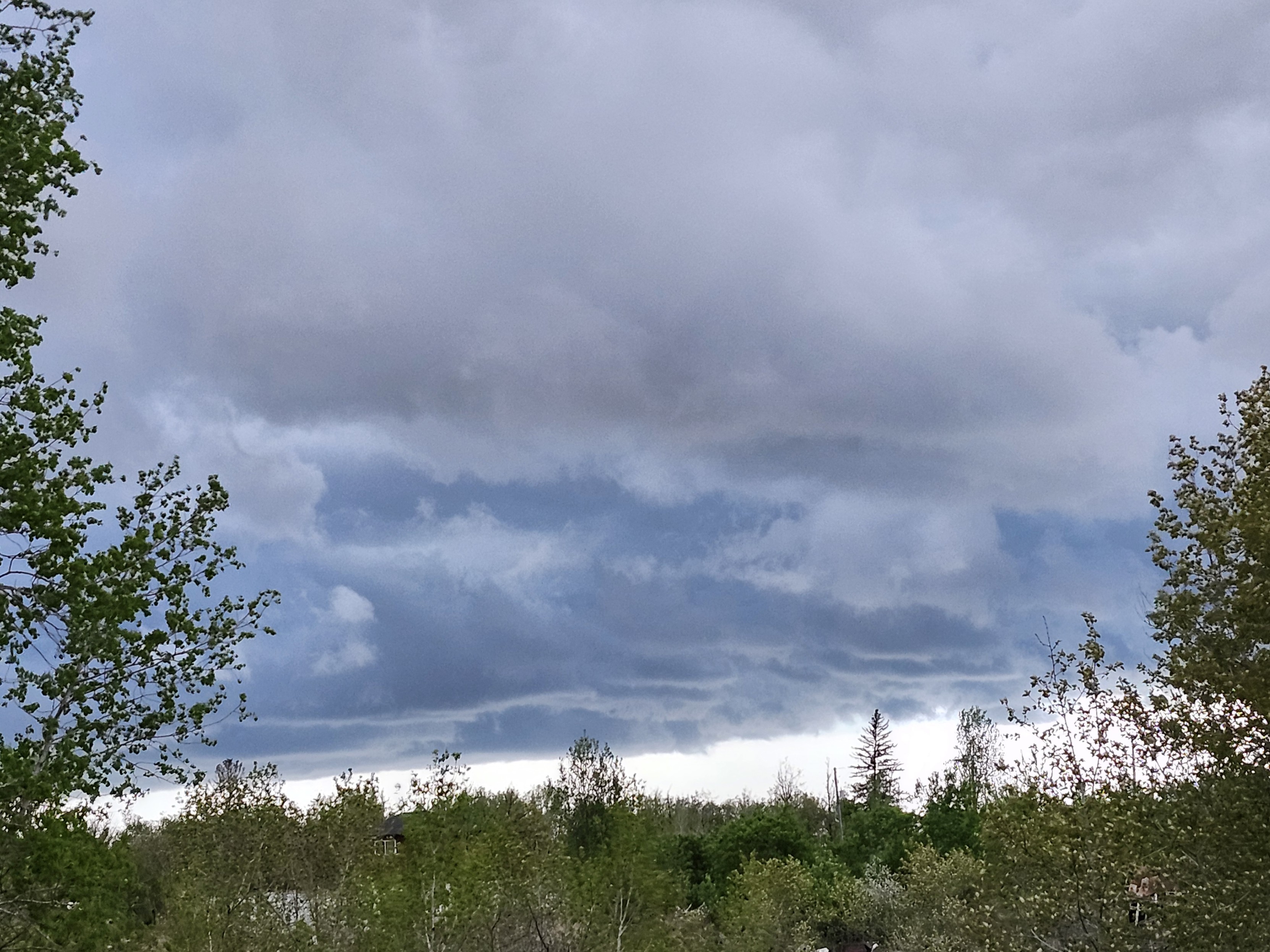
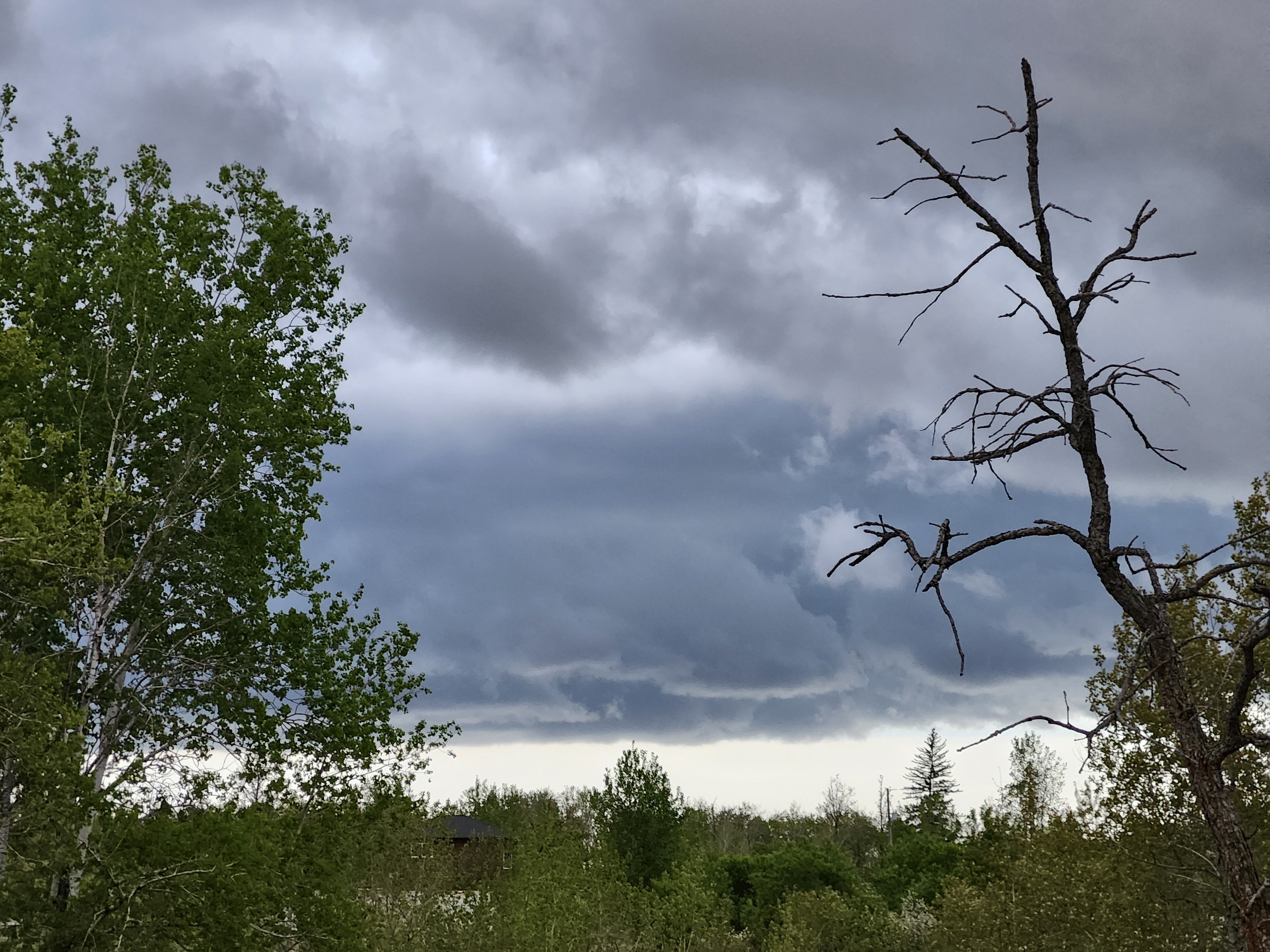
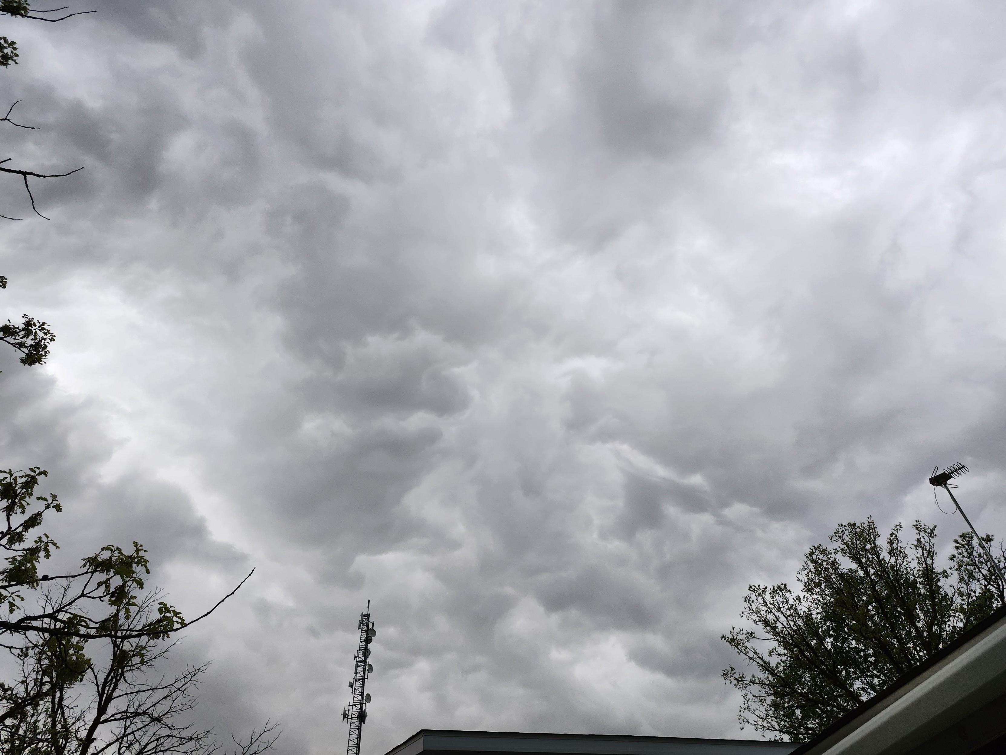
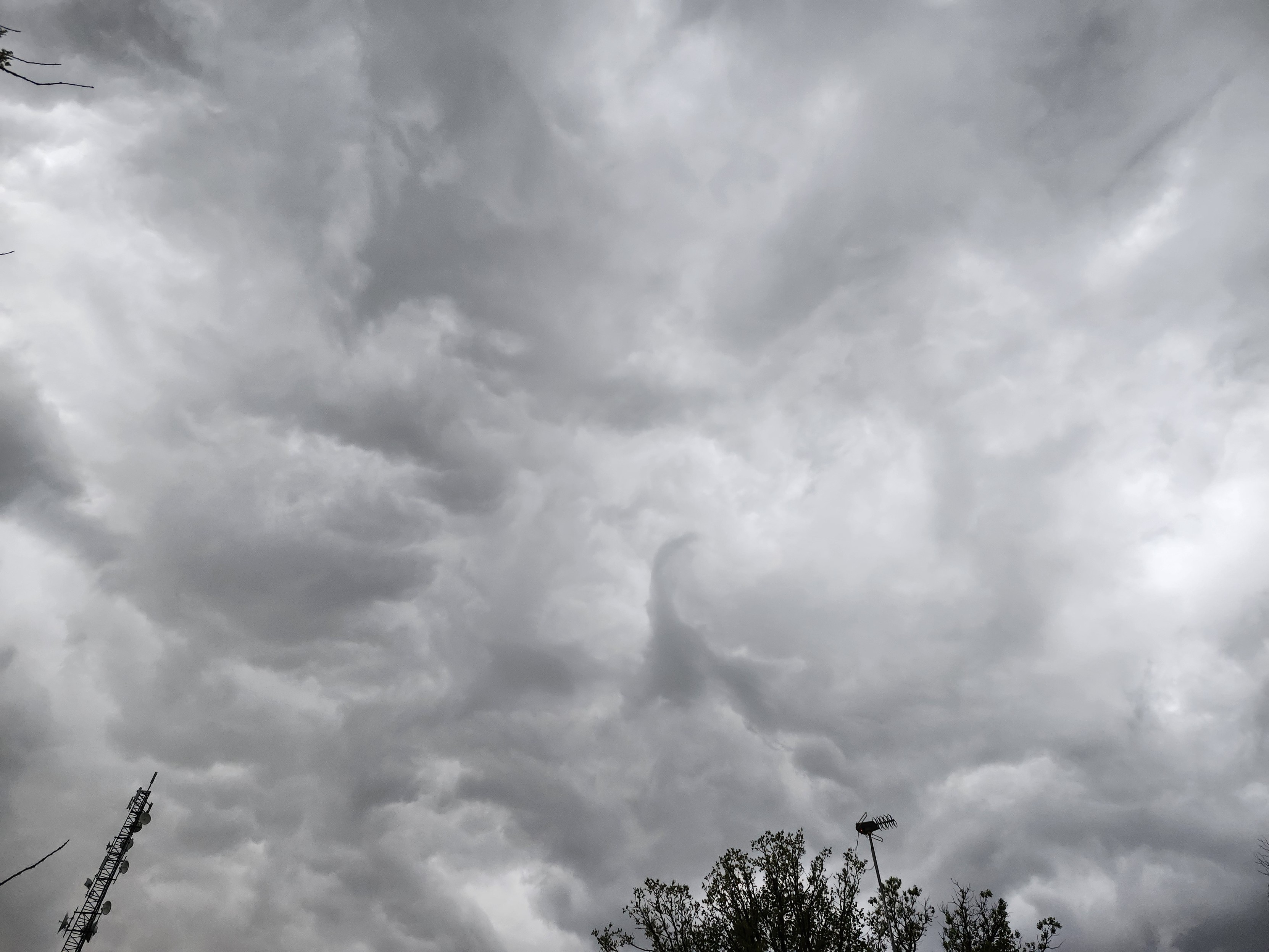
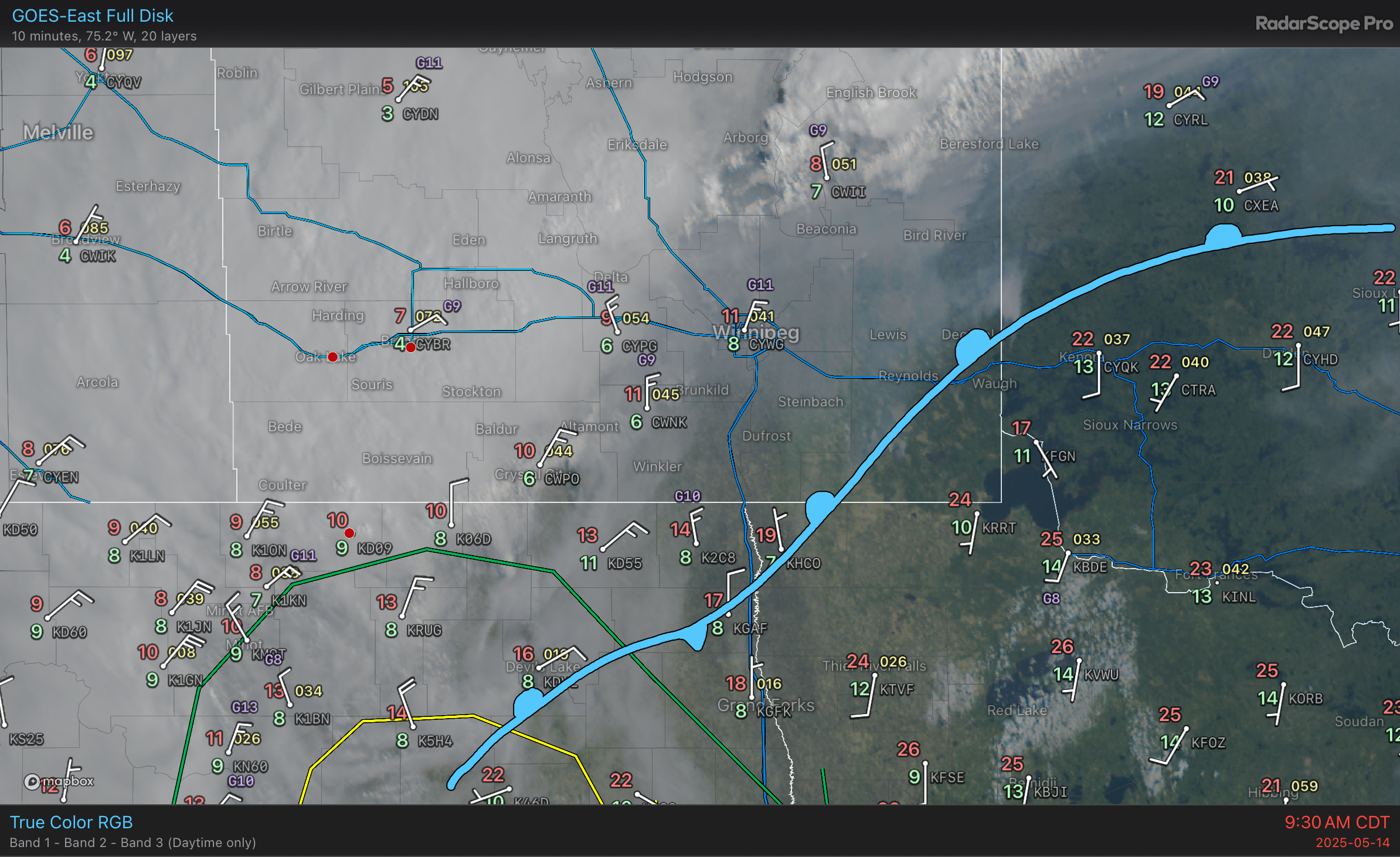
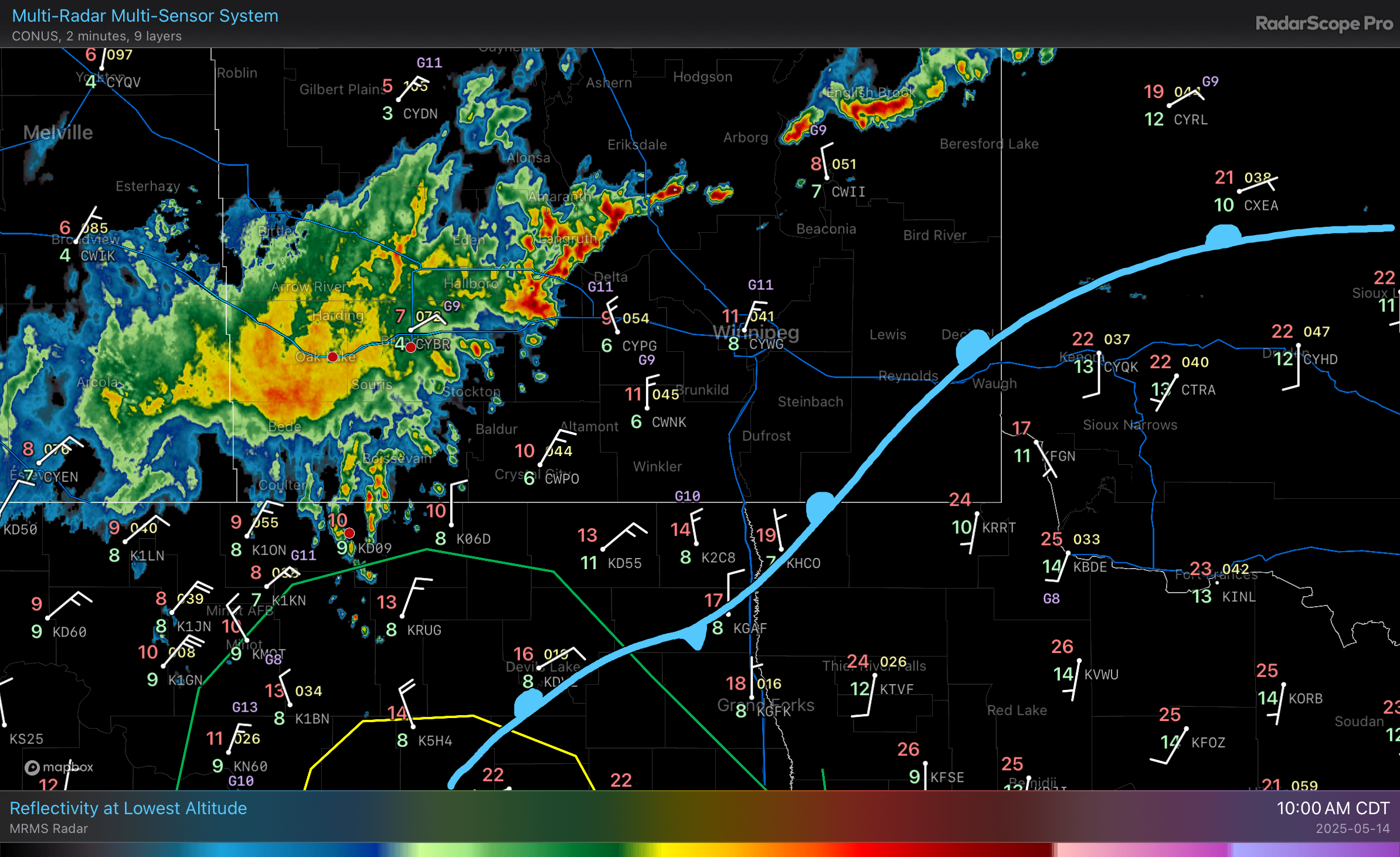
The weather’s starting to get more complex as an upper trough approaches. The main frontal boundary slumped south overnight and now cuts through SE #Manitoba; smoke from the #wildfires will pool in the region and shift west later today as easterly winds develop. The first wave of many waves of convection over the coming days is moving through WestMan: a broad area of showers/thunderstorms with a band of elevated thunderstorms arcing northeast ahead of the frontal boundary. #Winnipeg #MBstorm
Pyrocumulonimbus in Mantioba
Temps nearby are around 35°C with relative humidity around 20%. Wind gusts up to 50 km/h.
#MBstorm #weather #fire
RE: https://bsky.app/profile/did:plc:sm753s4lkdso676exaj2nbwx/post/3lp35zb4vjc2s
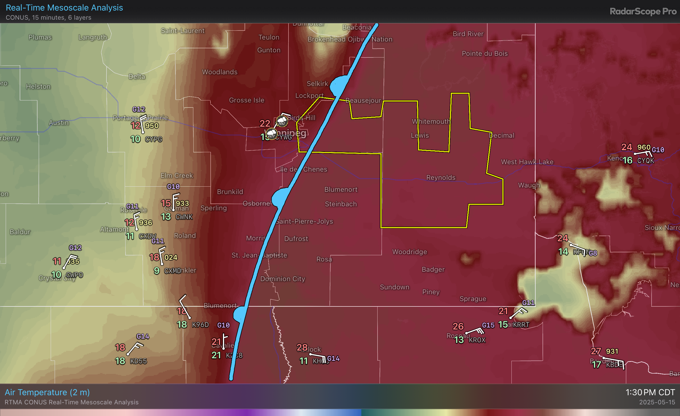
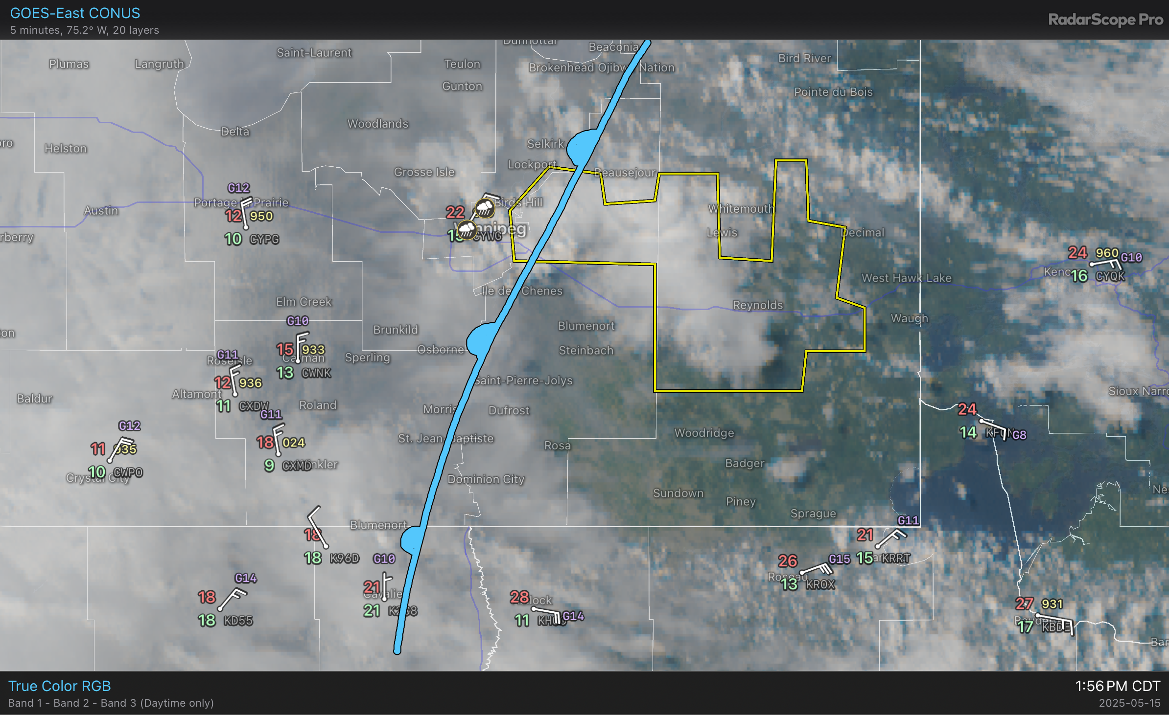
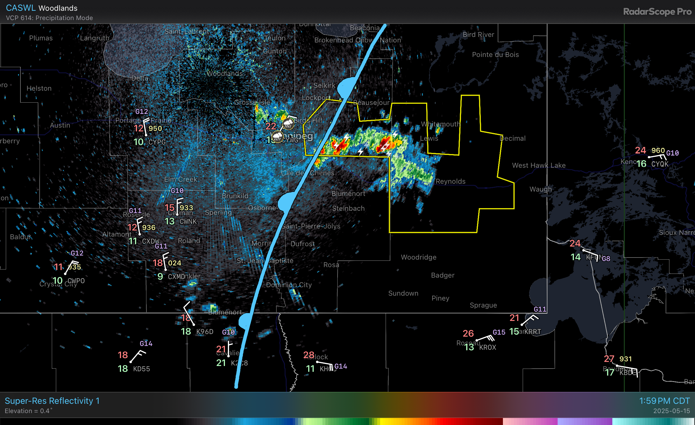
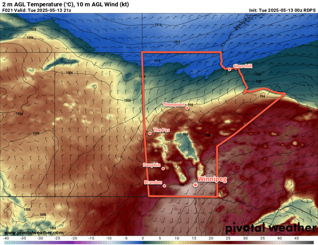
Scorching Heat to Give Way to Unsettled and Much Cooler Weather
The scorching heat and dangerous fire conditions will persist in Winnipeg and the Red River Valley for another day before the heat shifts east and showers and thunderstorms move into the region.
Read the full forecast on our site: https://www.aweathermoment.com/2025/05/13/scorching-heat-to-give-way-to-unsettled-and-much-cooler-weather/
#AboveNormalTemperatures #FreezingRain #mbstorm #Rain #Thunderstorms #Winnipeg
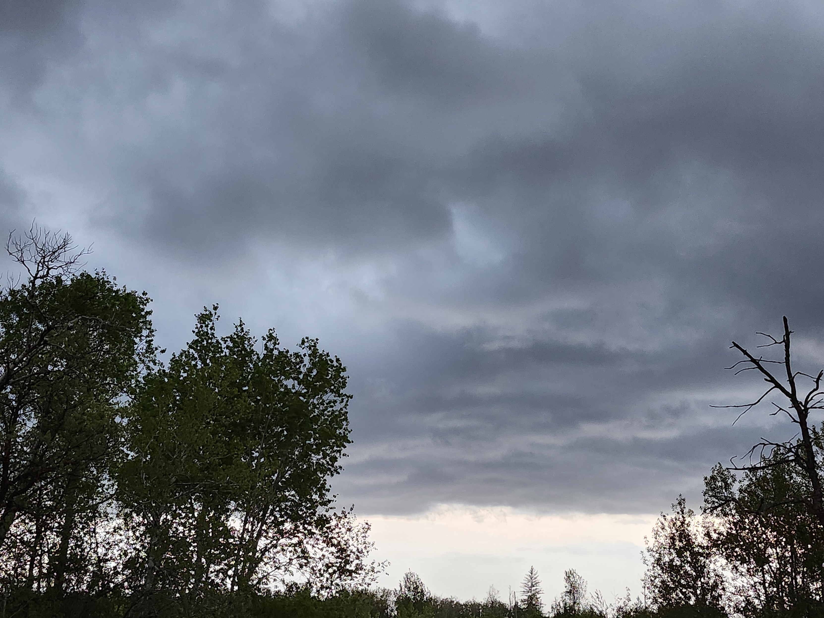
A bit of activity pushing through the region tonight; the main feature is precipitation along a cold front that will gradually weaken as it pushes across the Red River Valley, but there are a few popcorn showers developing out ahead of it that could also clip through #Winnipeg. Amounts will generally be light, though localized accumulations of 5 to 10 mm are possible in the main band to the west before it begins to weaken later tonight. #MBStorm
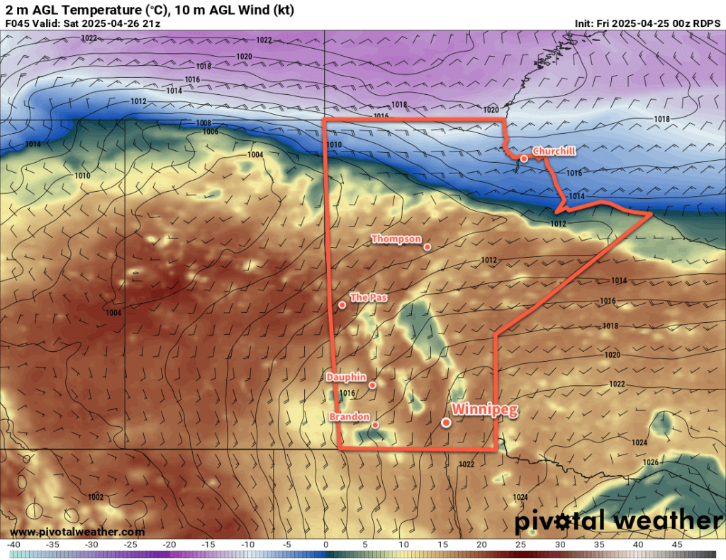
Pleasant Weekend Weather Arrives
Temperatures in Winnipeg will climb into the upper teens as the weather turns sunny and warm this weekend.
Read the full forecast on our site: https://www.aweathermoment.com/2025/04/25/pleasant-weekend-weather-arrives/
#AboveNormalTemperatures #BenignWeather #mbstorm #Rain #Winnipeg
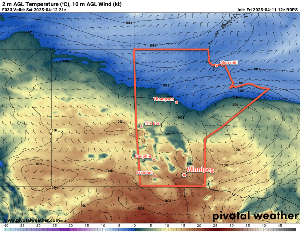
Beautiful Spring Conditions Ahead
Winnipeg will see a couple beautiful days before seasonal temperatures return to end the weekend.
Read the full forecast on our site: https://www.aweathermoment.com/2025/04/11/beautiful-spring-conditions-ahead/