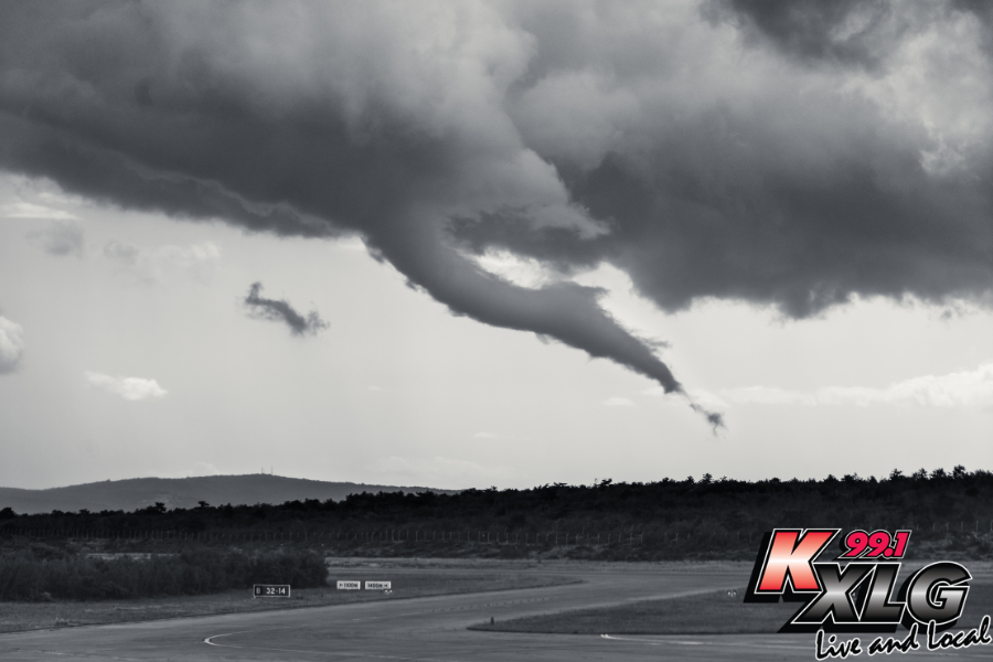
Special Weather Statement Issued for Northeastern South Dakota: Brief Cold Air Funnels Possible
#KXLGNews #KXLGRadio991 #LiveandLocal #LocalNews #WeatherAlert
#WatertownSD #SouthDakota #NWSAberdeen
Special Weather Statement Issued for Northeastern South Dakota: Brief Cold Air Funnels Possible
#KXLGNews #KXLGRadio991 #LiveandLocal #LocalNews #WeatherAlert
#WatertownSD #SouthDakota #NWSAberdeen
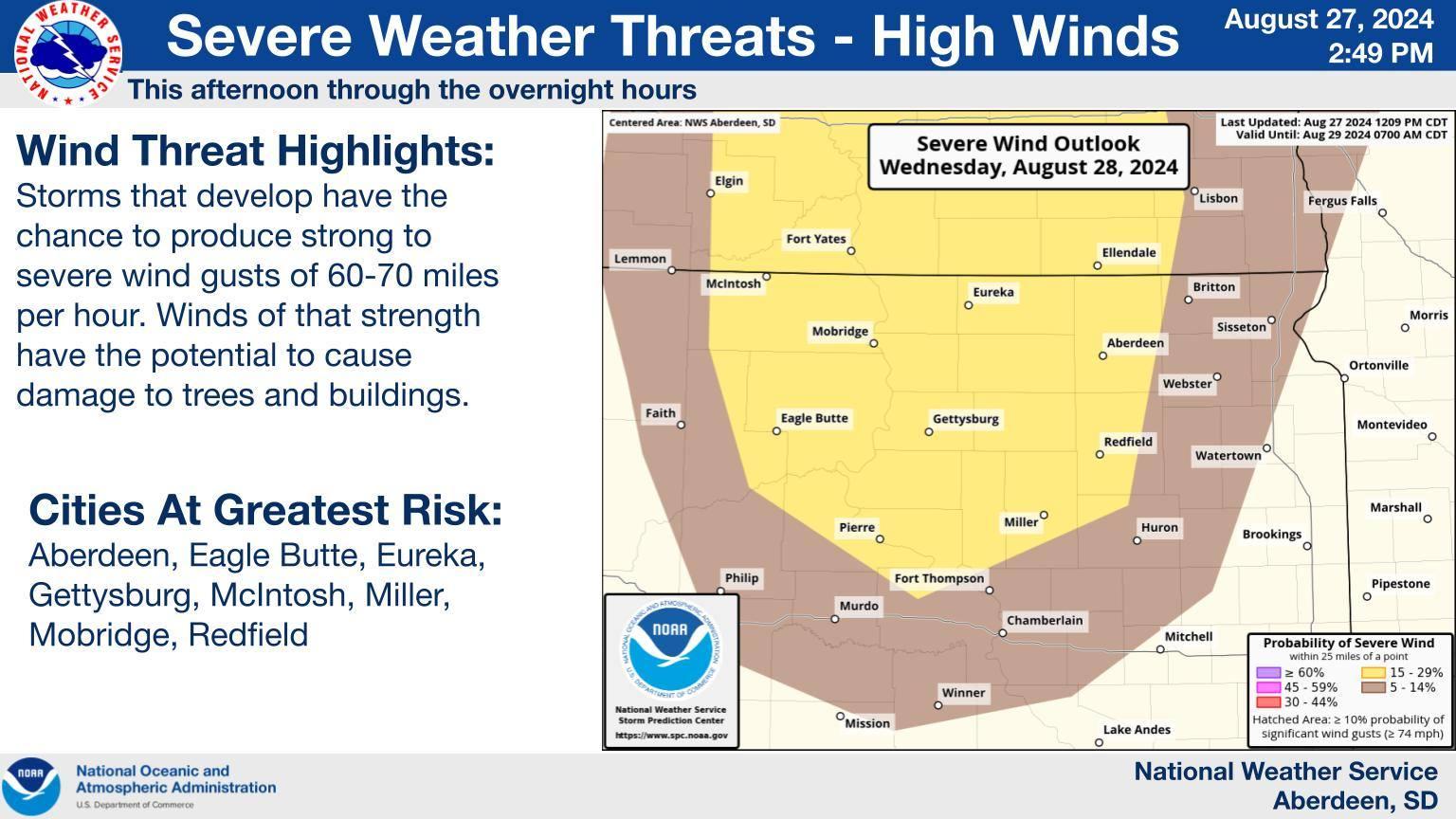
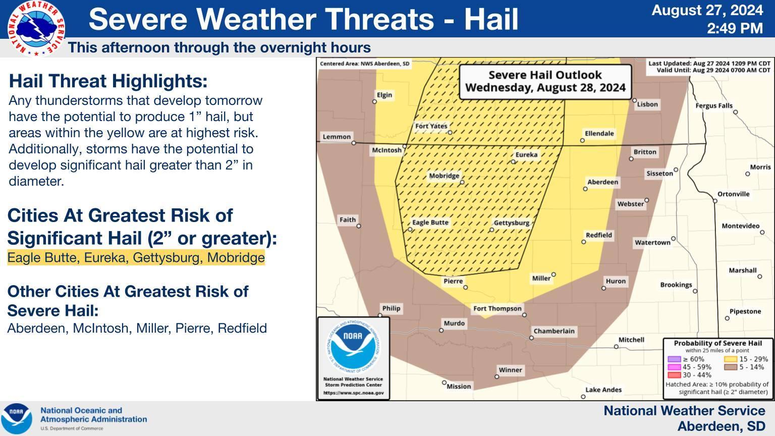
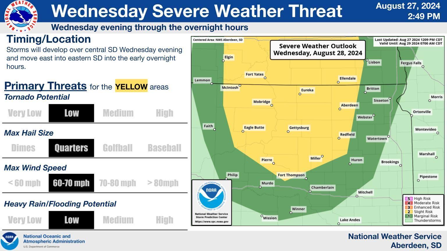
The next threat of severe weather comes on Wednesday. Hail and wind are the main potential threats. Be sure to remain weather aware and have multiple ways to receive weather alerts!
Tune into KXLG Radio when severe weather hits the listening area! 📻
#KXLGRadio991 #NWSAberdeen

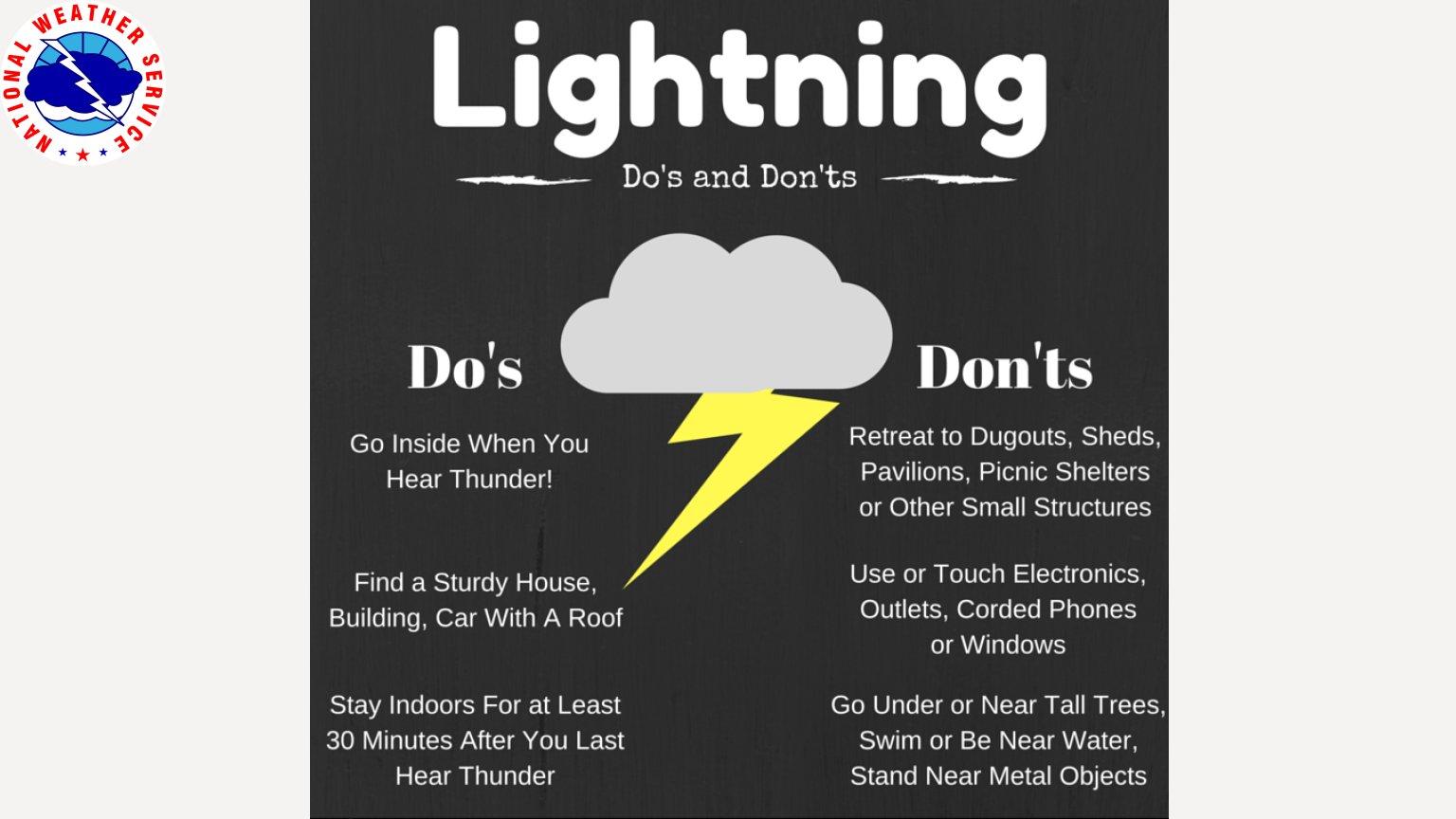
Scattered rain showers and isolated thunderstorms will continue into the evening while gradually diminishing with time. While severe weather is not expected, lightning may occur, so go indoors if you see lightning or hear thunder! #NWSAberdeen #KXLGRadio991
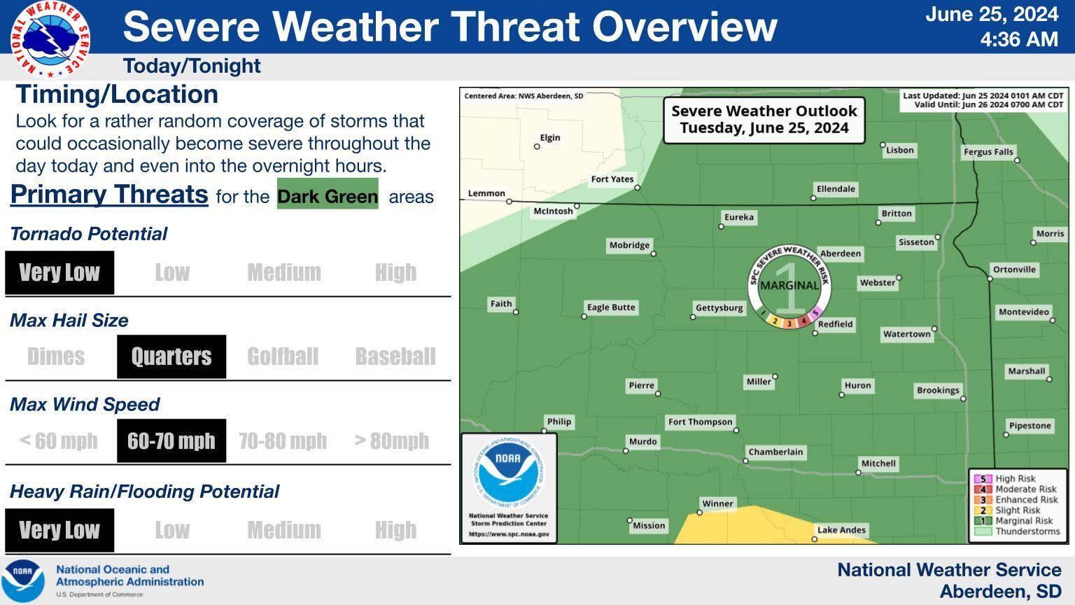
While organized severe weather is not expected, we still can't rule out an isolated severe storm or two today/tonight. Hail to 1" and wind gusts up around 60mph are probably the most we would see.
#NWSAberdeen #KXLGNews #KXLGRadio991 #weatherupdate
The National Weather Service in Aberdeen, SD has issued a hazardous weather outlook for parts of Minnesota and South Dakota.
👉Read more: https://zurl.co/ZTGW 👈
#KXLGNews #KXLGRadio991 #LiveandLocal #LocalNews #LocalWeather #NWSAberdeen

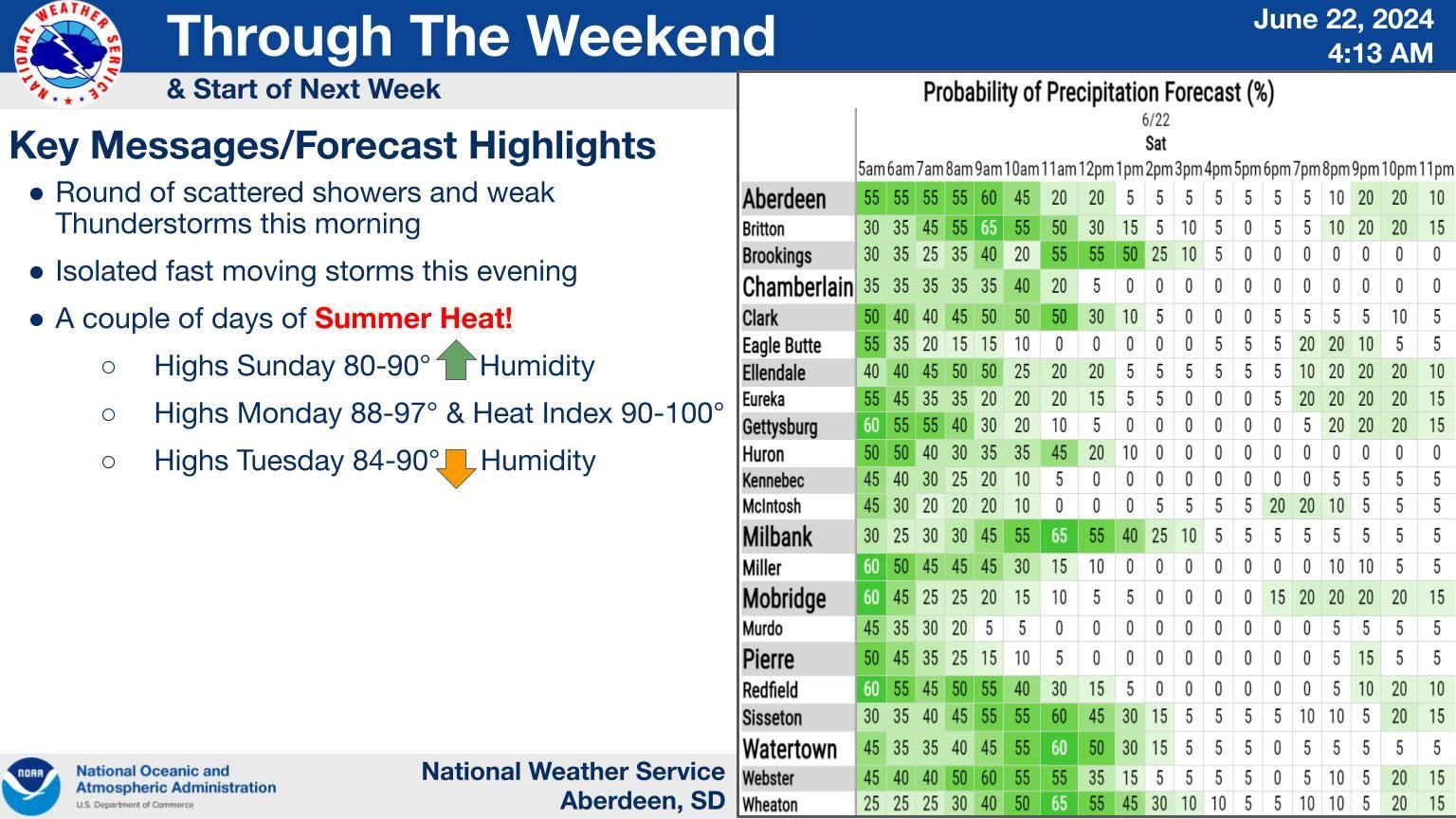
We will continue to see light amounts of moisture this morning, with more isolated storms coming out of North Dakota this evening. Otherwise, we will see a shift to hot and humid conditions to start the work week.
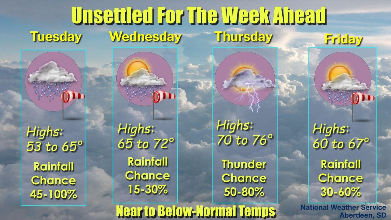
Another storm system will track across the region late tonight and Tuesday and bring a chance for showers and thunderstorms. Most storms are expected to remain sub-severe. Drier, more windy conditions set in by the middle to latter half of the work week. #sdwx #nwsaberdeen
A series of weather systems will bring ample opportunities for moisture this week, along with periods of windy conditions.
#NWSAberdeen #KXLGRadio
A severe thunderstorm watch has been issued for parts of North Dakota and South Dakota until 11 PM CDT
#NWSaberdeen #KXLGNews #KXLG

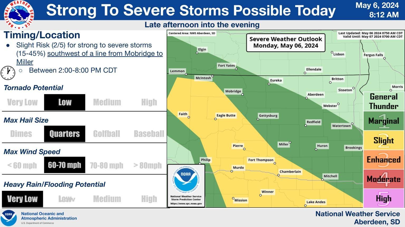
Severe storms are expected to develop this afternoon and march east into central SD by early this evening. This cluster or line of storms will continue eastward this evening before weakening later tonight. Large hail and damaging winds will be the main threats. #sdwx #nwsAberdeen
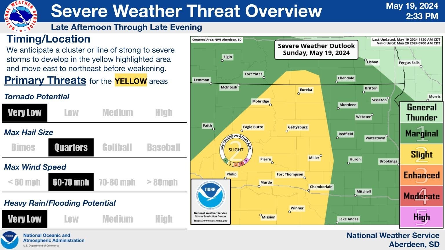
🚨 Severe Weather Update 🚨
2/5 risk for strong to severe storms SW of Mobridge to Miller line. Quarter-size hail & 60-70mph winds possible. Uncertain if tornadoes will occur. Threats are expected between 2-8 PM CDT. #SevereWeather #SDwx #KXLG #LiveandLocal
#NWSAberdeen
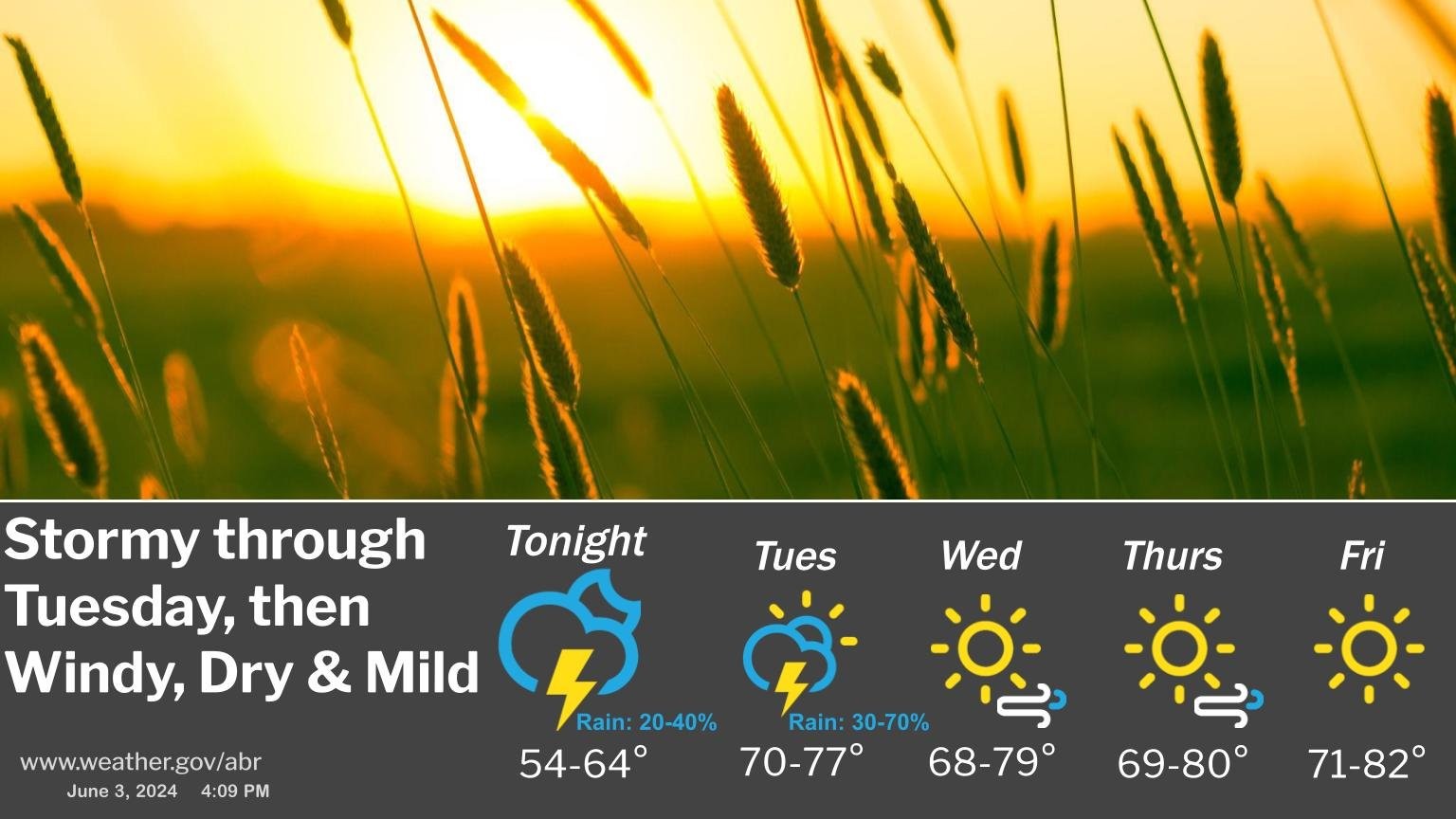
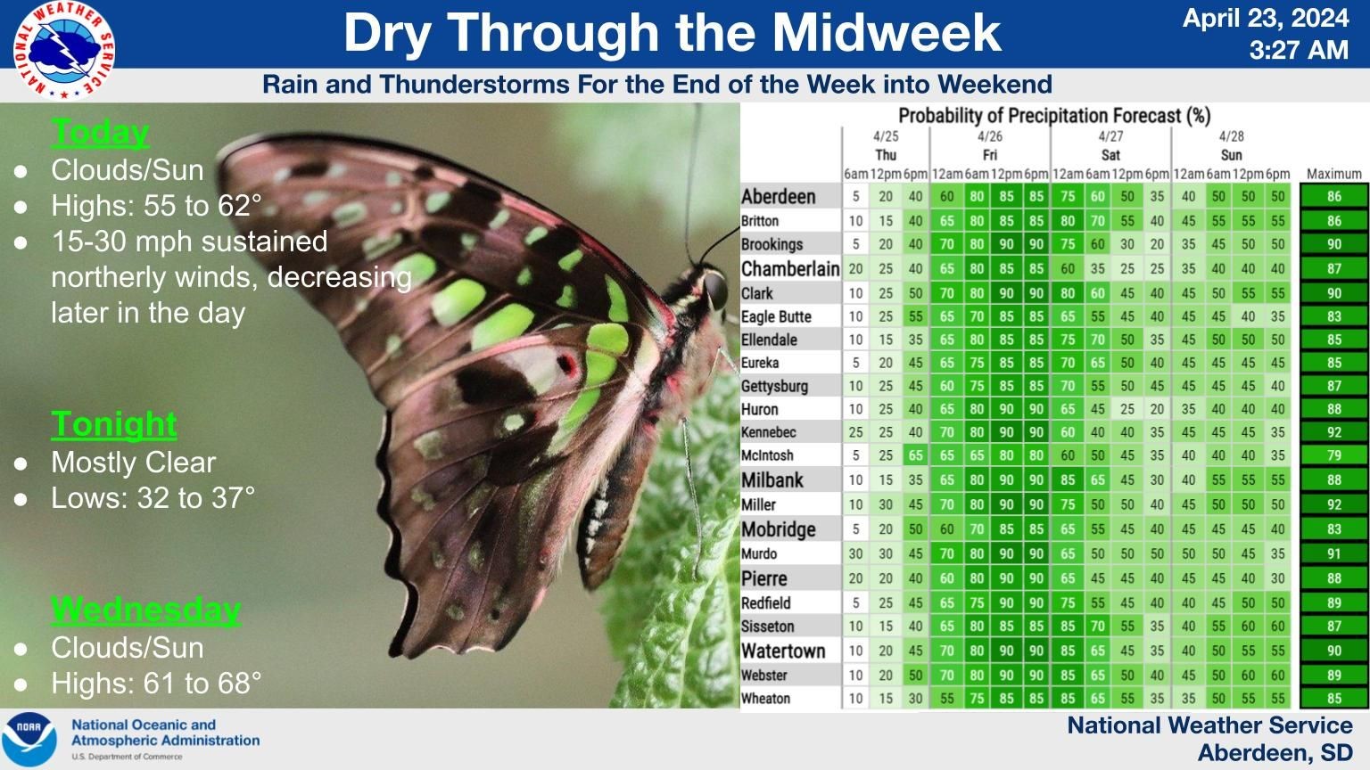
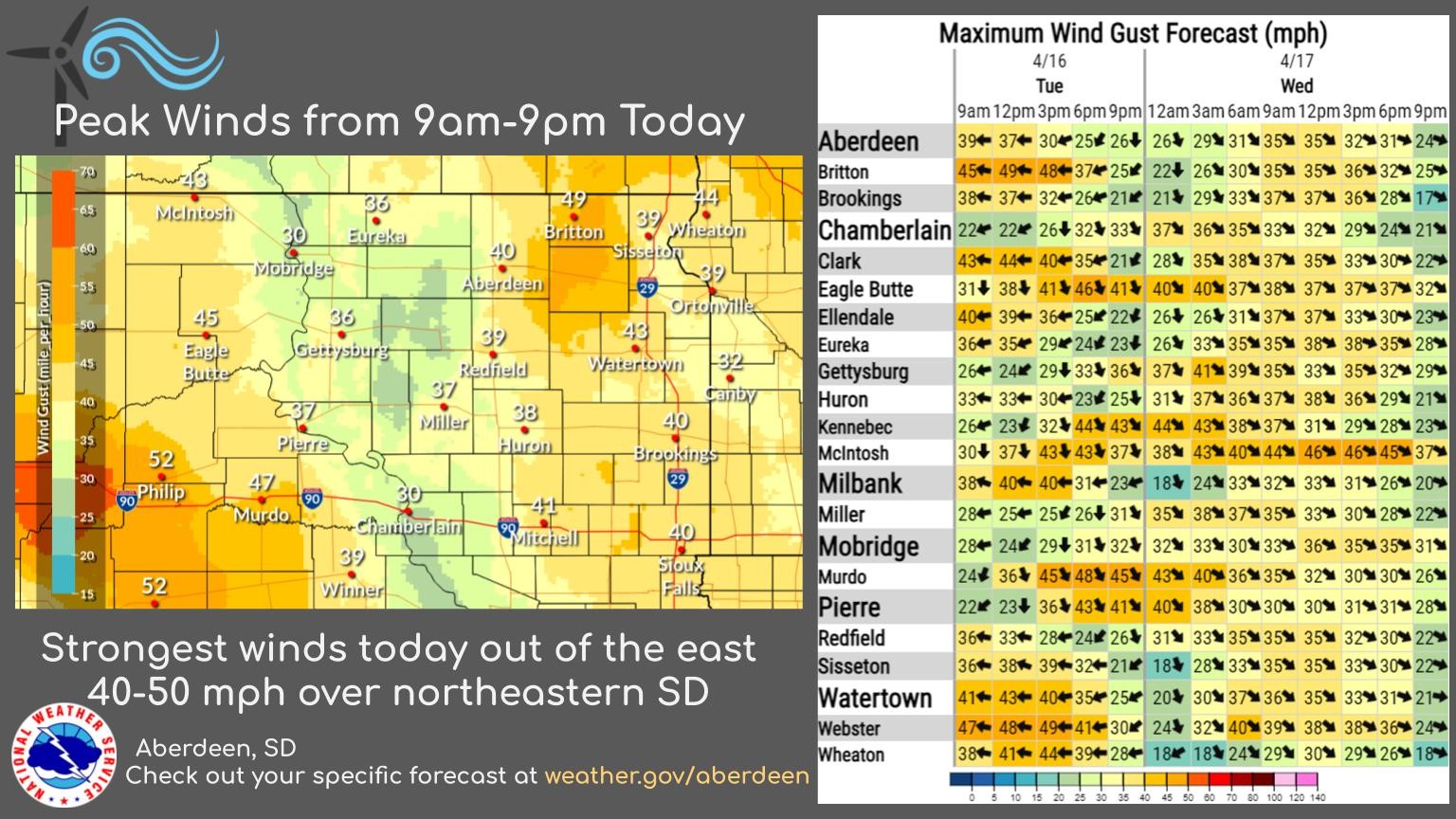
Today will be breezy and dry with sustained winds of 15-30 mph from the north, gradually diminishing. Expect dry and calm conditions tonight and tomorrow, followed by rain showers and thunderstorms starting Thursday evening through the weekend.
#NWSAberdeen #KXLG #LiveandLocal
Rain showers will continue, with thunderstorms ending in central and eastern South Dakota. Watch out for gusts of wind above 50mph. Temperatures will fall into the 40s-50s before rebounding on Sunday and Monday.
#weatherupdate #SouthDakota #KXLG #NWSAberdeen
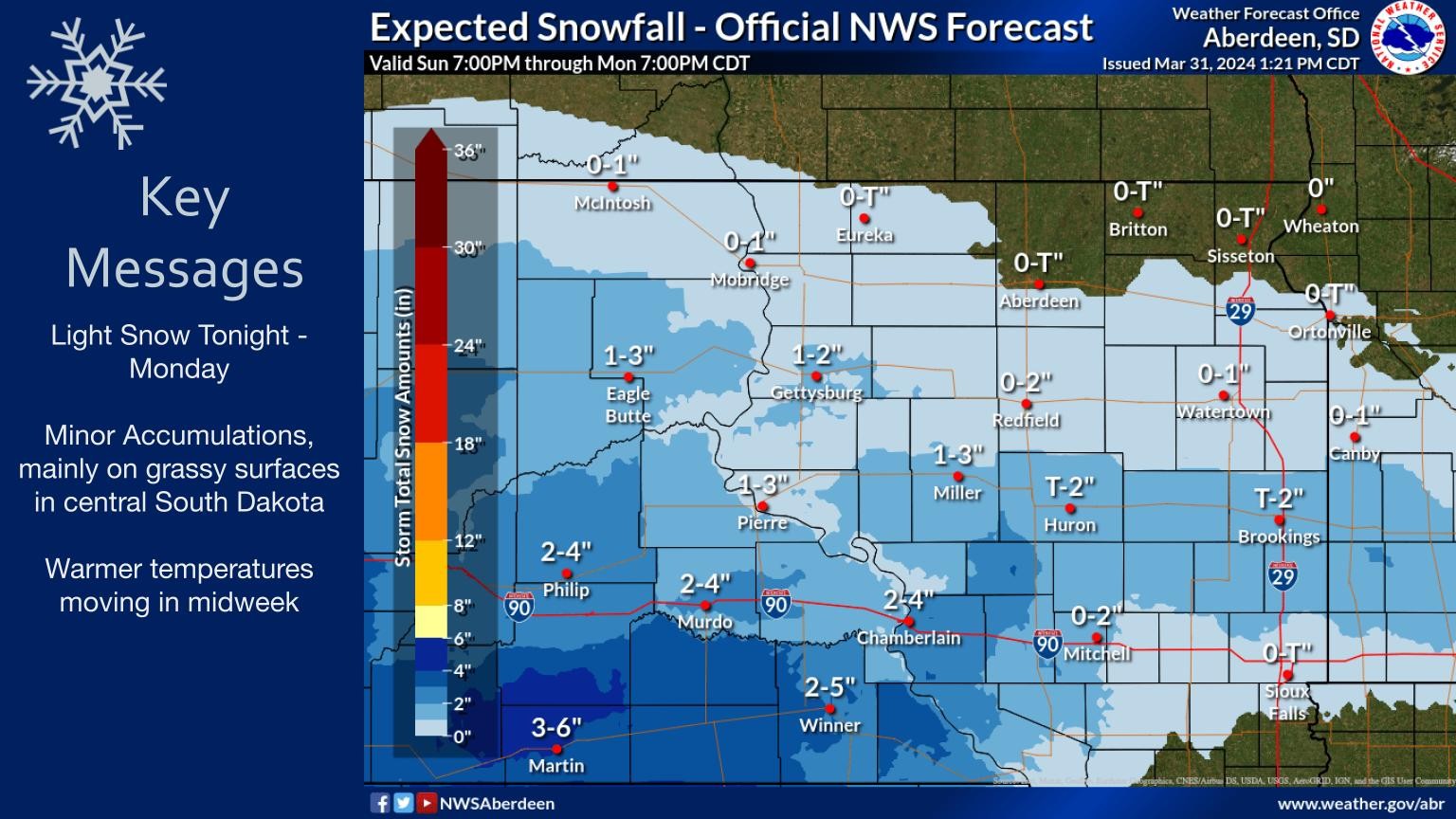
Light snow to persist through today and into Monday morning, with minor accumulations expected mainly on grassy surfaces in central SD. Warmer temperatures are forecasted for mid-week.
#SDweather #snowfall #winterforecast #KXLG #NWSAberdeen
@NWSAberdeen
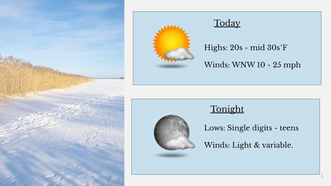
Expect mostly clear skies and lighter winds as surface high pressure builds across the region today and tonight. #WeatherUpdate #ClearSkies #NWSAberdeen #KXLG #KXLGNews #SDNews
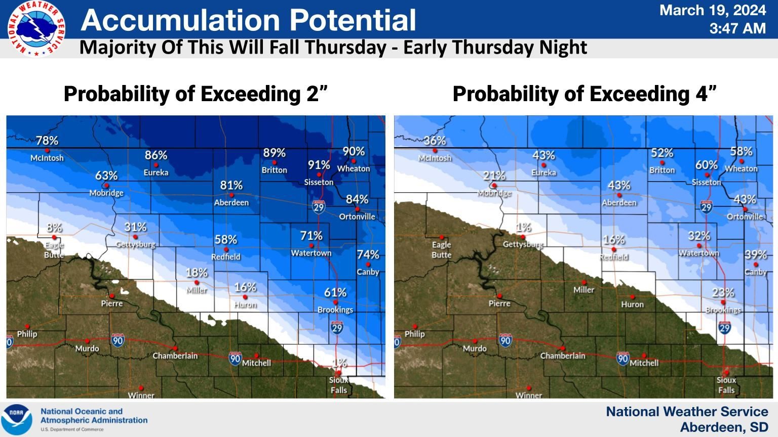
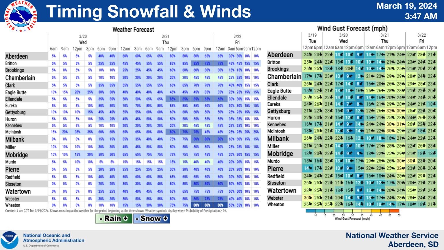
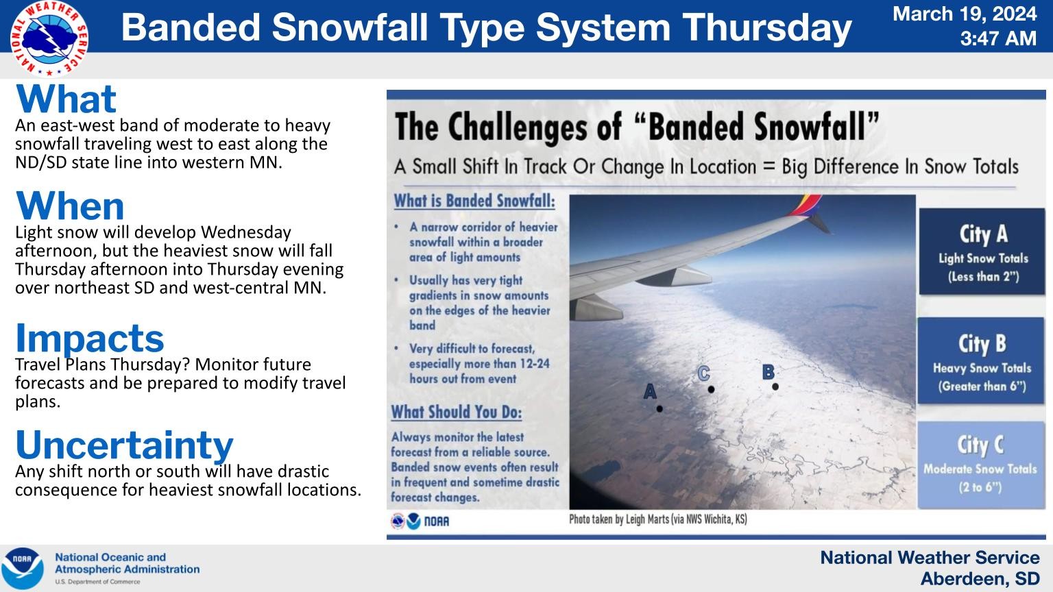
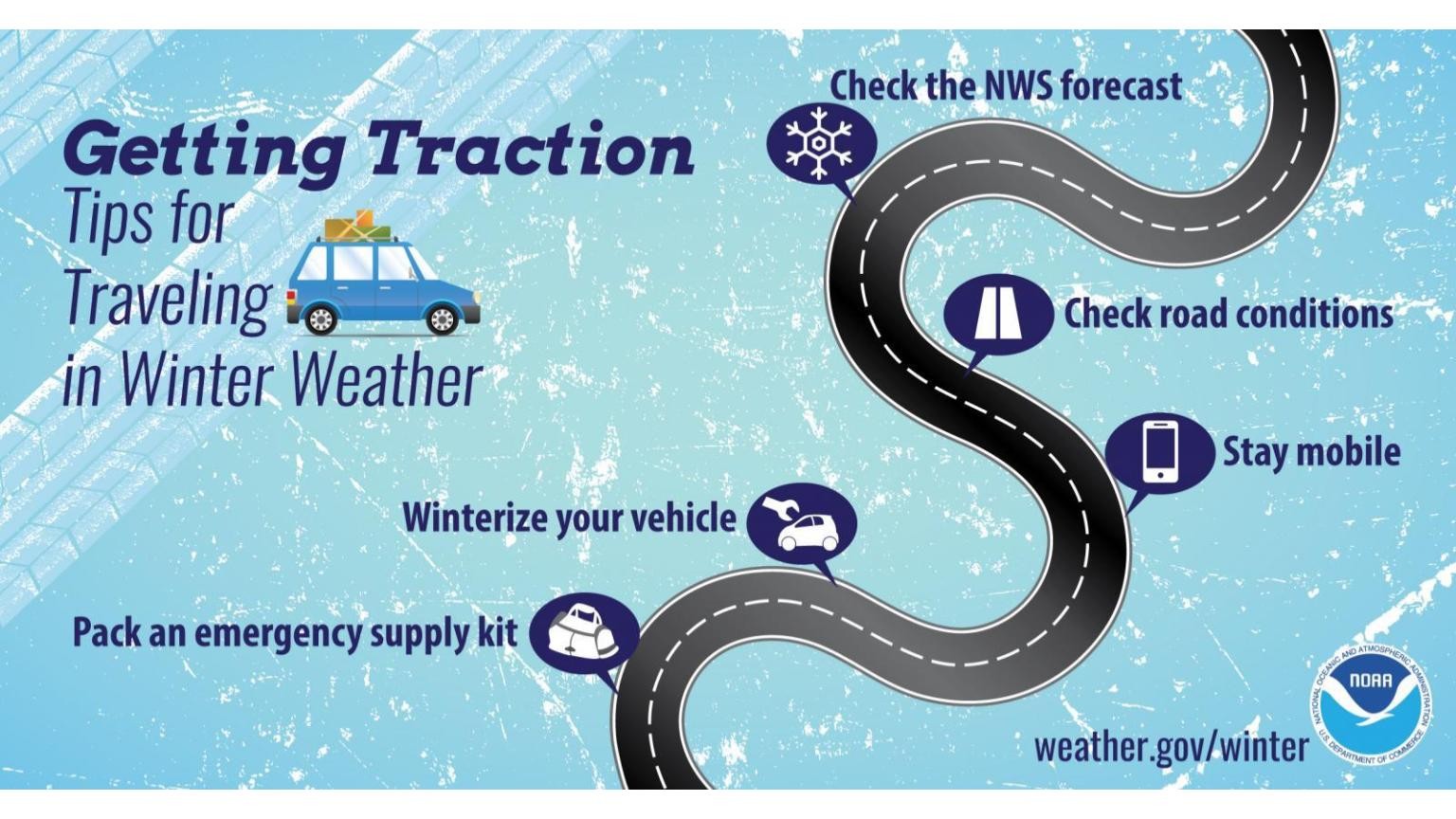
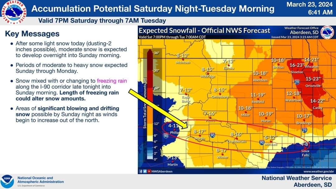
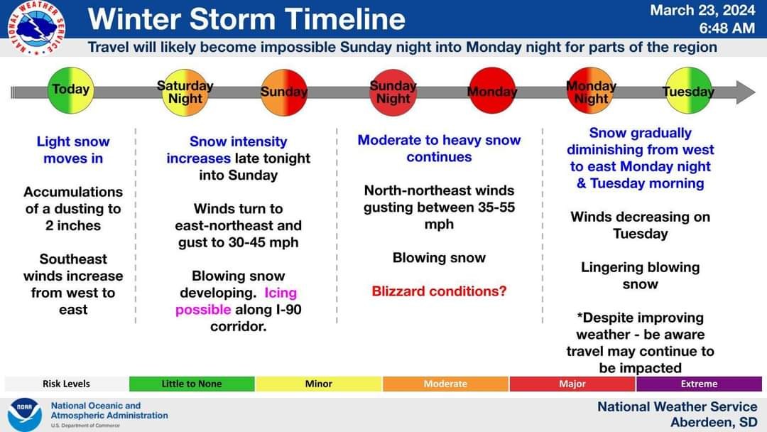
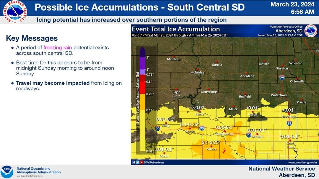
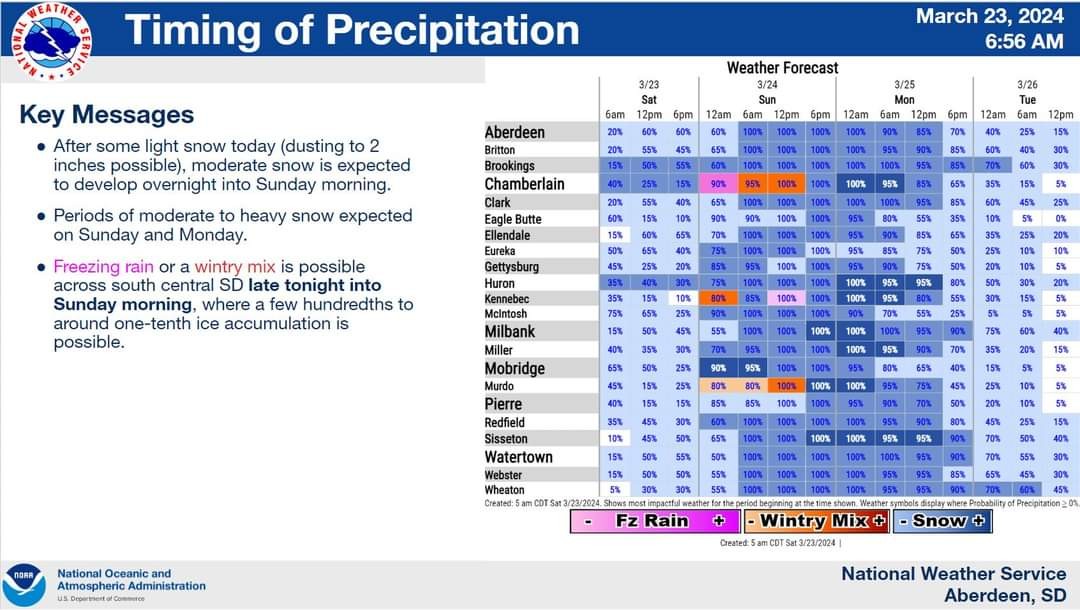
Here is the latest information concerning the upcoming storm system. Prepare and be safe. Hazardous travel conditions are expected! #NWSAberdeen #weather #sdweather #winterstorm
A system crossing the Dakotas on Thursday will bring an east-west band of snow moving from west to east, with potential for moderate to heavy snow. Here are the probabilities of 2 and 4 inches accumulation. Stay safe and warm! #snow #weather #Dakotas #KXLG #KXLGRadio #NWSAberdeen