#Q533046

2022-11-28

#MappingChallenge (Day 105/200)

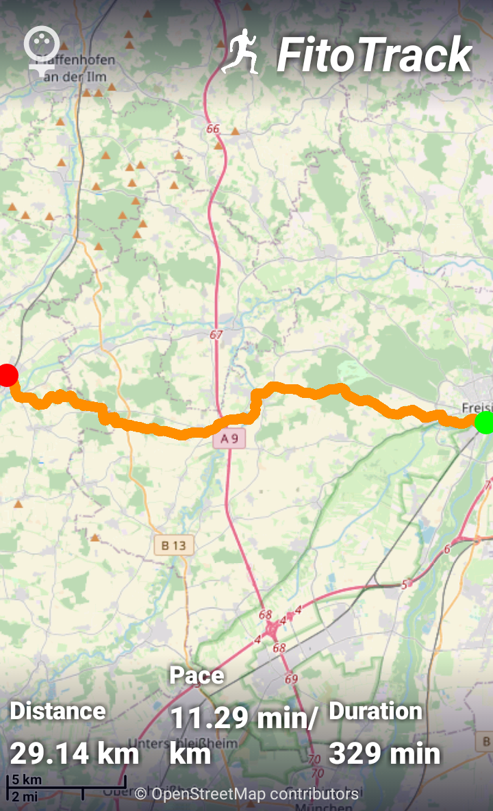
Had the fortune to be able to do another #hike today. This time it was from #Petershausen (#Q533046) to #Altomünster (#Q443815).

Compared to the previous hike on day 103 (en.osm.town/@barefootstache/10) the first half was missing almost all hunting stands and the second half basically didn't have any.

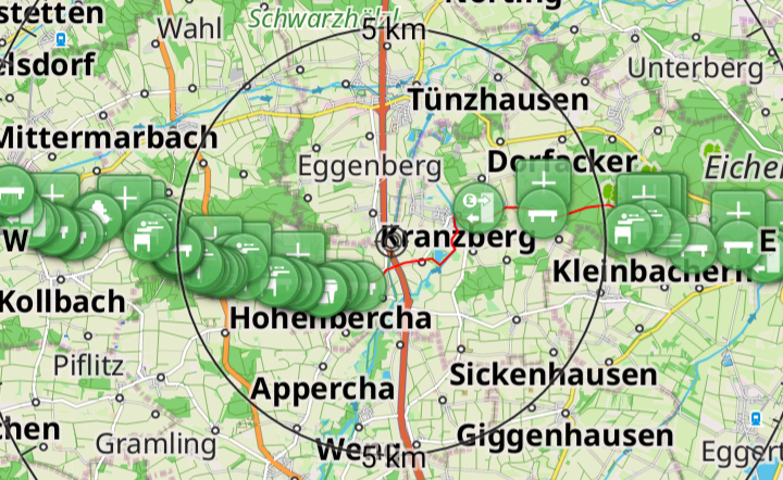
In the first two images you can see the difficulty of calculating where a hunting stand should be positioned (up to 600m away).

Summary:

#osmand: 75

#OpenStreetMap

Some forest about 500m away with a hunting stand camouflaged in the center. Prior to the forest are farm fields and a road with one reflector post.Open Street Map centered around a newly added hunting stand that is 477m away from the current location. The hunting stand is placed on the edge of a forest.GPS route in FitoTrack from Petershausen to Altomünster. Distance: 20.84 km; Pace: 10.99 min/km; Duration: 229 min;POI plotting from Petershausen to Altomünster in the Osmand app.
2022-11-26

#MappingChallenge (Day 103/200)

Did a #hike (ca. 29km) from #Freising (#Q6998) to #Petershausen (#Q533046) over #Kranzberg (#Q506248). It was surprising how heavily the noise from the highway was being funneled to the higher locations in Kranzberg.

Summary:

osmand: 50

#OpenStreetMap #FitoTrack

Route from Freising to Petershausen over Kranzberg in OsmAnd. Lots of POIs added along the route.FitoTrack from Freising to Petershausen. Distance: 29.14km; Pace: 11.29 min/km; Duration: 329 min;

Client Info

Server: https://mastodon.social
Version: 2025.04
Repository: https://github.com/cyevgeniy/lmst