Awesome work by #NASA portraying #Ocean currents.
Imagine this with #Mercator 😆. What you see in this video is called the #PerspectiveMapProjection.
Awesome work by #NASA portraying #Ocean currents.
Imagine this with #Mercator 😆. What you see in this video is called the #PerspectiveMapProjection.
@infobeautiful Not only is this map utterly incorrect, so are all those simplistic solutions like "TrueSize".
If you wish to compare areas you need an equal-area #MapProjection
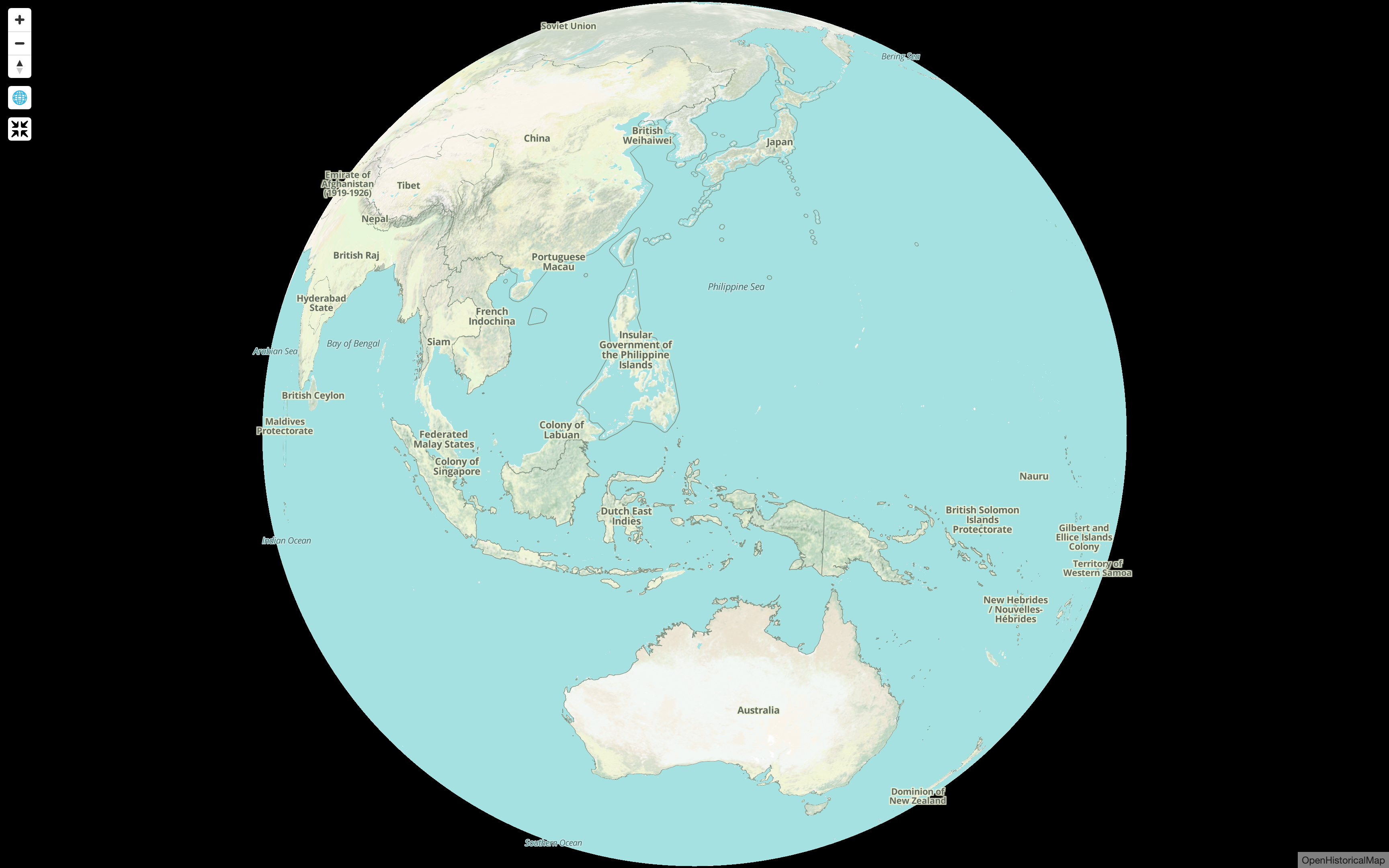
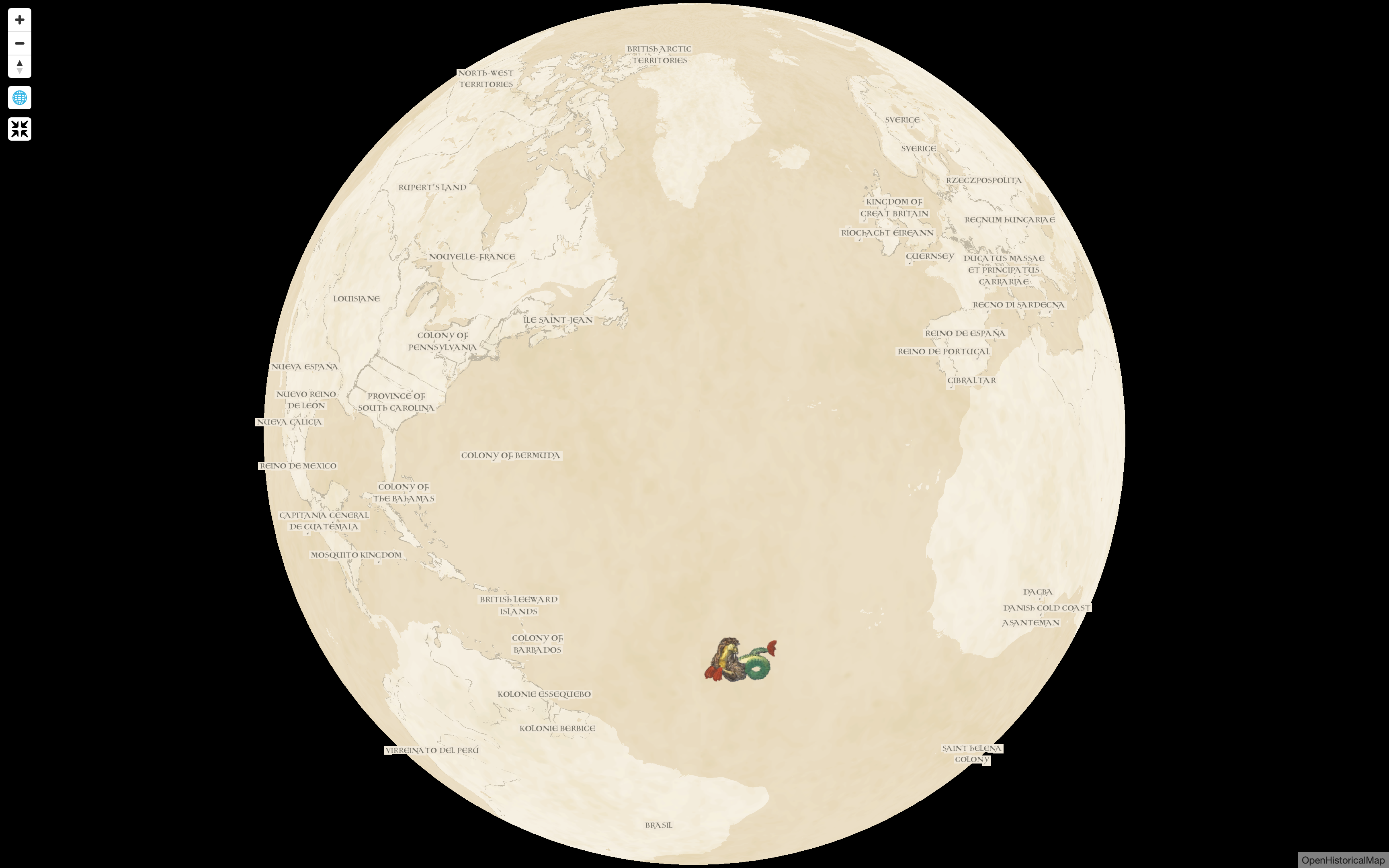
We just added a button to toggle the *revolutionary* new globe view from @maplibre and we think it’ll turn some heads.
For now, it’s only available in a special “embed” version of the map. This is same version of the map as when you Share a map from our homepage and choose “HTML”. It’s perfect for inserting a quick historical map into a blog post or other webpage.
Take it for a spin!
https://embed.openhistoricalmap.org/#map=3/16.82/130.83&projection=globe&date=1925-02-04
https://embed.openhistoricalmap.org/#map=2.87/36.74/-43&projection=globe&date=1725-02-04&layer=W
Documentation at https://github.com/OpenHistoricalMap/openhistoricalmap-embed/
Very disappointed to see Prof. Michael Clarke involved in this. A video published by #SkyNews days ago portrays distances on the #Mercator projection, misinforming the public on the real range of #Russia 's #WMDs.
This is a very obvious misuse of #cartography, that cannot possibly be a mistake.
Detailed analysis of the dramatic events in #Russia the past few days. Some observers are calling this a watershed moment, turning the tide in favour of #Ukraine. We shall see.
Note however that @HMexperience@YouTube.com and @noelreports seem to be measuring distances on the #Mercator projection.
Now that @openstreetmap is all grown up, wouldn't it be great if it stopped using the horrendous Mercator projection once and for all?
@phanecak @bert_hubert A most depressing map because it uses Mercator. #StopMercator
@fionag11 Why in hell would you portray this data with Mercator? #StopMercator! Now!
@amalgam_ Very uncool map. #StopMercator
@klaskarlsson Extra points for renouncing to Mercator. #StopMercator.
@Micha_Silver @pokateo Footnote: you can't portray the poles on Mercator. #StopMercator
The "Mercator size" of Antarctica is dead wrong in this map by @conradhackett. Part of the problem with this projection: most folk do not fully understand it. #StopMercator
https://mastodon.social/@conradhackett@sciences.social/109463292346807245
@jaz Moving to #Mastodon is always a good opportunity to drop Mercator. In the #Fediverse you are not compelled to make monstrous maps. 😉
A growing number of global studies using the #Homolosine projection. There is life beyond Mercator.
#StopMercator
@pokateo There should be a #StopMercator day somewhere in that list.
See if I can put something up for the 14th.
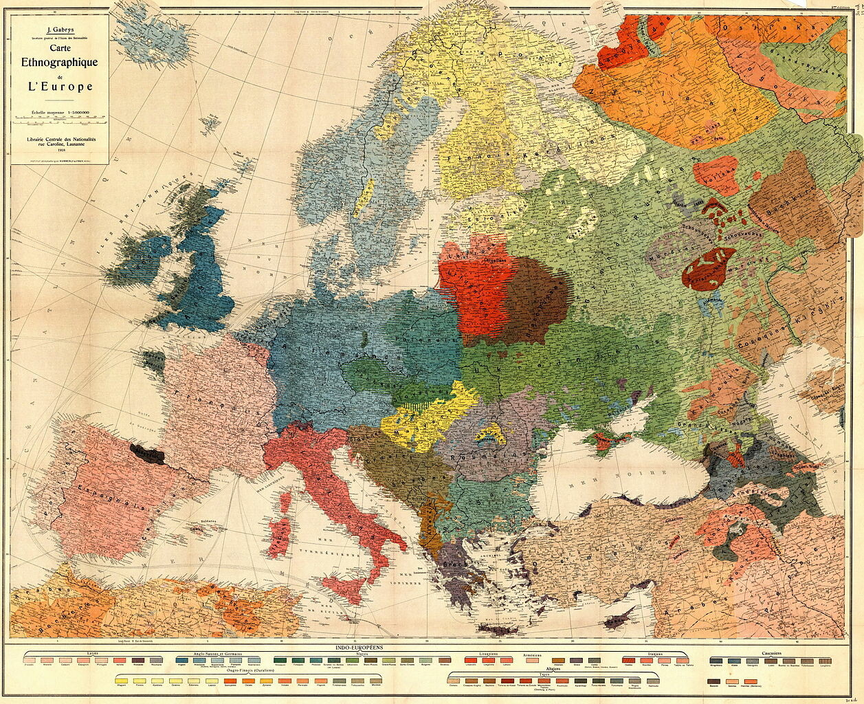
I will just leave this map here without geo-political comment.
I would just note that #Cartography was far more advanced 100 years ago. Hard to imagine a map like this produced today without Mercator. #StopMercator
https://commons.wikimedia.org/wiki/File:Carte_Ethnographique_de_L%27Europe.jpg
@amapanda What an horrible choice of projection for that map. Looks like Mercator, Gerard de Krammer revolving in his grave.
Since you are trying to show water basins an equal-area projection would have been in order. The Lambert Azimuthal Equal-Area recommended by the @EU_Commission is there to help you in these cases (EPSG code 3035).
The #MapProjection demo is particularly interesting. Accurately representing the Earth on the web is not a dream. #StopMercator
Gerard de Kremer was a brilliant man that solved a centuries old problem in sea faring. But that was almost 500 years ago, the world has changed, there are computers and the internet. Time to move on. #StopMercator #EndMercator.