#bneWeather

David de Grootdavid@theblower.au
2025-06-26

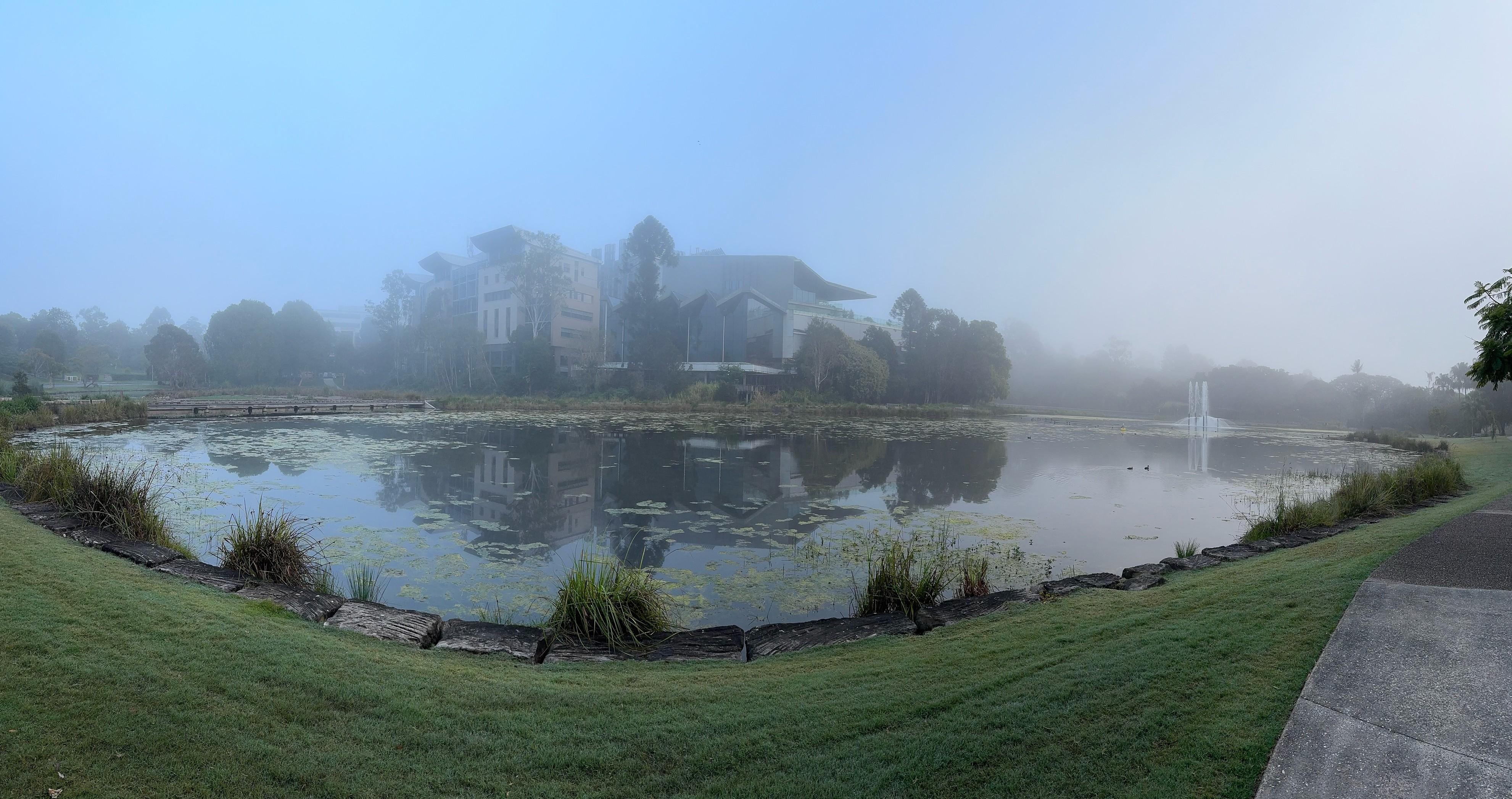
Bit nippy outside (for SE Qld)

8.7ºC currently at 8pm.

#BNEweather

David de Grootdavid@theblower.au
2025-06-23

Foggy on campus this morning.

#BNEweather #fog

Panorama over the main UQ Lake. Thin fog softens the scene of a fountain with buildings and trees emerging from the fog in the distance.
David de Grootdavid@theblower.au
2025-06-19
David de Grootdavid@theblower.au
2025-06-11

Weather is weird.

When we were in Tasmania, 11º was a very pleasant day to be spent outdoors going for a walk.

It’s 11º in Brisbane, it is NOT a pleasant day, the wind is blowing and it actually feels chilly.

#BNEWeather

2025-04-21

Wow, this thunderstorm is really something. #BNEStorm #BNEWeather

David de Grootdavid@theblower.au
2025-03-07

What a difference a good night's sleep makes.

When I went to bed, I was expecting to wake to gale force winds and driving rain.

When I woke, there's no wind, and steady rain.

We'll likely still be cut off with flooding, but that's about it.

#cycloneAlfred #exCyclone #BNEweather

BoM Cyclone warning map, showing landfall at 8am around Caboolture (about an hours drive NE of me).Another BoM map, this time showing a tropical low instead of a cyclone, which has turned north up the coast, likely to come inland around the middle of the Sunshine Coast.
David de Grootdavid@theblower.au
2025-03-02
2025-01-24

Storm missed us. Guess the aircon is staying on all night then. #BNEWeather

2025-01-19

Hey Summer, knock it off will you? Those hot days will have humid winds from the north as well. #BNEWeather #Brisbane

A weekly weather forecast for Brisbane displaying temperatures and conditions from Sunday to Saturday. Highs range from 29°C to 37°C, with varying cloud coverage indicated by icons. The lows range from 18°C to 24°C.Weekly weather forecast for Brisbane, showing temperatures and conditions from Sunday to Saturday. Highs range from 84°F to 99°F, with varying cloud coverage. Nightly minimums up to 75°F.

Got to the pool just in time to get rained on :dickbutt:

#BNEWeather #BrisbaneWeather #BNEWeatherTooting

39 today! Whew! Water out for the wildlife and pets maybe indoors, y'know

#BNEWeather #BNEWeatherTooting #Brisbane #BrisbaneWeather

2025-01-15

Bracing for 36deg hell tomorrow. The storms can't come quick enough. Take care Brisbanians. Shelter and hydrate. #BNEWeather

2025-01-15

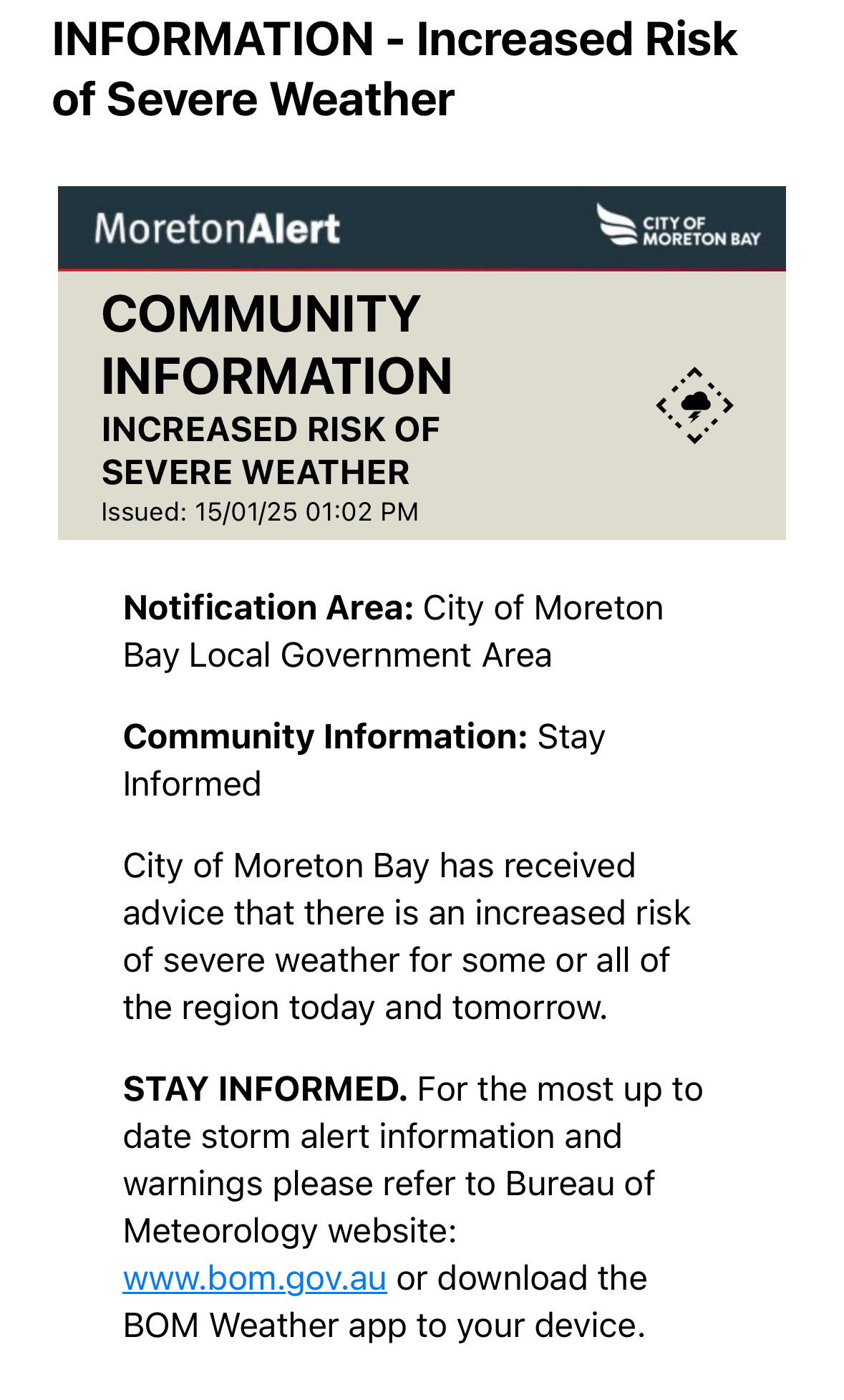
The vaguest of vague weather warnings from CoMB.

#bneWeather #weathertooting

COMMUNITY INFORMATION
INCREASED RISK OF SEVERE WEATHER
Issued: 15/01/25 01:02 PM


Notification Area: City of Moreton Bay Local Government Area

Community Information: Stay Informed

City of Moreton Bay has received advice that there is an increased risk of severe weather for some or all of the region today and tomorrow.

STAY INFORMED. For the most up to date storm alert information and warnings please refer to Bureau of Meteorology website: www.bom.gov.au or download the BOM Weather app to your device.
2024-12-18

TIL there's a webcam of Wivenhoe Dam. It looks pretty churny today.

widget.coastalcoms.com/video/c

#BNEWeather

2024-12-18

Some great thunder echoing through the valley at the moment (Cedar Creek valley that is, not Fortitude Valley).

Also, bucketing down.

#BNEweather

2024-12-18

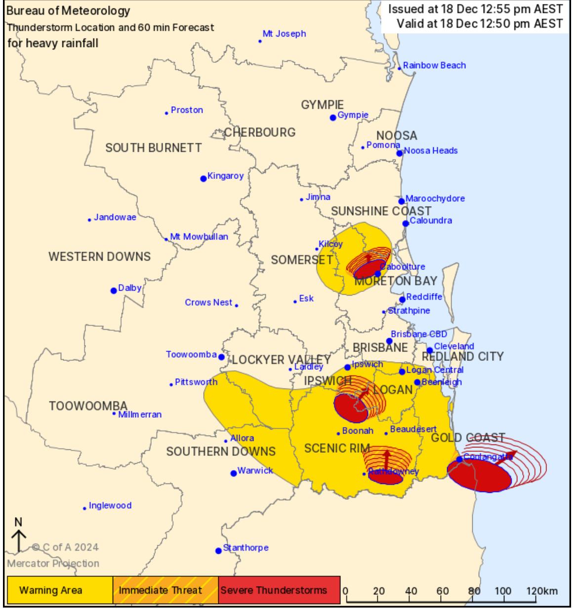
Prepare for imminent storm Brisbane!

Noticeably darker, windier and more noisy (thunder) outside right now.

#BNEWeather #Storm

David WakehamwakehamAMR
2024-12-18

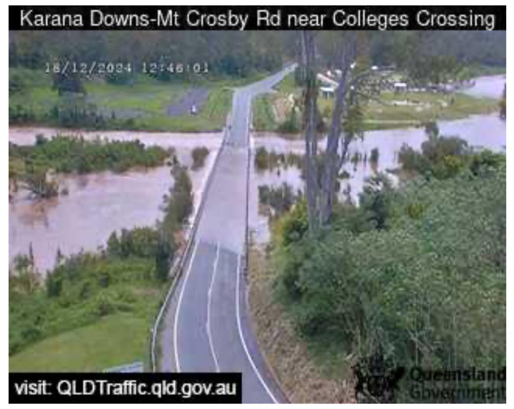
Luckily, I had finished my four river crossings today.

Crossed here just as it started to flood late this morning..

Already had more rainfall than in our previous major flood years (2x November falls).

Ground already very wet.

Gulp and with even more rainfall and storms today.

If it’s flooded, forget it!

#

image shows a flooded road in Karana Downs-Mt Crosby Rd near Colleges Crossing in Queensland, Australia. The water level is high, covering the entire road surface and reaching up to the bottom of the guardrails. The water is a murky brown color, suggesting it is carrying sediment and debris. Due to the flooding, the road has been closed by police, requiring motorists to take a lengthy detour. In the background, there are trees and lush green vegetation, indicating a rural area. The image was captured on December 18, 2024, at 12:46:01 PM. 
Imagine a map of Southeast Queensland. It's a mess! Big red circles, like angry eyes, are scattered everywhere. These are severe thunderstorms, and they're overlapping, getting closer and closer. You see 'Brisbane' and 'Gold Coast' written there, but those names are almost lost in the sea of red.

Then there's this smaller, darker red circle around Brisbane. That's the 'Immediate Threat,' and it's creeping in. You can almost hear the sirens wailing. And look at that wider red circle! It covers a huge area, and it's getting bigger. It's like the whole region is on fire.

But that's not all. As in previous pic Colleges crossing is CLOSED due to flooding. Closed! People are not yet stranded but some starting to panic. Reports of other “minor flooding” nearby in other parts of Southeast Queensland already. Minor? It doesn't sound so minor when you see those storms brewing.

And the forecast? More rain. More thunderstorms. Today. It feels like the sky is about to crack open. This isn't a drill, folks. This is real!
2024-12-17

I saw they mentioned there wasn't a cyclone forming, but if you look at the rain radar zoomed out it's definitely got some spin to it. So there must have been the possibility.

#ArmchairMeteorology #BNEWeather

David de Grootdavid@theblower.au
2024-12-01

A bit humid outside this morning.

#BNEweather

Weather station display showing the outside relative  humidity at 100% (but only 21°C).

Client Info

Server: https://mastodon.social
Version: 2025.04
Repository: https://github.com/cyevgeniy/lmst