Oh no. Microsoft is gonna turn off Bing Aerial Imagery for #OpenStreetMap in ca 2 months??!?!? 😳😳😭😭
https://community.openstreetmap.org/t/discontinued-services-bing-maps-rest-services/117308/30
Tombé dans le chaudron des SIG depuis plusieurs années, j'affectionne tout ce qui touche à l'Open Source, au web mapping et à OpenStreetMap.
Oh no. Microsoft is gonna turn off Bing Aerial Imagery for #OpenStreetMap in ca 2 months??!?!? 😳😳😭😭
https://community.openstreetmap.org/t/discontinued-services-bing-maps-rest-services/117308/30
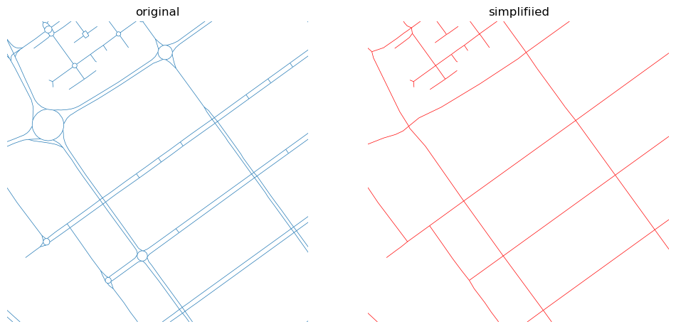
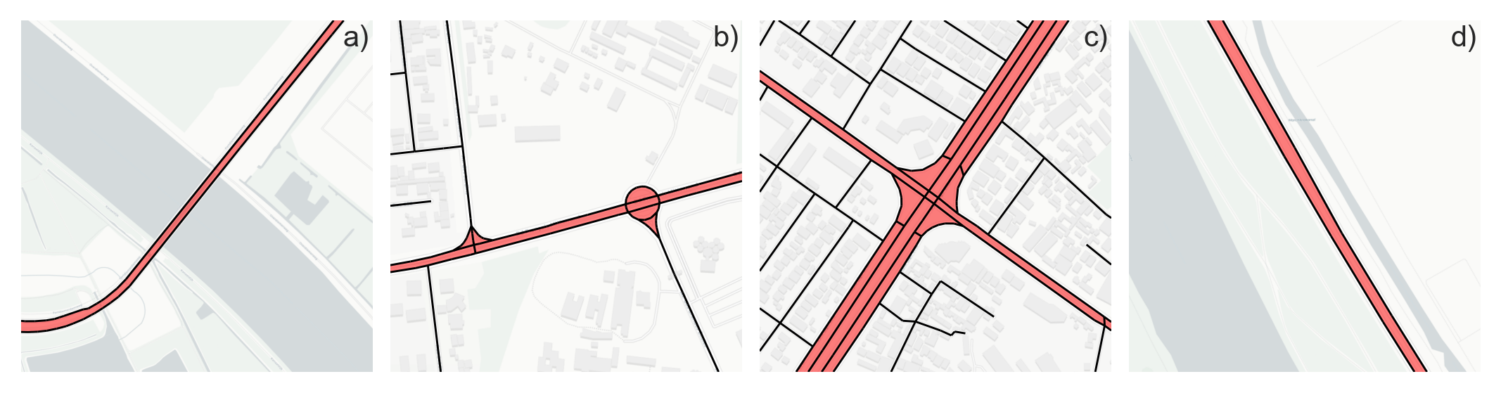
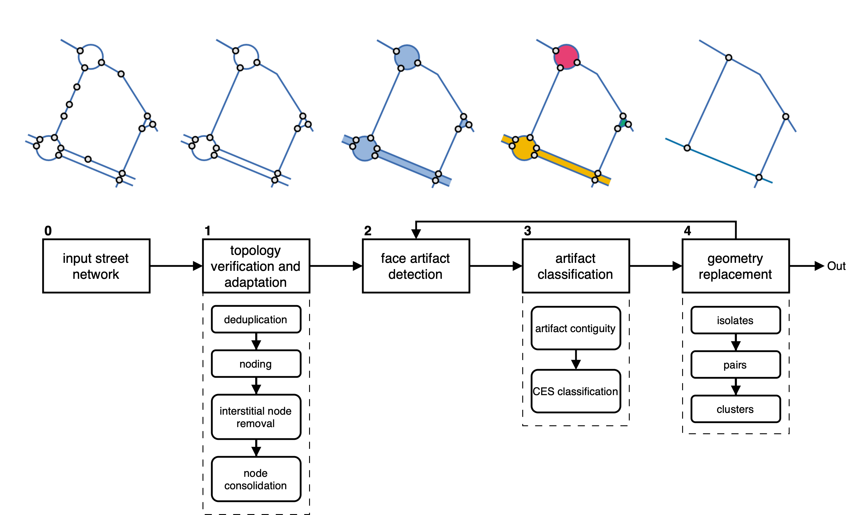
Ever needed to simplify street networks? I did. And it is a pain. So we joined forces with @anavybor and @JamesGaboardi and wrote an algorithm that does that for us. And can do for you, as it is available as a Python package called `neatnet`.
Here's a short blog about it - https://martinfleischmann.net/simplification-of-street-networks/
And here's, not so short preprint - https://arxiv.org/abs/2504.16198
But you probably want the package. That is here - https://uscuni.org/neatnet.
Happy coding!
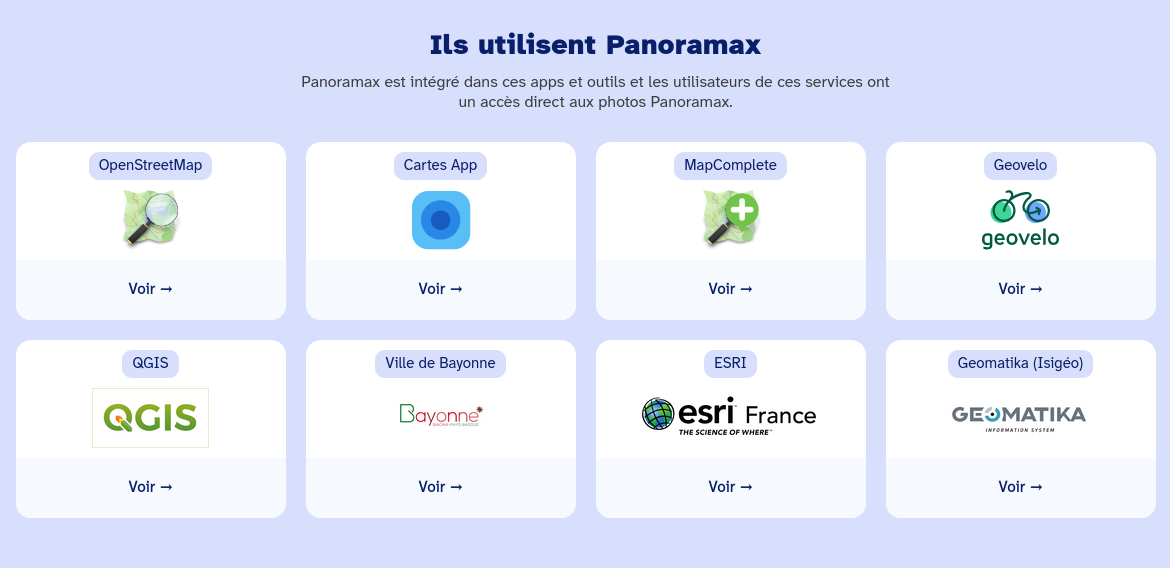
@panoramax pensez-vous qu'il soit possible d'ajouter l'extension Panoramax pour Lizmap à la partie du site "Ils utilisent Panoramax" ? Est-ce pertinent ?
📢 Nous sommes en train de déployer l'acceptation des CGU, une nécessité légale qui a fait l'objet de plusieurs échanges lors des temps mensuels et sur le forum.
Penser à aller cocher la case en vous reconnectant sur votre instance Panoramax habituelle pour vous permettre de continuer à verser des photos.
Discussion ouverte à ce sujet sur :
https://forum.geocommuns.fr/t/activation-de-la-validation-des-conditions-generales-dutilisation-de-panoramax/2268
Heureux hasard, le script @panoramax pour @3liz_news est la 100e contribution :)
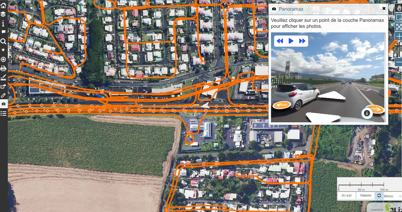
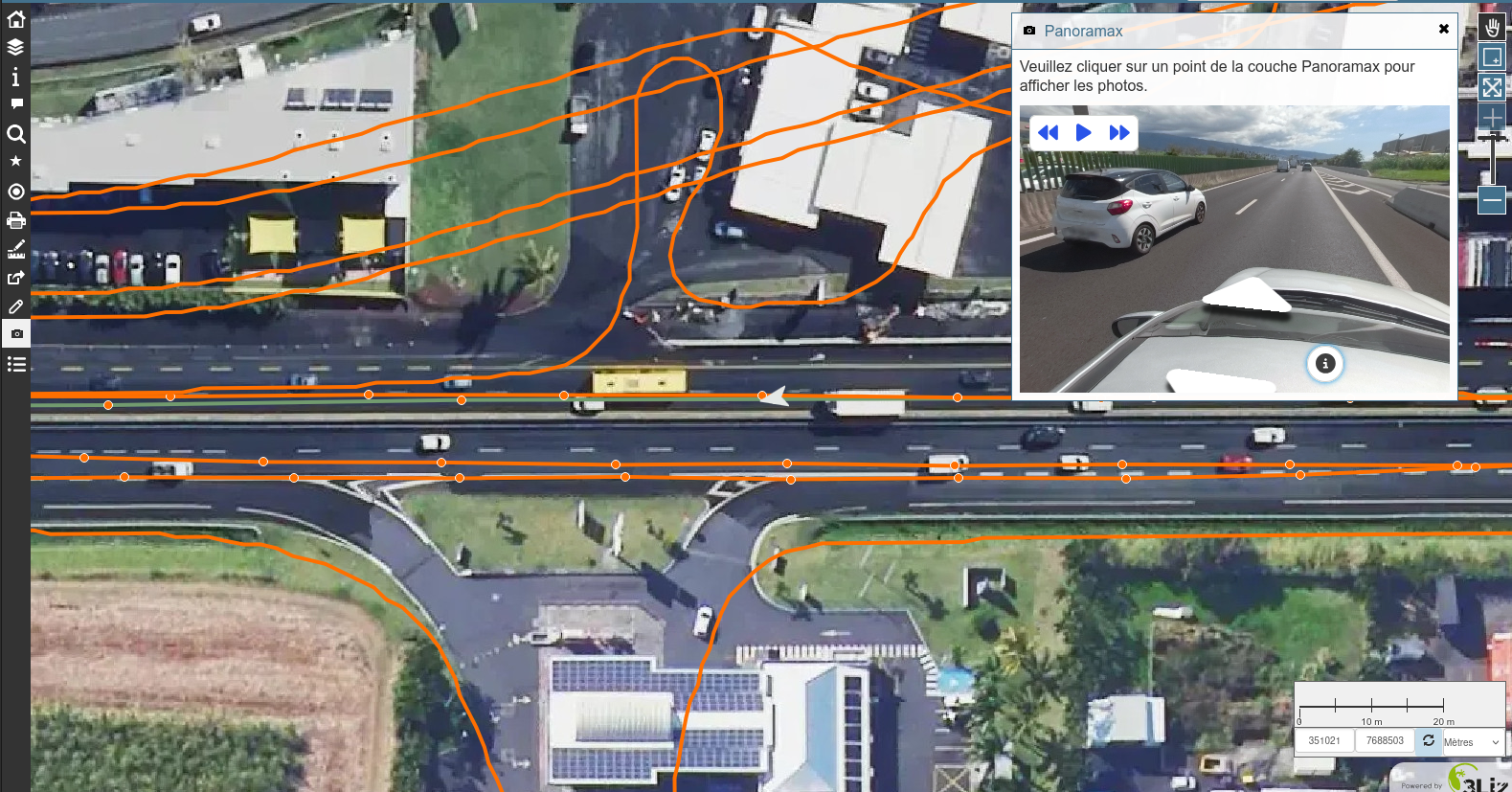
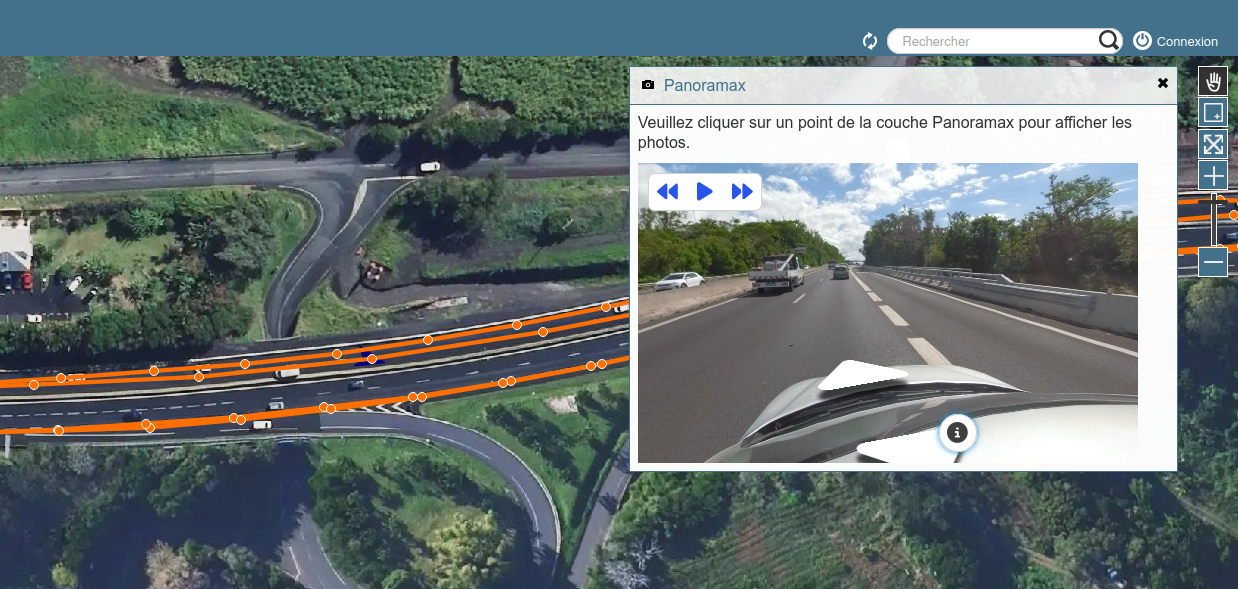
Vous pouvez maintenant visualiser les photos de Panoramax dans Lizmap.
A noter que le script Lizmap pour la nouvelle version du viewer de Panoramax est en cours de finalisation (merci à @PanierAvide pour son aide et sa disponibilité)
Pour le script c'est ici :
https://github.com/3liz/lizmap-javascript-scripts/tree/master/library/api/panoramax
@panoramax @LizmapForQgis @lizmapforqgis@bird.makeup
Script finalisé et fonctionnel ! Une fois le fork accepté, il sera disponible sur le Github Javascript de Lizmap https://github.com/3liz/lizmap-javascript-scripts
@panoramax @LizmapForQgis @lizmapforqgis@bird.makeup Avec plaisir
@geojulien @panoramax @LizmapForQgis @lizmapforqgis@bird.makeup
J'avais en tête de faire une extension pour Lizmap et quand j'ai vu dans la #GeoRDP que ça avait été fait pour #QWC cela m'a encore plus motivé.
Planning du jour : Finaliser l'extension @panoramax pour @LizmapForQgis @lizmapforqgis@bird.makeup
Un beau programme :)
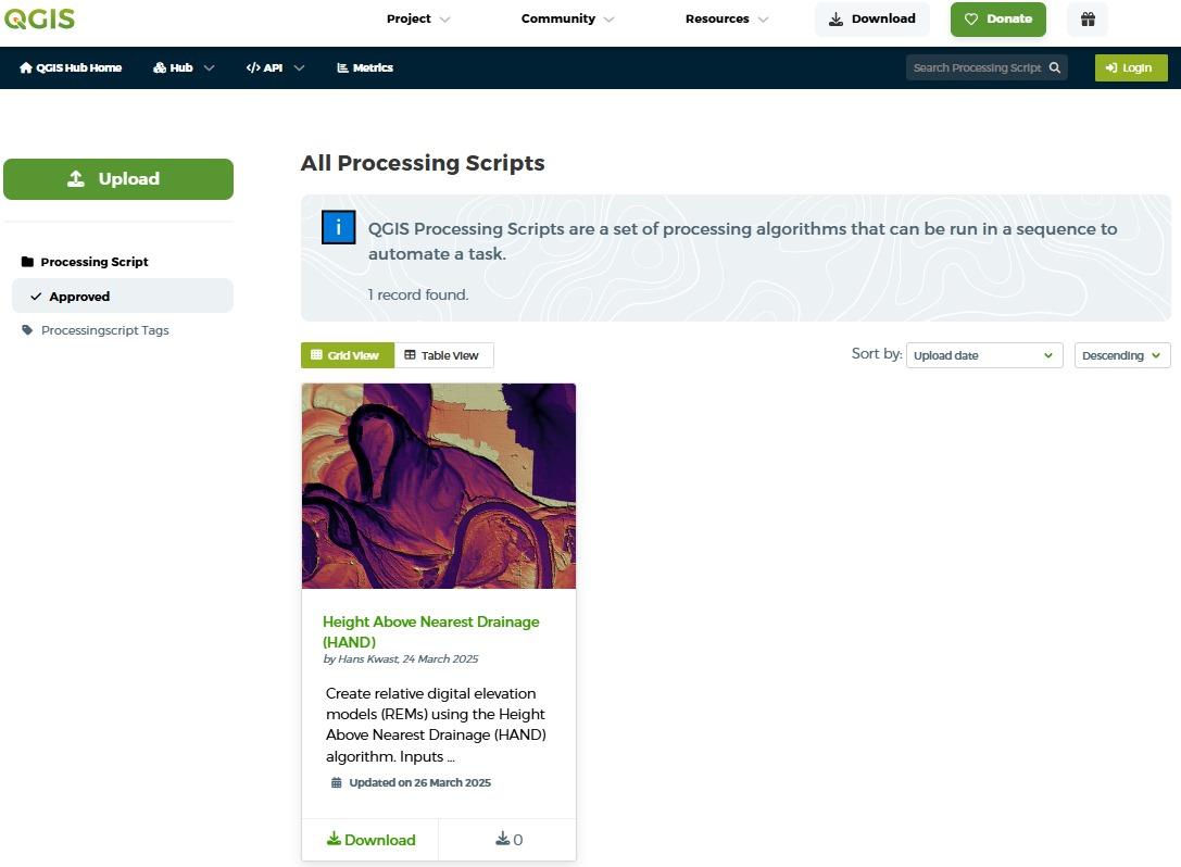
🚀 QGIS Processing Scripts can now be shared via the QGIS Resources Hub! 🎉
They’re efficient, lightweight tools for automating tasks in #QGIS, requiring #Python & #PyQGIS skills. Easier to develop than plugins, they’re perfect for customizing workflows.
💡 Learn more: https://hub.qgis.org/scripts/
:qgis:💚
Do you want to learn to create your own QGIS Processing Scripts? Check these resources:
🎥 Watch the tutorial video: https://youtu.be/DlKBn7vMT4s
📓 Follow the step-by-step guide: https://courses.gisopencourseware.org/course/section.php?id=376
Géo Outre-mer de La Réunion : une semaine pour réinventer la cartographie du territoire ! 💡
Face aux défis climatiques et environnementaux, l'IGN transforme la carte en un outil stratégique pour protéger, planifier et agir !
📣 Du 17 au 25 avril, l'IGN organise une semaine d'ateliers et d'échanges à La Réunion pour explorer les données et services publics de l'IGN.
📅 Inscriptions et programme détaillé : https://www.ign.fr/agenda/ateliers-geo-outre-mer-de-la-reunion-une-semaine-pour-reinventer-la-cartographie-du-territoire
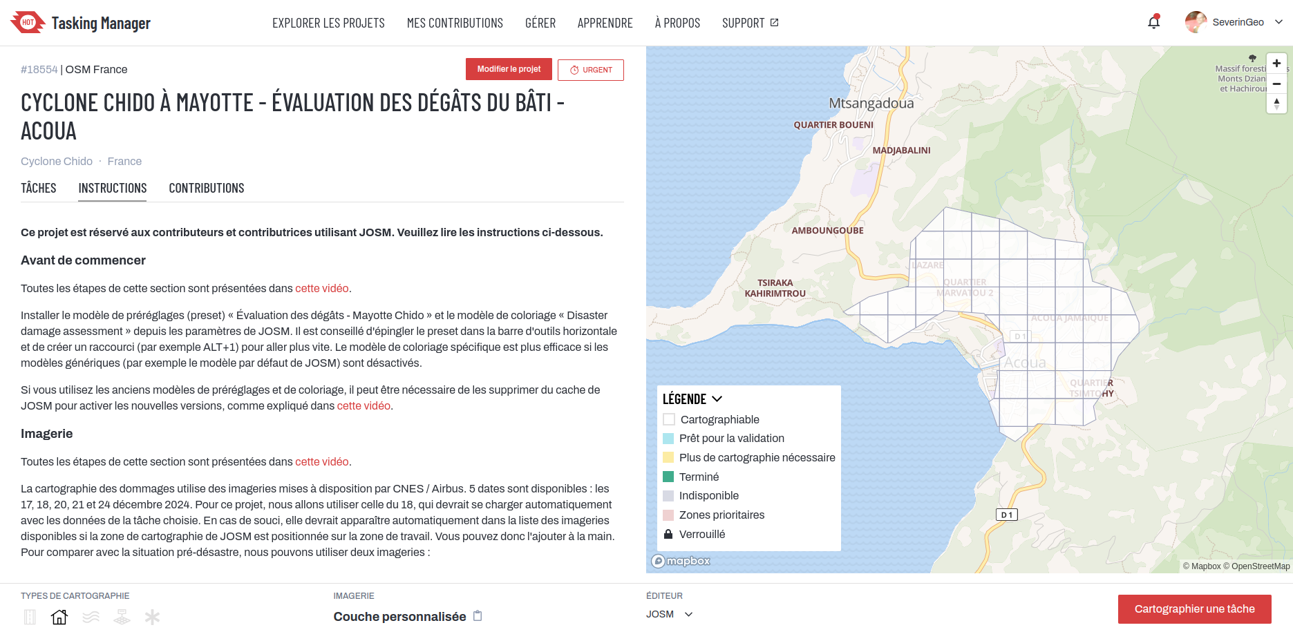
Après Mamoudzou, Tsingoni, Bandraboua et M'Tsamboro, Acoua dans le nord-ouest de Grande-Terre est le nouveau projet @osm_fr@fr.osm.socialproject dans le #taskingmanager pour cartographier dans #josm #openstreetmap les dégâts des bâtiments après le cyclone #chido à #mayotte en utilisant l'imagerie post-catastrophe de @CopernicusEU.
Nous manquons de volontaires, n'hésitez pas à venir apprendre une cartographie différente sur #osm !
The security project for #QGIS : pledge now !
https://oslandia.com/en/2025/03/25/le-security-project-for-qgis-contribuez-maintenant/
Orfeo ToolBox 9.1.1 released
@RegisHaubourg @geotribu Hello, présent à La Réunion et dispo pour en discuter :)
L'infolettre #Panoramax de mars est sortie !
https://website.panoramax.fr/wp-admin/admin-ajax.php?action=tnp&na=v&nk=2-7c1f6b605b&id=6
WE ARE EXCITED TO LAUNCH THE LEARN QGIS WITH BNHR SITE!
A free learning platform that includes the most recent versions of our Essentials and Layers & Expressions courses.
We're grateful for everyone's continued support and wanted to give back in some small way.
Thank you so much and I hope this helps you in your QGIS journey!
Start learning QGIS for free at: https://learn-qgis.bnhr.xyz

happy birthday to #QGIS! 🎂🥳 23 years since Gary Sherman's v0.0.0 release
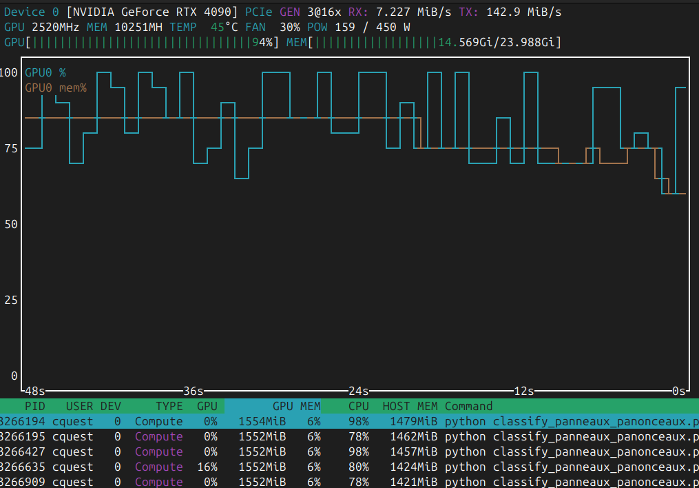
Hack du week-end pour #panoramax, l'industrialisation du traitement des panneaux de signalisation détectés par l'API de floutage de @panoramax
L'API de floutage détecte et extrait les panneaux en petits fichiers JPEG.
3 autres modèles de computer-vision sont ensuite utilisés pour :
- séparer panneaux et panonceaux (qui changent le sens du panneau),
- reconnaître le type du panneau et de panonceau
Ici, un mois d'images versées (janvier 2024), soit 433239 extraits a été traité en... 6'26" :)
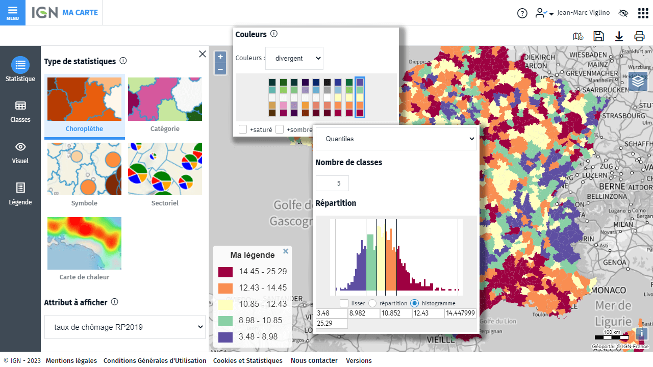
✨[magisAR9] [#CarteBlanche]
webinaire #18 #CartoGeoViz
Gdr CNRS Magis
➡️ #Technologies autour de #MaCarteIGN
by @Jean-Marc Viglino (Université Gustave Eiffel/IGN
#cartographie_statistique #cartographie_thematique #choroplèthe #outil #edugeo #enseignement
🎥 15 octobre 2024 : 12h30-13h30
ℹ️ Accéder : https://magisar9.github.io/webinaires/cartogeoviz18-viglino.html