
Yay. I have finally deleted my old #OpenStreetMap profile. Now I can start clean from this new सिर्फ春 username.
#openstreetmap

La AI a veces alucina y cuando se trata de mapear, pone construcciones en cualquier lugar. Por eso, es mejor tomar el tiempo de mapear manualmente en #OpenStreetMap


36 people made 726 changes yesterday to #OpenStreetMap using https://mapcomplete.org
Dedeil59 added 4 points and answered 157 questions with the thematic map street_lighting
lunar_jaws812 answered 123 questions with the thematic maps etymology and education
StefDeGreef added a point, answered 77 questions and uploaded 13 images with the thematic maps cafes_and_pubs and food
gxbz answered 74 questions with the thematic map maxspeed


Spotted a defibrillator on Midsomer Murders and thought "I should probably map that", but then I realised that I hadn't a clue where the actual village is, but I'm fairly sure it's an actual defibrillator. Ah well, I'll leave it to the UK mappers. And yes, I'm also always looking for benchmarks on the old buildings. I'm beyond help. #OpenStreetMap

🗺️ Pesaro ha bisogno di te!
Attività di Alternanza Scuola/Lavoro a Pesaro con #OpenStreetMap
https://www.openstreetmap.org/user/Galessandroni/diary/408254

What? Our Eurocity train runs far abroad? – Yes! – Why didn't you add panning to your map? Your data source has worldwide coverage and it's best in Germany.
I don't know why but my #SBB #Giruno train fell off the map in Fulda. 😁
Of course, they used #OpenStreetMap data.


São José, Pará parece que precisa de mapeamento!
População: 36
Contagem de edificações: 0
Link do mapa: https://www.openstreetmap.org/#map=16/-2.6891177/-54.21753
#OpenStreetMap


Holdfast, Saskatchewan seems like it could use some mapping!
Population: 247
Building count: 9
Map link: https://www.openstreetmap.org/#map=16/50.958534/-105.42146
#OpenStreetMap


Edinburg, North Dakota seems like it could use some mapping!
Population: 231
Building count: 0
Roads to review: 47
Map link: https://www.openstreetmap.org/#map=16/48.496662/-97.86204
#OpenStreetMap


The #OpenStreetMap community of #Mumbai invites everyone to its 7th mapping party!
🗓️ Sunday, 22nd of February
🕙 3 PM to 6 PM, followed by dinner (sponsored by #TomTom)
📌 High Point restaurant, Lokhandwala, Andheri
https://osmapp.org/way/1479855071
To learn more, register, and to add the event to your calendar, visit - https://osmcal.org/event/4316/

The Third Place Index - a project which combines OSM and US Census data to score the availability of "third places" nationwide.

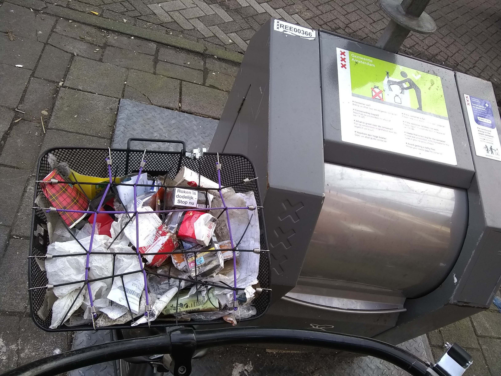
A couple more baskets of litter plicykled off Amsterdam while wondering what it takes for a plicyklist to get noticed around here. I thought for sure I'd shaking the hand of the king by now. #biketooter #plicykling #amsterdam
Here are the culprits on #openstreetmap:
https://www.openstreetmap.org/node/13579772423/
&


It's wild how much you learn by contributing to #OpenStreetMap data. I discovered via aerial view that the golf course next to me demolished more forest recently, and also that there's a weird religious compound with a history of scandals literally a few blocks away form me.

@GarrickWinter I don't know about the quality of Canadian gazetteer data in #OpenStreetMap , but my technique is to add business data for the all places I use, then #OSMAnd and all data consumers "just work".
Yeah, I know, a new search can be bad, but the second look-up is great! 🙂
#StreetComplete is nice for casual surveying.

"[In] July 2025, the tile.openstreetmap.org service handled [..] 121 billion tile requests, with a weekday daily peak of about 70k requests per second and peak bandwidth of 6-7 Gbps. The total monthly bandwidth usage was 1.4 Petabytes" #Openstreetmap
More Technical Updates to the ...

More open: On National Gallery of Denmark's online collection 'SMK Open' (https://open.smk.dk/en) we're swapping out Google Maps for @openstreetmap to show artwork locations. 🗺️
#openaccess #openculture #openstreetmap #musetech #dkmuseum


O semanário nº 812 está disponível em https://weeklyosm.eu/pt/archives/18419 Conheça as novidades do mundo
#openstreetmap #OSM por @weeklyOSM

Vienne: OpenStreetMap, rencontre mensuelle, Le mercredi 18 février 2026 de 18h30 à 20h30. https://www.agendadulibre.org/events/34476 #osm #openstreetmap #rencontreMensuelle #contributeurs #donnéesOuvertes #discussion #logicielsLibres


As always you can find all of our #OpenStreetMap interviews over on the blog: https://blog.opencagedata.com/tagged/osminterview

Client Info
Server: https://mastodon.social
Version: 2025.07
Repository: https://github.com/cyevgeniy/lmst