#PreHistory

2025-05-08

Homo sapiens regularly crossed the Pyrenees during the Ice Age – here’s what they took with them.

Flint tools carried across the Pyrenees reveal the routes prehistoric humans took.

mediafaro.org/article/20250507

#HomoSapiens #Pyrenees #Prehistory #Palaeolithic #IceAge #History #Archaeology #Research #Science #Spain #Catalonia #France

2025-05-08

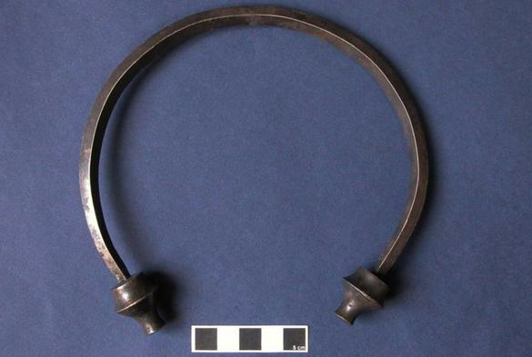
Bronze-age Britain traded tin with the Mediterranean, a new study shows – settling a two-century debate.

The tin would have made a 4,000km journey to thriving markets in the east Mediterranean.

mediafaro.org/article/20250507

#Britain #Mediterranean #Archaeology #Tin #BronzeAge #Prehistory #History #Research #Science #Cornwall #Devon #UK #Sardinia #Cyprus

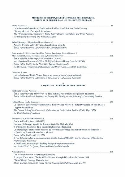
Vient de paraître

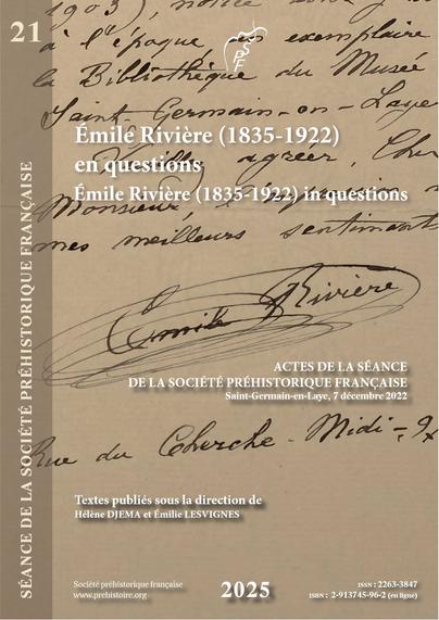
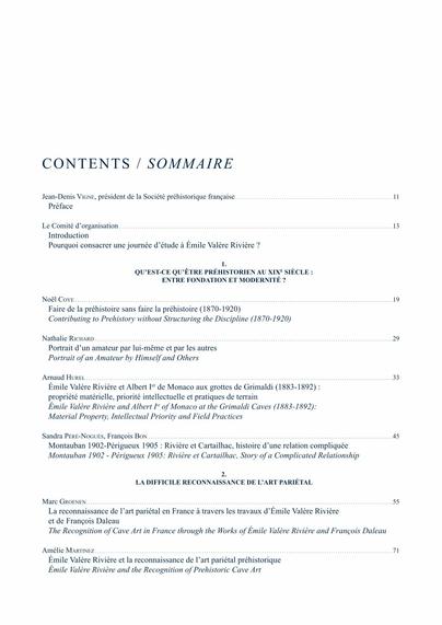
DJEMA H., LESVIGNES É. Eds. (2025) - Émile Rivière (1835-1922) en questions = Émile Rivière (1835-1922) en questions : Actes de la Séance commune de la Société préhistorique française, Saint Germain-en-Laye, le 7 décembre 2022, Paris, Société préhistorique française (Séances de la Société préhistorique française [ISSN 2263-3847] ; 21), 233 p. [978-2-913745-96-2 (en ligne)]

prehistoire.org/515_p_58400/ac

#préhistoire #prehistory #archaeology #SPF

Illustration de première de couverture : courrier d’Émile Valère Rivière daté du 13 avril 1913, archives du musée d’Archéologie nationale, fonds de correspondance ancienne/dossier É. Rivière (photo É. Lesvignes)sommaire de l'ouvragesommaire de l'ouvragesommaire de l'ouvrage
Orkney Riddlerjiffynorm@c.im
2025-05-07

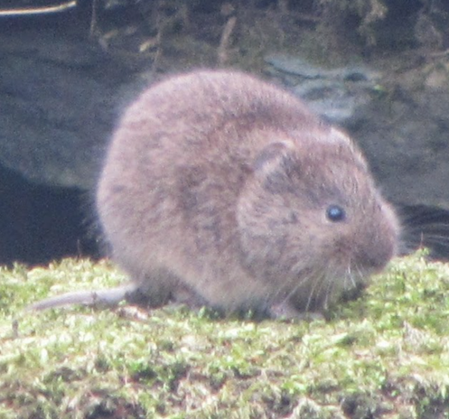
This is a short telling of the journey of the Orkney #Vole.
It is the story of how a European species of rodent, the Orkney Vole, travelled from Germany, Denmark and the Netherlands to Orkney over 5,000 years ago, without actually setting foot in Britain.
No convincing explanation for this phenomenon has been researched or provided.
To understand how this was possible,  the formations on the floor of the North Sea must be explained.
At the end of the ice age the North Sea didn't really exist. There was a deep trench along the Norwegian Coast called the Norwegian Channel,  and deep water features along the east coast of England and Scotland.
Between those deep water coastal features was a ridge of land linking the well-known Doggerland in the southern North Sea to the now-removed Land-East-of-Shetland.
There was no direct access from the #Atlantic Oceanic waters through the Dover Strait,   or between Scotland and Orkney,  or between Orkney and Shetland.
Animals, and people, were able to walk from mainland Europe onto Doggerland until 10,000BP when rising seas connected deep water on the English coast with the Norwegian Channel around the south coast of Dogger Bank.
Animals inhabiting Doggerland,  and the Land-East-of-Shetland would have been able to migrate from mainland Europe to Orkney without passing through Britain.
The Orkney Vole was one of those animals that did.

At about 3000BC,  as rising sea-levels surged down the Norwegian Channel,  and through the Dover Strait,  the narrowest region of land separating #Doggerland from Land-East-of-#Shetland collapsed.
This event was followed by the swift removal of loose sands and gravels from the whole of the northern North Sea.
In this process, land bridges joining Scotland to Orkney and Orkney to Shetland were removed.
People who had been nomadic shepherds living in Orkney for summer months were denied access to the place where they had built stone circles, and Cairns.
Some people remained on Orkney,  either by accident or on purpose. They were marooned on the islands and as a result they set about developing the more permanent and weatherproof settlements of Skara Brae and the Ness of Brodgar.
A detailed account, with substantial evidence is in the blog:-
orkneyriddler.blogspot.com/202
#Orkney #Neolithic #archaeology #Prehistory #northsea #Orkneyvole

Orkney Riddlerjiffynorm@c.im
2025-05-04

I'm going to keep on harping on about land in the middle of the North Sea until I'm hoarse!

It's difficult to convince people of the idea partly because it seems so unlikely.  The level of the seabed east of Shetland is over 100 metres below present sea level. The idea that a depth of material of that height could have been washed away in the recent past is too incredible to be believed.
There is lots evidence to support this notion , but it's a bit like being aware of something that's invisible only by the touch of the breeze on your skin as it passes. It requires the willingness to consider the possibility.
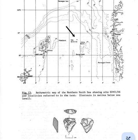
The first piece of evidence is actually archaeological.  A flint artefact was discovered in a borehole in the floor of the North Sea half way between Shetland and Norway.  It was identified, by Caroline Wickham-Jones , as a piece of prehistoric struck flint. How an article created by a prehistoric human could have been deposited so far from land is a bit of a head- scratcher.

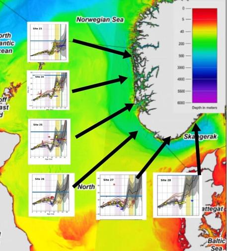
The second piece of evidence referrs to a meltwater surge that drained off from glaciers on Norway and Sweden at 12,000BP. Water and ice fell into the Skaggerak and flowed down a wide trench beside the coast of Norway,  called the Norwegian Channel. 
As sea level in the area was 60 metres below our sea level at 12,000BP,  and the height of the surge , as demonstrated on the sea level graphs on the sketch below , was 10 metres, the surge was supported at 50 metres below current sea level.
This 50 metres surge was supported along most of the length of the Norwegian Channel,  dissipating in the Atlantic Ocean.
As there was deep water against the English and Scottish coasts the west bank of the Norwegian Channel may have been a narrow strip of land running north from Doggerland to the Atlantic coast,  where the flint artefact was found.

This looks suspiciously as if prehistoric people may have been able to walk on land in the northern North Sea,  and that the land they walked on was higher than we thought.

What do you think?

Detailed, if longwinded, analysis is in the blog:-

orkneyriddler.blogspot.com/202

#archaeology #Orkney #prehistory #Neolithic #Norway #Shetland #flint #artefact

The Prehistoric SocietyPrehistoricSociety@mastodonapp.uk
2025-05-03

A lovely read for the Bank Holiday weekend: PAST 109 is now online and free to read.

This issue looks at textile working in Sussex, new Dartmoor stone circles and even barrows used as windmill-steads!

Enjoy!

#Archaeology #Prehistory ⚱️

prehistoricsociety.org/publica

Orkney Riddlerjiffynorm@c.im
2025-05-03

Audrey Henshall, in “Neolithic cairns of Orkney” finds that there are around 80 cairns in Orkney, of which half are stalled cairns, linear structures with an oblong space within a great mound. The name refers to upright stones that divide the side walls into partitioned stalls.
As well as the 40 or so that are recognisable, there are about 25 cairns that are in poor condition, and cannot be categorised, but are probably also stalled cairns. There another 14 that are in some way hybridised. A common hybrid is called the Maeshowe type, but this is a misnomer, Maeshowe compares to no other Neolithic structure on Orkney, (or probably anywhere else)
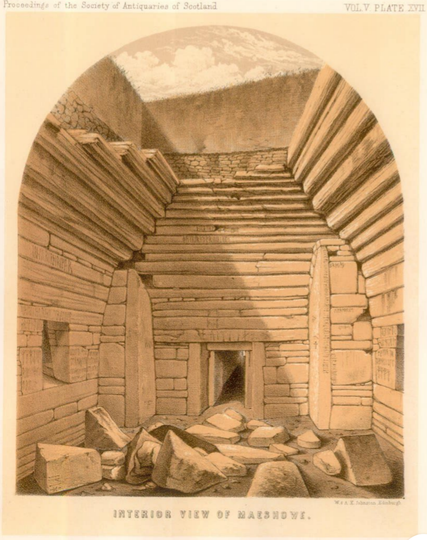
Maeshowe is a splendid ancient mound, in the heart of which is a large rectangular space with a corbelled ceiling. The design of the interior is very fine with a tall standing stone built into each corner. The room is entered through a long tunnel to one of the inner walls of the structure, and behind each of the other three walls of the interior room are small galleries which would apparently be blocked off from view, by blocking stones, to any normal user of the main room.
The entrance to Maeshowe has a stone beside it, fitted into a recess, that can be pulled across and used to block entrance into the interior. The design of this arrangement makes it clear that people wishing to make the closure would have to be within Maeshowe to do it.
The other cairns of the Maeshowe type have a central room with galleries arrayed around the walls of the room, the interiors of which, in many cases look suspiciously like bedding places.

Detailed, if longwinded, additional info is in the blog:-

orkneyriddler.blogspot.com/202

#archaeology #Orkney #prehistory #Neolithic

Orkney Riddlerjiffynorm@c.im
2025-05-02

My blog is a bit long, so probably off-putting. 
It attempts to "prove" that people were walking from Scotland to Orkney in the early part of the #Neolithic period.
In extensive and detailed research I have found a series of observations derived from other peoples work that, put together,  may be enough to prove that there was walkable land from Doggerland north to the Shetlands,  and also from #Orkney to Caithness.

In brief , there is evidence of a passage of land leading from #Dogger Bank to a location in the north of the North Sea where a flint artefact was found half way between Shetland and Norway.
There is also evidence that that land collapsed towards the Norwegian Coast in 3000BC.

On Orkney, Barnhouse and many other small settlements across mainland Orkney are all shallow sites that are clearly not designed to be occupied in an Orkney winter. These settlements were all abandoned before 3000BC.

My only assumption is that when land in the North of the North Sea was lost so also was a bridge between South Ronaldsay on Orkney,  and Caithness, north Scotland.

The Stones of #Stenness and Ring of #Brodgar were abandoned, unfinished, probably at 3000BC.
The Westray islands are abandoned at 3000BC, and not colonised again until the second half of the 3rd millennium BC.
#Skara #Brae, and the #Ness of #Brodgar, both have dated deposits from before 3000BC indicating there was some kind of occupation until then, but not till after 3000BC are the revolutionary solid structures with stone lined drains and other necessary amenities for winter weather designed and constructed.
The structures at the Ness of Brodgar were made of wood, largely, so they would not have lasted long, a couple of generations perhaps.
The dates of the human bones found in the cairns are largely assessed to before 3000BC, and the dates of the animal bones, also in the cairns, which were arguably being eaten by people, are largely after 3000BC.
This suggests that when a few groups of people isolated from mainland Britain lost the structural secuity of their solidly built structures, they may have sought desperate refuge in the cairns.
Temporary visitors returned,  by newly developed boats, in the second half of the 3rd millennium BC.

Detailed, if longwinded, analysis is in the blog:-

orkneyriddler.blogspot.com/202

#archaeology #Orkney #prehistory #Neolithic

Orkney Riddlerjiffynorm@c.im
2025-05-02

In “Beside the Ocean of Time: a chronology of Neolithic #burial, #Monuments and houses in Orkney”, Seren Griffiths lists the carbon dates of human bones from 10 Orkney cairns. The cumulative data for these skeletal remains demonstrates that about 75% of the people lain in the cairns died roughly before 3000BC, the rest of them died later, mostly through the 3rd millennium BC. Similar findings are suggested by dating of #skeletons in Scotland and England, and it is likely that the fall in numbers of bodies in cairns is, as much as anything, because after a couple of hundred years of existence the cairns were in poor condition, and often collapsing, making them sometimes risky places to enter.
Personally, I could never believe that the purpose of cairns was for the storage of corpses. Clearly in later millennia they were regarded as suitable sites for depositing cremated remains and the like.
Later burials seem to be dug into the perifery of the monuments, or a later addition.
In the few examples of funerary monuments that I've seen it's only special sites like Sutton Hoo that are obviously built with the intention of burying bodies.
See more in the Orkney Riddle blog:- orkneyriddler.blogspot.com/202
#Orkney #Neolithic ##prehistory #archaeology #cairns

Orkney Riddlerjiffynorm@c.im
2025-05-01

I could never quite believe that Neolithic people came to Orkney by boat.
As it is thought that they brought cattle and sheep with them, I could not envisage any animal, or any human, surviving a sea crossing of any British tidal waters in any prehistoric vessel.
Standard sources tie themselves in knots to persuade us that Neolithic people had boats that could carry beasts of both sexes that, once landed, would reproduce and help their tribe to survive on the unknown territory across the dangerous waters.
However, evidence has recently emerged that added another dimension to the problem. It was discovered that the Orkney Vole, a species that is unique to the archipelago, had been found by DNA analysis, to originate from northern Europe, and that it was not directly related to the common vole in Britain. (Thomas Cucchi et al)
This meant that the animal that arrived in Orkney did not pass through England, Wales or Scotland.
A vole arriving in Orkney, from Europe, without passing through Britain was a clue that all was not as it seems, and that in spite of the insistence of some that voles may have been carried as pets or food items, another possibility was probably more likely.
I therefore rather assumed that it must be necessary to question what places were passable around the coasts of Neolithic Britain, which areas were land, and which places were water, and when did land areas stop being land.
It is understood that much of the southern North Sea area was land at some point in the past. A piece of shallow sea called Dogger Bank has been named Doggerland as artefacts of 8000 years of age, and older, are frequently dredged up there. The rise in sea level which has occurred since the last ice age has clearly flooded lands here, but which lands, where, and when?
The obvious location, or so I thought, for a route to Orkney from Europe , that would be passable for small rodents, on foot, and avoiding England and Scotland, would be somewhere in the middle of the North Sea which, of course, is a bizarre idea.
Indeed, it was such a bizarre idea that I followed it, to see where it took me.
The result of my research can be seen in my blog:-

orkneyriddler.blogspot.com/202

#Orkney #Neolithic #archaeology #prehistory #Brodgar #nessofbrodgar #Skara #skarabrae  #barnhouse #knapofhowar #linksofnoltland #Noltland #cairns #Maeshowe

Orkney Riddlerjiffynorm@c.im
2025-05-01

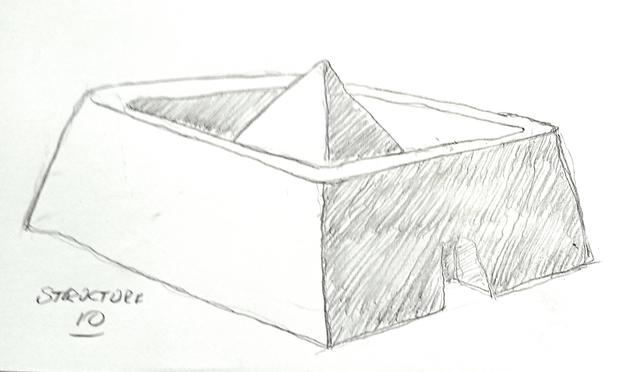
At the Ness of Brodgar, Structure 10, is more complicated. The earliest dates are between 2935BC and 2705BC, and most of those dated samples are from carbonized residues on grooved ware pottery which is likely to have been furniture in a roofed structure.
The square structure is formed as two concentric/parallel walls around a near-square internal space, (Cavity walling!?) and the two concentric walls are separated by a continuous narrow channel.
The outer wall was tall, and functioned as a windbreak. (Neolithic people on Orkney were fond of windbreaks). This may have been 2 or 3 metres high.
The inner wall supported the eaves of a pyramid shaped roof over the internal space, and the narrow channel between the concentric walls of the structure served as a drain for rainwater falling off the roof of the pyramid
The kingpost for the pyramid roof was in the current location of the central firepit, and the height of the peak may have been four or five metres.
This pyramid structure survived in the first quarter of the 3rd millennium BC, and may have been a sweat Lodge. A similar structure, Structure 8 at Barnhouse was definitely a sweat lodge, and hut 8 at Skara Brae may also have been one.
In the second half of the 3rd millennium BC mariners entered the Stenness Loch, beaching their boats at Brodgar and, finding the windbreak around structure 10 there. The roof of the building had collapsed and any usable material long removed. What was left was a sheltered enclosure in which they dug out the firepit.
They probably came every year and caught and killed an auroch, part of which they cooked on the firepit here, and ate, before removing the majority of the carcase of the animal back to their winter homeland.
These visitors left a dump of animal bones  outside Structure 10, between 2620BC and 2460BC, and
between 2465BC and 2360BC a stray bone drifted into the upper fill of the firepit in the centre of Structure 10.
#nessofbrodgar #archaeology #Orkney #prehistory #Neolithic

Beyond the Grave: Burial and the Human Condition in Deep Time

Introduction: Death as a Mirror of Mind

In the tapestry of human evolution, few threads are as evocative as the act of burial. The deliberate interment of the dead signifies more than a practical response to mortality; it reflects cognitive depth, emotional resonance, and social complexity. For early hominins, grappling with death may have been a pivotal moment—marking the emergence of symbolic thought and cultural expression. It is in this reckoning with the finality of life that we catch glimpses of an evolving consciousness, one not purely driven by survival, but by memory, grief, and meaning.

This article delves into the archaeological and anthropological evidence of burial practices among ancient hominins, focusing on three seminal sites: Shanidar Cave, Sima de los Huesos, and the Rising Star Cave system. Each site offers a unique window into the evolving relationship between early humans and the concept of death, hinting at a complex interplay between biology, belief, and behavior. Understanding these practices allows us to reimagine the ancient mind and our shared emotional lineage.

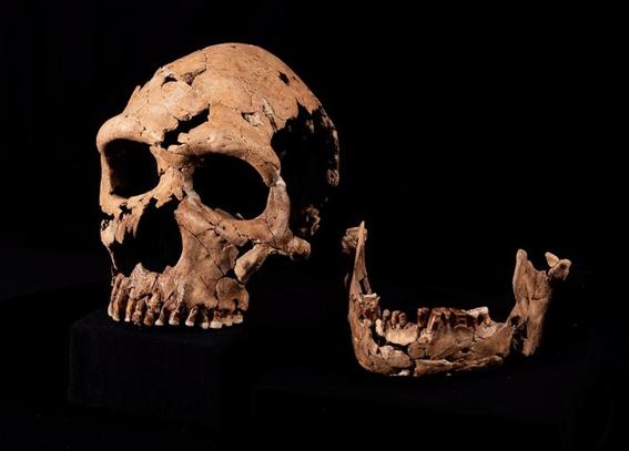
Shanidar Cave: Neanderthals and the “Flower Burial”

Located in the Zagros Mountains of northern Iraq, Shanidar Cave has yielded some of the most compelling evidence of Neanderthal burial practices. Excavations led by Ralph Solecki in the 1950s and ’60s uncovered the remains of ten Neanderthal individuals, some of whom appear to have been deliberately buried. Among them, the discovery of Shanidar IV has become particularly iconic.

Next to the bones of Shanidar IV, archaeologists found clusters of ancient pollen grains, potentially representing specific flower species. Solecki interpreted this as evidence of a “flower burial,” suggesting that Neanderthals placed flowers with their dead—a profoundly symbolic act pointing to emotional depth and cognitive sophistication ([cam.ac.uk](https://www.cam.ac.uk/stories/shanidarz?utm_source=chatgpt.com)). Although some have argued that the pollen may have entered the site through rodent activity or natural deposition, the overall context supports a more deliberate interpretation.

Further excavations and re-analyses in the 21st century have strengthened the case for intentional burial. The careful placement of bodies and lack of disturbance from carnivores suggest that Neanderthals were not simply reacting to the presence of the dead but were actively managing death in socially meaningful ways. This insight challenges outdated views of Neanderthals as cognitively inferior and reframes them as complex, emotionally responsive beings.

Sima de los Huesos: A Middle Pleistocene Mortuary Site

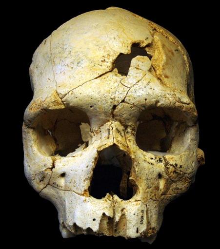
Deep within the Atapuerca Mountains of northern Spain lies one of paleoanthropology’s most haunting sites: Sima de los Huesos, or the “Pit of Bones.” Over 6,500 fossil fragments have been recovered here, representing at least 28 individuals of Homo heidelbergensis. These remains date to approximately 430,000 years ago, making this the earliest known accumulation of hominin bodies in a single context.

What makes this site remarkable is not just the quantity of remains, but the manner of their deposition. The bones were found in a vertical shaft deep within a cave system, suggesting that individuals were intentionally placed or dropped there post-mortem. Taphonomic analyses have revealed breakage patterns consistent with a fall, indicating that bodies were likely lowered or tossed into the pit after death ([phys.org](https://phys.org/news/2025-03-burials-compelling-evidence-neanderthal-homo.html?utm_source=chatgpt.com)).

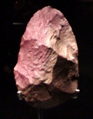
Adding a layer of intrigue, a single finely made handaxe of red quartzite—nicknamed “Excalibur”—was found among the bones. This artifact, too large and unworn to be utilitarian, is interpreted as a symbolic offering or grave good ([sciencedirect.com](https://www.sciencedirect.com/science/article/pii/S1631068305001697?utm_source=chatgpt.com)). If this interpretation holds, it represents one of the earliest instances of funerary symbolism in the human lineage.

Though less visually evocative than Shanidar, Sima de los Huesos may tell a deeper story. The sheer number of individuals represented and the possible inclusion of symbolic items suggest a communal awareness of death and a response that transcends basic hygiene or danger. It suggests the stirring of mortuary tradition and even proto-spirituality among pre-Neanderthal populations.

Rising Star Cave: Contested Homo naledi Burials

In 2013, a team of cavers and scientists working in South Africa’s Rising Star Cave system made a discovery that would shake the foundations of paleoanthropology. The remains of at least 15 individuals of Homo naledi were found in an almost inaccessible chamber called Dinaledi. These fossils, remarkably preserved and undisturbed, presented a new puzzle: how and why were they placed there?

The physical context of the chamber—accessible only through a narrow and perilous route—rules out most natural causes of body accumulation. There are no signs of predator activity, and the presence of articulated skeletons suggests minimal post-mortem disturbance. Over time, researchers proposed a radical hypothesis: Homo naledi may have deliberately placed their dead in this secluded location, engaging in a rudimentary form of burial or body disposal ([nhm.ac.uk](https://www.nhm.ac.uk/discover/news/2023/june/claims-homo-naledi-buried-their-dead-alter-our-understanding-human-evolution.html?utm_source=chatgpt.com)).

This claim, if verified, is profound. Homo naledi lived around 236,000 to 335,000 years ago, during a time when they coexisted with early Homo sapiens. Yet their brain size, roughly one-third that of modern humans, challenges assumptions about the cognitive requirements for mortuary practices.

New findings from 2023 have revealed shallow pits containing skeletal remains within the chamber, interpreted as intentional graves. If Homo naledi did engage in deliberate burial, they were doing so independently of other hominin groups with larger brains, suggesting that symbolic behavior evolved more than once in our evolutionary history. Not everyone agrees, and critics point to the need for further evidence and alternative explanations such as accidental entrapment or natural events ([timesofisrael.com](https://www.timesofisrael.com/new-evidence-points-to-neanderthal-burial-rituals/?utm_source=chatgpt.com)).

Regardless of the final verdict, the case of Homo naledi forces a reevaluation of what it means to be “human” in a behavioral sense and reminds us that evolution is rarely linear or simple.

The Significance of Burial Practices

Burial, in its many forms, offers critical insight into the cognitive, social, and emotional dimensions of hominin life. Across the three cases discussed, several overarching themes emerge:

1. **Cognitive Complexity**: The act of burial implies an understanding of death as a transformation or final state. In some contexts, it may signal belief in an afterlife or a spiritual world.

2. **Social Cohesion**: Burial reflects a strong group identity. The care shown to the dead—whether through floral arrangements, artifact placement, or careful body positioning—indicates that bonds extended beyond life.

3. **Symbolic Behavior**: The use of objects, color (such as red ochre or quartzite), and spatial placement in funerary contexts demonstrates the emergence of symbolic thinking and perhaps language.

4. **Evolutionary Insight**: Studying the diversity of burial practices across species and time periods helps us understand the multiple pathways through which behavioral modernity emerged.

These practices, far from being peripheral cultural details, are central to what makes us human. They mark the emergence of moral frameworks, collective memory, and spiritual imagination. Through burial, the dead remain a part of the living community.

Conclusion: Reflections on Mortality and Humanity

The act of burying the dead transcends mere practicality; it reflects our deep-seated need to find meaning in life and in death. From the fragrant pollen at Shanidar to the enigmatic bodies of Homo naledi, burial practices across hominin species speak to a universal theme: the recognition of mortality and the emotional bonds that outlast it.

As we unearth and interpret these ancient acts, we are not merely studying bones or sediment. We are listening to the whispers of ancient minds—beings who mourned, remembered, and perhaps even imagined a world beyond this one. In these burial sites, we find not just the story of evolution, but the roots of the human soul.

References

  1. Solecki, R. et al. Shanidar Z: What did Neanderthals do with their dead? University of Cambridge (2023). https://www.cam.ac.uk/stories/shanidarz?utm_source=chatgpt.com
  2. Pettitt, P., & Bader, N. New Neanderthal remains associated with the ‘flower burial’ at Shanidar Cave. Antiquity(2017). https://www.cambridge.org/core/journals/antiquity/article/new-neanderthal-remains-associated-with-the-flower-burial-at-shanidar-cave/E7E94F650FF5488680829048FA72E32A
  3. Rodríguez, J. et al. The emergence of a symbolic behaviour: the sepulchral pit of Sima de los Huesos. Journal of Human Evolution 48, 1–21 (2005). https://www.sciencedirect.com/science/article/pii/S1631068305001697?utm_source=chatgpt.com
  4. Arsuaga, J. et al. Breakage patterns in Sima de los Huesos (Atapuerca, Spain). Journal of Archaeological Science58, 104–113 (2015). https://www.sciencedirect.com/science/article/abs/pii/S0305440315000059?utm_source=chatgpt.com
  5. Dirks, P. et al. Evidence for deliberate burial of the dead by Homo naledi. eLife (2023). https://elifesciences.org/reviewed-preprints/89106
  6. National History Museum. Claims that Homo naledi buried their dead could alter our understanding of human evolution. NHM UK (2023). https://www.nhm.ac.uk/discover/news/2023/june/claims-homo-naledi-buried-their-dead-alter-our-understanding-human-evolution.html?utm_source=chatgpt.com
  7. Hoffmann, H. New evidence points to Neanderthal burial rituals. Times of Israel (2023). https://www.timesofisrael.com/new-evidence-points-to-neanderthal-burial-rituals/?utm_source=chatgpt.com
  8. University of Oxford. Burials provide compelling evidence of Neanderthal social complexity. Phys.org (2025). https://phys.org/news/2025-03-burials-compelling-evidence-neanderthal-homo.html?utm_source=chatgpt.com

#AncientMind #Anthropology #Archaeology #BurialPractices #DeepHistory #FuneraryRituals #HomininBurial #HomoNaledi #HumanEvolution #MortuaryArchaeology #Neanderthal #Paleoanthropology #Pleistocene #Prehistory #SimaDeLosHuesos #SymbolicBehavior
Orkney Riddlerjiffynorm@c.im
2025-04-29

As these structures at Ness of Brodgar are likely to have been constructed and roofed with timber, an estimate of their likely duration would suggest that they are unlikely to have survived much more than 50 years, a hundred at most.
In “To Cut a Long Story Short: Formal Chronological Modelling for the Late Neolithic Site of Ness of Brodgar, Orkney.” By Nick Card, dates for the structures at the settlement are roughly as follows :-
Structure 1  has dates between 3000BC and 2700BC
Structure 7, between 2965BC and 2880BC
Structure 8, 3005BC and 2910BC
 Structure 12 has dates between 2880BC and  2710BC, but also earlier samples dating from between 3335BC and 2935BC
Structure 14 has dates between 2985BC to 2900BC
Trench R, dates between 3335BC and 2940BC
Trench T, between 2905BC to 2725BC
The foregoing sample dates have a fairly clear division between those that favour 3000BC, and going backwards into the 4th millennium BC, and those that come forward from that date and into the 3rd millennium BC.
#neolithic #Nessofbrodgar #archaeology #prehistory #Orkney

Sté préhistorique françaisespf@archaeo.social
2025-04-29

Since 1904, the *Bulletin de la société préhistorique française* (BSPF) is a leading scientific journal for Prehistoric archaeology.
Submit your paper!

(open access without APC)
#archaeology #prehistory

Orkney Riddlerjiffynorm@c.im
2025-04-29

The Ness of Brodgar
 
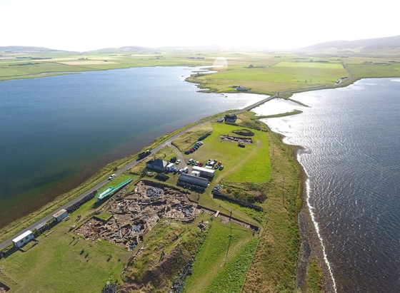
The Ness of Brodgar sits on the south eastern tip of the Brodgar isthmus separating the Loch of Harray to the east, and the Loch of Stenness to the west, at the centre of the large natural bowl of hills of the West Mainland of Orkney.  The Ness of Brodgar is a big settlement, It consists of a complex sequence of large, mainly stone, buildings contained within a massive walled enclosure. 
Like Barnhouse, the Ness of Brodgar is a predominantly “Grooved Ware Site”
The Grooved Ware pottery which was found in large quantities in these places reappears, more or less after 3000BC, at places in England. One of the earliest site to which these people may have travelled, taking their experience in making Grooved Ware pottery with them, is at Nosterfield in Yorkshire (3020-2870 cal BC).
Grooved Ware is a style of Neolithic pottery that has spread throughout Britain, and is found in large quantities at Barnhouse. It is a bucket shaped form with a flat bottom, in contrast with the “Carinated” pottery which was the rounded based form of pottery that was made by the shepherds that first occupied the Knap of Howar.
At the Ness of Brodgar though, evidence of the use of Grooved Ware defines a period during which the buildings themselves were being used as structures with rooves. The dating of carbon residues on sherds of the pottery, is limited to a period between 2950BC, and 2750BC. The residues on the pottery are from either fire or food, indicating a likely direct usage of both vessel and building.
As these structures are likely to have been constructed and roofed with timber, an estimate of their likely duration would suggest that they are unlikely to have survived much more than 50 years, a hundred at most.
#neolithic #archaeology #prehistory #Orkney #NessOfBrodgar.

Orkney Riddlerjiffynorm@c.im
2025-04-28

Skara Brae
Historic Environment Scotland, Statement Of Significance, Skara Brae
“The excavated remains of Skara Brae, as currently presented, consist of a tightly clustered grouping of stone-built structures connected by narrow passageways.  The structures, many of which are interpreted as houses, have internal fittings of stone. There were two main phases of building and occupation in the development of the settlement, with a gap relating to the probable abandonment of the settlement due to inundation by sand.
Individual buildings were, at first, freestanding, with open passageways between them. Some of the passageways were subsequently roofed over, creating the passages visible today.
Skara Brae was occupied at various times – not continuously – from the late fourth Millennium to the mid-third millennium BC (with sporadic activity after that). Recent Bayesian modelling of radiocarbon dates has indicated that while occupation on the site started at some time between 3360 and 3160 cal BC (with the inhabitants using pottery that was probably round-based: Phase 0), the earliest houses that survive today (Phase 1) were constructed in the early third millennium BC (from 2920–2885 Cal BC).
After less than a century of occupation – possibly as short a period as 50 years, that means two generations – the settlement seems to have been abandoned (probably as a result of inundation by sand), around 2870–2760 cal BC. It was then reoccupied, with new houses being built and some old houses being remodelled (early House 7, for example), within the time frame of 2840–2685 cal BC and remained in use until 2545–2440 cal BC. After its abandonment, there are hints of ‘squatting’-like activity at various times including the Iron Age (as demonstrated by, amongst other things, a horse tooth bead radiocarbon dated to 170 cal BC–cal AD 10, SUERC-40339, 2060±30 BP).
Activity after the settlement’s abandonment also included the deposition of human remains at various times, with some of the disarticulated bones found during the nineteenth century having recently been radiocarbon dated (for Whittle and Bayliss’ The Times of Their Lives project and for Rick Schulting) to the late third to early second millennium BC – the time when beaker pottery was in use in Orkney."
Whatever happened through the 3rd millennium BC, the data, as expressed here shows a surprisingly clear separation between the occupation of Skara Brae before 3000BC, and the development after, again suggesting that something happened at that date affecting how the inhabitants of Orkney could live.
#neolithic #archaeology #prehistory #skarabrae #Skara #Brae #C14 #Orkney

Orkney Riddlerjiffynorm@c.im
2025-04-28

"Much debate surrounds the origins of the Orkney vole Microtus arvalis orcadensis (Yalden 1999; Corbet 1961). It is the only vole on Orkney and is found on eight islands, while in mainland Britain the field vole (M. agrestis) is the only Microtus species. M. arvalis and M. agrestis occur widely across continental Europe with overlapping distributions (Mitchell-Jones et al 2003). It is therefore clear that M. arvalis did not colonise Orkney naturally (Haynes et al 2003; Haynes et al 2004), and although modern consensus supports a human introduction during the Neolithic (Hedges et al 1987), their geographic origin and mechanisms of introduction still remain uncertain."
Analyses of the vole remains, by Cucchi et al
#neolithic #Orkney #archaeology #prehistory

Orkney Riddlerjiffynorm@c.im
2025-04-27

In "Beside the Ocean of Time: a chronology of Neolithic burial monuments and houses in Orkney" by Seren Griffiths, she lists a full range of carbon dates for archaeologically dated samples in Orkney sites until the mid-2010s.
The dates at which the remains of humans, cattle, sheep, red deer, and grains were present in Orkney can be quite revealing. Type specific samples , when dated can indicate the presence of the material, be it wood, bone, or seed.
In my analysis of the carbon dates of these materials I have tended to steer clear of calibrated dates that span much more than 300 years, where I could.
In Seren's lists then, 60 human bone samples are from cairns, of which 50 date to before 3000BC, 5 before 2500BC,  and 5 after.
Sheep are continuously present on Orkney from 3500BC to 2000BC, suggesting that they came with Neolithic shepherds and were left to forage unenclosed.
With the exception of the one cow sample at the Knap of Howar, the cattle are continuously present in Orkney from 3000BC to 2000BC. This may mean that the cattle were a wild population that inhabited land close to Orkney and that they withdrew to the higher ground that Orkney represented as sea levels rose.
Red deer are also continuously present from. 3000BC to 2000BC. These animals, with huge mobile territories, may have made landfall in the same way as the cattle did, driven by rising seas onto shrinking islands.
Grains samples largely precede 3000BC.
#Orkney #Neolithic #prehistory #archaeology

Client Info

Server: https://mastodon.social
Version: 2025.04
Repository: https://github.com/cyevgeniy/lmst