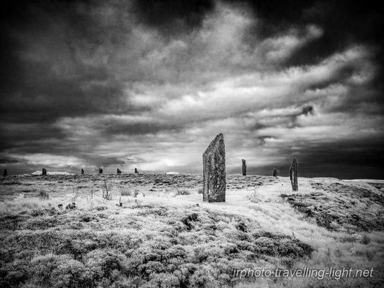
#Brodgar
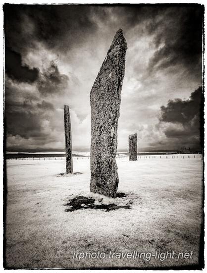
The Stones of #Stenness on the #Orkney #Mainland, close to the #Brodgar monuments and part of the Heart of Neolithic Orkney World Heritage Site.
#Infrared #Photography #BlackAndWhite #BWPhotography #BlackAndWhitePhotography #LumixGH3 #720nm #LandscapePhotography
Of course, Neolithic people had boats to get them from Europe to Britain, Ireland, and Orkney.
Everybody says it, so it must be true. Mustn't it?
https://orkneyriddler.blogspot.com/2025/07/they-must-have-had-boats.html
#neolithic #Britain #Orkney #archaeology #prehistory #Brodgar #Stenness #north-sea #skarabrae #harrayloch #nessofbrodgar
The Neolithic people of Britain were a nomadic group of cultures that entered the country from the Dutch region of northern Europe from before 7000 years ago until after 6000 years ago.
They came on foot, across a land bridge that is now shallow water between Holland and East Anglia, in England.
These people brought with them a suite of technologies, including pottery, domesticated animals, landscape structures, economic systems, community activities, timber joinery, structural engineering, and small-scale industries.
They had boats, but these were limited to dugout canoes for use on inland waters, lakes, harbours, and perhaps for crossing rivers.
In spite of their construction of cairns, these people retained their nomadic lifestyle, at least here in Orkney. They would cross from Caithness to South Ronaldsay along a strand made up of geologically soft sediments between those locations.
They came to Orkney every summer, returning to the south when the weather turned. As they crossed, from year to year, the people would have noted that the strand linking the two regions was narrowing. Sea levels were rising and coastal beaches were being eroded by strong tides.
At the very end of the 4th millennium BC, when sea-level wasn't yet high enough to cause concern, the summer solstice, and the Orkney Simmerdim, became an annual event, drawing hundreds of people to settle in temporary campsites around the Harray Loch.
While they were temporary residents, camping in Orkney, these huge groups built some of the monuments of the Orkney World Heritage Site. These include the Maeshowe Chambered Cairn, the Stones of Stenness, and the Ring of Brodgar.
As seasons progressed, and people returned to Orkney, to continue this great work, the sea rose, and whittled away at the strand that joined Caithness to Orkney.
At a critical point in the erosion of the strand between Caithness and Orkney, most people no longer returned to Orkney. Their campsite was abandoned just after 3000BC, and the stone circles that they were building remained, incomplete.
The very few people that remained in Orkney formed into small co-habiting communities, and built solid structures of stone and timber, with covered drains, and great windbreaks, or covered interconnecting passages.
These communities were based at Skara Brae, and the Ness of Brodgar.
In the middle of the 3rd millennium BC boats were being developed , and people were setting out to explore offshore islands, like Orkney.
When the mariners in their boats arrived in Orkney in the second half of the 3rd millennium BC it is possible that they met face-to-face with some of the surviving ancestors of the Neolithic Orcadian Founding Population.
https://orkneyriddler.blogspot.com/2025/07/neolithic-migration-to-orkney.html
#neolithic #Britain #Orkney #archaeology #prehistory #Brodgar #Stenness #north-sea #skarabrae #harrayloch #nessofbrodgar
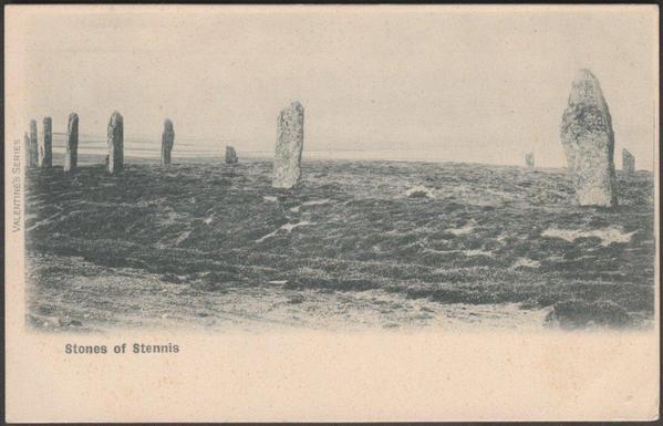
Printed monochrome postcard showing the "Stones of Stennis", or the Ring of Brodgar on Mainland, Orkney. Published by Valentine & Sons Ltd of Dundee & London in the Valentine's Series. Not numbered. Postally unused, but is c.1905.
#RingOfBrodgar #Brodgar #Orkney #StoneCircles #Postcards #StandingStoneSunday
A traveller in 18th century Orkney describes the fun and games of love and marriage in the Brodgar henges.
https://orkneyriddler.blogspot.com/2025/06/a-custom-among-lower-class-of-people.html
#Orkney #matrimony #marraige #history #Brodgar #henges #neolithic #Stenness #prehistory
In Orkney, the henge monument, the Ring of Brodgar, is huge. The exact number of stones standing in the circle is difficult to establish, so there is a lot of guesswork involved in the counting. Also, we have to wonder if the monument was ever finished!
https://orkneyriddler.blogspot.com/2025/06/the-ring-of-brodgar.html
#Orkney #archaeology #neolithic #prehistory #StandingStones #Brodgar #ringofbodgar
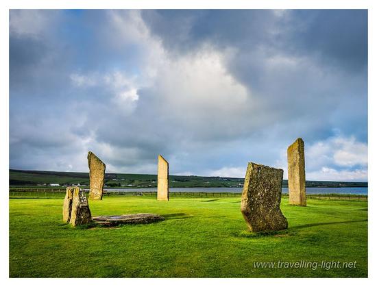
The Stones of Stenness are part of the Brodgar group of monuments in the Orkney World Heritage Site. They consist of a group of standing stones within a circular ditch. The entrance to the ditch enclosure is oriented to the north pole. Owing partially to human interference, only four of the original twelve stones placements still contain a stone. Six more stone positions are marked by broken off stones or evidence that a stone has been removed somehow. Two positions suggest that although holes were dug, no stones were raised in them.
Does this mean that the Stones of Stenness were never really finished?
Why?
What happened? Why was the construction abandoned?
https://orkneyriddler.blogspot.com/2025/06/stones-of-stenness-graham-ritchies.html
Barnhouse is the site of a small group of Neolithic dwellings close to the coast of Harray Loch, in Orkney. It is part of the Orkney World Heritage Site.
It is a lucky survival as it is an area that has not been ploughed by modern agriculture.
The evidence of habitation is physically very shallow, and for the most part, the buildings the structures represent were likely to be lightweight shelters.
The location of the settlement, on the shore of Harray Loch, and a stones throw from the Stones of Stenness suggests that this was a temporary campsite for the people who would build that henge monument.
Also, it is probable that such shallow dwellings were a feature of the shorelines of this, and other Orkney Lochs. There are many monuments in this area that would have required the Labour of large groups of people in Neolithic Orkney.
https://orkneyriddler.blogspot.com/2025/06/barnhouse.html
#Barnhouse #archaeology #neolithic #prehistoric #stonesofstenness #Brodgar
My blog is a bit long, so probably off-putting.
It attempts to "prove" that people were walking from Scotland to Orkney in the early part of the #Neolithic period.
In extensive and detailed research I have found a series of observations derived from other peoples work that, put together, may be enough to prove that there was walkable land from Doggerland north to the Shetlands, and also from #Orkney to Caithness.
In brief , there is evidence of a passage of land leading from #Dogger Bank to a location in the north of the North Sea where a flint artefact was found half way between Shetland and Norway.
There is also evidence that that land collapsed towards the Norwegian Coast in 3000BC.
On Orkney, Barnhouse and many other small settlements across mainland Orkney are all shallow sites that are clearly not designed to be occupied in an Orkney winter. These settlements were all abandoned before 3000BC.
My only assumption is that when land in the North of the North Sea was lost so also was a bridge between South Ronaldsay on Orkney, and Caithness, north Scotland.
The Stones of #Stenness and Ring of #Brodgar were abandoned, unfinished, probably at 3000BC.
The Westray islands are abandoned at 3000BC, and not colonised again until the second half of the 3rd millennium BC.
#Skara #Brae, and the #Ness of #Brodgar, both have dated deposits from before 3000BC indicating there was some kind of occupation until then, but not till after 3000BC are the revolutionary solid structures with stone lined drains and other necessary amenities for winter weather designed and constructed.
The structures at the Ness of Brodgar were made of wood, largely, so they would not have lasted long, a couple of generations perhaps.
The dates of the human bones found in the cairns are largely assessed to before 3000BC, and the dates of the animal bones, also in the cairns, which were arguably being eaten by people, are largely after 3000BC.
This suggests that when a few groups of people isolated from mainland Britain lost the structural secuity of their solidly built structures, they may have sought desperate refuge in the cairns.
Temporary visitors returned, by newly developed boats, in the second half of the 3rd millennium BC.
Detailed, if longwinded, analysis is in the blog:-
http://orkneyriddler.blogspot.com/2025/04/the-orkney-riddle.html
I could never quite believe that Neolithic people came to Orkney by boat.
As it is thought that they brought cattle and sheep with them, I could not envisage any animal, or any human, surviving a sea crossing of any British tidal waters in any prehistoric vessel.
Standard sources tie themselves in knots to persuade us that Neolithic people had boats that could carry beasts of both sexes that, once landed, would reproduce and help their tribe to survive on the unknown territory across the dangerous waters.
However, evidence has recently emerged that added another dimension to the problem. It was discovered that the Orkney Vole, a species that is unique to the archipelago, had been found by DNA analysis, to originate from northern Europe, and that it was not directly related to the common vole in Britain. (Thomas Cucchi et al)
This meant that the animal that arrived in Orkney did not pass through England, Wales or Scotland.
A vole arriving in Orkney, from Europe, without passing through Britain was a clue that all was not as it seems, and that in spite of the insistence of some that voles may have been carried as pets or food items, another possibility was probably more likely.
I therefore rather assumed that it must be necessary to question what places were passable around the coasts of Neolithic Britain, which areas were land, and which places were water, and when did land areas stop being land.
It is understood that much of the southern North Sea area was land at some point in the past. A piece of shallow sea called Dogger Bank has been named Doggerland as artefacts of 8000 years of age, and older, are frequently dredged up there. The rise in sea level which has occurred since the last ice age has clearly flooded lands here, but which lands, where, and when?
The obvious location, or so I thought, for a route to Orkney from Europe , that would be passable for small rodents, on foot, and avoiding England and Scotland, would be somewhere in the middle of the North Sea which, of course, is a bizarre idea.
Indeed, it was such a bizarre idea that I followed it, to see where it took me.
The result of my research can be seen in my blog:-
http://orkneyriddler.blogspot.com/2025/04/the-orkney-riddle.html
#Orkney #Neolithic #archaeology #prehistory #Brodgar #nessofbrodgar #Skara #skarabrae #barnhouse #knapofhowar #linksofnoltland #Noltland #cairns #Maeshowe
Each stone in the circle at the Ring of Brodgar has been worked to break along a fissure, creating a unique common profile. Each stone has more or less upright edge on one side, and on the opposite side a sloping edge.
At Vestra Fiold on the west coast, a partially quarried stone that conforms to this design has been discovered and excavated. (Colin Richards) It is cut out and ready to move, but has not been taken, suggesting that work on the Ring of Brodgar, for which it was destined, was also halted before it was completed.
Why?
#Orkney #Neolithic #Brodgar #prehistory #archaeology
The Ring of Brodgar is one of the two famous henges at Brodgar, and a major monument of the World Heritage Site.
“The original number of stones is uncertain. At the present time the position of at least forty can be identified, and there are spaces for twenty more, if it is assumed that they were erected at approximately equal distances apart. This would bring the total in the original plan to sixty.” (RCAHMS)
Today, the stone circle comprises 21 erect monoliths. The position of a further ten is represented by either stumps or packing stones projecting through the turf. Two more stones lie prone just inside each causeway respectively. Of the c. 60 stones only 13 remained standing. (Downes) “
#Orkney #Neolithic #prehistory #Brodgar #henges #archaeology
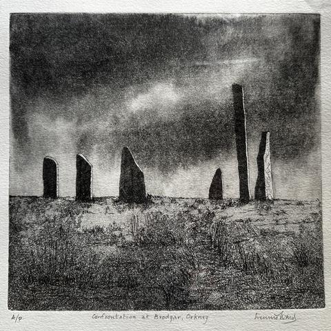
We found this A/P etching by Dennis Ward in a vintage place in Leith today. Titled ‘Confrontation at Brodgar, Orkney’, it has a brooding light-and-darkness quality reminiscent of many of Orkney’s landscapes.
It turns out Ward was latterly Professor Emeritus of Russian Studies at Edinburgh University, and in fact the first Professor of Russian there, and was chair of Edinburgh Printmakers in the late 1990s.
#DennisWard #Etching #Printmaking #EdinburghPrintmakers #Orkney #Brodgar #RingOfBrodgar
#StandingStones #StoneCircle #NeolithicScotland #neolithic #Scotland #Photography #LandscapePhotography
Prints @ pixels.com: https://colin-and-linda-mckie.pixels.com/featured/the-stones-of-stenness-orkney-scotland-colin-and-linda-mckie.html
#Infrared #Photography #BlackAndWhite #BWPhotography #BlackAndWhitePhotography #LumixGH3 #720nm #LandscapePhotography
@theguardian_science
"Did the Neolithic builders of the megalithic stone circles intend to express pi?" 2012.03.14
https://jqjacobs.net/archaeology/stonehenge/stonehenge_pi.html
#Stonehenge #Avebury #Orkney #Brodgar #Archaeology #Neolithic #Megaliths
#StandingStoneSunday #StoneCircle #StandingStones #Megalithic #Henge #Brodgar #RingOfBrodgar #Orkney #Scotland #Photography #LandscapePhotography
Ring of Brodgar
One of the many 'must see' places on the Orkney's are the Ring of Brodgar. The Ring of Brodgar Stone Circle and Henge is an enormous ceremonial site
https://wulliebroon.com/ring-of-brodgar/
#Islands #Orkneys #brodgar #orkney #Scotland #StandingStones
Am Ring of #Brodgar gibt es diesen Sommer jeden Tag um 13 Uhr eine kostenlose Führung 👍
Mit 103 Meter Durchmesser ist der Steinkreis einer der größten und schwer zu fotografieren.
