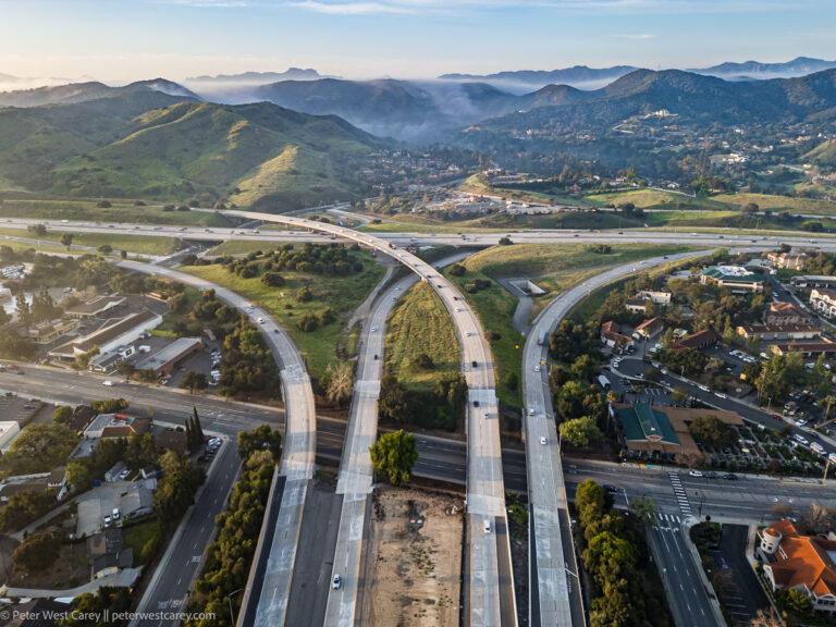
#The101

Peter West Careypwc@mastodon.online
2024-11-27

Pick A Lane

Description: Where The 23 meets The 101, you need to pick a lane.

Location: Ventura County, California, USA, North America

Photograph copyright Peter West Carey. All rights reserved

thecareyadventures.com/blog/pi

#California #Featured #NorthAmerica #PhotoOfTheDay #USA #aerial #AerialPhotography #California #freeway #highway #Highway101 #mountains #PhotoOfTheDay #Photography #The101 #The23 #ThousandOaks #travel

Conspiracy of CartographersConspiracyOfCartographers
2023-01-10

Not to be outdone by the previous map to the east, here's the 1952 quad, just west of Santa Barbara.

A different kind of flooding...66m of sea level rise—if all the world’s ice caps melted.

Conspiracy of CartographersConspiracyOfCartographers
2023-01-10
Vintage USGS topo map of Santa Barbara with 66 meters of sea level rise
2023-01-10

Today was a bad day to drive 250 miles down #the101 with the family in a rented car, from #MLA23 to Santa Barbara. We made it home all right, but lots of flooding, exit closures, and cautious maneuvers. A midway rest at the unique/bizarre #MadonnaInn in #SanLuisObispo proved vital.

Client Info

Server: https://mastodon.social
Version: 2025.04
Repository: https://github.com/cyevgeniy/lmst