One for the geo format nerds https://element84.com/software-engineering/is-zarr-the-new-cog/
#rspatial #gdal
Julien Cabieces
Work @oslandia
SIG C++/Python developer, QGIS (www.qgis.org) contributor, Emacs addict and of course, FOSS advocate
Julien Cabieces boosted:
Julien Cabieces boosted:
We've done it 🥳
Finally, there's a canonical paper on the #QGIS project, its history, workings, and challenges: https://www.sciencedirect.com/science/article/pii/S2666389925001138
Thanks to @timlinux and @mbernasocchi for joining me in trying to tell the QGIS story 💚
Julien Cabieces boosted:
Why is your open source project still hosted on GitHub?
https://unixdigest.com/articles/why-is-your-open-source-project-still-hosted-on-github.html
Seriously, we need to talk about your #github addiction!
https://ploum.net/2023-02-22-leaving-github.html
Here’s a short tutorial to #sourcehut but there are many others ethical forges, like #codeberg
Julien Cabieces boosted:
And... we're back!
Julien Cabieces boosted:
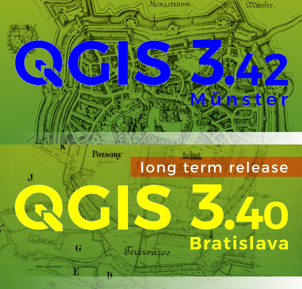
Linux and Windows packages of #QGIS release 3.40.7 "Bratislava" (LTR) and 3.42.3 "Münster" ready on https://qgis.org. Make maps not war!
Julien Cabieces boosted:
Et en français dans le texte (parce que c'est la langue de la VO du texte)
Voilà donc ma première "vraie" publication scientifique en archéologie, un résumé de mon projet de doctorat. "Publiez tôt, publiez souvent", comme dit le fameux adage de l'open source !
Merci à Préhistoires Méditerranéennes pour l'opportunité.
Julien Cabieces boosted:
En route pour quelques jours de travail à Nanterre avec le GDR Silex, autour de la bascule de la plateforme https://Cartosilex.fr vers une chaîne entièrement open source.

Julien Cabieces boosted:
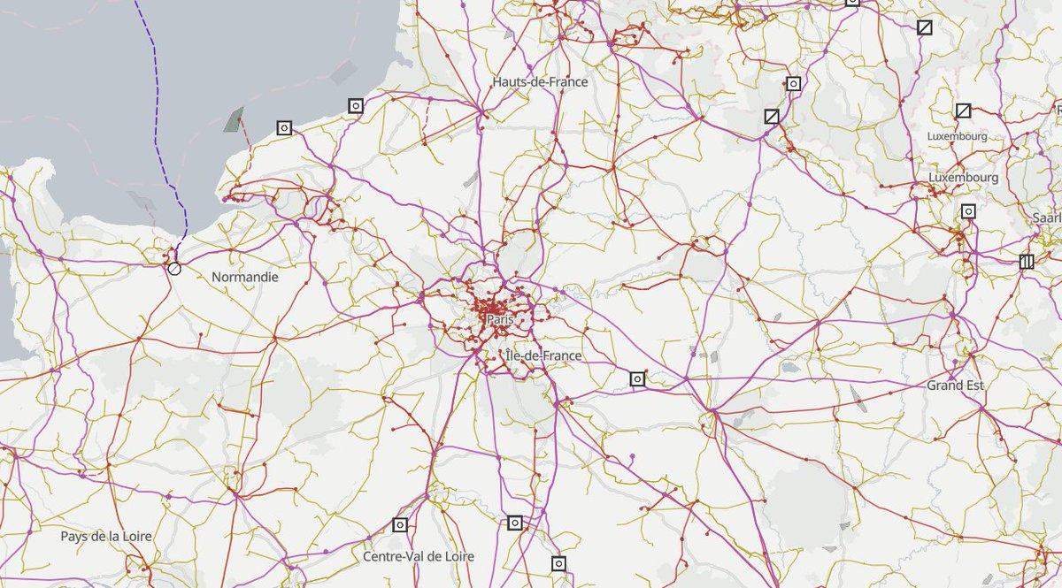
Pratique, toutes les données d'infrastructure électrique d'openstreetmap sont à disposition sur Open Infrastructure Map https://openinframap.org/#2/26/12
Julien Cabieces boosted:
Declaring a friendship to self
https://www.sandordargo.com/blog/2025/05/14/friend-self
Discussions: https://discu.eu/q/https://www.sandordargo.com/blog/2025/05/14/friend-self
Julien Cabieces boosted:
This painting was inspired by the park around Meiji shrine in Tokyo. #Art #TraditionalArt #Nature #Landscape #Environment

Julien Cabieces boosted:
Taskflow v3.10 released! Thank you for your support!
https://taskflow.github.io/taskflow/release-3-10-0.html
Discussions: https://discu.eu/q/https://taskflow.github.io/taskflow/release-3-10-0.html
Julien Cabieces boosted:
GDAL 3.11.0 "Eganville" is released. The highlight is the new "gdal" front-end command line utility: https://gdal.org/en/latest/programs/index.html#gdal-application.
Release announcement at https://lists.osgeo.org/pipermail/gdal-dev/2025-May/060547.html
Julien Cabieces boosted:
Merci @GIPCraig pour son soutien financier 🙏 (niveau OR) !
https://www.craig.fr/
Si comme eux vous souhaitez nous aider à financer les rencontres francophones #QGISFR2025 et le projet #QGIS, n'hésitez pas, c'est encore possible!
https://conf.qgis.osgeo.fr/z30_mecenat.html
Julien Cabieces boosted:
Looks like we've got an influx of new users on Mapstodon.Space, so welcome everyone!
Check the server announcements, visit around, follow a bunch of people, make friends, and please, do get in touch if needed!
Glad to have you on the Fediverse.
Julien Cabieces boosted:
We are extremely pleased to announce the six funded proposals for our 2025 QGIS.ORG grant programme.
http://blog.qgis.org/2025/04/24/qgis-grant-programme-2025-results/
Julien Cabieces boosted:
Merci @oslandia pour son soutien financier 🙏 (niveau OR) !
https://oslandia.com/
Si comme eux vous souhaitez nous aider à financer les rencontres francophones #QGISFR2025 et le projet #QGIS, n'hésitez pas, c'est encore possible!
https://conf.qgis.osgeo.fr/z30_mecenat.html
Julien Cabieces boosted:
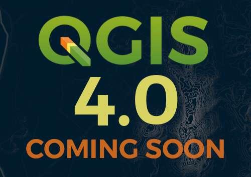
🎉 Big Changes Ahead: We're moving to Qt6 and Launching #QGIS 4.0!
https://blog.qgis.org/2025/04/17/qgis-is-moving-to-qt6-and-launching-qgis-4-0/
Julien Cabieces boosted:
🎉 The road to QGIS 4 is open ! The #QGIS Roadmap for the next major version is now official ! https://blog.qgis.org/2025/04/17/qgis-is-moving-to-qt6-and-launching-qgis-4-0/
🚀 The migration to Qt6 is almost complete and will enable QGIS to improve significantly. The #CMYK mode will namely be fully available.
📆 As for releases, QGIS 3.40 LTR will be supported until may 2026. QGIS 4.2 will be the next official LTR in February 2026.
👩💻 Migration work will be required for plugins, we are working on tools and docs.
Julien Cabieces boosted:
We’ve spent the last 10 years building powerful open-source geospatial tools — and we’re just getting started 💚
The next decade will be all about deepening our impact, growing our community, and continuing to push the boundaries of what’s possible in the field and geospatial tech.
Want to be part of the journey?
👉 Join our newsletter https://buff.ly/n3g6c6a to stay in the loop, share your voice, and shape the future with us.
Client Info
Server: https://mastodon.social
Version: 2025.04
Repository: https://github.com/cyevgeniy/lmst