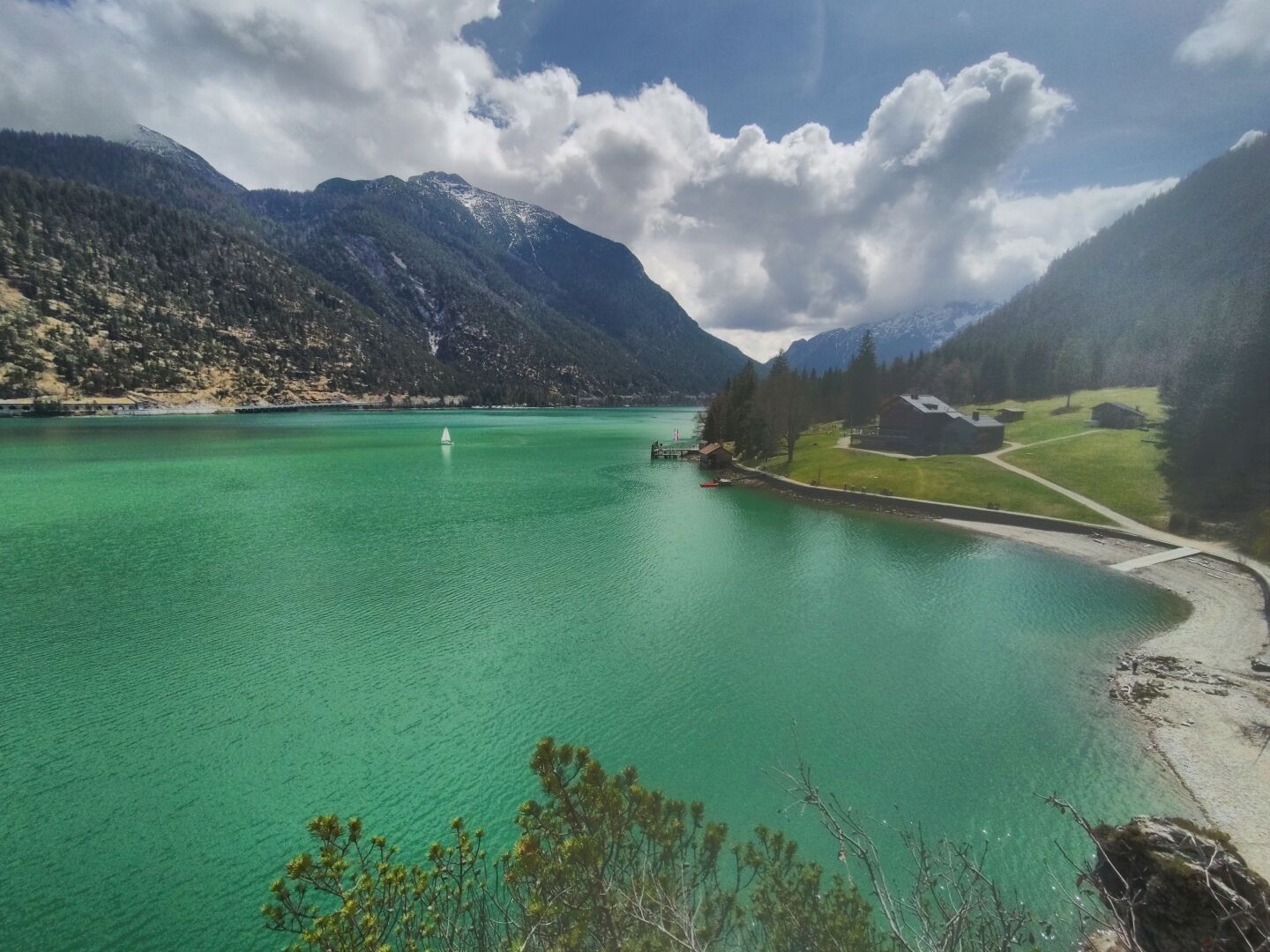
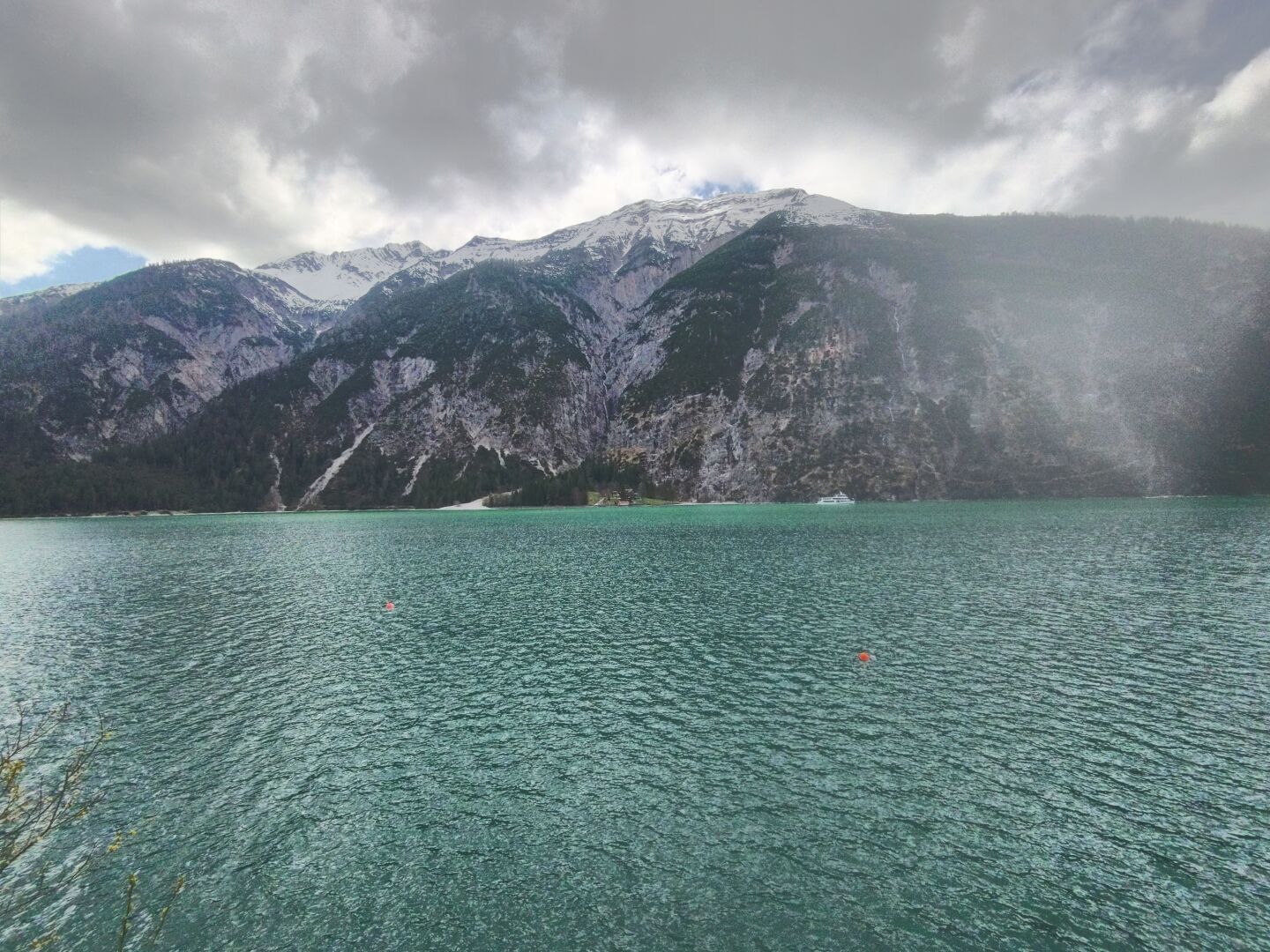
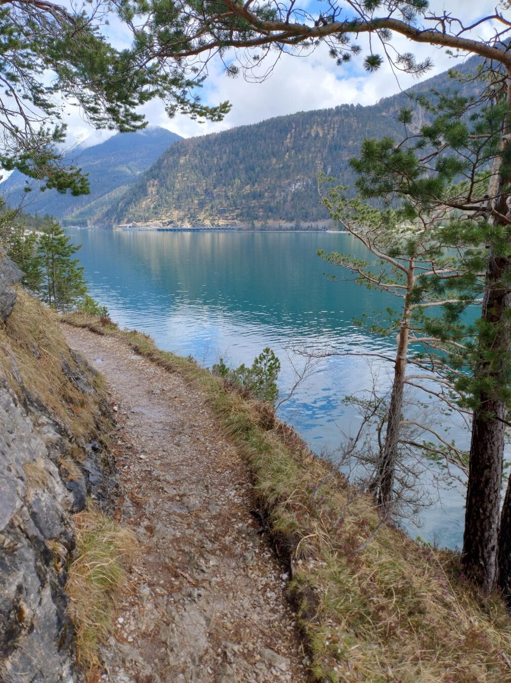
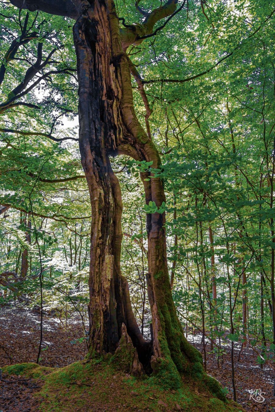
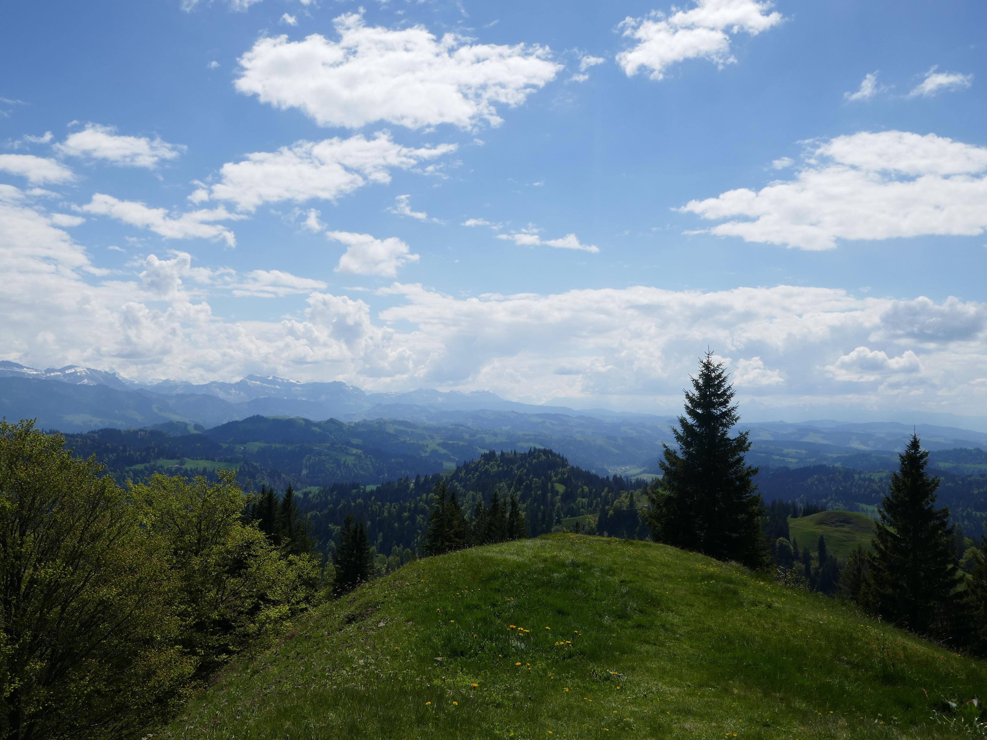
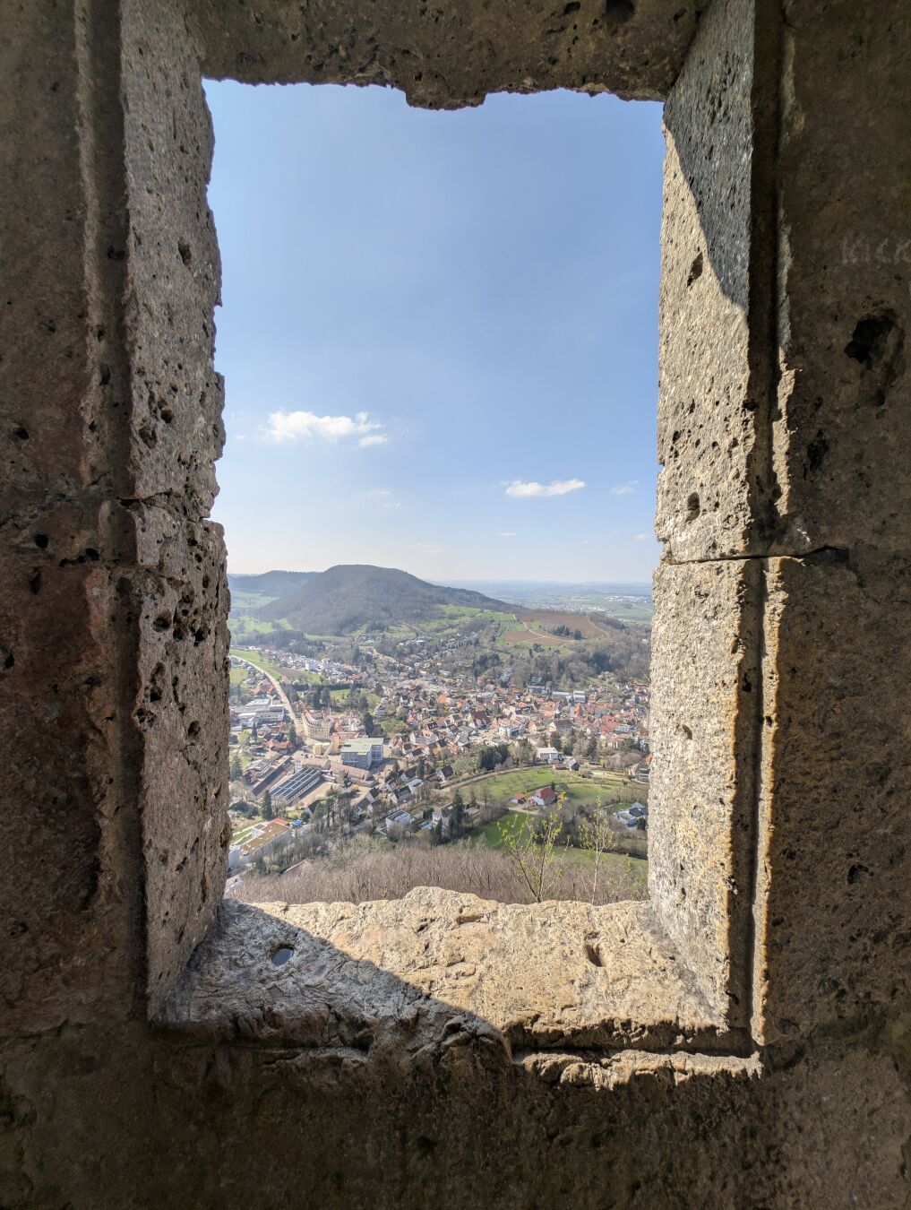
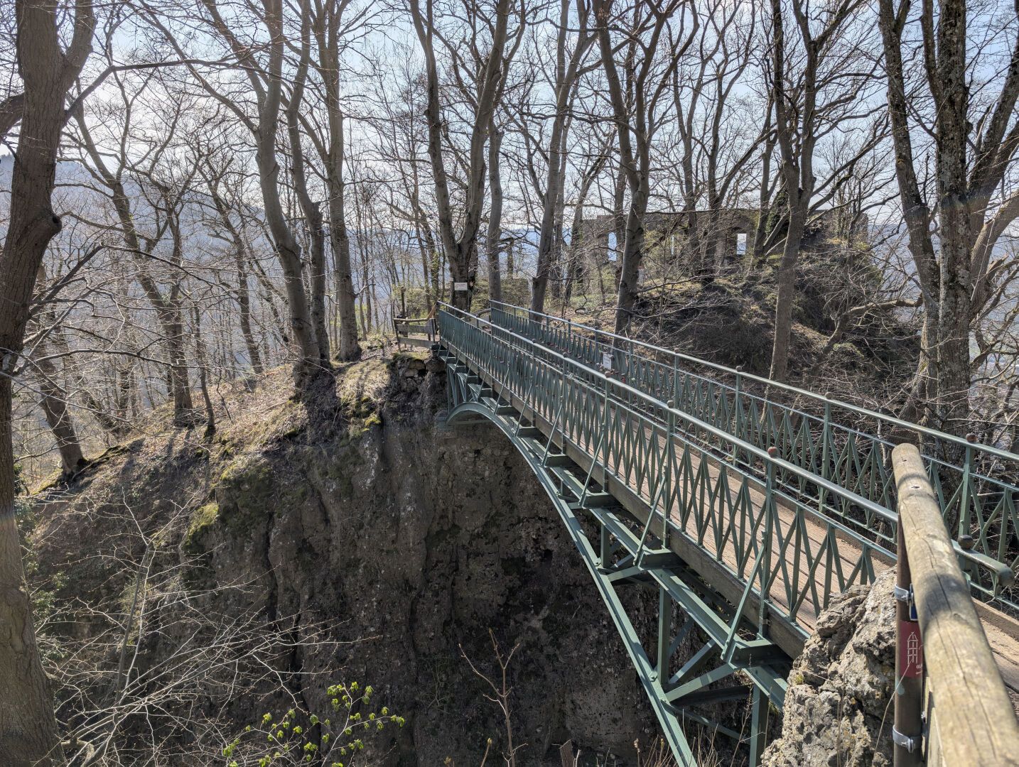
Roughly two years ago we've been on a short trip to Stans in Tyrol. We did most of our activities this holiday at a more leisurely pace, but also had one day where we encircled the nearby Achensee via Mariensteig and Gaisalmsteig in more or less five hours.
#TBT #ThrowbackThursday #Throwback #Achensee #Tyrol #Tirol #Österreich #Alpen #Alps #Berge #Mountains #Austria #Switzerland
Tim
Guy with a passion for trains, opensource software and - of course - hiking in the mountains 🏔️🥾.
Languages: 🇩🇪🇬🇧
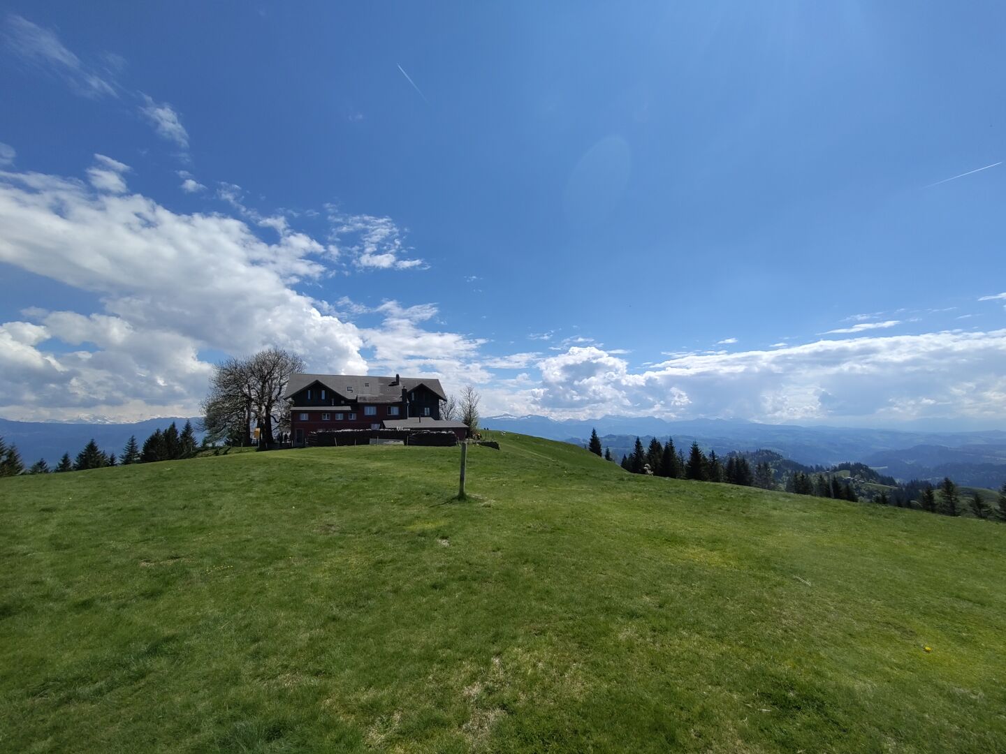
Roughly two years ago we've been on a short trip to Stans in Tyrol. We did most of our activities this holiday at a more leisurely pace, but also had one day where we encircled the nearby Achensee via Mariensteig and Gaisalmsteig in more or less five hours.
#TBT #ThrowbackThursday #Throwback #Achensee #Tyrol #Tirol #Österreich #Alpen #Alps #Berge #Mountains #Austria #Switzerland
#TBT #ThrowbackThursday #Throwback #Achensee #Tyrol #Tirol #Österreich #Alpen #Alps #Berge #Mountains #Austria #Switzerland

Tim boosted:
Alpstein
#landscapephotography #swissalps #alpstein #Schweiz #Alpen #fotografie #Berge #Wandern #Fujifilm
#landscapephotography #swissalps #alpstein #Schweiz #Alpen #fotografie #Berge #Wandern #Fujifilm
Tim boosted:
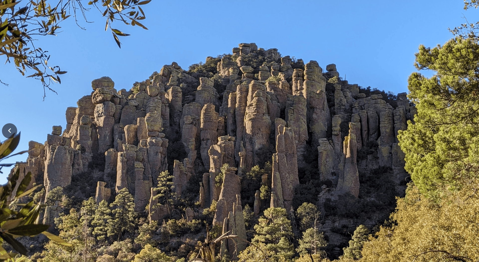
Typical cluster of tuff pillars at Chiricuahua National Monument (Arizona, USA)
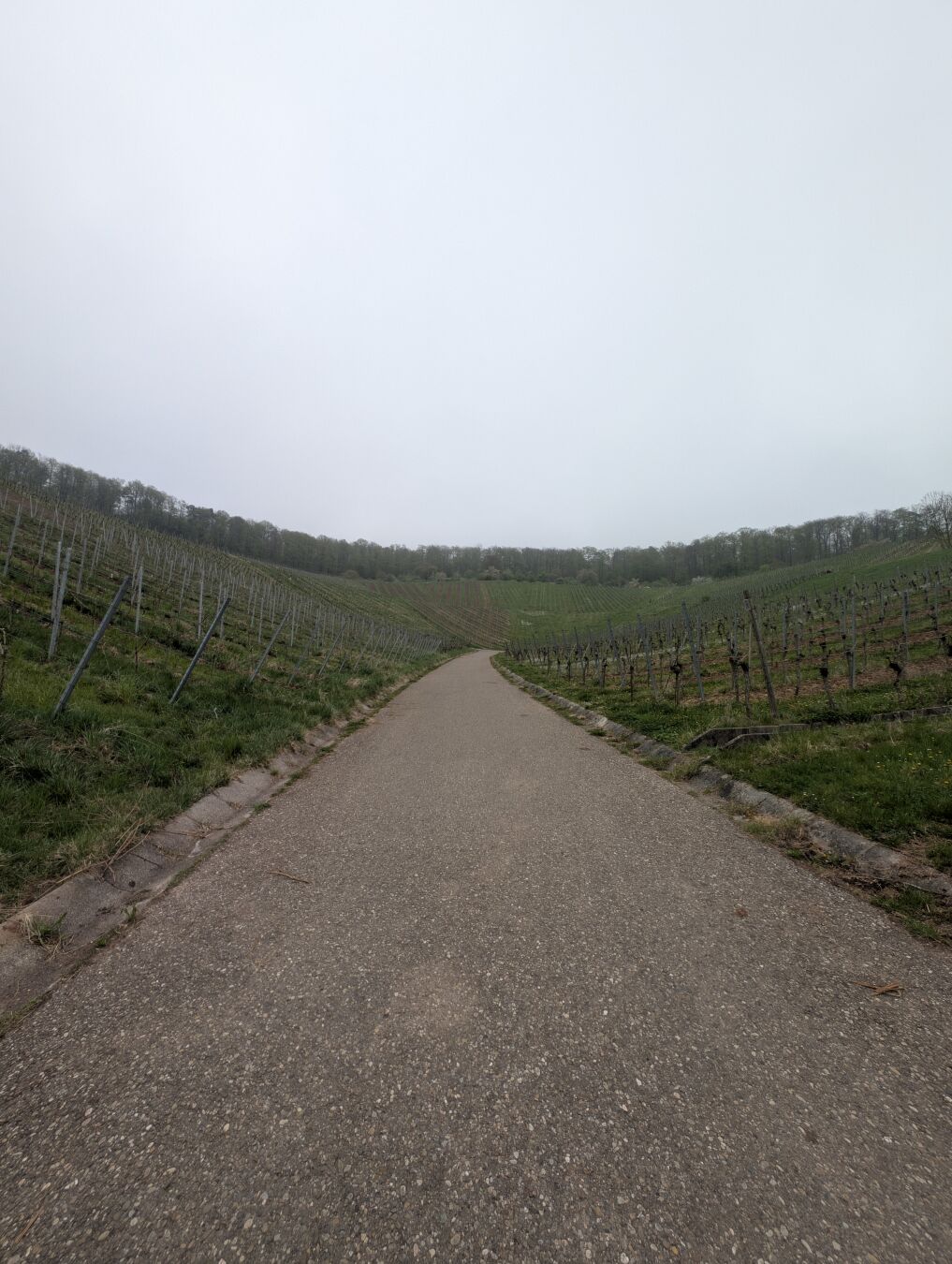
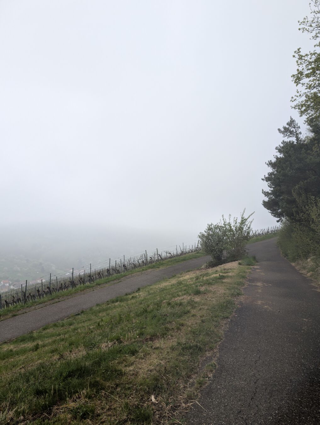
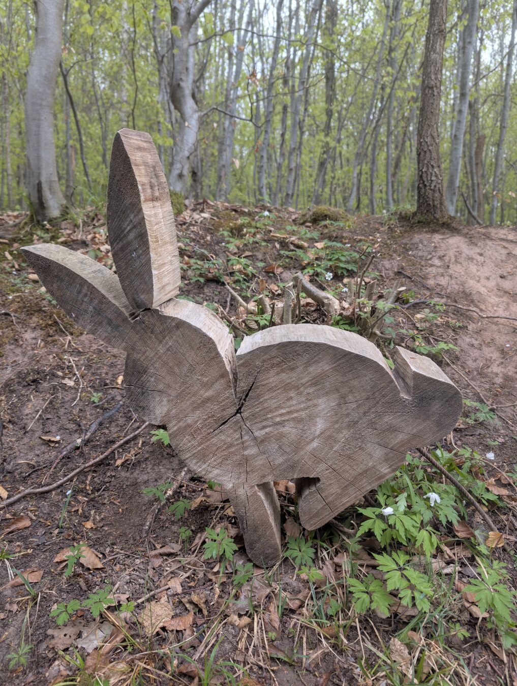
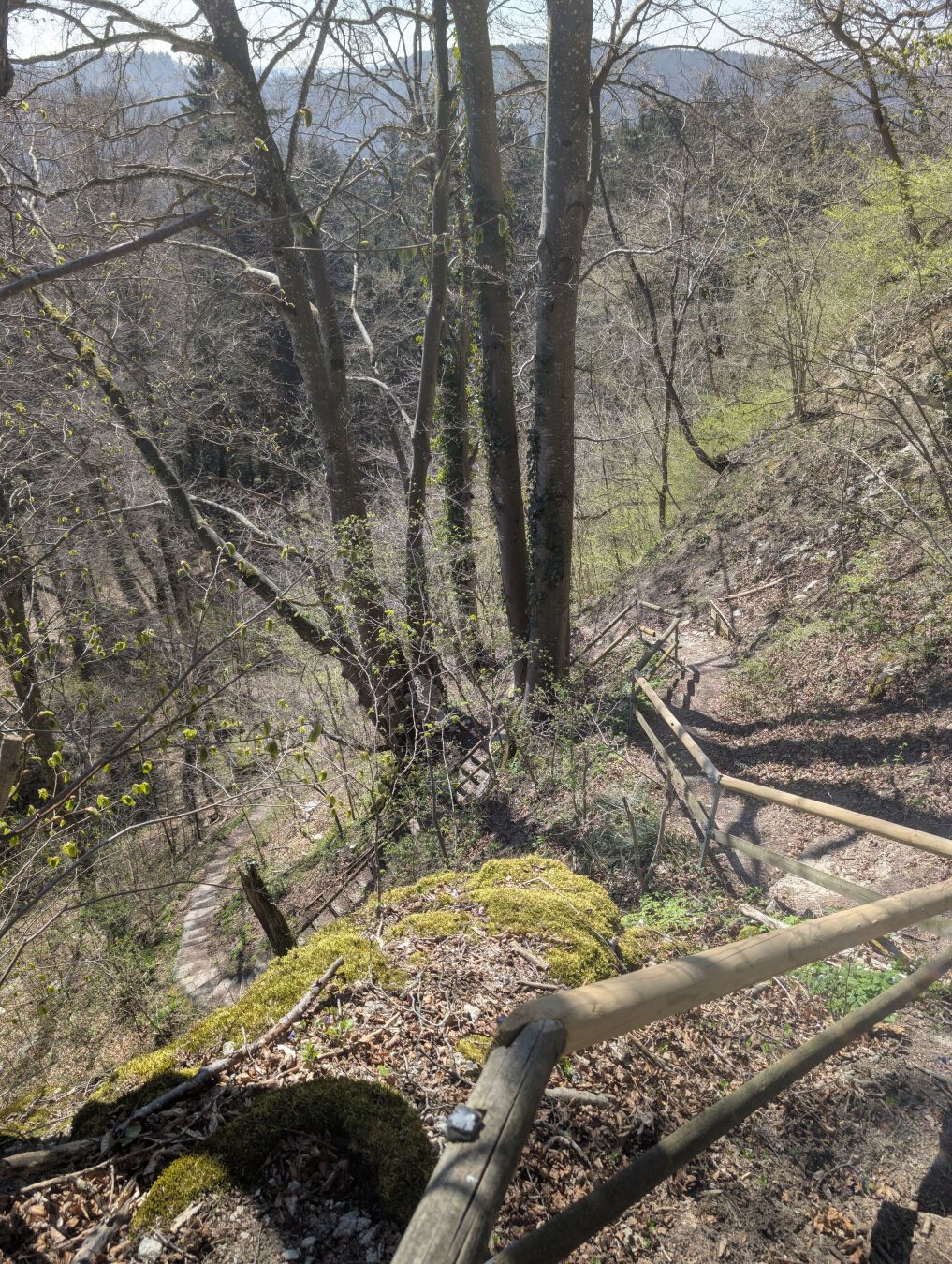
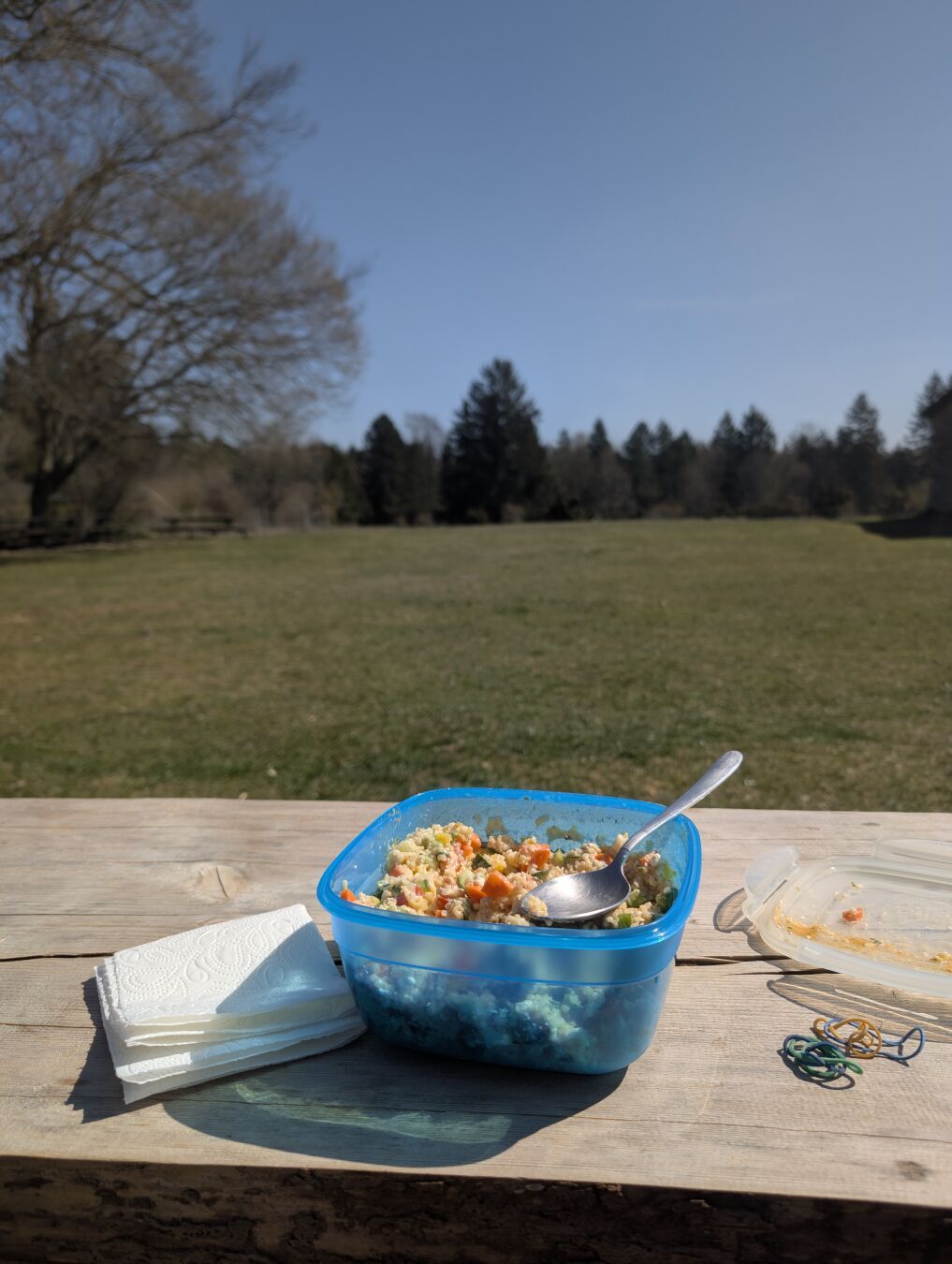
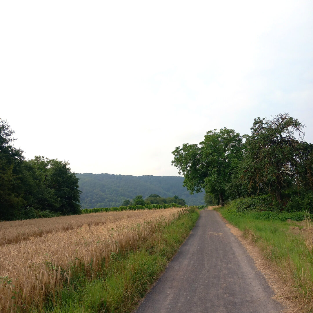
Here are a few photos from a hike I did mid-April through vineyards and forests.
Because of the cold and damp weather I ended the hike earlier than I initially wanted to.
Duration: 3 hours and 44 minutes (excluding an approximately 15 minute lunch break)
Length: 17.8 km
Elevation: 245 m to 484 m
Ascent/Descent: 390 m ↑ and 485 m ↓
#Trees #ForestLovers #Vineyards #Mist #Fog #RainyDay #RainyMood #Hiking #RemstalWeg #SwabianMountains #SwabianJura #Wanderlust #Wandern #Remstal

Alles klar, danke für die Infos. Würde mir einige Etappen davon vielleicht mal für nächstes Jahr vormerken und zusammen mit meiner Partnerin machen :).
I haven't posted anything for #ThrowbackThursday in a long time so let's get back to more activity!
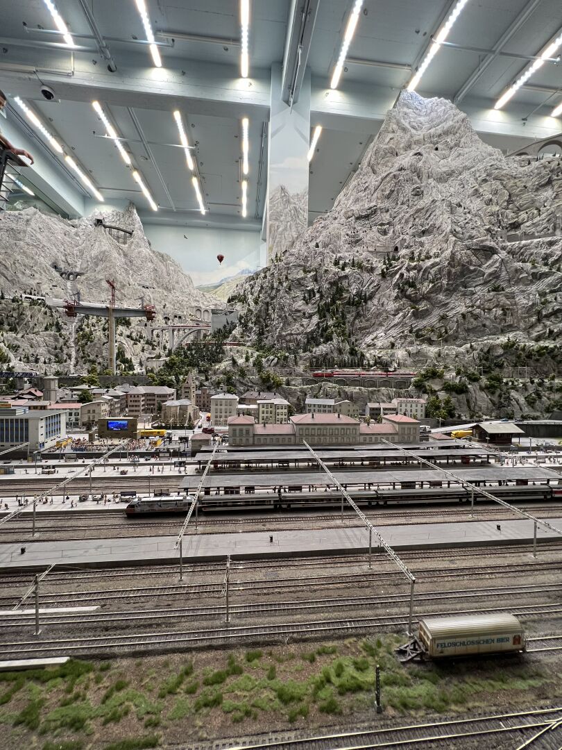
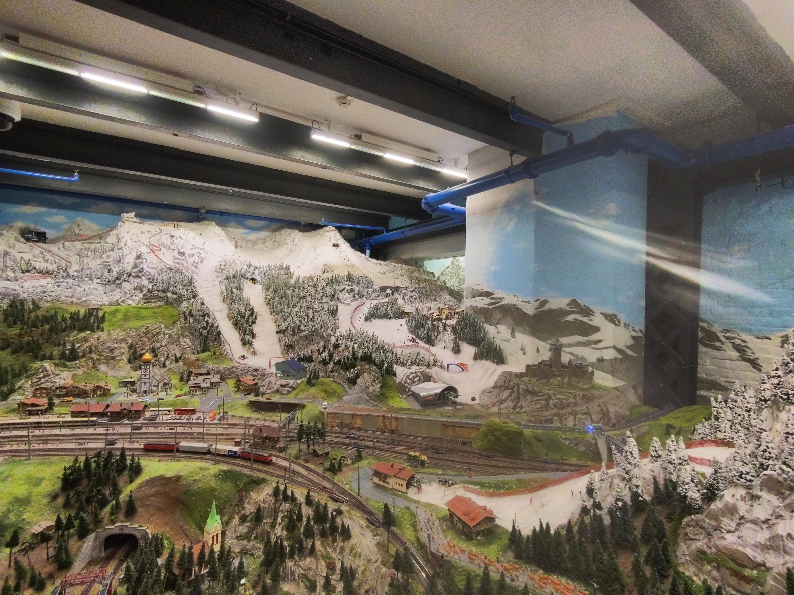
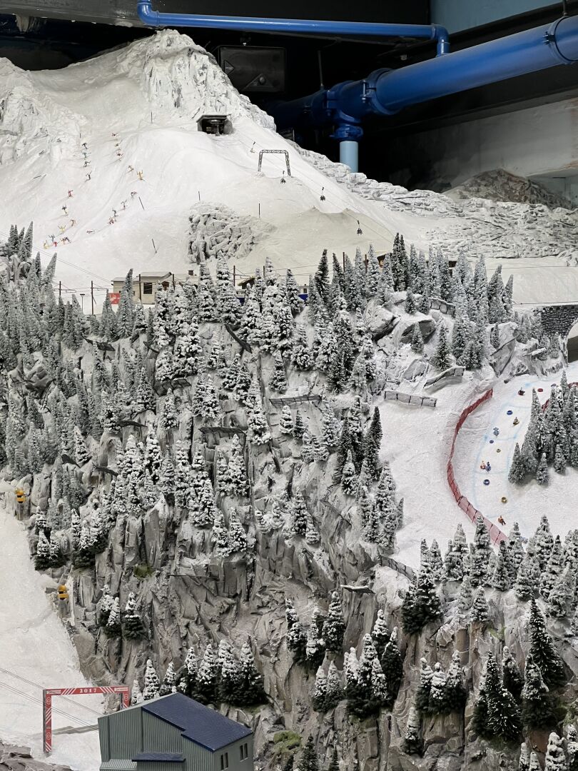
In Spring 2023 I've been in Hamburg for a weekend. Interesting city, but the highlight - at least for me - was the visit in the Miniaturwunderland where I was dumbstruck by the sheer amount of work which had to be invested to build these mini worlds.
They even have some mountains in the Swiss and Austrian part of the exhibition!
#TBT #Throwback #Hamburg #MiniaturWunderland #Trains #Züge #MiWuLa #Alpen #Alps #Mountains #Austria #Switzerland
Sechs schöne Etappen scheint ihr da gehabt zu haben! :) Allein schon aufgrund der Höhe ist es wohl ratsam, die Tour im Frühjahr oder Herbst zu gehen, oder? War viel los auf den Wegen?
Tim boosted:
Welterbesteig Tag 4: Pausentag in Spitz & Jauerling
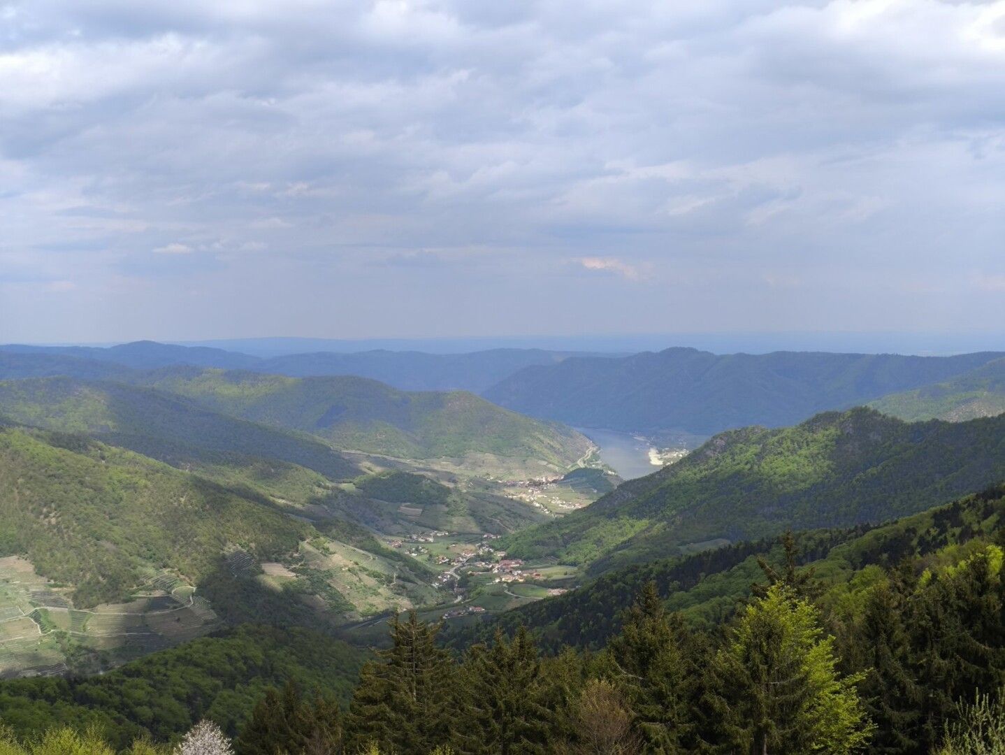
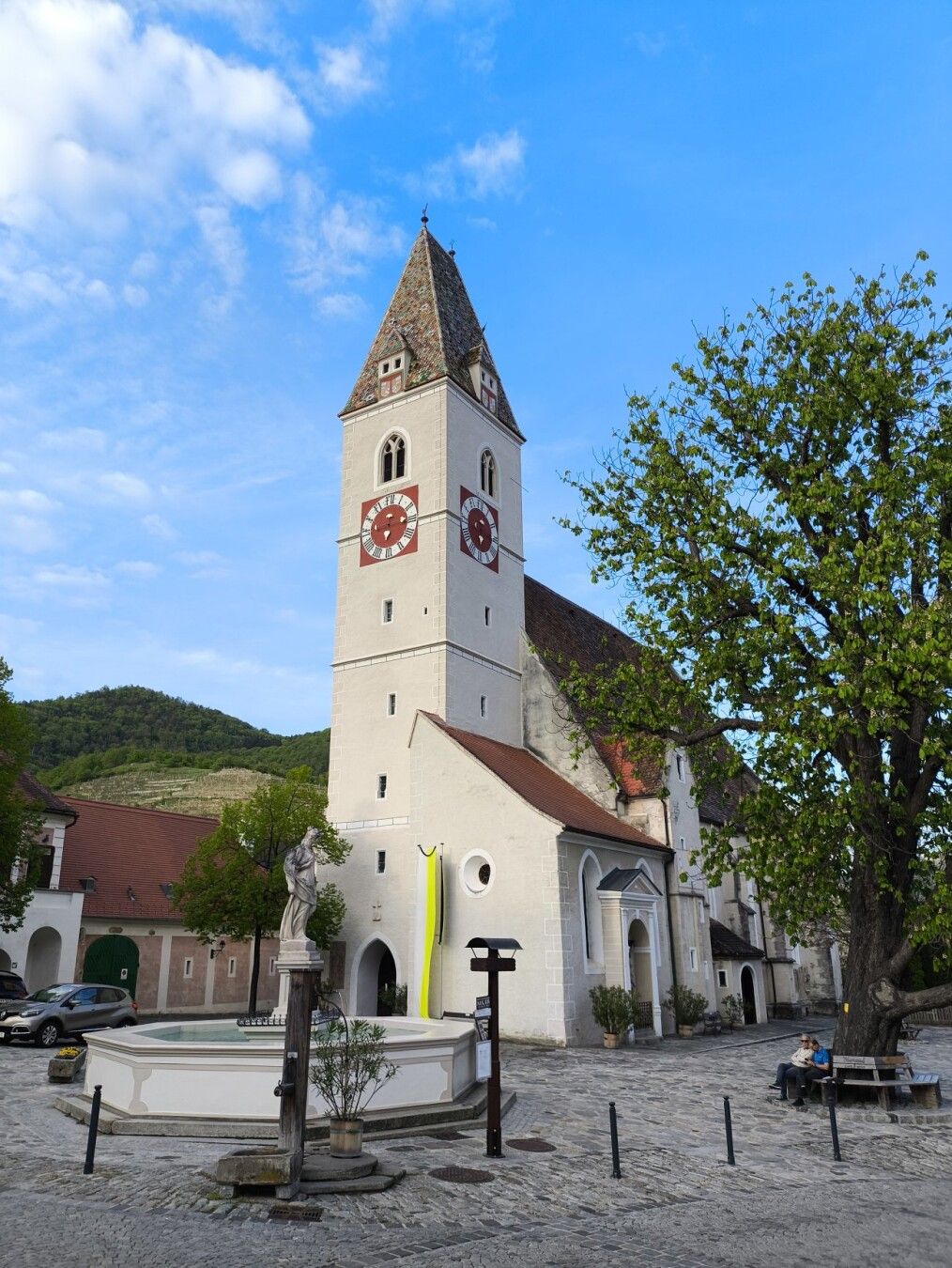
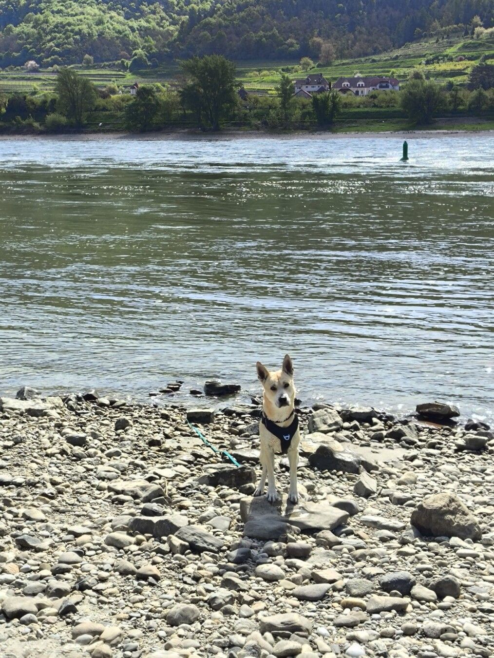
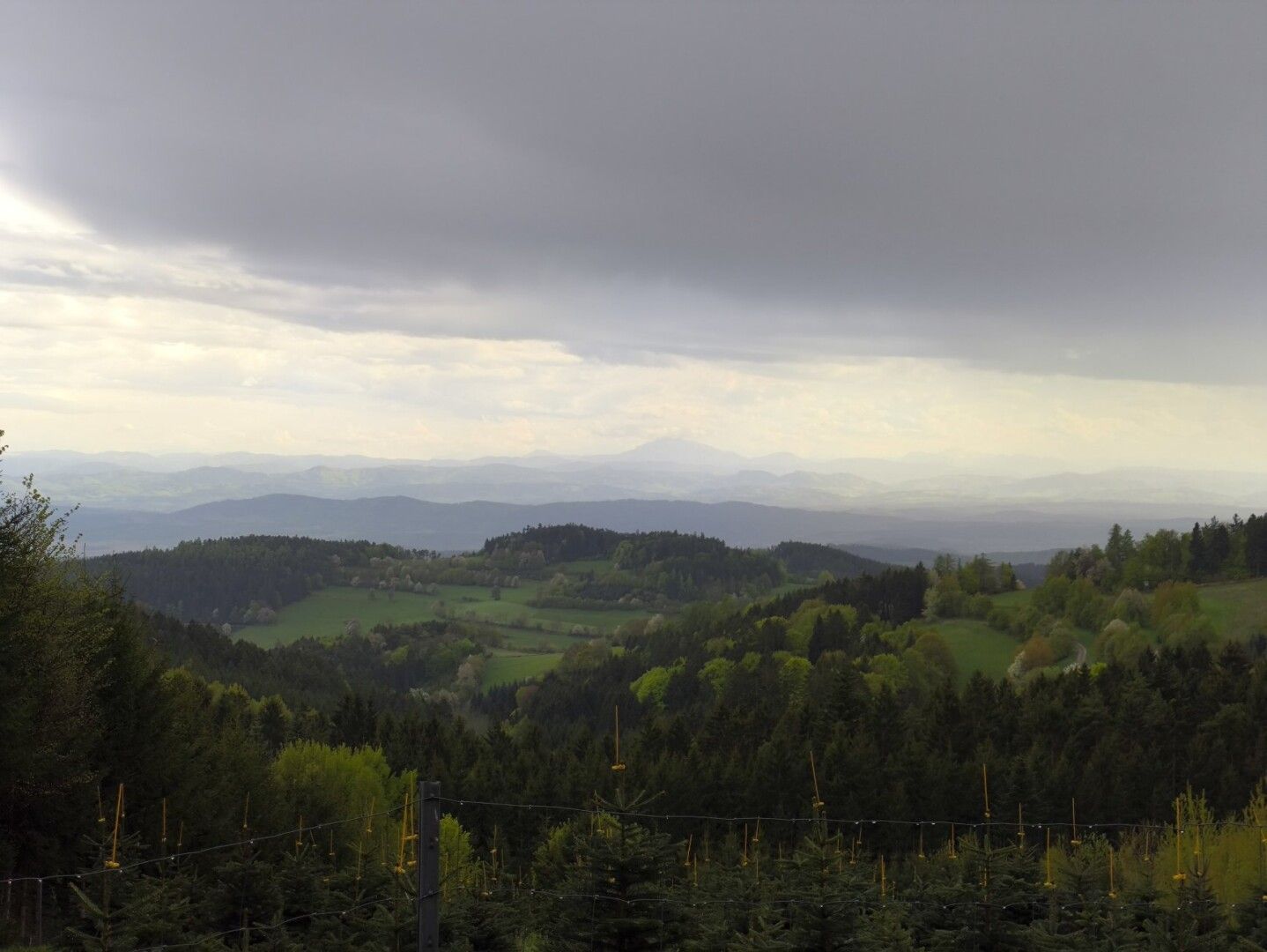
Den heutigen Vormittag haben wir zum ausgiebigen Pause machen genutzt. Wie bei allen Orten die wir hier bisher gesehen haben, hat auch #Spitz einen besonderen Charakter. Wir haben uns etwas die Ortschaft angesehen und für den Hund gab es ein Bad in der #Donau.
Leider macht der Fuß meiner Partnerin momentan nicht so gut mit, daher sind wir dann mit dem Bus weiter. Zum Glück fährt dieser bis knapp unter den #Jauerling-Gipfel. Zum Wandern sind wir aber doch noch etwas gekommen. Vom Naturpark Gasthaus aus hatten wir eine schöne Aussicht auf den Spitzer Graben und die Donau.
Nach einem Besuch des bewaldeten Gipfels sind wir dann wegen des Regens schnell wieder Richtung Nonnersdorf abgestiegen, wo wir heute übernachten. Trotz Schlechtwetter hatten wir auch hier teilweise einen schönen Ausblick, etwa bis zum Ötscher.
#Wandern #hiking #Welterbesteig #Wachau #dogsOfPixelfed #DogsOfMastodon
Tim boosted:
Welterbesteig Tag 5: Maria Laach - Emmersdorf
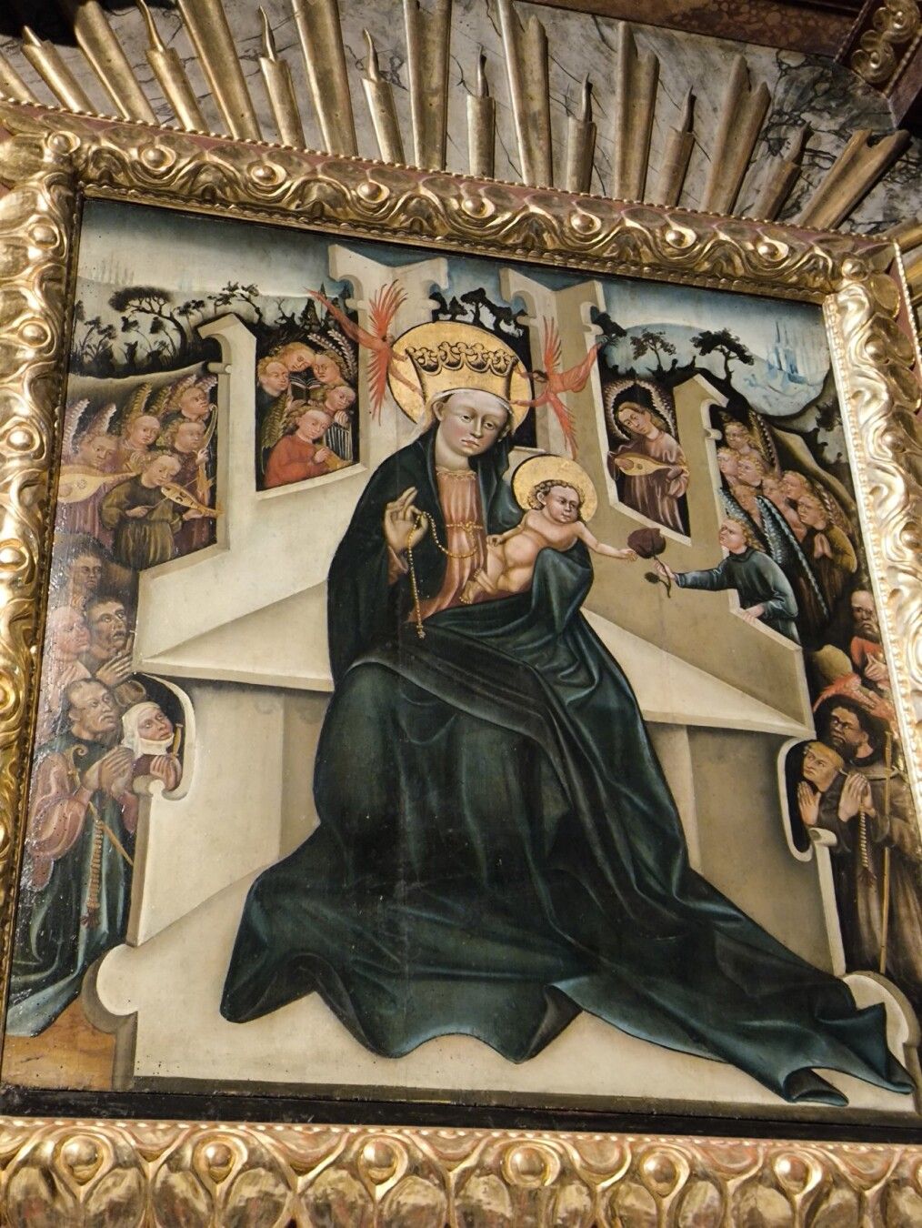
Heute wieder alles nach Plan. Zuerst im Regen nach Maria Laach wo wir die Wallfahrtskirche besichtigt haben. Nicht nur die Darstellung der Maria mit sechs Finger ist interessant, sondern auch der Flügelaltar ist eine Besonderheit.
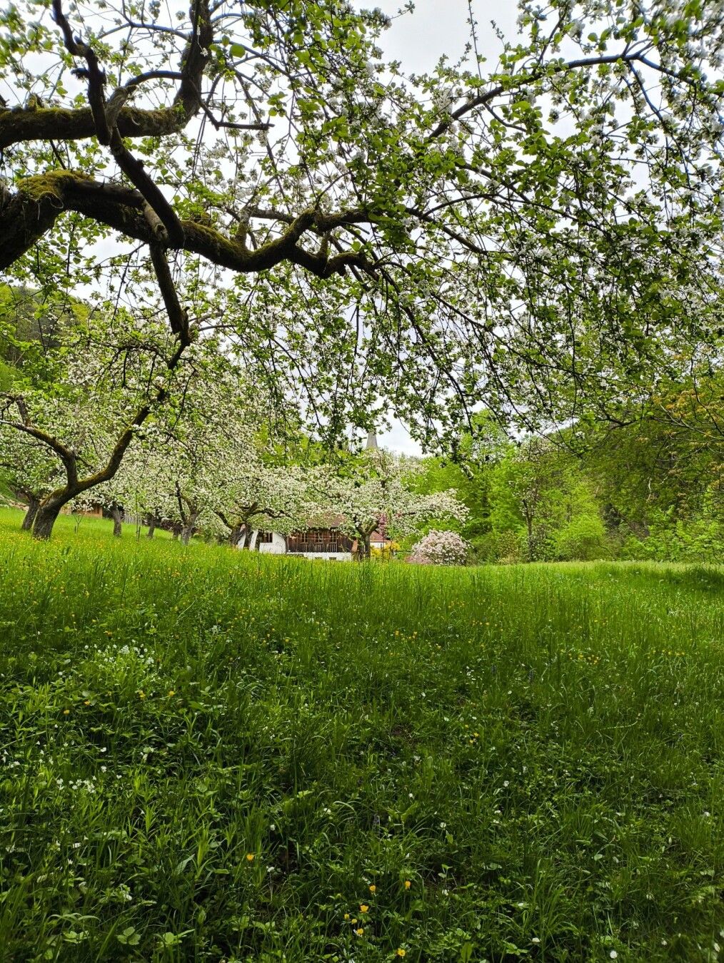
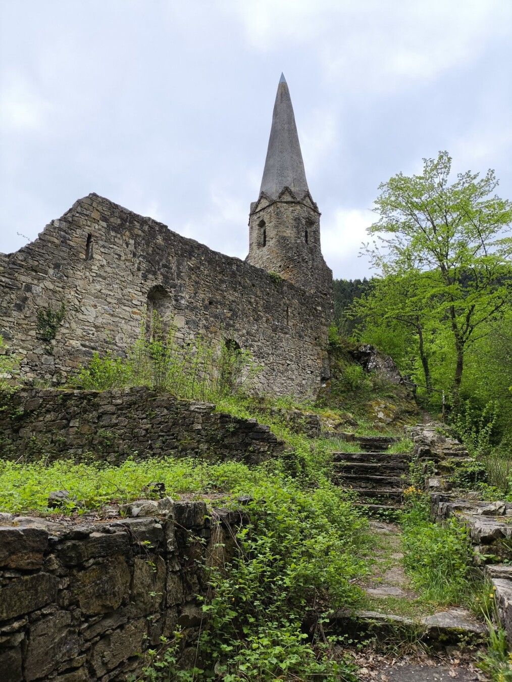
Dann bereits ohne Regen auf Asphalt Richtung Felbring wo wir wieder auf den Welterbesteig auftreffen. In einem schönen Waldgraben geht es abwärts Richtung Gossam. Neben einer tollen Obstbaum-Frühlingswiese haben wir dort eine alte Ruine einer Burgkirche (erbaut etwa 1100) gesehen.
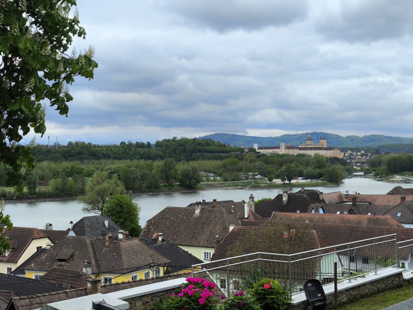
Aufwärts über den Briefträgersteig nach Mödelsdorf und dort über Winterbühel aus dem Wald heraus wieder abwärts zur #Donau. Schöner Blick auf das Stift Melk beim Einmarsch nach Emmersdorf an der Donau.
#Wandern #hiking #Welterbesteig #Wachau #MariaLaach #Emmersdorf #Melk #StiftMelk
Heute wieder alles nach Plan. Zuerst im Regen nach Maria Laach wo wir die Wallfahrtskirche besichtigt haben. Nicht nur die Darstellung der Maria mit sechs Finger ist interessant, sondern auch der Flügelaltar ist eine Besonderheit.
Dann bereits ohne Regen auf Asphalt Richtung Felbring wo wir wieder auf den Welterbesteig auftreffen. In einem schönen Waldgraben geht es abwärts Richtung Gossam. Neben einer tollen Obstbaum-Frühlingswiese haben wir dort eine alte Ruine einer Burgkirche (erbaut etwa 1100) gesehen.
Aufwärts über den Briefträgersteig nach Mödelsdorf und dort über Winterbühel aus dem Wald heraus wieder abwärts zur #Donau. Schöner Blick auf das Stift Melk beim Einmarsch nach Emmersdorf an der Donau.
#Wandern #hiking #Welterbesteig #Wachau #MariaLaach #Emmersdorf #Melk #StiftMelk
Tim boosted:
Welterbesteig Tag 6: Emmersdorf - Melk
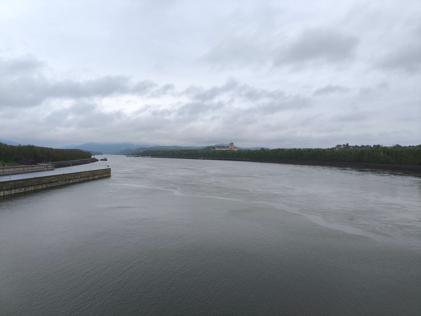
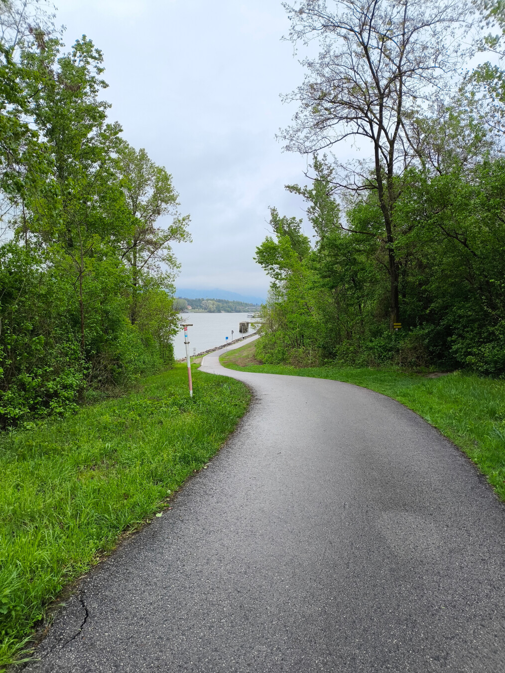
Der letzte Wandertag. Wir verabschieden uns von den höchst sympathischen Wirtsleuten beim ehemaligen Ghf. Weidenauer in #Emmersdorf und entscheiden uns die Etappe auf Grund des Wetters abzukürzen. Es regnet einigermaßen stark, es ist kalt und es ist zudem recht windig.
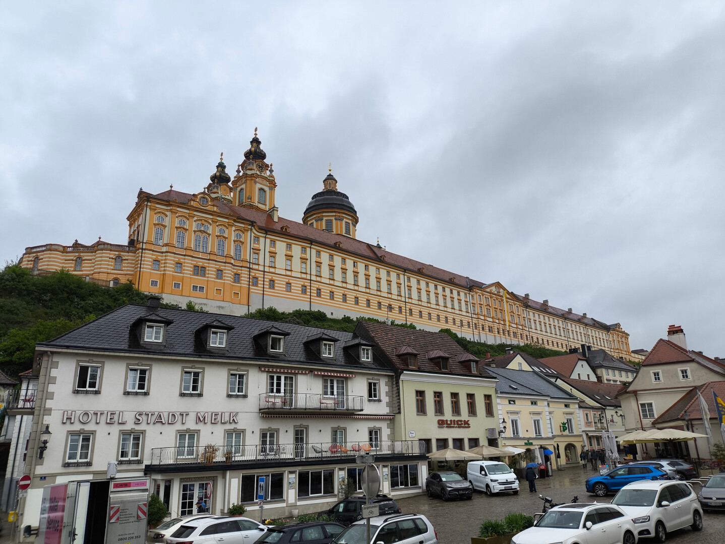
Wir gehen mit ständigen Blick auf das Stift Melk, direkt der #Donau entlang flussaufwärts bis wir zum Schloss Luberegg kommen. Etwa dort geht es weg von der stark befahrenen Straße Richtung Kraftwerk Melk. Auf dieser überqueren wir die Donau, was die Ausmaße dieser recht eindrucksvoll aufzeigt.
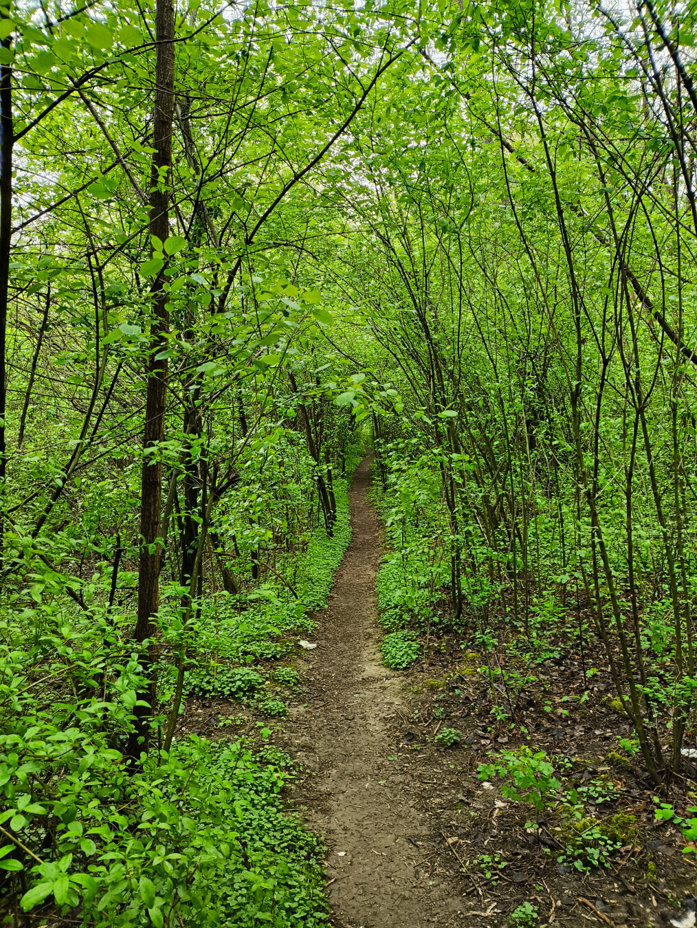
Auf der anderen Seite geht es ein letztes Mal ins Grüne. Durch einen Art Au-Wald geht es wieder flussabwärts bis wir unser endgültiges Ziel Melk erreichen. Höchst eindrucksvoll wie das Stiftsgebäude mit seinen enormen Ausmaßen über der Stadt thront.
Damit endet der erste Teil unserer Wanderung auf dem Welterbesteig Wachau.
#Wandern #Hiking #Welterbesteig #Wachau #Melk #StiftMelk
Der letzte Wandertag. Wir verabschieden uns von den höchst sympathischen Wirtsleuten beim ehemaligen Ghf. Weidenauer in #Emmersdorf und entscheiden uns die Etappe auf Grund des Wetters abzukürzen. Es regnet einigermaßen stark, es ist kalt und es ist zudem recht windig.
Wir gehen mit ständigen Blick auf das Stift Melk, direkt der #Donau entlang flussaufwärts bis wir zum Schloss Luberegg kommen. Etwa dort geht es weg von der stark befahrenen Straße Richtung Kraftwerk Melk. Auf dieser überqueren wir die Donau, was die Ausmaße dieser recht eindrucksvoll aufzeigt.
Auf der anderen Seite geht es ein letztes Mal ins Grüne. Durch einen Art Au-Wald geht es wieder flussabwärts bis wir unser endgültiges Ziel Melk erreichen. Höchst eindrucksvoll wie das Stiftsgebäude mit seinen enormen Ausmaßen über der Stadt thront.
Damit endet der erste Teil unserer Wanderung auf dem Welterbesteig Wachau.
#Wandern #Hiking #Welterbesteig #Wachau #Melk #StiftMelk
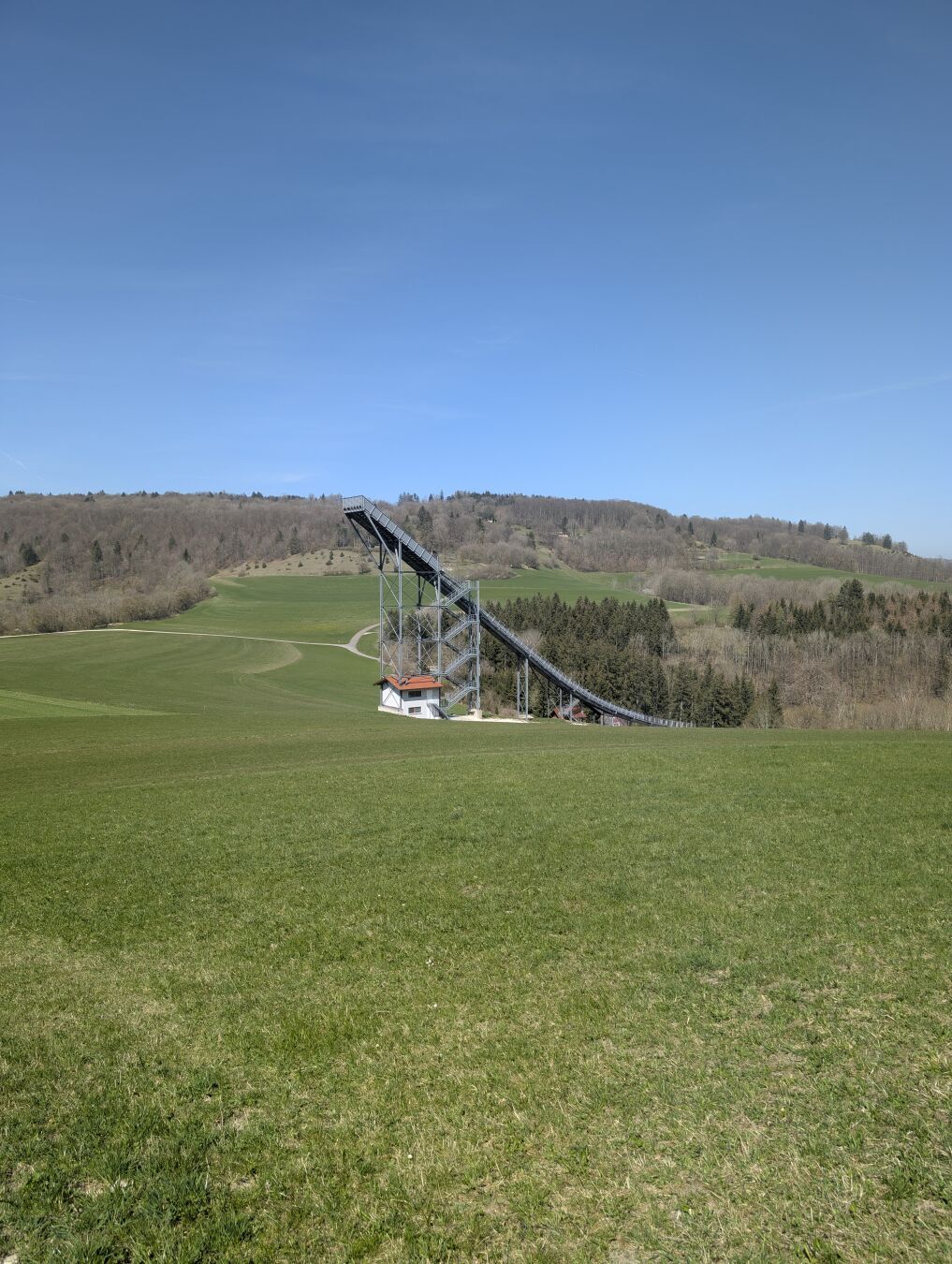
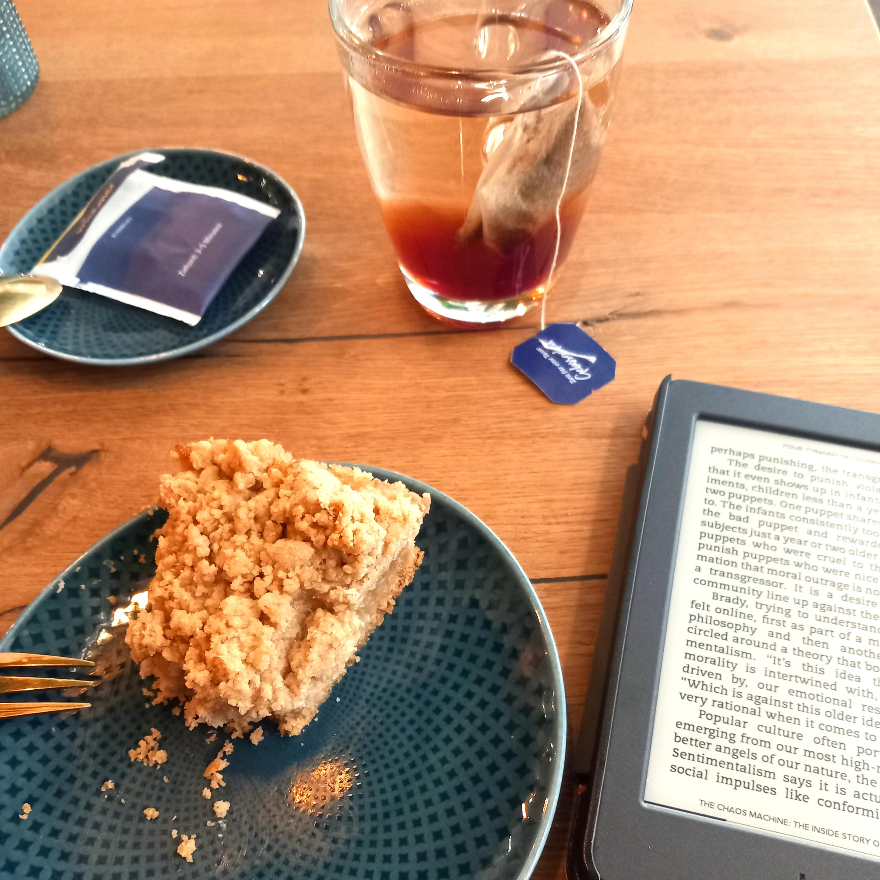
I chose a sunny friday mid-April for a challenging hike I wanted to do for some time: The "Heldentour", queen's stage of a collection of hiking routes called "Löwenpfade" in the area of Göppingen.
At the end of the tour I rewarded myself with some mango icecream from a local farm shop while waiting for the bus.
Duration: 5 hours and 7 minutes (excluding an approximately 30 minute lunch break)
Length: 23.7 km
Elevation: 460 m to 780 m
Ascent/Descent: 760 m ↑ and 770 m ↓
#Trees #ForestLovers #Hiking #Löwenpfade #Heldentour #SwabianMountains #SwabianJura #Wanderlust #Wandern #SchwäbischeAlb

Tim boosted:
DAY 10 #MoselHöhenWeg Winningen > #Koblenz Deutchen Eck, 15km. The last day of a backpacking trip is always bittersweet and I try to enjoy every step of it. Just out of Winningen I was welcomed by a last climb straight up the vineyards and in between the flowers. From there onward it's all downhill to the Deutchen Eck, where the #Mosel falls into the Rhine. I treated myself with a wonderful vegan cake at Laibgenuss but left Koblenz early to spend a little time at my stopover in #Köln. I did a quick visit of the Germanian-Roman archaeological collection that is currently housed in the Begian House and a few vegan snacks later it was time to take the train back to Brussels. 2h to plan my next backpacking trip 😂🥾. July 2024.
#hiking #hikingingermany #hikingineurope
#hiking #hikingingermany #hikingineurope

Drama...
Tim boosted:
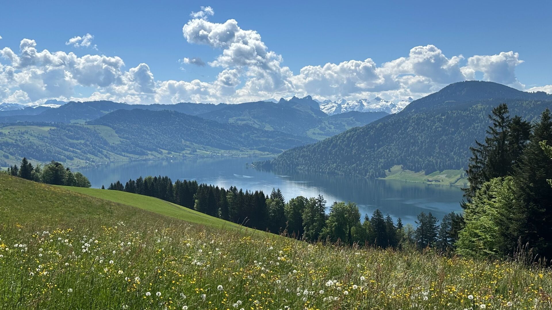
View over lake Ägeri from the White Cross. By far the best view available a short distance from home: 37 minutes from my front door today. At 15°C and sunny, it was already as hot as I’d like it to get.
Tim boosted:
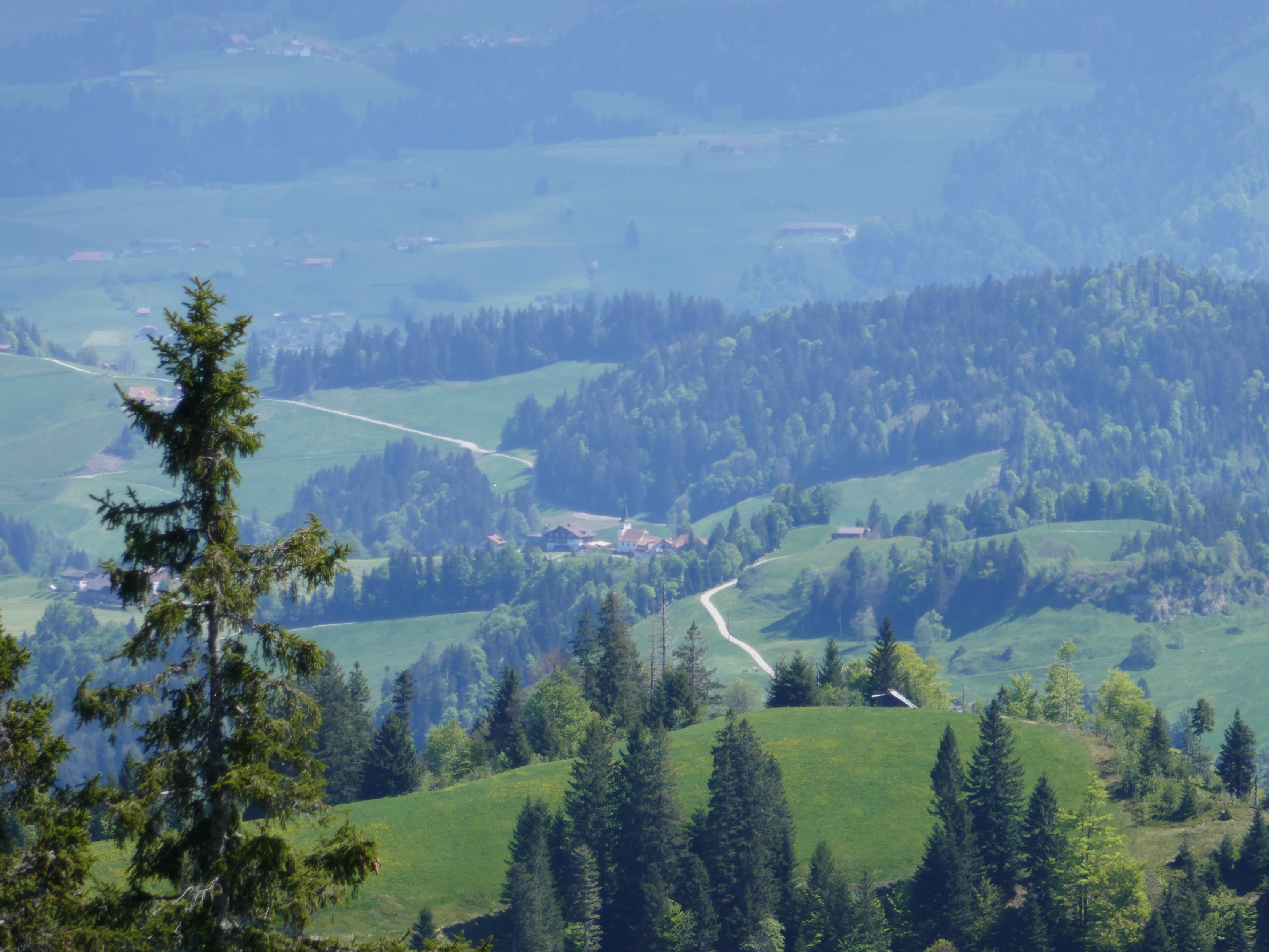
Impressions of today's hike to the summit of Napf.
#Hiking #Napf #Mountains #Switzerland #LandscapePhotography
#Hiking #Napf #Mountains #Switzerland #LandscapePhotography

Sorry for not posting anything these last few weeks - real life has been busy.
I have to do some catch up, so let's get started:
On the end of March I hiked from Heubach to Mögglingen via Aalen-Essingen. The tour was again part of the RemstalWeg.
Duration: 5 hours and 15 minutes
Length: 24.5 km
Elevation: 404 m to 733 m
Ascent/Descent: 565 m ↑ and 634 m ↓
#Trees #ForestLovers #Hiking #RemstalWeg #SwabianMountains #SwabianJura #Wanderlust #Wandern #SchwäbischeAlb #Sundowner #Sundown
Tim boosted:
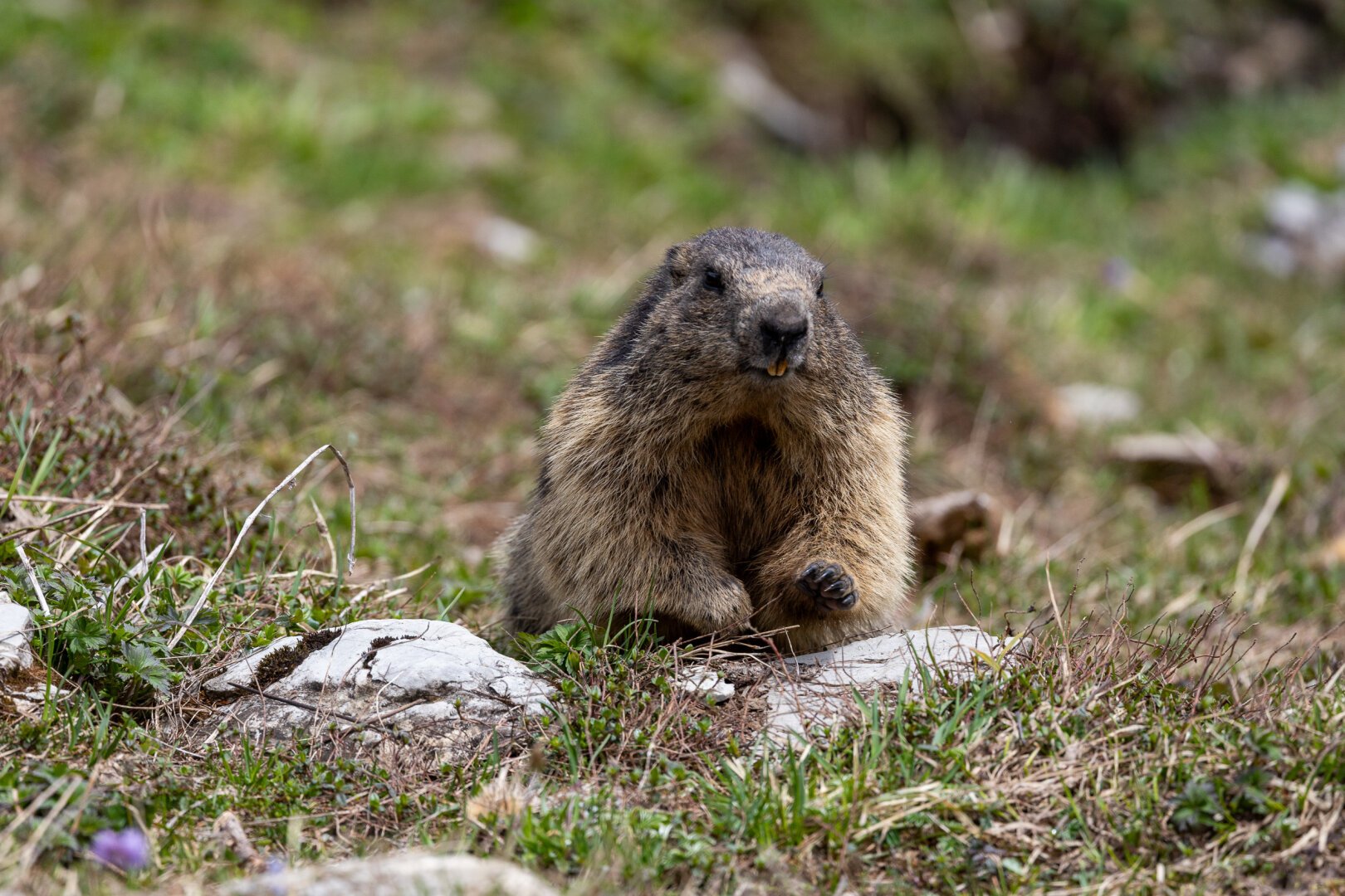
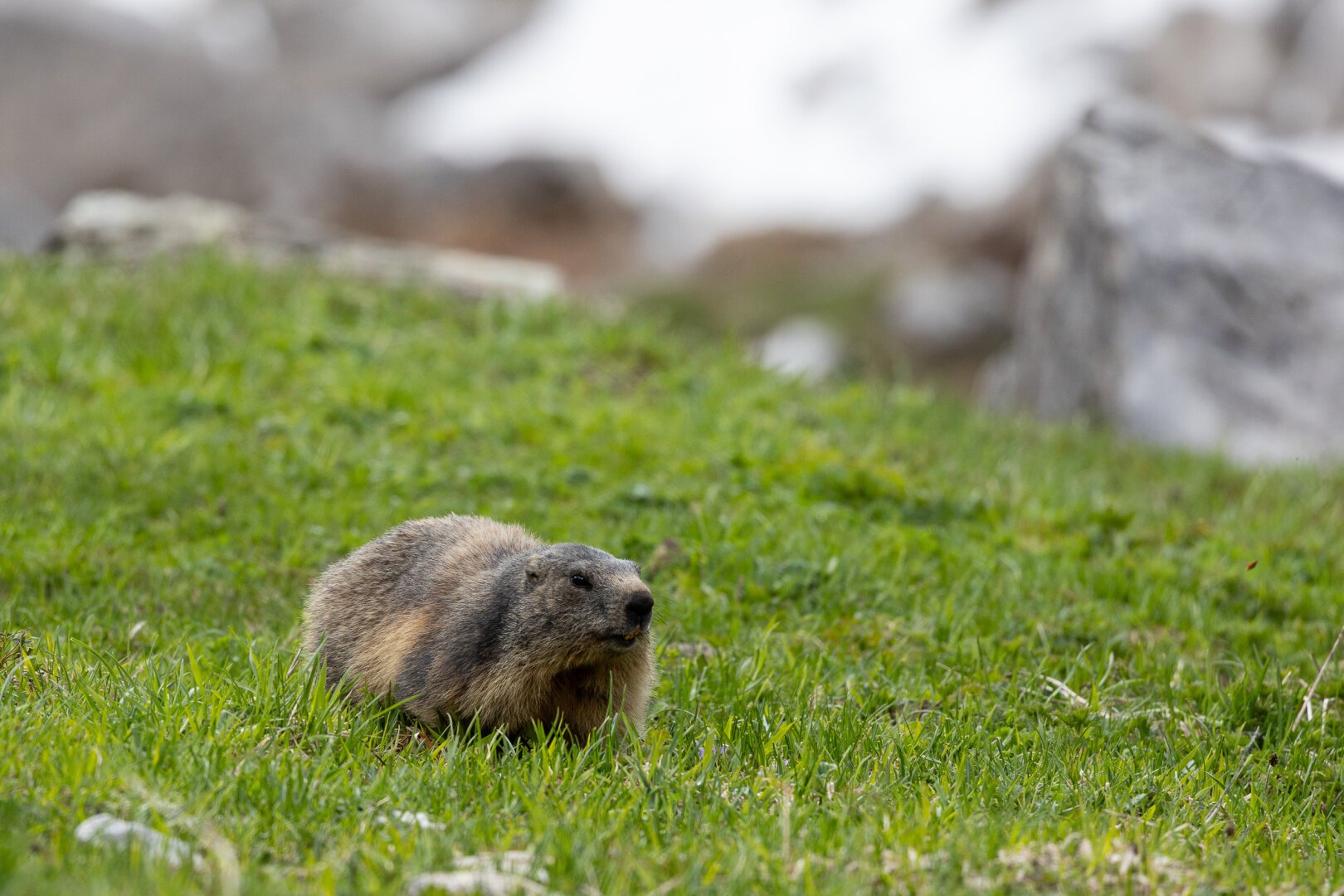
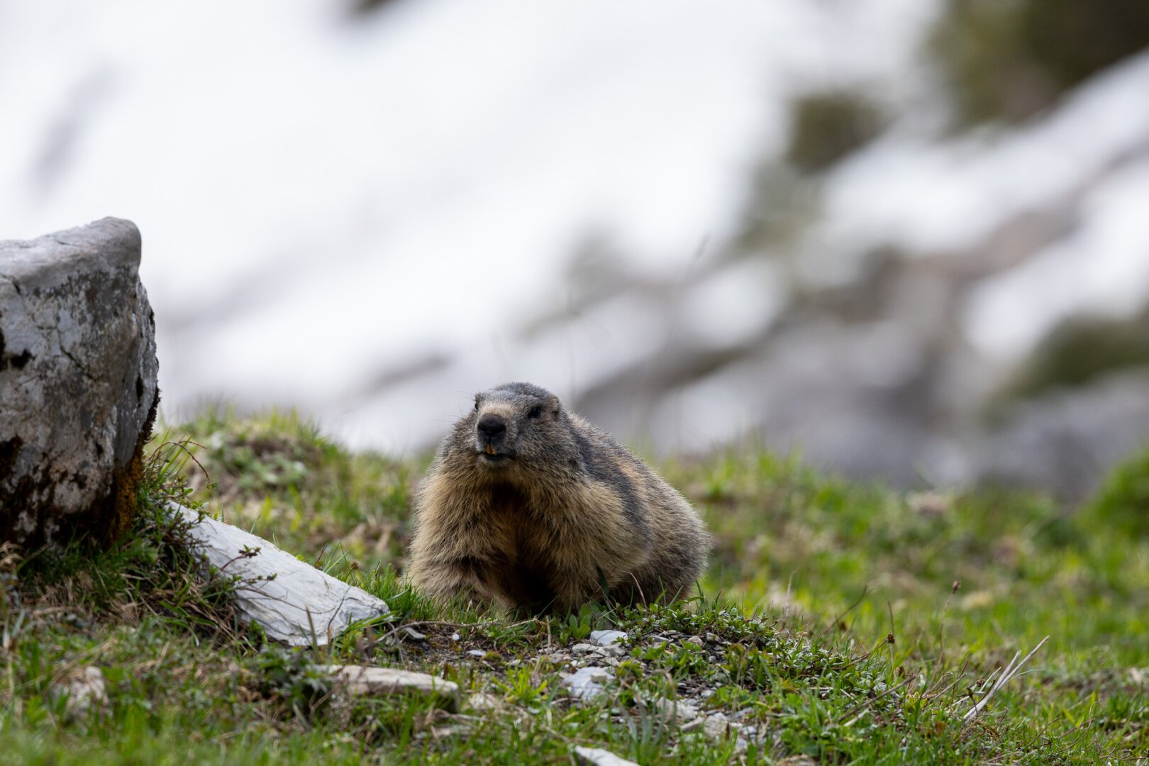
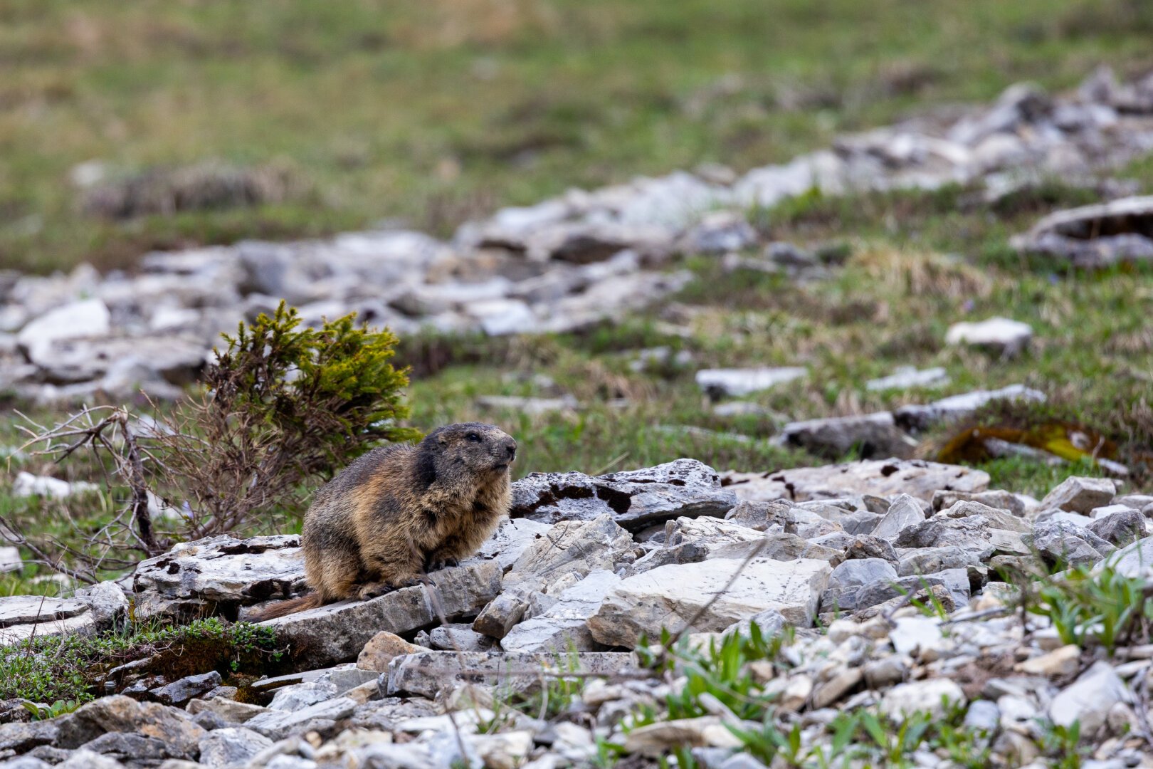
Die heutige Wanderung führte mich in ein Murmeltier-Gebiet. Seit ein paar Wochen sind diese aus dem Winterschlaf erwacht und kümmern sich um die Nahrungssuche, die Höhlen und wohl bald auch um den Nachwuchs.
Today's hike took me to a marmot area. They have been awake from hibernation for a few weeks now and are looking for food, burrows and will soon be looking after their offspring.
#natur #naturfotografie #berge #wandern #murmeltier #wildtiere #wildtierfotografie #schweiz #berneroberland #nature #naturephotography #mountains #hiking #marmot #wildlife #wildlifephotography #switzerland
Tim boosted:
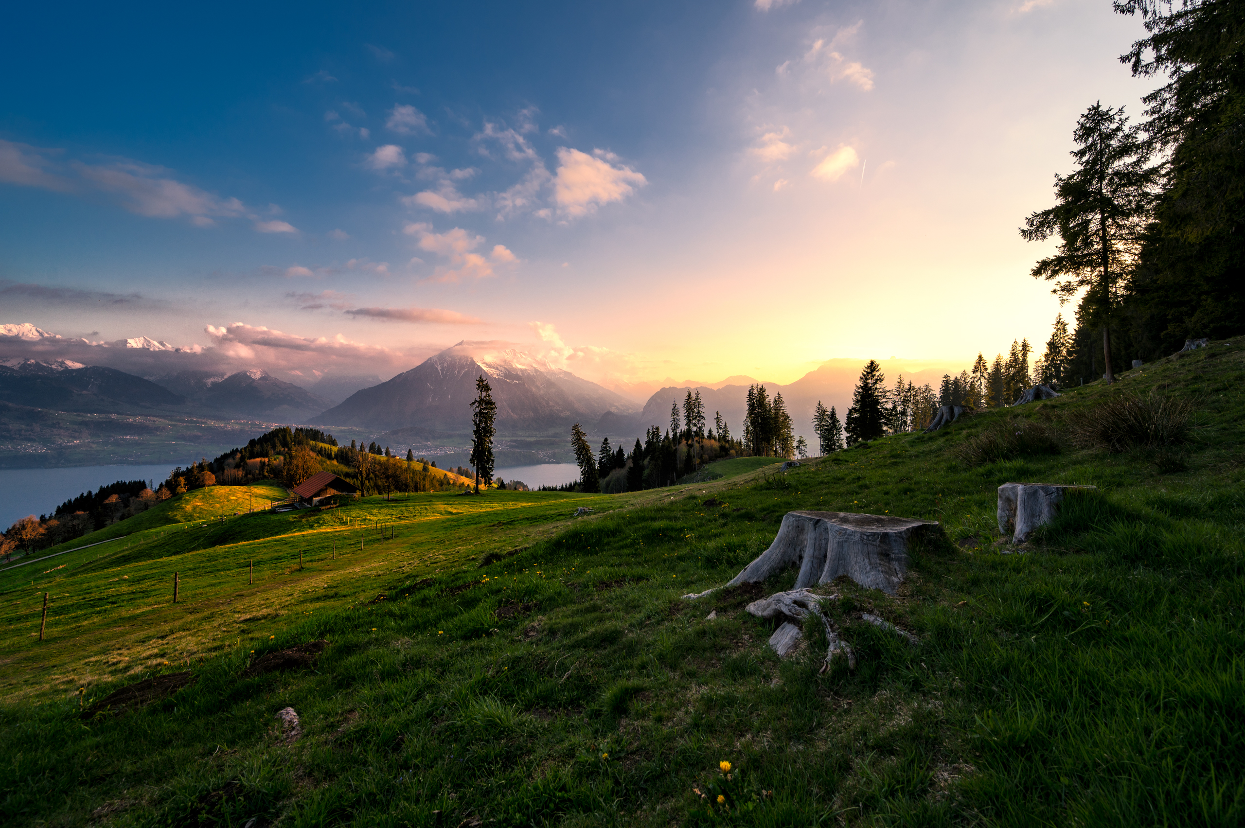
Waldrand Tschingelallmi
#NikonZ6 #NikonZ #Nikon Z 6 | 14mm | f/8 | 1/100s | 27/04/2022
#hess_photography #photography #fotografie #landscapephotography #landschaftsfotografie #Berge #BernerAlpen #BernerOberland #BerneseAlps #BerneseOberland #evening #forestedge #lake #LakeThun #mountains #Niesen #Schweiz #sunset #Switzerland #Thunersee #Wald
Client Info
Server: https://mastodon.social
Version: 2025.04
Repository: https://github.com/cyevgeniy/lmst