Robbi Bishop-Taylor

Coastal Earth Observation Scientist at Geoscience Australia. Studying the earth through time and space using #satellites, #datascience and #dataviz 🛰️🌏🌊

Currently working on new methods for mapping our coasts using satellite imagery from #DigitalEarthAU and the Open Data Cube :opendatacube:. Developer of #DEACoastlines and #DEAfricaCoastlines:
maps.dea.ga.gov.au/story/DEACo
maps.digitalearth.africa/story

Robbi Bishop-TaylorSatelliteSci@mapstodon.space
2023-03-13

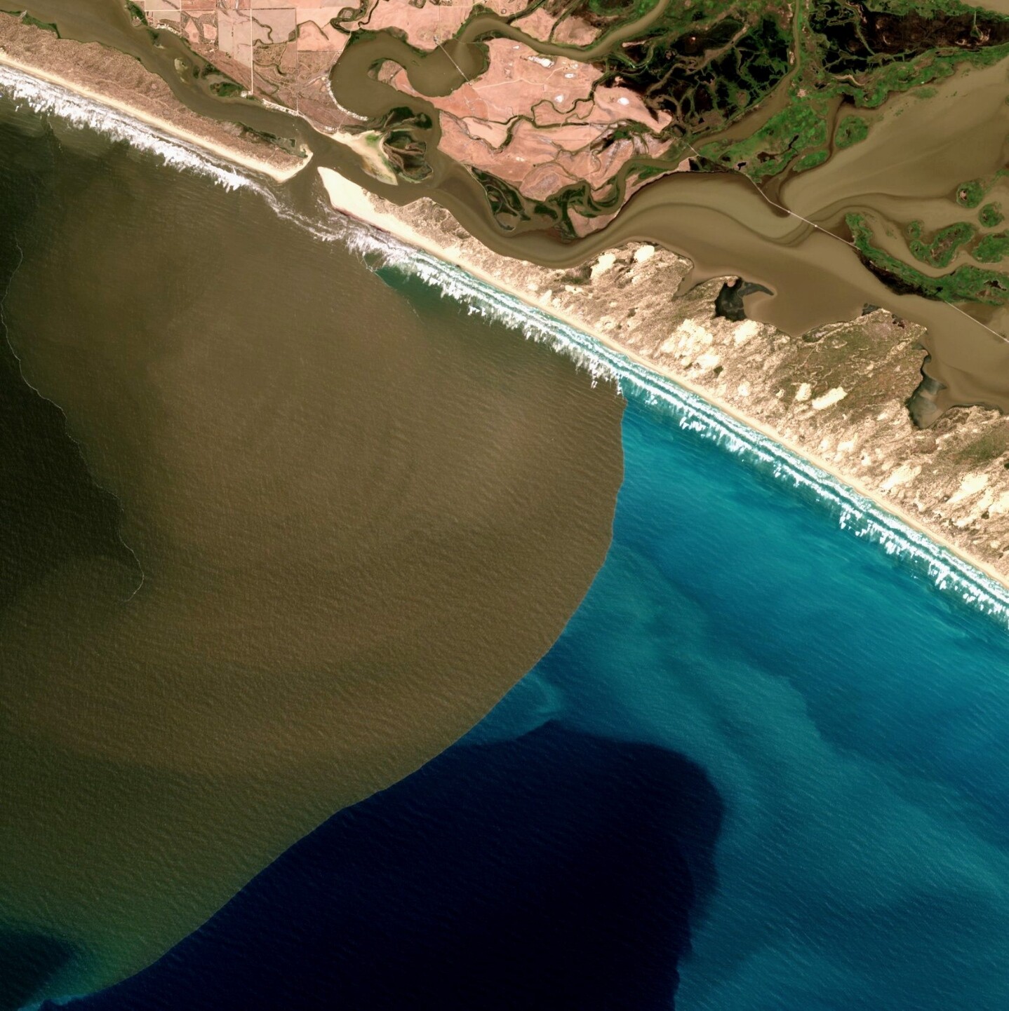
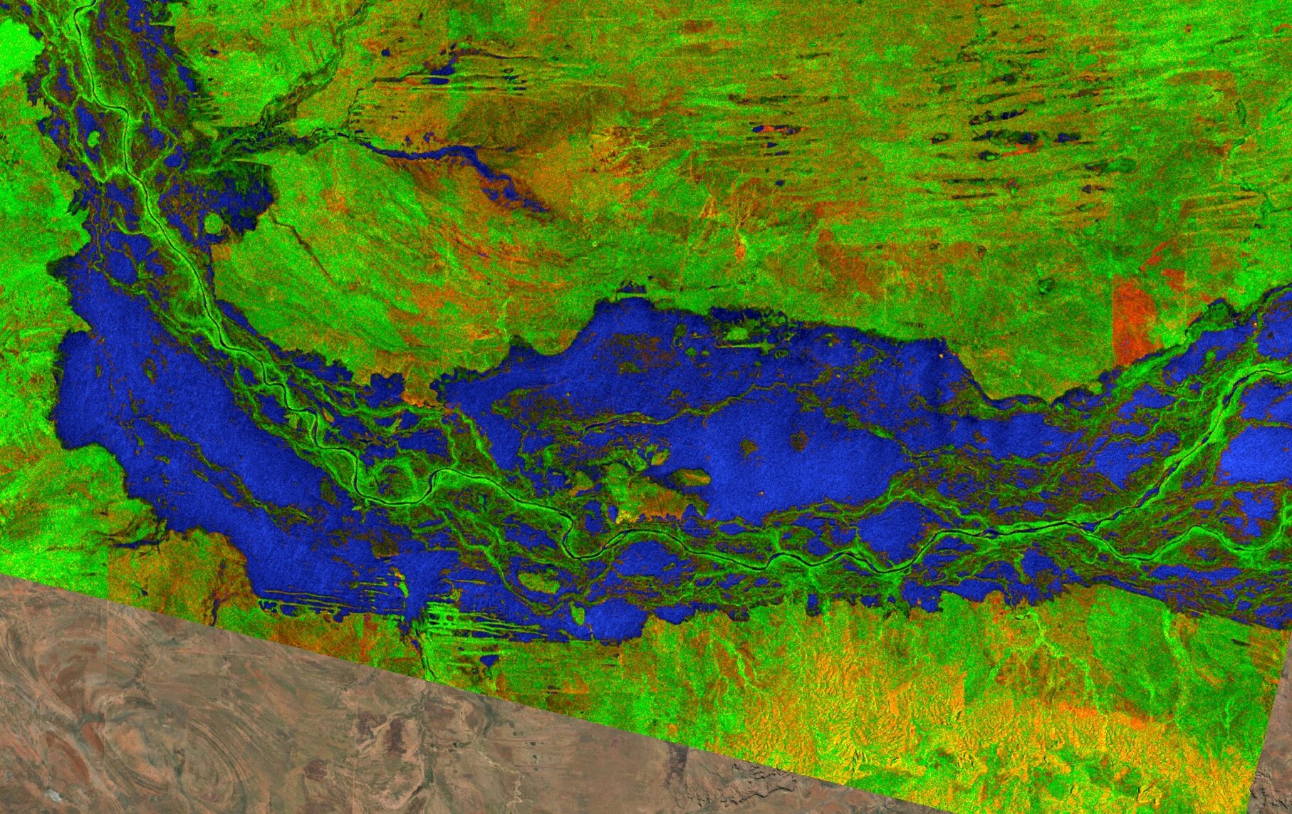
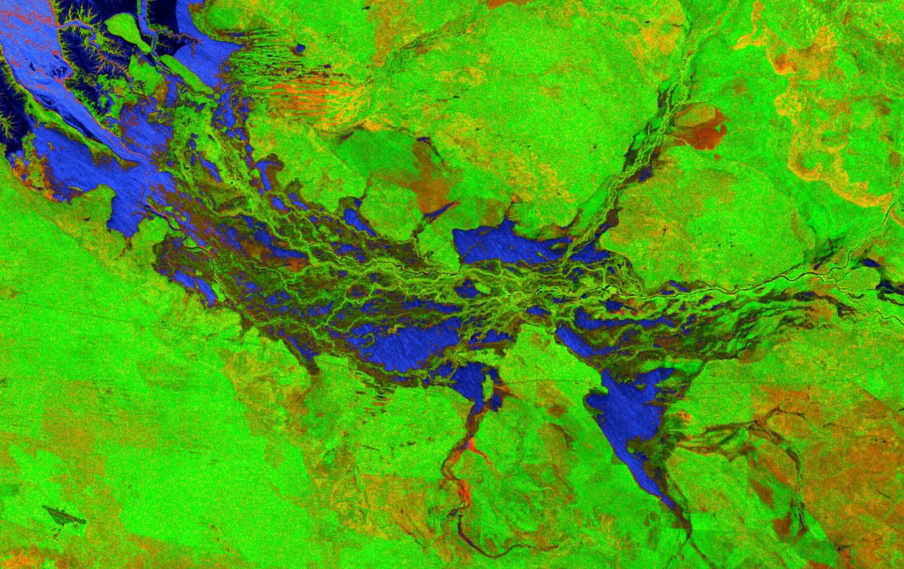
Version 2.0 of Geoscience Australia's #DEACoastlines coastal change dataset is available now!

This update includes lots of exciting new improvements:

🌊 Brand new annual shoreline data for 2021
🏝️ Extra coverage of remote islands and reefs
⚠️ Improved quality data flags for each individual shoreline and rates of change
🛰️ Now includes #Landsat9 satellite data and a new global tide model

More information and important links in the #DigitalEarthAU story here!
dea.ga.gov.au/news/dea-coastli

Robbi Bishop-TaylorSatelliteSci@mapstodon.space
2023-01-21

An incredible satellite view of the Murray River flood plume - thick turbid water pushing up against milky coastal and darker ocean waters offshore of the Murray Mouth in South Australia's Coorong region.

Some amazing flow dynamics along the lower river channel river as well!

@CopernicusEU #Sentinel2 imagery from 6th January 2023 processed by #DigitalEarthAU:
maps.dea.ga.gov.au/#share=s-A8

Flood plume at base of Murray River captured by satellite imagery
Robbi Bishop-TaylorSatelliteSci@mapstodon.space
2023-01-08

Some close-ups of the flooding just downstream of Fitzroy Crossing:

Robbi Bishop-TaylorSatelliteSci@mapstodon.space
2023-01-08

Very few clear satellite images of the major flood disaster unfolding across Western Australia's Kimberley region over the past few days, but using radar data from @CopernicusEU's #Sentinel1 we can peer through the clouds:

Floodwaters appear as deep blue in this false colour imagery created from radar data from 4th Jan 2023

Robbi Bishop-Taylor boosted:
2023-01-06

184 years ago today an extreme windstorm hit Ireland & the UK, known as the 'Night of the Big Wind'. This event was one of the most severe & damaging windstorms to ever hit these islands.

We now need some help to learn from this event... #Archives

We have found a surprising number of locations with barometer measurements of pressure during Jan 1839. This should allow us to build a reanalysis to inform about the risks of such events today.

But, are there other sources we have not yet found?

Ships in Dublin harbour damaged by a windstormMap showing locations of available measurements of pressure
Robbi Bishop-TaylorSatelliteSci@mapstodon.space
2023-01-06

Also, check out this fantastic grappling hook + knee spikes setup for safely locking onto plants while sleeping! ⚓

Robbi Bishop-TaylorSatelliteSci@mapstodon.space
2023-01-06

A super fun new visitor to our native garden - a female Bottlebrush Sawfly (Pterygophorus cinctus)!

Although this species looks suspiciously similar to the black + orange Australian Hornet, it's thankfully harmless with no sting (and no wasp-like waist)! #wildoz #invertebrates

Bottlebrush Sawfly sitting on reed
Robbi Bishop-Taylor boosted:
Sebastian RaschkaSebRaschka
2022-12-26

Scikit-learn 1.2 is out: github.com/scikit-learn/scikit

Was an eventful December & I totally missed the new release of my favorite library!

My personal highlights are around the HistGradientBoostingClassifier (if you haven't used it yet, it's a LightGBM impl that works really well)

It now supports

1. interaction constraints (in trees, features that appear along a particular path are considered as "interacting")
2. class weights
3. feature names for categorical features

Robbi Bishop-Taylor boosted:
Philippe Massicottephilmassicotte@fosstodon.org
2022-12-26

Just discovered this nice reference list of #remotesensing spectral indices:

github.com/awesome-spectral-in

Robbi Bishop-TaylorSatelliteSci@mapstodon.space
2022-12-22

@sohkamyung @theconversationau Yes, I really enjoyed that article!

Robbi Bishop-TaylorSatelliteSci@mapstodon.space
2022-12-22

@irenedf Sand mining has now been phased out there, so it will be fascinating to see how the islands recover over the next few years!

Robbi Bishop-TaylorSatelliteSci@mapstodon.space
2022-12-22

@irenedf Yes, good spotting! I recently put together a similar animation focusing specifically on sand mining in this article below, focusing on Stradbroke Island just to the south: earthobservatory.nasa.gov/imag

Robbi Bishop-TaylorSatelliteSci@mapstodon.space
2022-12-22

@tat2dfarmlady It's a beautiful part of the world! I have some other animations from further up the coast that I'll share at some point too 🙂

Robbi Bishop-TaylorSatelliteSci@mapstodon.space
2022-12-22

Finishing the year with some beautiful satellite imagery: three decades of spectacular subtidal dynamics at the southern tip of Moreton Island in south-east Queensland, driven by the slow drift of sand northward along Australia's east coast.

USGS/NASA #Landsat 5, 7 and 8 satellite data from the #DigitalEarthAU datacube :opendatacube:

Robbi Bishop-Taylor boosted:
2022-12-21

In the next 2 months @lindakladivova and her mentors will be working on further enhancing the new single window GUI of #grassgis with a #student grant 🙌 🤓👩‍💻

Have a look at her project and follow the #development 🚀 trac.osgeo.org/grass/wiki/wxGU

@OSGeo @foss4g #opensource

Robbi Bishop-TaylorSatelliteSci@mapstodon.space
2022-12-19

@richardvenusfo @conorosully Thanks for the connection - yep, we do a lot of coastal monitoring work using free and open Landsat data - you can see it on a map here! maps.dea.ga.gov.au/story/DEACo

Robbi Bishop-TaylorSatelliteSci@mapstodon.space
2022-12-19

@conorosully Yep, NASA/USGS are firmly on the free and open access train! 🔓🚂

Robbi Bishop-Taylor boosted:
Donald Hoberndhobern@scicomm.xyz
2022-12-18

I run an automated #moth light and motion-detection #camera each night and now have literally hundreds of thousands of timestamped images to segment and go through identifying insects to try to train an #AI classifier.

Sample image from 23:36 last night here in Aranda, ACT, with #Nacoleia rhoeoalis (male, top-left), #Gastrophora henricaria (orange hindwings), #Ptyoptila matutinella (pink/orange, top-centre) and a locally common but undescribed #Aporoctena species (brown/orange centre).

Night-time image of an illumated sheet with twelve assorted moths (each a different species) and a number of small flies.
Robbi Bishop-TaylorSatelliteSci@mapstodon.space
2022-12-16

@JamesTrezise Best recommendation is to use something like this to automatically find people you follow on Twitter who have an account here! fedifinder.glitch.me/

Client Info

Server: https://mastodon.social
Version: 2025.04
Repository: https://github.com/cyevgeniy/lmst