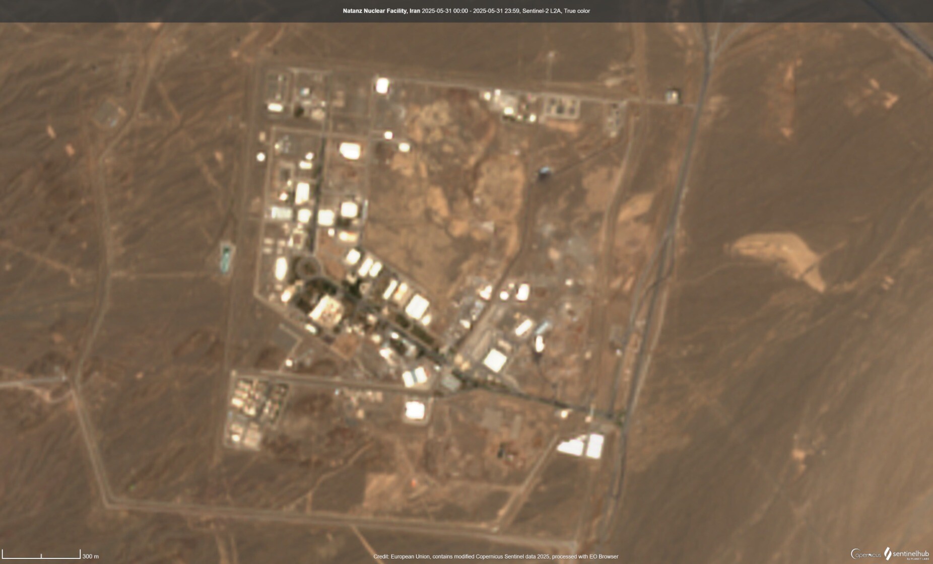
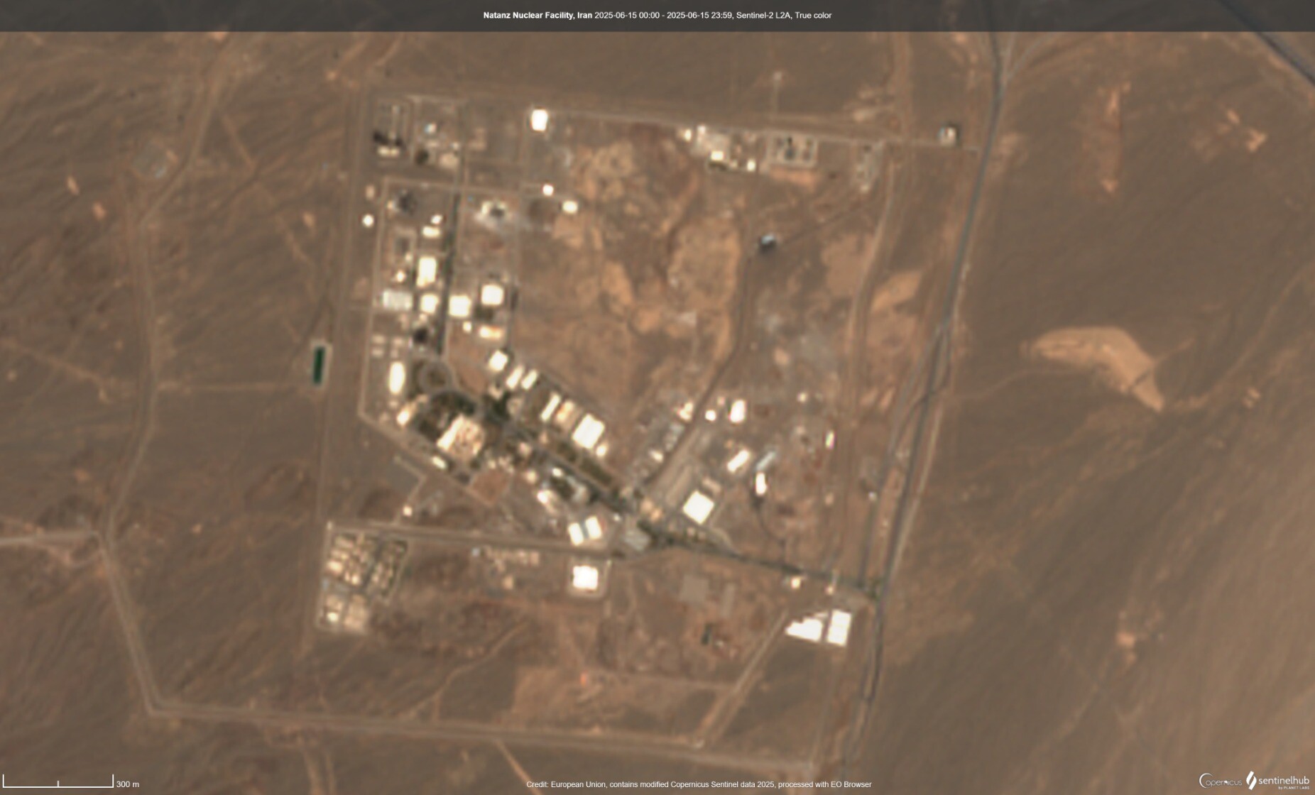
Takhle na snímku #ESA #Sentinel2 tedy žádný jednoznačný rozdíl nevidím, ale to nic moc neznamená...
#Iran #Natanz #uranium #NuclearWeapons #satellite
#Sentinel2
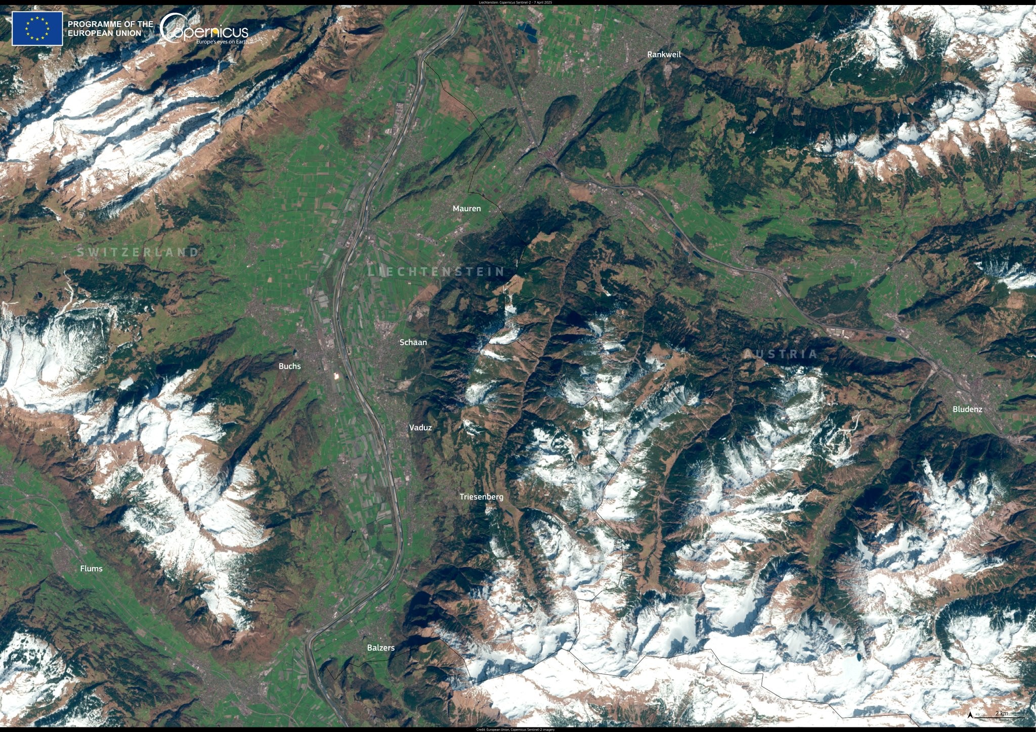
🇱🇮 Savez-vous situer le Liechtenstein, l'un des plus petits pays au monde ?
Ses 160 km2 se trouvent entre la Suisse et l'Autriche.
📷 Satellite #Sentinel2 du programme européen #Copernicus
The #Drakensberg mountains of Lesotho and South Africa following a damaging storm a few days ago that brought severe floods and heavy widespread #snow seen yesterday by #Sentinel2 #SouthAfrica
Severe flooding in the Sylhet region of Bangladesh.
#EU #Sentinel2 #Copernicus #Bangladesh #Flooding
https://www.copernicus.eu/en/media/image-day-gallery/severe-flooding-sylhet-region-bangladesh
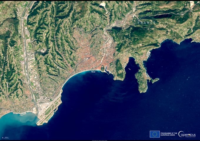
🛰️📷 #Nice et la Côte d'Azur depuis le satellite #Sentinel2 du programme #Copernicus le 31/03/2025, lieu où la Conférence des Nations Unies sur l’Océan 2025 #UNOC3 a débuté ce lundi
In #Zypern zeigt sich die anhaltende #Dürre deutlich am Asprokremmos-Stausee.
#Satellitenbilder belegen den starken Rückgang der Wasserfläche zwischen Juni 2024 und Juni 2025. Felder in der Umgebung wirken deutlich trockener.
https://www.copernicus.eu/en/media/image-day-gallery/visible-impact-drought-cyprus
#Klimawandel #Trockenheit #Wasserknappheit #Erdfernerkundung #Sentinel2 #Ostmittelmeer #Wassermangel #Landwirtschaft
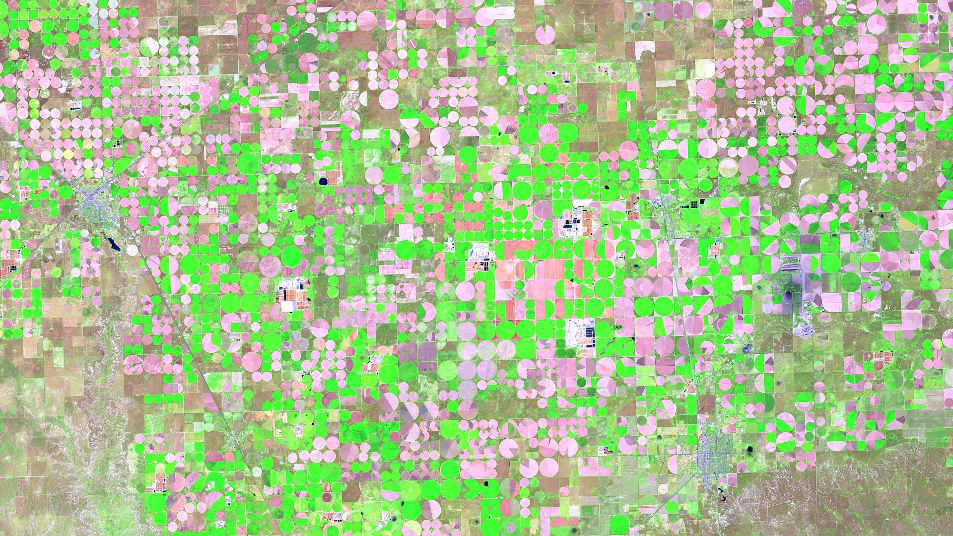
Satellite Image of the Month – June 2025: Take a look at the stunning circular fields near Dalhart, Texas! This vibrant false-color image, captured by Sentinel 2, reveals the impact of center-pivot irrigation in one of the most productive farming regions of the U.S. High Plains.
👉 Read more: https://www.mundialis.de/en/satellite-image-of-the-month-june-dalhart-texas-usa/
#SatelliteImagery #RemoteSensing #Texas #Copernicus #Agriculture #EarthObservation #Sentinel2
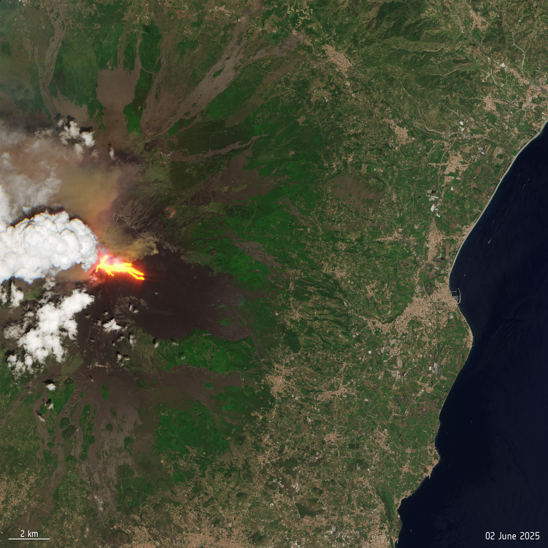
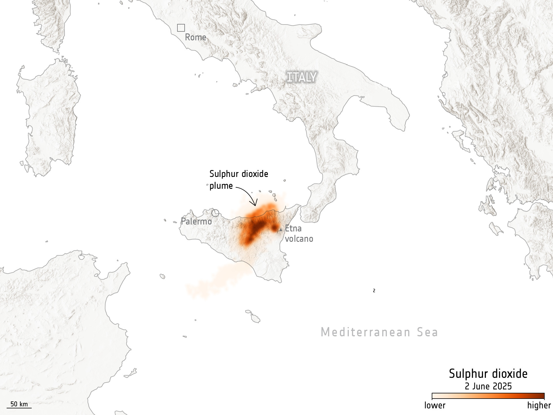
🛰️🌋 La dernière éruption de l' #Etna du 2 juin a été observée par le satellite #Sentinel2.
1e image : la distribution de la lave issue de l'éruption, en superposition infrarouge.
2e image : la propagation du dioxyde de soufre sur une grande partie de la Sicile par Sentinel-5P
Look at the beauty... but we're just letting it and everything/one that lives there disappear under the waves.
Baa Atoll, the Maldives.
#EU #Sentinel2 #Copernicus #Maldives
https://www.copernicus.eu/en/media/image-day-gallery/baa-atoll-maldives
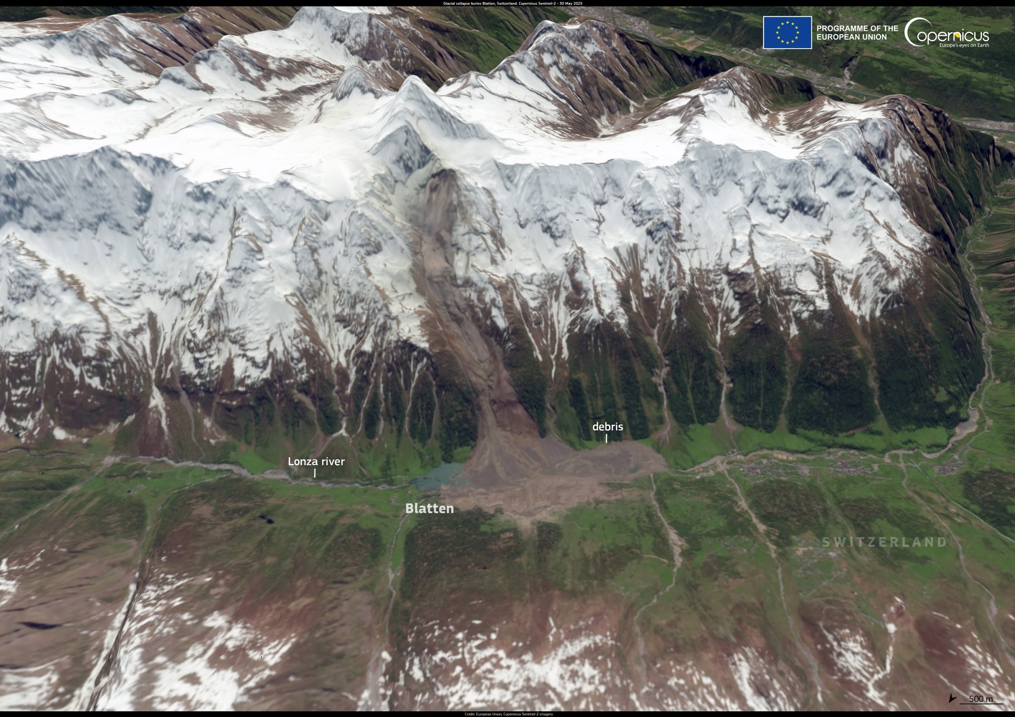
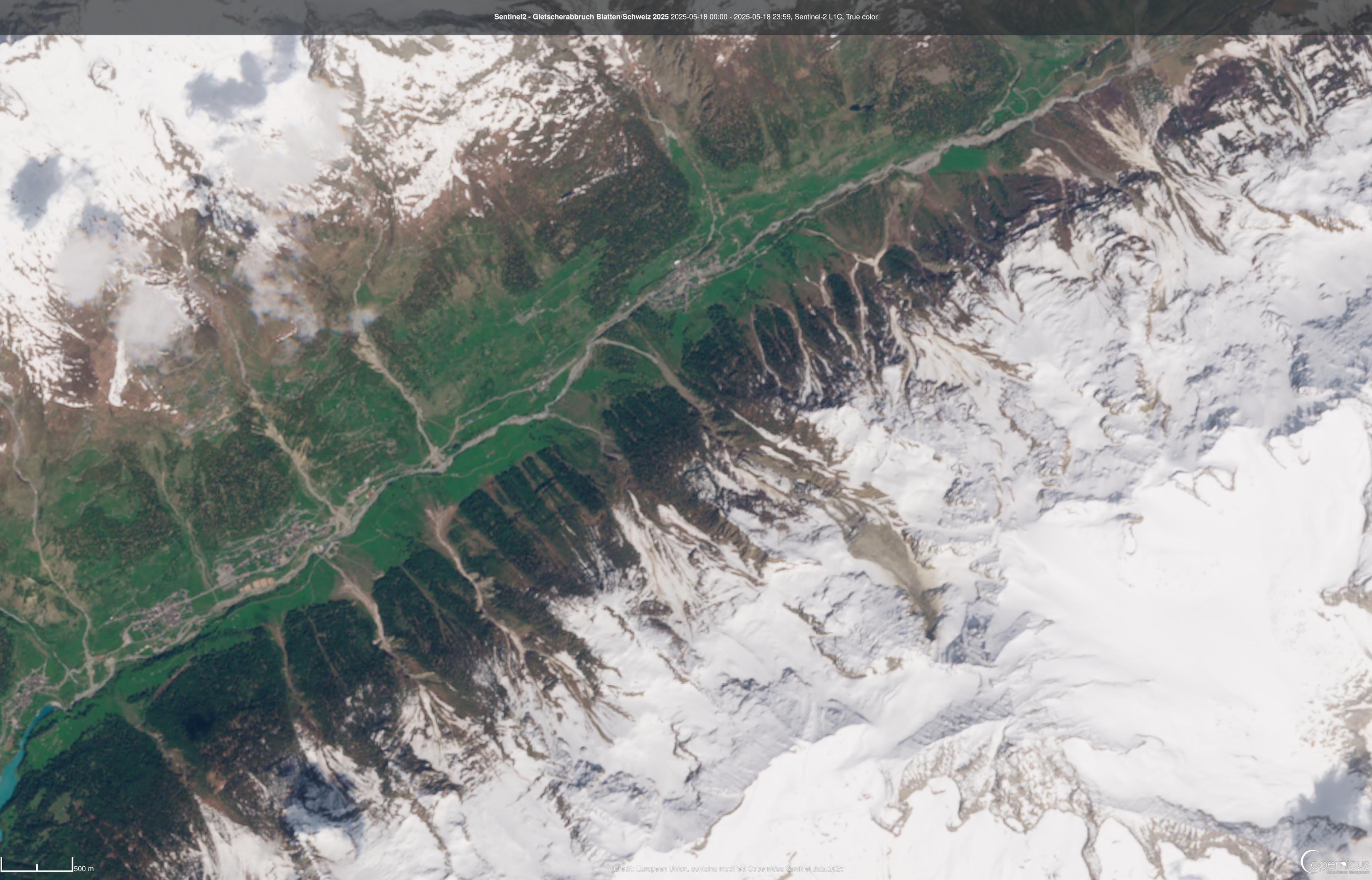
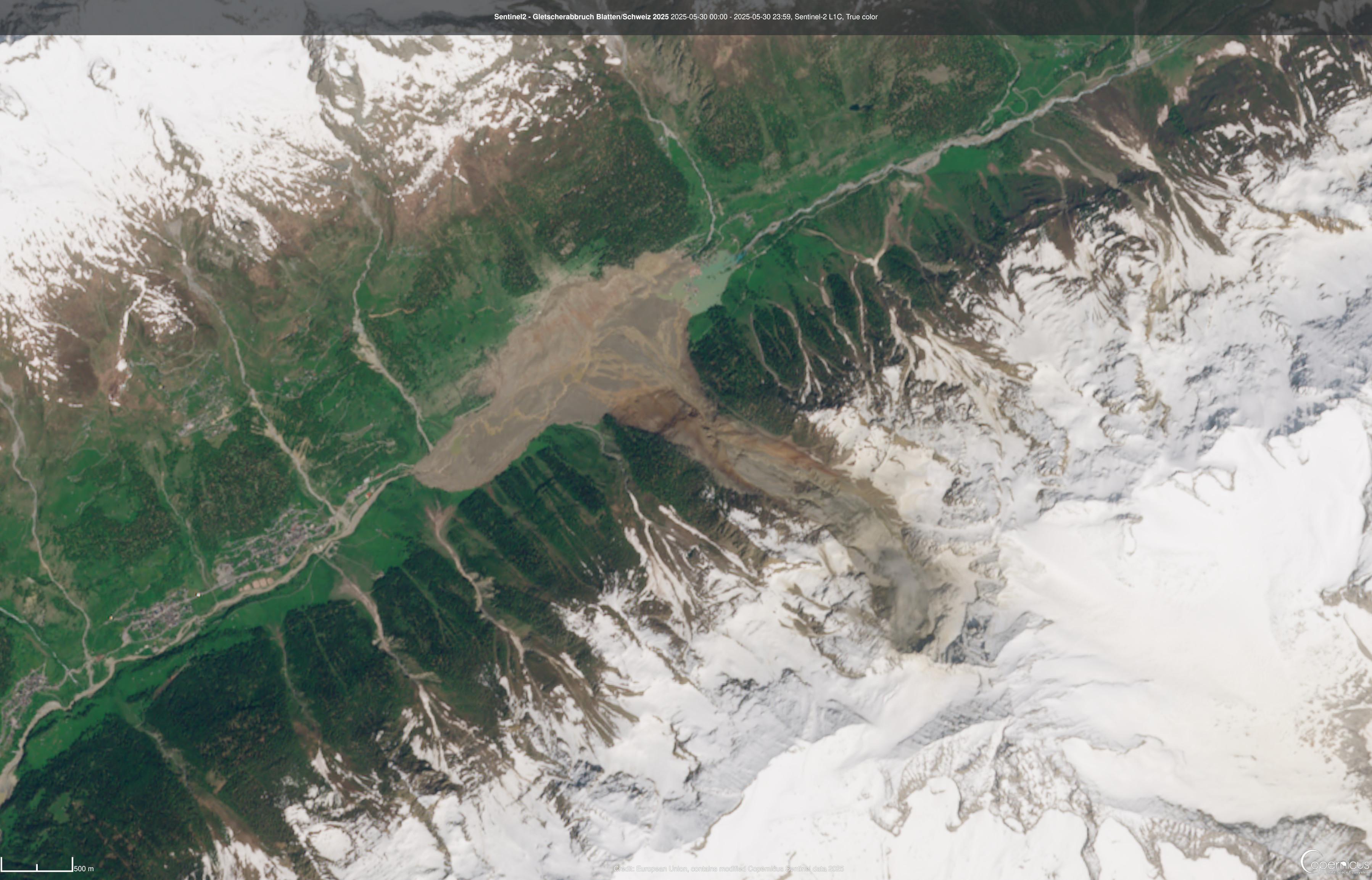
Viewed from Sentinel 2, the damage is shocking.
Glacial collapse buries Blatten, Switzerland.
#EU #Sentinel2 #Copernicus #Blatten #Switzerland
https://www.copernicus.eu/en/media/image-day-gallery/glacial-collapse-buries-blatten-switzerland
🛰️📷 Image satellite impressionnante de l'effondrement du glacier Birch qui a rayé de la carte le village de #Blatten en Suisse, par le satellite #Sentinel2 du programme européen #Copernicus
Before/after image from the Sentinel-2 satellite of the glacier collapse near Blatten in Switzerland.
Before image is from 18.05.2025
After image is from 30.05.2025
#sentinel #sentinel2 #copernicus #EarthObservation #swiss #glacier #glaciercollapse
Dry conditions in the UK.
#EU #Sentinel2 #Copernicus #UK #Haweswater #LakeDistrict
https://www.copernicus.eu/en/media/image-day-gallery/dry-conditions-uk
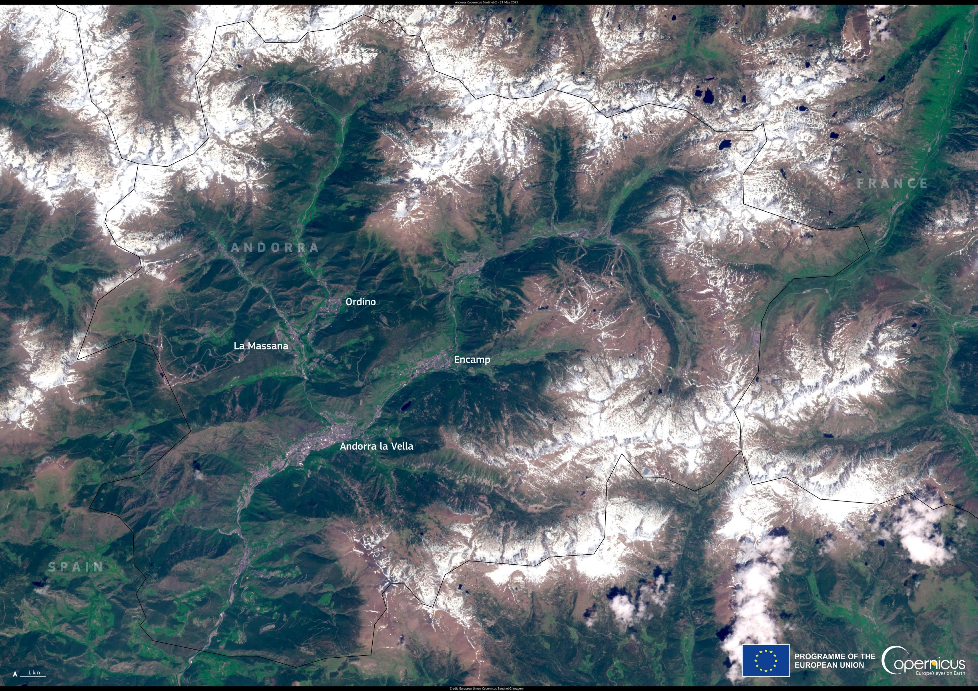
🛰️📷 Bien connue des Toulousains, voici la Principauté d' #Andorre photographiée par le satellite #Sentinel2 du programme #Copernicus le 21 mai
Natura 2000 Day: Žemaitija National Park, Lithuania.
What are people using to view and download sentinel imagery in #qgis these days, I see several plugins but I'm not sure which one is best?
Los Manglares de David.
#EU #Copernicus #Sentinel2 #Panama
https://www.copernicus.eu/en/media/image-day-gallery/david-mangroves-panama
Mmm, lovely cheese 😋
Gouda, the Netherlands.
#EU #Copernicus #Sentinel2 #Gouda
https://www.copernicus.eu/en/media/image-day-gallery/gouda-netherlands
This looks quite stunning.
Elephant Foot Glacier, Greenland.
#EU #Copernicus #Sentinel2 #Greenland
https://www.copernicus.eu/en/media/image-day-gallery/elephant-foot-glacier-greenland
Laguna Colorada, Bolivia.
#EU #Copernicus #Sentinel2 #Bolivia
https://www.copernicus.eu/en/media/image-day-gallery/laguna-colorada-bolivia
Client Info
Server: https://mastodon.social
Version: 2025.04
Repository: https://github.com/cyevgeniy/lmst