
1000 followers on Behance! 🎉
For those who just joined: I make maps (200+ about Ukraine), work with QGIS & Python, teach architecture, and do 3D printing. OSM contributor since 2010, #30DayMapChallenge participant since 2019.
Here you'll see: work in progress, failed experiments, Ukrainian cartography, and GIS nerding.
https://www.behance.net/gontsa
#30DayMapChallenge


While I love the #30DayMapChallenge, I couldn't fit it in my schedule last year. I like the idea of making for-fun-maps based on fixed themes. So I created a list of 52 subjects for myself to use over the course of this year to create maps that I can share. You can find it on https://52maps.org, or you can follow @52maps. If you want you can join me and share your for-fun-maps using #52maps.

For what it's worth, I've updated my shed https://anisotropi4.github.io/shed/30daymapchallenge.html with links to the data used and published a register of data and associated licenses used in talks and visualisations https://anisotropi4.github.io/shed/opendata.html
#DataVisualisation #PublicTransport #30DayMapChallenge

Inspired by @kamapu map for day 16 of #30DayMapChallenge and playing with the amazing {isocubes} by @coolbutuseless I decided to do an spatial introduction.
I'm from León, a province in the NW of Spain. Here is where I was born and raised and where after some time I got my BSc in Biology.
1/n

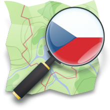
WeeklyOSM CZ 802:
Kaufland ČR. Číslování kolejí. Adventní kalendář. OSRM či GraphHopper? Čísla domů. Oprava povrchů. Telefonní čísla. #30DayMapChallenge. Nástupní bloky. Stopy z GNSS-RTK. Výzvy bodů zájmu. Co chybí ve stylu. Weby pro IKEA. OSM pro AI. ohsomeDB. Jména kruháčů. Jména ulic. Data budov. Budoucnost OpenTopoMap? Strava v editoru iD. extrahuj-transformuj-nahraj. AI pro tagování. Změny s MapComplete. Geolokace s AI. Volební okrsky. Snímky ze Sentinel. Bee Maps.
Completing the #30DayMapChallenge. Topic: raster.
The Rodderberg, located on the opposite side of the Rhine River from the Siebengebirge, is an inactive volcano. Although its last eruption was 250,000 years ago, the crater can still be seen in the landscape today. Here, I used my own procedure to contrast the elevations of the south-east and north-west quarters of a circular window against a standard procedure.

Filling in the gaps for the #30DayMapChallenge – Day 12: Map of 2125.
I gave an artistic piece of work (a Gelli plate print) a futuristic look for a kind of worst-case scenario.


This year's #30DayMapChallenge was a bit challenging due to my activities in November: 9 concerts, teaching, trips to Algeria and Morocco... Read the new blog on the #QWAST website on how I made each map. www.qwast-gis.com/l/30daymapch...
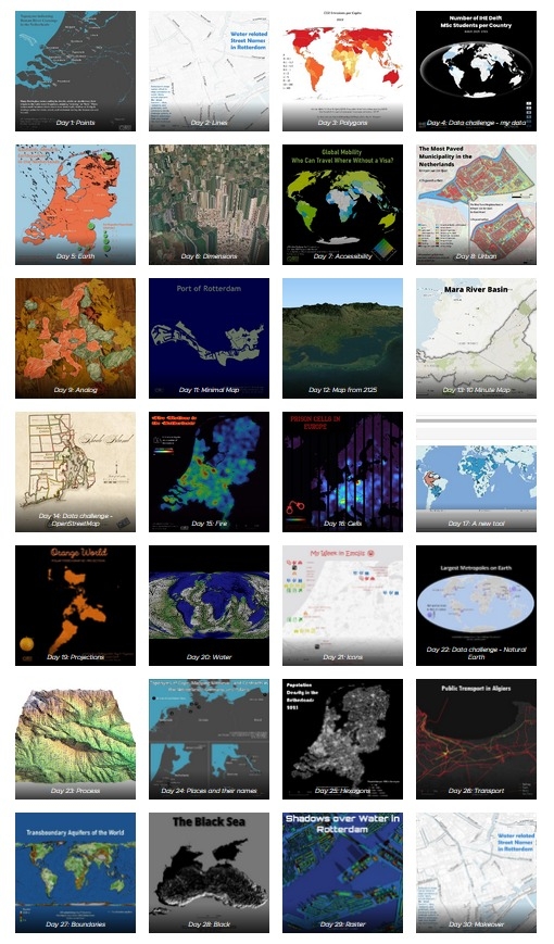
This year's #30DayMapChallenge was a bit challenging due to my activities in November: 9 concerts, teaching, trips to Algeria and Morocco... Read the new blog on the #QWAST website on how I made each map. https://www.qwast-gis.com/l/30daymapchallenge-2025/


The final installment of my #30DayMapChallenge #MapoftheWeek #GulfofMexico #gulfofmexico4ever https://mapoftheweek.substack.com/p/30-day-map-challenge-2025-days-26

Post #30DayMapChallenge syndrome
@seanhood is it any good?
* I'm out as I did the #30DayMapChallenge which finishes Sunday...
One of the many reasons I struggled to finish the #30DayMapChallenge was because we had to go pick up our newest family member, name still TBD. He's very nervous but we're working on it.

Map 30 of #30DayMapChallenge - Makeover
This is not the final version, but an improvement on "Map 24" (Names). I added multiple name occurrences in Chile and expanded the map to include the Argentinean side, showing almost all toponyms, including the Mapudungún word "ko" for water.


В 2023 у QEMU был забавный advent-календарь со странными виртуалками https://qemu-advent-calendar.org/2023
В этом году SadServers порадовал, устроив свой для сисадминов https://sadservers.com/advent (к стыду пока не смог решить первое задание -_-)
Профессиональные картографы в декабре отдыхают после ноябрьского #30DayMapChallenge Осмеры пока до своего адвента не дошли :(
Потратить что ли декабрь на OSM Wrapped™ 🤔 А то глядя на очередные разноцветные скриншоты итогов Яндекс.Музыки хочется сделать что-то ламповое
For those interested in such things, I've written up all my #Fosstodon social media toots with visualisations for the #30DayMapChallenge here https://anisotropi4.github.io/shed/30daymapchallenge with some commentary.
I have to thank the people who commented and liked this, and for all the organisations who publish #OpenData and #OpenSource who make this possible. I just need to not draw another map for a bit.
TL;DR some people liked it and I learnt some stuff. Maybe that's enough.
1/n
This is my seventh season participating in the #30DayMapChallenge
https://www.behance.net/gallery/239645361/30DayMapChallenge-2025

#30DayMapChallenge Day 24: Places and their names. Here is another edition extended to the keld, kirk, thwaite and toft elements. #placenames #OldNorse @histodons

Day 30. Makeover #30DayMapChallenge
Redesigned my Day 24 toponymic analysis into a hexgrid. Two naming traditions, one map: medieval Slavic fortresses (-gorod/-grad) and 17-19th-century Greek-style cities (-pol/-pil). The hexgrid shows where these linguistic layers overlap


My final map(s) from the #30DayMapChallenge is for the day 23 prompt of "process" with a gif showing the process of making a few of the other maps from across the month!
Client Info
Server: https://mastodon.social
Version: 2025.07
Repository: https://github.com/cyevgeniy/lmst