#ADVICE

Chery (Great Australian Pods)cheryanne@aus.social
2025-10-11

Beyond Body
Join hosts Mia and Holly on a heartfelt journey through the world of mental health...

Great Australian Pods Podcast Directory: greataustralianpods.com/beyond

#GreatAusPods #AusPods #Podcast #Podcasts #Podcasting #Podcasters #Australia #Health #Wellness #MentalHealth #WellBeing #SelfDevelopment #Advice #Eating

Beyond Body
Screenshot of the podcast listing on the Great Australian Pods website
UNOFFICIAL Queensland fire botqldfire@longlandclan.id.au
2025-10-11

#StayInformed #FireVegetation #DoughboyQld #WonbahQld #QG54 #QLDFire #BushfireWarning. See fire.qld.gov.au/Current-Incide for official warnings from the QFD. DO NOT RELY ON THIS SERVICE FOR TIMELY EMERGENCY WARNINGS.

STAY INFORMED - Doughboy to Wonbah - Multiple Warnings - fire as at 6:07pm Saturday, 11 October 2025 (IF39-5042021)

Location: Doughboy, Wonbah, Mount Perry and surrounding areas. -25.125372338465° latitude, 151.73023942444° longitude, grid square QG54UU79
Map: openstreetmap.org/#map=14/-25.
Incident Type: FIRE VEGETATION
Alert Level: Advice
Severity: Moderate
Action:
Expires: 2025-10-12T18:00:00+10:00

*** There are multiple warnings for this area. To see all current warnings, visit the QFD Current Bushfires and Warnings website ***

A fire is burning at Doughboy and Nearum. ‎

- Stay informed because conditions could change:

- Check the QFD Current Bushfires and Warnings website regularly.

- Follow QFD on Facebook and X.com.

- Listen to your local radio station.

- Tell friends, family and neighbours in the area.

- Decide what you will do if the bushfire gets closer:

- Follow your bushfire survival plan now. If you do not have a bushfire survival plan, make one on the QFD website.

- Decide where you and the people you live with will go. This could be with family or a friend away from the fire.

- Keep medications close by.

- Avoid smoke - stay indoors, close windows and doors, and avoid driving through smoke.

- Watch out for firefighters working in the area.

- Do not fly drones around the fire. Drones affect air operations.

- If your life is in danger, call Triple Zero (000) immediately.
- fire.qld.gov.au/Current-Incide ← Click here for current QFD incidents and warnings
- fire.qld.gov.au/prepare/bushfi ← Click here for bushfire preparation tips
- apps.des.qld.gov.au/air-qualit ← Click here for health advice and air quality information
- Follow QFD on facebook.com/qldfiredepartment ← Facebook and x.com/QldFireDept ← X.com
- qldtraffic.qld.gov.au ← Click here for road closure information or call 131940

- See help.abc.net.au/hc/en-us/artic for a listing of ABC Local Radio stations which may be broadcasting emergency information in your area. #StayInformed #DoughboyQld #WonbahQld #Advice #FireVegetation #QG54

UNOFFICIAL Queensland fire botqldfire@longlandclan.id.au
2025-10-11

#AvoidSmoke #FireVegetation #WondaiQld #QG53 #QLDFire #BushfireWarning. See fire.qld.gov.au/Current-Incide for official warnings from the QFD. DO NOT RELY ON THIS SERVICE FOR TIMELY EMERGENCY WARNINGS.

AVOID SMOKE - Wondai - fire as at 3:42pm Saturday, 11 October 2025 (IF39-5037121)

Location: Wondai and surrounding areas -26.366465913224° latitude, 151.94395638116° longitude, grid square QG53XP32
Map: openstreetmap.org/#map=14/-26.
Incident Type: FIRE VEGETATION
Alert Level: Advice
Severity: Moderate
Action:
Expires: 2025-10-12T15:42:00+10:00

Smoke is currently affecting Wondai and surrounding areas. This is from a fire burning in the Wondai State Forest.

- Stay inside and close windows and doors.

- Keep respiratory medication close by.

- Follow your bushfire survival plan now. If you do not have a bushfire survival plan, make one on the QFD website.

- Avoid driving through smoke if you can.

- Watch out for firefighters working in the area.

- Do not fly drones around the fire. Drones affect air operations.
- fire.qld.gov.au/Current-Incide ← Click here for current QFD incidents and warnings
- fire.qld.gov.au/prepare/bushfi ← Click here for bushfire preparation tips
- apps.des.qld.gov.au/air-qualit ← Click here for health advice and air quality information
- Follow QFD on facebook.com/qldfiredepartment ← Facebook and x.com/QldFireDept ← X.com
- qldtraffic.qld.gov.au ← Click here for road closure information or call 131940

- See help.abc.net.au/hc/en-us/artic for a listing of ABC Local Radio stations which may be broadcasting emergency information in your area. #AvoidSmoke #WondaiQld #Advice #FireVegetation #QG53

UNOFFICIAL Queensland fire botqldfire@longlandclan.id.au
2025-10-11

#AvoidSmoke #FireVegetation #MountBingaQld #BlackbuttQld #QG53 #QLDFire #BushfireWarning. See fire.qld.gov.au/Current-Incide for official warnings from the QFD. DO NOT RELY ON THIS SERVICE FOR TIMELY EMERGENCY WARNINGS.

AVOID SMOKE - Mount Binga (near Blackbutt) - fire as at 3:10pm Saturday, 11 October 2025 (IF39-5036221)

Location: Mount Binga, Gilla and surrounding areas -26.988794704023° latitude, 151.9743022725° longitude, grid square QG53XA62
Map: openstreetmap.org/#map=14/-26.
Incident Type: FIRE VEGETATION
Alert Level: Advice
Severity: Moderate
Action:
Expires: 2025-10-12T15:07:00+10:00

Smoke is currently affecting Mount Binga, Gilla and surrounding areas. This is from a fire burning near Cooyar Mount Binga Road. This fire is under control.

- Stay inside and close windows and doors.

- Keep respiratory medication close by.

- Follow your bushfire survival plan now. If you do not have a bushfire survival plan, make one on the QFD website.

- Avoid driving through smoke if you can.

- Watch out for firefighters working in the area.

- Do not fly drones around the fire. Drones affect air operations.
- fire.qld.gov.au/Current-Incide ← Click here for current QFD incidents and warnings
- fire.qld.gov.au/prepare/bushfi ← Click here for bushfire preparation tips
- apps.des.qld.gov.au/air-qualit ← Click here for health advice and air quality information
- Follow QFD on facebook.com/qldfiredepartment ← Facebook and x.com/QldFireDept ← X.com
- qldtraffic.qld.gov.au ← Click here for road closure information or call 131940

- See help.abc.net.au/hc/en-us/artic for a listing of ABC Local Radio stations which may be broadcasting emergency information in your area. #AvoidSmoke #MountBingaQld #BlackbuttQld #Advice #FireVegetation #QG53

UNOFFICIAL Queensland fire botqldfire@longlandclan.id.au
2025-10-11

#AvoidSmoke #FireVegetation #BloomsburyQld #ProserpineQld #QG49 #QLDFire #BushfireWarning. See fire.qld.gov.au/Current-Incide for official warnings from the QFD. DO NOT RELY ON THIS SERVICE FOR TIMELY EMERGENCY WARNINGS.

AVOID SMOKE - Bloomsbury (near Proserpine) - fire as at 1:46pm Saturday, 11 October 2025 (IF39-5032221)

Location: Bloomsbury and surrounding areas -20.675708965359° latitude, 148.56399057037° longitude, grid square QG49GH77
Map: openstreetmap.org/#map=14/-20.
Incident Type: FIRE VEGETATION
Alert Level: Advice
Severity: Moderate
Action:
Expires: 2025-10-12T13:41:00+10:00

Smoke is currently affecting Bloomsbury and surrounding areas. This is from a fire burning along the Bruce Highway, between Odonnells Road and Caping Road.

- Stay inside and close windows and doors.

- Keep respiratory medication close by.

- Follow your bushfire survival plan now. If you do not have a bushfire survival plan, make one on the QFD website.

- Avoid driving through smoke if you can.

- Watch out for firefighters working in the area.

- Do not fly drones around the fire. Drones affect air operations.
- fire.qld.gov.au/Current-Incide ← Click here for current QFD incidents and warnings
- fire.qld.gov.au/prepare/bushfi ← Click here for bushfire preparation tips
- apps.des.qld.gov.au/air-qualit ← Click here for health advice and air quality information
- Follow QFD on facebook.com/qldfiredepartment ← Facebook and x.com/QldFireDept ← X.com
- qldtraffic.qld.gov.au ← Click here for road closure information or call 131940

- See help.abc.net.au/hc/en-us/artic for a listing of ABC Local Radio stations which may be broadcasting emergency information in your area. #AvoidSmoke #BloomsburyQld #ProserpineQld #Advice #FireVegetation #QG49

LBHustonlbhuston
2025-10-11

"This post defines what we mean by machine identity, explores why it is risky, surveys real incidents, lays out best practices, tools, and processes, and suggests metrics and a roadmap to help organizations secure their non‑human identities at scale." lttr.ai/Ajs9V

UNOFFICIAL Queensland fire botqldfire@longlandclan.id.au
2025-10-11

#AvoidSmoke #FireVegetation #ThangoolQld #QG55 #QLDFire #BushfireWarning. See fire.qld.gov.au/Current-Incide for official warnings from the QFD. DO NOT RELY ON THIS SERVICE FOR TIMELY EMERGENCY WARNINGS.

AVOID SMOKE - Thangool - fire as at 12:52pm Saturday, 11 October 2025 (IF39-5031321)

Location: Thangool and surrounding areas -24.443320896932° latitude, 150.5451875925° longitude, grid square QG55GN53
Map: openstreetmap.org/#map=14/-24.
Incident Type: FIRE VEGETATION
Alert Level: Advice
Severity: Moderate
Action:
Expires: 2025-10-12T12:52:00+10:00

Smoke is currently affecting Thangool and surrounding areas. This is from a fire burning near the Burnett Highway.

- Stay inside and close windows and doors.

- Keep respiratory medication close by.

- Follow your bushfire survival plan now. If you do not have a bushfire survival plan, make one on the QFD website.

- Avoid driving through smoke if you can.

- Watch out for firefighters working in the area.

- Do not fly drones around the fire. Drones affect air operations.
- fire.qld.gov.au/Current-Incide ← Click here for current QFD incidents and warnings
- fire.qld.gov.au/prepare/bushfi ← Click here for bushfire preparation tips
- apps.des.qld.gov.au/air-qualit ← Click here for health advice and air quality information
- Follow QFD on facebook.com/qldfiredepartment ← Facebook and x.com/QldFireDept ← X.com
- qldtraffic.qld.gov.au ← Click here for road closure information or call 131940

- See help.abc.net.au/hc/en-us/artic for a listing of ABC Local Radio stations which may be broadcasting emergency information in your area. #AvoidSmoke #ThangoolQld #Advice #FireVegetation #QG55

UNOFFICIAL Queensland fire botqldfire@longlandclan.id.au
2025-10-11

#AvoidSmoke #FireVegetation #LakelandQld #RossvilleQld #QH24 #QLDFire #BushfireWarning. See fire.qld.gov.au/Current-Incide for official warnings from the QFD. DO NOT RELY ON THIS SERVICE FOR TIMELY EMERGENCY WARNINGS.

AVOID SMOKE - Lakeland and Rossville - fire as at 12:10pm Saturday, 11 October 2025 (IF39-5028221)

Location: Lakeland, Rossville and surrounding areas -15.742411137288° latitude, 145.06249078829° longitude, grid square QH24MG71
Map: openstreetmap.org/#map=14/-15.
Incident Type: FIRE VEGETATION
Alert Level: Advice
Severity: Moderate
Action:
Expires: 2025-10-12T12:10:00+10:00

Smoke is currently affecting Lakeland, Rossville and surrounding areas. This is from a fire burning in the Springvale Station Nature Refuge and Kings Plains Station east of the Mulligan Highway.

- Stay inside and close windows and doors.

- Keep respiratory medication close by.

- Follow your bushfire survival plan now. If you do not have a bushfire survival plan, make one on the QFD website.

- Avoid driving through smoke if you can.

- Watch out for firefighters working in the area.

- Do not fly drones around the fire. Drones affect air operations.
- fire.qld.gov.au/Current-Incide ← Click here for current QFD incidents and warnings
- fire.qld.gov.au/prepare/bushfi ← Click here for bushfire preparation tips
- apps.des.qld.gov.au/air-qualit ← Click here for health advice and air quality information
- Follow QFD on facebook.com/qldfiredepartment ← Facebook and x.com/QldFireDept ← X.com
- qldtraffic.qld.gov.au ← Click here for road closure information or call 131940

- See help.abc.net.au/hc/en-us/artic for a listing of ABC Local Radio stations which may be broadcasting emergency information in your area. #AvoidSmoke #LakelandQld #RossvilleQld #Advice #FireVegetation #QH24

LBHustonlbhuston
2025-10-11

These identities are used in many roles: securing service‑to‑service communications, granting access to back‑end databases, code signing, device authentication, machine users (e.g.

Read more 👉 lttr.ai/Ajs39

UNOFFICIAL Queensland fire botqldfire@longlandclan.id.au
2025-10-11

#AvoidSmoke #FireVegetation #StuartQld #CludenQld #TownsvilleQld #QH30 #QLDFire #BushfireWarning. See fire.qld.gov.au/Current-Incide for official warnings from the QFD. DO NOT RELY ON THIS SERVICE FOR TIMELY EMERGENCY WARNINGS.

AVOID SMOKE - Stuart and Cluden (Townsville) - fire as at 11:41am Saturday, 11 October 2025 (IF39-5028821)

Location: Stuart, Cluden and surrounding areas -19.312390928917° latitude, 146.82512698417° longitude, grid square QH30JQ95
Map: openstreetmap.org/#map=14/-19.
Incident Type: FIRE VEGETATION
Alert Level: Advice
Severity: Moderate
Action:
Expires: 2025-10-12T11:41:00+10:00

Smoke is currently affecting Stuart, Cluden and surrounding areas. This is from a fire burning near Southern Port Road and the Bruce Highway.

- Stay inside and close windows and doors.

- Keep respiratory medication close by.

- Follow your bushfire survival plan now. If you do not have a bushfire survival plan, make one on the QFD website.

- Avoid driving through smoke if you can.

- Watch out for firefighters working in the area.

- Do not fly drones around the fire. Drones affect air operations.
- fire.qld.gov.au/Current-Incide ← Click here for current QFD incidents and warnings
- fire.qld.gov.au/prepare/bushfi ← Click here for bushfire preparation tips
- apps.des.qld.gov.au/air-qualit ← Click here for health advice and air quality information
- Follow QFD on facebook.com/qldfiredepartment ← Facebook and x.com/QldFireDept ← X.com
- qldtraffic.qld.gov.au ← Click here for road closure information or call 131940

- See help.abc.net.au/hc/en-us/artic for a listing of ABC Local Radio stations which may be broadcasting emergency information in your area. #AvoidSmoke #StuartQld #CludenQld #TownsvilleQld #Advice #FireVegetation #QH30

UNOFFICIAL Queensland fire botqldfire@longlandclan.id.au
2025-10-11

#AvoidSmoke #FireVegetation #InglewoodQld #QG51 #QLDFire #BushfireWarning. See fire.qld.gov.au/Current-Incide for official warnings from the QFD. DO NOT RELY ON THIS SERVICE FOR TIMELY EMERGENCY WARNINGS.

AVOID SMOKE - Inglewood - fire as at 11:22am Saturday, 11 October 2025 (IF39-5028721)

Location: Inglewood and surrounding areas -28.394506628377° latitude, 151.09142556244° longitude, grid square QG51NO05
Map: openstreetmap.org/#map=14/-28.
Incident Type: FIRE VEGETATION
Alert Level: Advice
Severity: Moderate
Action:
Expires: 2025-10-12T11:20:00+10:00

Smoke is currently affecting Inglewood and surrounding areas. This is from a fire burning near Osborne Road and Lovells Crossing Road in the Bringalily State Forest.

- Stay inside and close windows and doors.

- Keep respiratory medication close by.

- Follow your bushfire survival plan now. If you do not have a bushfire survival plan, make one on the QFD website.

- Avoid driving through smoke if you can.

- Watch out for firefighters working in the area.

- Do not fly drones around the fire. Drones affect air operations.
- fire.qld.gov.au/Current-Incide ← Click here for current QFD incidents and warnings
- fire.qld.gov.au/prepare/bushfi ← Click here for bushfire preparation tips
- apps.des.qld.gov.au/air-qualit ← Click here for health advice and air quality information
- Follow QFD on facebook.com/qldfiredepartment ← Facebook and x.com/QldFireDept ← X.com
- qldtraffic.qld.gov.au ← Click here for road closure information or call 131940

- See help.abc.net.au/hc/en-us/artic for a listing of ABC Local Radio stations which may be broadcasting emergency information in your area. #AvoidSmoke #InglewoodQld #Advice #FireVegetation #QG51

UNOFFICIAL Queensland fire botqldfire@longlandclan.id.au
2025-10-11

#AvoidSmoke #FireVegetation #CanalCreekQld #ByfieldQld #StanageQld #QG57 #QLDFire #BushfireWarning. See fire.qld.gov.au/Current-Incide for official warnings from the QFD. DO NOT RELY ON THIS SERVICE FOR TIMELY EMERGENCY WARNINGS.

AVOID SMOKE - Canal Creek, Byfield and Stanage - fire as at 11:01am Saturday, 11 October 2025 (IF39-5025521)

Location: Canal Creek, Byfield, Stanage, The Caves, Mulara and surrounding areas -22.670581174691° latitude, 150.17106455956° longitude, grid square QG57CH09
Map: openstreetmap.org/#map=14/-22.
Incident Type: FIRE VEGETATION
Alert Level: Advice
Severity: Moderate
Action:
Expires: 2025-10-12T11:01:00+10:00

Smoke is currently affecting Canal Creek, Byfield, Stanage, The Caves, Mulara and surrounding areas. This is from multiple fires burning in the area.

- Stay inside and close windows and doors.

- Keep respiratory medication close by.

- Follow your bushfire survival plan now. If you do not have a bushfire survival plan, make one on the QFD website.

- Avoid driving through smoke if you can.

- Watch out for firefighters working in the area.

- Do not fly drones around the fire. Drones affect air operations.
- fire.qld.gov.au/Current-Incide ← Click here for current QFD incidents and warnings
- fire.qld.gov.au/prepare/bushfi ← Click here for bushfire preparation tips
- apps.des.qld.gov.au/air-qualit ← Click here for health advice and air quality information
- Follow QFD on facebook.com/qldfiredepartment ← Facebook and x.com/QldFireDept ← X.com
- qldtraffic.qld.gov.au ← Click here for road closure information or call 131940

- See help.abc.net.au/hc/en-us/artic for a listing of ABC Local Radio stations which may be broadcasting emergency information in your area. #AvoidSmoke #CanalCreekQld #ByfieldQld #StanageQld #Advice #FireVegetation #QG57

UNOFFICIAL Queensland fire botqldfire@longlandclan.id.au
2025-10-11

#StayInformed #FireVegetation #HerveyRangeQld #TownsvilleQld #QH30 #QLDFire #BushfireWarning. See fire.qld.gov.au/Current-Incide for official warnings from the QFD. DO NOT RELY ON THIS SERVICE FOR TIMELY EMERGENCY WARNINGS.

STAY INFORMED - Hervey Range (near Townsville) - fire as at 10:48am Saturday, 11 October 2025 (IF39-5027821)

Location: Hervey Range -19.377241080377° latitude, 146.45604976281° longitude, grid square QH30FO49
Map: openstreetmap.org/#map=14/-19.
Incident Type: FIRE VEGETATION
Alert Level: Advice
Severity: Moderate
Action:
Expires: 2025-10-12T10:48:00+10:00

A fire is burning on Hervey Range Road. It is moving towards Hervey Range Village and Sharps Road. ‎

Firefighting aircraft are helping ground crews. Major roads or highways may be impacted, including Hervey Range Road and Sharps Road .

- Stay informed because conditions could change:

- Check the QFD Current Bushfires and Warnings website regularly.

- Follow QFD on Facebook and X.com.

- Listen to your local radio station.

- Tell friends, family and neighbours in the area.

- Decide what you will do if the bushfire gets closer:

- Follow your bushfire survival plan now. If you do not have a bushfire survival plan, make one on the QFD website.

- Decide where you and the people you live with will go. This could be with family or a friend away from the fire.

- Keep medications close by.

- Avoid smoke - stay indoors, close windows and doors, and avoid driving through smoke.

- Watch out for firefighters working in the area.

- Do not fly drones around the fire. Drones affect air operations.

- If your life is in danger, call Triple Zero (000) immediately.
- fire.qld.gov.au/Current-Incide ← Click here for current QFD incidents and warnings
- fire.qld.gov.au/prepare/bushfi ← Click here for bushfire preparation tips
- apps.des.qld.gov.au/air-qualit ← Click here for health advice and air quality information
- Follow QFD on facebook.com/qldfiredepartment ← Facebook and x.com/QldFireDept ← X.com
- qldtraffic.qld.gov.au ← Click here for road closure information or call 131940

- See help.abc.net.au/hc/en-us/artic for a listing of ABC Local Radio stations which may be broadcasting emergency information in your area. #StayInformed #HerveyRangeQld #TownsvilleQld #Advice #FireVegetation #QH30

UNOFFICIAL Queensland fire botqldfire@longlandclan.id.au
2025-10-11

#AvoidSmoke #FireVegetation #PrattenQld #WarwickQld #QG51 #QLDFire #BushfireWarning. See fire.qld.gov.au/Current-Incide for official warnings from the QFD. DO NOT RELY ON THIS SERVICE FOR TIMELY EMERGENCY WARNINGS.

AVOID SMOKE - Pratten (near Warwick) - fire as at 10:34am Saturday, 11 October 2025 (IF39-5026121)

Location: Pratten and surrounding areas -28.063882326224° latitude, 151.73617321783° longitude, grid square QG51UW84
Map: openstreetmap.org/#map=14/-28.
Incident Type: FIRE VEGETATION
Alert Level: Advice
Severity: Moderate
Action:
Expires: 2025-10-12T09:50:00+10:00

Smoke is currently affecting Pratten and surrounding areas. This is from a fire burning in the Talgai State Forest. This fire is under control.

- Stay inside and close windows and doors.

- Keep respiratory medication close by.

- Follow your bushfire survival plan now. If you do not have a bushfire survival plan, make one on the QFD website.

- Avoid driving through smoke if you can.

- Watch out for firefighters working in the area.

- Do not fly drones around the fire. Drones affect air operations.
- fire.qld.gov.au/Current-Incide ← Click here for current QFD incidents and warnings
- fire.qld.gov.au/prepare/bushfi ← Click here for bushfire preparation tips
- apps.des.qld.gov.au/air-qualit ← Click here for health advice and air quality information
- Follow QFD on facebook.com/qldfiredepartment ← Facebook and x.com/QldFireDept ← X.com
- qldtraffic.qld.gov.au ← Click here for road closure information or call 131940

- See help.abc.net.au/hc/en-us/artic for a listing of ABC Local Radio stations which may be broadcasting emergency information in your area. #AvoidSmoke #PrattenQld #WarwickQld #Advice #FireVegetation #QG51

Dave Volekdavevolek
2025-10-11

TDG Advisor 1

TDG advisors are an important check-and-balance for Tiered Democratic Governance.

Advisors can attend TDG meetings of the elected representatives. But rather than working to find a solution, the advisors are more focused on the process of reaching whatever decision the group will be coming too.

A unique relationship in governance:

tiereddemocraticgovernance.org


TDG Advisor 1

TDG advisors are an important check-and-balance for Tiered Democratic Governance. 

Advisors can attend TDG meetings of the elected representatives. But rather than working to find a solution, the advisors are more focused on the process of reaching whatever decision the group will be coming too. 

A unique relationship in governance:
UNOFFICIAL Queensland fire botqldfire@longlandclan.id.au
2025-10-11

#AvoidSmoke #FireVegetation #DidcotQld #BiggendenQld #QG54 #QLDFire #BushfireWarning. See fire.qld.gov.au/Current-Incide for official warnings from the QFD. DO NOT RELY ON THIS SERVICE FOR TIMELY EMERGENCY WARNINGS.

AVOID SMOKE - Didcot (near Biggenden) - fire as at 10:20am Saturday, 11 October 2025 (IF39-5024821)

Location: Between Mount Steadman Road, Gooroolba Biggenden Road and Wateranga Road -25.454043168485° latitude, 151.8220652535° longitude, grid square QG54VN81
Map: openstreetmap.org/#map=14/-25.
Incident Type: FIRE VEGETATION
Alert Level: Advice
Severity: Moderate
Action:
Expires: 2025-10-12T10:16:00+10:00

Smoke is currently affecting Between Mount Steadman Road, Gooroolba Biggenden Road and Wateranga Road. This is from a fire burning near Mount Steadman Road and Spring Creek Road.

- Stay inside and close windows and doors.

- Keep respiratory medication close by.

- Follow your bushfire survival plan now. If you do not have a bushfire survival plan, make one on the QFD website.

- Avoid driving through smoke if you can.

- Watch out for firefighters working in the area.

- Do not fly drones around the fire. Drones affect air operations.
- fire.qld.gov.au/Current-Incide ← Click here for current QFD incidents and warnings
- fire.qld.gov.au/prepare/bushfi ← Click here for bushfire preparation tips
- apps.des.qld.gov.au/air-qualit ← Click here for health advice and air quality information
- Follow QFD on facebook.com/qldfiredepartment ← Facebook and x.com/QldFireDept ← X.com
- qldtraffic.qld.gov.au ← Click here for road closure information or call 131940

- See help.abc.net.au/hc/en-us/artic for a listing of ABC Local Radio stations which may be broadcasting emergency information in your area. #AvoidSmoke #DidcotQld #BiggendenQld #Advice #FireVegetation #QG54

UNOFFICIAL Queensland fire botqldfire@longlandclan.id.au
2025-10-10

#StayInformed #FireVegetation #TakilberanQld #QG55 #QLDFire #BushfireWarning. See fire.qld.gov.au/Current-Incide for official warnings from the QFD. DO NOT RELY ON THIS SERVICE FOR TIMELY EMERGENCY WARNINGS.

STAY INFORMED - Takilberan - fire as at 9:29am Saturday, 11 October 2025 (IF39-5024521)

Location: Between Gaeta Road, Habbermans Road, Wonbah Road and Four Mile Road. -24.954301567453° latitude, 151.60542823835° longitude, grid square QG55TB20
Map: openstreetmap.org/#map=14/-24.
Incident Type: FIRE VEGETATION
Alert Level: Advice
Severity: Moderate
Action:
Expires: 2025-10-12T09:26:00+10:00

A fire is burning near Gaeta Road, Takilberan. This fire is under control.

- Stay informed because conditions could change:

- Check the QFD Current Bushfires and Warnings website regularly.

- Follow QFD on Facebook and X.com.

- Listen to your local radio station.

- Tell friends, family and neighbours in the area.

- Decide what you will do if the bushfire gets closer:

- Follow your bushfire survival plan now. If you do not have a bushfire survival plan, make one on the QFD website.

- Decide where you and the people you live with will go. This could be with family or a friend away from the fire.

- Keep medications close by.

- Avoid smoke - stay indoors, close windows and doors, and avoid driving through smoke.

- Watch out for firefighters working in the area.

- Do not fly drones around the fire. Drones affect air operations.

- If your life is in danger, call Triple Zero (000) immediately.
- fire.qld.gov.au/Current-Incide ← Click here for current QFD incidents and warnings
- fire.qld.gov.au/prepare/bushfi ← Click here for bushfire preparation tips
- apps.des.qld.gov.au/air-qualit ← Click here for health advice and air quality information
- Follow QFD on facebook.com/qldfiredepartment ← Facebook and x.com/QldFireDept ← X.com
- qldtraffic.qld.gov.au ← Click here for road closure information or call 131940

- See help.abc.net.au/hc/en-us/artic for a listing of ABC Local Radio stations which may be broadcasting emergency information in your area. #StayInformed #TakilberanQld #Advice #FireVegetation #QG55

UNOFFICIAL Queensland fire botqldfire@longlandclan.id.au
2025-10-10

#StayInformed #FireVegetation #DoughboyQld #WonbahQld #QG54 #QLDFire #BushfireWarning. See fire.qld.gov.au/Current-Incide for official warnings from the QFD. DO NOT RELY ON THIS SERVICE FOR TIMELY EMERGENCY WARNINGS.

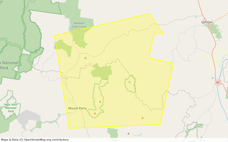
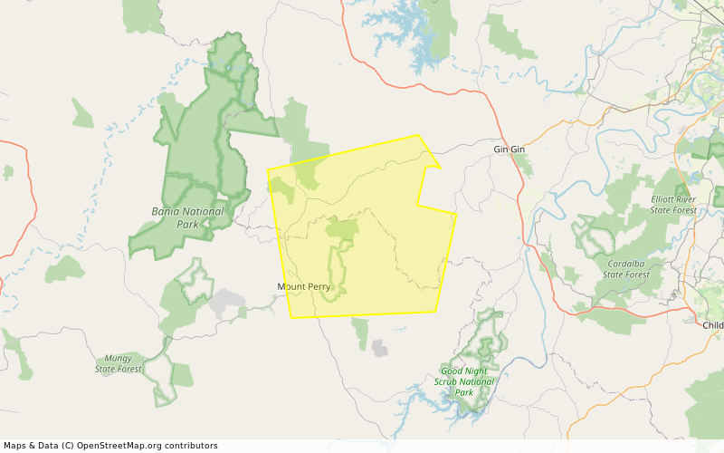
STAY INFORMED - Doughboy to Wonbah - Multiple Warnings - fire as at 9:20am Saturday, 11 October 2025 (IF39-5024221)

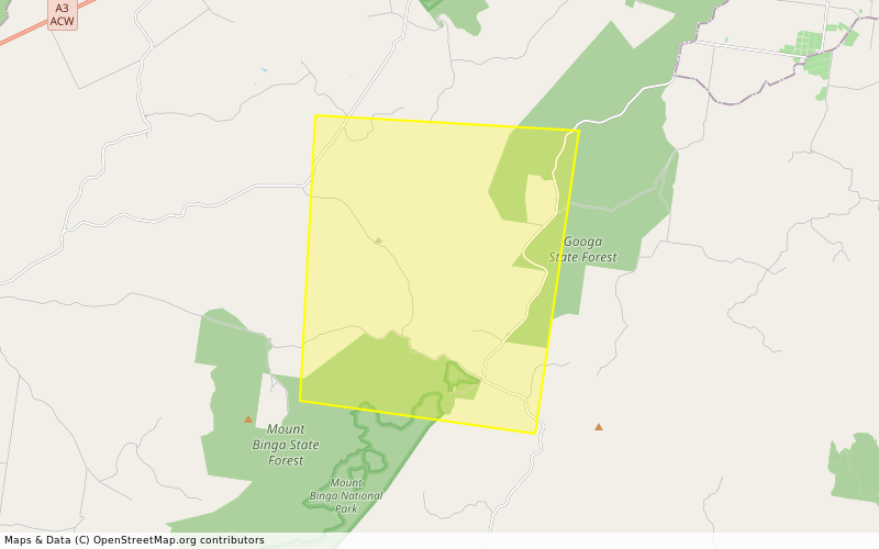
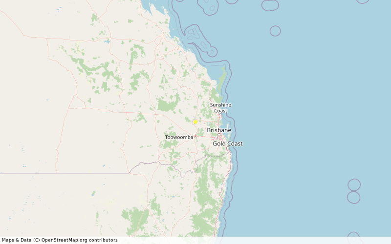
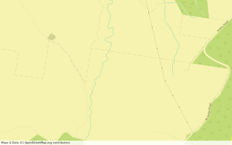
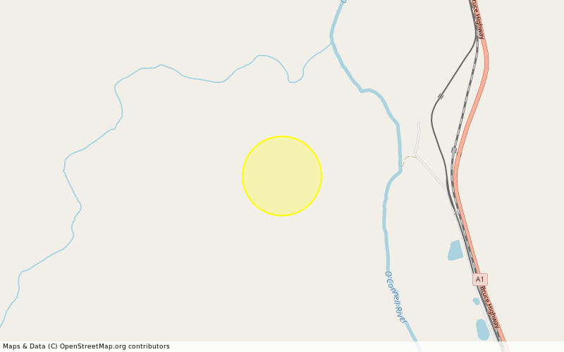
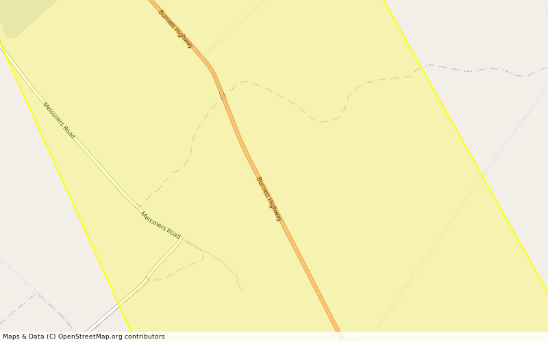
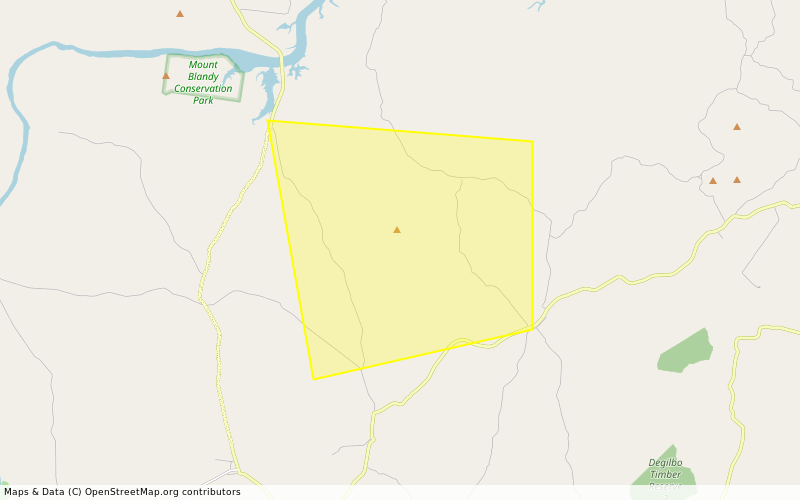
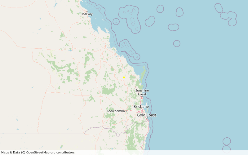
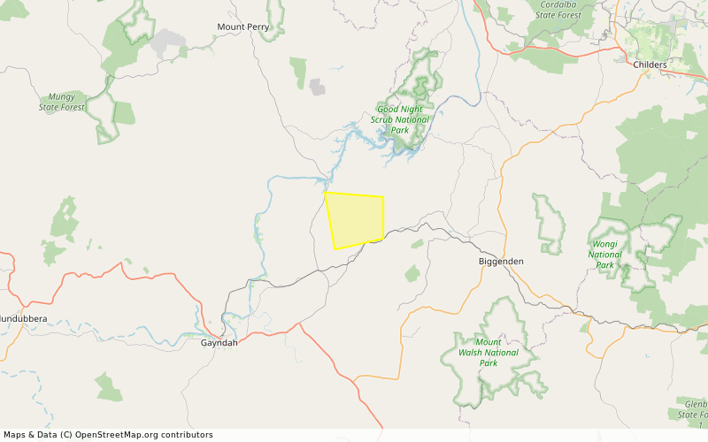
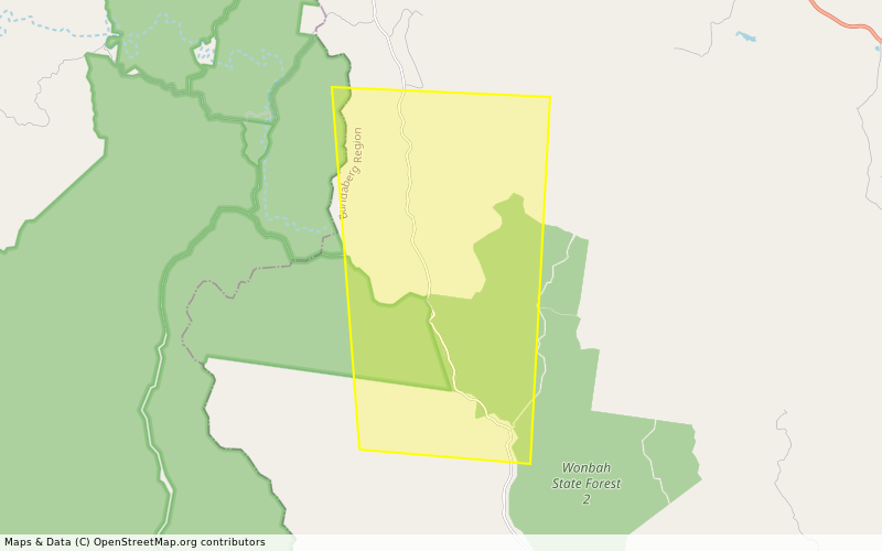
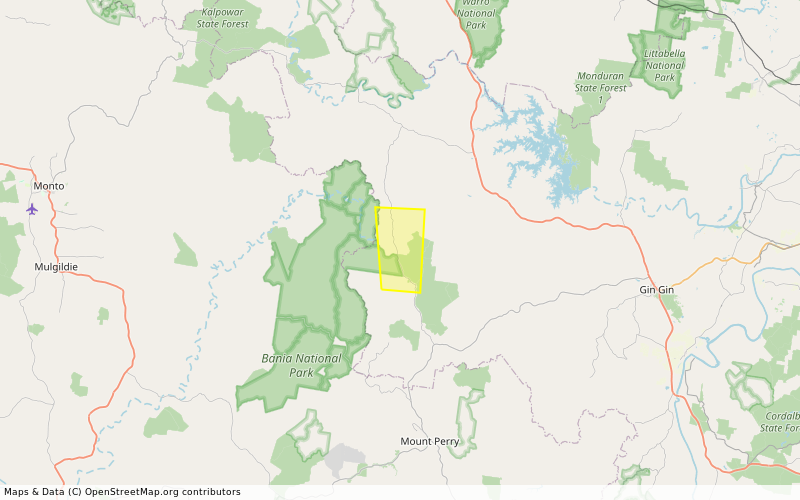
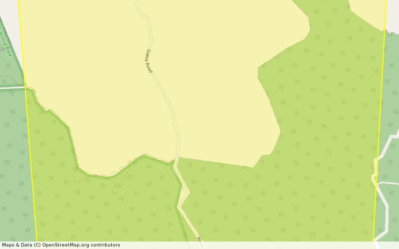
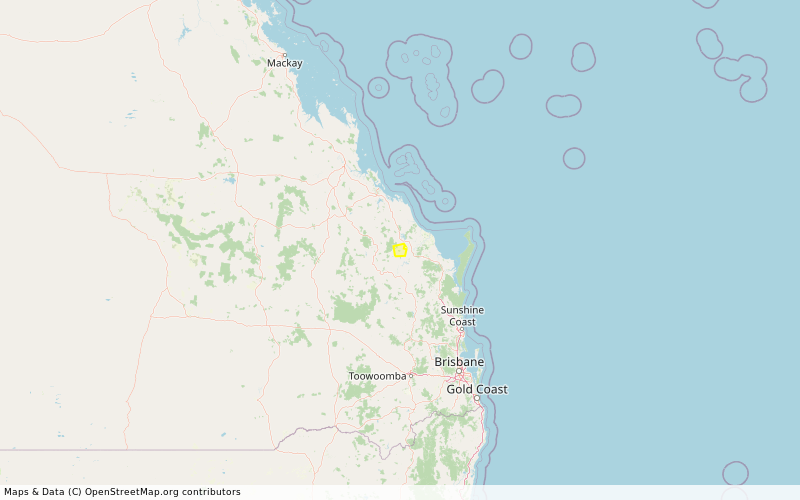
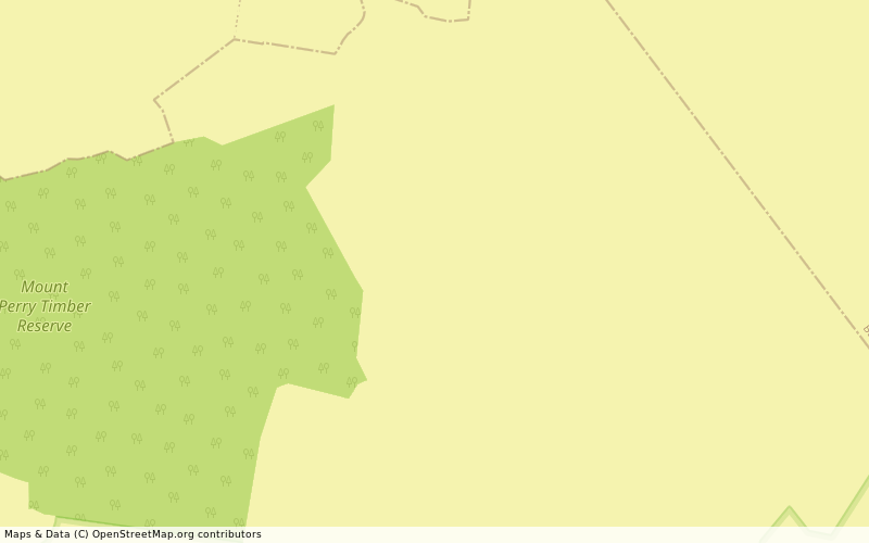
Location: Doughboy, Wonbah, Mount Perry and surrounding areas. -25.119777129041° latitude, 151.73301819298° longitude, grid square QG54UV71
Map: openstreetmap.org/#map=14/-25.
Incident Type: FIRE VEGETATION
Alert Level: Advice
Severity: Moderate
Action:
Expires: 2025-10-12T09:05:00+10:00

*** There are multiple warnings for this area. To see all current warnings, visit the QFD Current Bushfires and Warnings website ***

A fire is burning at Doughboy and Nearum. ‎

Firefighting aircraft are helping ground crews.

- Stay informed because conditions could change:

- Check the QFD Current Bushfires and Warnings website regularly.

- Follow QFD on Facebook and X.com.

- Listen to your local radio station.

- Tell friends, family and neighbours in the area.

- Decide what you will do if the bushfire gets closer:

- Follow your bushfire survival plan now. If you do not have a bushfire survival plan, make one on the QFD website.

- Decide where you and the people you live with will go. This could be with family or a friend away from the fire.

- Keep medications close by.

- Avoid smoke - stay indoors, close windows and doors, and avoid driving through smoke.

- Watch out for firefighters working in the area.

- Do not fly drones around the fire. Drones affect air operations.

- If your life is in danger, call Triple Zero (000) immediately.
- fire.qld.gov.au/Current-Incide ← Click here for current QFD incidents and warnings
- fire.qld.gov.au/prepare/bushfi ← Click here for bushfire preparation tips
- apps.des.qld.gov.au/air-qualit ← Click here for health advice and air quality information
- Follow QFD on facebook.com/qldfiredepartment ← Facebook and x.com/QldFireDept ← X.com
- qldtraffic.qld.gov.au ← Click here for road closure information or call 131940

- See help.abc.net.au/hc/en-us/artic for a listing of ABC Local Radio stations which may be broadcasting emergency information in your area. #StayInformed #DoughboyQld #WonbahQld #Advice #FireVegetation #QG54

IndieAuthors.Social Newsindieauthornews@indieauthors.social
2025-10-10

5 Steps To Writing Success (Or Why Optimism Bias Kills Your Chances)

What Is ‘Optimism Bias’? Optimism bias is the tendency of an individual to overestimate the likelihood of positive events and underestimate the possibility of negative events. I see it all the time in writers, who may feel their masterpiece novel or…
bang2write.com/2025/10/5-steps

#advice #audience #books #craft #debate

2025-10-10

A question for my knowledgeable friends:

I have an LVM with two VGs, one on each disk. VG1 has swap, / and a large empty LV (say, VG1-LV3). VG2 has my /home. I want to store my dropbox folder in VG1-LV3 (VG1 is my slower, replaceable storage). Question:

How do I mount it to /home/X/Dropbox so that it ONLY mounts for user X, and works on any login (ssh, shell, DE).

A simple fstab with uid,gid makes it visible to all.

#sysadmin #LVM #linux #advice #fstab #dropbox

Client Info

Server: https://mastodon.social
Version: 2025.07
Repository: https://github.com/cyevgeniy/lmst