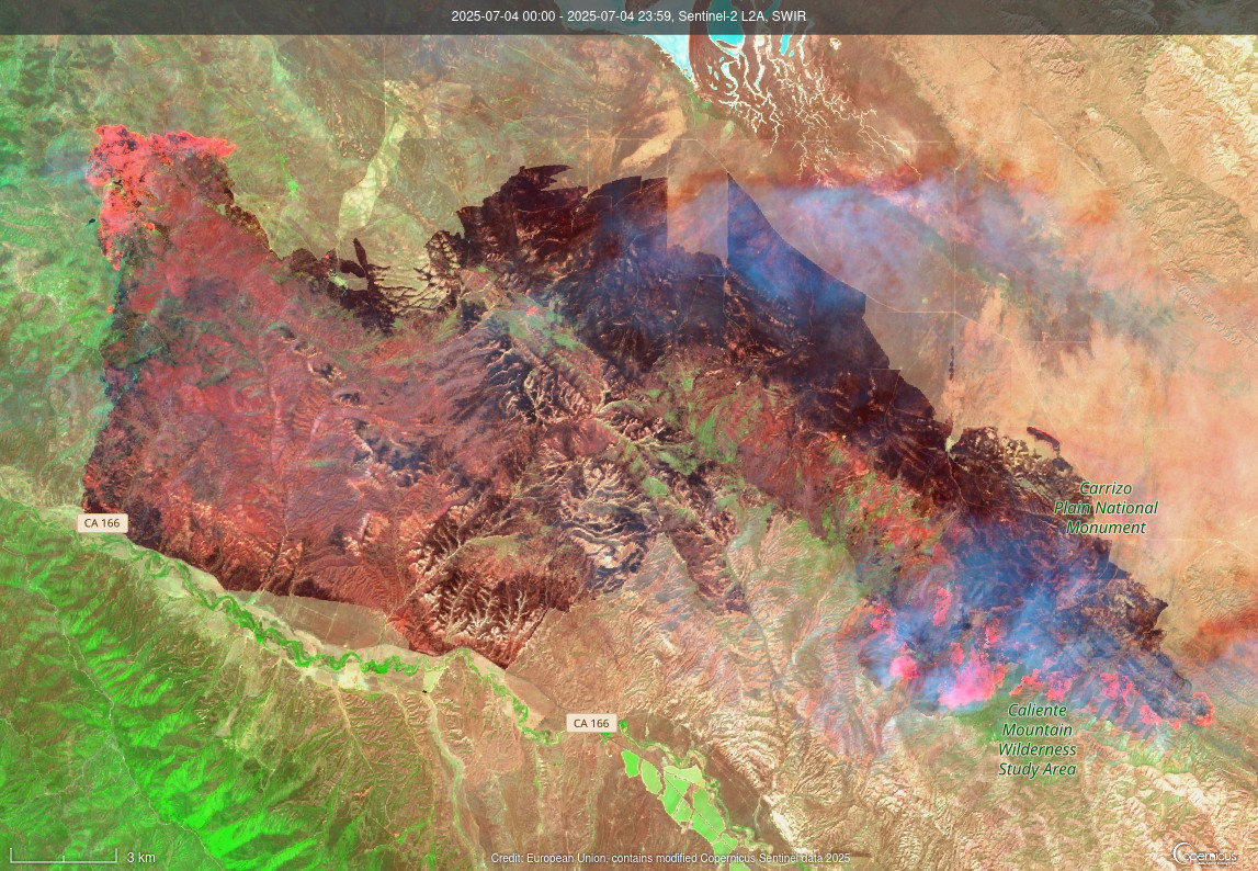
Shortwave Infrared (SWIR) image of the same location, you can see the heat on the northwest and southeast sides of the fire. Taken on July 4th, 2025. #MadreFire #SLO #CAwx #wildfires #remoteimaging
#RemoteImaging
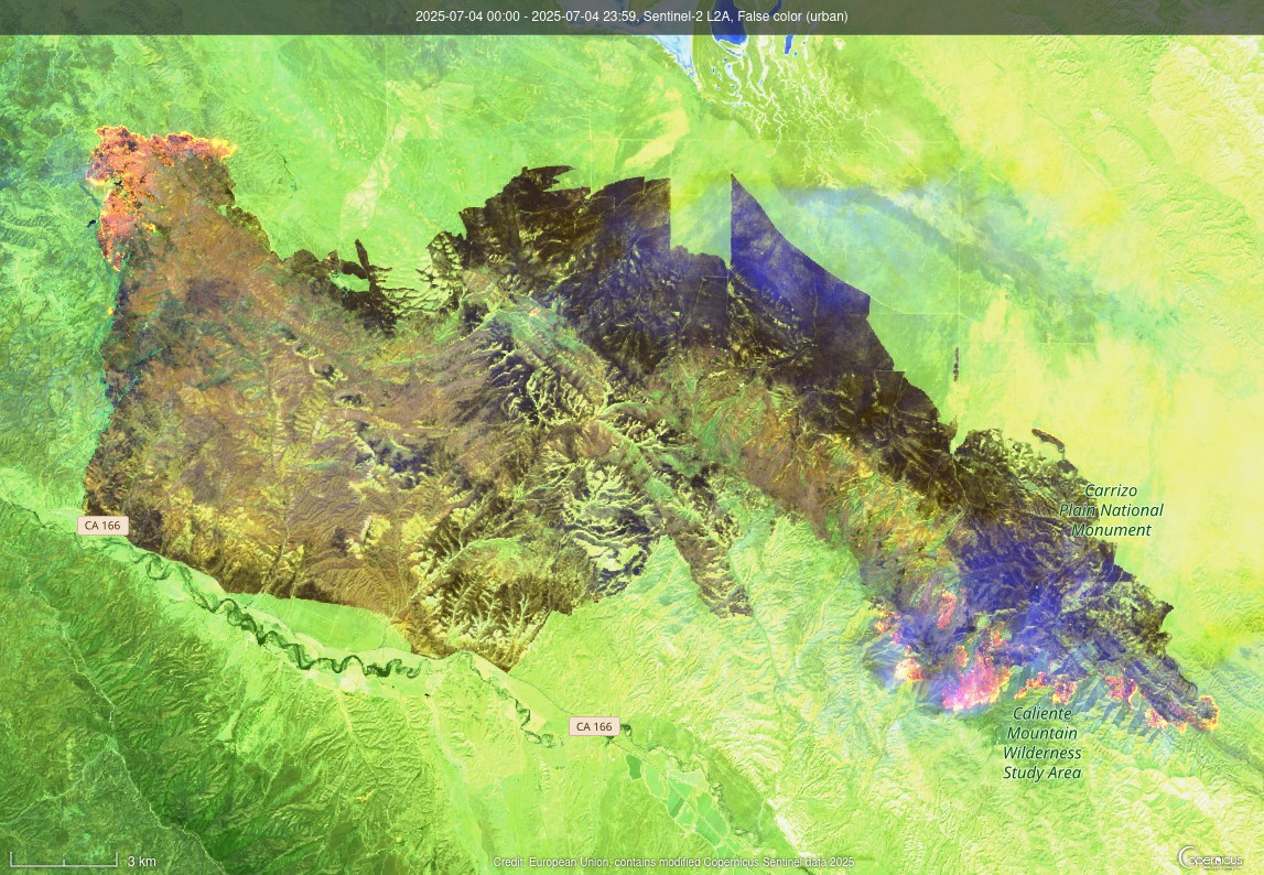
Madre Fire burn scar as of July 4th, 2025 via Sentinel-2 satellite. False Color, Urban to highlight the scar. #MadreFire #SanLuisObispo #SLO #CAwx #wildfires #remoteimaging
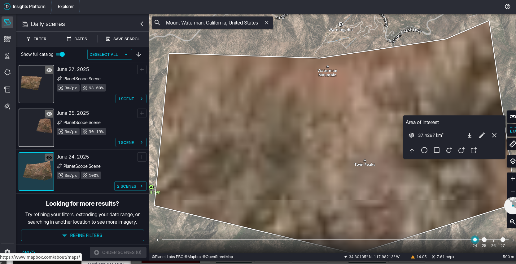
Hmm, if someone has 3m/px PlanetScope access, could be helpful for that missing woman near Mt. Waterman, California. (I don't have real time access, only archive access) #remoteimaging #gis #SearchAndRescue #SAR #AngelesNF
Oopsie?
(also, how many people are going to lose their heads over this one?)
Last night's nighttime view of Spain/Portugal before their power outage. (VIIRS Day/Night Band)
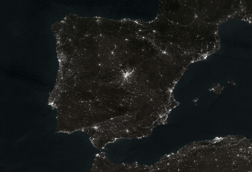
Ah, nothing to see folks, it's all fine. Move along, move along...
Impending disintegration of Thwaites Eastern Ice Shelf https://aluckman4.wixsite.com/ade-s-world-of-ice/post/impending-disintegration-of-thwaites-eastern-ice-shelf #thwaites #glacier #remoteimaging
BBC Verify: What satellite images reveal about Myanmar's quake https://www.bbc.com/news/videos/cn4wzyv21jvo
#RemoteImaging #satellite #disasters #earthquakes
May not load great here (Mastodon does not like these GIF animations), but comparison of 3/24/25 and 3/29/25 images on this small town (Sam Ngao) you can see there have many areas where there have been some high rises/buildings collapsed. You can tell because the color of the buildings change from one color to another (roof into pile of rubble). 3/29/25 #Thailand #Earthquake #disaster #RemoteImaging
Scale is not exactly, but the cluster of lights in that 3/26 image does correspond with Mandalay, Myanmar--apparently NO detectable light on the VIIRS Day/Night band satellite. #Myanmar #Burma #Earthquake #RemoteImaging #satellite
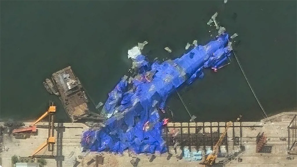
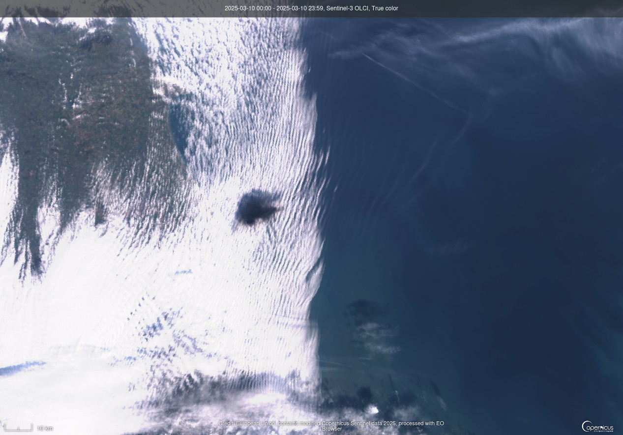
The accident is visible on Sentinel-3 satellite. #marineaccident #mvstenaimmaculate #remoteimaging
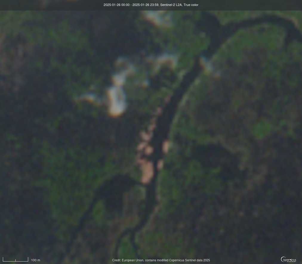
Hmm, let's see what Boloko, DRC looks like from space. Sentinel-2 on 1/26/2025 #RemoteImaging #DRC
Tokyo seen on VIIRS DNB Nighttime Imagery on Feb 11, 2025. That city sure has a lot of light! #Tokyo #RemoteImaging #VIIRS
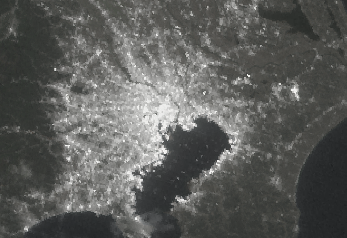
Sentinel-1 imaging of the ocean near Anydros Island, the island approximately at the center of the we-don't-know-why-it's-an-earthquake-swarm-we-swear-it-is-not-a-volcano-please-remain-calm activity in the Aegean. #RemoteImaging #earthquake #Greece
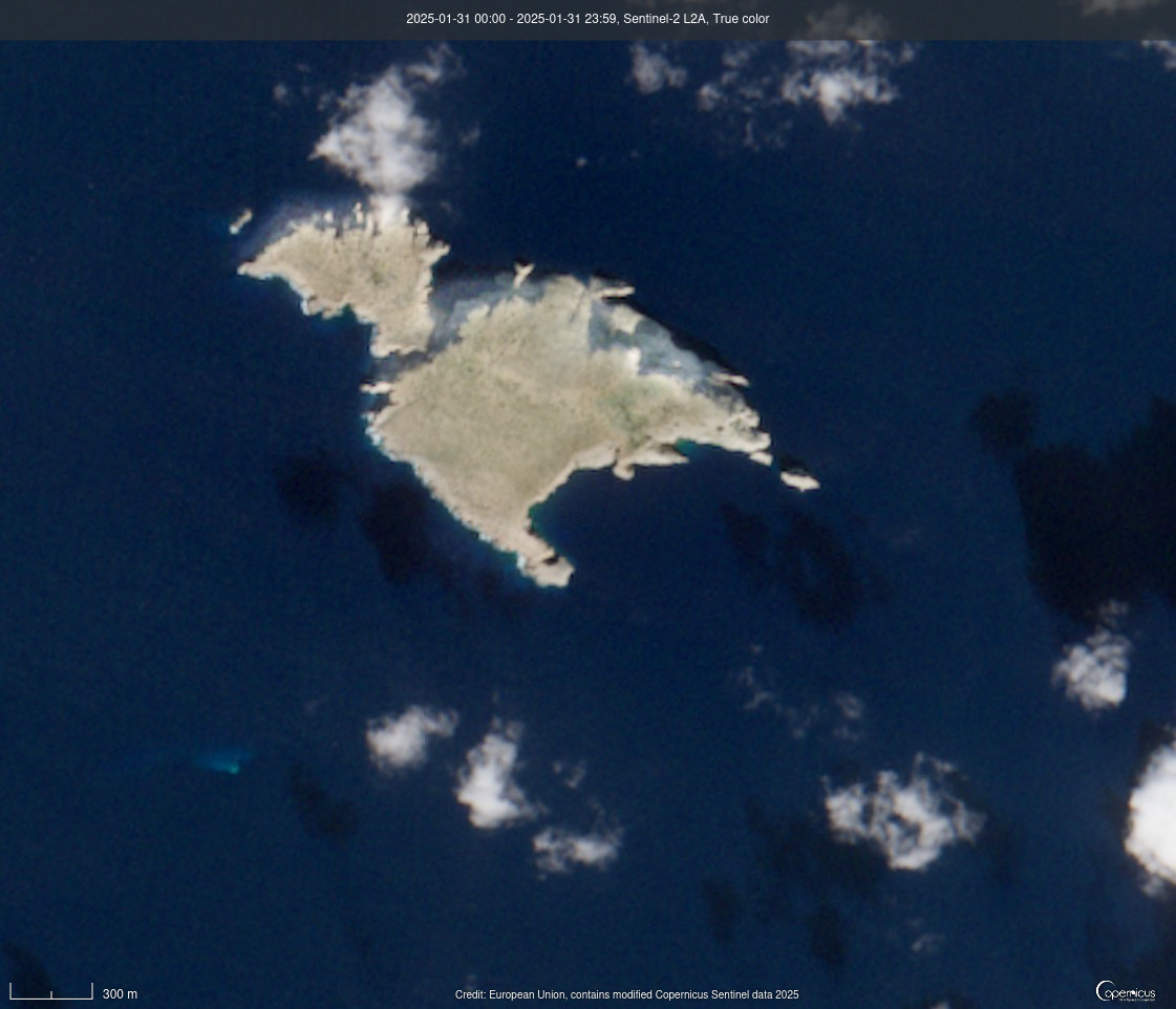
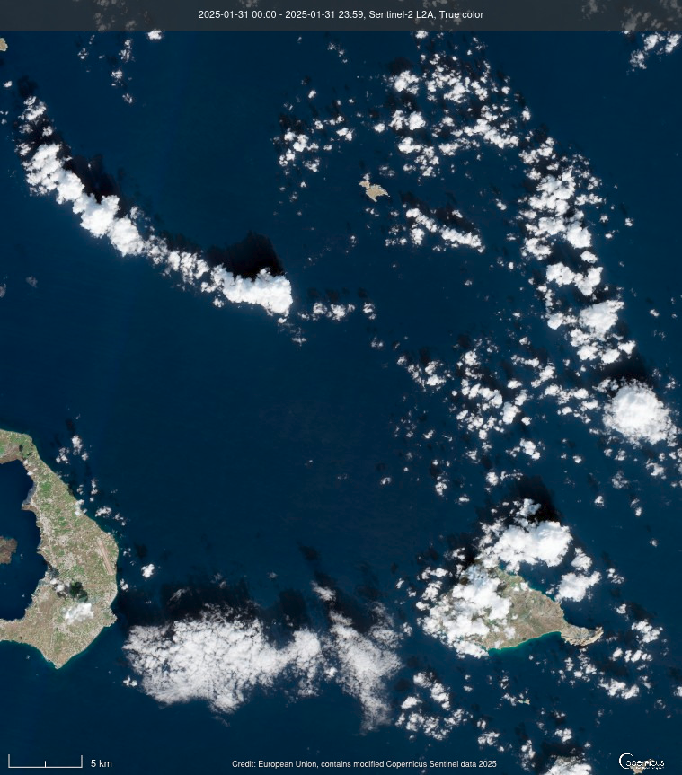
View of the area of earthquake activity in the Aegean sea near Santorini (Santorini is the island down to the left). 1/31/25 from Sentinel-2 satellite. #RemoteImaging #satellite #Santorini #earthquakes
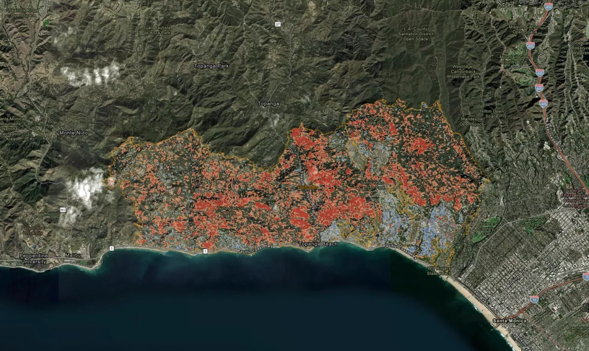
Use of Sentinel-1 satellite to assess landscape changes due to the Palisades Fire (via NASA). #PalisadesFire #RemoteImaging #Wildfires #Sentinel1
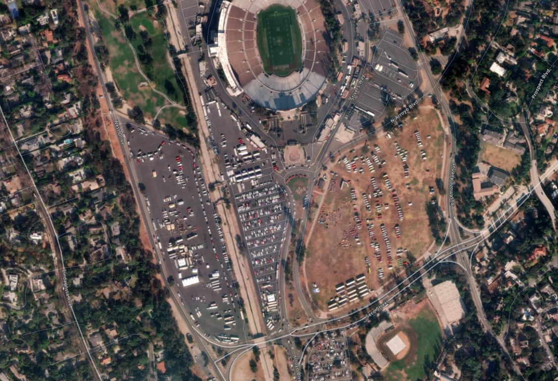
Rose Bowl is being used as Fire Camp, you can see the fire camp here.
(Off topic: man, the grass there is completely thrashed right now. They usually use those fields where all the fire trucks are parked for soccer and lacrosse. Apparently got thrashed in a concert in the summer and they were going to have to re-do it all). #RoseBowl #EatonFire #RemoteImaging
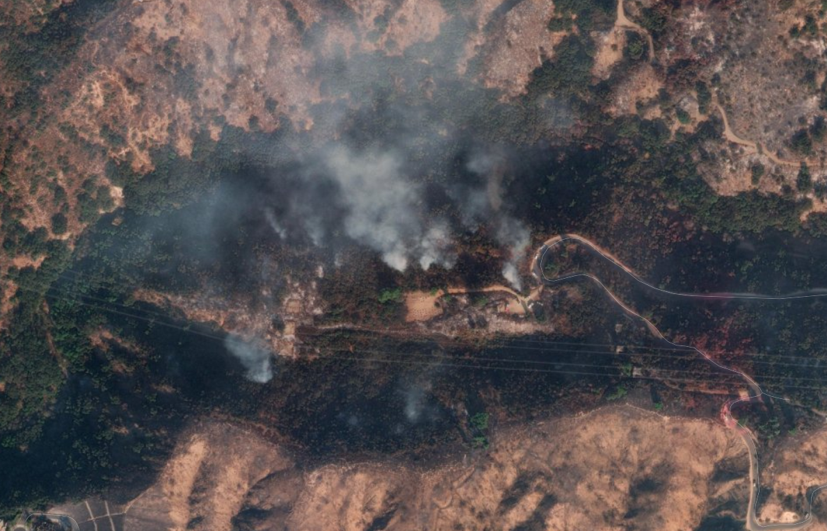
Smoke at the north end of Eaton acquired by Maxar on 01/14/25 -- they typically hit these with long line helicopters, but it appears the high tension power lines rule that out in this case. CALFIRE is on scene.... you can see either beehives or an old pot grow (with no plants growing) there nearby. (probably beehives) #EatonFire #RemoteImaging
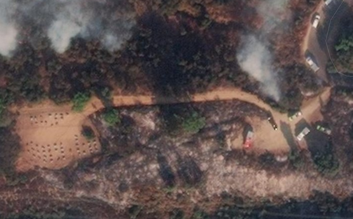
Wind driven embers laugh at your defensible space.
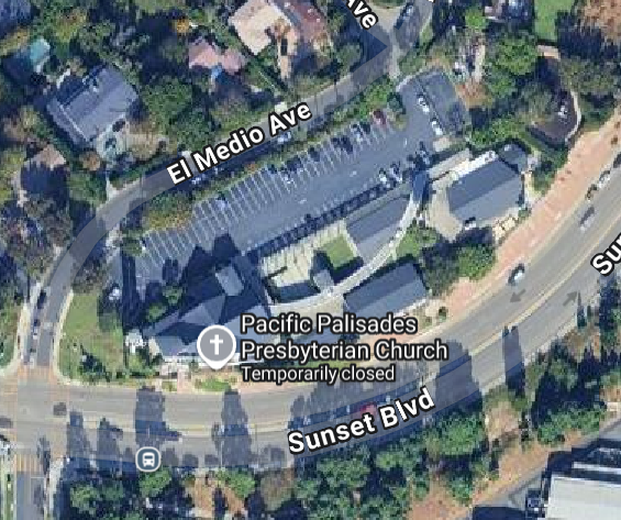
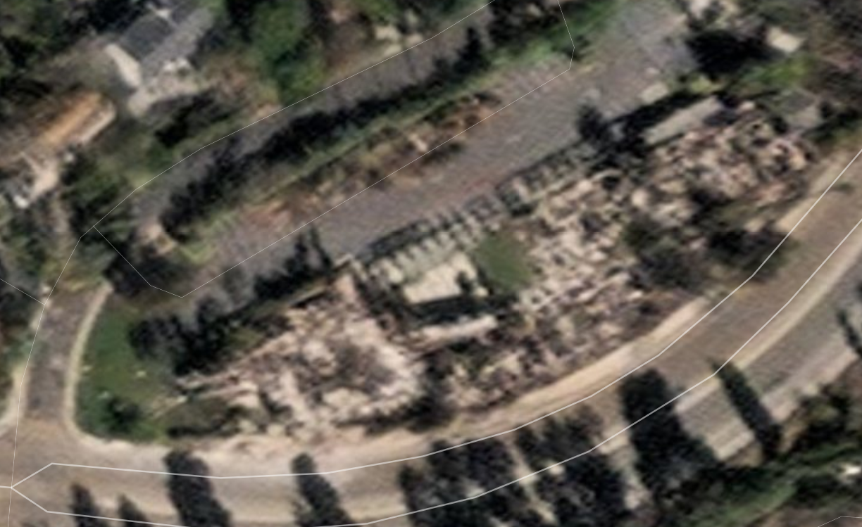
Pacific Palisades Prebysterian Church (Before/After) on Sunset Blvd. (After: MAXAR remote imaging).
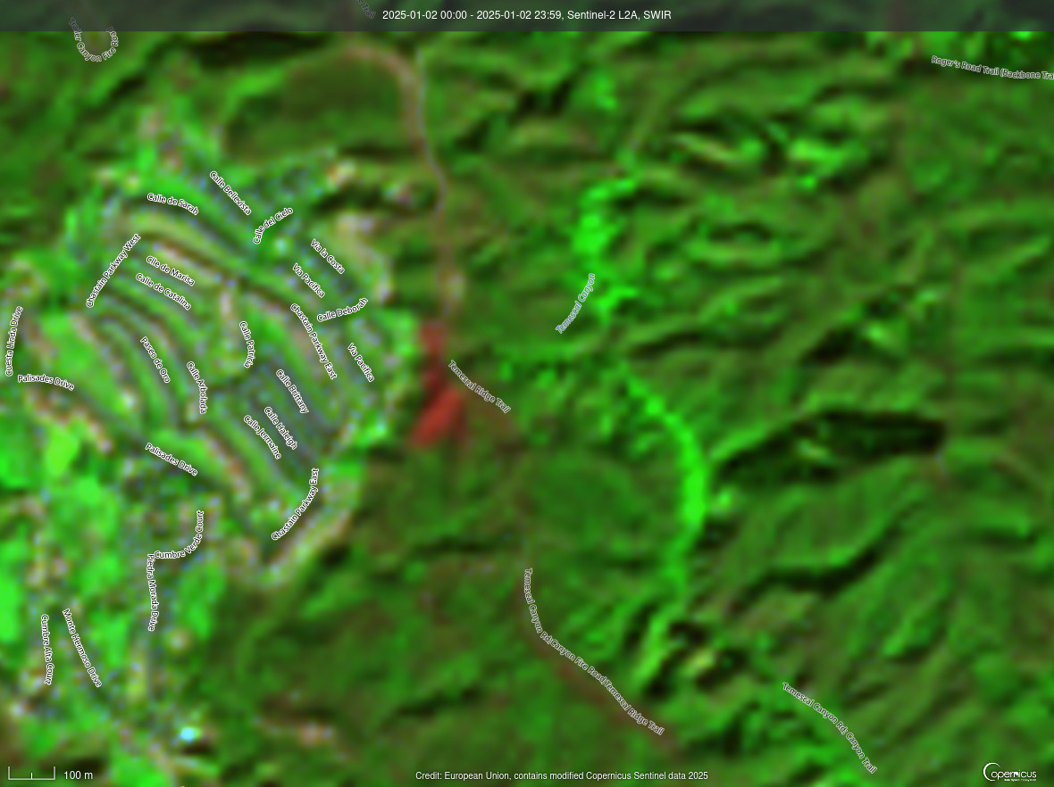
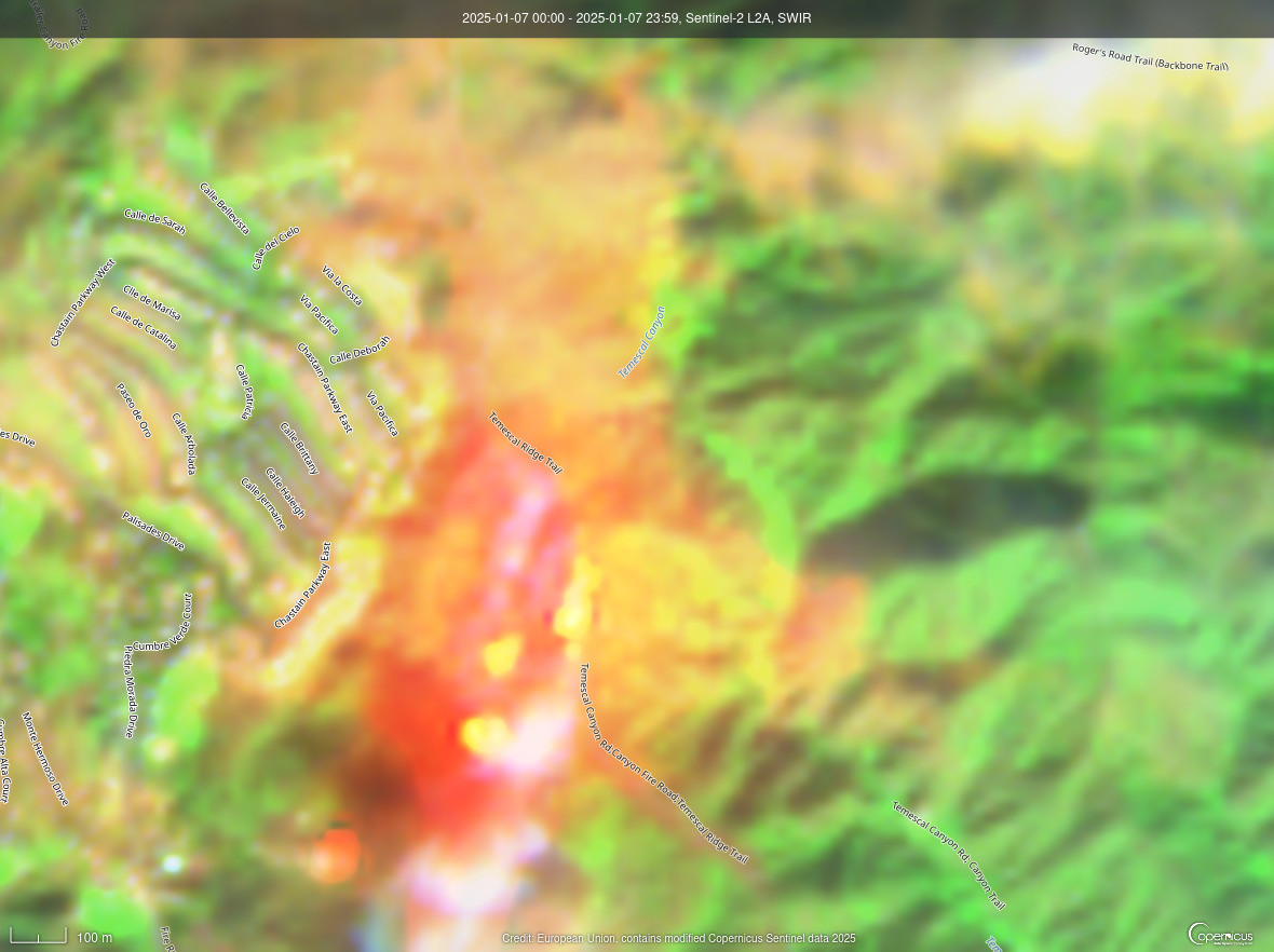
The Sentinel-2 satellite tells the tale.
Red is the burn scar from New Year's eve firework 1/2/25
Initial ignition point of Palisades Fire (which happened to be caught by pass of Sentinel-2!) 1/7/25
(unclear if it was reignite or someone started the fire at the same point). #PalisadesFire cc @skiswmm @skiswm.bsky.social #RemoteImaging #Sentinel2
Client Info
Server: https://mastodon.social
Version: 2025.04
Repository: https://github.com/cyevgeniy/lmst