Madeira Drive / Mural
#PublicArt #wayfinding #brighton #photography
https://flic.kr/p/2rK9oy6
#wayfinding

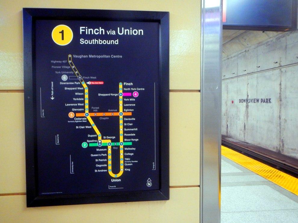
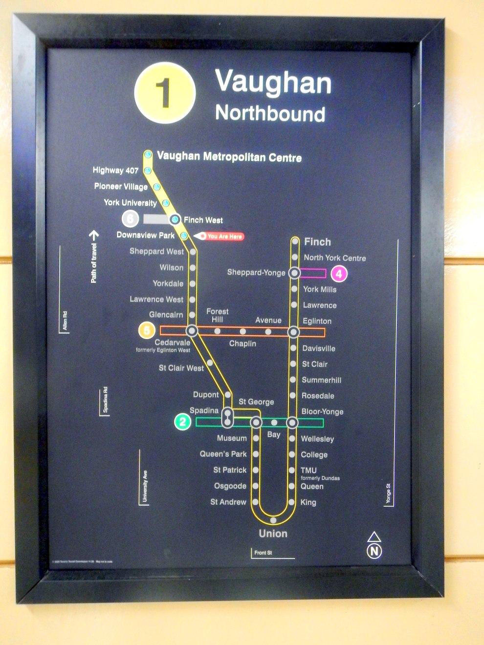
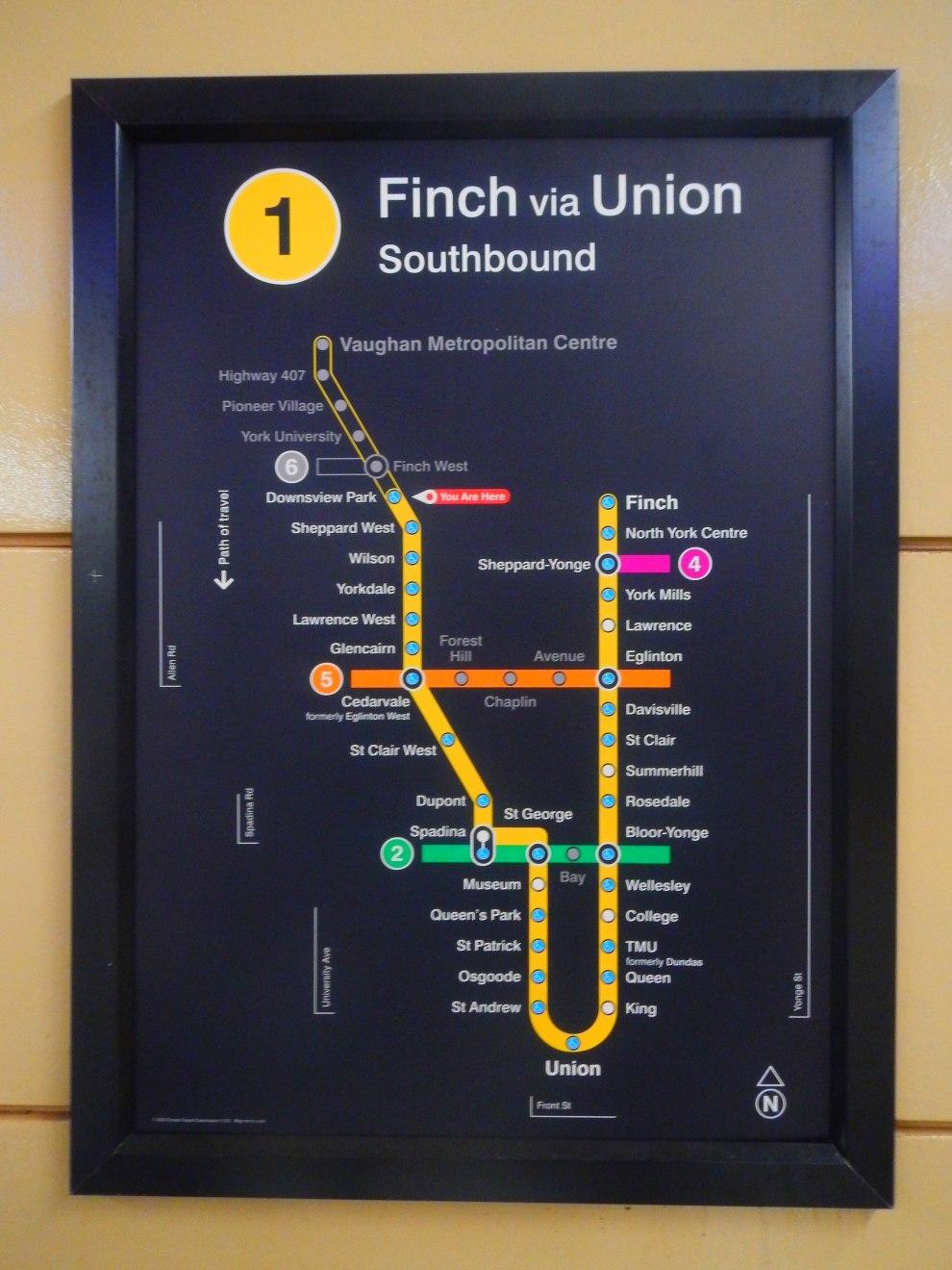
@c_9 TTC “Subway and Light Rail” maps now up on the Line 1 Downsview Park subway station platform pillars/walls
Line 6 and Line 5, represent.
| #TTC #DownsviewPark #NorthYork #Toronto #Wayfinding #TransitMaps #PublicTransit #TOpoli


Where is the small problem of #Wayfinding and Map design
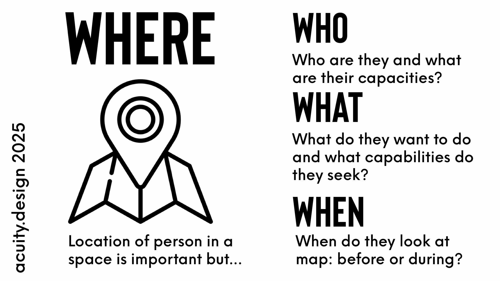
On #Wayfinding for agency and accessibility acuity.design/one-map-is-n...
One map is never enough – Acui...
It’s never one map The map before and the map during is the minimum #wayfinding #care

#Wayfinding site visit: you take photos on the way in to understand the problems and map confusions, then you take photos on the way out to highlight usable touchpoints for showing a route. The return/reverse journey is where you map clarity.

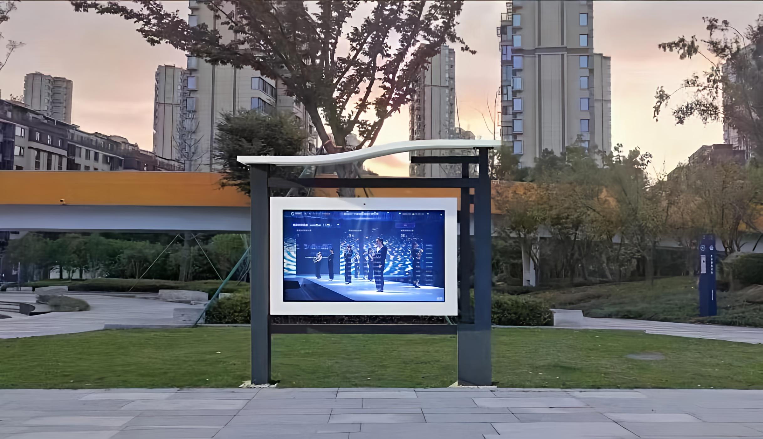
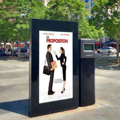
Innovation in Wayfinding Displays🗺️
Our wayfinding displays help people navigate complex public spaces with ease. The ability to access real-time location data through interactive screens is the future of urban navigation.
Have you used wayfinding technology in a public space?
#Wayfinding #UrbanTech #OutdoorDisplays #InteractiveSignage

to a wayfinding project for Atelier Gardens in Berlin
Architecture by MVRDV and HS Architekten
.
#wayfindingdesign #wayfinding #signage #graphicdesign #ateliergardens
Architecture by MVRDV and HS Architekten
.
#wayfindingdesign #wayfinding #signage #graphicdesign #ateliergardens


#Toronto new-fangled tall wayfinding signpost at Budd Sugarman Park, doesn't look like a City thing, must be a BIA initiative
signs gives minutes to nearby locations in Summerhill and Yorkville

Giải pháp tìm đường đi trong bệnh viện: Một nhà phát triển đang xây dựng nền tảng bản đồ số giúp điều hướng trong các tòa nhà phức tạp như bệnh viện, đại học, cơ quan chính phủ. Nền tảng này cung cấp lộ trình rõ ràng, thông tin thời gian thực (ví dụ: mức độ bận rộn của khoa). Mục tiêu là giảm bớt căng thẳng cho người dùng.
#hospital #wayfinding #navigation #healthcare #bệnhviện #điều hướng #chăm sóc sức khỏe
https://www.reddit.com/r/SaaS/comments/1ng4b57/hospital_wayfinding_is_broken_im_trying
Modular Displays for Urban Spaces🏙️
We’re excited about the potential of modular outdoor displays in urban environments. These flexible systems allow for easy scaling and integration into smart city projects, providing interactive wayfinding and dynamic information in high-traffic areas.
Are you working on any smart city initiatives? Let’s connect and share insights!
#SmartCities #UrbanTech #Wayfinding #ModularDisplays #OutdoorSignage

📍 Case Study: Smart City Integration
Our modular outdoor displays were recently installed in a smart city project, providing interactive wayfinding and real-time data in high-traffic areas. It’s incredible how these displays help people navigate complex spaces more efficiently!
Check out the full case study on our site.
#SmartCities #Wayfinding #OutdoorSignage #TechInUrbanSpaces

B•O•A•T / Sign
Direction sign for the Brighton Open Air Theatre
#PublicArt #photography #WayFinding
https://flic.kr/p/2rqdoXT
Direction sign for the Brighton Open Air Theatre
#PublicArt #photography #WayFinding
https://flic.kr/p/2rqdoXT


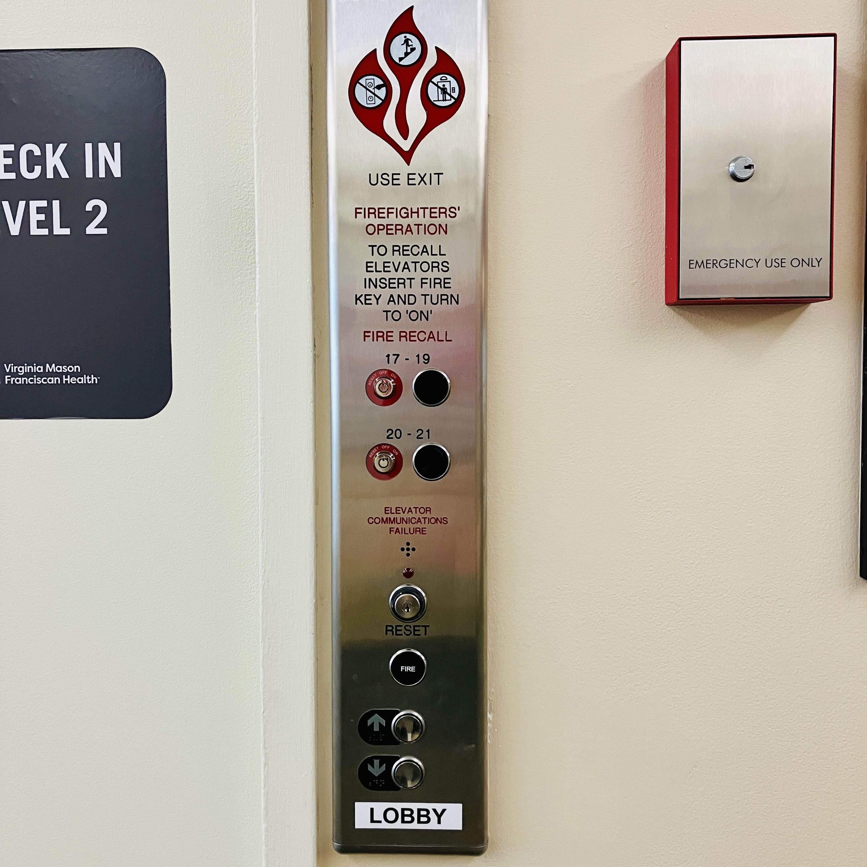
Elevator button panels are always the worst infringers on this front, too.
#elevator #design #wayfinding #interface #accessibility #hospitals
Look for the up / down buttons:
The ratio of patients to firefighters is large enough that we need to sit down with #elevator #design staff to come up with more effective #wayfinding and #interface concepts.
Worldwide.

The “Vignelli” Map at 50 (okay, 53):
https://www.nytransitmuseum.org/vignelli/ #wayfinding #design #urbanism #maps #helvetica #redesigns #nyc #subways

The “Vignelli” Map at 50 (okay, 53):
#wayfinding #design #urbanism #maps #helvetica #redesigns #nyc #subways
Towards a Better Way: The “Vig...

“A Change of Course – Honing Network Rail’s #Wayfinding Guidance.”
^ via @thebeautyoftransport
🚲 #Brantford’s #bikelanes exist, but are they actually safe?
🚫 Cars parked in the #contraflowlane
❌ No #wayfinding at key connections
🚧 Inconsistant layout changes
This North/South route looks good on paper, but in reality it's a mess!
📺WATCH: https://youtu.be/qzBVXYw5zj8

Client Info
Server: https://mastodon.social
Version: 2025.07
Repository: https://github.com/cyevgeniy/lmst