#Europe Removes Record Number of #River #Barriers
https://www.onlygoodnewsdaily.com/post/europe-removes-record-number-of-river-barriers
Hundreds of #dams, #weirs, #culverts and #sluices dismantled in 2024 to help #waterways resume natural course.
#Europe Removes Record Number of #River #Barriers
https://www.onlygoodnewsdaily.com/post/europe-removes-record-number-of-river-barriers
Hundreds of #dams, #weirs, #culverts and #sluices dismantled in 2024 to help #waterways resume natural course.
📍: Sprotbrough Towpath (Horse) Footbridge
ℹ️: towpath bridge
🗺: https://www.openstreetmap.org/?mlat=53.5080562597858&mlon=-1.19019352792248#map=17/53.5080562597858/-1.19019352792248
📸: Photo by mattbuck4950 on Flickr https://www.flickr.com/photos/23136508@N00/53849803949
#canal #narrowboat #england #uk #flickr #unitedkingdom #europe #photosbymatt #camerapentaxk70 #lenssigma18300mm #water #yorkshire #rivers #visitswithheathermcrae #november #weirs #2023 #sprotbrough #riverdon
Fortgeschrittene gehen weiter zu den #Weirs, meine (late to the party) Neuentdeckung des Winters, einfach umwerfend!
https://www.youtube.com/watch?v=Fa1rpnFXQ9w
(Prepare to meet God, Album von 2022)
https://westhillrecords.bandcamp.com/album/prepare-to-meet-god
📍: Mill Lane Pipe Bridge
ℹ️: pipe bridge
🗺: https://www.openstreetmap.org/?mlat=53.5078325927546&mlon=-1.19034856692827#map=17/53.5078325927546/-1.19034856692827
📸: Photo by mattbuck4950 on Flickr https://www.flickr.com/photos/23136508@N00/53849803949
#canal #narrowboat #england #uk #flickr #unitedkingdom #europe #photosbymatt #camerapentaxk70 #lenssigma18300mm #water #yorkshire #rivers #visitswithheathermcrae #november #weirs #2023 #sprotbrough #riverdon #milllanesprotbrough

Unidentified Weir, c.1910 - RP Postcard
https://www.ebid.net/uk/for-sale/unidentified-weir-c-1910-rp-postcard-220788193.htm
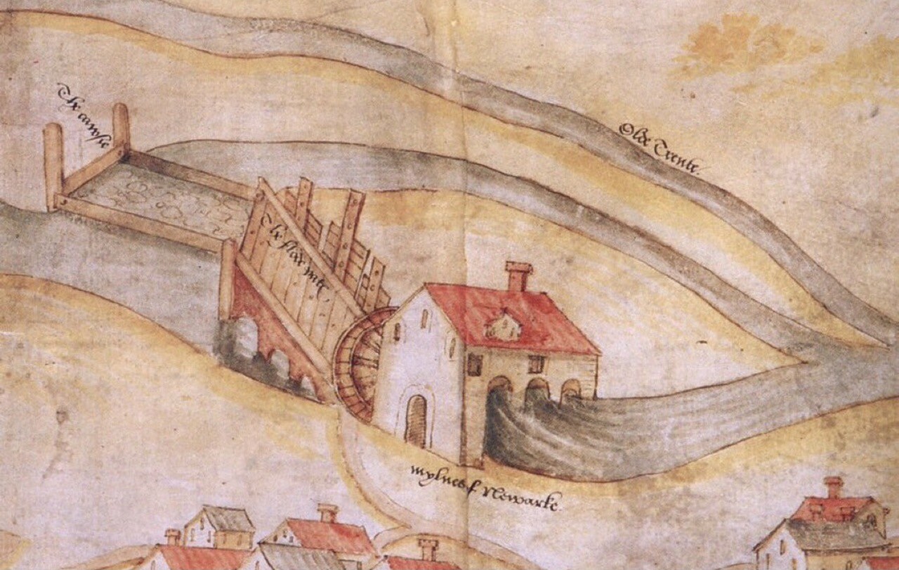
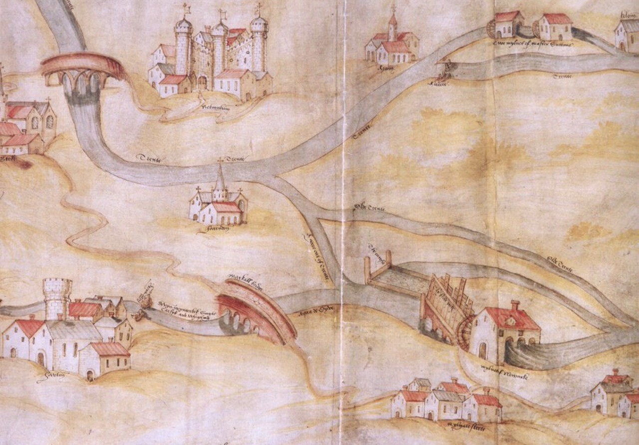
It's always interesting to see a past #landscape through the eyes of the people who inhabited it. This beautifully drawn and painted #map shows the #bridges, #weirs and #watermills across the river #Trent between Nottingham and Newark in the early 16thC in such loving detail that one can almost imagine standing on each site with the cartographer as he sketches.
The (enlargeable) map is online at https://www.bl.uk/collection-items/map-of-the-river-trent-and-its-tributaries-between-nottingham-and-newark