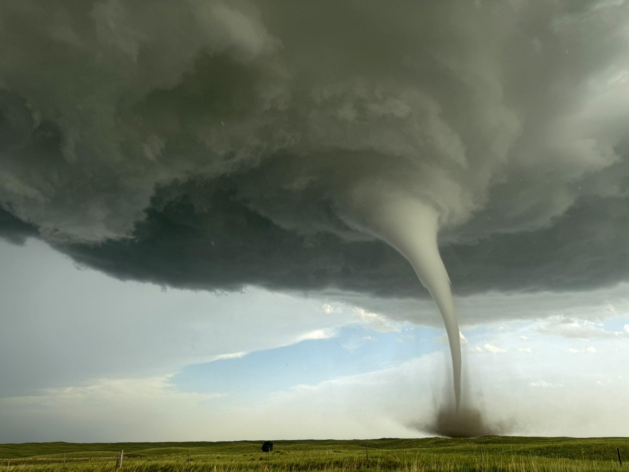
RT from Laura Gaynor (@wxfantasies)
She danced for us 🌪️ somebody pinch me 😍
Dickens, Nebraska | 16 June 2025
#newx #wxtwitter
RT from Laura Gaynor (@wxfantasies)
She danced for us 🌪️ somebody pinch me 😍
Dickens, Nebraska | 16 June 2025
#newx #wxtwitter
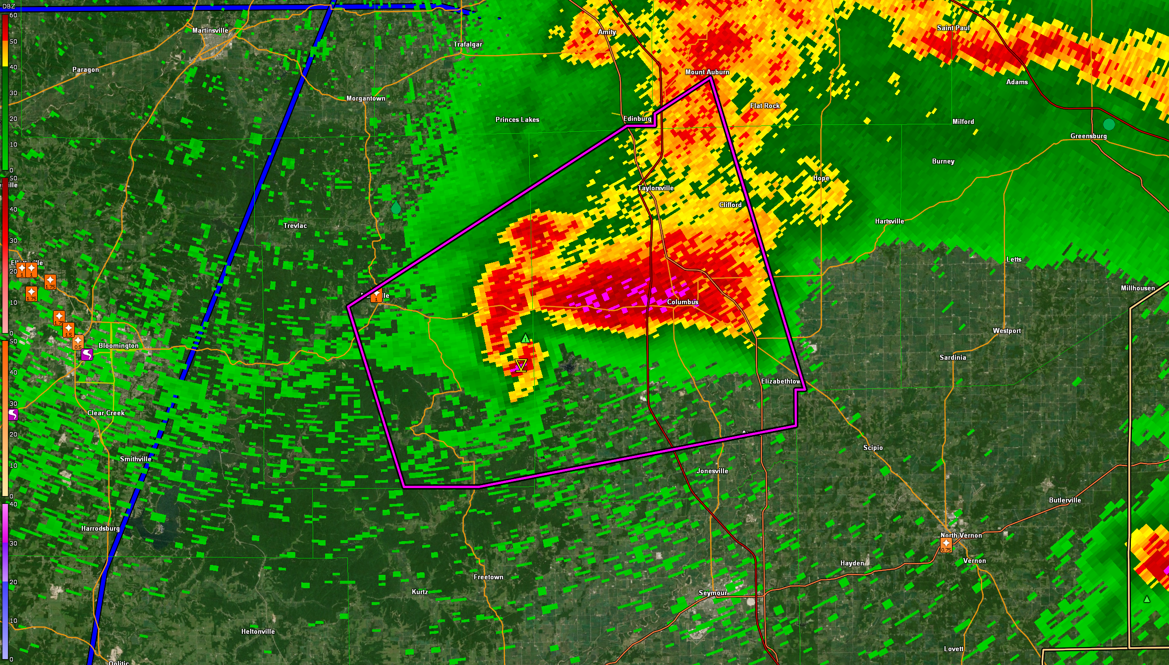
LARGE #TORNADO ON THE GROUND IN #BARTHOLOMEW COUNTY, #INDIANA. This is a PARTICULARLY DANGEROUS SITUATION. TAKE COVER NOW!
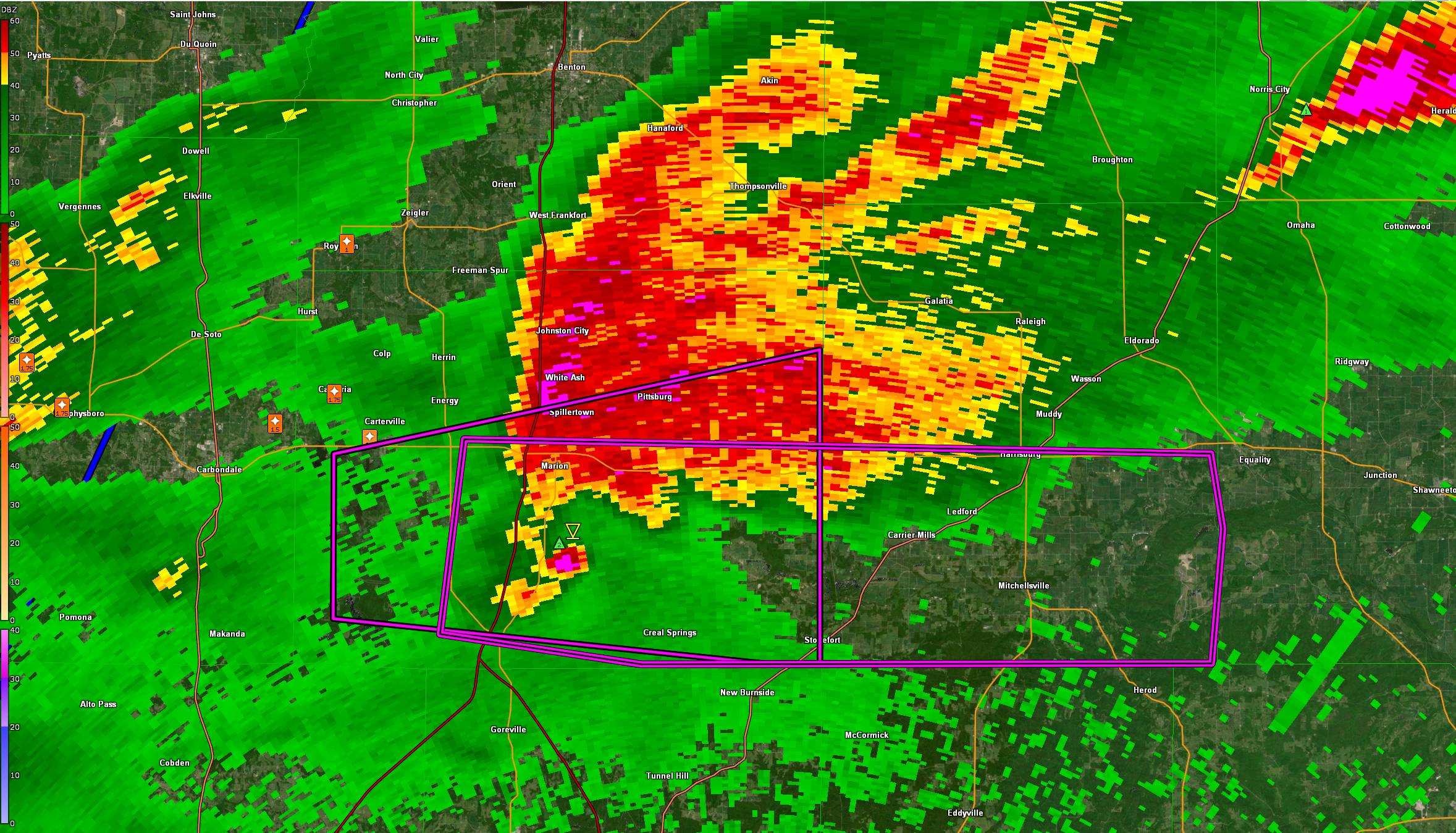
#TORNADO EMERGENCY for #WILLIAMSON, AND #SALINE
COUNTYS IN #ILLINOIS. This is a LIFE-THREATENING SITUATION. TAKE COVER NOW!
The tornado will be near Creal Springs and Carrier Mills around 6:30 PM. And Harrisburg around 6:35 PM. A large, extremely dangerous and potentially deadly tornado is on the ground.
#ilwx #wxtwitter
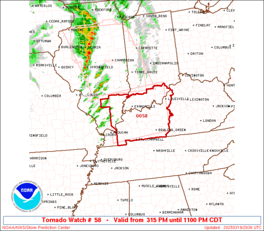
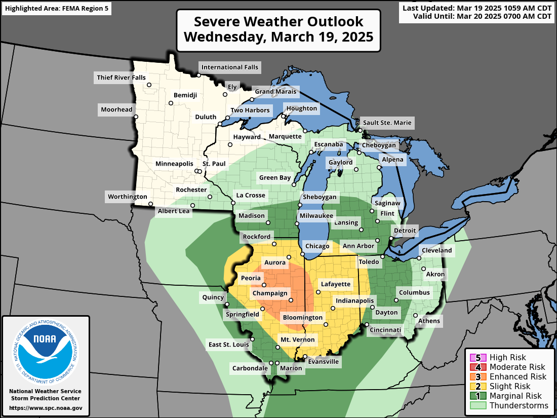
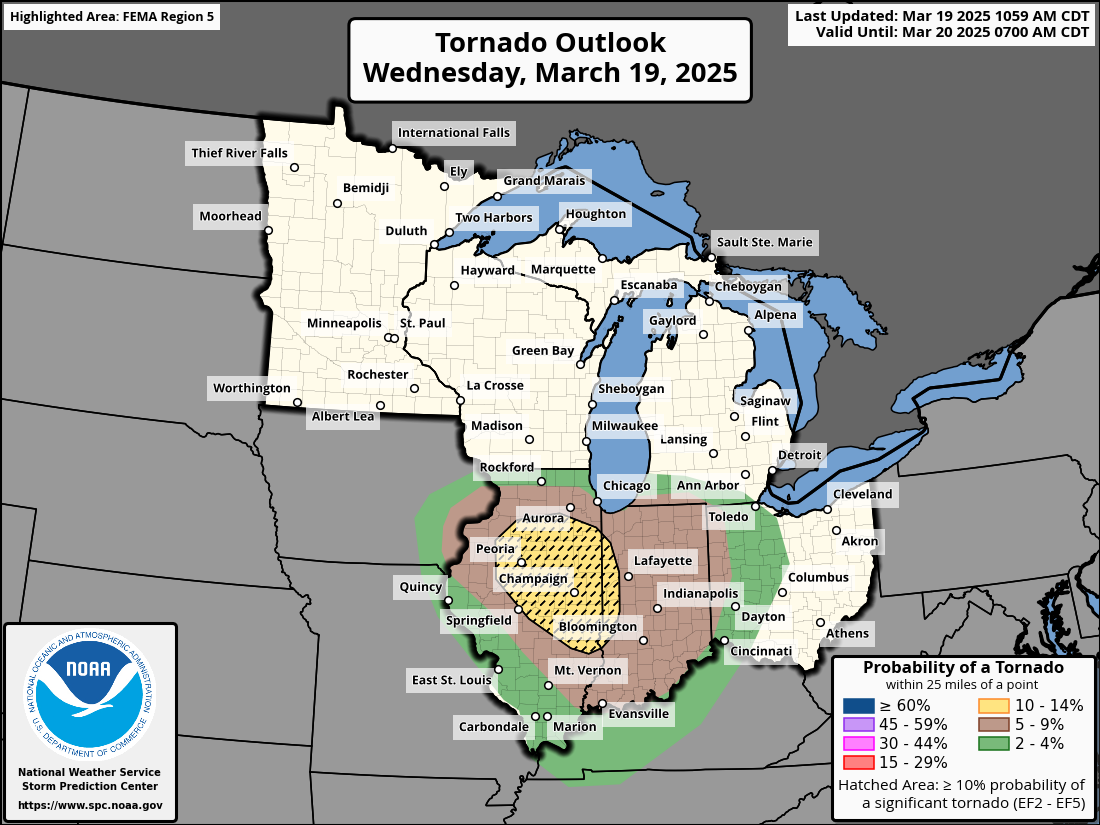
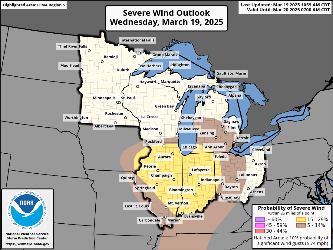
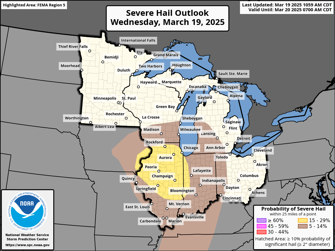
A tornado watch is in effect for southern Indiana and Illinois into western Kentucky. Risks include a few tornadoes, scattered damaging wind gusts, and scattered large hail. Please stay weather alert.🚨#wx #weather #severewx #twitterwx #wxtwitter #storms #tornadowatch
LIVE over at https://youtube.com/live/4q_RInrj4OM?feature=share covering the weather for 3/19/2025 #wx #wxtwitter #twitterwx #weather #severewx #storms #ILwx #INwx #illinoiswx #indianawx #indiana #illinois
A tornado watch is in effect for Illinois and western Indiana until 9 PM CDT. This has been issued ahead of severe storms including the potential for a few tornadoes, some of which could be significant. Stay weather alert🚨
#wx #wxtwitter #twitterwx #weather #severewx #ILwx #INwx
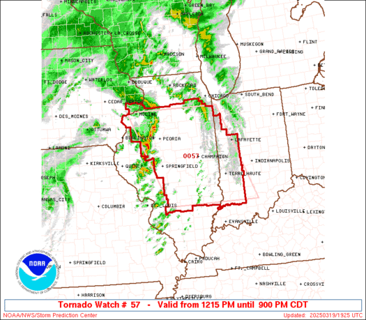
The potential for a couple of tornadoes, some strong, exists across Illinois and Indiana today accompanied by scattered large hail and scattered damaging wind gusts. Please stay weather alert.🚨#wx #weather #storms #twitterwx #wxtwitter #ILwx #INwx
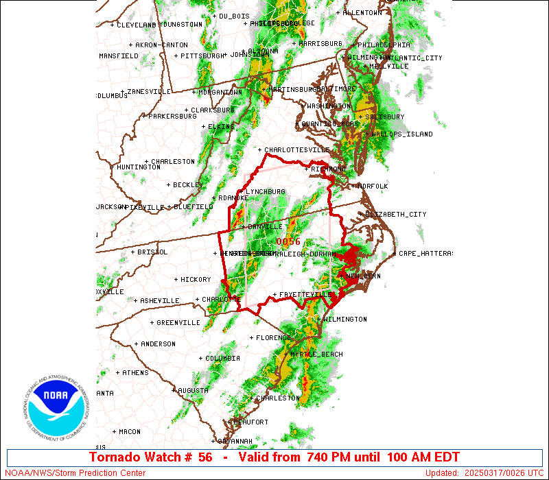
Tornado watch is in effect for portions of Virginia and North Carolina until 1 AM EST. Risks include a couple of tornadoes, scattered wind gusts upwards of 70 mph, and isolated large hail up to 1.5 inches. Stay weather alert🚨#wxtwitter #twitterwx #wx #weather #ncwx #vawx #storms
My weather: Rain and sleet Wednesday, sunbathing nude Thursday, Snow on Friday, no coat needed on Saturday. #WxTwitter
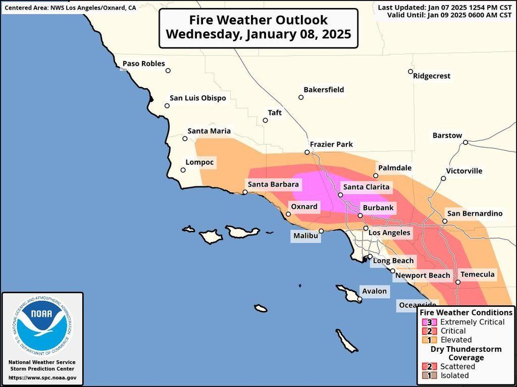
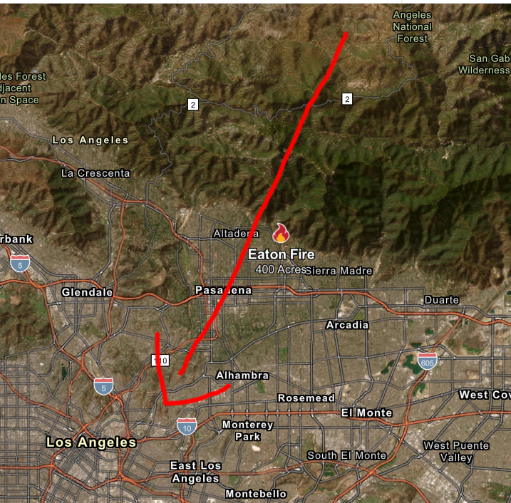
The Eaton fire is just Northeast of Pasadena. This is horrible because winds intensify tonight into tomorrow, wind gusts 75-100 mph spread it at an unprecedented rate directly into areas such as Pasadena and eventually LA! Evacuations are underway.
#wxX #wxtwitter #cawx #CALFIRE
Jon Noble (@NobleF1):
Might not be much track action in Macau tomorrow….#HongKong SAR's HKO is going #Typhoon Signal 8 at 11.10pm #China Time, shutting the city down on Thurs tmr
#Macau SAR planning to do so with low to medium chance early tmr morning
https://t.co/wegtVHQcQT
#Wxtwitter #wxx #tropicswx #TyphoonToraji #NikaPH #台風23号 #Macao #Toraji https://t.co/VOHLU8ZwOp
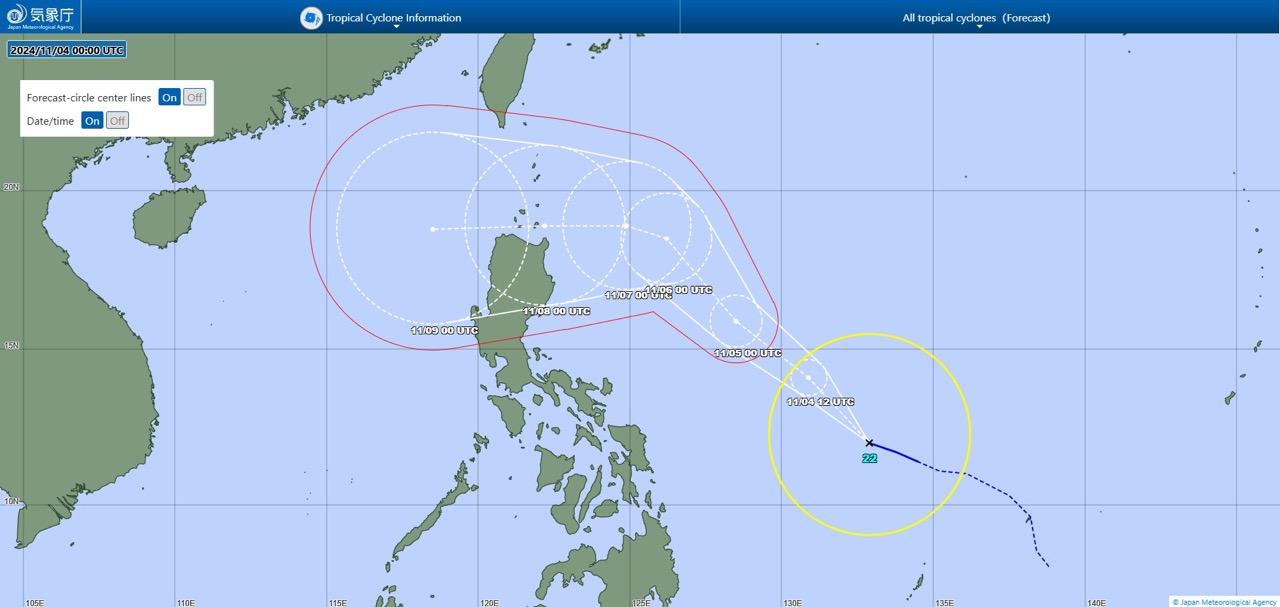
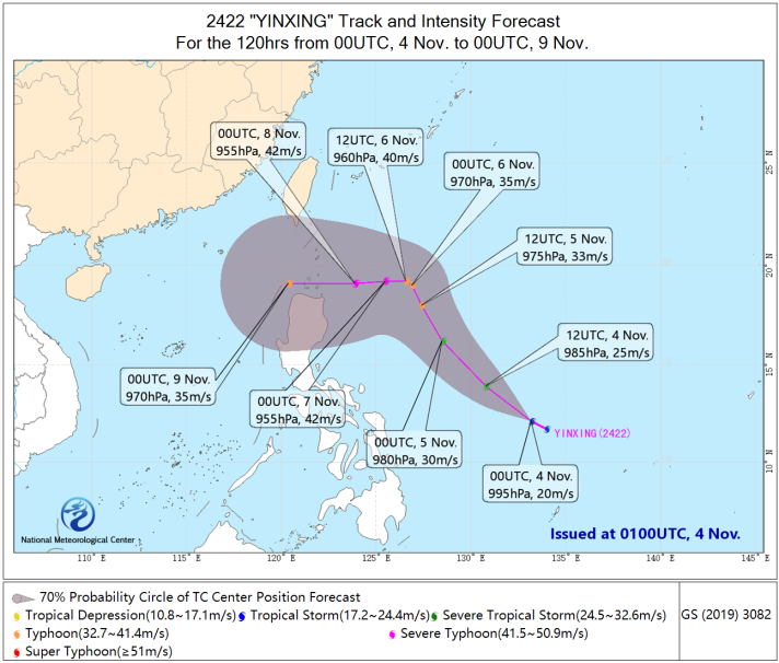
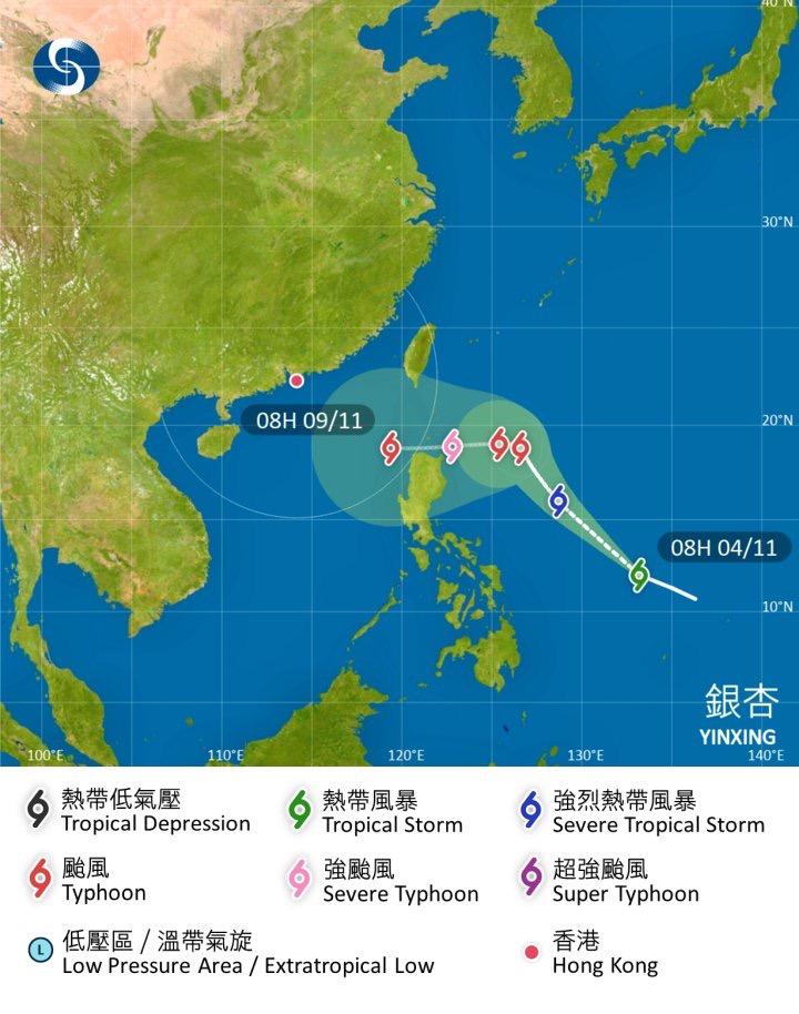
Typhoon #Yinxing
from LimWx (@LimWeather X/Twitter)
【 105mph c2 #Typhoon #Yinxing forecast to peak at 120mph+ Major C3 or even C4, nearing N #Luzon,#Philippines,ALL interests there should begin preps now! #Hainan,S #China,C,N #Vietnam interests should watch closely! #Wxtwitter #Wxx #台風22号 #MarcePH #Hue #Cagayan #TyphoonYinxing 】
↑
https://x.com/limweather/status/1853982264398688680?s=46
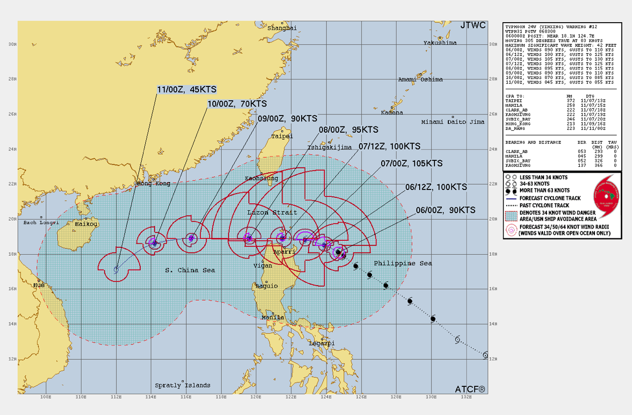
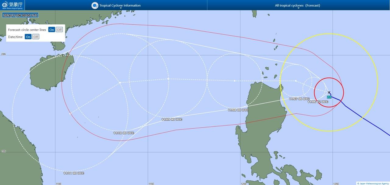
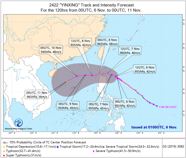

台風22号
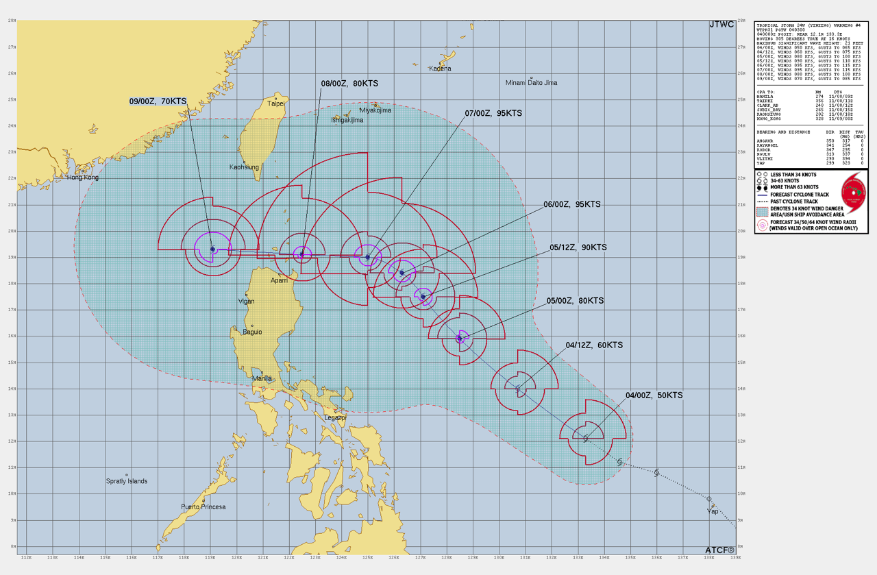
Tropical Storm #Yinxing (#MarcePH)
from LimWx (@LimWeather X/Twitter)
【 60mph #TropicalStorm #Yinxing forecast to peak at 110mph+ C2 #Typhoon or even a C3 Major and head towards N #Luzon,#Philippines,interests there should begin preps now!
#Wxtwitter #Wxx #Yinxing #台風22号 #MarcePH #Yagi #Soulik #Trami #TyphoonYinxing #tropicalStormyinxing 】
↑
https://x.com/limweather/status/1853262789621825578?s=46
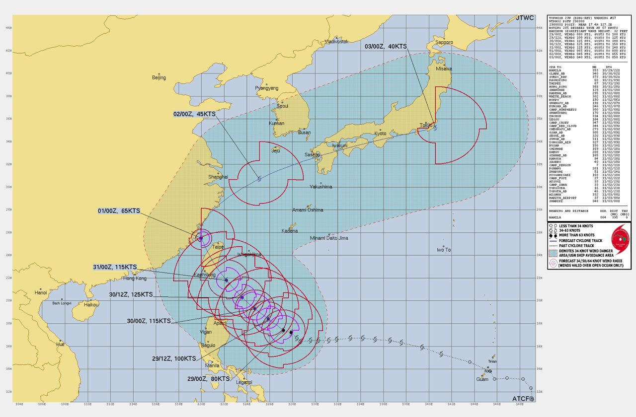
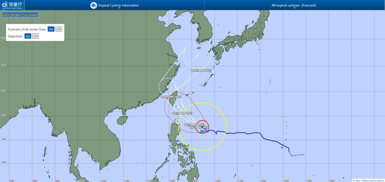
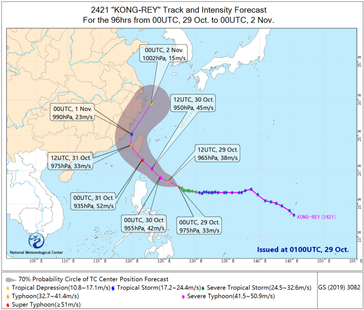
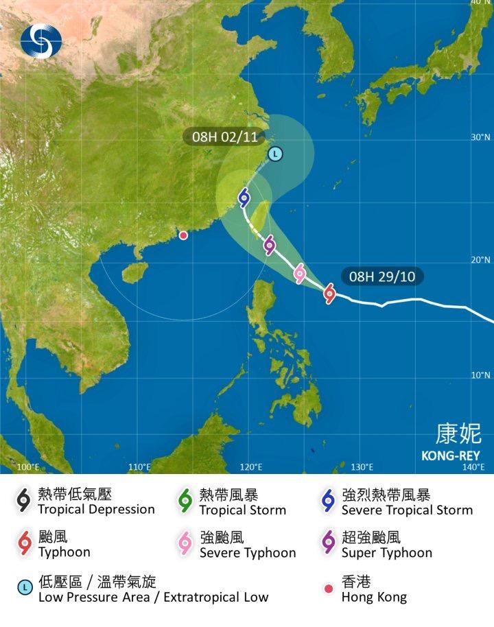
台風21号「コングレー」
Typhoon #Kong-rey
台風21号(コンレイ)
Typhoon #Kongrey
from LimWx (@LimWeather X/Twitter)
【 #Typhoon #Kongrey to peak at 145mph+ C4 nearing #Taitung,#Taiwan
interests there,#Kyushu,#Japan,#Fujian,#Zhejiang,#Shanghai,E #China should begin preps!
#Wxtwitter #Wxx #台風21号 #LeonPH #tropicswx #Yonaguni #Wenzhou #Fuzhou #Ningbo #TyphoonKongrey #Supertyphoon #Jeju #Southkorea 】
↑
https://x.com/limweather/status/1851086078792646945?s=46
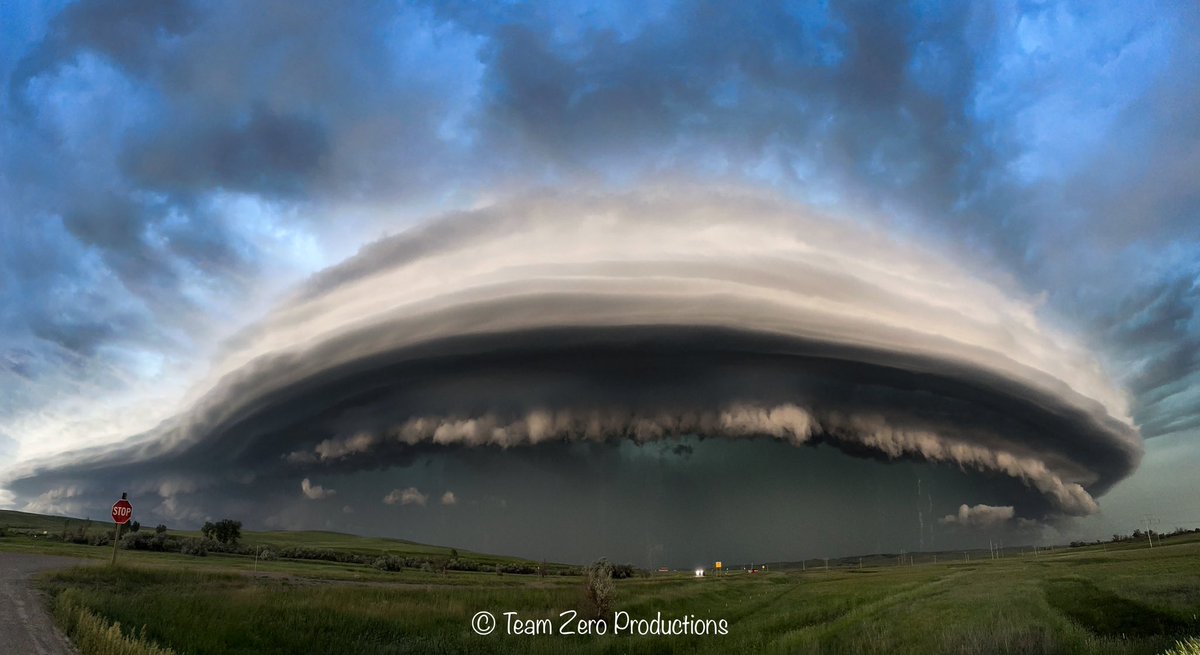
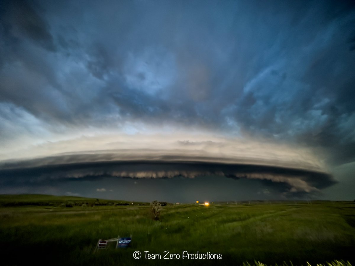
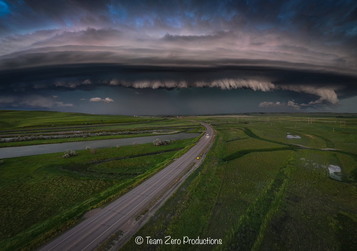
RT by @SwiftOnSecurity: Yesterday evening will go down in history as one of the most memorable northern plains chases for me personally. Little did I know that I would capture the most incredible shelf structure of my career, and quite possibly a contender for structure of the year. These photos were taken from Poplar, Montana to Williston, North Dakota! I hope you all enjoy them! #ndwx #wxtwitter
🐦🔗: https://nitter.oksocial.net/PappenheimWx/status/1802377572401009148#m
[2024/06/16 16:27]

A HIGH risk will be introduced in the next outlook update by #SPC #wxtwitter https://t.co/rCFCq8Exmu
A fourth OBSERVED #Tornado Warning has now been issued for this tornado near #RobertLee, #Texas. Please Take Cover Now! #txwx #wxtwitter https://t.co/taFBfZRnlt https://t.co/sfoLX5OSOk
Now a third #Tornado Warning for this one storm. Please seek shelter now. This is an OBSERVED Tornado! #txwx #wxtwitter https://t.co/31lsk5QOXD https://t.co/vYzCRUwjJC
New OBSERVED #Tornado Warning for the same storm near #Silver, #Texas. Please take cover now! #txwx #wxtwitter https://t.co/2pJrtSSBDw https://t.co/F3JcfCanmC
OBSERVED PDS #Tornado on the ground in #CokeCounty, #Texas. Take cover now! #txwx #wxtwitter https://t.co/aFoTh6vVwk https://t.co/iZ0DZv1D7V